Make a day out of this one, visiting several old places on the way. From Comrie take the B827 road to Braco, turning right at the tiny Glen Artney road a half-mile along (easy to miss). 3 miles along, pass the derelict Dalness cottage, you can follow the directions to get to the Mailer Fuar (2) cup-and-ring stone; and from here go up the field past the Mailer Fuar (1) carving, through the gate and follow the fence to your right. Keep going till your reach the Allt na Drochaide cup-and-ring stone. From here you’re heading (south) towards the rounded crags of Cnoc Brannan. It’s boggy as fuck in parts so cautiously zigzag through this section up towards the small grassy rise about 350 yards from the cup-and-ring stone. You’ll find it!
Archaeology & History
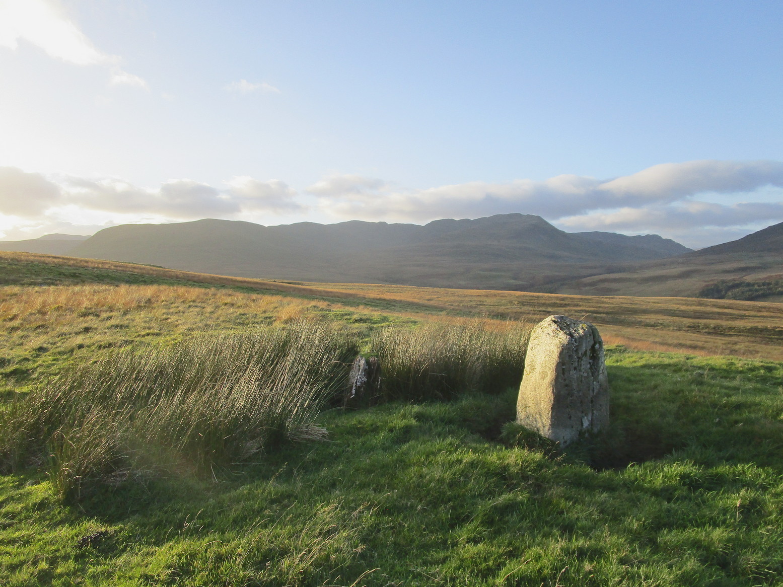
From the old stone, gazing S
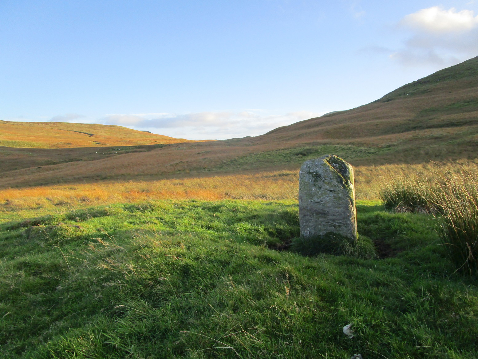
On one of the gentle rises below the northern slope of Cnoc Brannan we find this sturdy old fella, 3-4 feet tall (I didn’t measure it), looking across the stunning landscapes north, east and west along Glen Artney. Not previously recorded and seemingly isolated from other prehistoric remains, he looks all alone at first sight, but laid down in the grassy rushes (Juncus conglomeratus) to his side, is a slender seven-foot long stone which may have stood upright in the not-too-distant past, giving us another double stone setting in this area (at least two others existed in this area—the closest being at Craggish, 3.7 miles northeast). I have little doubt that other undiscovered prehistoric remains are hiding in the area. (there are a number of single cup-marked stones in the locale, although I tend to leave such examples off the catalogues as they can be somewhat dubious [and many are]. I mention this just in case any rock art students want to forage the area.)
From Comrie take the B827 road to Braco and less than a mile out of town take the tiny Glen Artney road on your right. Past the derelict Dalness cottage 3 miles on, a half-mile further, there’s a gated road veering downhill on your right. Park in the small parking-spot at the left. Walk along 100 yards to the gate on your left and walk up the old path which bends back on itself before leveling out. As it does so, just where the Mailer Fuar (2) carving lives, head uphill to the derelict house and, before reaching the fence, check out the several isolated stones on your right. You’ll find it!
Archaeology & History
Several faint cupmarks
This is nowt special to look at and, as I always tend to say with carvings such as this, it’s probably only gonna be of interest to the petroglyphic puritans amongst you. It was described by George Currie (2006) as possessing just one cup-mark, but there are in fact at least three of them on this sloping rock face, possibly four. One of them may—may—have a half-ring around it, but this is very hard to see and might be little more than a trick of the light and just a forlorn hope of something better… It’s worth a brief look before you venture further uphill to the much more impressive Allt na Drochaide carving.
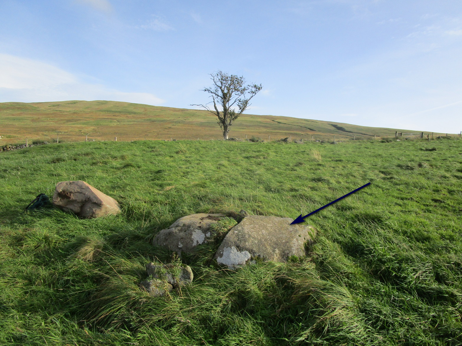
From Comrie take the B827 road to Braco and less than a mile out of town keep your eyes peeled for the tiny Glen Artney road on your right. Past the derelict Dalness cottage 3 miles on, a half-mile further, just where you hit a track-road veering downhill on your right, you need to park up in the small parking-spot on your left. Walk along the road 100 yards, keeping your eyes peeled again for the gate set back on your left (easy to miss!); go thru here, walk up the old path which bends back on itself before leveling out and, as it does, two or three small boulders lie just off the pathway on your right, one with its own petroglyph.
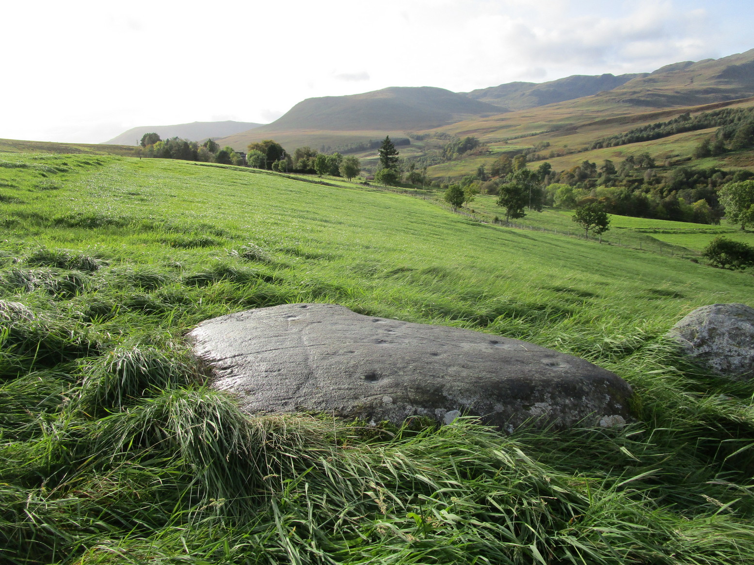
Archaeology & History
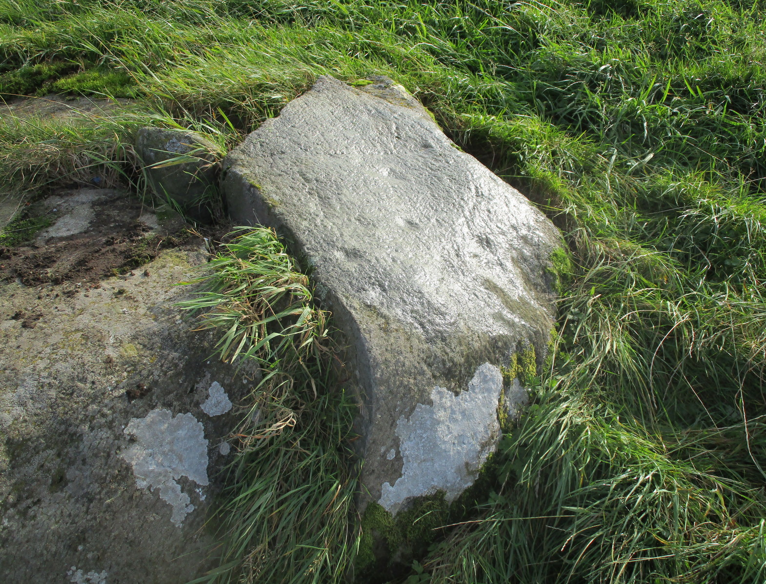
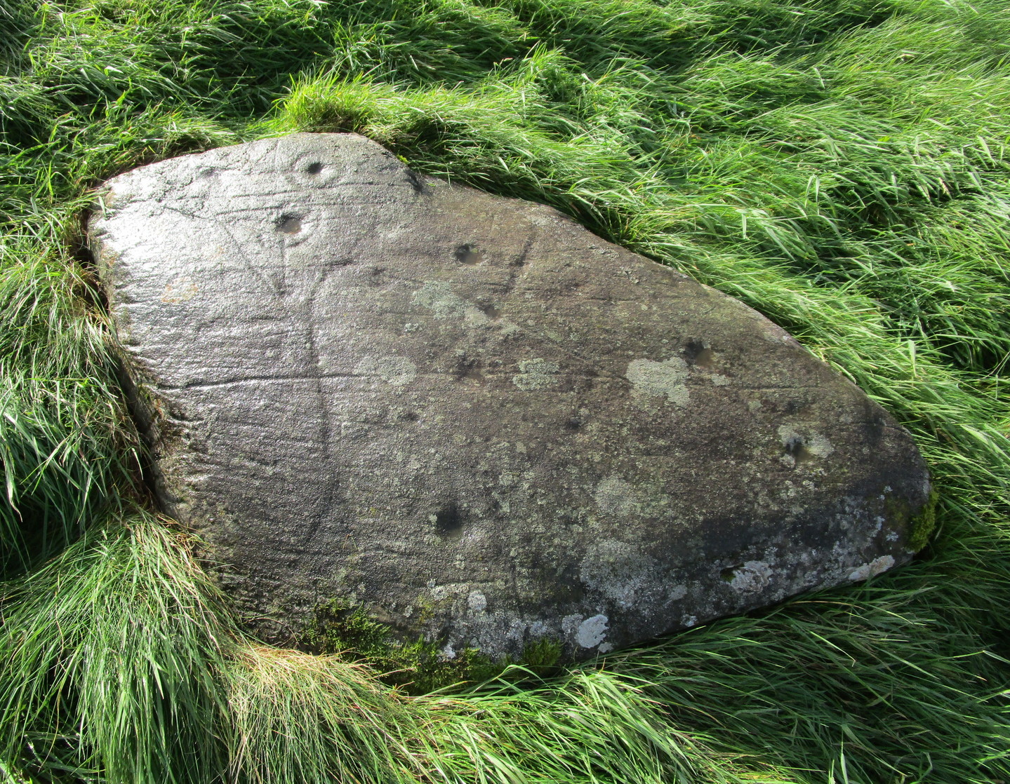
There are cups, rings and lines on this old stone, with the lines in particular being somewhat troublesome when it comes to working out their origin: some are natural, some made by modern farming implements (about a hundred years back), and some that were carved thousands of years ago—and it’s not that easy to work out which is which. You’ll be able to see what I mean by looking at the photos.
Rediscovered, it would seem, by M.D. King in 1991, he described it plainly as a simple
“recumbent cup-marked stone 1900mm by 1200mm by 300mm…found in a stone dyke running down the hill from the deserted farm of Mailer Fuar. The stone may have been moved down from its original position for inclusion in the now ruinous stone dyke. Fourteen cup-marks were visible on the stone.”
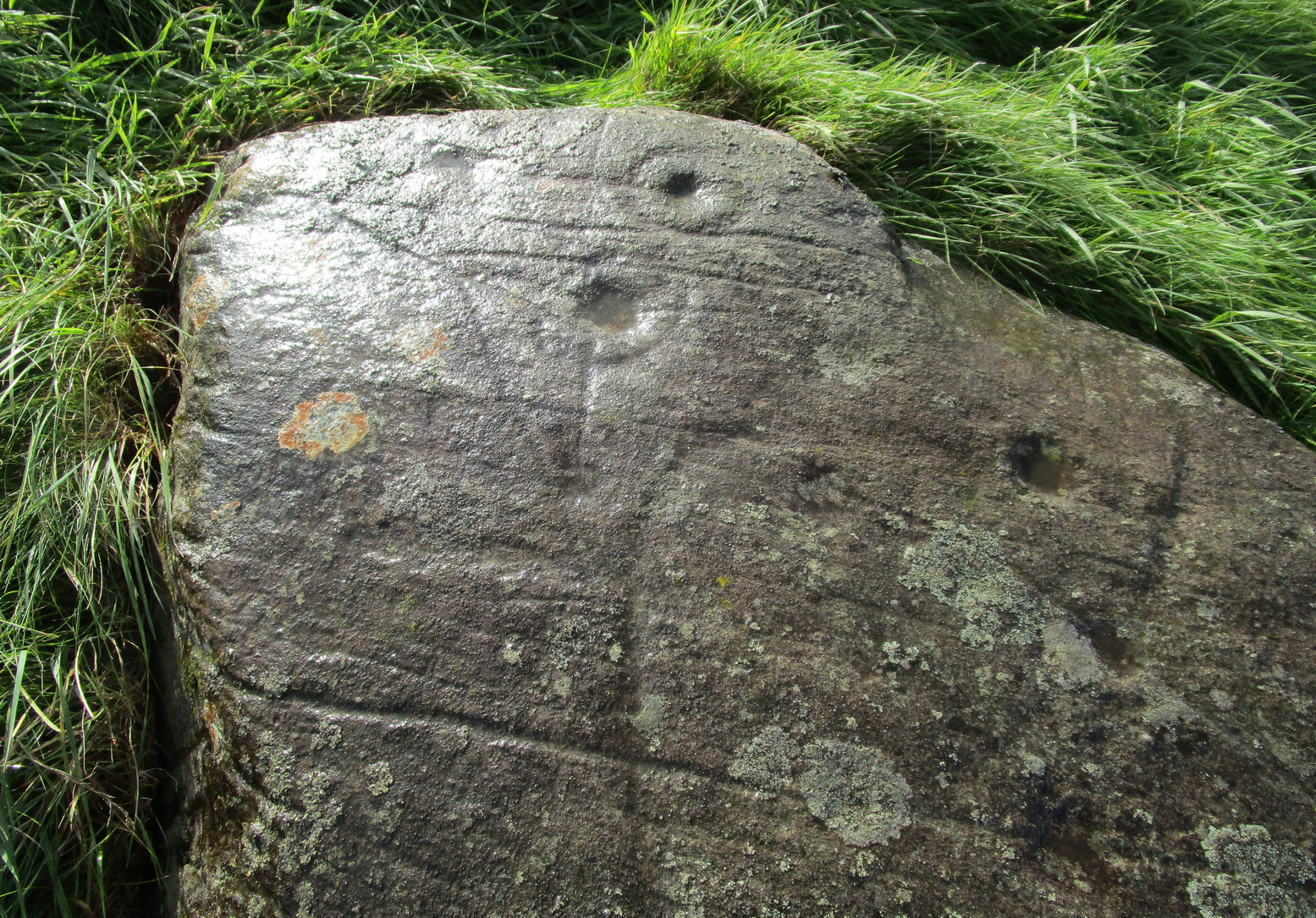
Complete cup-and-ringsCnRs and various lines
But there’s much more to it than that! There are rings around the cups for starters. Four of them. Two cup-and-rings next to each other at the southeast portion of the stone are just about complete, as you can see (right); the various lines that run either side and into them seem to be a mix of early and more recent scratches—although I think we’re best asking a petromorphologist to tell us which is which! We have a similar problem for another cup-and-ring near the centre of the stone, for it has two lines going right through its centre: one of them running almost the full north-south length of the stone giving the impression it was carved a long time back, yet looking much less ancient when it comes to its form and erosion; whilst the other line—almost at right-angles to the first—has a decidedly more archaic worn appearance.
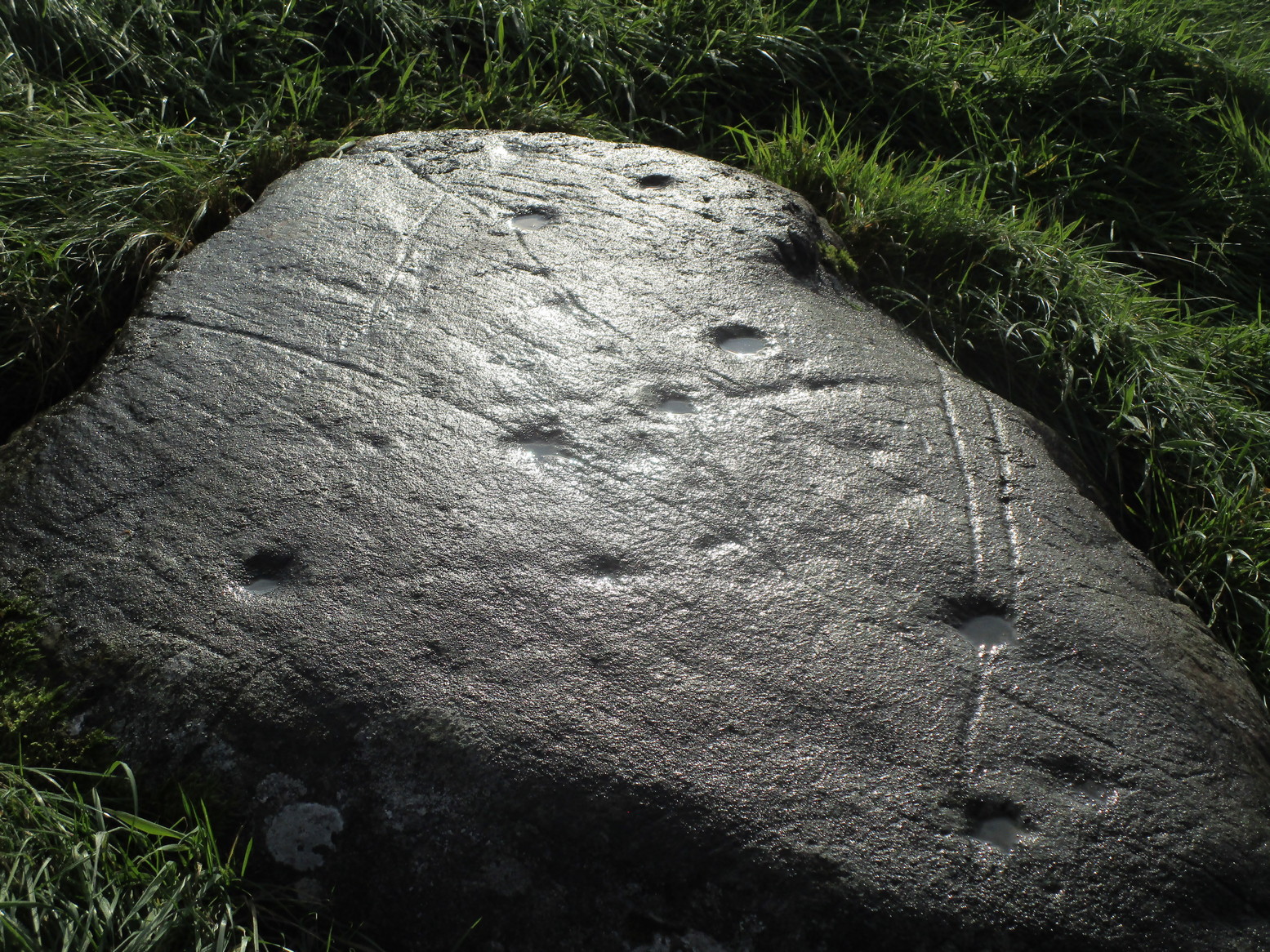
General design in low lightLong line, curving at top
One of the more assured “ancient” carved lines is on the eastern section of the stone. (left) It’s an odd looking thing, not very clear on the photo, comprising an elongated curved line, with a fork at the bottom, almost like short legs on an elongated stick-man like the ones we drew as kids. The long line seems to eventually curve over and into one of the cup-marks. Adjacent to the bottom of this forked curve is a cup and faint incomplete ring with a faint line running out of its centre to a smaller faint cup to its west. You can see this reasonably well in the lower photo (right)
The carving needs a lot of attention if we’re to work out its original design, as the photos show. Even the millionaire computer-tech work of the Scottish rock art club didn’t really suss out the differences regarding chronological elements in this carving (I don’t think they even mentioned it), which shows how difficult some of these buggers can be! Personally, I’d love to see the impression of some good artists at this stone when the light’s just right and see what their mind’s eye brings to the fore.
After all this I’ve not even mentioned its position in the landscape. Go check it out and see for y’selves. It’s a bittova beauty! And then wander a little further uphill to look at the Allt na Drochaide (1) carving I found not long ago. The view’s even better from there!
Tale the A85 road between Comrie and Crieff and, roughly halfway between the two towns, take the minor road south to Strowan (it’s easily missed, so be aware!). A few hundred yards along, stop where the trees begin and walk into the fields immediately east. Keep walking, below the line of the trees, and you’ll get to it within five minutes.
Archaeology & History
Samson’s Stone, looking east
Mistakenly cited by some as a standing stone, the large boulder which rests here on the hillside just below the woodland is a glacial erratic. Highlighted on the 1866 OS-map of the region, I hoped that we might find some rock art on the stone, but cup-and-rings there were none. However, there is a curious ‘footprint’ on top of it, similar to the ones found at Dunnad, at Murlaganmore and other places (see Bord 2004); but I can find no previous reference to this carved footprint.
‘Footprint’ on top of stone
In 1863 the site was described in the local Name Book, where it was reported to be “a large oblong shaped stone lying on the surface, eight feet long, four wide, and three thick”; but, much like today, it was also reported that “There is no tradition respecting it in the neighbourhood. Supposed to have received the name in consequence of its great size.”
Most peculiar…..
References:
Bord, Janet, Footprints in Stone, Heart of Albion Press 2004.
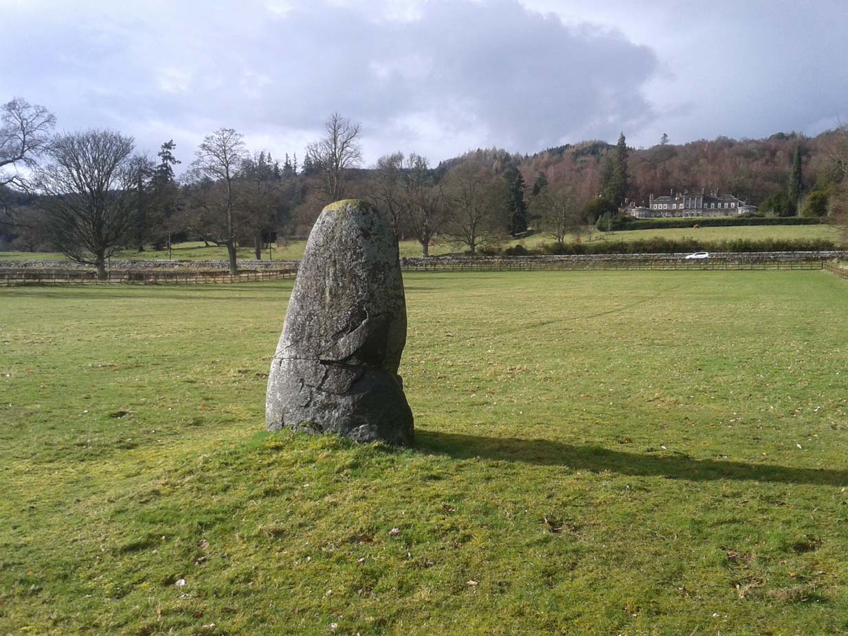
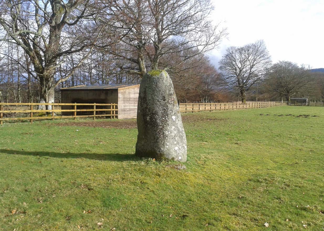
Take the A85 road between Comrie and Crieff. Nearly 1.7 miles (2.7km) east out of Comrie—or 4 miles (6.44km) west out of Crieff—keep your eyes peeled on the fields to the south-side of the road, below and across the mansion of Lawers House. Alongside a long but small plantation of trees you’ll see a large upright stone. You can walk along the track adjacent to the field and through the gate.
Archaeology & History
The stone on 1886 OS-map
Shown on the early Ordnance Survey maps of the area, this probably neolithic monolith was suggested by Fred Coles (1911) to have once been part of a larger megalithic circle—although Aubrey Burl (2000) didn’t consider it as a good enough contender to be listed as such in his gazetteer; and unless we can have some positive affirmation, either through folklore or excavation, we should maintain its status as a singular monolith. There is the possibility that it stood as an outlier or had some relationship with a nearby prehistoric tomb—but even this is contentious. Nevertheless, the stone itself is an impressive one!
Mr Coles curiously got the size of the old stone wrong too (although, we have to give him credit, as he did all of his work without electricity or any of our modern ‘stuff’). He wrote that:
“This massive boulder of whinstone is rounded at the base, where it girths 10 feet 3 inches, but tapers upwards to its apex of 5 feet 10 inches, with the eastern edge somewhat jagged and broken. Near its base on the west is a small slab-like fragment of stone, quite earthfast. The north and south surfaces are smooth and nearly vertical, and the longer axis is ESE 75º by WNW 75º.”
Fred Coles’ 1911 sketch
Lawers monolith, looking SE
The stone is actually larger than Coles described, being more than 6 feet 6 inches tall. His sketch (right) “shows the stone from the east”, and is pretty much as we find it today. A notable crack in the stone along the southern face, about a third of the way up, suggests that the stone was broken at some time in the past.
Local architect Andrew Finlayson (2010) included the stone in his local megalith guide and noted how the axes of the stone, east-west, lines it up with Ben Halton to the west and The Knock to the east.
References:
Burl, Aubrey, The Stone Circles of Britain, Ireland and Brittany, Yale University Press 2000.
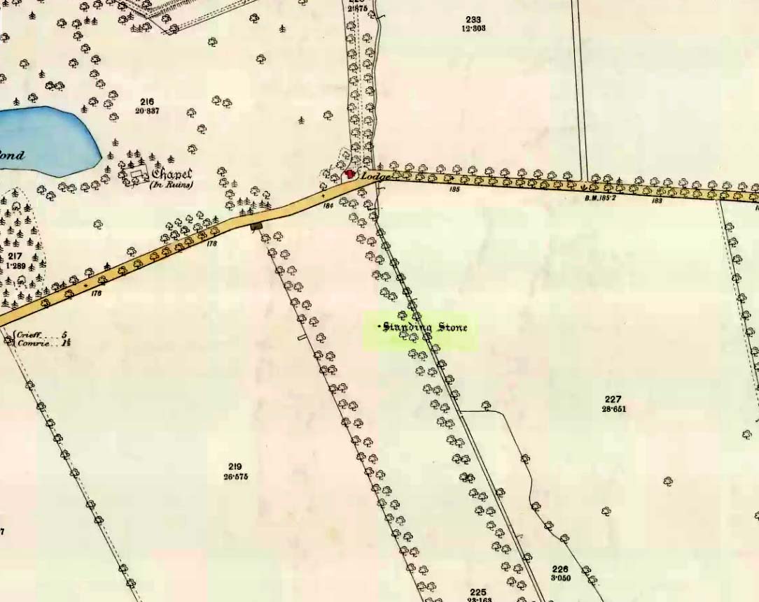
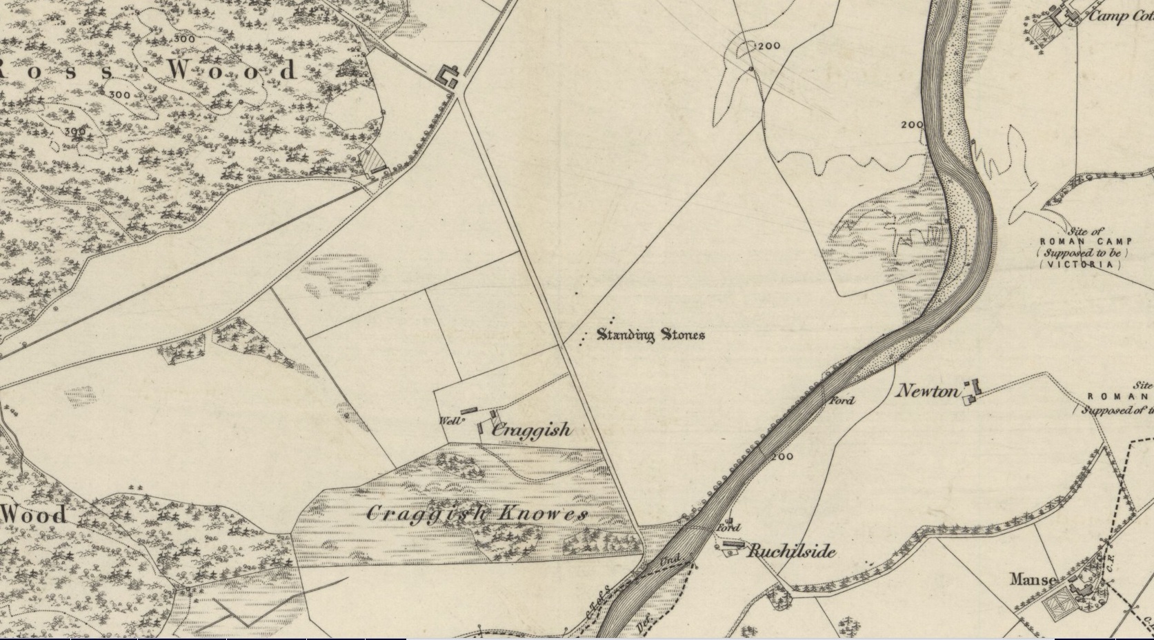
Standing Stones (destroyed): OS Grid Reference – NN 7643 2086
Archaeology & History
Site shown on 1886 OS-map
Highlighted on the 1866 OS-map was an impressive cluster of standing stones that sadly met their demise sometime around at the end of the 19th century. They were mentioned to “still exist” when the local writer Samuel Carment passed them in 1882, but had been destroyed by the time the Ordnance Survey lads resurveyed here in 1899. Altogether there were at least six of them, standing aligned sharply northeast-southwest and were described in one of Fred Coles’ (1911) essays, who lamented their passing. Listed in the stone row surveys by Burl (1993) and Thom (1990), the prime description we have of them was by Cole himself, who told:
“This site has also been wantonly bereft of its group of megaliths. Up to so recent a date as 1891 there were several. These were shown on the (Ordnance Survey map) as three in one line and two in another, on a field about one furlong NE of Craggish farmhouse, close to the road coming down from Ross, and nearly a quarter-mile NW of the ford across the Ruchil at Ruchilside.”
In Finlayson’s (2010) colourful survey of the local megaliths he told that the stones,
“Stood, by the road, in what is now ‘The Whinney Strip’: a boulder-strewn strip of land 20m wide dividing up otherwise flat and even grazing land.”
References:
Burl, Aubrey, From Carnac to Callanish, Yale University Press 1993.
Cole, Fred, “Report on Stone Circles Surveyed in Perthshire, Principally Strathearn,” in Proceedings of the Society of Antiquaries, Scotland, volume 45, 1911.
Thom, A., Thom, A.S. & Burl, Aubrey, Stone Rows and Standing Stones – 2 volumes, BAR: Oxford 1990.
Acknowledgments: Big thanks for use of the early edition OS-map in this site profile, Reproduced with the kind permission of the National Library of Scotland.