Gab Wood (2), Cookridge, Leeds, West Yorkshire

Cup-and-Ring Stone:  OS Grid Reference – SE 24602 40614

Getting Here

Gab Woods (2) carving

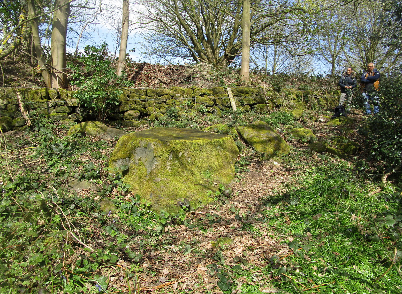
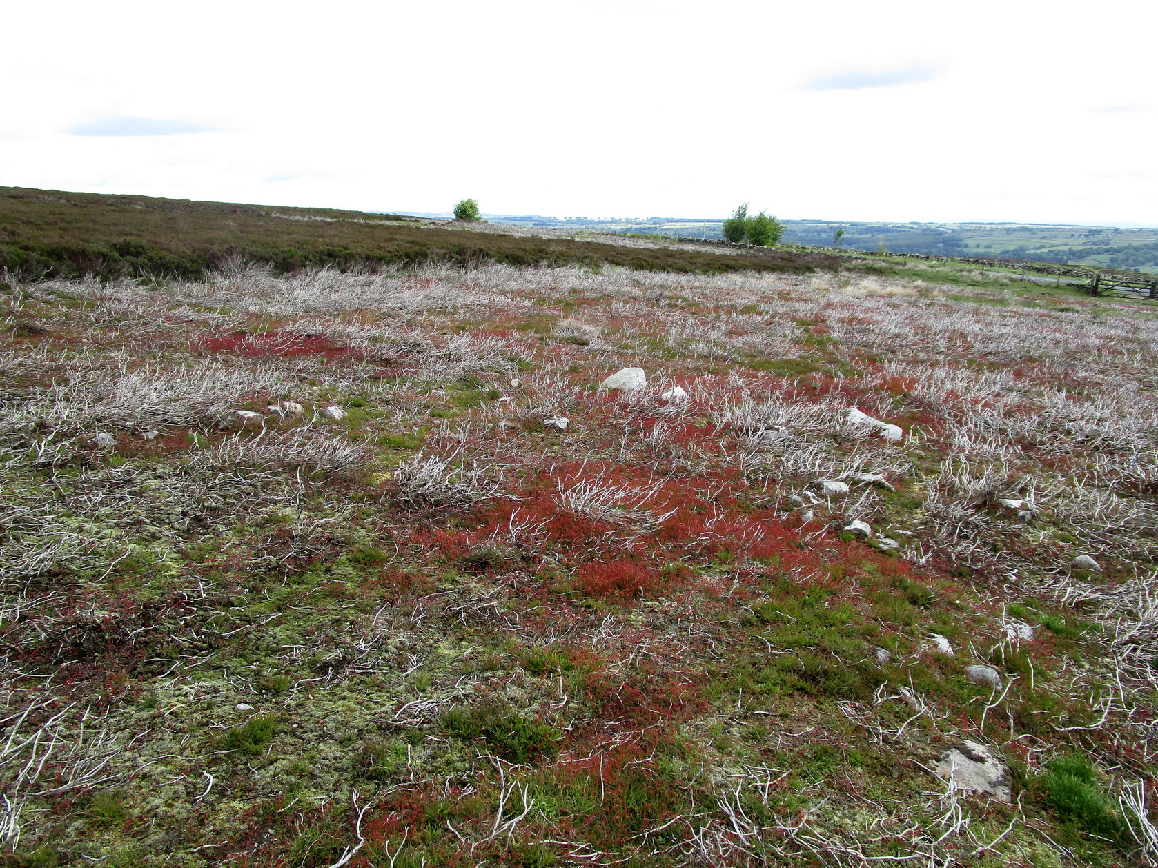
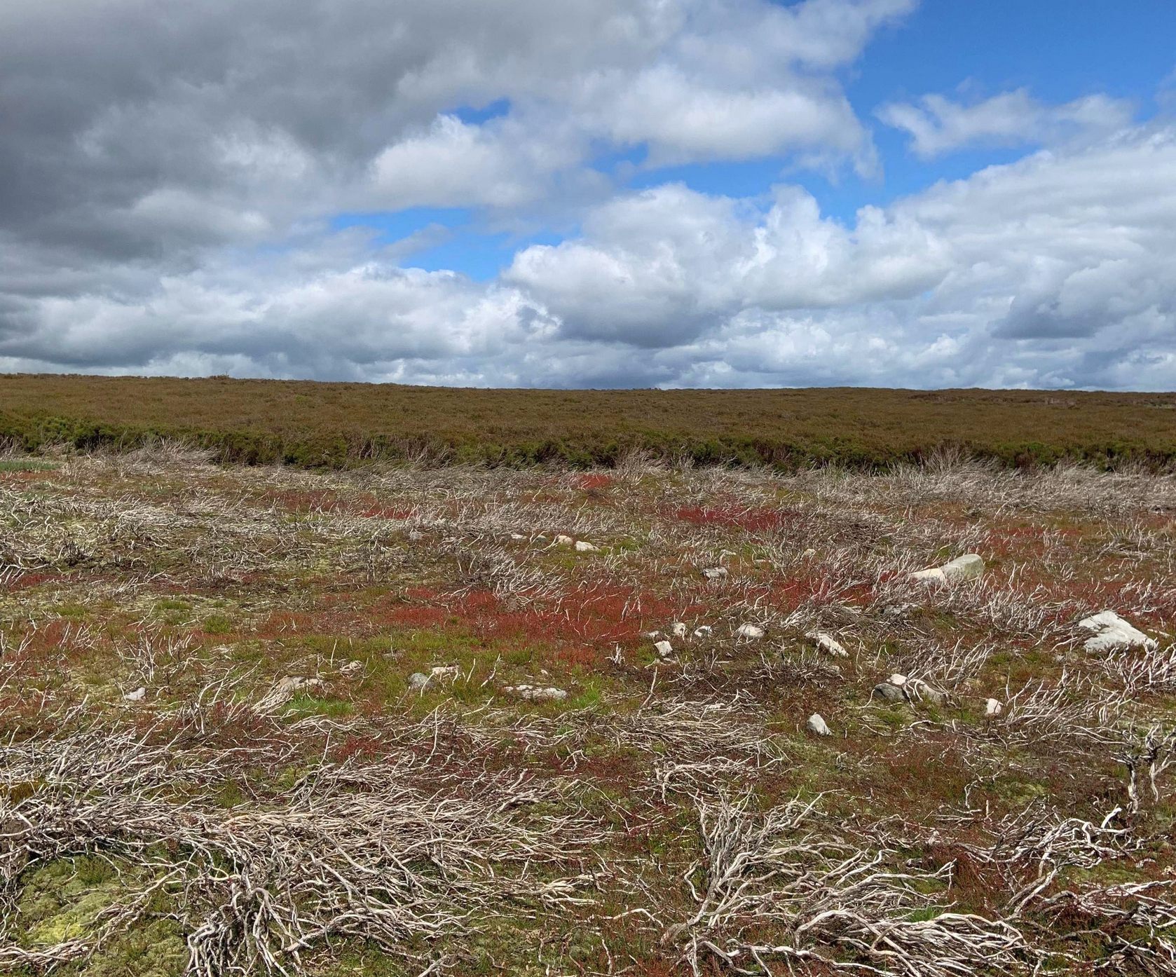
Follow the same directions as if you’re visiting the Gab Woods (1) carving—which you’re probably visiting if you’re checking this one out.  Walk south into the middle of the woods and you’ll soon notice the road/houses on the other side of the trees.  Once here, staying in the woods, follow the walling down for about 100 yards, keeping your eyes peeled for a reasonably large flat stone about 15 yards from the wall in the trees.  If you can’t find it at first, patiently zigzag back and forth until it eventually appears!

Archaeology & History

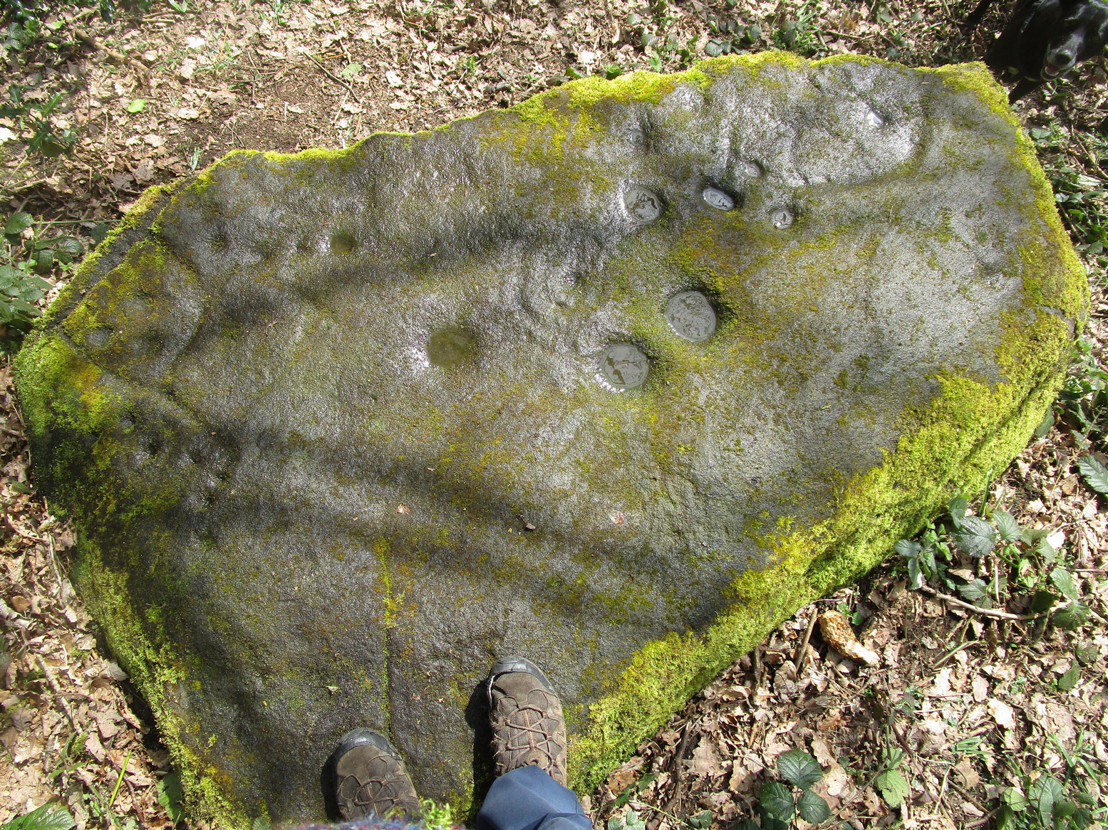
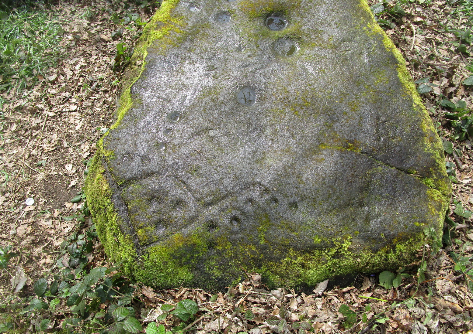
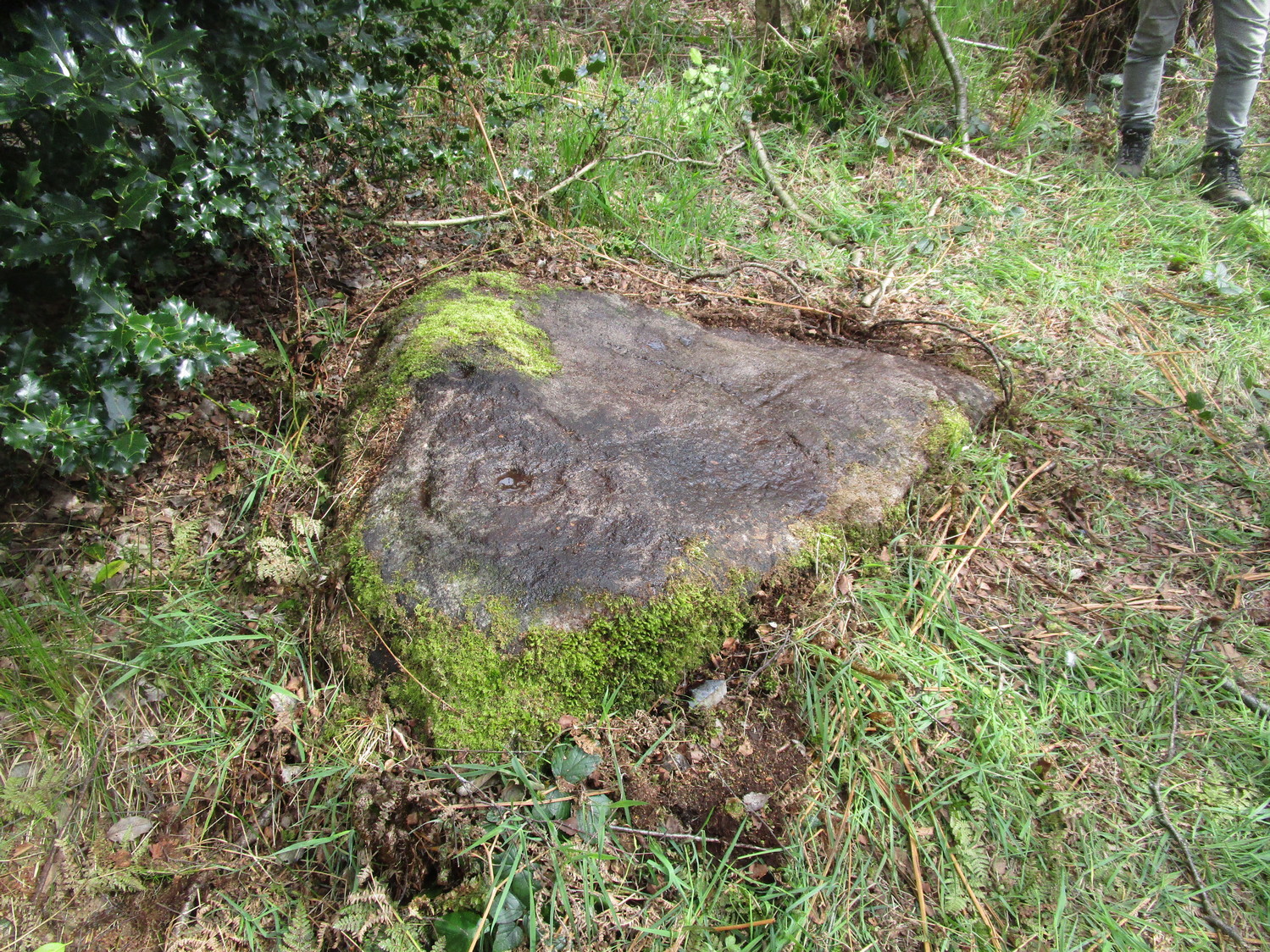
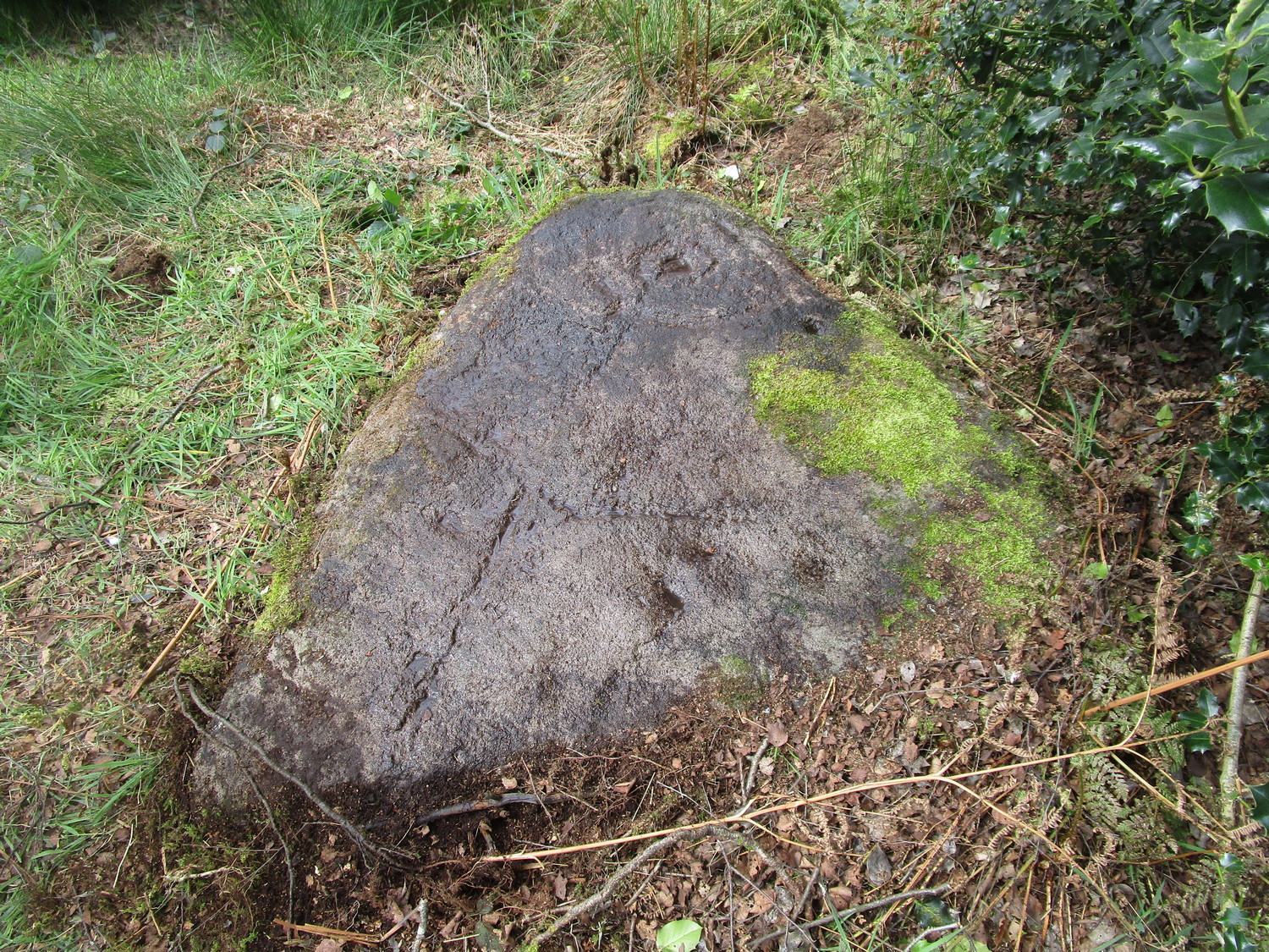
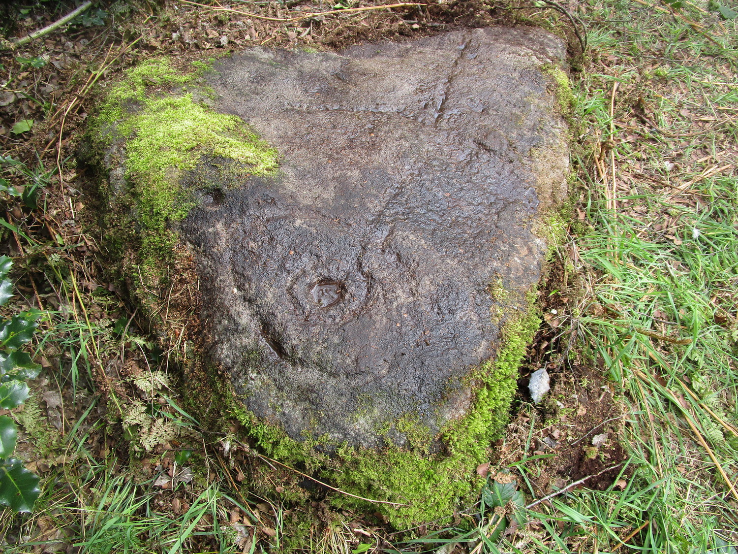
One of two known petroglyphs in this woodland (there may be more hidden away) that was first found in the 1940s by Dan Cole.  The main feature here consists of a cup-mark encircled by two large, well-defined oval-shaped “rings”, a bit like a large eye.  From the central cup, a long carved line runs down the gently sloping surface of the stone and, roughly halfway down from the cup-and-ring to the edge of the stone, another carved line cuts across at rough right-angles, giving the carving a slight anthropomorphic (human-like) appearance when looking up the stone.  This humanesque figure may have been the intention—though for my part I have to say that I’m slightly skeptical about it.  We may never know either way.  Several other single cups are on the stone: one to the side of the large “eye” and two or three below the elongated “arms.”

Vague humanesque figure
Large eye-shaped element

An additional, interesting non-petroglyphic feature is the name of the woodland in which the stone resides.  In Thomas Wright’s massive dialect work, Gab is a northern dialect word meaning “to talk”, or “idle chatter” (and variants thereof); this is echoed in Blakeborough’s (1911) Yorkshire survey; and Wilkinson’s (1924) local study tells simply it’s “idle talk…able to talk glibly and with much plausibility—a Town Hall Square orator for instance.” This makes the place as something akin to being “the woodland that talks”, “the chattering woods” or “the talking woodland”, etc.  You can make up your own mind as to what this might mean… *

References:

  1. Blakeborough, Richard, Wit, Character, Folklore and Customs of the North Riding of Yorkshire, W. Rapp: Saltburn 1911.
  2. Wilkinson, John H., Leeds Dialect Glossary and Lore, privately published: Leeds 1924.
  3. Wright, Joseph, English Dialect Dictionary – volume 2, Henry Frowde: London 1900.

Links:

  1. Dan Cole’s Image Archive, The Thoresby Society

Acknowledgements:  Huge thanks must go to Peter Murphy for recovering this impressive carving from the archives, and from beneath the carpet of soil and vegetation, so enabling it to see the light of day once again.  Also big thanks to the usual culprit of James Elkington, as well as Sarah Walker and Sarah Jackson.

* a Scottish dialect variant of gab relates to the mouth, tongue, taste.

© Paul BennettThe Northern Antiquarian

Gab Wood (1), Cookridge, Leeds, West Yorkshire

Cup-and-Ring Stone:  OS Grid Reference – SE 24610 40721

Getting Here

Gab Wood (1) stone

On the north side of Cookridge, find Smithy Lane and go to the western-end, where it meets up with a dirt-track.  Walk straight along here by the side of the cricket-pitch and then take the first turn left where you walk along the other edge of the cricket pitch.  About 150 yards along, the track hits the woods; keep along here for about another 200 yards where you’ll find a small footpath on your left goes into the woods. Once you’re in in the trees, walk to your right, following the wall, for about 50 yards where you’ll see a large flat stone by the holly trees.  That’s it!

Archaeology & History

Rediscovered by the Leeds historian Don Cole in the 1940s, this complex multi-period carving etched onto a flattened rock surface is an unusual outlier from the Rombalds Moor complex several miles to the west.  At its heart, around the semi-natural deep “cups” near the middle of the southern side of the stone, is the oldest part of the carving comprising a very faint incomplete triple-ring design which, as we move around it, almost has the look of a Newgrange-lozenge form to it.  But I’m unsure…

Very faint incomplete triple-ring at top-middle
Waves & cups and rings

More obvious (apart from the deep “cups”), and the first thing you notice as you approach the stone, are the later and much more well-defined elements on the east side of the stone: a curious wave-form writhes from the edge of the rock across its smooth surface, beneath which we find a cup-and-ring and a number of single cup-marks, some enclosed inside a rounded box, with others sat between the curved carved line and the stone’s edge.  The “rounded box” with its three cups at first seems to be on its own, but as the light changes you’ll notice a much fainter (possibly older) rectangular box attached to it; no cups are visible inside this.

A hundred yards due south in the same woodland you’ll find the Gab Woods (2) carving.

One interesting feature is the name of the woodland in which the stone resides.  In Thomas Wright’s massive dialect work, Gab is a northern dialect word meaning “to talk”, or “idle chatter” (and variants thereof); this is echoed in Blakeborough’s (1911) Yorkshire survey; and Wilkinson’s (1924) local study tells simply it to be “idle talk…able to talk glibly and with much plausibility—a Town Hall Square orator for instance.” This makes the place as something akin to being “the woodland that talks”, “the chattering woods” or “the talking woodland”, etc.  You can make up your own mind as to what this might mean… *

References:

    1. Blakeborough, Richard, Wit, Character, Folklore and Customs of the North Riding of Yorkshire, W. Rapp: Saltburn 1911.
    2. Wilkinson, John H., Leeds Dialect Glossary and Lore, privately published: Leeds 1924.
    3. Wright, Joseph, English Dialect Dictionary – volume 2, Henry Frowde: London 1900.

Acknowledgements:  Huge thanks must go to Peter Murphy for recovering this impressive carving from beneath the carpet of soil and vegetation, and so enabling it to be seen by others once more. Also big thanks to the usual culprit of James Elkington, as well as Sarah Walker and Sarah Jackson.

* a Scottish dialect variant of gab relates to the mouth, tongue, taste.

© Paul BennettThe Northern Antiquarian

Killiesmont, Keith, Moray

Cup-Marked Stone (destroyed):  OS Grid Reference – NJ 4124 5308

Archaeology & History

Diagonally across the road from Killiesmont, about a hundred yards up the sloping field on “a piece of ground called the Helliman Rig,” could once be seen a large flat stone with cup-markings on its surface.  Walter Gregor (1881) told that,

“It lay on the top of a rising ground, and commanded a very wide view of the country, stretching for many miles over the hills of Banff and Moray.  In a part of it the rock–a kind of slate–came to the surface.  In the rock were cut out nine cups in three rows.”

The carving was earlier described in one of the Topographical Gazetteers of Scotland (1848) where its story is bound up with local tradition and folklore of the land where it lie.  There it was described as being “a flat circular stone of about 8 feet in diameter, in which there are a number of holes, but for what purpose tradition is silent.”  Subsequently the local historian J.F.S. Gordon (1880) talked of this “large flat circular Stone, of about 8 feet in diameter, in which there was a number of half-pierced holes…. It was too large for a Quern or even a Millstone; and its purpose remained an enigma.”

The stone came to light when a local farmer was digging in the field and, “at the upper end of the Rig, there was found a rude Cist among a heap of stones, which contained ashes.”  The cup-marked stone was “turned up” at the same time.  It has sadly been destroyed—along with the associated cairn that probably had some relationship with the carving.  Prehistoric tombs and rock art are frequent bedfellows and it seems likely that the equation occurred here.  But the location of the site had some fascinating local lore told of it…

Folklore

The location of this carved stone in the field called ‘Helliman Rig’, was also known as the Guidman’s Croft or the Gi’en Rig.  This was a portion of land that was never to be touched or ploughed as it was “given or appropriated…to the sole use of the devil, in order to propitiate the good services of that malign being.”  This devilish tradition superseded the earlier faith of it being a place set aside for the fairy folk and their allies—nature spirits no less.  And it’s a tradition found in many places across Scotland and elsewhere, as the account in the Scottish Gazetteer told :

“Like other crofts of this description in Scotland, the present remained long uncultivated, in spite of the spread of intelligence (pedantic bastard! PB).  The first attempt to reclaim it was made not more than 50 years since, when a farmer endeavoured to improve it; but, by an accidental circumstance, it happened that no sooner had the plough entered the ground than one of the oxen dropped down dead. Taking this as an irrefragable proof of the indignation of its supernatural proprietor, the peasant desisted, and it remained untilled till it came into the possession of the present occupant…”

This of course fortified the old folklore in the eyes of local people.  I’ve found that even up to recent times, such folklore is still held quite seriously by some of the old folk in the mountain villages and hamlets.

References:

  1. Anon, The Topographical, Statistical and Historical Gazetteer of Scotland – volume 2, A. Fullarton: Edinburgh 1848.
  2. Gregor, Walter, Notes on the Folk-lore of the Northeast of Scotland, Folklore Society: London 1881.
  3. Gordon, J.F.S.,  The Book of the Chronicles of Keith, Grange, Ruthven, Cairney and Botriphnie, Robert Forrester: Glasgow 1880.

© Paul BennettThe Northern Antiquarian

Shooting House East, Askwith Moor, North Yorkshire

Hut Circles:  OS Grid Reference – SE 17401 50967

Getting Here

Askwith Moor hut circle (1)

Along the only road that crosses Askwith Moor, park up at the single carpark on the east-side of the road.  Walk up the road for 350 yards and through the gate on the left-hand (west) side of the road onto the moorland.  Once through the gate, walk directly west into the heather immediately below the path for some 25-30 yards.  Look around!

Archaeology & History

Rediscovered by Helen Summerton in May 2022 are at least two simple hut circles on this level piece of land close to the roadside, amidst this much wider and impressive prehistoric landscape.

The small ring of stones (SE 17430 50978) closest to the road is slightly more troublesome to make out due to it being more deeply embedded in the peat than its companion about 30 yards away.  Comprising of typically small rubble walling, this first circle is only 4 yards across and would certainly have been fine for one person or, at a push, perhaps a small family.

Askwith Moor hut circle (2)

Its companion immediately west (SE 17401 50953) is somewhat larger and slightly more elongated in shape, being 10 yards along and 5-6 yards across, as well as being in a better state of preservation.  This larger hut circle has been raised on a notable artificial earth-and-rubble plinth, being one or two feet higher than the surrounding peatland.  A notable internal stretch of walling only a yard or two in length exists within the southeastern side of the construction, whose nature can only be discerned upon excavation: an issue we can say applies to the many prehistoric settlements and tombs across this small moorland.  It’s very likely that other settlement remains will be found close to these two hut circles.

The remains of another hut circle can be found closer to Shooting House Hill, several hundred yards away; whilst five hundred yards southwest we find a small but impressive cairnfield.  There are also a good number of petroglyphs close by and on much of the surrounding landscape.

Acknowledgments:  Huge thanks to Helen Summerton (not Winterton) for finding these ‘ere remains – and for the photos accompanying this site profile.

© Paul BennettThe Northern Antiquarian

Black Morrow Well, Kirkcudbright, Kirkcudbrightshire

Well:  OS Grid Reference – NX 6843 4940

Archaeology & History

A curious little-known site with more of a Scottish genealogical history behind it.  Mentioned in McCormick’s (1906) fascinating survey of tinkers in the Galloway region, the site was given a more succinct description in the Morris survey (1982), where they told that,

Well shown on 1854 map
Black Morrow Well, c.1905

“a mile from the town in Black Moray (formerly Morrow) Road, a short distance from the road…was this well that the MacLellan family are said to have derived their crest of a Moor’s head impaled on a sword.  The local story is that James II wanted to get rid of some gypsies infesting Galloway and offered the Barony of Bombie to anyone who could do so.  MacLellan filled the well with potent liquor which the gypsy chief drank to excess and while he was in a drunken stupor MacLellan killed him, cut off his head and presented it to the King on the point of his sword, immediately receiving the barony as his reward.”

This story goes way back and was first mentioned in 1680.  According to McCormick (1906), the name Black Morrow derived from the “More”, the title given to the leader of the so-called gypsy clan, “or, as tradition suggests, a man named Black Morrow, of Irish tinkler descent.”

References:

  1. Andrew McCormick, The Tinkler-Gypsies of Galloway, J. Maxwell: Dumfries 1906.
  2. Morris, Ruth & Frank, Scottish Healing Wells, Alethea: Sandy 1982.

© Paul BennettThe Northern Antiquarian