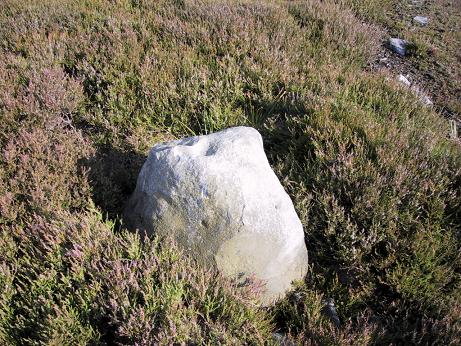
Go northwest along the country lane running between High Utley (on the outskirts of Keighley) and Steeton known as Hollins Lane, which then becomes Hollins Bank Lane. You’ll see the fine castle building as you go along, known simply as The Tower arising from the top of the tree-line. As you get to the driveway leading down to the Tower, a less impressive farm building is on the other side of the road, known as Hollins Bank Farm. On the right-hand side of this house is an old overgrown road. Walk along here to the end, going into the field immediately left where a small group of stones can be seen halfway up the field by the tree. You’re here!
Archaeology & History
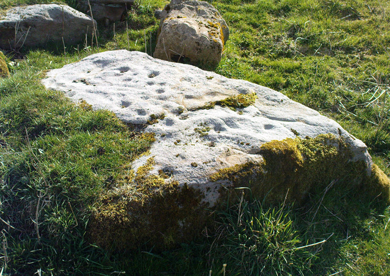
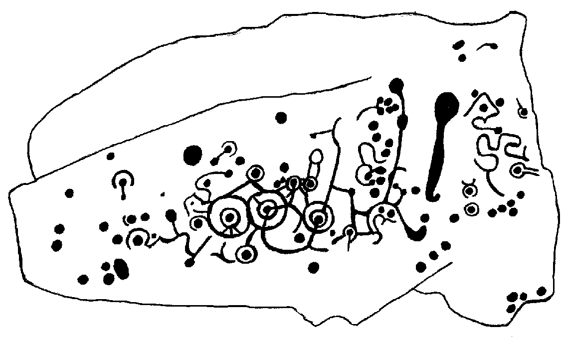
First discovered one sunny afternoon on April 7, 2010, in the company of Buddhist scholar Steve Hart, this is a really curious carving, inasmuch as it seems to have been deliberately carved around what may be curious naturally eroded cup-forms. You’ll have to visit it to see what I mean. They’re a bit odd. Almost too perfect as cups to be the ancient eroded ones we’re used to looking at. But this aside….
…and againDragon Stone, looking NW
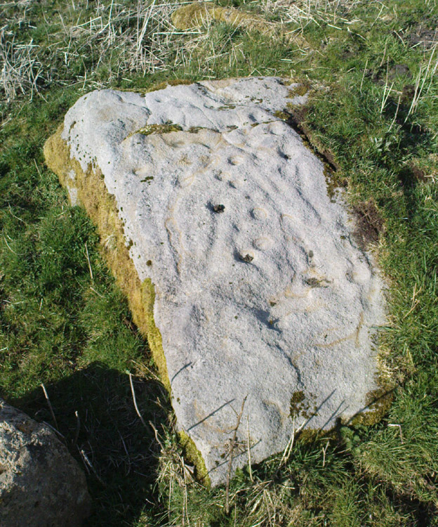
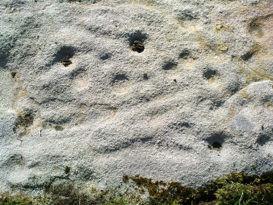
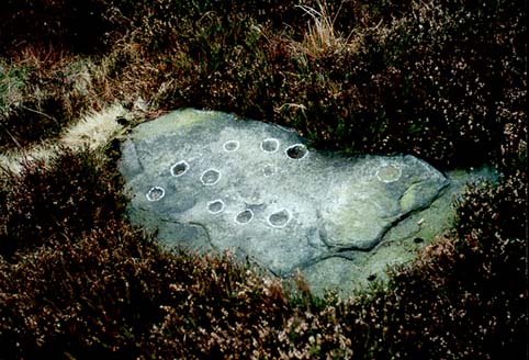
It’s a lovely flat stone, with curvaceous lines running across the middle and edges and into cup-markings. Although some of the cups give an impression of being natural, others have the authentic-looking ring to them, with at least one of them possessing a near-complete ring encircling it (as you can faintly see in the close-up photo here). There are at least 19 cup-markings on this stone, and four main ‘lines’ running roughly in north-south directions, with the cups interspersed between them. At the top (north) end of the rock, separated by a crack, the lines stop and we just have some cup-markings. The crack in the stone may have been functional here.
Although graphically different, the carving has a similar feel in design (for me at least) to that of the Wondjina Stone at Rivock Edge, on the other side of the Aire Valley a couple of miles east of here — though this newly found carving is in a better state of preservation. The small scatter of rocks around it seem to have been unearthed or moved recently by the land-owner (who aint keen on you looking on his land, so be careful) and the good state of preservation may be that they were only unearthed sometime this century. We must also keep in consideration that the lines that run across the surface of this stone are water-lines and may be more the result of Nature’s hand than humans. It’s obvious that some human intervention has occurred here, but it may be difficult to ascertain the precise degree of affectation between the two agencies.
Close-up of cups & lines
According to the archaeological record-books there are no carvings here, but another simple cup-marked stone accompanies this more extravagant serpentine design just a few yards away; a simple cup-marked stone may be seen at the top of the hill; and the faint Currer Woods carving can be found 0.68 miles (1.09km) due west of here, on the other side of the small valley. Other outcrop stones scatter the fields and slopes here, some of which still need checking to see whether or not further carvings exist.
…And for those who may bemoan my seemingly romantic title of the carving: remember! — close by in Steeton township, between the years 1562 and 1797, there was an old field-name known well to local folk, of “one parcel of arable land in town field called Drakesyke, 3 acres”, i.e., the dragon’s stream or dyke. (Gelling 1988; Smith 1956)
References:
Clough, John, History of Steeton, S. Billows: Keighley 1886.
Gelling, Margaret, Signposts to the Past, Phillimore: Chichester 1988.
Smith, A.H., English Place-Names Elements – 2 volumes, Cambridge University Press 1956.
Pretty simple this one. From Chipping Norton, head west on the A44 for a coupla miles till you hit the lovely Salford village. The church stands out, so head for it and, as you walk towards the building, watch for the small stone cross in front of you.
Archaeology & History
Salford Cross cup-markings
This is curious. Very curious! We might expect to find cup-markings occasionally on some of the cross-bases or other early christian monuments in northern England and Scotland, but to find them in the heart of a small Oxfordshire village where the tradition of cup-marked stones is unknown, was something of a surprise when Tom Wilson and I (1999) found it, to say the least! But this is what we’re looking at here.
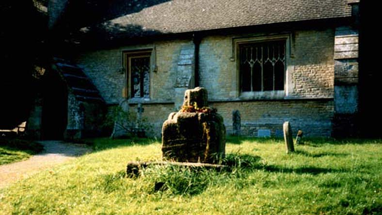
Salford Cross remains
On the remains of an old medieval cross, whose broken shaft has seen better days, as the photo shows — and as a personal viewing shows even clearer — there are 3 simple cup-markings etched on one side of the cross-base in Salford churchyard. The cups certainly aint natural, but then also they don’t have the archaic looks of the prehistoric carvings from Yorkshire to Scotland. It would be good if we had a more extensive history of the cross monument itself, perhaps saying precisely where the stones which make it up came from, but local records tell us nothing it seems. If we could ascertain that parts of it were made up of some remains taken from some local prehistoric ‘pagan’ tomb (and a number of tombs have been found in and around this area), then some sense could be thrown upon its position here. But until we can ascertain more about the history of the cross, the three clear cup-markings on the cross-base remain somewhat of a mystery.
Folklore
Lovers of ley lore will be intrigued to find this carved cross-base is on a very accurate ley linking the King Stone, Rollright stone circle, Little Rollright church (where a standing stone can be found in the walling just before it), the Salford Cross and the site of another cross on the hill outside the village.
References:
Bennett, Paul & Wilson, Tom, The Old Stones of Rollright and District, Cockley: London 1999.
Go over Ilkley Bridge and take your first left, on & over the roundabout, then follow the road as it bends uphill. Keep going until you reach the fields and moors either side of you, up Hardings Lane, stopping at the bend in the land where it meets a couple of dirt-tracks. Go up the track onto the moor and follow this right into the moorland (avoiding the path to your right after a few hundred yards) where it follows the edge of the walling again. After a few hundred yards there’s a gate on your right. Go thru this and, after 40-50 yards, walk up into the heather. You’re damn close!
Carving no.484
Archaeology & History
This is another cup-marked stone that’ll only be of interest to the petroglyphic purists amongst you, as it’s another one of those incredibly interesting single cup-marked rocks — this time with an additional single line running from it! WOWWWW….! The photo here just about does it justice, as in some light conditions you wouldn’t even notice it. There’s also the possibility that this ‘carving’ was actually Nature’s handiwork.
It was first described by our old mate Stuart Feather in 1965, and was then included in Boughey & Vickerman’s (2003) survey as stone 484, describing it as, “medium-sized, approximately square rock of fairly smooth grit. One cup with groove leading from it.”
References:
Boughey, Keith & Vickerman, E.A., Prehistoric Rock Art of the West Riding, WYAS: Wakefield 2003.
Feather, Stuart, “Mid-Wharfedale Cup-and-Ring Markings: Nos. 36, 37 and 38, Middleton Moor, Ilkley,” in Cartwright Hall Archaeology Group Bulletin, volume 10, 1965.
ACKNOWLEDGEMENTS: to Richard Stroud for use of his photo
To be found a couple of hundred yards west of Askwith Moor Road, head towards the bottom of the row of grouse-butts, following the fence that runs into the moorland across from the dusty car-park.
Archaeology & History
Single cup-marked stone
This single cup-marked stone — list as carved stone no.529 in Boughey & Vickerman’s (2003) survey — was reported when some English Heritage doods came here and found this small upright stone (probably part of a larger prehistoric monument, e.g., walling or cairn) and gave the cup-marking their “all clear” stamp and thought it authentic. But if memory serves me right (which it doesn’t always do these days!), I’m pretty sure Graeme Chappell came across this possible carving in the early 1990s during one of our many forays over these moors. It’s a cute little thing — though only for the purists amongst you perhaps — but, of course, needs to be seen in the context of its proximity to the many other prehistoric monuments across this moorland plain.
References:
Boughey, Keith & Vickerman, E.A., Prehistoric Rock Art of the West Riding, WYAS: Wakefield 2003.
Stuck in the middle of the moor, at the bottom (southern) side of the Lippersley Ridge promontory. Head towards it from the Askwith Moor Road, along the track past Sourby Farm and onto the end. Then walk along the easy footpath which that takes you below the southern side of the ridge and, about 100 yards before getting to the end of the rise, look around in the heather. You’ll find it.
Archaeology & History
Graeme Chappell’s early photo of the carving
Graeme Chappell rediscovered this seemingly isolated cup-marked stone during one of our many exploratory ambles upon these moors in the early 1990s. The carving is a pretty simple one, consisting of between 10 and 12 cupmarks on the upper surface of a reasonably large elongated stone. No discernible rings or other lines seem to be visible. There are no other cup-and-ring stones close by; but two small prehistoric cairns can be found along the same sloping ridge east and west of here when the heather is low, and the larger Lippersley Pike Cairn stands out on the western end of the ridge 450 yards away. A more detailed exploration of this part of the moor may bring other previously unknown findings to light.
References:
Boughey, Keith & Vickerman, E.A., Prehistoric Rock Art of the West Riding, WYAS: Wakefield 2003.
Cup-and-Ring Stone: OS Grid Reference – NM 027 487
Also Known as:
Kettle Stone
Ringing Stone
Singing Stone
Archaeology & History
This is a fascinating large coastal boulder with around 53 cup-markings on it — but whether these are all man-made is a matter of debate. Some of them may be natural. However some of the cups have lines and faint rings around them, showing that at least they’re man-made; and also in one of the large cups are placed small pebbles, similar in form to the well-known Butter Rolls, or bullaun stone at Feaghna, Ireland.
Folklore
This large boulder (suggested to have been dragged and dropped here from the Isle of Rhum in an earlier Ice Age) is known in the modern tongue as the ‘Ringing Stone’ because, allegedly, if you knock the surface hard with another stone it supposedly chimes with a metallic noise. As one of the links below shows, however, it doesn’t necessarily do the trick! Local folklore tells that if the stone is ever destroyed, or falls off its present platform of smaller stones, Tiree itself will sink beneath the waves. Other lore tells that this great rock is hollow; and another that it contains a great treasure. According to Otta Swire (1964),
“Some believe this to be a treasure of gold, others claim it to be the resting place of the Feinn who there await the call to rescue Scotland.”
References:
Royal Commission on the Ancient & Historical Monuments of Scotland, Argyll – volume 3: Mull, Tiree, Coll and Northern Argyll, HMSO: Edinburgh 1980.
Swire, Otta F., Inner Hebrides and their Legends, Collins: London 1964.
Prehistoric petroglyphs are rare things indeed in Leicestershire! But the example that was found here — at the now destroyed prehistoric tomb which archaeologists catalogued as ‘Lockington Barrow VI’ in this small graveyard — shows that such ritual art spreads further afield than previously reported by archaeologists. Yet as with countless other cup-marked stones, it should come as no surprise to be found associated with a tumulus. Death and petroglyphs are common bedfellows – even in this part of Britain!
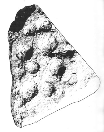
Lockington cup-marking (courtesy Gwilym Hughes)Lockington cup-marked stone
Found on the northern edge of a ring ditch surrounding this once-fine tomb, the carving was found on a small, triangular-shaped, broken piece of rock , less than 12 inches across along its longest side. The small stone has what seems to be eight cup-marks (5 seem certain) pecked onto the stone: simple, without additional ingredients, akin to the basic forms found at Baildon and other more northern climes. The stone itself didn’t seem to be local and was thought by Hughes (2000) “to be from one of the outcrops of millstone grit to the north of the site in southern Derbyshire.”
Less than 7 feet from this petroglyph, inside the barrow, was a pit containing a hoard of ancient gold and copper ware — though any likely relationship between the carving and the treasure hoard is doubtful. The carving was probably a “portable” relic, carried some distance and put here for some reason or other: perhaps as an offering; perhaps a magickal artifact — we’ll probably never know…
This is an intriguing find inasmuch as cup-marked stones are rare in this part of the British Isles. Antiquarians have noted examples of such carvings in the Cornish townships of Davidstow, Delabole, Portreath, but very few others are known about. But in the once-impressive Tregulland Burrow barrow that was found here on the south-side of the road a few hundred yards up from Cold Northcott, just next to the old township boundary line, as many as eighteen carved stones were unearthed!
Fig.2
They were all found inside different sections of the barrow, which was built on top of an earlier cairn structure, which appears to have been built upon an even earlier concentric ring of upright wooden poles. The cup-marked stones appear to have been introduced, or etched, around the time when the cairn structure was laid on top of the concentric ring of stake-holes. This “tradition” of adding cup-marked stones to cairns is a feature found at a number of sites in the northern lands of Yorkshire, Northumbria and across the Scottish counties, but such a celebrated event as this in the far southwest is highly unusual! (although the custom is pretty universal and is found, not only in the UK, but in many parts of the world).
Fig.3Fig.4
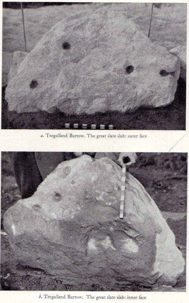
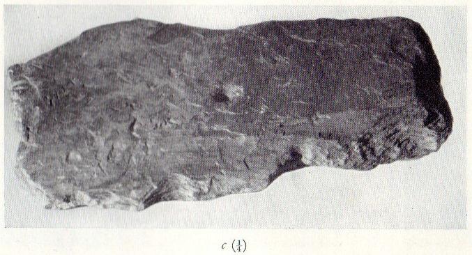
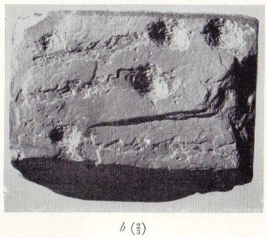
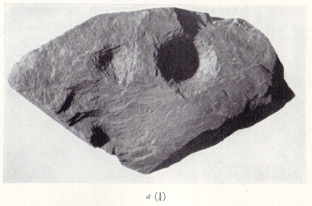
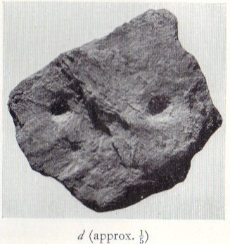
In Paul Ashbee’s (1958) excellent essay on this prehistoric tomb, he described the carvings at some considerable length — which is unusual for an archaeologist of that period — noting them as the “cup-marked and ornamented stones”. I hope that people won’t mind me repeating his lengthy notes on the relevant carved stones found in the tomb, the largest of which was on a big slab near the middle of the cairn that possessed cup-markings “and an ‘eyebrow’ motif”,* (figure 1, above) as he called it. He described the respective carvings as follows:
“From the Cairn-Ring:
1-2. A hog-backed outlined slate slab (figure 1, above). The bottom has a straight worked edge which suggests that the form was deliberate. On the inner face are four close-set cup-marks, and an ‘eyebrow’ device which has been made around a natural flaw, whilst the outer half has been formed by pecking and bashing to remove an appropriate amount of the laminated slate structure to form a depression. On the outer face there are four widely set cup-marks, one being connected by a channel to the edge of the slab…
3-4. A roughly rectangular slate slab. The upper face bears two cup-marks, one much smaller than the other, together with one abortive cup-mark, the lower a single cup-mark. Four perforations had been used to remove this slab from a parent block, the halves of these perforations gracing the upper edge. The slab was incorporated in the upper part of the cairn-ring material stacked against the largest of the sub-megalithic blocks of the cairn-ring.
5. The slab is hog-backed in outline, resembling No.1 above in general form. On the upper face, at a right-angle to the straight bottom edge, a channel had been produced by pecking, the marks of a pointed instrument being clearly discernible at the bottom of the channel. This channel extends almost from edge to edge of the slab, being narrow at the bottom and then expanding, being thus wider and then gradually tapering. Were it not asymmetrical it could be considered as a dagger representation.
6. A small block of roughly pentagonal outline, one side being irregular. The device it bears has been made by pecking an outline and removing the intervening laminated slatey rock. Found at the base of the cairn-ring on the south side.
7. A weathered pillow-like lump of a coarse sandstone-like rock. The plane face bears at least seven small ‘cup-marks.’ On other sides there are more weathered and uncertain marks which may well be natural. It was found surmounting, in a central position, the faced walling on the western side of the cairn-ring. Dr F.S. Wallis reports that: “This is evidently a sandstone rock with a large amount of quartz. This is a very generalized rock and I am afraid that it is not possible to tie it down to any particular part of Cornwall. The rock is much weathered and, judging from the print, I should say that the pits are entirely natural. Such a rock would hardly contain fossils and thus the pits could not have an organic origin.”
8. A roughly rectangular slate slab with opposing ‘cup-marks’ broken through before complete perforation. In addition there is a single cup-mark on the upper edge. (see figure 2) It was in the banked stones on the western side of the cairn-ring.
“From the soil bank:
1. An even, rectangular slab bearing a group of three cup-marks in one corner, and single cup-marks in two other corners. (see figure 3) From the outer cup-marks of the group run two channels. A channel runs from one of the solitary corner cup-marks. It was found, cup-marks and channels uppermost, almost exactly above the satellite cremation trench-grave.
2. A roughly triangular slab, bearing on its upper face a single centrally set cup-mark. Found by the cairn-ring in the eastern quadrant.
3. A small slab, of pentagonal outline, bearing a single shallow cup-mark. Found by the cairn-ring in the eastern side.
4. A thin U-shaped slab which has been battered into shape by edge chipping. A concavity has been made along the upper edge.
“From the ditch infilling:
5. A tough, quartz-veined slab with a shallow battered cup-mark. From the western side of the barrow.
6. A small, tough, even, rectangular piece of slate, bearing an abortive cup-mark. From the western side of the barrow.
7. A thin piece of slate bearing a small cup-mark set at a point where laminae of slate have left the piece. From the eastern side of the barrow.
“Unstratified:
All the “unstratified” cup-marked slabs recovered from the central disturbances, both recent and earlier, may well be derived from the destruction of the central grave arrangements.
8. A thick lozenge-outlined slab bearing one large cup-mark, and one smaller set side-by-side. (figure 4, above)
9. A roughly square-outlined slab with two cup-marks of even size set across one diagonal. (figure 5, below) One cup-mark has a smaller one close by it.
10-11. Irregular pieces of thin slate, bearing traces of perforations on their edges, one bearing cup-marks.
12. A roughly triangular slab bearing an ? unfinished cup-mark.
13. An even hexagonal slab that appears to have been, by edge trimming, worked into this form.”
Fig.5
The prolific collection of cup-marked stones in this once-impressive monument would probably indicate that the character buried here was of some significance to the local people, both to those who knew him and, evidently, in the subsequent mythologies surrounding the site (click here for the details of Tregullan Burrow barrow if you wanna know the archaeology and structure of the site). And although we find, statistically speaking, a lacking of other cup-markings in this region, it’s more than likely there are others that are hiding away amidst other old tombs and rocks…
References:
Ashbee, Paul, “The Excavation of Tregulland Burrow, Treneglos Parish, Cornwall,” in Antiquaries Journal, volume 38, 1958.
* the eyebrow motif description was used by a number of archaeo’s for sometime following publication of O.G.S. Crawford’s book, The Eye Goddess, to which the Antiquity Journal editor speculated some cup-and-rings may have owed their origin.
It is best approached from the track at the side of Weecher reservoir (site of the destroyed Weecher stone circle) on the east side of Rombalds Moor, where you should follow the natural curve of the track till you reach the tiny hamlet of Faweather where, on your right, just in the garden edge, you’ll see this faded old carving. This has only recently been incorporated into the garden (it used to sit on a small triangle of grass where three old tracks meet), but the people living here seem pleasant enough and will let you look at the carving if you ask.
Archaeology & History
Hedges 1986 drawing
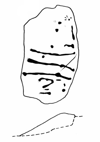
Just off the far-eastern edge of Rombald’s Moor and north of Baildon Moor, this faded cup-marked stone might only be for the real fanatics amongst you! I like it though. Described in Sidney Jackson’s rare Bradford archaeology journal, the site was added to Hedges (1986) survey, and the subsequent Boughey & Vickerman’s (2003) work, neither of whom said much about it. It’s a pretty basic carving though, consisting of several cups and lines that run over the top of the stone, some of which seems to be due to natural weathering — it’s hard to say for sure.
References:
Boughey, Keith & Vickerman, E.A., Prehistoric Rock Art of the West Riding, West Yorkshire Archaeology Service 2003.
Hedges, John (ed.), The Carved Rocks on Rombalds Moor, West Yorkshire Metropolitan County Council: Wakefield 1986.
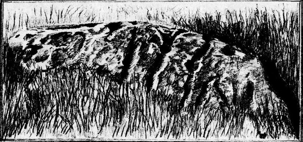
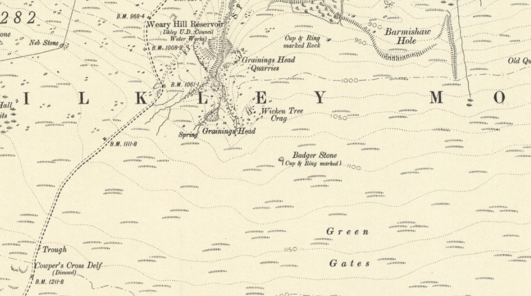
Although there are several routes to this site, for those who are not used to walking or find maps difficult to read [get a life!], it is best approached from the Ilkley side of the moor. Follow the old track that cuts the moor in half past the remains of Graining Head quarry where the moor begins to level out. Once here cut straight east until you find the footpath which, after a while, you will see leads to a wooden seat right in the middle of nowhere. Here is our Badger Stone.
Archaeology & History
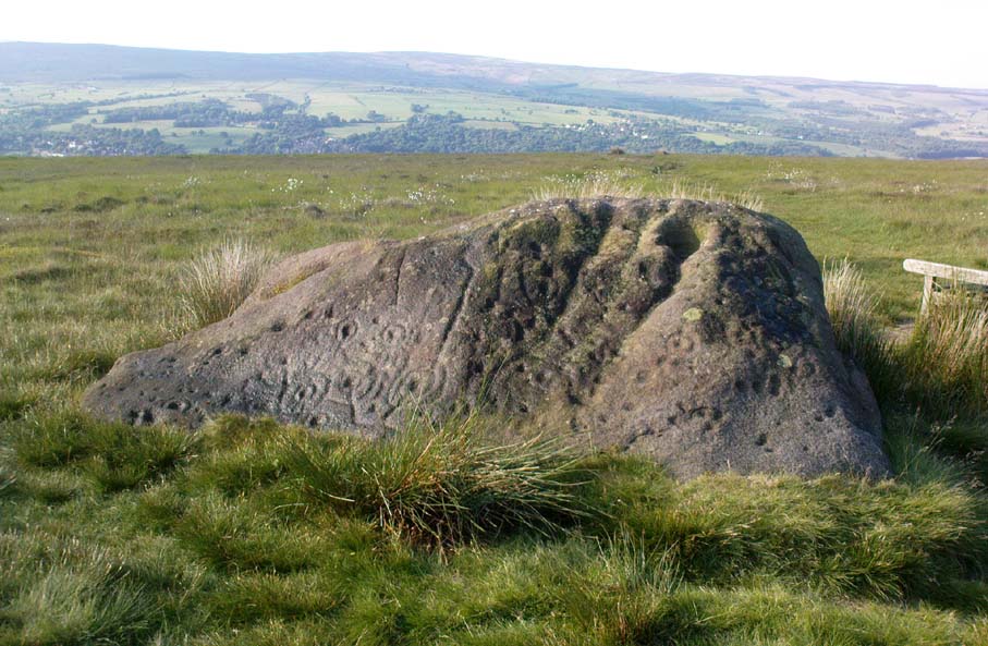
An eroded but quite excellent cup-and-ring stone — one of the very best on Ilkley Moor — comprising nearly a hundred cups, ten rings, what seems to be a half-swastika design, plus a variety of other odd motifs. It’s one of the best carvings on the entire moor and has been written about by many folk over the years. First described in an early essay on cup-and-ring stones by J. Romilly Allen (1879) — who must have visited it in poor light, as some elements of the carving weren’t noticed — he described it as a “sculptured stone near Grainings Head”, saying:
“This stone…is a block of gritstone 12ft long by 7ft 6in broad, by 4ft high. The largest face slopes at an angle of about 40° to the horizon, and on it are carved nearly fifty cups, sixteen of which are surrounded with single concentric rings. At the west end of the stone are a group, three cups with double rings and radial grooves. At the other end, near the top, is a curious pattern formed of double grooves, and somewhat resembling the “swastika” emblem… At the highest part of the stone is a rock basin 8in deep and 9in wide. On the vertical end of the stone are five cut cups, three of which have single rings. This is one of the few instances of cup and ring marks occurring on a vertical face of rock.”
Badger Stone on 1910 map
The title “badger” dates back to at least medieval times when, as the Yorkshire historian Arthur Raistrick (1962) explained, the word represented “a corn dealer, corn miller or miller’s man.” It is likely that this traditional title goes much further back, probably into prehistory, as grain was one of the earliest forms of trade. Very close to this sacred old stone are place-names verifying this, like Grainings Head and Green Gates. A little higher upon the moor is the twelfth century Cowper’s Cross (which used to have cup-markings etched upon it) where, tradition tells, a market was held that replaced an older one close by.
The Badger Stone carvingClose-up of cup-and-rings
Our Badger Stone rests beside the prehistoric track which Eric Cowling termed “Rombald’s Way” (after the legendary giant, Rombald, who lived with his old wife upon these hills): an important prehistoric route running across the mid-Pennines. This ancient route runs east-west, traditionally the time of year when agricultural needs are greatest at the equinoxes. This may have been the time when any ancient grain traders met here. (In modern times a number of archaeologists have emphasized such routes as “trade routes”: a notion that derives from the modern religion of Free Market Economics in tandem with the rise of Industrialism and social Darwinism, much more than the actuality of them as simple pathways or means of accessible movement).
There are accounts from other places in Yorkshire about these badger men. We find a number of other “badger” stones, gates, ways, stoops and crosses on our Yorkshire hills. One of them in North Yorkshire, wrote Raistrick (1962), “is an ancient trade way.” In Richmond, North Yorkshire, around the time of the autumn equinox, Badger men from across the Dales followed the old routes over the hills into town, held annual festivities and sold their grain. (see Smith 1989; Speight 1897) It is perhaps possible that our old Badger Stone would have been a site where some form of indigenous British Demeter was revered.
Sketch of Badger Stone carving
Some elements of the Badger Stone carving have what could be deemed as primitive human images (anthropomorphic) mainly on the northwestern side of the rock, emerging from the Earth Herself. And certainly amidst the same portion we have a very distinct ‘solar’ symbol, very much like the ones found at Newgrange and, for that matter, many other parts of the world.
Some New Age folk have given the fertility element to the Badger Stone a deeper status, using imagination as an aid to decode these old carvings. When feminist New-Age writer Monica Sjoo visited Badger Stone she described it as “erotic”, with the carvings giving her a distinct impression of “vulvas” and she also thought orgies of sorts had been enacted here. (Billingsley & Sjoo, 1993) The vulva imagery is a well-known idea to explain cup-and-rings and in some cases this will be valid; but when I passed an illustration of this rock-art to a number of people (all women), there was not a vulva to be mentioned — merely the OM symbol, sperm entering the egg, a snail, a bicycle, a willy, a paw-print, eyes, a face, a tadpole, cartoon breasts, the rear end of a dog, grapes, letters, numbers, ears and a snake! Awesome stuff! Take a look at the design yourself and see what you can see in it. Answers on a postcard please! (The dilemma of making specific interpretations of these carvings is that we tend to approach them with dominant ego perspectives, many of them reflecting little more than our own beliefs or search for identity, imposing unresolved journeys and conflicts on that which we encounter, as with the above case.)
As with prehistoric rock-art in general, they are a number of things: functional, ritual, history, spirit; different at each and every site. As if to exemplify this at Badger Stone, note how the detailed carvings have been executed mainly on the southern face of the stone. The northern face has little if anything to show on it. It would suggest therefore, that this stone had some mythic relationship with events during daylight hours. But we have to be careful here…
At sunrise on a good morning, we note how the eastern edges of this stone show up very clearly indeed. If Nature’s conditions are damp and wet (as they tend to be each morning on the hills), the visible outline of these cup-and-rings show up very clearly indeed. Oddly, as the sun then passes through the daytime sky each and every day on its cyclical movement, the petroglyphic content becomes a little less visible unless the stone is wet. Indeed at sun-high (midday period) the carving doesn’t show up as well as it did in the morning light. And we find the same characteristic as the sun goes to set in the west: where that part of the carved stone shows up very clearly again — much clearer than during full daytime hours. If rain has fallen, the glyphs stand out very clearly indeed.
As all cultures imbued the natural world with animistic, living qualities, it seems probable that these periods of the day (sunrise and sunset) were significant at this particular carving. It may be, very simply, that the Badger Stone “came to life” with the sunrise and its mythic nature was alive during this period; whereas with many other carvings (both on these moors and elsewhere in Britain) their strong mythic associations related to the northern Land of the Dead. But then, I could be talking bullshit!
The Badger Stone is also a strong contender for it being a painted stone. Many petroglyphs like this in other cultures were ceremonially coloured-in using lichens and other plants dyes at certain times of the day or year, relating specifically to important mythic relationships between the people and the spirit of the rock at such places. This probably occurred here.
References:
Allen, J. Romilly, “The Prehistoric Rock Sculptures of Ilkley,” in Journal of the British Archaeological Association, volume 35, 1879.
Bennett, Paul, The Old Stones of Elmet, Capall Bann: Milverton 2001.
Billingsley, John & Sjoo, Monica, “Monica Sjoo in West Yorkshire,” in Northern Earth Mysteries, no.53, 1993.
Boughey, Keith & Vickerman, E.A., Prehistoric Rock Art of the West Riding, WYAS: Leeds 2003.
Hedges, John, The Carved Rocks on Rombald’s Moor, WYMCC: Wakefield 1986.
Cowling, Eric T., Rombald’s Way, William Walker: Otley 1946.
Raistrick, Arthur, Green Tracks on the Pennines, Dalesman: Clapham 1962.
Smith, Julia, Fairs, Feasts and Frolics: Customs and Traditions in Yorkshire, Smith Settle: Otley 1989.
Speight, Harry, Romantic Richmondshire, Elliot Stock: London 1897.