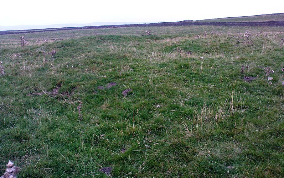
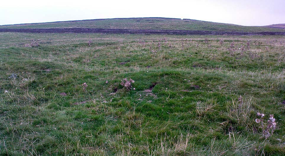
Green Plain, Blubberhouses Moor, North Yorkshire

Settlement:  OS Grid Reference – SE 1492 5378
Getting Here

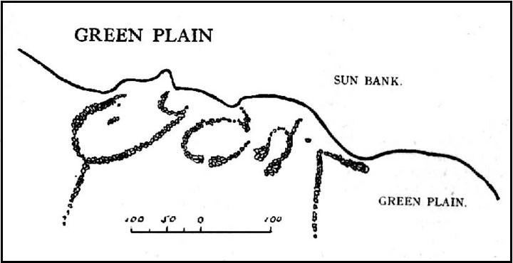
Cowling’s 1946 ground-plan of a portion of the settlement

From Blubberhouses church by the crossroads, walk up the slope (south) as if you’re going to Askwith, for 100 yards or so, taking the track and footpath past the Manor House and onto the moor.  Once you hit the moorland proper, take the footpath that bears left going down into heather and keep going till you hit the dead straight Roman Road path running west onto Blubberhouses Moor.  Go on here for nearly a mile until you hit the valley stream with its Eagle Stone down on your left.  Walk downstream, past the Eagle Stone, and cross over 100 yards down until you’re back on the level ground with the scatter of bracken and heather.  You’re here!

Archaeology & History

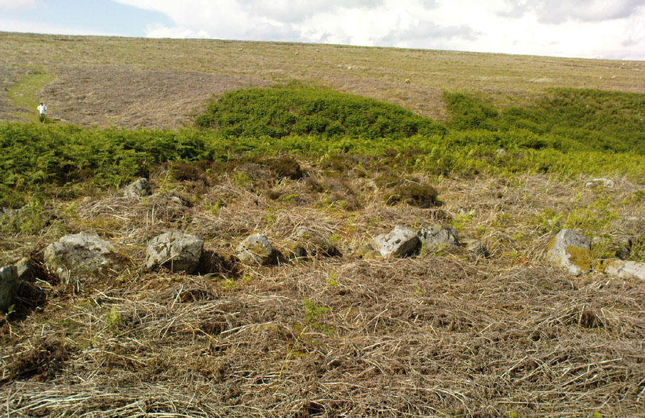
On the other side of the stream a short distance southeast of the large cup-marked Eagle Stone is a curious site, first described by Eric Cowling (1946) as “a series of enclosures of varying size and roughly circular shape” which he ascribed as a Bronze Age settlement.  Certainly we have a rather extensive scattered group of walled structures just as he described, but not all of the walling here seems typical of local Bronze Age constructions.  Cowling suggested the remains to be “useful for protection, herding and for shelter,” though admitted archaeological excavation would be the best way to ascertain their specific nature.  Such undertakings have yet to be done — and I wouldn’t hold your breath either.
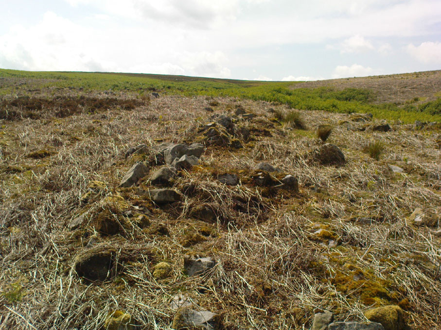
Large section of walling
Walls of large circular structure

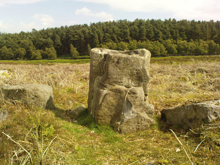
Although he described some of the walls here as nearly four-feet tall, when Graeme Chappell and I first ventured here in the winter of 1990, the walling wasn’t quite as high.  There are a number of individual tall stones sat in the walls that stand three-feet tall, with some that have been cut and dressed in more historic times.  Who did this and when is unknown.  However, if we visited this place when all the vegetation has been cut and burnt back at the end of winter and early months of Spring — a fact not lost on Cowling when he first found this place — we would gain a much clearer picture of things here.

Some sections of lower walling above the streamside appear to be prehistoric in nature, but many other parts of the walled structures across this flatland plain have a much later look and feel about them, illustrating that the site may have been used well into post-medieval periods.  This seems increasingly obvious where we find a number of the stones cut at sharp angles, with some having distinctive quarried grooves in them.  However, I can find no historical records to verify this at present.
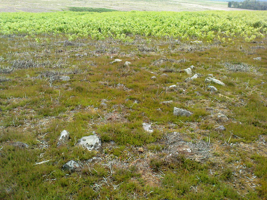
Hut circle remains
Medieval cut upright stone?

If we walk up the slight slope westwards however (before bracken and heath grow) there are more distinct prehistoric remains in the form of typical hut circles with low walls emerging from deep peatlands — although even these have been cut in one or two places by metal tools.  My view of this little-known but large settlement arena is that we’re looking at a site initially built in the Bronze Age period, continuing to be used by local tribespeople throughout the Iron Age and, as the cut stones clearly show, was a village that was certainly made use of in the last millenium.  But until someone comes along here and gives the site the attention it deserves, we’re not gonna know…

On the southern fringe of the copious walled structures we also find a very curious medicinal chalybeate spring that may have been of some importance to those who once lived hereby.  A ‘standing stone’ and prehistoric cairn can also be seen close by.

References:

  1. Cowling, E.T., Rombald’s Way: A Prehistory of Mid-Wharfedale, William Walker: Otley 1946.

© Paul Bennett, The Northern Antiquarian

Slade Carving (02), Blubberhouses Moor, North Yorkshire

Cup-Marked Stone:  OS Grid Reference – SE 1411 5431

Also Known as:

  1. Owl Stone
  2. Sunset Stone

Getting Here

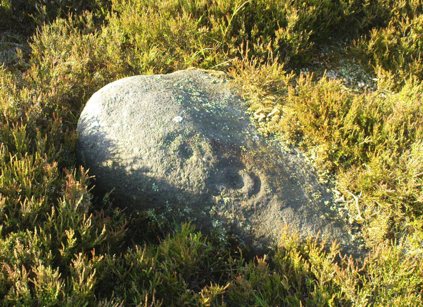
Cup-and-rings, looking NE

Same directions as the Slade 01 carving.  But once you reach the upstanding stone cairn on the rocky hill, walk 220 yards (less than 200m) WSW and look around.  You’re damn close!  If you find the large cup-marked Slade 03 carving,  walk back east about 10-20 yards and you can’t really miss it!

Archaeology & History

This is just one of at least seven previously undiscovered carvings on this section of moorland – and it’s worth looking for!  The two other names we gave it — ‘owl’ and ‘sunset’ — come from the very notable design: owl thanks to it having the appearance of large owl-like eyes, and sunset as the two cup-and-rings are etched on the western edge of the rock and, when we found it yesterday, the sun was setting (albeit to the NW) and the image prompted talks of setting suns, the land of the Dead and other such worldwide indigenous religious myths (Harvey 2000) — for without recourse to such ingredients, these carvings are vacuous archaeocentric museum pieces and nothing more.  And this carving at least deserves much more than mere cataloguing!  The internationally renowned archaeologist, O.G.S. Crawford (1957) would have entered this carving into his ‘eye’ and ‘owl’ motif, representative of goddesses or spirit-forms, as would Gimbutas. (1989)

…and from above

But this carving is archetypal, as we can see, though would appear to have no other etched features on the stone’s surface.  It is very close (if not within) the prehistoric graveyard that is plainly evident 30-40 yards south in the burnt heather and would very likely have had some mythic relationship with the dead (a symbiosis we have found in many cup-and-rings).  We plan further ventures here in the coming weeks in the hope that we can unearth other prehistoric remains.

References:

  1. Crawford, O.G.S., The Eye Goddess, Phoenix House: London 1957.
  2. Gimbutas, Marija, The Language of the Goddess, Harper Collins: New York 1989.
  3. Harvey, Graham (ed.), Indigenous Religions, Cassell: London 2000.

© Paul Bennett, The Northern Antiquarian

Slade Carving (01), Blubberhouses Moor, North Yorkshire

Cup-Marked Stone:  OS Grid Reference – SE 1421 5440

Getting Here

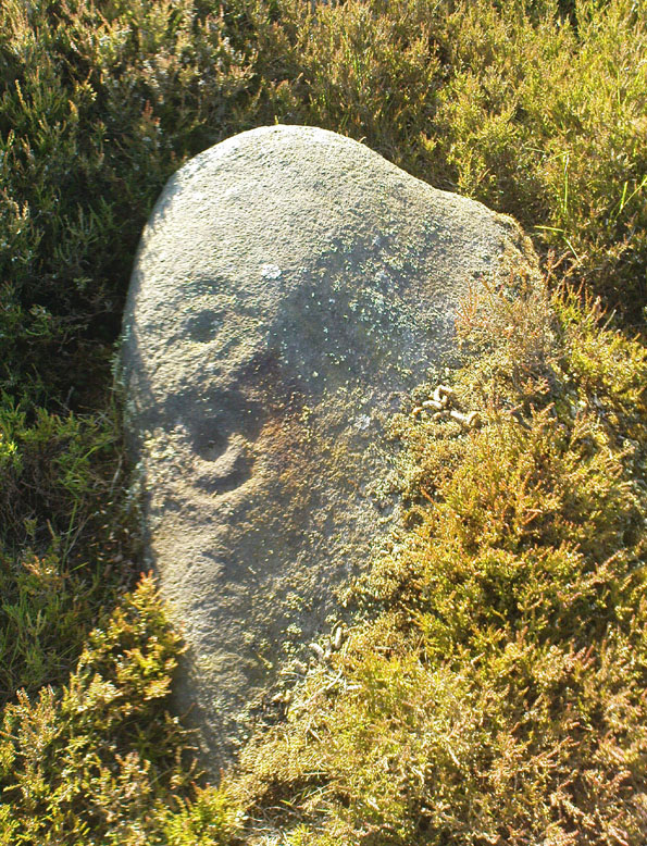
Simple cup-marked stone

From Blubberhouses church by the crossroads, walk up the slope (south) as if you’re going to Askwith, for 100 yards or so, taking the track and footpath past the Manor House and onto the moor.  Once you hit the moorland proper, take the footpath that bears left going down into heather and keep going till you hit the dead straight Roman Road path running west onto Blubberhouses Moor.  Go on here for nearly a mile until you hit the stream and nearby Eagle Stone boulder.  Walk upstream from here, on its eastern (right-hand) side for 100 yards, then walk up onto the level moor, scattered with rushes.  Keep up here, heading towards the upright cairn open the skyline to the north.  Once here, walk 80 yards (73m) WNW and you’ll note a number of flat stones embedded in the heather around you.  You’re damn close!

Archaeology & History

Off-path and takes some finding and will all-but disappear when the heather grows back, so this one’s probably only for the purists amongst you.  But I like it anyway!  This is one of at least seven newly-discovered cup-marked stones hereby, including the nearby ‘Owl Stone’ with it’s big eyes!  There are just two cup-marks on the flat surface: one an archetypal large cup 3 inches across and a half-inch deep; the other, a small faint cup less than 2 inches wide and very shallow which is easily missed if you pay little attention.  On the photo here, the fainter cup is slightly above right of the centre.  The carving appears to be on the far eastern edges of the Slade Cairnfield.  Other undiscovered remains are likely to be found here.

© Paul Bennett, The Northern Antiquarian

Lippersley Pike, Denton Moor, North Yorkshire

Cairn:  OS Grid Reference – SE 14335 52478

Getting Here

Follow the directions to reach the Lippersley Pike cup-marked stone, then keep walking westwards, but go up the slope immediately on your right (north) and walk upwards along the path to the notable stone structure at the top-end of the ridge a coupla hundred yards ahead.  Once there, you’re standing on it!

Archaeology & History

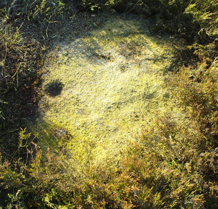
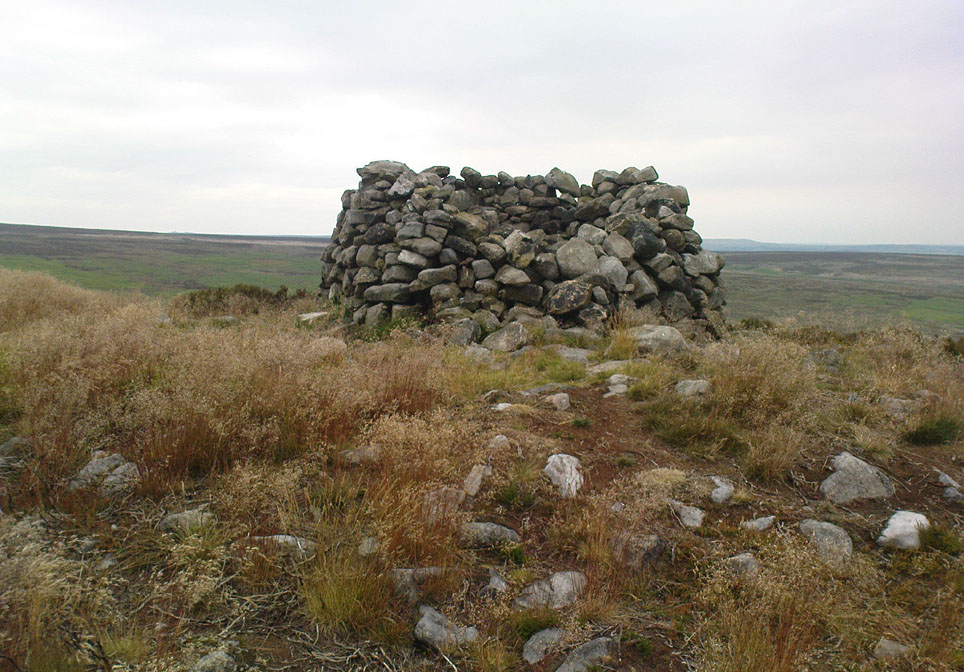
Lippersley Pike & shooter’s butt

A little known site with some excellent 360° views all round, reaching as far west as Pendle Hill, north past Simon’s Seat, and east onto the far reaches of the North York Moors.  The landscape here is truly superb!  And humans have been here since, it would seem, mesolithic periods at least, if Cowling’s finds are owt to go by! For although he described the much denuded tomb that we can still see under the herbage and recently-built shelter, there was also, “on the northern slope…a small occupation immediately below the summit on the northern side.”  We found remains of it on our visit here the other day.  But of the tomb itself — which Mr Cowling thought was neolithic in age — he wrote:

“The highest point of Lippersley Pike, on Denton Moor, is crowned by a stone cairn 1083 feet above sea level, and overlooks, on the northern side, a small site which appears to have been occupied by the ‘Broad Blade’ people, for there occur several pieces of patinated flint, along with scrapers and worked blades.”

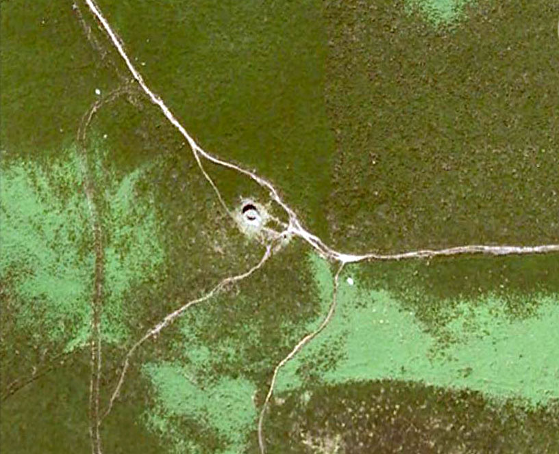
Aerial view of Lippersley Pike

Cowling then describes a number of flints and other prehistoric working utensils that he found all round here.  The remains of the cairn measure some 25 feet east-west and 23 feet north-south.  There has been no excavation here, although the fella’s who dug out much of the stone to build the shooter’s butt on its top may have found summat, but have kept it quiet!

The cairn is an ancient marker along the boundary line marking the townships of Denton and Great Timble and was visited in perambulation walks in previous centuries.  Grainge (1871) describes the extensive perambulation in his Knaresborough Forest work.  ‘Lippersley’ itself first appears in records from 1576, although A.H. Smith (1963:5) does not suggest an etymology.  The place is worth visiting as a good starting point to explore the other little-known prehistoric remains on these moors, including the Crow Well settlement, the Heligar Pike tomb, etc, etc.

References:

  1. Cowling, E.T., Rombald’s Way: A Prehistory of Mid-Wharfedale, William Walker: Otley 1946.
  2. Grainge, William, The History and Topography of Harrogate and the Forest of Knaresborough, John Russell Smith: London 1871.
  3. Grainge, William, The History and Topography of the Townships of Little Timble, Great Timble and the Hamlet of Snowden, William Walker: Otley 1895.
  4. Smith, A.H., The Place-Names of the West Riding of Yorkshire – volume 5, Cambridge University Press 1963.

© Paul Bennett, The Northern Antiquarian

Snowden Carr (597), Askwith Moor, North Yorkshire

Cup-Marked Stone:  OS Grid Reference – SE 17965 51158

Getting Here

Find your way to the excellent Tree of Life cup-and-ring stone, then walk about 10-15 yards west.  It’s under your nose!

Archaeology & History

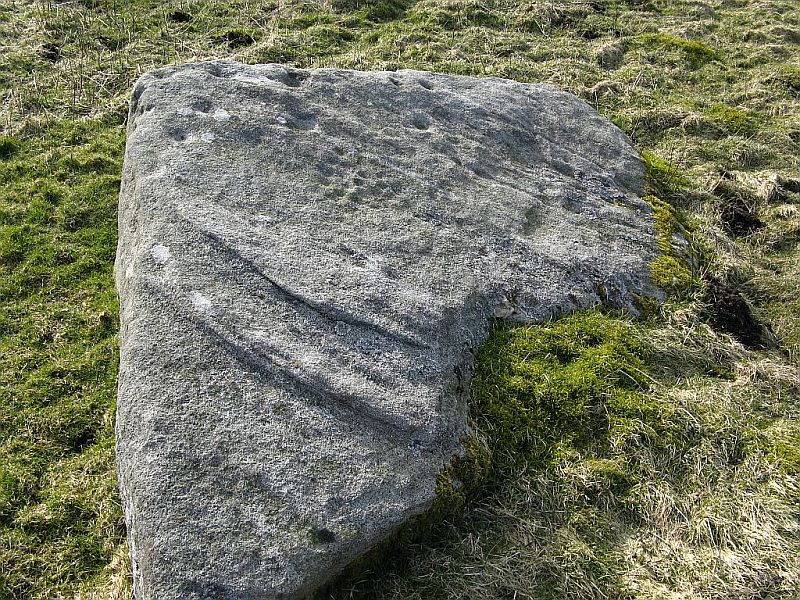
Single cup-marked stone

Another stone for the rock art purists amongst us: a singular cup-marking near the edge of the rock.  Although the photo here seems to show three cup-markings close to each other, only one of the three is in fact real.  The other two are simple geological creations.  But this fact seemed to go over the heads of some English Heritage archaeologists who reported to Boughey & Vickerman (2003) that this was a stone “with three cup markings” on it.  I’m not sure who trains EH rock-art enthusiasts, but they seem to have a tendency to mistake natural features with artificial cup-markings and their evaluations should be treated with considerable caution (you’ve gotta wonder who the students are that are teaching them).

The rock itself is found in close association with other prehistoric remains and may have been a part of enclosure walling.  Very close by are numerous well-preserved settlement remains, cairns and other cup-and-ring stones.

References:

  1. Boughey, Keith & Vickerman, E.A., Prehistoric Rock Art of the West Riding, WYAS: Wakefield 2003.

© Paul Bennett, The Northern Antiquarian

Eller Edge (431), Pock Stones Moor, Thruscross, North Yorkshire

Cup-Marked Stone:  OS Grid Reference – SE 09059 61506

Getting Here

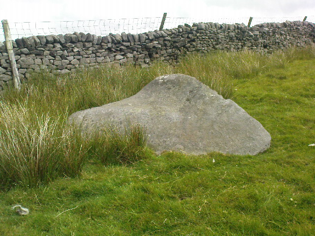
From Appletreewick take the road east through Skyreholme and up Skyreholme Bank, bearing right at the fork in the tracks along the ancient Forest Road.  Keep going till you cross the Larnshaw Beck and keep walking along the track until it runs wallside.  Look over the wall and you’ll see this sloping-chair-shaped rock .  You’re here!

Cup-Marked stone 431

Archaeology & History

Worth looking at if you’re visiting the Spiral Stone of Eller Edge field and its large associate, but otherwise this cup-marked stone is probably only for the purist rock-art mad-folk amongst us!  There are what seem to be three decent cup-marks upon the sloping face of the rock here, with a possible pecked line to the side of two of them — though we have to consider the possibility that a geological condition is responsible for the easternmost cup.  Described in the Boughey & Vickerman (2003) survey simply as:

“Large triangular rock of smooth gritstone, quarried at SE and sloping into ground at W and N.  Three cups on top sloping face.”

Thirty yards up the slope along the wall-side you’ll find carving 432 with its single cup-marking.


References:

  1. Boughey, Keith & Vickerman, E.A., Prehistoric Rock Art of the West Riding, WYAS: Wakefield 2003.

Links:

  1. Eller Edge Rock Art – more notes & images

© Paul Bennett, The Northern Antiquarian


Eller Edge (426), Pock Stones Moor, Thruscross, North Yorkshire

Cup-and-Ring Stone:  OS Grid Reference – SE 08991 61486

Also Known as:

  1. Spiral Stone
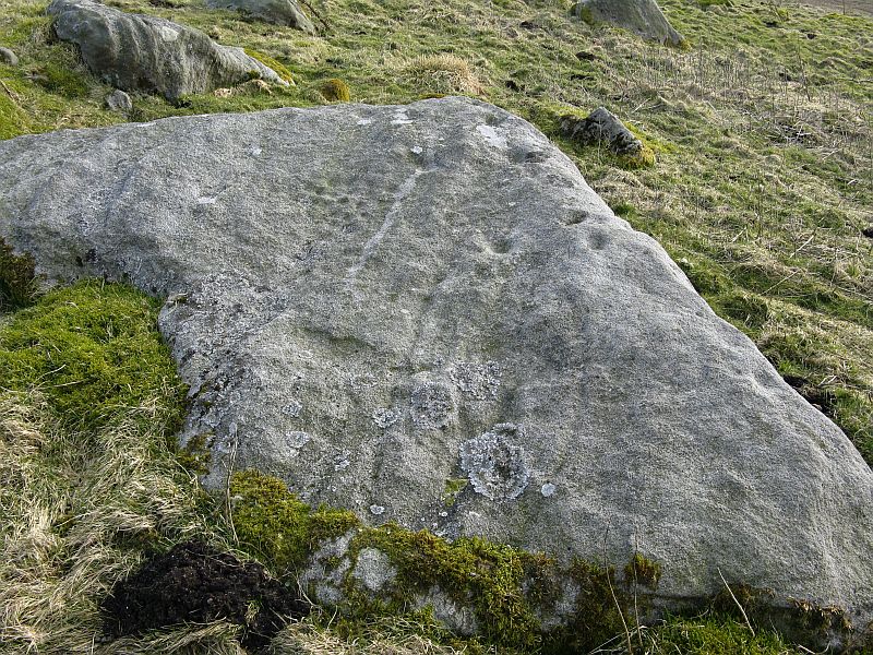
Spiral Stone with cluster of cups (image © QDanT)

Getting Here

A slight walk to get here, but well worth it once you arrive!  From Appletreewick, take the road east through Skyreholme and up Skyreholme Bank track, bearing right at the fork in the tracks along the ancient Forest Road.  Keep going and after a couple of zigzags, you’ll cross the Larnshaw Beck.  Keep walking along the track until it runs wallside — and here, go straight down the field for 75 yards (best climbing over the rickety wooden bridge by the stream 50 yards back and walking up).  Although there are a number of other stones hereby, you can’t really miss this.

Archaeology & History

This carved stone and its close associates rest upon the green slopes overlooking the Blands Valley and further across upper Wharfedale and the lands beyond.  The majestic Simon’s Seat rises on the nearby western slope and there in the greater distance, once more reaches the sacred hill of Pendle, with whom so many other ancient sites commune within our northern lands.  It’s hard to say for sure that the Witch’s Hill was of little relevance to this and other stones, but only a fool would ignore the geomancer’s notes about this constant.

Eller Edge carving, looking south (image © QDanT)
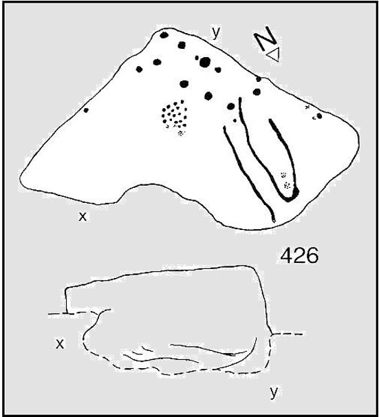
Boughey & Vickerman’s drawing

The carving here doesn’t give much clues in any direct sense either.  We have an almost arrowhead-shaped rock with a dozen decent cup-marks or so cut along and near its western side; but the notable curiosity here is the small circular cluster of smaller cup-marks dotted in a near circular mass near the middle of the stone.

When Danny, Paul and I came here the other week, the initial impression of this cluster was one of a primitive solar symbol etched onto the rock; but the more we looked, the more it seemed that these small cups appeared to have been arranged in a very rough spiral lay-out.  Now I know that spirals are damn rare items in rock art (especially in this part of the world), but the more we looked and then subsequently checked Boughey & Vickerman’s (2003) illustration, the more evident it became.  Of course the ‘spiral’ could be merely fortuitous, but I’m not so sure misself.  In discussing this with our field archaeologist later, he suggested getting a rubbing of this part of the stone on his next visit.

The stone was first described by the petroglyph explorer Stuart Feather (1964) and later described by the rock art students Boughey & Vickerman (2004), simply as:

“Large, rough grit rock with face sloping SE down into grass at N.  About twenty cups to W, with three grooves at N corner and group of about twenty small cups at NE.”

A very intriguing carving.  And if you visit here, make sure you check out carving 424 and others in the same field.

References:

  1. Boughey, Keith & Vickerman, E.A., Prehistoric Rock Art of the West Riding, WYAS: Wakefield 2003.
  2. Feather, Stuart, “Appletreewick, WR,” in ‘Archaeological Register, 1963’, Yorkshire Archaeological Journal, volume 41, 1964.

Links:

  1. Eller Edge Rock Art – more notes & images

© Paul Bennett, The Northern Antiquarian


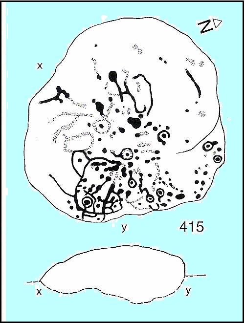
Burhill Kiln Allotment (415), Appletreewick, North Yorkshire

Cup-and-Ring Stone:  OS Grid Reference – SE 07792 61829

Also Known as:

  1. Carving no.415 (Boughey & Vickerman)
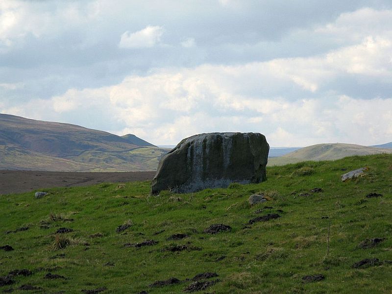
Burhill’s cup-and-ring stone (image courtesy ‘QDanT’)

Getting Here

Probably the easiest way is to park up at Stump Cross Caverns on the B6265 road, then walk down the road for 200 yards till you reach the track on your left running over the fields in the direction towards Simon’s Seat.  Walk along the track past the Skyreholme Wall carving, where it starts going downhill and, 100 yards before you reach the fork in the tracks, look in the field on your left.  The other route is to go east through Appletreewick village up to and through Skyreholme as far as you can drive, where the dirt-track begins.  Keep going up till you hit the fork in the tracks.  Go left, then thru the first gate you come to and walk up into the second field up where the notable rock stands out.  If you can’t see it at first, look around!

Archaeology & History

Boughey & Vickerman’s plan of the carving

This carving was rediscovered by Stuart Feather (1964) in one of his ambles in the area — and he would have been pretty pleased when he found this one!  It is the most complex and ornate of all the prehistoric carvings in and around this large open field.  With at least nine cup-and-rings and more than fifty other cups etched onto its rounded upper surface, there are various other lines and grooves linking up some elements of this mythic design. The best ones are on the upright and sloping east-face of the rock, into the rising sun.  In animistic terms the rock is distinctly female in nature.

Illustrated in one of Stan Beckensall’s (1999) works, the rock art students Boughey & Vickerman (2003) also include it in their survey, but give an inaccurate grid reference for the site.  They nevertheless describe it as:

“Large upstanding rock with slightly domed top surface. Most of top surface decorated but weathering makes detail uncertain: over sixty cups, eight or more with rings, many grooves.”

Many other carvings can be found in the area.

References:

  1. Beckensall, Stan, British Prehistoric Rock Art, Tempus: Stroud 1999.
  2. Boughey, Keith & Vickerman, E.A., Prehistoric Rock Art of the West Riding, WYAS: Wakefield 2003.
  3. Feather, Stuart, “Appletreewick, W.R.” in ‘The Yorkshire Archaeological Register, 1963’, Yorkshire Archaeological Journal, 41 (part 162), 1964.
  4. Morris, Ronald W.B., “The Prehistoric Rock Art of Great Britain: A Survey of All Sites Bearing Motifs more Complex than Simple Cup-marks,” in Proceedings of the Prehistoric Society, volume 55, 1989.

Acknowledgements:  Huge thanks to the pseudonymous ‘QDanT‘ for use of the photo in this profile.  Cheers Danny!

© Paul Bennett, The Northern Antiquarian

Burnett’s Ridge (421), Appletreewick, North Yorkshire

Cup-and-Ring Stone:  OS Grid Reference – SE 08103 61500

Also Known as:

  1. Carving no.421 (Boughey & Vickerman)
The beautiful stone… (courtesy ‘QDanT’)

Getting Here

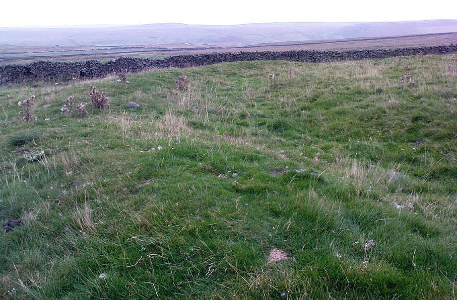
One way is to go east through Appletreewick village up to and through Skyreholme (making sure you bear right at the turn and not go up the left turn, which takes you uphill and elsewhere!) as far as you can drive, where the dirt-track begins.  Keep going up till you hit the fork in the tracks, and here, look into the field on your right.   The other way is to park up at Stump Cross Caverns on the B6265 road, then walk down the road for 200 yards till you reach the track on your left running towards Simon’s Seat.  Walk all the way down this till you reach the fork in the tracks.  There’s a gate into the field just yards below the split in the tracks.  Go thru it and walk into the middle of the field where the stone unmistakably calls out for you to go sit with it for a while!

Archaeology & History

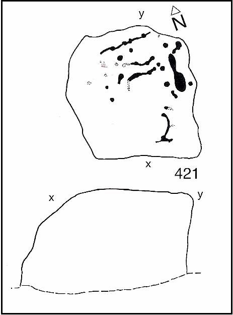
Boughey & Vickerman’s plan of the cup-marks

Sat near a ridge due north of the magnificent Simon’s Seat, this faded carved stone gets its name from the field in which it lives — and as Danny’s photo here shows, it’s a fine stone indeed in a very fine setting.  The cup-marks on its top were first described by Stuart Feather (1964), who found there to be around 20 cup-markings on the top, with some grooves — possibly natural, possibly man-made — linking them together.

However, in the fields north of here are a number of other cup-and-ring carvings, but much of the landscape has been damaged by industrial workings.  It makes you wonder how many there used to be here before the industrialists started digging the land up…

References:

  1. Boughey, Keith & Vickerman, E.A., Prehistoric Rock Art of the West Riding, WYAS: Wakefield 2003.
  2. Feather, Stuart, “Appletreewick, WR,” in Archaeological Register, Yorkshire Archaeological Journal, volume 41, 1964.
  3. Morris, Ronald W.B., “The Prehistoric Rock Art of Great Britain: A Survey of All Sites Bearing Motifs more Complex than Simple Cup-Marks,” in Proceedings of the Prehistoric Society, volume 55, 1989.

Acknowledgements:

Huge thanks to the pseudonymous ‘QDanT‘ for use of the photo in this profile.  Cheers Danny!

© Paul Bennett, The Northern Antiquarian

Yarnbury Henge, Grassington, North Yorkshire

Henge:  OS Grid Reference – SE 01405 65413

Getting Here

Yarnbury henge from the air

In Grassington, go up the main street and keep going uphill, out of town.  You’re on Moor Road now and it keeps going northeast for about a mile, where the small copse of trees grows just before Yarnbury House.  However, on the other side of the road (right) two field before you reach the house, you’ll notice a slightly raised elevation in the field, close to the wall.  A footpath runs right past it, so you shouldn’t have too much trouble finding it!

Archaeology & History

This is a fine, roughly circular neolithic monument, sat not-quite-on-the-heights, but still possessing damn good views all round (except immediately west), begging the question, ‘what on earth are you and why were you built here?’  Answers to which, we don’t really know.  But ascertaining its geomantic nature wouldn’t be too difficult for local people who have spent years visiting the site.  John Dixon (1990) mentioned how, in the winter months,

“the sun falls behind Pendle (Hill) providing it with a sky-red backdrop.  In my own view the site is related to the presence of Pendle…and may have been the major factor in the location of the monument.”

He may be right!  It has been suggested by one archaeologist (King et al, 1995) that the site was “most probably a wood henge” with upright rings of wooden posts that were built onto the central platform — but until we get a full dig here, we’re not gonna know.

N-NE section of henge
SW section of the henge

Found close to an extensive amount of other prehistoric remains in the area (dating from the neolithic to Iron Age), this henge monument is notable for its size, as it’s only a little fella!  It’s like a mini-version of the Castle Dykes henge near Aysgarth, 14 miles to the north!  First mentioned as a ‘disc barrow’ in 1929, J. Barrett (1963) added the Yarnbury Henge to the archaeological registers 32 years later, citing it as a “circular platform 60-63 ft diameter, surrounded by a ditch 20ft wide (crest to crest) and an outer bank.”  A couple of years later D.P. Dymond (1965) described the henge in slightly more detail, telling:

“At Yarnbury, just over one mile north-east of Grassington there is an earthwork 116ft in diameter overall, consisting of a ditch with external bank.  On surface inspection the earthwork appeared to have the characteristics of a henge monument.  An excavation carried out in July 1964 , by an archaeological summer school based on Grantley Hall, proved this thesis.  There was no trace of an internal mound and the entrance to the southeast was obviously  original.  No traces were found of any sort of internal structure, and a square pit in the centre of the circle had been caused by an excavation earlier this century.  The ditch was rock-cut and the bank of simple dump construction.  No dating evidence was found… With its single entrance the Yarnbury henge falls into Atkinson’s Class 1.”

SW area of the henge

In recent years it seems that some damage has been done by digging into the east and southeastern sections of the henge.  Summat we hope doesn’t get any worse.  In the field on the other side of the road we found traces of prehistoric enclosure walling (along with a curious, large, almost cursiform shadow, 44 yards across and running 110 yards NE), typical of the extensive settlement remains found less than a mile away at Lea Green and High Close Pasture, Grassington.  It’s an impressive area, well worth checking out!

References:

  1. Barrett, J., “Grassington, W.R.,” in Yorkshire Archaeological Journal, part 161, 1963.
  2. Beck, Howard, Yorkshire’s Roots, Sigma: Wilmslow 1996.
  3. Dixon, John & Phillip, Journeys through Brigantia – volume 2: Walks in Ribblesdale, Malhamdale and Central Wharfedale, Aussteiger Publishing: Barnoldswick 1990.
  4. Dymond, D.P., “Grassington, W.R.,” in Yorkshire Archaeological Journal, part 163, 1965.
  5. Harding, A.F., Henge Monuments and Related Sites of Great Britain, BAR 175: Oxford 1987.
  6. Harding, Jan, The Henge Monuments of the British Isles, Tempus: Stroud 2003.
  7. King, Alan, et al, Early Grassington, Yorkshire Archaeological Society 1995.
  8. Wainwright, G.J., “A Review of Henge Monuments in the Light of Recent Research,” Proceedings of the Prehistoric Society, volume 35, 1969.

© Paul Bennett, The Northern Antiquarian