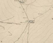
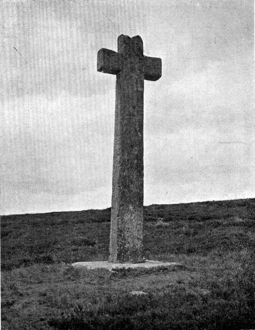
Redmire Maypole, North Yorkshire

Maypole (destroyed):  OS Grid Reference – SE 0458 9121
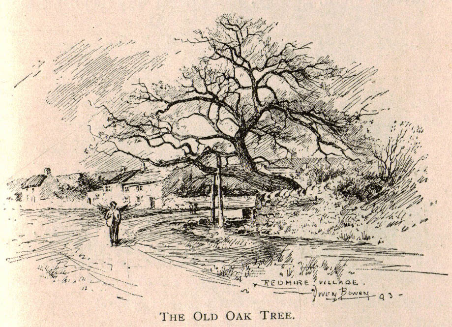
Redmire’s ancient Oak

Archaeology & History

As with many of Britain’s old maypoles, the one at Redmire has long since disappeared and no local in the 20th century appears to have had any memory of it.  However, it was mentioned in Victorian times and described in McGregor’s (1989) fine history work on the village:

“At one time, somewhere on the Green, stood a maypole which was destroyed by lightning.  I never heard the memory of it recalled during my early life, but it is mentioned in their books by both Barker and Bogg.  The remnants of it appear to have been there in 1850 or 1852, as Barker, writing at that time says, ‘A maypole, rare in Yorkshire, stands on the Green.  It was shivered to pieces by the electric fluid, during a thunderstorm, in the summer of 1849.  This poor maypoles catastrophe would have been regarded by the old Puritans as a direct and visible manifestation of the wrath of heaven at such a heathenish practice.’  Redmire, as we know, took pleasure in dancing in the 19th century, and continued to do so, especially after the building of the Town Hall…”

When Edmund Bogg came here at the end of th 19th century, he saw “the base of the ancient maypole…near to, a twisted and ancient oak” whose ancient branches were being held upright by large wooden posts.  This sacred oak itself was said to “still cast its shade over a small spring of water.”  Unfortunately I ‘ve found no more about this lost pagan relic…

References:

  1. Barker, W.G.M.J., The Three Days of Wensleydale, Charles Dolman: London 1854.
  2. Bogg, Edmund, Wensleydale and the Lower Vale of Yore, E. Bogg: Leeds n.d. (c.1900)
  3. McGregor, Isabelle, Redmire – A Patchwork of its History, privately printed: Redmire 1989.

© Paul Bennett, The Northern Antiquarian
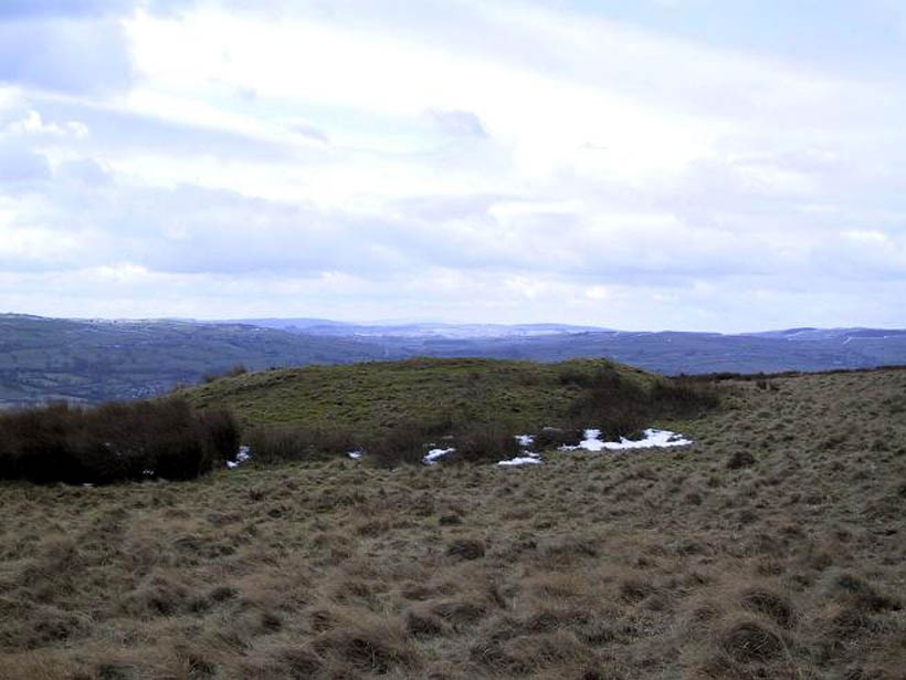

Round Hill, Middleton Moor, North Yorkshire

Tumulus:  OS Grid Reference – SE 107 509

Also known as:

  1. Black Hill tumulus

Getting Here

Round Hill tumulus, Middleton Moor

From Ilkley town centre, taken the road north across the River Wharfe, turning left and up the country lane towards Nesfield.  As you’re driving with the farmed fields on either side, you’ll go round a couple of swerves in the lane and reach the open moorland on your right, just past the small copse of trees on the same side.  There’s a small place to pullover on the right 100 yards on and walk up the footpath running northeast onto the moor.  Go past the disused quarry and up further till you reach the rounded hill where the tumulus stands.

Archaeology & History

On the moors north of Ilkley – as shown on OS-maps since the 1850s – on the southeastern edge of Middleton Moor, is this singular tumulus, a short distance west of some old quarrying at the curiously-named Lurgy Delf.  The small hill is easy to find and appears at the western edge of a whole host of neolithic and Bronze Age remains.  It is included as a boundary marker between Middleton and Langbar, as marked by an old stone on its southern side.  Eric Cowling (1946) described this as “a spread of stones on Round Hill” in the same context as other burial mounds and cairns in the region, also naming it as the Black Hill tumulus.  Many flints had been found all round here and it stands at the western edge of a great number of cup-and-ring stones, stretching eastwards across the moors for several miles.  To my knowledge, no excavation has taken place here.

References:

  1. Cowling, Eric T., Rombald’s Way, William Walker: Otley 1946.

© Paul Bennett, The Northern Antiquarian

West Agra Plantation 3, Colsterdale, North Yorkshire

Cup-and-Ring Stone:  OS Grid Reference – SE 14236 81675

Also Known as:

  1. WAP 3a & 3b (Brown & Brown)

Getting Here

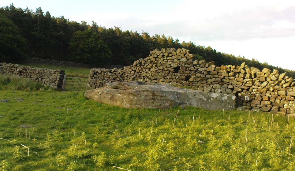
West Agra 3 Rock

From Masham take the Fearby Road & go through the village, onwards & past Healey village and less than a mile on where the road forks, bear to the right past and go along the gorgeous little-known vale of Colsterdale.  Less than 2 miles on, walk up the notable track veering to your right that goes diagonally uphill and past the bottom of West Agra farm along the wallside till you reach the gate.  Thru the gate, walk immediately uphill on your right following the walling for a coupla hundred yards until you reach another gate into the field on your right.  You’ll see a cluster of large boulders in the first field, which you need to walk past and look at the large boulder up against the walling in the next field.  You can’t miss it!

Archaeology & History

Photo by Geoff Watson

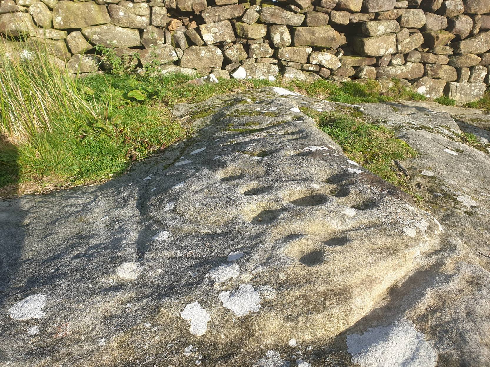
First mentioned — albeit briefly — in Brown’s (2008) work, this large bedrock stone, covered down its eastern side by a line of drystone walling, has a good scattering of cups and lines, mainly on its central and westerly side.  A cluster of them were etched onto a natural rise near the middle of the rock, which itself has a long circuitous line running around its northern and western sides, which you can just see below centre in the photo (below left).  Altogether on this side of the rock surface there appears to be some 56 cup-marks plus a number of long carved grooves curling in differing directions: some of these appear to have been Nature’s handiwork that were subsequently modified by human hands.  It’s an impressive-looking petroglyph.

Main rock surface
Cluster of cups – by QDanT

If we go over to the other side of the walling, we find more cup-markings.  This discovery led Paul & Barbara Brown (2008) to classify the site as being two separate carved rocks — calling them 3a and 3b — thinking that the much smaller carved area on the other side of the wall, “may have originated from WAP 3a’s quarried southern section.”  On this smaller section we find some 7 cup-markings with possible carved lines running off the edge of the stone and some running roughly parallel to the walling.  Whatever the truth of the Browns’ assertion, this is a fine carving well worth looking at!

References:

  1. Brown, Paul & Barbara, Prehistoric Rock Art in the Northern Dales, Tempus: Stroud 2008.

Links:

  1. Agra Wood Rock Art – more notes & images

Acknowledgements:  For use of their photos, many thanks to Geoff Watson; and QDanT and his Teddy!

© Paul Bennett, The Northern Antiquarian

West Agra Plantation 2b, Colsterdale, North Yorkshire

Cup-Marked Stone:  OS Grid Reference – SE 14126 81669

Also Known as:

  1. WAP 2b (Brown & Brown)

Getting Here

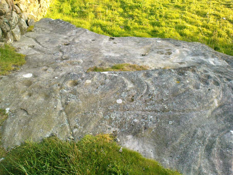
West Agra Carving 2b

From Masham, take the Fearby Road to the village, keep going on the same road through Healey village and less than a mile on where the road forks, bear to the right past and go along the gorgeous little-known vale of Colsterdale.  It’s bloody beautiful!  Less than 2 miles on, walk up the notable track veering to your right that goes diagonally uphill and past the bottom of West Agra farm along the wallside till you get to the gate.  Thru the gate, follow the wall immediately uphill to the right for a coupla hundred yards until you reach a gate into the field on your right.  The cluster of large boulders in front of you is where you need to be!

Archaeology & History

Cluster of cups on WAP-2b (image by ‘QDanT’)

This carving is to be found on the largest of the boulders in this cluster.  It’s a large scattered cluster of cup-markings and natural bowls all over the rolling surface of the rock.  It was first described in the Browns’ (2008) survey, although as they have given this and one of the adjacent stones incorrect grid-references, it made it troublesome to initially work out which carving was which!  But the photos here certainly lets you know which one I’m describing!  In the event that I’ve got the wrong title for this one, someone lemme know and I’ll remedy the situation!

Brown (2008) describes this design as being “cups some linked by grooves, a rectangular feature and eroded cups and depressions.”  We couldn’t work out any further elements on the stone, but the cloudy conditions when we were here prohibited a decent view of the surface.

References:

  1. Brown, Paul & Barbara, Prehistoric Rock Art in the Northern Dales, Tempus: Stroud 2008.

Links:

  1. Agra Wood Rock Art – more notes & images

© Paul Bennett, The Northern Antiquarian

West Agra Carving, Colsterdale, North Yorkshire

Cup-Marked Stone:  OS Grid Reference – SE 14069 81627

Getting Here

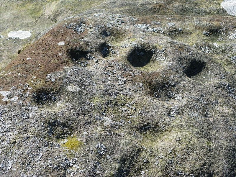
Cup-marked stone near West Agra

From Masham, take the Fearby Road to the village, keep going on the same road through Healey village and less than a mile on where the road forks, bear to the right past and go along the gorgeous little-known vale of Colsterdale.  It’s bloody beautiful!  Less than 2 miles on, walk up the notable track veering to your right that goes diagonally uphill and past the bottom of West Agra farm along the wallside till you get to the gate.  Thru the gate, follow the wall immediately uphill to the right and, about 100 yards up, watch out for the large flat stone by the side of the footpath.  You can’t really miss it.

Archaeology & History

Initially we thought that this carving was one described in Paul Brown’s work as ‘West Agra Plantation no.1’, but this is clearly a different carved stone.  It is found close to WAP-1 (as he called it), but a few yard further up alongside the footpath by the walling.  With two large bowls on the top of the stone and another at the edge, two average-sized cup-markings are several inches away to the bottom-right of the largest bowl.  What seems to be a carved line runs from one of the cups.  We need to visit this stone again and look at it when there’s better lighting conditions so we can get a more accurate assessment of its nature.

References:

  1. Brown, Paul & Barbara, Prehistoric Rock Art in the Northern Dales, Tempus: Stroud 2008.

Links:

  1. Agra Wood Rock Art – more notes & images

© Paul Bennett, The Northern Antiquarian

Brown Beck Stone, Agra Moor, North Yorkshire

Standing Stone:  OS Grid Reference – SE 13499 82440  —  NEW FIND

Also Known as:

  1. Agra Moor Standing Stone

Getting Here

Agra Moor standing stone

From Masham, take the Fearby Road to the village, keep going on the same road through Healey village and less than a mile on where the road forks, bear to the right past and go along the gorgeous little-known vale of Colsterdale.  It’s bloody beautiful!  Less than 2 miles on, walk up the notable track veering to your right, diagonally uphill.  Walk along till you get to the moor edge.  Go thru the gate and follow the swerving uphill path to the bottom of Slipstone Crags.  Once you level out at the Crags top, look across the small valley to your left and, on t’other side, you’ll notice a standing stone upright in the heather, just 100 yards on the flat on the other side of the valley.  Head right for it!

Archaeology & History

Looking west

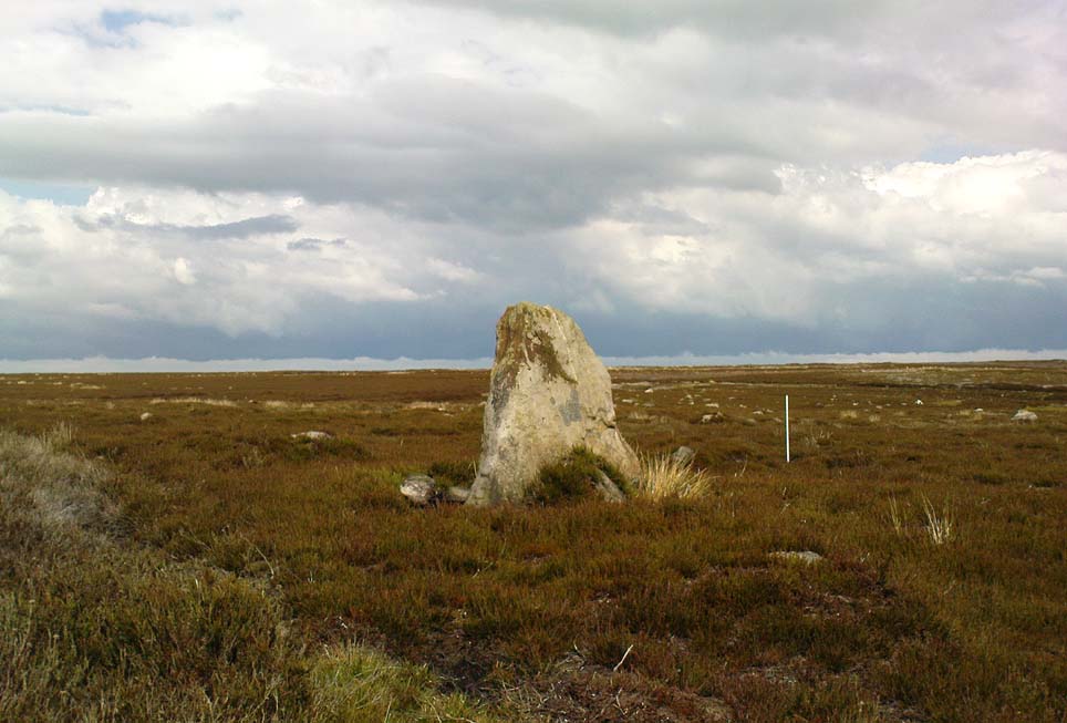
There are no known written references to this standing stone, which we visited for the first time yesterday, in a brief wander to the nearby Agra Woods cup-and-ring stones a few hundred yards southeast.  The monolith stands some four-and-half-feet tall and, at its base, is more than three feet broad and just one foot wide.  Just to its side and almost completely covered in peat and vegetation is what may have been another once-upright companion asleep in the Earth.  Another possibly fallen stone is less than 10 yards west.  The upright stands on the flat moorland overlooking the confluence of two (once) fast-flowing waters of Brown Beck and Birk Gill; and the landscape that reaches out from here is something to behold!

We found the remains of other old monuments on the moor, but some were obviously related to the industrial mining not far away.  However, two or three other small upright stones and a large stone circular structure were also located which very obviously predated any industrial or medieval workings.  We need to revisit this moorland and spend more time exploring to see what other things are hidden, lost midst the peat and heather.

© Paul Bennett, The Northern Antiquarian 

West Agra Plantation (8), Colsterdale, North Yorkshire

Cup-and-Ring Stone:  OS Grid Reference – SE 14250 81756

Also Known as:

  1. WAP 8 (Brown & Brown)

Getting Here

The ‘West Agra 8’ Stone (after ‘QDanT’)

From Masham, head westwards along the country lanes to Fearby village (passing the old cross on the green), through old Healey village (where once stood four stone circles, seemingly destroyed) and onwards to Gollinglith.  From here, keep going up the winding steep lane until you’re at the top where, on the right-hand side of the road, a footpath takes you diagonally northwest over the uphill fields.  When you hit the walling which leads to the woods, follow it up and, once at the corner of the trees, follow the track back eastwards along the wall edge, keeping your eyes peeled when you pass the second line of walling that runs down the slope.  You’re damn close!

Archaeology & History

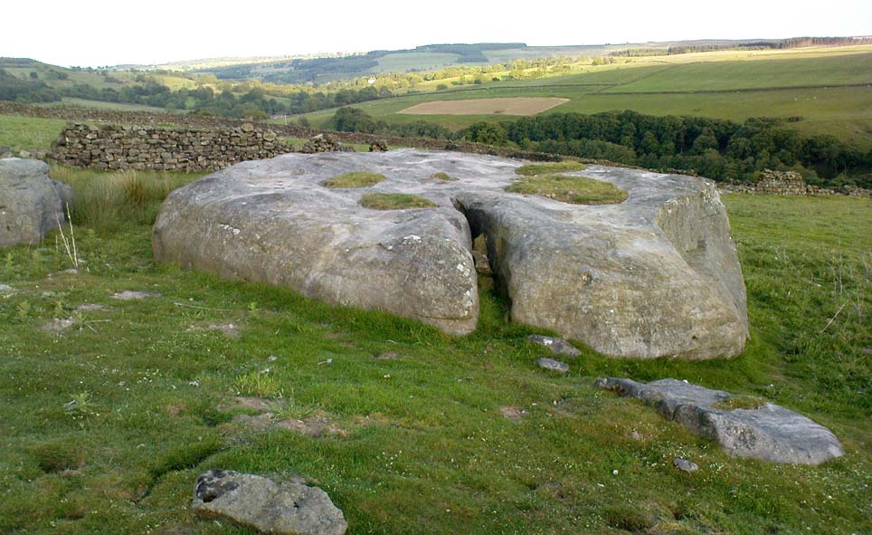
One of a cluster of fascinating carvings in this remote region of the upland Dales, this is perhaps the most impressive multiple-ringed carving of the group, known collectively as the West Agra Plantation group.  The carving was rediscovered sometime in 2002 by Emily McIntosh and was described by Brown & Brown (2008) thus:

“This boulder measures 5.5 x 3.1 x 1.28m and has a multiringed motif 50cm in diameter linked by a number of grooves and isolated cups.”

Teddy with his rings! (after ‘QDanT’)
Primary cup-and-multiple-rings (after ‘QDanT’)

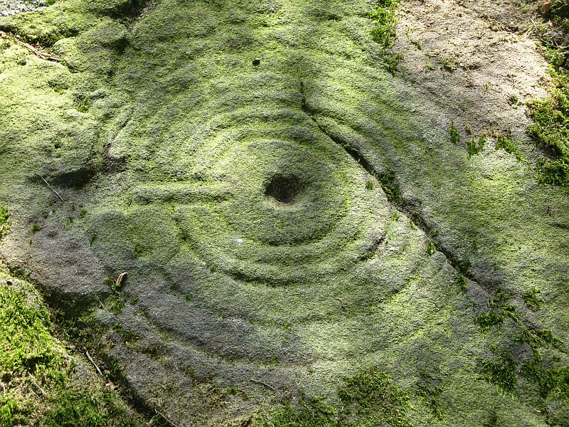
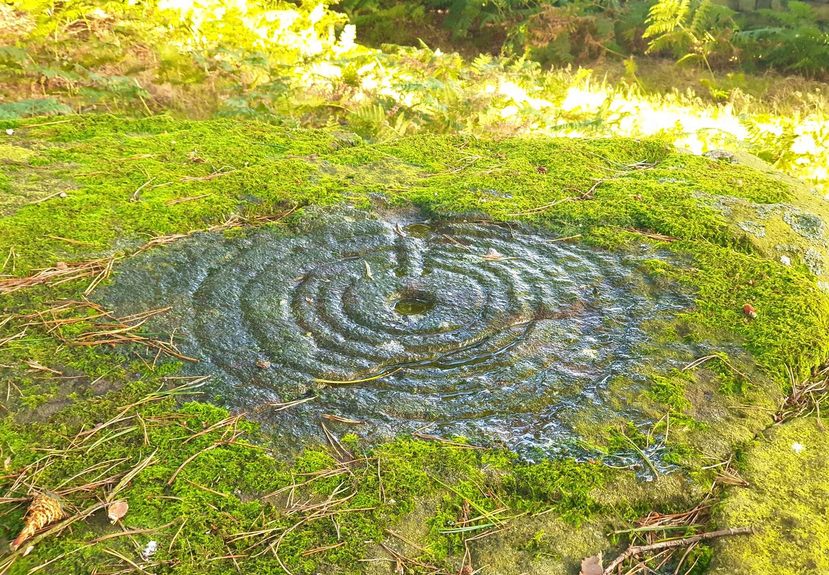
But this barely does the stone justice.  The main focus is on the cup with six surrounding rings, intersected by an intrusive double-line from outside the series of rings then running into the central ring itself — though not touching the focal cup at the very centre.  This double line points to the southeast and is somewhat akin to a sliver of light running to or from old solar designs.  It is a little bit like some aspects of the carved stones found on Ilkley’s Panorama Stones (though Ilkley’s carvings are much fainter).  At the end of the intrusive double-line is a small cluster of cup-marks.  There’s also another curious singular carved line running outwards from the third ring, running out of the concentric rings then heading off further down the stone.  More cups and lines scatter other parts of the stone and there may be another faint line running from near the central cup all the way out of the rings close to the main ‘ray’ of lines.

Photo by Geoff Watson

A large standing stone can be seen if you walk a few hundred yards east along the side of the wall.  It’s quite impressive.

Apparently the woodland in which this carving (and its associates) can be found is supposedly ‘private’ and one is supposed to contact some group calling itself Swinton Estates to set foot in the woods.  Not the sort of practice we usually put up with in Yorkshire.  If anyone has their contact details, please add them below in the event that anyone has need to ask ’em about going for a walk here.

References:

  1. Brown, Paul & Barbara, Prehistoric Rock Art in the Northern Dales, Tempus: Stroud 2008.

Links:

  1. Agra Wood Rock Art – more notes & images

AcknowledgementsFor use of their photos, many thanks to Geoff Watson; and QDanT and his Teddy!

© Paul Bennett, The Northern Antiquarian

Solar Stone, Askwith Moor, North Yorkshire

Cup-and-Ring Stone:  OS Grid Reference – SE 17738 51003

Also Known as:

  1. Carving no.567 (Boughey & Vickerman)
  2. TV Stone

Getting Here

Stone at cairn edge

From the scruffy Askwith Moor lay-by car-park, along Askwith Moor road, follow the fence north up along the roadside until you reach the gate on your right.  Go thru this and head due west into the moor, towards the small cluster of other carved stones (carvings 581, 582, etc), particularly the Small Rings Stone (carving 579).  Around here, you’ll notice a cluster of about 10 mounds in the heather, which seem to be prehistoric cairns, and this particular stone rest against the northwestern side of one of them, about 30 yards west of carving 579.  If you’re patient, you’ll find it! (if you fancy a look at all these on the moor, gimme a shout & I’ll take you straight to ’em – but you need to make a booking!)

Archaeology & History

This carving takes a bitta finding amidst the mass of deep heather and open moorland and is probably only gonna be of interest to real cup-and-ring fanatics.  But it’s the setting which makes it more intriguing — for me anyhow!

Trying to highlight the internal CnR
Solar Stone carving

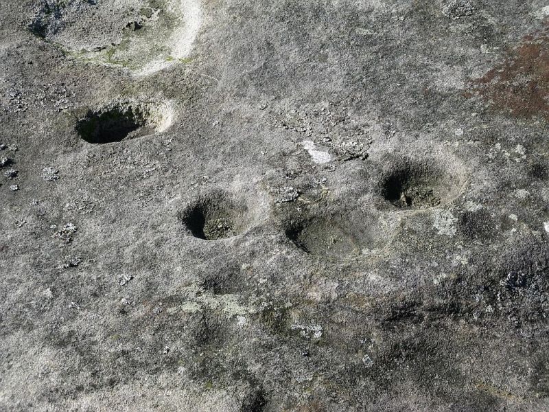
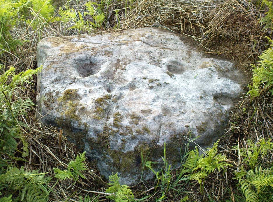
Like other carvings on this moorland, we find it in direct association with a prehistoric tomb (though it aint been excavated), resting up against the edge of one.  However, it seems to have been moved from its original position and may, perhaps, have actually faced the other way at some time in the past.  We might never know.  However, some student in the recent past saw fit to name this small carving the ‘TV Stone’, thanks to the slightly cronky outline of an old television screen, with its small half-cup-and-ring near the bottom corner of the rock.  You can see where they were coming from!

Boughey & Vickerman (2003) made only a brief note of the stone, seeing only the cup-and-half-ring here; but there seems to be a faint cup-marking near the middle of their TV screen, along with faded evidence of an incomplete ring around it.  You can just about make it out in the poor photos we took of it. (sadly, we were without water when we visited it, which would have highlighted the additional cup-and-slight ring more clearly)

Close-up of cup-and-half-ring

We gave this stone the title ‘Solar Stone’* as it seems more appropriate and would certainly have more mythic relevance to the people who carved this.  The curious natural ring, or TV outline, running round most of the stone (with the faded cup-and-part-ring near its centre) may have been attached with more animistic attributes than us moderns tend to give things — children notwithstanding!  Circular forms in Nature have universal tendencies in more traditional cultures with such heavenly bodies as sun or moon, which might have been relevant here with the stones association with a tomb.

…Again, we might never know…

References:

  1. Boughey, Keith & Vickerman, E.A., Prehistoric Rock Art of the West Riding, WYAS: Wakefield 2003.

* though did debate in somewhat primitive northern lingo: “Ugh – errr…solar? lunar? Ey? — Solar? Lunar?” uttering the same queried mantra numerous times between ourselves till we got tired and stuck with ‘solar’, as seems common these days (though I preferred ‘lunar’, it’s gotta be told!).

© Paul Bennett, The Northern Antiquarian


Lilla Cross, Fylingdales Moor, North Yorkshire

Cross:  OS Grid Reference – SE 88923 98686

Also Known as:

  1. Lilla’s Cross

Getting Here

Lilla Cross is situated on Fylingdales Moor, north Yorkshire, between Pickering and Whitby at the junction of two major moorland footpaths. It is located close to the Fylingdales Ballistic Missile Early Warning Station – which resemble giant golf balls on the horizon.

Archaeology & History

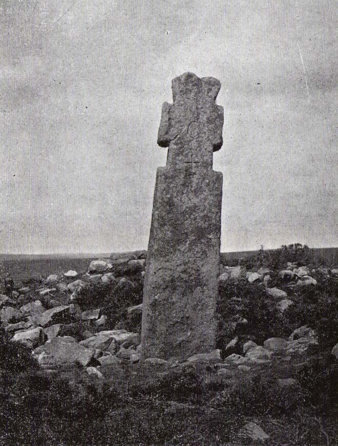
Woodwark’s 1930s photo of Lilla Cross

The ancient cross is 10 foot high and free-standing but it sits upon what is probably a ruined Bronze-Age bowl barrow called Lilla Howe; the recumbent stones that lie around the base of the cross may form part of that. It is a sturdy, stocky cross that has some letters carved onto it, one in particular being a large letter “C” possibly meaning Christos (Christ) and with that a small thin cross; there are a few other faint letters but these are difficult to decipher now. A plaque on a nearby stone gives information about the cross. I think Lilla Cross was used as a sort of Medieval milestone or way-marker – hence the lettering on the cross.

In 1952 the cross was moved to Sil Howe near Goathland but 10 years later in 1962 it was returned to its original site on top of Lilla Howe. In the 1920s excavations on the barrow revealed some artefacts of jewellery, but no remains of Edwin’s trusty chief minister were found; the jewellery was, in fact, said to date from the mid 9th century. Lilla Cross has been referred to by historians as the oldest christian cross on the north York Moors.

Folklore

Lilla Cross on 1854 Map

According to the legend, in AD 625 or 626 King Edwin of Northumbria was travelling with his entourage across the moors, but an assassin had been dispatched by the king of the west Saxons to kill Edwin. The assassin lunged forward with his poison tipped sword, but Lilla his chief minister at the king’s court, leapt in between his sovereign and the swordsman. Poor Lilla took the full thrust of the sword and died on the spot thus saving the king from being murdered. King Edwin, who was greatly impressed by this selfless act of devotion, ordered that Lilla being a newly converted christian be buried here in a christian way though he asked that a number of articles be placed with the body including gold and silver. The king then had a cross erected in memory at the spot where Lilla died. But it seems likely that the cross dates from the 10th century, though there may have been an earlier Saxon cross here.

References:

  1. Ogilvie, Elizabeth & Sleightholme, Audrey, An Illustrated Guide to the Crosses on the North Yorkshire Moors, Village Green Press: Thorganby 1994.
  2. White, Stanhope, Standing Stones and Earthworks on the North Yorkshire Moors, Fretwell & Cox: Keighley 1987.
  3. Woodwark, T.H., The Crosses on the North York Moors, Whitby Literary & Philosophical Society 1934.

© Ray Spencer, 2011 


Ralph Cross, Westerdale Moor, North Yorkshire

Cross:  OS Grid Reference – NZ 67724 02092

Also Known as:

  1. Ralph’s Cross
  2. Young Ralph’s Cross

Getting Here

The cross stands high-up on Danby High Moor between Hutton-le-Hole and Castleton, just by the junction of two moorland roads to Rosedale and Westerdale, in north Yorkshire.  The monument stands on private land. (Ed. – though in Yorkshire, many of us ignore such signs)

Archaeology & History

Mr Woodwark’s 1930s photo of Young Ralph

First described in old deeds from the early 13th century, Ralph’s Cross stands nine feet high on a solid stone base.  There is uncertainty about its age; the present-day cross could date from the 18th century though some historians date it to around 1200, certainly the base could date from that time.  It seems likely that a much older cross once stood on this site — perhaps an Anglo-Saxon one that was actually made of wood.  At that time it may have been referred to as ‘The Roda Cross’ (Rude Cross).  More than likely the cross acted as a medieval highway marker because it stands at the junction of two moorland roads. Originally there were some letters carved on the cross, one in particular, being the letter “R” for Ralph was carved on the south face.

Over the centuries the cross has suffered damage and vandalism by being knocked down, particularly in the 1960s and again in 1984 after which it lay in two pieces. However, in 1985 the cross was lovingly restored and re-erected by some local men, Mr Robert Dixon, Mr Tom Rudd and Mr Michael Smith, at the English Heritage Commission’s stone masonry workshop at Mount Grace Priory.  The middle section of the cross was made from new stone from nearby quarries; the top section was not badly damaged, but a section of delta metal was inserted inside the shaft to make a secure link between the sections and the cross-head.  The cross is a listed monument.

A few hundred yards to the south stands another cross called ‘Old Ralph’ which is just 5 feet high and is located on Blackey Ridge. This cross dates from the beginning of the 13th century and is perhaps a memorial to Ralph, bishop of Guisborough.

Folklore

According to legend, the cross was set up to mark the resting place of a monk from Farndale and a nun from Rosedale.  They would often meet here and a romantic liason of sorts occurred, but they were found out by their superiors and came to a nasty end, possibly with their deaths.  But the most common folk-tale tells us that a farmer called Ralph from Danby found the dead body of a traveller at this spot.  He was so moved by this that he decided to erect a cross in memory of this poor unfortunate traveller, who had starved to death and was found to be penniless.  Ralph had a hollow carved into the top of the cross so that more wealthy travellers, those on horseback, might place a few coins for the benefit of any less fortunate travellers, or as a thanksgiving for having reached this point on their journey. The poor traveller was able to take a coin, if he/she could reach the hollow, and buy a hot meal at the nearest inn.  Ralph then vowed that such a terrible thing would never ever happen again, and it seems to have worked, thanks to him.

References:

  1. Ford, Joseph, Some Reminiscences and Folk-Lore of Danby Parish & District, Horne and Son: Whitby 1953.
  2. Ogilvie, Elizabeth & Sleightholme, Audrey, An Illustrated Guide to the Crosses on the North Yorkshire Moors, Village Green Press: Thorganby 1994.
  3. Woodwark, T.H., The Crosses on the North York Moors, Whitby Literary & Philosophical Society 1934.

© Ray Spencer, 2011