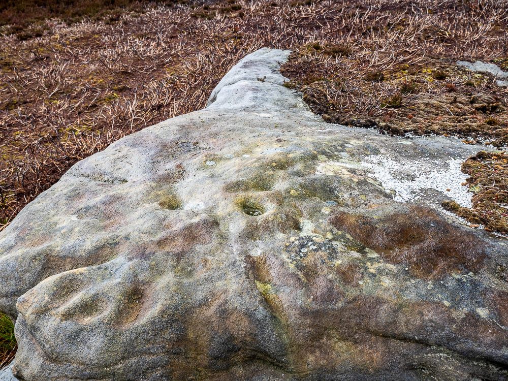
Follow the same directions as if you’re visiting the Falls of Monzie (2) carving; but instead of walking off the track to see that particular carving, keep to the track for about another 60 yards then go up the slight slope on your right. The stone is pretty much overgrown, but if you’re patient you’ll find it.
Archaeology & History
It is difficult to say with any certainty whether or not this petroglyphs has previously been reported. A somewhat confusing series of descriptions by several writers would indicate that is has not been recorded; but I’m happy to be shown otherwise… It’s nowt much to look at if truth be had. Heavily eroded by the elements, this elongated flat stone possesses seven very shallow cups, with a possible eighth, as you can see highlighted in the photo.
Chambered Cairn (destroyed): OS Grid Reference – C 003 396
Archaeology & History
In unpublished Notebooks written by one Thomas Fagan during the years 1845-48 (held by the National Archives in Dublin), he wrote how a local man had told him of the existence of “a supposed Druid’s Altar” in Claggan township, but its precise location has never subsequently been established. In Eamon Cody’s (2002) magnum opus he told what little we know about the place, saying,
“It stood on a slight rise adjoining Claggan Upper, the name assigned to a group of houses in the townland. It was reportedly encircled by “a wall or parapet” and consisted of several large upright stones2-4 feet high and arranged in two rows of few feet apart with a pillar at either end.”
The structure had been completely destroyed just a few years before Fagan’s visit to the place and no further information of it has yet been uncovered.
References:
Cody, Eamon, Survey of the Megalithic Tombs of Ireland: Volume VI – County Donegal, Duchas: Dublin 2002.
From Skipton head up the B6265 Grassington Road and after a short distance you will reach the Craven Heifer Pub on your left. About ¾-mile past the pub is a small turning on your left called Bog Lane. Go along here for about ¼-mile till you come to a sharp left bend and on the right you will see a gateway with room to park. Once here you’ll notice a sharp-pointed hill—and that’s Sharp Haw! Go through the gate, up the gravel track parallel to the wall on your left for 500 yards. Where the wall ends take the small path on your right and walk up here for ¾-mile where the path splits again. Take the right-hand path for 85 yards and the stone is on the left of the path.
Archaeology & History
Positions of cup-marks
Nowt special to look at, this is merely an elongated earthfast female stone that will be hard to find when the reeds grow high. The design consists of at least three cup-marks, with the most prominent one near the middle of the stone. A second one is shallow and on its northern side, near the middle; whilst the third one on its southern side was uncovered when we peeled back the vegetation; the peck marks are still visible. In the photo to the left I’ve placed numbers below the position of the respective cup-marks. In a cursory meander here, we found no other carvings – but that doesn’t mean there aren’t any!
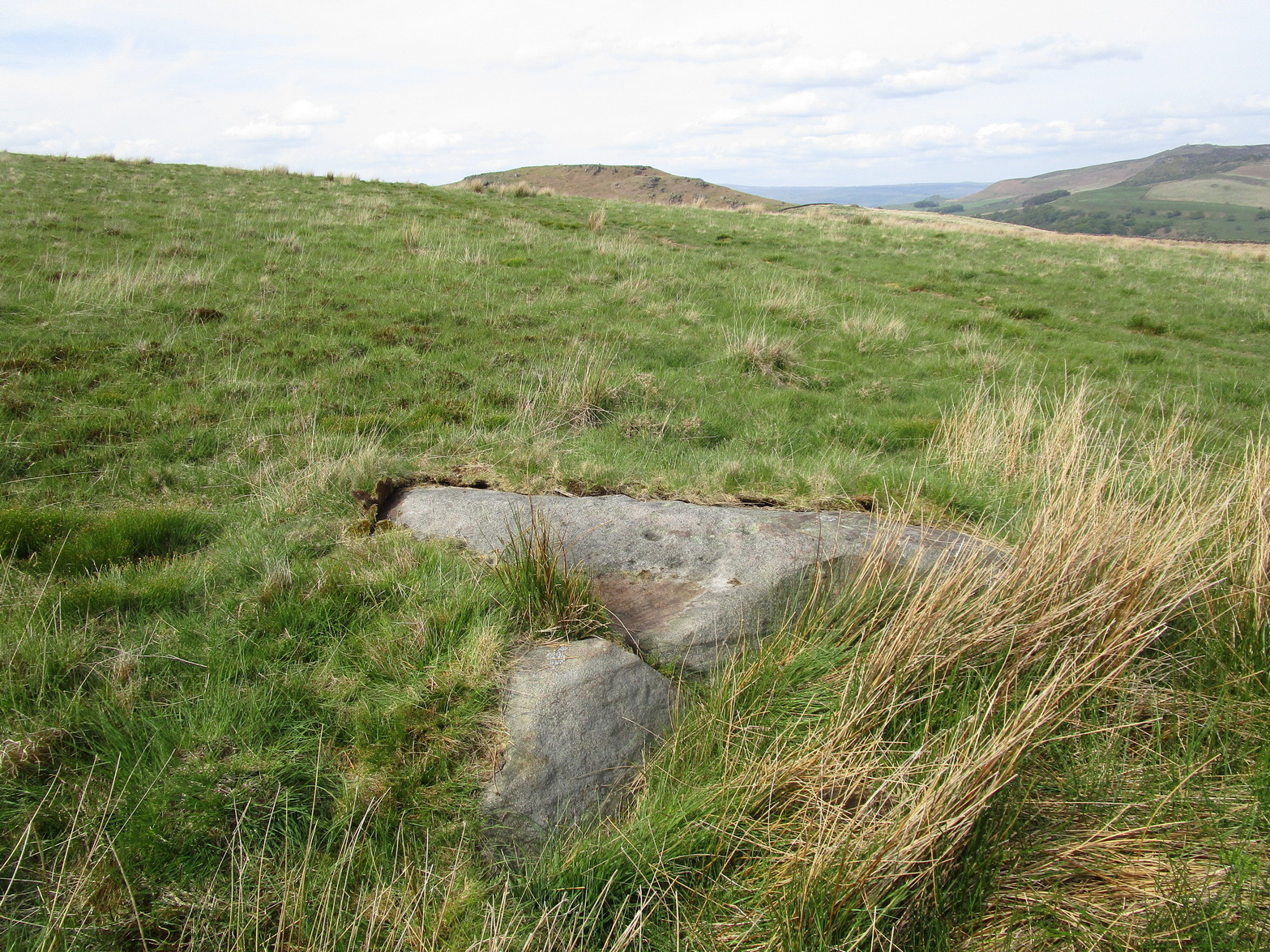
A couple of miles east of Crieff, take the A822 road from the Gilmerton junction towards the Sma’ Glen. After literally 1¾ miles (2.8km)—just 100 yards before the track up to Connachan Farm—you’ll reach a dirt-track on your left that leads into the hills. Go along here for 250 yards (230m) yards (the track has straightened out here) and then walk into the reeds on your right. About 15 yards in, look around!
Archaeology & History
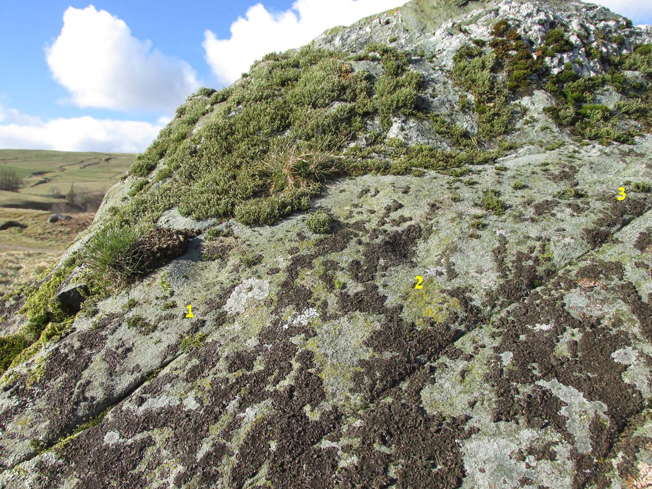
Another one of those fascinating carvings that had me here for an hour, maybe more, poring over more and more features as the light, shadow and rock gave more and more depending on how I looked at it. Tis the same with many petroglyphs, of course… But I liked this one.
On initial impression it didn’t seem up to much: maybe a few faint cups—some certain, others no so much. But the more attention we gave this stone, so more of those unlikely faint cups became much more real. At first there were a dozen; then 15 or more; but as we gave it more and more attention, so more of the petroglyphic design showed its original form. They do that, these stones! When George Currie rediscovered this carving in 2008 he found 17 cup-marks on the stone, but at least thirty of them go to make up this petroglyph. There may even be a very faint, albeit incomplete ring around one of them, but I’ll let the computer-tech kids work that one out!
Natural cracks with cups & carved extensionsNatural cracks with cups & carved extensions
This carving has that peculiar and not-too-infrequent element of having some cups carved into the natural cracks in the stone. In this case, at least four of them can be seen etched into the large deep crack that runs along its more northern edge. They’re quite distinct once you get your focus on them. In this case—albeit it to a much lesser extent—this feature reminded me of the impressive West Strathan carving in Sutherland. But where this natural crack finishes, it has been artificially extended until it reaches the eastern edge of the stone. You’ll also notice in the photos highlighting this feature, that another artificial line has been carved at right-angles to it, heading south, until it meets another natural crack in the stone. It’s quite distinct. And along this second artificial line, you’ll notice another cup or three—one of which has been cut into the line. These two man-made extended cracks in the stone, give the simple impression of an early cross symbol. Features such as this, whilst seemingly trivial to the bog standard explorer, possess some very curious myths in some living traditions elsewhere in the world; but such things are beyond the remit of this site profile.
References:
Currie, G., “Falls of Monzie, Perth and Kinross (Crieff parish), Cup-marked rock”, in Discovery & Excavation Scotland (New Series) volume 9, 2008.
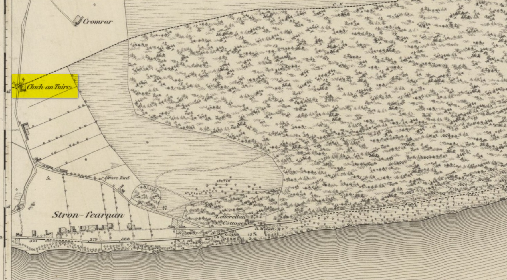
Pretty easy to find unless the vegetation takes over! From Fearnan take the road to Fortingall. Just as you’re going out of Fearnan, in the walling by the very last house on the right-hand side of the road is this large earthfast boulder. Y’ can’t miss it!
Archaeology & History
I first visited the Clach an Tuirc – or the Boar’s Stone – in 1981 when I stayed at Fearnan for a few weeks and, after clambering on top, looked down on the several simple cupmarks. Forty years later, I returned with a camera!
First highlighted on the 1862 OS-map, Fred Coles (1910) made a brief note of the petroglyph in one of his megalithic surveys, but only noticed a single cup, saying:
“Near Cromraor, close to the cottage at Clash na Tuirc, stands the large boulder bearing that name, the Boar Stone. Its highest point is about six feet above the road, and bears one very distinct cup-mark.”
But there are several cup-markings on top of the stone, just as William Gillies (1938) described.
Folklore
Not far from here tradition tells of a legendary figure who is known today only as the Lady of Lawers (whom tradition asserts to have been a member of the Stewart family, from Appin, Argyll – they of the daemonic Red Book of Appin). She made various prophecies, one of which said “that when Clach an Tuirc, the Boar’s Stone at Fearnan, would topple over, a strange heir would come to Balloch.” Though as the stone still aint toppled, we’re still waiting… (let’s just hope this doesn’t augur more of those selfish tories into our mountains who bring with them their mantras of “gerrof mah land”)
References:
Coles, Fred, “Report on Stone Circles Surveyed in Perthshire (Aberfeldy District),” in Proceedings Society Antiquaries, Scotland, volume 44, 1910.
Gillies, William A., In Famed Breadalbane, Munro Press: Perth 1938.
MacMillan, Hugh, ‘Notice of Two Boulders having Rain-Filled Cavities on the Shores of Loch Tay, Formerly Associated with the Cure of Disease,’ in PSAS 18, 1884. ???
Yellowlees, Walter, Cupmarked Stones in Strathtay, Scotland Magazine: Edinburgh 2004.
Acknowledgements: Huge thanks for use of the 1st edition OS-map in this site profile, Reproduced with the kind permission of the National Library of Scotland.
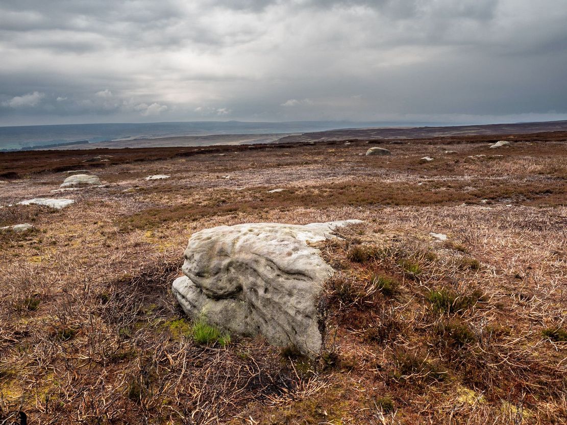
This one really takes some finding. Take the high moorland road running between Lofthouse and Healey villages, and at the very top by the cattle-grid, park up. Walk across the road and walk east. A mile or so on you’ll pass the Shooting Lodge house: keep walking for nearly another mile where another track goes left. Walk down here about ½-mile and you’ll see a crag down the the slope on your right. From here, walk uphill to your left; over the wall, and keep going about 500 yards until the moorland levels out. Hereby is a small outcrop of rocks. Look around!
Archaeology & History
Recently rediscovered by young antiquarian Mackenzie Erichs in May 2021, this flat rock—roughly 5 feet by 3 feet— is one of many amidst the heather which, when fully grown, is gonna be hard to see. This is one of the many petroglyphs possessed with both natural and artificial elements roughly of the same number here.
Upon the mainly southern-side of the stone is a cluster of cup-marks with several on the edges of the rock, most of which are probably natural, or naturally affected. The main cluster of cups—about eight in all—have differing levels of erosion, suggesting differing periods of execution. The most obvious cup is the deep one near the middle of the stone; a group of 3-4 very eroded ones are closer to the edge; and 2-3 three others of varying shallow depths can be seen. One of the cups at the edge of the rock may also have been partially worked.
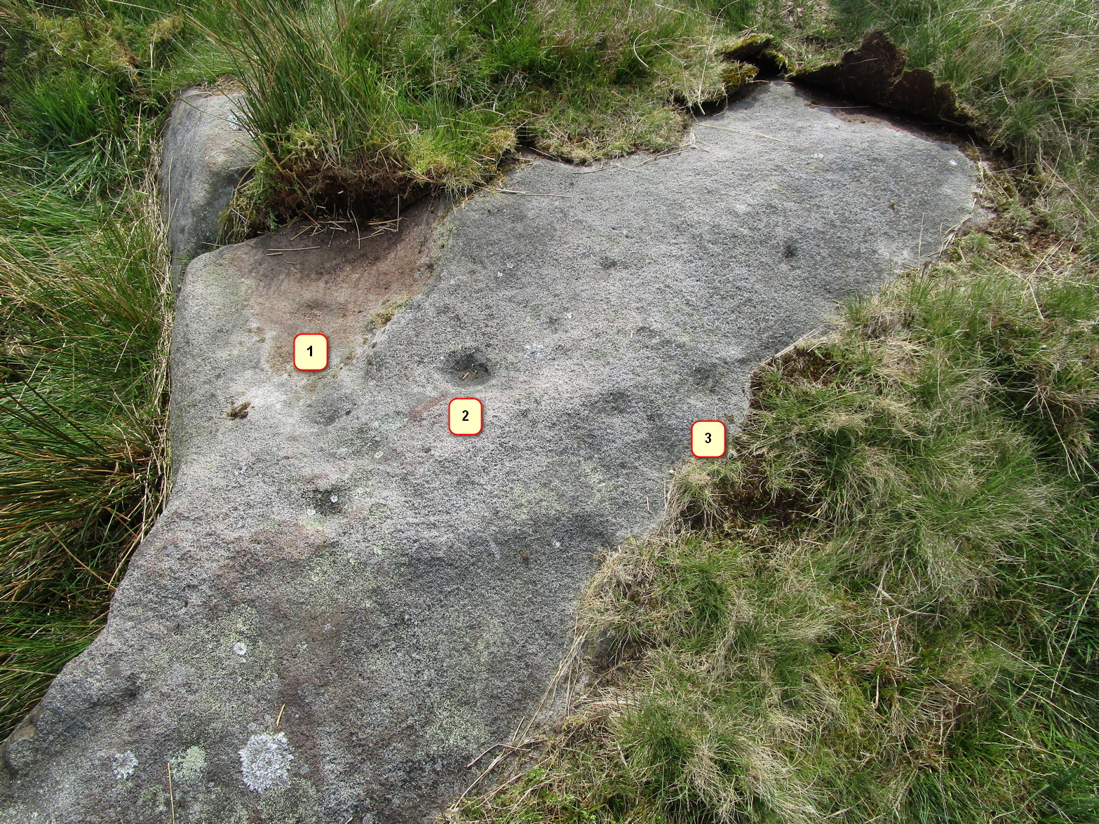
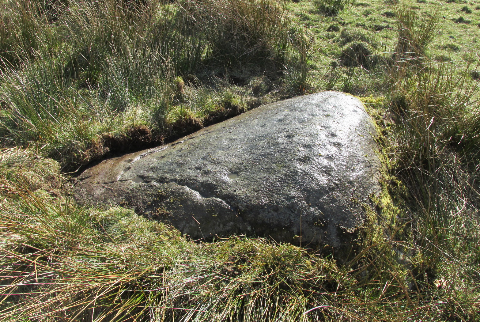
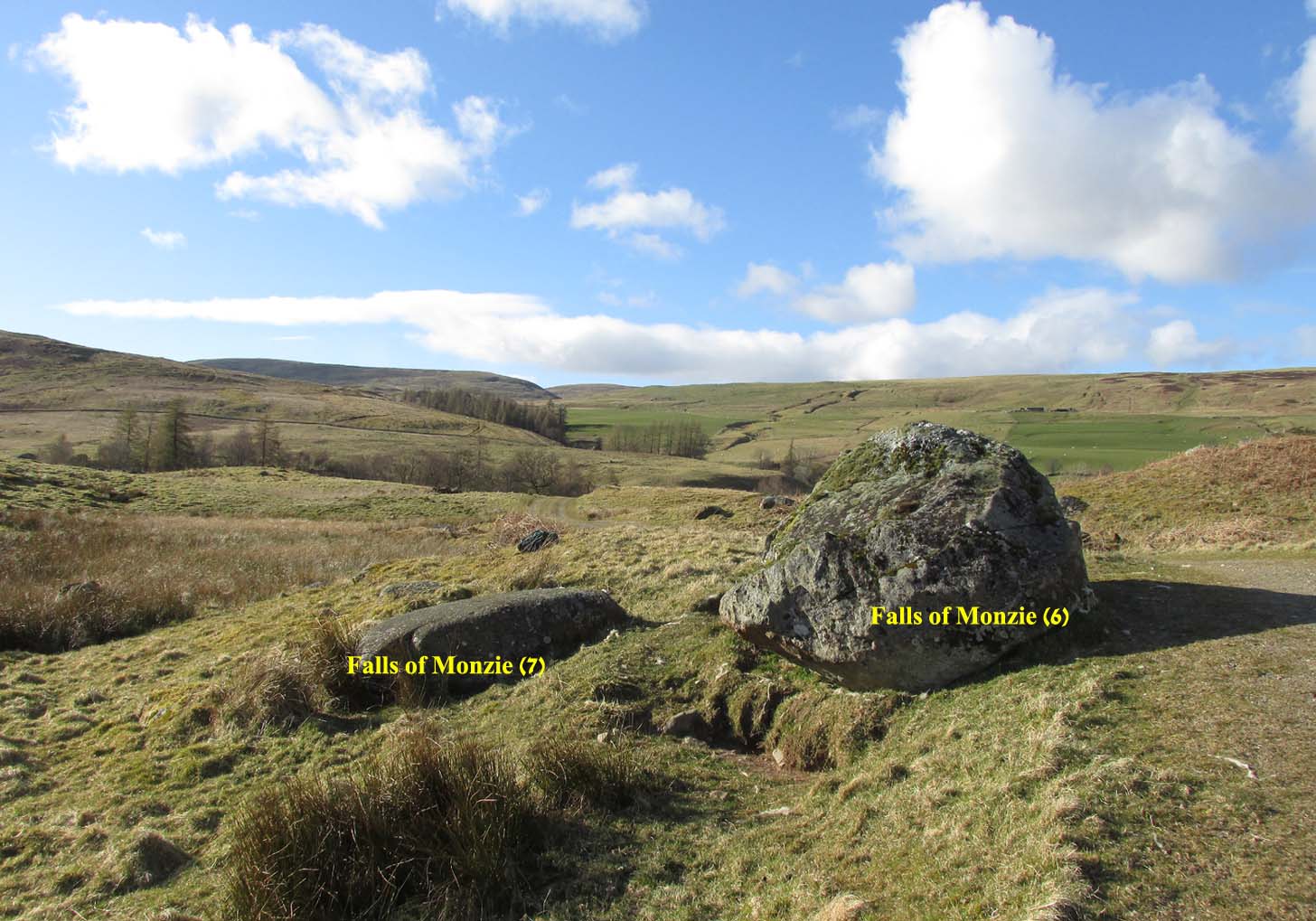
A couple of miles east of Crieff, take the A822 road from the Gilmerton junction towards the Sma’ Glen. After literally 1¾ miles (2.8km)—just 100 yards before the track up to Connachan Farm—you’ll reach a dirt-track on your left that leads into the hills. Go on here and after an easy walk of 400 yards or so, you’ll reach a conspicuous large boulder just by the track-side, on your left. It’s impossible to miss!
Archaeology & History
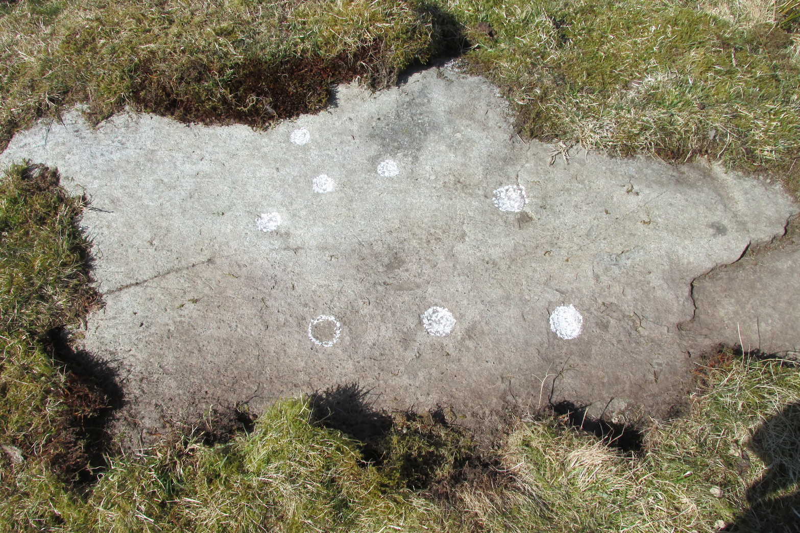
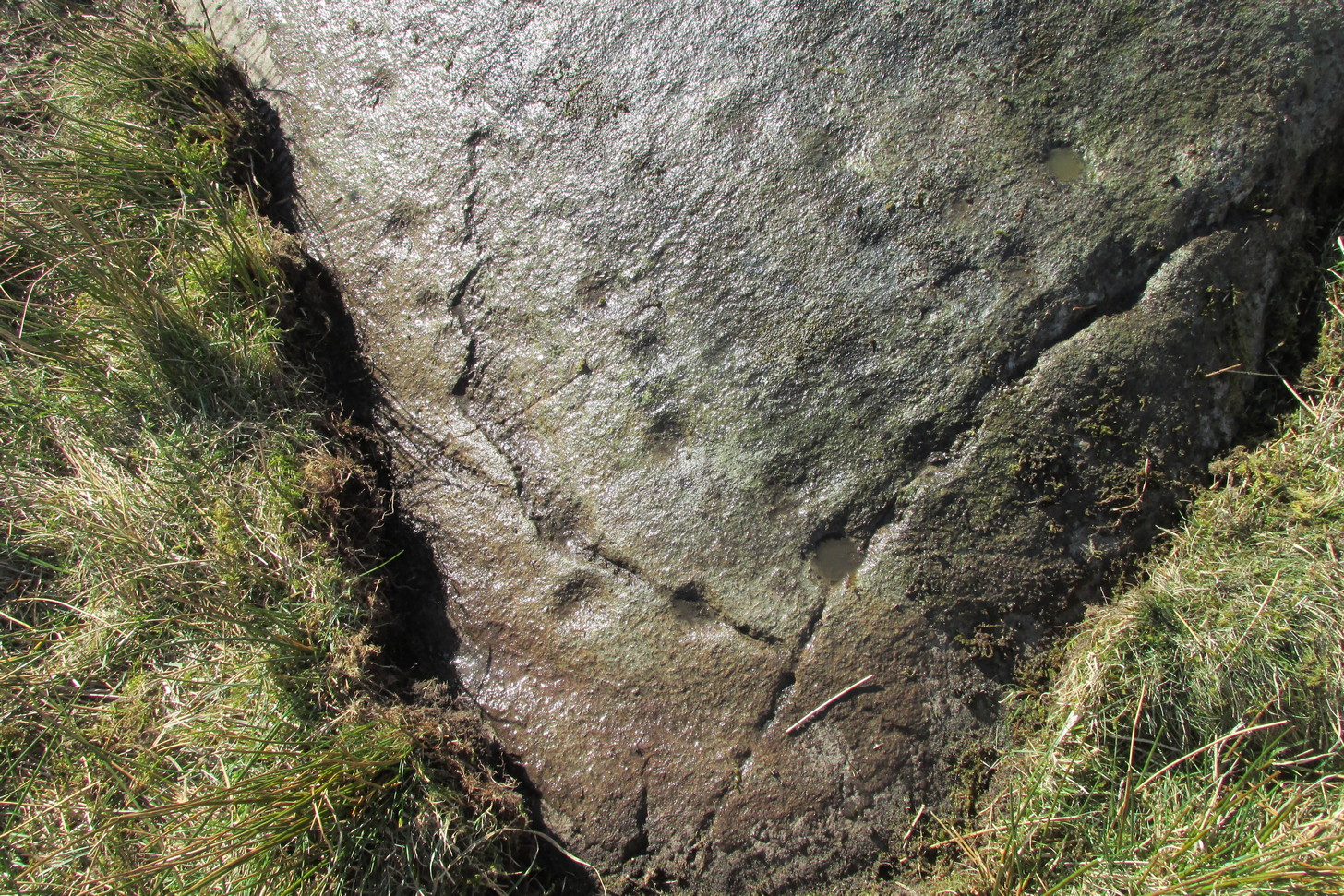
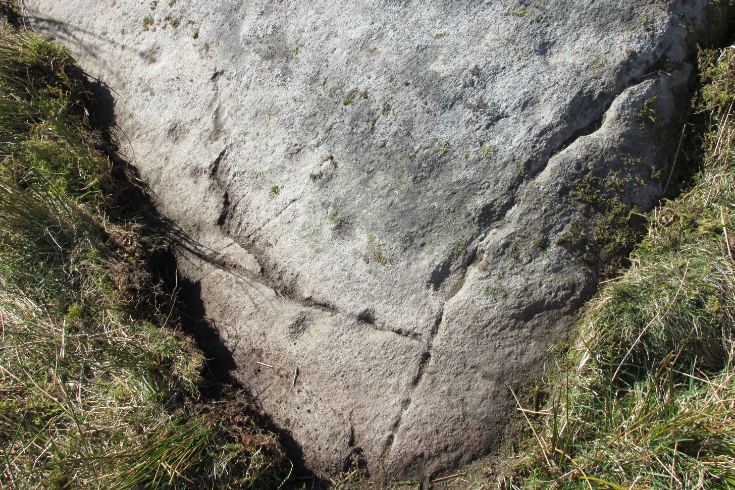
Immediately adjacent to the Falls of Monzie (7) carving, this petroglyph was located by Paul Hornby on a recent visit to the Falls of Monzie cluster.
The 3 cups numerated
More than halfway up its south-sloping face are two very distinct cup-marks, some two inches across and up to half-inch deep: one near the western-edge and the other closer to the middle of the rock face. You can’t really miss them. They seem to be accompanied by a third about 2 feet further across to the right on its more eastern side. In formation, the three of them form a small raised arc. With the naked eye they’re very easy to make out, but were difficult to photograph due to the daylight and angle of the stone; hence in the photo here, I’ve numerated them.
Stone Circle (destroyed): OS Grid Reference – N 96998 14582
Archaeology & History
This stone circle was found close to the roadside and is remembered today only by the street-name of ‘Pipers Stones’. Shown on the first OS-map of the area, the site was destroyed sometime before 1838.
Folklore
In a folklore motif found at a number of megalithic rings, Grogan & Kilfeather (1997) tell us that the name of this circle,
“refers to a tradition that people caught dancing on a Sunday were turned to stone.”
References:
Grogan, Eion & Kilfeather, Annaba, Archaeological Inventory of County Wicklow, Stationery Office: Dublin 1997.
o’ Flanagan, Michael, Letters Containing Information Relative to the Antiquities of the County of Wicklow, Bray 1928.
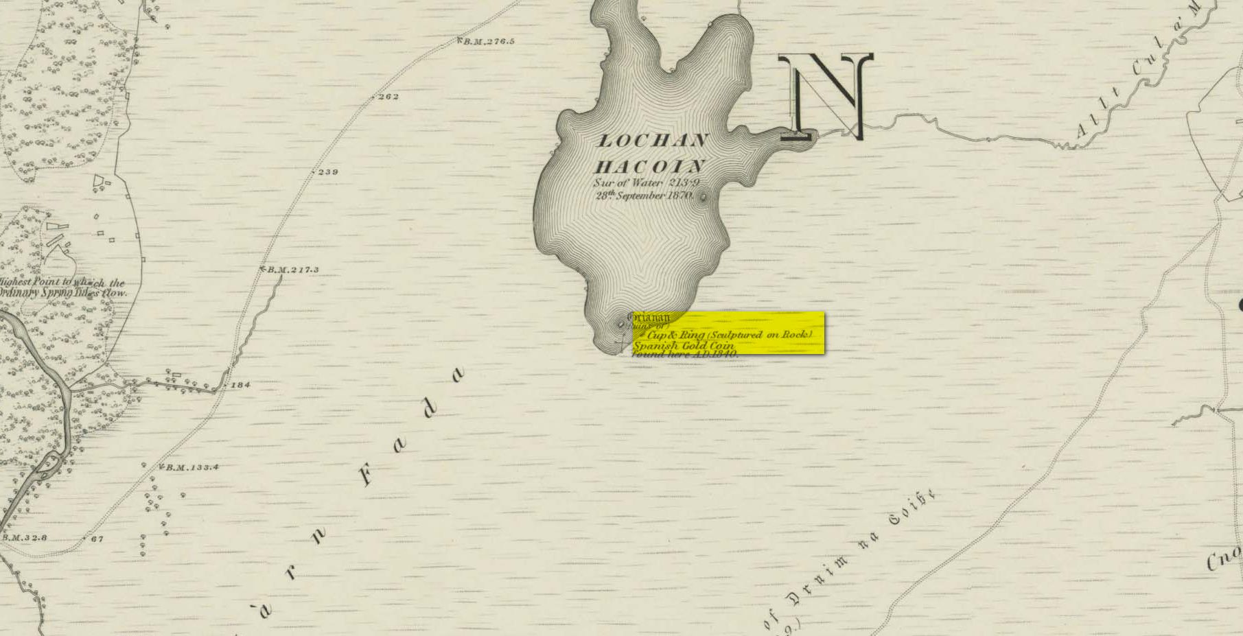
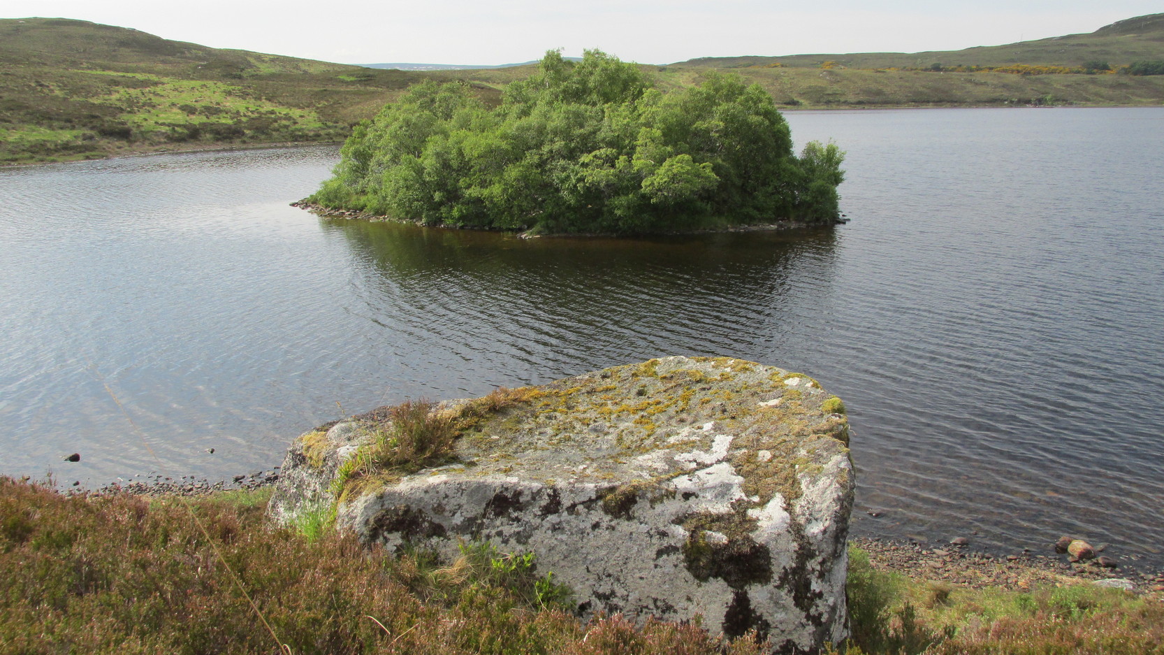
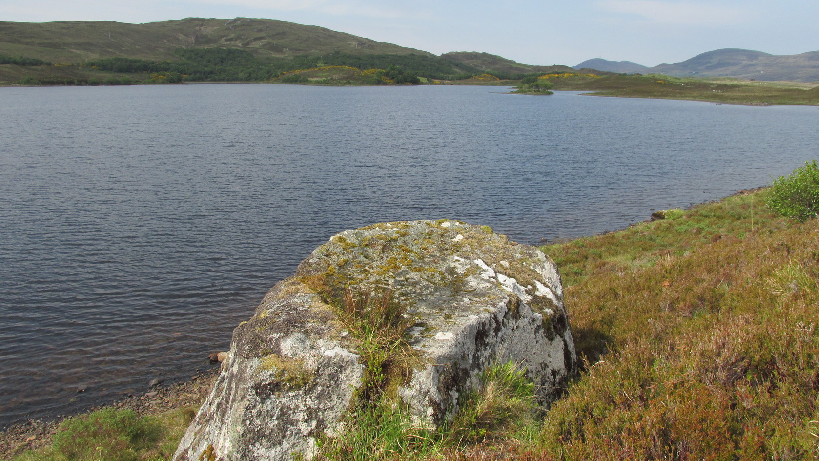
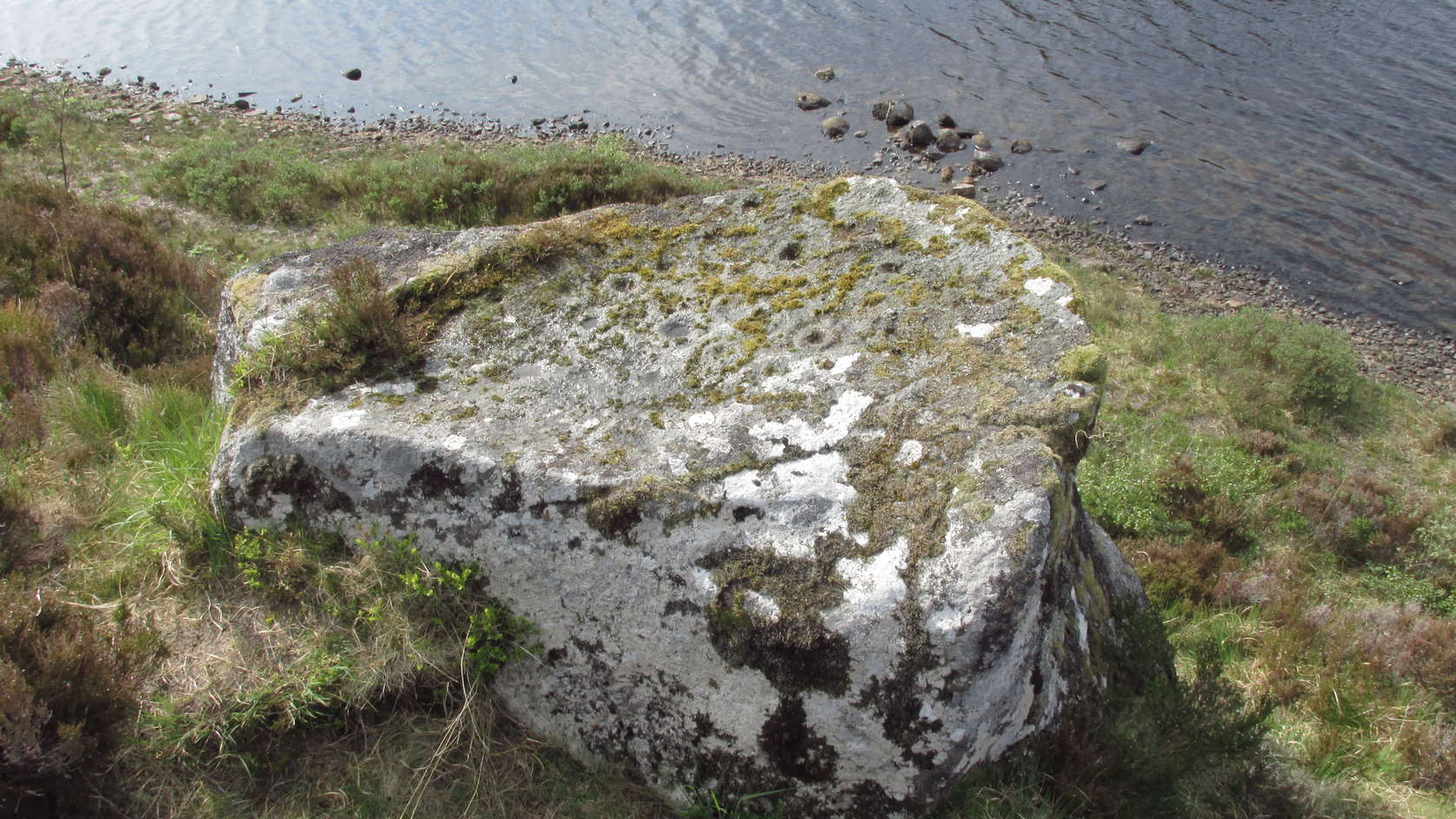
Whether you take the A836 or A838 into Tongue (through truly beautiful wilderness), make sure you go into the village itself—and then keep going, south, along the tiny country road. Nearly 2½ miles along, note the small loch of Lochan na Cuilce on your right. A few hundred yards past this, on the other side of the road (barely visible at first) is Lochan Hakel. Walk around to the south-side of the loch until you find the Lochan Hakel 1 carving. Then look up at the rock right above you. That’s the one!
Archaeology & History
In James Simpson’s (1867) primary work on British petroglyphs, he mentions this site as being in the lands of “Ribigill, near Tongue”, although it is a little further to the south. He said that a certain “Mr Mitchell” had come across it in one of his many rambles in the hills (this was probably Arthur Mitchell, author of the 1880 book, The Past in the Present). Simpson told that he had:
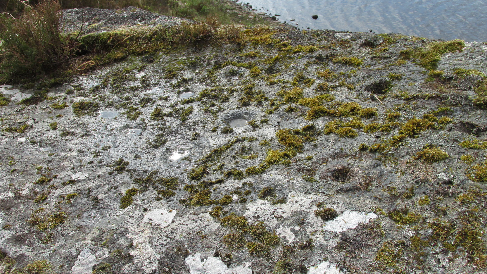
“discovered cups and circles upon a large stone, about nine feet square, apparently lying in its original position, close to the edge of a loch, which contains the remains of an old castle… The surface of the stone shows eighteen or twenty round cup excavations, about an inch deep. There is a ring of ‘hollow around each cup.'”
Although there aren’t rings around every cup, a great number of clear and impressive rings exist around many of them and are, thankfully, still reasonably visible amidst the mass of lichens.
Around the same time as Mr Simpson’s description, James Horsburgh (1868) wrote about the carving, telling us:
The rock and its islandSome of the cup-and-rings
“On the edge of the precipitous bank of the loch, and exactly opposite the island, there is a large boulder with a flat top, and on this there are a number of cups and rings… This stone is not generally known. Old Ross, the gamekeeper at Tongue, first told me of it, and he and I scraped off the moss and exposed the whole. He thought it was for playing some game. On the left of the stone, on a bit separated by a crack, there is a sort of a figure which appears to have been formed by cutting away the stone around it and leaving it in relief, and also some artificial cutting on the right, a sort of circular groove.”
A better description of the carving came near the beginning of the 20th century, when the Scottish Royal Commission (1911) lads included the site in their inventory. They told:
From the rock, looking NThe carving from above
“At the S end of Lochan Hacoin, to the SE of the islet on the top of the bank, is a large earth-fast boulder, on the flat upper surface of which are a number of cup and ring marks placed irregularly over it. The total number of undoubted markings is thirty-four, of which those surrounded by a ring number eleven. No cup with a double ring round it is observable. The best defined cup-mark measures 3″ across by 1¼” deep, and the enclosing ring is 7″ in diameter. Eight of the markings are well defined; the others less noticeable. At the S end there is a boss or projection, roughly rectangular, measuring 12″ x 6″. A sketch of this stone, made about the year 1866 by Mr James Horsburgh, is preserved in the library of the Society of Antiquaries of Scotland.”
Does anyone know if this drawing still exists? Anyhow, whilst you’re stood here looking at this petroglyph, don’t forget to look at the other one on the rock below you closer to the loch-side.
Folklore
In Horsburgh’s essay on the prehistoric remains of the area, he said how local people told that the cup-and-rings “were made by the high heels of a fairy who lived in the castle” on the island of Grianan, just 40 or 50 yards away.
References:
Close-Brooks, Joanna, Exploring Scotland’s Heritage: The Highlands, HMSO: Edinburgh 1995.
o’ Reilly, Kevin, What to See Around the Kyle of Tongue, privately printed 1980.
Royal Commission on Ancient & Historical Monuments & Constructions of Scotland, Inventory of Monuments and Constructions in the County of Sutherland., HMSO: Edinburgh 1911.
Simpson, James, Archaic Sculpturings of Cups, Circles, etc., Upon Stones and Rocks in Scotland, England and other Countries, Edmonston & Douglas: Edinburgh 1867.
Acknowledgments: Huge thanks to Sarah MacLean for guiding me to this carving, and also for the kind use of her photos in this site profile. Cheers Sarah! And to Donna Murray again, for putting up with me whilst in the area! Also – Huge thanks for use of the 1st edition OS-map in this site profile, Reproduced with the kind permission of the National Library of Scotland.
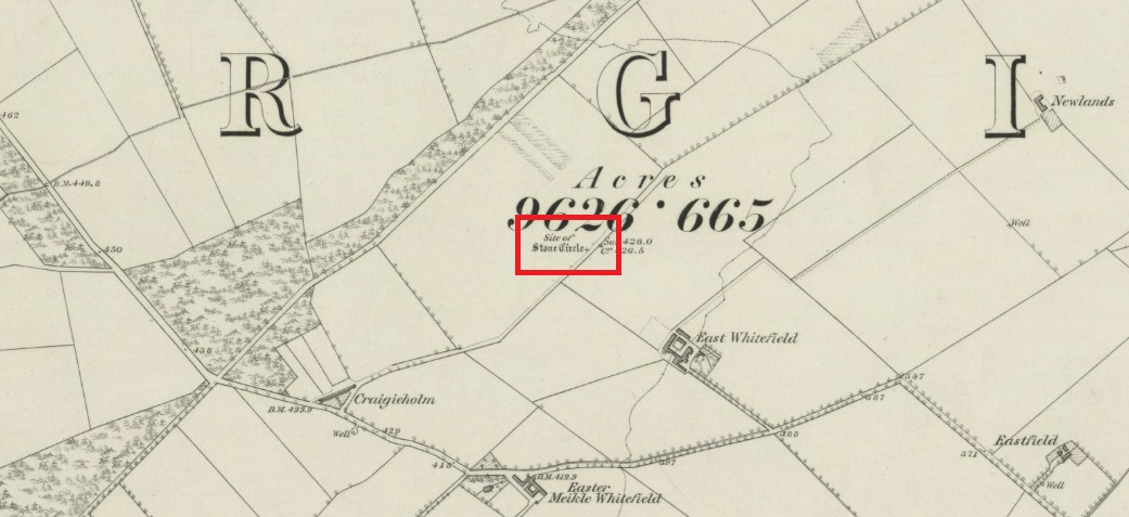
Travelling north from Perth on the A94, take the left hand turn to Strelitz as you go into Burrelton, and follow that road for two miles, and park up about 300 yards past the turning to Gallowhill. The circle stood at the far end (south-east) of the field on your left. Keep the distant gap in the hills in sight and the probable site of the circle is in a dip in the land in front of the ditch.
History & Archaeology
The circle had been destroyed by the middle of the nineteenth century, but was remembered by locals who gave this description to the Ordnance Survey bods:
‘The authorities quoted says that this is the site of a number of standing stones, they formed a circle, and one stood in the centre and according to tradition they were the remains of a Druidical Temple.’
In 1969 an Ordnance Survey archaeologist wrote:
‘There is no trace of this circle, the site being in a level arable field. Immediately to the SE in a ditch running parallel to the fence are about a dozen large boulders cleared from the field, possibly from the site of the circle.’
The boulders have now gone but there are some broken stones on the banks of the drainage ditch which may or may not be the sorry remains of some of the stones. There is a depression in the field just in front of the ditch which is the likely site of the circle based on the position shown on the 1867 map.
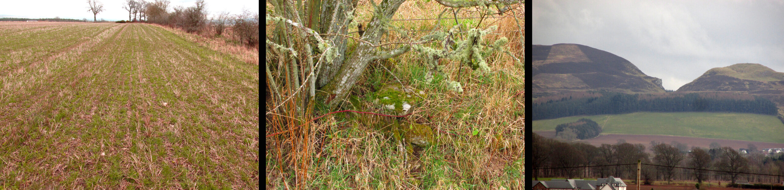
Left – A faint cropmark which may show the position of the circle in this winter view. Centre – Shattered stones in the ditch bank. Right – View looking south-east from the probable site of the circle – the gap between Black Hill, left and Dunsinane, right
What is interesting is the gap in the horizon facing south east from the site of the circle. On the left of the gap is Black Hill, and on the right Dunsinane Hill of Macbeth fame. My reading of the angle from the probable site of the circle to the gap using a hand held compass was around 135° to 140°, and that may indicate a midwinter sunrise alignment from the lost circle. Something to be checked out when winter comes.
And there is a legend of a giant who leaped from Black Hill to Dunsinane who also tossed a boulder which stands between the two hills – whether this legend has anything to do with the possible solstitial sighting line from East Whitehill is an intriguing question.
Acknowledgements: Big thanks for use of the 1st edition OS-map in this site profile, Reproduced with the kind permission of the National Library of Scotland.