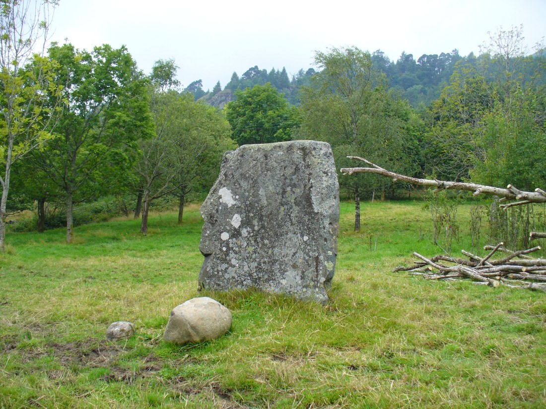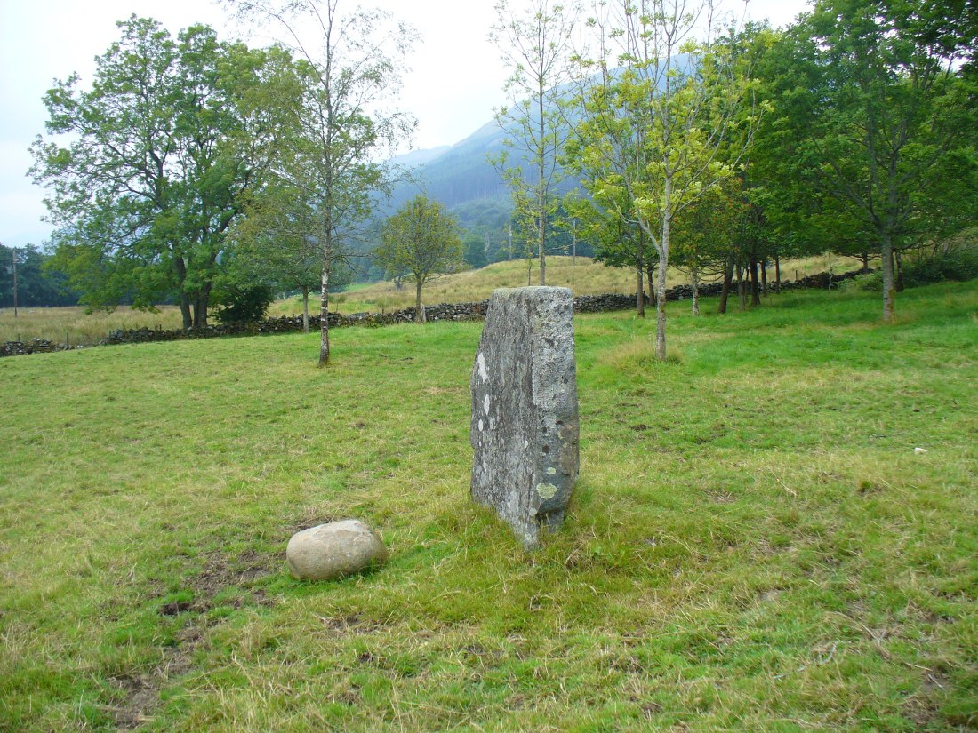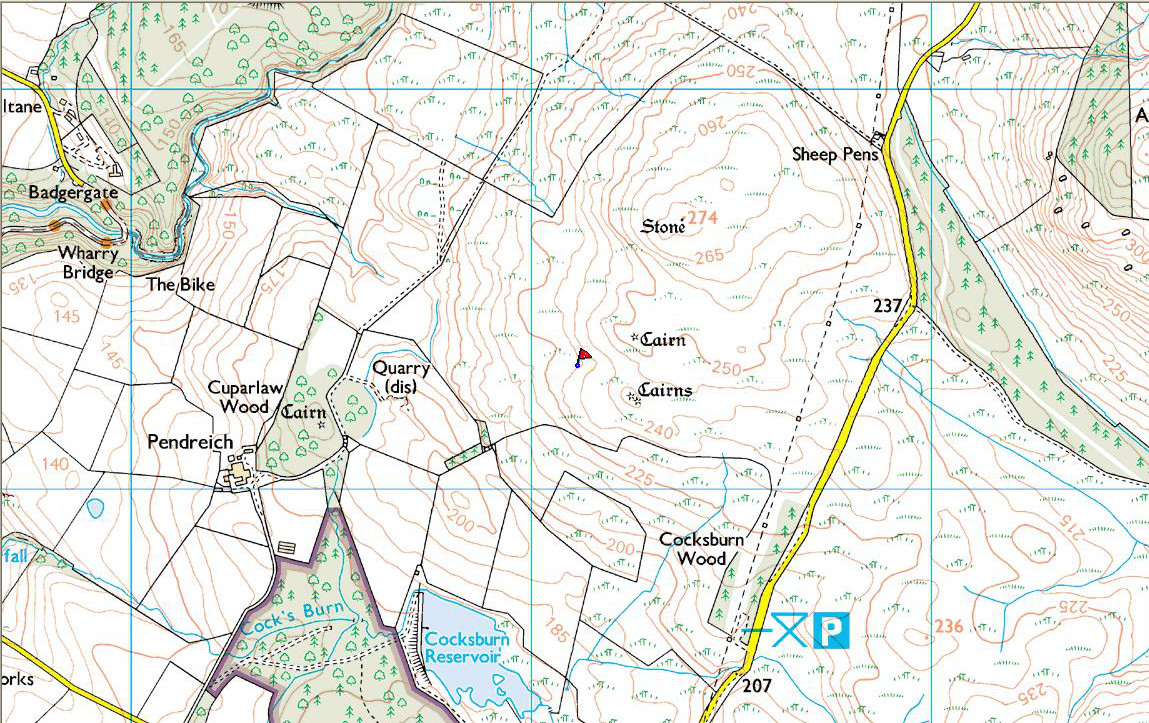
Balinshoe, Kirriemuir, Angus

Standing Stone (destroyed):  OS Grid Reference – NO 4164 5219

Also Known as:

  1. Canmore ID 33871
  2. The Stannin Stane of Benshie

Archaeology & History

Site of the standing stone on 1865 OS-map
Stone on the 1865 OS-map

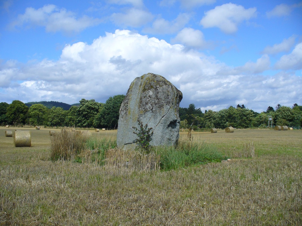
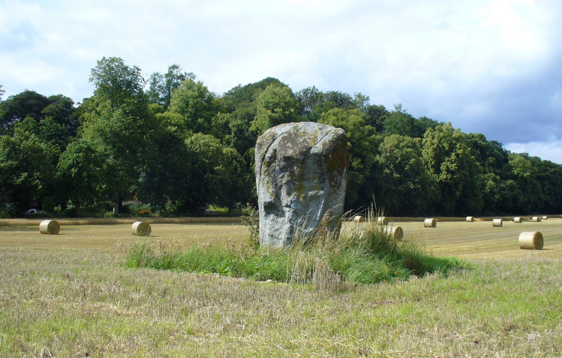
In a region that is full of prehistoric remains, we find here another example of another megalithic site that was sadly destroyed, not too long ago by the scale of things.  Found in association with a large prehistoric urn, we are thankful to have a couple of early local history accounts that describe the place.  The stone was obviously of some considerable height and bulk, though I can find no specific references to the dimensions of the monolith.  It was described effectively in the middle-half of the 19th century by Andrew Jervise (1853), who told us:

“‘The Stannin Stane of Benshie’, which stood for unknown ages…was demolished by gunpowder about half a century ago, and the spot is now covered by luxuriant crops of corn. This rude monument of antiquity is supposed to have been about twenty tons in weight; and at a considerable depth below it, a large clay urn, measuring about three feet in height and of corresponding circumference, was found containing a quantity of human bones and ashes.  Like its rude protector, however, the urn was broken to pieces; and, beyond the mere fact of its discovery, nothing authentic, as to either the style of its manufacture, or the precise nature or state of its contents, is preserved.”

More than 30 years later, A.J. Warden (1884) and then J.G. MacPherson (1885) all but copied Mr Jervise’s words, adding no further information.

From some reason, a small chapel dedicated to St. Ninian (NO 41567 51932) was built about 100 yards or so to the southwest of the old standing stone.  Its ruins are still to be seen. Whether this was an attempt to divert local people away from their animistic ecocentricism at the stone, into the more ecocidal egocentricism of the incoming christian cult (as was/is their common practice), we may never know for sure.

Folklore

The local name of this stone, ‘The Stannin Stane of Benshie’, indicates simply that this was “the standing stone at the hill of the faerie folk” (or variations thereof) and suggest it stood upon or next to a mound. I can find no immediate reference to stories of the little people here, and their whisper may have faded into unconscious memory.  Does anyone know more about this place?

References:

  1. Jervise, Andrew, The History and Traditions of the Land of the Lindsays in Angus and Mearns, Sutherland and Knox: Edinburgh 1853.
  2. MacPherson, J.G., Strathmore: Past and Present, S. Cowan: Perth 1885.
  3. Royal Commission on the Ancient & Historical Monuments of Scotland, The Archaeological Sites and Monuments of Central Angus, Angus District, Tayside Region, Edinburgh 1983.
  4. Warden, Alex J., Angus or Forfarshire: The Land and People – Descriptive and Historical – volume 4, Charles Alexander: Dundee 1884.

© Paul Bennett, The Northern Antiquarian

Witches Stone, Monzie, Crieff, Perthshire

Standing Stone:  OS Grid Reference – NN 87980 24321

Also Known as:

  1. Canmore ID 25448
  2. The Witches Stone & her crags to the rear
    The Witches Stone & her crags to the rear

    Kor Stone

Getting Here

Along the A822 road past Crieff and then Gilmerton, shortly past here is a small road to Monzie and the Glenturret Distillery or Famous Grouse Experience. Go on this road and after a just a coupla hundred yards you’ll see the large old gatehouse for Monzie Castle on the left. Ask at the gatehouse and they’ll point you to the stone—in the field about 300 yards past the Monzie stone circle, 200 yards past the gatehouse itself.  You can’t really miss it!

Archaeology & History

The southern flat face of the Witches Stone

This is a fascinating stone for a variety of reasons—not least of which it enabled us to identify an otherwise curious geological anomaly as an unerected standing stone some 16 miles SSW…but that’s a story for later!  The stone here leans at an angle in the field, as shown in the photo, but it still rises 5 feet tall and is a thick chunky fella, with one face very flat and smoothed indeed from top to bottom.  This side of the stone was obviously cut and dressed this way when first erected.  As Paul Hornby then noted, its western face is also quite flat and smoothed aswell, with the edge between the two sides almost squared at right-angles.  The eastern and southern sides of the stone are undressed, as the phrase goes.  These physical characteristics have just been found at a newly found pair of un-erected standing stones on the western edges of the Ochils, just below a newly found cairn circle.

Fred Coles 1911 drawing
Witches Stone, looking NE past Milquhanzie Hill fort

There were several early descriptions of this stone, two of which talked about an avenue or road along which the stone seemed to stand within.  This ‘avenue’ was in fact the very edge of what is probably an earlier prehistoric enclosure—but you can’t really see this anymore unless you’re in the air (check Google Earth, which shows it reasonably well).

In J. Romilly Allen’s (1882) account, he mentions the stone only in passing, telling it to be “a single standing stone measuring 4 feet by 3 feet and 5 feet high (with) no markings on it.”  It was later described in Fred Coles’ (1911) survey of the region where he told:

“This monolith is the westerly of the two prehistoric sites grouped on the O.M. as Standing Stones. It stands a few yards to the south of the avenue, almost half a mile from the East Lodge. The Stone has a slight lean towards the north. Its southern side is remarkably broad and smooth, measuring 4 feet across the base on that side, in girth 13 feet 1 inch and in vertical height 4 feet 9 inches.”

Alignment to Monzie stone circle, just visible in field

In Alexander Thom’s edited magnum opus (1980) he found that this standing stone—800 feet northwest of the superb Monzie cup-and-ring stone and associated megalithic ring—marks the midsummer sunset from the stone circle. We noted on our visit here, that this alignment runs to the distant cairn on the far northwest horizon, many miles away.

Folklore

In Joyce Miller’s (2010) excellent work on Scottish heathenism, she told the folowing tale of this stone:

“The standing stone is said to mark the site of Kate McNiven or MacNieven’s, sometimes known as the witch of Monzie, execution. The story goes that she was put in a barrel and rolled down what is now known as Kate MacNieven’s Craig on the north side of the Knock of Crieff before being burnt.  Kate had been the nurse to the Grahams of Inchbrackie, and was accused of witchcraft, including turning herself into a bee.  Graham of Inchbrackie tried to save her but to no avail, but as she was about to die it is said that she spat a bead from her necklace into his hand. The bead – a blue sapphire – was turned into a ring and it was believed that the ring would keep the family and lands secure.  She did, however, curse the laird of Monzie, although whether this worked or not is not known. MacNiven or Nic Niven was also believed to be the name of the Queen of Fairies.  Indeed it is not clear whether Kate MacNiven was a real person or is a conflation of stories. There do not appear to be any contemporary records of her execution at or near Crieff, and dates for her unpleasant death are variously given as 1563, 1615 and 1715.”

…to be continued…

References:

  1. Allen, J. Romilly, “Notes on some Undescribed Stones with Cup Markings in Scotland,” in Proceedings of the Society of Antiquaries Scotland, volume 16, 1882.
  2. Coles, F.R., “Report on stone circles in Perthshire principally Strathearn,” in Proceedings of the Society of Antiquaries, Scotland, volume 45, 1911.
  3. Finlayson, Andrew, The Stones of Strathearn, One Tree Island: Comrie 2010.
  4. Holder, Geoff, The Guide to Mysterious Perthshire, History Press 2006.
  5. Marshall, William, Historic Scenes in Perthshire, Oliphant: Edinburgh 1881.
  6. Miller, Joyce, Magic and Witchcraft in Scotland, Goblinshead 2010.
  7. Thom, Alexander, “Megalithic Astronomy: Indications in Standing Stones,” in Vistas in Astronomy, volume 7, 1966.
  8. Thom, A., Thom, A.S. & Burl, H.A.W., Megalithic Rings, BAR: Oxford 1980.
  9. Watson, David, A Simple Introduction to the Stone Circles and Standing Stones of Perthshire, 2006.

© Paul Bennett, The Northern Antiquarian

Deil’s Cradle, Dollar, Clackmannanshire

Legendary Rock:  OS Grid Reference – NS 9686 9906

Also Known as:

  1. Devil’s Cradle

  2. Devil’s Rock

Folklore

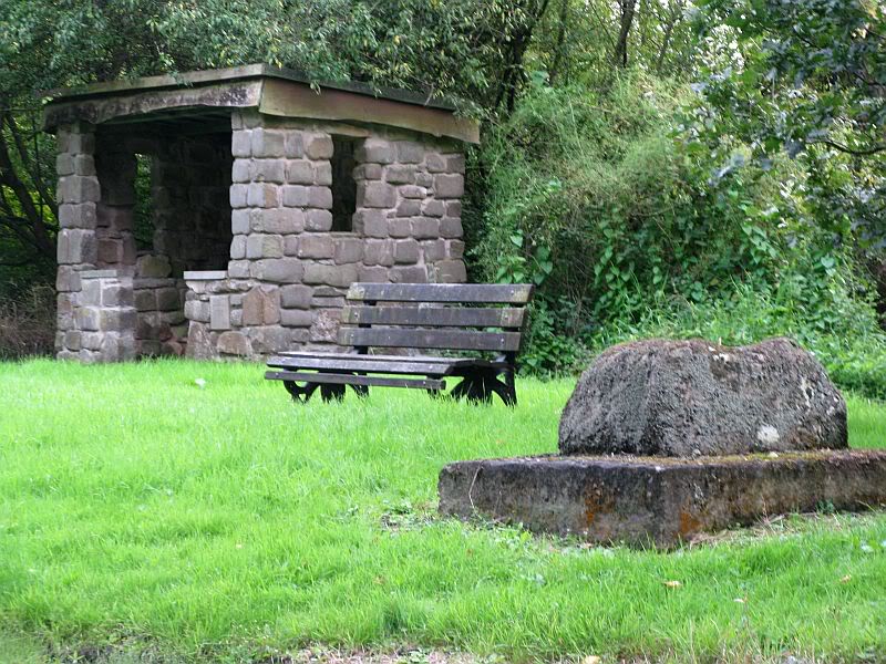
The Deil’s Cradle stone

A few hundred yards below the legendary old Wizard’s Stone, we find there’s a real cluster of witch-lore in the small area to the north of Dollar which, to be honest, is deserving of wider analysis from competent researchers and historians.  Not only is there the legendary Lochy Launds of the Black Goddess hereby, but we also find this curious rock, described by one ‘J.C.’  in an early edition of the Scottish Journal (1848), which told:

“On the confines of the parish of Dollar, not far from Hillfoot, the seat of John McArthur Moir, Esq., lies a glen, called Burngrens, watered by a small stream and planted with numerous large trees.  A great number of these, however, have fallen, during the last few years, beneath the unsparing axe; but strong, healthy saplings are rising rapidly to supply their place.

“In this glen there is a large stone, of peculiar formation, in every way like a cradle. It is currently believed by the superstitious in the vicinity, that the stone, every Hallowe’en night, is raised from its place, and suspended in the air by some unseen agency, while “Old Sandy,” snugly seated upon it, is swung backwards and forwards by his adherents, the witches, until daylight warns them to decamp.

The following rather curious affair is told in connection with the “Cradle:”

“One Hallowe’en night a young man, who had partaken somewhat freely of the intoxicating cup, boasted before a few of his companions that he would, unaccompanied, visit the stone. Providing himself with a bottle, to keep his courage up, he accordingly set out.  The distance not being great, he soon reached his destination.  After a lusty pull at the bottle, he sat down upon the “Cradle,” boldly determined to dispute the right of possession, should his Satanic majesty appear to claim his seat. Every rustle of a leaf, as the wind moaned through the glen, seemed to our hero as announcing the approach of the enemy, and occasioned another application to fortifying “bauld John Barleycorn.” Overpowered at last by repeated potations, our hero, dreaming of “Auld Nick,” and his cohort of “rigwuddie hags,” fell sound asleep upon the stone.

“His companions, who had followed him, now came forward. With much shouting and noise, they laid hold of him, one by the head and another by the feet, and carrying him, half-awake, to the burn, dipped him repeatedly, accompanying each immersion with terrific yells. The poor fellow, thinking a whole legion of devils were about him, was almost frightened to death, and roared for mercy so piteously that his tormentors thought proper to desist. No sooner had our hero gained his feet than he rushed up the glen, and ran home, resolving never to drink more, or attempt such a feat again. For many a long day he was ignorant who his tormentors really were.

“We stood upon the stone about a week ago. Ivy and moss are slowly mantling over it, a proof that it is some considerable time since the Devil has been rocked on it.”

Historian Angus Watson (1995) told the place to be “south of Wizard’s Stone…near Kelty Burn,” and also that,

“it is said to be where witches rock Satan to sleep on Halloween.”

Above here, the tree-topped rounded hill to the north was one of the meeting places of the witches of Fife, Perthshire and Clackmannan.  Something of sincere pre-christian ritual importance was undoubtedly enacted in this region, as we also find sites of the Maiden a short distance due north.  Does anyone know more about this fascinating sounding place?

References:

  1. ‘J.C.,’ “The Deil’s Cradle”, in The Scottish Journal, February 5, T.G. Stevenson: Edinburgh 1848.
  2. Simpkins, John Ewart, County Folklore – volume VII: Examples of Printed Folk-Lore Concerning Fife, with some Notes on Clackmannan and Kinross-Shires, Folk-Lore Society: London 1914.
  3. Watson, Angus, The Ochils: Placenames, History, Tradition, PKDC: Perth 1995.

© Paul Bennett, The Northern Antiquarian

Dargill, Crieff, Perthshire

Standing Stone:  OS Grid Reference – NN 85918 20054

Also Known as:

  1. Canmore ID 25443

Getting Here

Dargill Standing Stone

Take the A822 straight road south out of Crieff and as you pass the garden centre on your right and the fields and trees begin either side of the road, you need to watch out in the field on your left-hand side.  Just a couple of hundred yards after passing beyond the garden centre, stop.  Look in the field there and you’ll see the object in question. You can’t really miss him!

Archaeology & History

As you approach or leave Crieff along the A822 you can easily pass this stone by. Which would be a pity, as it’s quite a giant standing alone just above the slight ridge in the field.  And in times gone by, not only were there other standing stones here as companions, but a cluster of other prehistoric pits, enclosures and linear markings were all around this very spot.  Some of them are visible as faint crop-marks even today, but they remain unexcavated and we are left (presently) in the dark as to their nature.

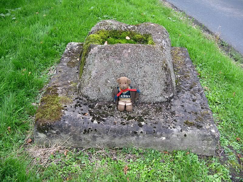
Dargill stone, looking NW
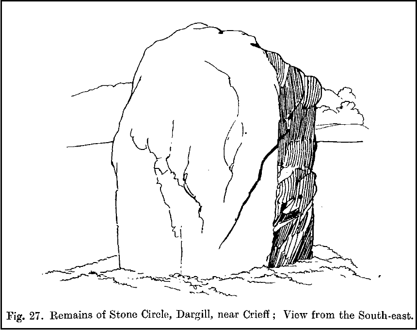
Old drawing by Fred Coles

The standing stone itself is a real beauty!  A huge fat fella, standing nearly eight feet tall, looking proudly across the field in all directions and gazing into the northern hills, where the wanderer’s eye naturally falls… In earlier years, the great megalithic explorer Fred Coles told of two other stones standing hereby—although they are not noted on the earliest OS-map of the area.  Nevertheless he wrote the following:

“This place-name deserves brief notice.  It is pronounced by persons in the locality as if it were spelt like the Irish name Dargle, having the stress on the first syllable.  The site is in a field between the main road from Crieff to Auchterarder and Dargill Island on the river Earn, at the height of 121 feet above sea-level…  There is here an indistinct mound, not now easily traceable, nor of any considerable height; but it is significant to have to report that up to 1909, when a new tenant entered the farm, two other great Stones were standing.  These were removed by the newcomer, much to the surprise and indignation (I was told) of the neighbours.  The remaining monolith is an unusually square and massive oblong block of schist, girthing over 16 feet, and standing clear of the ground 7 feet 8 inches in height.  Its eastern edge is rough and riven into long vertical hollows; but the other sides are, on the whole, smooth.  I append a view from the south-east.”

More recently the Dargill stone was described in Andy Finlayson’s (2010) excellent photo-history guide to the megaliths of the region.

Folklore

In recent years this great stone has received the attention of local ley hunter David Cowan, who dowsed here and found ‘earth energies.’ These are in fact water-lines: the primary dowsing response and not related to leys.

References:

  1. Coles, F.R., “Report on stone circles in Perthshire principally Strathearn,” in Proceedings of the Society of Antiquaries, Scotland, volume 45, 1911.
  2. Cowan, David, Ley Lines and Earth Energies, Adventures Unlimited 2003.
  3. Finlayson, Andrew, The Stones of Strathearn, One Tree Island: Comrie 2010.

© Paul Bennett, The Northern Antiquarian 

Caddam, Kirriemuir, Angus

Stone Circle (remains of):  OS Grid Reference – NO 3848 5625

Also Known as:

  1. Caldhame
  2. Canmore ID 32196
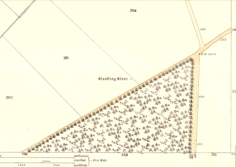
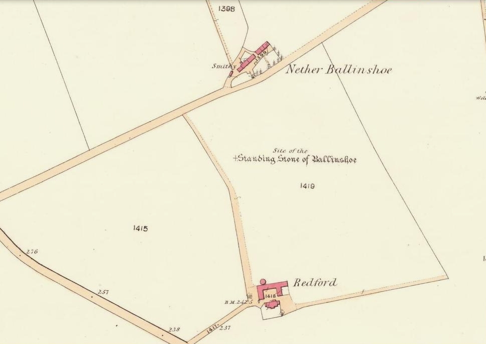
1865 OS-map showing the stone
1865 map showing the site

Getting Here

From Kirriemuir centre, take the B956 out of town until you hit the B955. Head north along this road until the houses are behind you. You’ll pass a woodland on your left straight away and as the road starts to bend right, take the first small road on your left. Go along here for about 150 yards and stop. Look into the fields across the road and there it is!

Archaeology & History

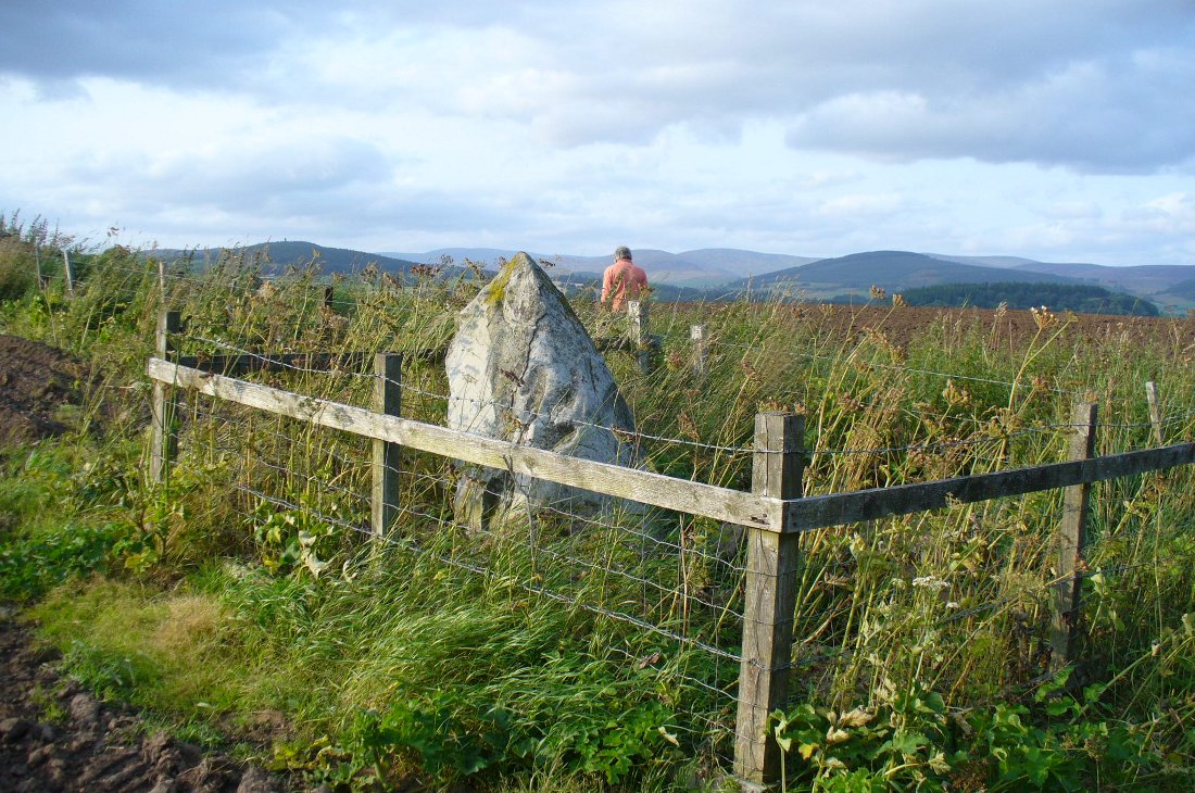
Caddam stone, looking north
Caddam stone, looking N

The small standing stone we see here today, within in a small fenced enclosure by the wall-side, was highlighted on the 1865 OS-map in exactly this position.  However, its earlier history seems much more intriguing – and at least one account tells us how this solitary stone was once part of something much bigger—implying that it was of some considerable important to our ancestors.  In A.J. Warden’s (1884) magnum opus on the history of this region he told that,

“A circle of stones was discovered in trenching a field at Caldhame, a little to the north of (Kirriemuir) town. It was over sixty feet in diameter, and in the centre was a large standing stone. The circle was removed, but the centre stone was left.”

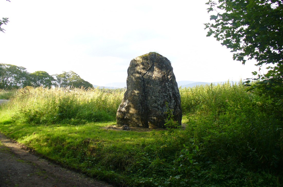
The Caddam stone, looking SW
Caddam stone, looking SW

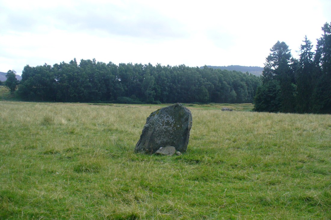
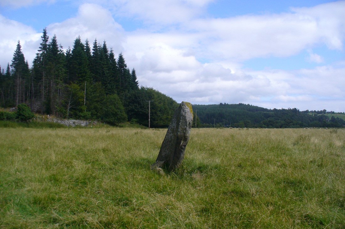
Another local writer later reported that there were remains of six stones in the field immediately below the remaining upright, but these have since disappeared. The descriptions seem to imply that the stone was a part of a burial complex of some sort.  Sadly, all we see today is this one remaining upright: some 5 feet tall, but looking shorter as it leans to its side, seemingly ready to fall.  Do any local people know anything more about this place?

References:

  1. Royal Commission on the Ancient and Historical Monuments of Scotland, The Archaeological Sites & Monuments of Central Angus, Angus District, Tayside Region, HMSO: Edinburgh 1983.
  2. Warden, Alex J., Angus or Forfarshire: The Land and People – Descriptive and Historical – volume 4, Charles Alexander: Dundee 1884.

© Paul Bennett, The Northern Antiquarian

Kirriemuir Hill, Kirriemuir, Angus

Standing Stone:  OS Grid Reference – NO 3917 5463

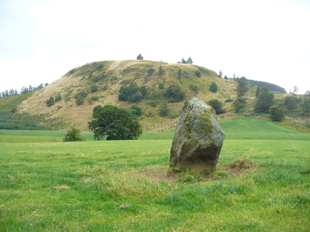
Kirriemuir Hill standing stone

Also Known as:

  1. Canmore ID 32295
  2. Hill of Kirriemuir
  3. Stannin’ Stane

Getting Here

Various ways to get here, but make your way to the large cemetery up on the top of the hill.  Once here, there is a playground and some trees. Go through the playground along the footpath for about 100 yards and you’ll eventually come to this great stone standing in front of you.

Archaeology & History

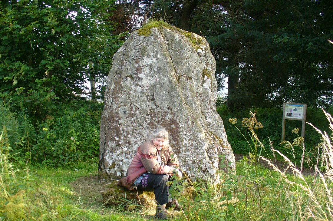
The Kirriemuir Stone, with a curious elemental at its base!

This place felt to have some real intrigue and hidden history laying close by when I came here for the first time the other week with Paul and Lindsey.  Notably standing on the top of the hill northwest above Kirriemuir town, with an excellent view all round (just about!), speaking with hills and rolling countryside and the feel of other monuments of the same age…but seemingly all alone at the moment…

The Kirriemuir Hill standing stone is reputedly the last survivor of a megalithic ring, or stone circle, according to old tongues and local folklore—though Aubrey Burl didn’t include it in his magnum opus.  And apart from the smaller piece of stone near its base and the curious long stone in an adjacent field wall not far away, this large 9-foot tall standing stone seems the last of its clan up here.

The stone was mentioned briefly in A.J. Warden’s (1884) massive history work on the region, where—near some legendary rocking stones that have long since been destroyed—he simply told that,

“The remains of a standing stone about 9 feet in height, by about 4 J feet in breadth, still rears its head above the Market Muir, and forms a very conspicuous object there.”

It hasn’t fared too well in archaeological surveys either, but thankfully local historians have written about it. Herbert Coutts (1970) told it to be,

“An impressive standing stone about 9ft (2.7m) in height and 6½ft (1.9m) broad at the base.  A recumbent stone is reported to have once lain nearby but has long since been removed.”

This recumbent stone may be the one sitting in one of the adjacent walls.

Folklore

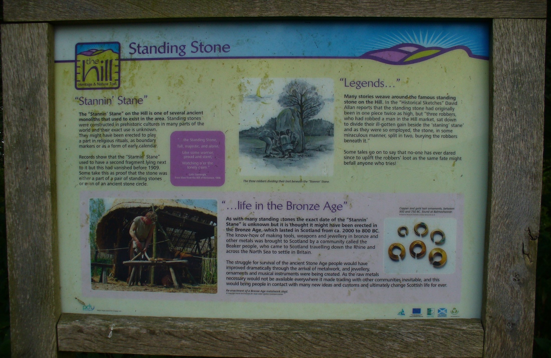
Notice board telling tales

A notice board set back from this great stone gives a good outline of its known history, archaeological speculations and the folklore of the place. As well as it being said that Kirriemuir’s hill stone was once part of a stone circle, local markets were once held close by.  Ascribed as being the burial site of three robbers, local historian David Allan (1864) was the first to write the legend which told that,

“three robbers, who had robbed a man in the Hill market, sat down to divide their ill-gotten gain beside the ‘staning stane’ and as they were so employed, the stone, in some miraculous manner, split in two, burying the robbers beneath it.”

The local history board tells “that no one has ever dared since to uplift the robbers’ loot, as the same fate might befall anyone who tries”!

…to be continued…

References:

  1. Allan, David, Historical Sketches, Original and Select of Kirriemuir and District, Robert Park: Dundee 1864.
  2. Coutts, Herbert, Ancient Monuments of Tayside, Dundee Museum 1970.
  3. Warden, Alex J., Angus or Forfarshire: The Land and People – Descriptive and Historical – volume 4, Charles Alexander: Dundee 1884.

© Paul Bennett, The Northern Antiquarian

Dunkeld Park, Dunkeld, Perthshire

Standing Stone:  OS Grid Reference – NO 01426 42994

Also Known as:

  1. Canmore ID 27205
  2. Dunkeld House
  3. Pulney Lodge

Getting Here

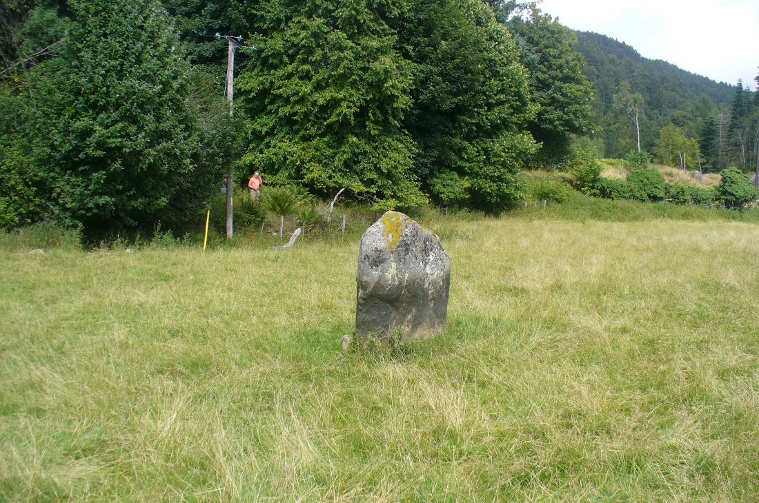
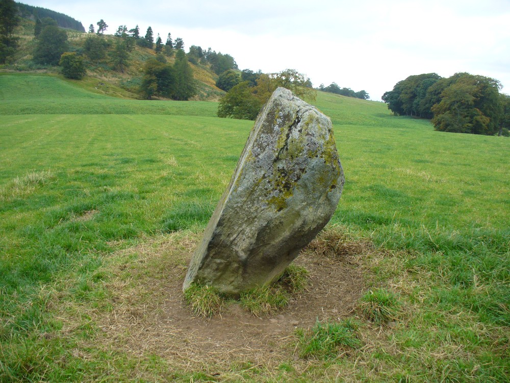
Dunkeld Park monolith

Take the A923 road through Dunkeld and across the river, making sure that where the road veers sharply to the right as you go out of town, you go the left as the road bends round.  100 yards along, past the trees on your left, fields open up. A few hundred yards along on the left, you’ll note the small standing stone about 50 yards in the field below the wall, getting close to some trees again. That’s the spot!

Archaeology & History

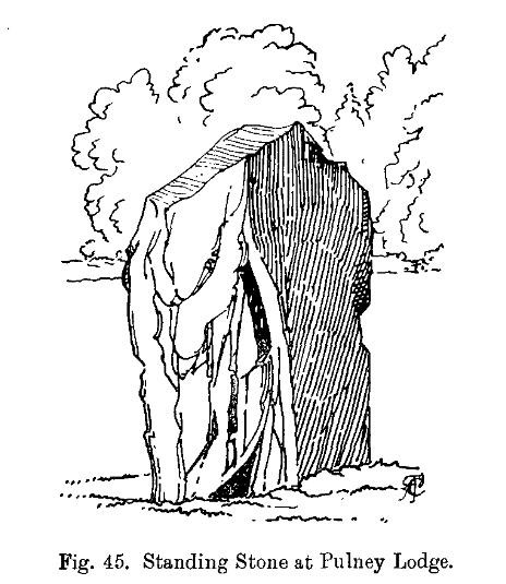
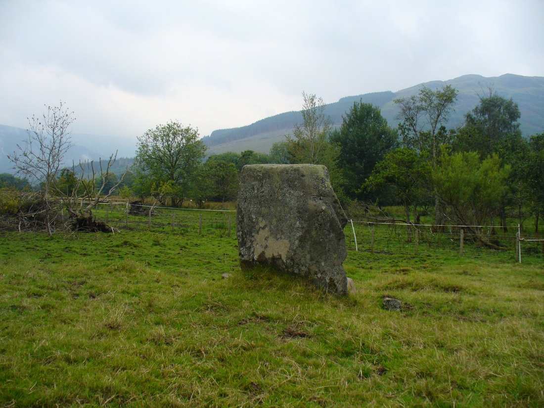
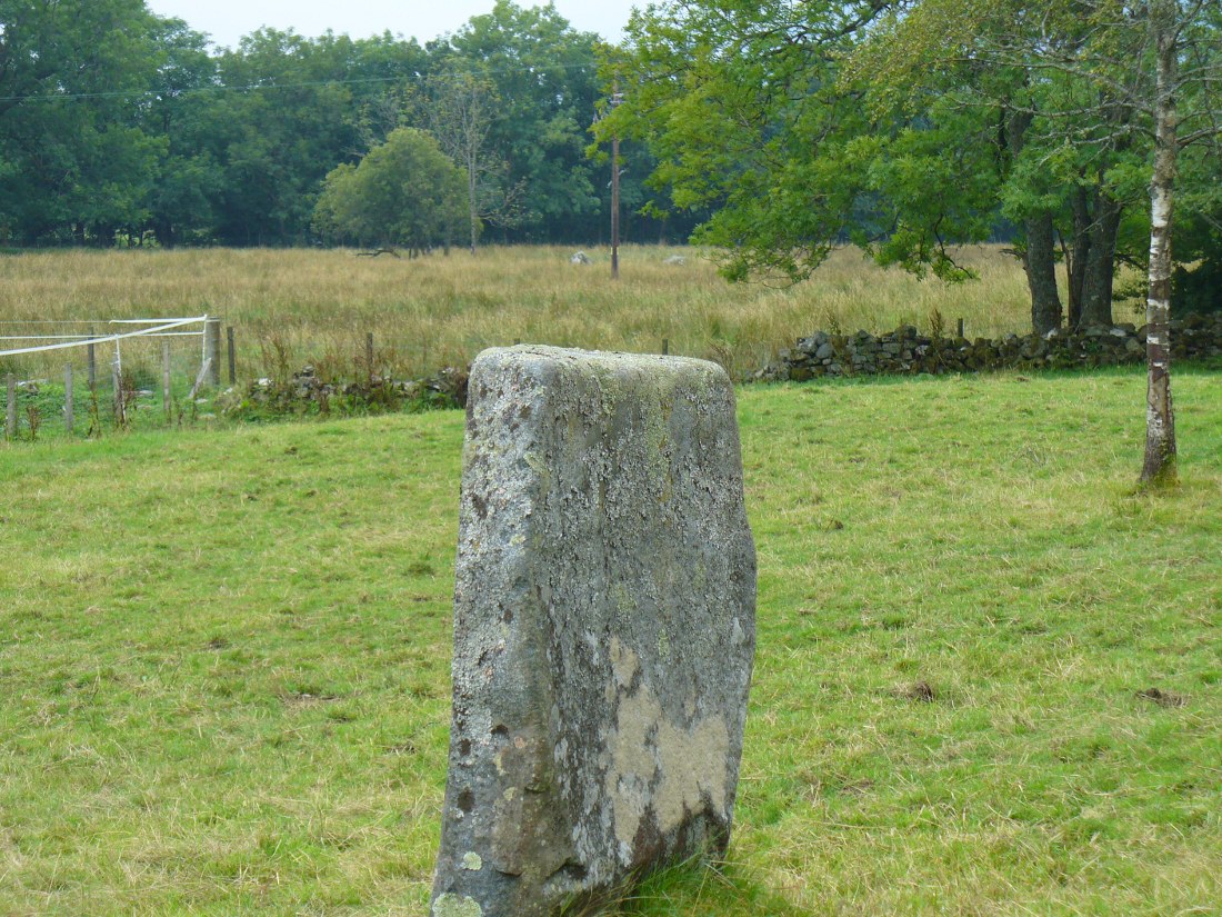
The stone is given only a passing mention in the Royal Commission’s (1994) poor work on the region, describing neither its height nor form and erroneously relating it to what is probably a much earlier series of pit alignments in the same field.  Thankfully we had a better description from the early 20th century antiquarian Fred Cole (1908) who visited and drew the site and who told us:

Standing stone, looking NE
Dunkeld Stone looking north

“This Stone is marked on the Ordnance Map in a field behind the Lodge, at a height above sea-level of 300 feet, and styled “sepulchral.”  In size and character it much resembles the Kilmoraich monolith, and seems to have stood solitary for ages.  It is a roughly oblong slab of schist, set with its longer axis nearly east and west, the north face measuring 4 feet and the south 4 feet 9 inches, and the basal girth about 10 feet 7 inches.  It is 4 feet 9 inches in height.  The grandly-timbered policies of the ducal estate enclose this site on all sides.  In the illustration…the Stone is drawn as seen from the east.”

Close to the walling on the WNW just a few yards away, we see a cluster of small rounded stones and a couple of larger stones, much overgrown, giving the impression that they were field clearance.  There is a possibility that they may have had something to do with the standing stone in earlier times; the small stones being very worn and perhaps being part of a cairn—although there seems little evidence of this in the on-line aerial surveys.  The stone was also mentioned in Elizabeth Stewart’s Dunkeld (1926), where she wrote:

“In the park near Polney Loch, one mile from Dunkeld, is a Standing Stone, quite noticeable from the Highland road. This monolith is one of those styled sepulchral, and is a rough oblong slab of schist, its basal girth being 10 feet 7 inches, and its height 4 feet 9 inches. Mr. Coles, who describes this stone in the “Proceedings of the Society of Antiquaries”, supposes it to have been part of a circle. It is not far from the ancient stronghold on King’s Seat.”

References:

  1. Coles, Fred, “Report on Stone Circles Surveyed in Perthshire – Northeastern Section,” in Proceedings of the Society of Antiquaries of Scotland, volume 42, 1908.
  2. Royal Commission on the Ancient & Historical Monuments of Scotland, South-East Perth: An Archaeological Landscape, HMSO: Edinburgh 1994.
  3. Stewart, Elizabeth, Dunkeld: An Ancient City, Munro Press 1926.

© Paul Bennett, The Northern Antiquarian 

Puidrac, Balquhidder, Perthshire

Standing Stone:  OS Grid References – NN 54058 20794

Also Known as:

  1. Canmore ID 24141

Getting Here

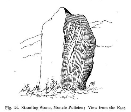
Puidrac Stone, looking SE

From Balquhidder village, take the road east towards Auchtubh as if you’re gonna visit the Priest’s Stone, just past the house of Tom na Cruich on the right-hand side of the road. When you get to the house, if you ask the owners there how best to get to the stone, they are very friendly and very helpful in pointing you in the right direction.

Archaeology & History

This solitary standing stone first seems to be mentioned in J.W. Gow’s (1887) essay on the prehistoric antiquities of this part of Rob Roy’s country.  Found below the house and hillock where the old gallows used to be, he told:

“On the level ground below (Tom na Croich) …there is a prominent monolith, standing about 4½ feet above ground, quite flat, on the top. It is shaped like a wedge, with the edge to the east, and is famous in Balquhidder as the place where trials of strength took place.”

Note the stones in the next field
Note the stones in next field
Puidrac Stone, looking north
Puidrac Stone, looking N

Below the standing stone is a small rock, whose predecessor played an important part in some local traditions relating to this site. (see ‘Folklore’ below)  Also, due west of here in the next field, you will be able to see a couple of seemingly upright stones in the tall reeds 200 yards away, which early records say were part of a stone circle—now much in ruin—known as Clachan Aoraidh or the Worshipping Stones.  There is the possibility that this single stone was an outlier to the circle.  It’s astronomy might be worth checking….

Folklore

When we visited the stone last week, the owners of the house above asked if we’d managed “to lift the stone”—and I wondered what they meant at first, until they told us the folklore about the site.  They narrated the tale almost exactly as it had been described first of all in J.W. Gow’s (1887) essay, which said the following:

A new ‘lifting stone’ in front of Puidrac

“It is shaped like a wedge, with the edge to the east, and is famous in Balquhidder as the place where trials of strength took place.  A large round water-worn boulder, named after the district, ‘Puderag’, and weighing between two and three hundredweight, was the testing stone, which had to be lifted and placed on the top of the standing stone. There used to be a step about 18 inches from the top, on the east side of the stone, on which the lifting stone rested in its progress to the top. This step or ledge was broken off about thirty years ago, as told to me by the person who actually did it, and the breadth of the stone was thereby reduced about 8 inches. This particular mode of developing and testing the strength of the young men of the district has now fallen into disuse, and the lifting-stone game is a thing of the past.  A former minister of the parish pronounced it a dangerous pastime.  Many persons were permanently injured by their efforts to raise the stone, and it is said that he caused it to be thrown into the river, but others said it was built into the manse dyke, where it still remains.  There were similar stones at Monachyle, at Strathyre, and at Callander, and no doubt in every district round about, but the man who could lift ‘Puderag’ was a strong man and a champion.”

The present stone that is positioned on the ground below the standing stone was put here in much more recent times.

References:

  1. Gow, James M., “Notes in Balquhidder: Saint Angus, Curing Wells, Cup-Marked Stones, etc”, in Proceedings of the Society of Antiquaries Scotland, volume 21, 1887.

AcknowledgementsTo Kenny and Laura for their help and guidance here. Huge thanks!

© Paul Bennett, The Northern Antiquarian

West Agra, Gollinglith Foot, Colsterdale, North Yorkshire

Standing Stone:  OS Grid Reference – SE 1516 8167

Getting Here

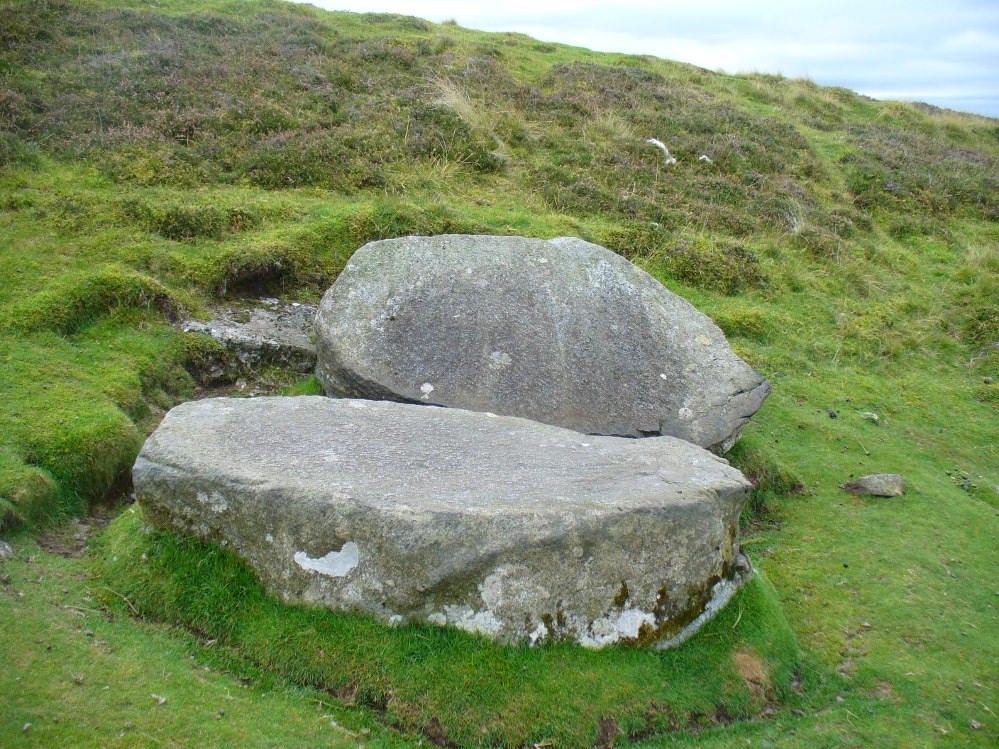
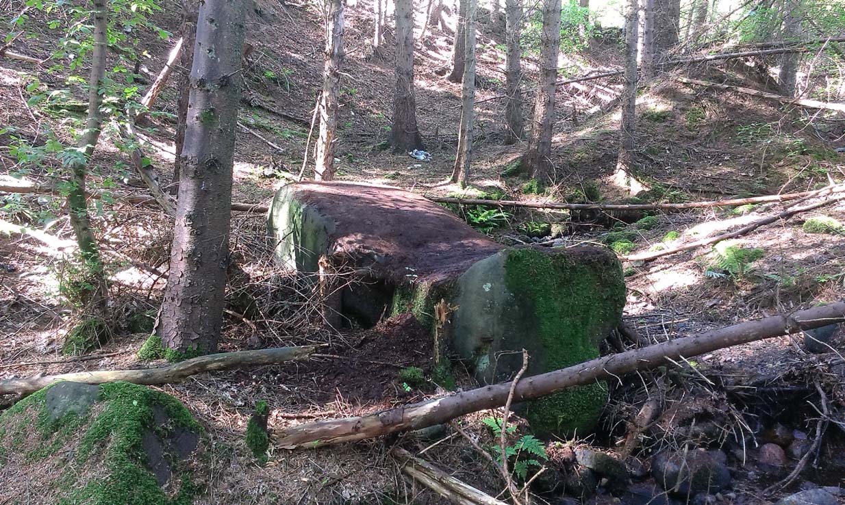
The forgotten standing stone of Agra Woods

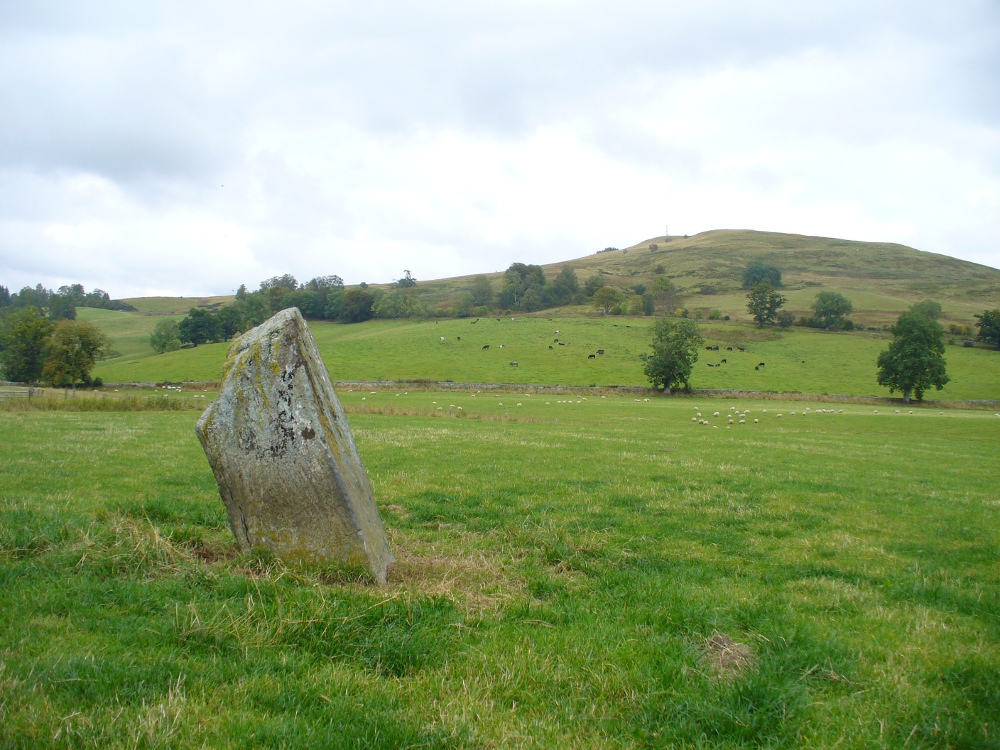
Take the same directions as if you’re visiting the multiple-ringed Agra Woods petroglyph (West Agra 8).  From just below here, keep to the woodland side, and follow the line of tall drystone walling along to the east for a hundred yards or more, keeping your eyes peeled for the stone in question, just in front of a nice oak tree.  You can’t really miss it!

Archaeology & History

Not too far away from the scattered cluster of West Agra’s cup-and-ring stones, can be found this very bulky six foot tall standing stone, near the edge of the old walling on the inner-side of the Agra Woods.  It was rediscovered by Paul Hornby on a Northern Antiquarian outing in May 2011, who told it to be “quite a massive thing!”  (I’ve yet to visit the site so can’t give my personal impressions of the site)

© Paul BennettThe Northern Antiquarian

Easthill, Auchterarder, Perthshire

Stone Circle (remains of):  OS Grid Reference – NN 9292 1246

Also Known as:

  1. Canmore ID 26104
  2. East Hill

Getting Here

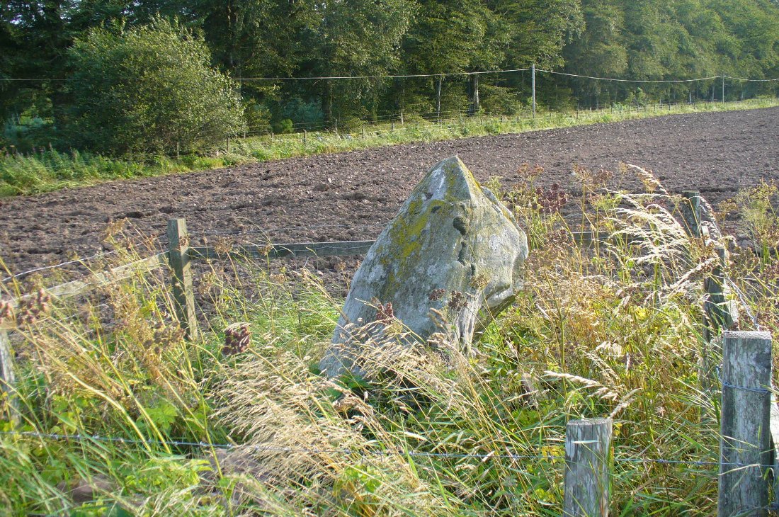
Easthill stone at the roadside
Easthill stone at roadside

From Auchterarder’s A824 main street, going out towards the golf course take the Orchil Road on your right and then about fifty yards along, turn right again up Tullibardine Road.  Park up somewhere about a hundred yards along, then just walk further down the road until you’ll see the standing stone right at the road junction. Look into the field on your right, above you, and another two are hiding in the brambles and grasses.

Archaeology & History

Included in Andy Finlayson’s (2010) fine local survey, this is an intriguing little group of three standing stones (and a fourth buried beneath the turf), all very close to each other.  They are shown on the modern Ordnance Survey maps as “standing stones”, but have been catalogued by archaeologists as the denuded remains of a ‘Four Poster’ stone circle.  Despite this, the circle wasn’t included in Aubrey Burl’s (1988) definitive work on the subject, nor his megalithic magnum opus. (Burl 2000)

Northern hedgerow stone
…and two in the hedgerow

Of the two uprights above the roadside at the field edge, a faint carved hand can be found on the upright west-facing side of the southernmost of the two standing stones. Although faint, this doesn’t appear to be ancient.  Written accounts of these stones are few and far between it seems.  The earliest seems to be in the lengthy essay written by Mr Hutchison (1893), in which he gave an excellent account:

“Less than a mile to the west of (Auchterarder)…is a fine group of stones, two only of which are now standing. These stand on the summit of what has been a well-defined mound, and the stones now lying where the roads unite seem to have stood originally at the same height.  The road has been driven through the group at a lower level than the summit of the mound, and the stones have been thrown down and laid in the waste space at the point of junction. The small mercy to be thankful for is that they have not been broken up altogether and used for road metaL This has probably been due to the circumstances that one of these stones has a curious encircling groove running round it, which perhaps impressed even the vandal roadmakers with the idea that it might be worthy of preservation. It would be interesting to know whether, when the circle or group of stones was cut through, any cist or interment was found.  One would expect such to be the case, but I have not yet got any information on the point.  There are several stones lying on the spot which may or may not be pieces of the original standing stones. Two considerable bits of old red sandstone, at least, look as if they were fragments of an original whole.  Two great stones, however, are unmistakably prostrate standing-stones; and from the positions in which they lie, it seems to me as if the persons who had uprooted them had laid them down as nearly as possible on the sites they had occupied (at the original higher level, of course) when standing.

“The direction in which both of the standing stones point is 236º, and a line taken from each of the prostrate stones to the opposite standing one gives very nearly the same angle (240º).  The prostrate stones are of metamorphic schist. The northerly one measures 7 feet in length by 3 feet in width, and is from 12 to 18 inches thick.  A grove or furrow, 2 inches deep at its greatest depth, and from 2 to 4 inches wide, appears to run right round it, at a distance of 2 feet 10 inches from the end, which may have been about the middle height of the stone when erect. The lower side of the stone cannot be seen, but the appearance at the edges indicates that the furrow is carried all the way round. It looks just such a hollow as might be worn in stone by the long continued attrition of an iron chain. The more southerly prostrate stone is 6 feet in length, 4 feet wide, and has an average thickness of 18 inches. The two stones still standing are on the high bank above the road, just inside the hedge. These are both of old red sandstone, thinnish slabs, facing in the direction already mentioned. That to the south is 4 feet 10 inches in height, 2 feet 8 inch broad at the base, and 10 inches thick. The other is 5 ft. 3 in. at its greatest height, 3 feet 10 inches wide, and from 13 to 15 indies thick. On its northern face it shows a number of depressions or indentations curiously resembling prints of human feet. These Mr Kidston considers to be due to natural weathering.”

Southern carved stone

Yet the “prints of human feet” are very much man-made.  A closer examination of these carvings is obviously needed.

Whether these stones originally played a part in an old tumulus, a cairn circle, or a typical stone circle, is hard to say with any certainty now.  We are in a landscape where megalithic remains were once in great excess: with the standing stones of Blackford to the south; the lost circle of Gleneagles nearby; the megaliths near Muthill and many many more…

References:

  1. Burl, Aubrey, Four Posters: Bronze Age Stone Circles of Western Europe, BAR 195: Oxford 1988.
  2. Finlayson, Andrew, The Stones of Strathearn, One Tree Island: Comrie 2010.
  3. Hutchison, A.F., “The Standing Stones of Stirling District,” in The Stirling Antiquary, volume 1, 1893.
  4. Strachan, Favid (ed.), A History of Blackford, Blackford Historical Society 2010.

© Paul BennettThe Northern Antiquarian