Deanside Well, Glasgow, Lanarkshire

Healing Well (destroyed):  OS Grid Reference – NS 5974 6534

Also Known as:

  1. Meadow Well

Archaeology & History

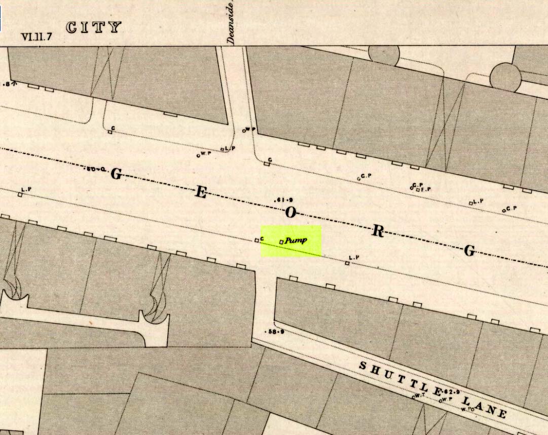
Probable site of Deanside Well, 1857
Deanside Well ‘pump’ in 1857

This little-known well—destroyed about two hundred years ago—was said to be one of the finest of all of the water supplies in the Glasgow district in pre-industrial days.  The Glasgow historian Andy MacGeorge (1880) told it to be “a spring which was then, and for long afterwards, in great repute.”  It was described as early as 1304 CE in a grant by Robert, bishop of Glasgow, allowing the christians to take water from the well and into their convent.  The Latin transcript told:

“Noveritis Ros intuita caritatis, Dedisse fratribus Predicatoribus de Glasgu, Fontem quendam qui dicitur Meduwel in loco qui dicitur Denside scaturientem, in perpetuum conducendum in claustrum dictorum fratrum, ad usus necessarios eorundem”  (Meaning, “Know ye that I Rosh, of charity, Among His brethren shared with the Preaching Friars of Glasgow, the gushing fountain called Meadow Well or Deanside as the place is called, to the cloisters is said to meet the needs” of the monks.”)

There is the possibility that the well was deemed as ‘holy’ due to it being of vital use to the bishop and monks, but I can find no record of it being ‘blessed’ as such; and the exact site of the bishop’s convent has been lost to history.  In 1574 the “Deynside Well” needed cleaning due to  people clogging up the waters with earth and stones; and sometime in the 18th century the spring of water was turned into a draw-well.

A northern antiquarian by the name of ‘ Senex’ (real name, Robert Reid) visited the Deanside Well at the end of the 18th century, telling of its whereabouts:

“In the year 1789 I had occasion daily to mount and descend the Deanside Brae, upon business, so that the state of the place at that date is quite familiar to me.  The whole of the Deanside Brae was then vacant ground, as is shown in the old Maps of Glasgow.  The Deanside or Meadow Well was situated in a meadow at the west end of Grayfriars’ (or Bun’s) Wynd, close to the footpath leading up to the Rottenrow; it is now on the street, at 88 George Street, opposite to the lane leading into Shuttle Street.  The Deanside Well was then in a rural spot, the whole lands on the west, as far as Partick, being garden grounds and com fields.

“In Stuart’s Views the lonely foot passage up the Deanside Brae, to the Rottenrow, is very distinctly shown. The well stood at the south extremity of the said footpath, about the centre of the wynd.”

‘Senex’ also told that an ancient fair was held in “an enclosure” at the northwest corner of Shuttle Street, close to the Deanside Well.

References:

  1. Bennett, Paul, Ancient and Holy Wells of Glasgow, TNA 2017.
  2. MacGeorge, Andrew, Old Glasgow, Blackie & Son: Glasgow 1880.
  3. ‘Senex’, Old Glasgow and its Environs, D.Robertson: Glasgow 1864.
  4. Stuart, Robert, Views and Notices of Glasgow in Former Times, R.Stuart: Glasgow 1848.

© Paul Bennett, The Northern Antiquarian

Physic Well, North Kelvin, Glasgow, Lanarkshire

Healing Well (destroyed):  OS Grid Reference – NS 5805 6728

Archaeology & History

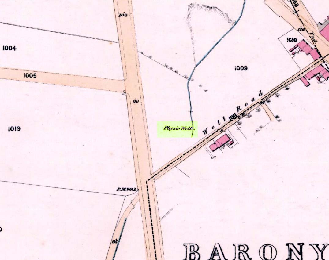
Physic Well on 1865 map

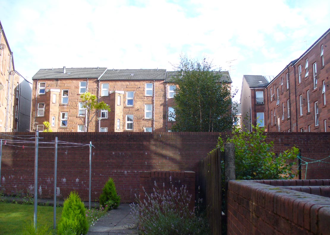
Any site named as a ‘Physic Well’ anywhere in Britain is, by definition, a spring of water renowned for its medicinal properties.  Nowadays however, at this and other sites with the same name, local people aren’t even aware that such places exist.  A sad state of affairs indeed…  This Physic Well was once found just off Trossach Street in Maryhill—which was once called ‘Well Street’, after the medicinal spring itself—in fields just above the road.  Today a small housing estate has been built on top of the site and the only sign of it ever being here appears to be marked by a birch tree in the gardens at the middle of the enclosing buildings.

Birch tree marks the spot!

The site was listed in several early 19th century municipal surveys of Glasgow, but the greater references to it seem to be from local people who described it as a place that was visited annually along the perambulation of the old Barony parish, despite it being just over the edge and into Maryhill.  In an extensive footnote in Renwick’s Glasgow Memorials he gives us a fascinating insight into the gatherings at the Well, and the popular customs and social activities of the period:

“William Graham, of Lambhill, aged 69, recollected in his school days, “drinking at a well a very little to the north of the Barony glebe, which was called the Physic Well, and there was then a Royalty stone a little to the west of the glebe.” The Physic Well, perhaps all that effective drainage had left of the former loch, otherwise called ‘Plommaris Hole,’ was utilised at the periodic perambulation of marches for impressing on the memory recollection of this part of the boundary. The means taken for this end may be gathered from the evidence of John Alston, weaver, aged 54, who says that, when he was an apprentice, his master told him that it was a custom, “when the magistrates rode the marches to duck some of the last-made burgesses in the Physic Well”; and, on the same topic, James Bryce, victualler, aged 70, depones that, forty years ago, it was commonly reported in the town that at the marches-riding it was the custom “to duck the youngest town-officer in a well called the Physic Well, which is now filled up, but which was near the Barony glebe.”  Janet Paterson, widow of William Paterson, labourer, aged 78, recollects of another well, called the Loanhead Well, in the Barony Glebe, from which she carried water when a young girl. ”About 57 yean ago she saw two ploughs going in the Barony Glebe on the Fast Day of the town Sacrament.  In general people wrought the Physic Well Park on the town’s Fast Day, but she never saw them working on the Barony Glebe except on the occasion mentioned.”  William M’Culloch, farmer, Lightbum, aged 57, says that when Mr. Hill was minister of the Barony parish, the deponent’s father was employed by him, for a good many years, to plough the Barony Glebe, and on one occasion he recollects the glebe being sown and harrowed upon a Fast Day preceding the town Sacrament.  Mr. Hill told his father that the glebe was not within the town’s bounds, that the sowing and harrowing it on the Fast Day could disturb nobody, and that his father could have the sowing finished in time to go to church.  Peter Ferguson, weaver, aged 5$, had resided in the neighbourhood of the Barony Glebe from his infancy. When he was a boy he heard it very frequently mentioned by old people, as a common report, that when delinquents or debtors, prosecuted before the town courts of Glasgow, were pursued by the town officers, for the purpose of being apprehended, they were in the practice of endeavouring to get across the Howgate Strand; and if they accomplished this they set the officer at defiance and pointed their fingers at them in derision, as being then without the city’s jurisdiction. Howgate Strand was a small run of water which crossed Castle Street, at the south end of the glebe, then passed through the infirmary grounds and joined the Molendinar Burn a little to the north of the High Church. Another witness, Thomas Alston, manucturer, aged 55, places the fugitives’ point of escape at the north end of the glebe. In his young days it was the practice for the town officers to apprehend boys who were playing on the streets upon the Sabbath and the Fast Days preceding town Sacraments; and he remembered well that it was a common opinion with him and his companions that they were safe from the town officers when they got beyond the Physic Well, on the Glasgowfield road, or beyond the spot marked on Mr. Fleming’s plan ‘Toll-house’, on the Kirkintilloch road, as they considered themselves to be then without the town’s jurisdiction.”

The Well was close to a series of old boundary or ‘merche’ stones, but no ancient ones seem to remain.

The medicinal potential for the water was examined in 1771 by a Dr William Irvine, who found it to be a chalybeate or iron-bearing spring, and to possess “a little muriatic acid”, giving the well both tonic and fortifying properties.

References:

  1. Irvine, William, Essays, Chiefly on Chemical Subjects, J. Mawman: London 1805.
  2. Renwick, Robert, Glasgow Memorials, James Maclehose: Glasgow 1908.

Acknowledgements:  Huge thanks to Nina Harris for guiding us to the spot where this old well once existed.

© Paul Bennett, The Northern Antiquarian

Pear Tree Well, Kelvinside, Glasgow, Lanarkshire

Healing Well (destroyed):  OS Grid Reference – NS 56728 67797

Also Known as:

  1. Canmore ID 164370
  2. Three Tree Well

Archaeology & History

Site of the Pear Tree Well

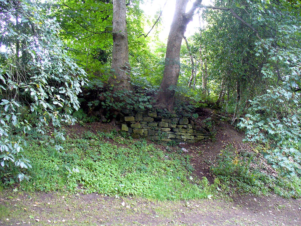
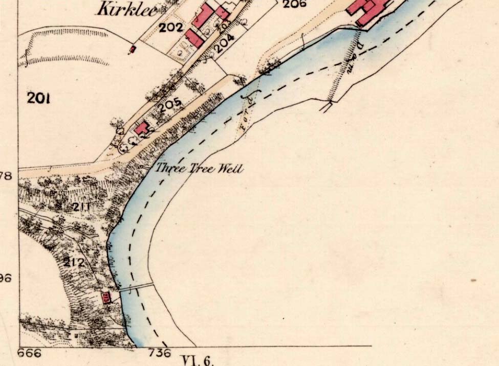
The demise of this old healing spring of water occurred a few generations ago by the look of things.  Marked on the earliest Ordnance Survey maps—erroneously as the ‘Three Tree Well’, as Mr McDonald (1860) will soon explain—it was located on the west side of the River Kelvin, halfway between the Kirklee footbridge and the ancient ford, but the only remains we can see of it now appears to be the brick-walling above which a pair of sycamore trees rise, or perhaps beneath the man-hole cover on the path lower down.

Three Tree Well on 1865 map

…But it wasn’t always this way… Known to be a chalybeate, or iron-bearing spring (which are always regarded as tonics in local lore, fortifying the blood general health), when the local writer Hugh McDonald (1860) wrote about it in his wonderful Rambles round Glasgow in the middle of the 19th century, he cast a picture of the area that few Glaswegians would recognise today—and a damn good swipe at the incomers trying to alter the names of traditional places:

“At the western extremity of the Botanic Gardens a narrow passage, in popular parlance called “the Kyber Pass,” leads over a green knoll to the volley of the Kelvin at the famous “Pear-tree Well.” …The scenery of the Kelvin in the vicinity of the Pear-tree Well is of the most romantic and beautiful description.  The banks are bold, and in many places fringed with masses of foliage to the water-lip; while the rustic bridge, the lonely cottage, and the picturesque mill, seem planted by the very hand of taste, along the meanderings of the rippled and murmuring stream, wherever they are likely to produce a telling effect… Altogether the scene and its accessories present the very choicest of those harmonious combinations of colour and form which the landscape limner loves to gaze upon, and fondly endeavours, in the pride of his skill, to transfer to the living canvas.  No wonder it is that Kelvin Grove has long been the favourite haunt of our City lovers, and the favourite theme of our local poets; for Nature has, indeed, strewn its recesses with charms as fresh and beautiful as though it were situated far from the dwellings of men, instead of almost under the wing of our most dinsome and dusky of towns.

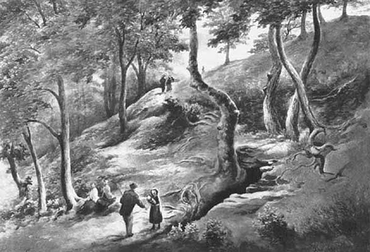
“The Pear-tree Well issues from the bottom of a steep and thickly-wooded bank, which, at this point, rises gracefully from the rocky bed of the streamlet.  The crystalline and deliciously cool water is collected into a considerable cavity in the earth; immediately over which three large trees—a plane and two handsome ashes—raise on high their umbrageous heads, while their sturdy roots, in serpent-like convolutions, twine around the watery hollow beneath, as if to defend it from the intrusion of the penetrating noonday sun.  Some suppose that it is from this trio of sylvan guardians that the fountain has received its name — and that the ‘Three-tree’ and not the ‘Pear-tree’ Well is its proper denomination.  The advocates of the latter theory further remark, that there is no pear-tree in the vicinity, and that consequently the popular name is probably but a corruption of “Three-tree.”  There is high authority for saying that names are things of slight consequence; but however that may be, we are inclined, in the present instance, to be conservative of the old name for this favourite well, and to retain it in spite of all attempts at innovation.  Whether from langsyne associations or not, we shall not attempt to discover, but Pear-tree Well sounds most musically on our ear — and we should be loath to have it suppressed by the word-coinage of any crotchety theorist; and besides, who can tell what kind of trees may have formerly graced the locality?  A perfect orchard of the pear tribe may, at some past period, have clothed the banks of Kelvin for anything that these violators of a time-honoured name—”these men who are given to change”—know to the contrary.  No, no!  Pear-tree Well it has been, and Pear-tree Well to us, at least, it must remain.  We had as lief meet an old friend with a new face, as an old haunt with a new name.

“Having done our devoirs to the spirit of the fountain, by draining a bicker of the translucent water, which, by the way, is slightly impregnated with iron, we sit ourselves down on the bank above, under the ashen tree, when one of two friends with whose company we have been honoured, inspired by the half-gelid beverage, bursts suddenly out with—

“Let us haste to Kelvin Grove, bonnie lassie, O.”

“We of course join heartily in the measure, which has for many years been highly popular in the west of Scotland, and which we naturally enjoy with double zest, amid the scenery to which it refers…”

Pear Tree Well in 1896

The great historian and romantic, J.A. Hammerton (1920) even passed here, telling how sufferers of disease relied upon its curing waters to heal them.  It is just such a pity that this picturesque medicinal spring and its rivulet are with us no more…

References:

  1. Brotchie, T.C.F., Glasgow Rivers and Streams: Their Legend and Lore, John Maclehose: Glasgow 1914.
  2. Brotchie, T.C.F., “Holy Wells in and Around Glasgow,” in Old Glasgow Club Transactions, volume 4, 1920.
  3. Hammerton, J.A., Wonderful Britain: Its Highways and Byways – volume 1, EBC: London 1920.
  4. McDonald, Hugh, Rambles round Glasgow, John Cameron: Glasgow 1860.
  5. Millar, A.H., By-gone Glasgow, Morison Bros: Glasgow 1896.
  6. Pagan, James & Stoddart, J.H., Relics of Ancient Architecture and other Picturesque Scenes in Glasgow, David Bryce: Glasgow 1896.

Acknowledgements:  Huge thanks to Nina Harris for guiding us to the spot where this old well could once be seen.

© Paul Bennett, The Northern Antiquarian

Homer Well, Looe, Cornwall

Healing Well (lost):  OS Grid reference – SX 25 53

Archaeology & History

This curiously-named and long lost well would almost have us believe that the Greek poet and philosopher himself was a-wandering in this neck of the woods.  But that sadly wasn’t the case.  It seems to have been mentioned just once in Looe’s early Town Books:

“In 1621 that part of West Looe Down which lieth on the West part of the Homer Well, was let to rent, for two crops, at 6s.8d. per acre”

In Courtney & Couch’s (1880) Cornish dialect work, the word homer is said to mean “homeward”; this is also echoed in Wright’s (1905) magnum opus. It seems to imply that it was a drinking well used by folk traveling the short distance from Looe village, across the river and onto or over West Looe Down towards their cottage or farmhouse; akin to a refreshing resting place halfway home, so to speak.  Sometimes the word homeward can be taken to simply mean “at home,” in which case it would suggest that the Well was simply next to someone’s house.  We may never know…

References:

  1. Bond, Thomas, Topographical and Historical Sketches of the Boroughs of East and West Looe, J. Nichols: London 1823.
  2. Courtney M.A. & Couch, T.Q., Glossary of Words of Use in Cornwall, English Dialect Society: London 1880.
  3. Wright, Joseph, English Dialect Dictionary – volume 3, Henry Frowde: London 1905.

© Paul Bennett, The Northern Antiquarian
Holy Well, Hollinshead Hall, Tockholes, Lancashire

Holy Well:  OS Grid Reference –  SD 6636 1994

Getting Here

Take the A675 road to Bolton from Abbey Village, going up the track opposite Piccadily farmhouse until you reach the ruins in the woods.  The site can also be reached by going south down the Tockholes Road car park following the sign for Hollinshead Hall on your right.

Archaeology & History

Hollinshead Hall
Hollinshead Hall

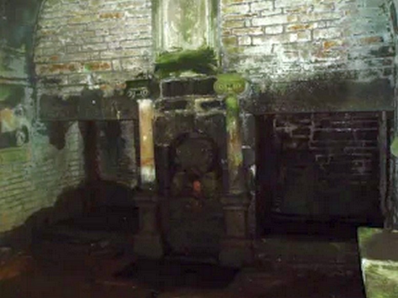
Associated with Hollinshead Hall, which is now a ruin, the well is made of the same sandstone rubble as the hall with a stone slate roof. The building a single cell is built into a slope from which the spring arises and is encapsulated by it. Either side a high walls creating a sort of forecourt with side benches with inward-facing chamfered piers with ball finials at the ends. The well house itself is quite an attractive building and is certainly not thrown up, having a symmetrical facade with chamfered unglazed widows which are fitted with spear-headed iron bars and clearly the building has never been glazed. The gable end has a large oval opening with a matching one at the rear. In the centre is a heavy board door with a chamfered doorway. This doorway unfortunately is locked baring any entrance to the well house.

Peering in through the windows one can see how strong the vaulted roof is, adorned by a pendent ball in its centre. The spring’s water flows from a crudely carved lion’s head, either side of a reredo of Ionic colonnettes, with a sunken stone tank beneath or each side a rectangular recess which enclose rectangular pools. There is a diamond-paved floor with a central gutter draining from this well or trough at centre of rear wall.

Local tradition accounts that there was a site here from Medieval times and indeed, that the name Hollinshead was derived from a version of holy well although O.E hol, for hollow is more likely although there is a Halliwell Fold Farm nearby being derived from O.E halig for healing. The pool with steps down above the well house may be the original well of course. The discovery of a hoard of medieval coins in 1970s would support the date and perhaps they were an offering.

Folklore

Abram’s Blackburn (1877) is perhaps the first to state that the water was curative. However, anonymous quote in Nightingales History of Tockholes  describes the well as:

“Here no less than five different springs of water, after uniting together and passing through a very old carved stone representing a lion’s head, flow into a well.  To this Well pilgrimages were formerly made and the water which is of a peculiar quality, is remarkable as an efficacious remedy for ophthalmic complaints.”

 Another tradition is that the site was a resting place for pilgrims to Whalley Abbey and that the trough was used as  baptistery, however, this would be more likely to be the spring above the well house.  It is probably a spring house, a structure built over a natural source of water for the storage of dairy products and other foods that needed to be kept fresh.

Reculsancy was very prevalent in Lancashire and the well house does the bear the coat of arms of the Radcliffes.  It would suggest why the structure is so ornate and suggest a 1600s date—although many authorities suggest an 18th century origin.  The site would be a secret baptistery and its design as a dairy would also help as well as being still function, certainly the presence of benches suggest this functionality.  It appears to be too close to the house to be a garden folly such as a grotto!  The suggestion of stained glass in the windows suggests something more significant discovered during the present stone roof’s construction.  Indeed, the choice of the lion’s head is possibly that of the ‘Lion of Judah’, meaning Jesus providing rich and valuable water, although this is a common motif on many drinking fountains of course!  Interesting, Cramshaw (1994) tells us that the site was in the 1980s the site of a well dressing, although what type is unclear and no other author has mentioned it as far as I am aware. Perhaps we shall never know the real origin of this delightful building.

References:

  1. Abram, William Alexander, History of Blackburn, Toulmin: Blackburn 1877.
  2. Billington, W.D., From Affetside to Yarrow, Ross Anderson: Bolton 1982.
  3. Crawshaw, J., “Hollinshead Hall Holy Well”, in Source new series Issue 2, Winter 1994.

Edited from – Holy & Healing Wells

© R.B. Parish, The Northern Antiquarian


Moir’s Well, Dollar, Clackmannanshire

Healing Well:  OS Grid Reference – NS 96535 98711

Getting Here

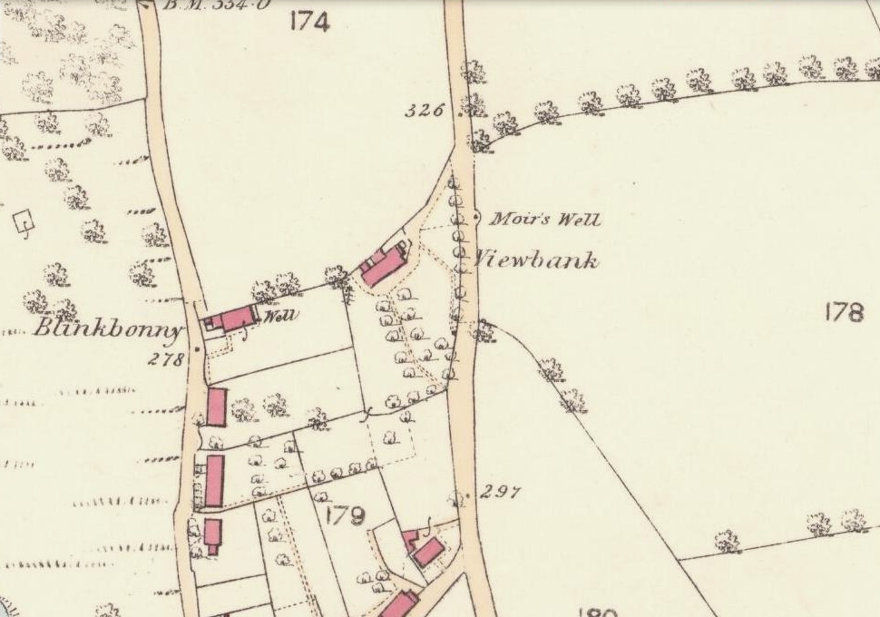
Moirs Well on 1866 OS-map

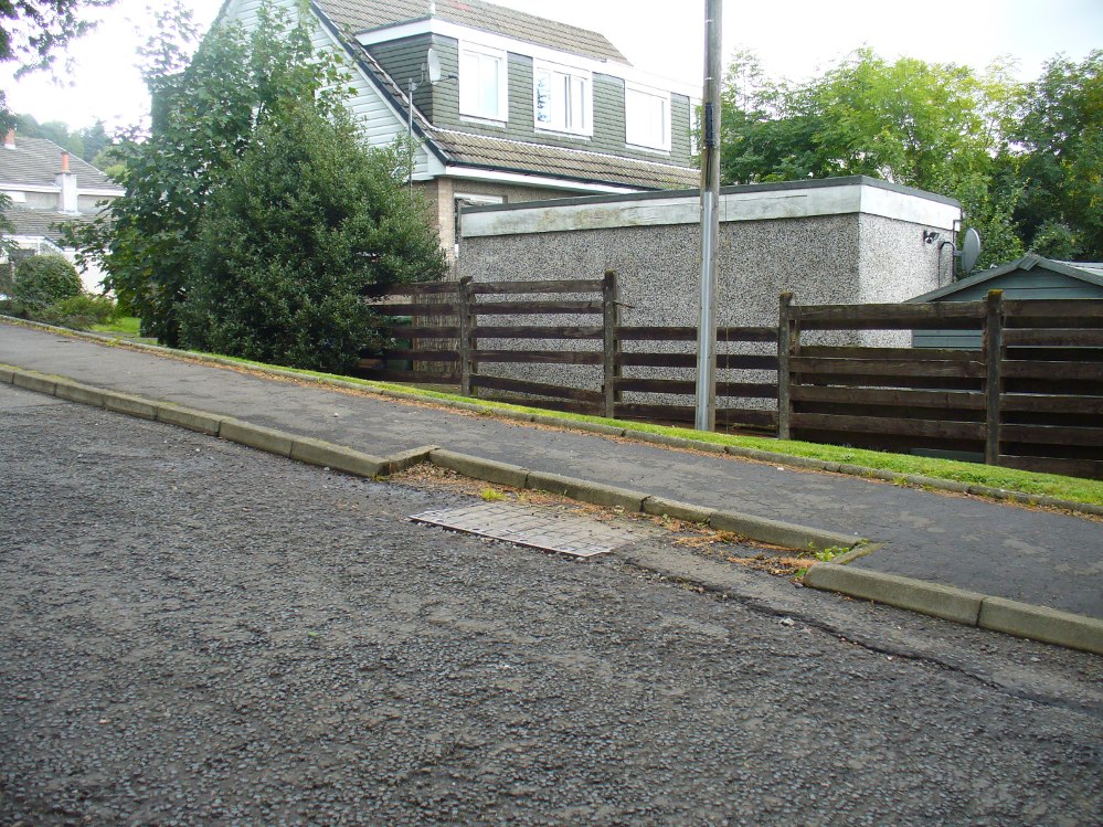
Go up the road alongside the Dollar Burn, turning right, up the steep hill as if heading to the Wizard’s Stone and the impressive Castleton monolith, a mile further along.  Before reaching the Wizard’s Stone, keep your eyes peeled on the right for the street-name, ‘Moir’s Well’.  From here, walk up the road less than another 100 yards and till you reach the water-cover.

Archaeology & History

Site of the old Muir's Well
Site of the old Muir’s Well

There is little known about any history of this now-covered old well, halfway up the steep slope towards Lochy Launds.  It was noted by Ordnance Survey in 1861 and subsequently published on the earliest OS-map a few years later. It was obviously a wayside well for those venturing up the steep hill and used to have an old stone trough into which the waters ran.  Although we don’t know for certain, the etymology of the well probably comes from the surname Muir, which according to William Gibson (1883) was common in the old village.

People living in the houses below here, told us that after heavy rains their gardens become very boggy, which is probably due to the sub-surface water from Muir’s Well.  Tis good to know that the waters are still finding their way out!

References:

  1. Gibson, William, Reminiscences of Dollar, Tillicoultry and other Districts Adjoining the Ochils, Andrew Elliot 1883.

© Paul Bennett, The Northern Antiquarian

New Edge Chalybeate, Colden, Heptonstall, West Yorkshire

Healing Well:  OS Grid Reference – SD 95447 29403

Getting Here

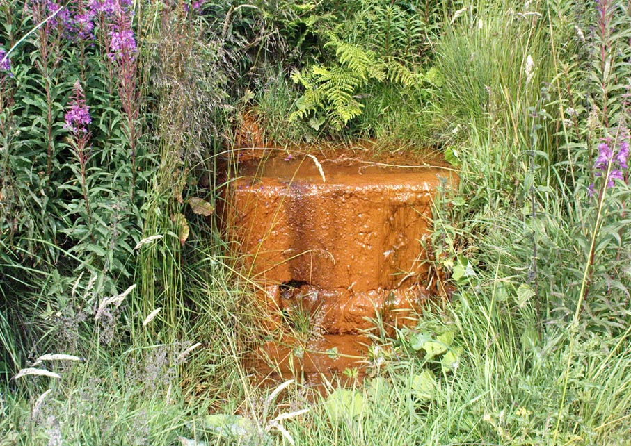
Take the Heptonstall road up from Hebden Bridge, going round the village (not into it) and head through Slack and onto Colden.  Just as the road begins to go downhill to Colden, note the small single-track road on your right called Edge Road.  Go on here for a good mile until it becomes a dirt-track and there, on your left, is the half-run-down old farmhouse called New Edge.  Just yards past it, off to the right by the trackside, you’ll see this large copper-coloured stone basin oozing with the same-coloured liquid.

Archaeology & History

New Edge Chalybeate, above Colden

This is one of what Thomas Short (1724) called “the ten thousand chalybeats”, or iron-bearing springs,  inhabiting the Yorkshire uplands — but he didn’t include this site in his huge survey.  But it’s a beauty amongst chalybeates, as a visit here clearly shows!  The well is one of two found on either side of the old building known as New Edge (as contrasted with Old Edge, a little further along the lane), and its waters trickle gently from the old stone trough.

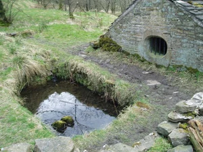
The waters are undoubtedly enriched with large amounts of iron, as the photo here shows, giving the waters clear medicinal value.  In tasting them, not only do the waters give you that copper-coloured hue, but you can clearly taste the minerals in the water. As with other iron-bearing springs, the water from the New Edge spring is good for the blood, good for anæmia, loss of energy and a low immune system.

References:

  1. Short, Thomas, The Natural, Experimental and Medicinal History of the Mineral Waters of Derbyshire, Lincolnshire and Yorkshire, privately printed: London 1734.

© Paul Bennett, The Northern Antiquarian


Dissenters Well, Kelbrook, Earby, Lancashire

Healing Well:  OS Grid Reference – SD 92104 43179

Getting Here

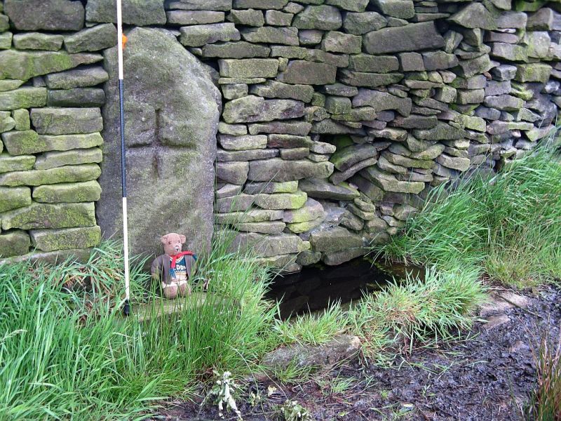
From Kelbrook village head south past Old Stone Trough then continue as far as the lane goes. Then head eastwards for about 1 mile on footpaths to a building called Laycocks. From here continue east along footpaths for another 1 mile or so until you reach Copy House (now called Hawres Farm). Go to the back of the farm where you will see in the wall a cross-incised boundary stone. At the side there is a square-shaped holy well. (You may need to ask permission at the farm).

Archaeology & History

Dissenters Well & Cross (image courtesy ‘QDanT’)

The so-called Dissenters’ Well is a rectangular feature in the ground next to the wall.  It is said locally to date from the 17th-18th century, but is most probably an ancient moorland spring.  The well was in use from the 17th century by Quakers, Baptists, Methodists and possibly Roman Catholics, at a time when there was much animosity towards non-Conformists.  Legislation was passed stopping all illegal gatherings to be held within a 5 mile radius of any church – thus leading to religious gatherings in bleak, remote places on the moorland above towns and villages.  In 1812 an Act of Parliament against non-Conformists was repealed and dissenters were given equality regarding where they could worship. The water in the well no doubt had some medicinal qualities or, was a source of spiritual up-lift at the time.

By the well there is 3 foot high pointed boundary stone or waymarker known as ‘Tom’s Cross’ and it has a thin incised cross carved onto it.  The stone is partly embedded in the wall.  It probably marks the old boundary between Lancashire and Yorkshire.  I don’t know who Tom was though he may have been the person who set up the stone. The age of the stone is not known.

The Bleara Lowe tumulus and its nearby prehistoric companion can be found upon the hilltop a mile north of here.

References:

  1. Oldland, Fay, The Story Of Foulridge, Pendle Heritage Centre Ltd, 1990.

Copyright ©  Ray Spencer 2011


True Well, Oakworth, West Yorkshire

Healing Well:  OS Grid Reference – SE 0272 4017

Getting Here

Modern True Well troughs

Take the Oakworth Road outta Keighley, turning right after a quarter-mile up Fell Lane.  Go all the way up the very end (a mile or so), turning right at the end.  After 100 yards or so, go up the track to the True Well Hall equestrian centre.  As you approach the farmhouse, look on the grassy slope to the left and you’ll see a small run-down stone structure in the field above you.  That’s it! 

Archaeology & History

This is a curious site by virtue of so little being said of it, despite some modern proclamations of it having pagan values.  Even the local historians say little on the place, with William Keighley (1858) being our notable exception.  In his notes on the erroneous dedication of the Jennet’s Well to a fictitious saint of the same name, he mentions this once important water supply, writing:

“Westwards of Jennet’s Well there was another fountain, emphatically styled the ‘true well’, and probably from its once boasted efficacy intended as a rival to the former.  This spring though no longer remembered for its healing qualities, evidently gave name to the farmhouse denominated ‘True Well Hole.'”

In Wright’s Dialect Dictionary (1898) we find the word ‘trew’ — also written as ‘true’ or ‘trow’ — could mean “to trust, believe, feel sure”, which may be applicable in terms of the value of the waters that once flowed here.  We may never know.  Though note should be made of the error at a recent exhibition in Cliffe Castle museum, where the 1842 Tithe Awards map of the region was copied and the field-names listed, showing the old True Well erroneously displayed as the ‘Time Well’.  I assume they must have had a long day when they were copying the notes…!

Spring behind True Well Hall

A little further along the track running beyond True Well Farm we find another spring of water emerging from the grassy hill and which, perhaps, relates to the True Well.  On the 1852 OS-map, we see a ‘trough’ shown in front of the farmhouse and not in the position where the modern map shows the True Well to be — and where the recent stone-worked trough in the photo is shown.  In fact, on the 1852 map, no such well nor stonework is shown in the position presently deemed to be where the True Well is supposed to be, so the original position of the well is unclear.  Is it possible that the spring of water which runs from the hillside behind True Well Farm may have been the site which gave this spot its name.  Certainly the water from this spring is quite fresh and drinkable.  If anyone knows owt more about the history of this curious site, it would be good to hear from you.

References:

  1. Keighley, William, Keighley Past and Present, Arthur Hall: London 1858.

© Paul Bennett, The Northern Antiquarian

Haworth Moor Spa Wells, West Yorkshire

Healing Wells:  OS Grid Reference – SE 0041 3513

Getting Here

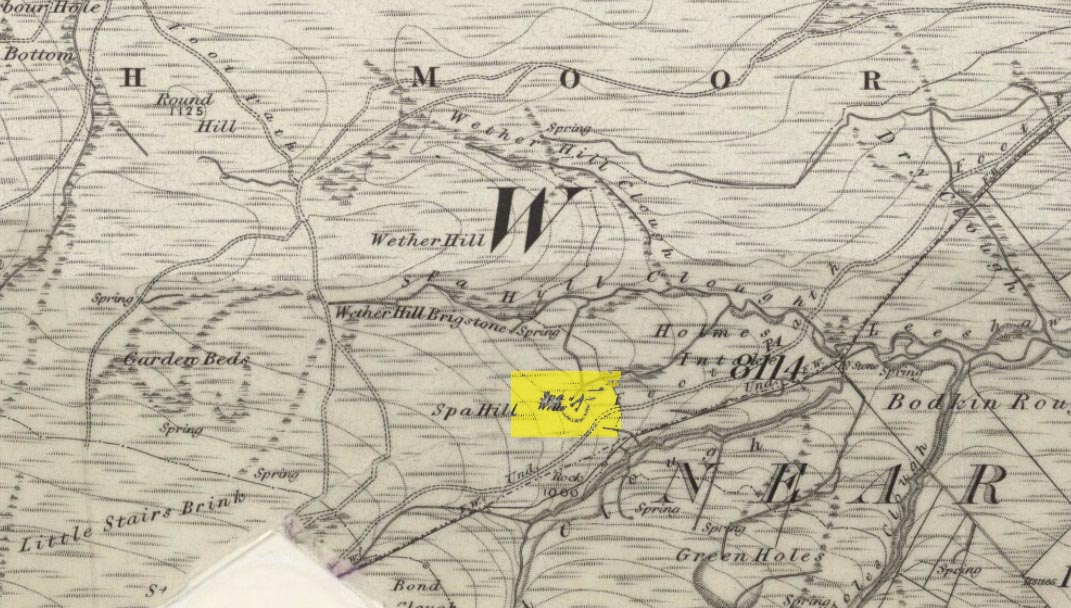
Spa Wells on 1852 map

Go through Haworth and head for the well-known Penistone Hill country park.  On the far western side of the hill up near the top of Moorside Lane, there’s a car-park.  Right across the road from this there are two footpaths: one heads you into the moor, whilst the other (going the same direction) follows the edge of walling onto the moors.  Take this path. Walk on and downhill, past the end of the reservoir, then the path continues uphill. You’ll hit a nice cheery tree beside the path a few hundred yards up.  Stop here, look into the boggy region with bits of walling on the moor in front of you.  That’s where you’re heading!

Archaeology & History

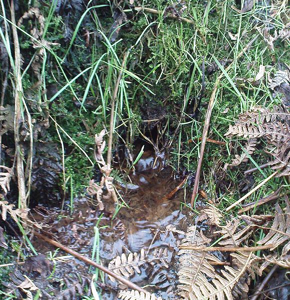
The first, weaker of the Spa Wells

This was a really curious spot to me, as I found absolutely nothing about the damn place!  But thanks to the assistance of local historian and writer Steven Wood (2009), that’s changed.  Shown on the 1852 OS-map, at least two springs of clear water trickle slowly from the wet slope above you into the boggy reeds.  Close by there are overgrown remains of old buildings, covered with the time of moorland vegetation, seemingly telling that the waters were collected for bathing rooms.  But who the hell even started the notion that they’d be able to get Victorian rich-folk up here at the crack-of-dawn to drink or bathe in the waters is seemingly forgotten.  And, as is evident from the lack of local history, the project was a failed one which seemed not to have lasted too long. 

Folklore

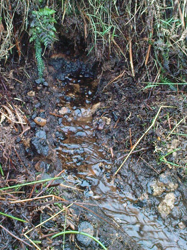
The stronger of the Spa Wells
The stronger Spa Well

It was quite obvious that of all the springs around here and despite the strong-flowing streams either side of these spa well, that the local animals drink here more than the other nearby springs of water, as there were literally hundreds of animal tracks all across the boggy ground of the spas.*  The waters also seem to have the usual ‘spa’ qualities of stinking, but once we’d cleaned out the overgrown springs — which looked as if they hadn’t been touched for 100 years or more — the waters were clear and tasted good, and were curiously slightly warm!

Although my initial search for information on this site drew a blank, Steve Wood pointed us in the right direction for info on the place.  As with many other holy wells and spas in Yorkshire, it turned out that this was another spot much revered around Beltane, indicating strongly there would have been  earlier pre-christian rites practiced at this site.   Steve pointed me to Martha Heaton’s (2006) local history work, which told:

“For many years the first Sunday in May was a special day. It was known as Spa Sunday, for on this day people gathered up in the hills overlooking what is now Leeshaw Reservoir, here was a well, known as Spa Well, and the stream which now feeds the reservoir is known as Spa Beck. People came from Haworth, Oxenhope, Stanbury, and other villages sitting round the well, they sang songs, some bringing their musical instruments to accompany the singing. Children brought bottles with hard spanish in the bottom filling the bottle with water from the well, shaking it until all the spanish or liquorice had been dissolved. This mixture was known as ‘Poppa Lol’ and would be kept for weeks after a little sugar had been added, then it was used sparingly as medicine.  The custom seems to have died out when Bradford Corporation took over the water and made Leeshaw Compensation Reservoir in 1875, though up to about 1930 two men from Haworth would wend their way to the spot on the moor, the first Sunday in May. The men were John Mitchell and Riley Sunderland, better known, in those days as ‘Johnny o’Paul’s’ and ‘Rile Sun’.

It was a great day for many people, the Keighley News of May 1867 mentioned it, the report of local news reads thus: ‘A large assembly met on Spa Sunday on the moors about two miles from Haworth, and a party of musicians from Denholme performed sacred music’.

This locality was often visited during the summer months by the Bronte family.”

References:

  1. Heaton, Martha, Recollections and History of Oxenhope, privately printed 2006.
  2. Wood, Steven & Palmer, Ian, Oxenhope and Stanbury through Time, Amberley Publishing 2009.

Acknowledgements: – Huge thanks to Steven Wood for his help; and to Hazel Holmes for permission to quote from Martha Heaton’s work.

* A common creation myth behind many healing wells is that animals with breaks or illness drag themselves to drink from otherwise small or insignificant springs and wells, despite of the copious streams or rivers which may be nearer.

© Paul Bennett, The Northern Antiquarian