Cairnfield (destroyed): OS Grid Reference – TQ 702 590
Archaeology & History
Ground-plan
In recent years it seems that very little has been written about this seemingly lost site, long since destroyed by the self-righteous advance of the Industrialists. It seems to have been an important place, as there were many cremated remains here in more than a dozen individual burial urns, some with flints deposited in them. The site was first described in a meeting of members of the Society of Antiquaries in 1898 by a Mr Frederick James. He talked about the site and some brief digging work around the area, thus:
“The site of the urnfield is on land belonging to Mr William Wigan, of Clare House, East Malling, and it was owing to his kind permission and active cooperation that I was enabled to visit the spot, which is on a small plateau above the River Medway, 350 yards to the southwest of New Hythe church, and between the river and the road leading from Rochester to Town Malling…
“The immediate neighbourhood…has been from time to time highly productive of archaeological remains dating from the Palaeolithic times and extended down to the Roman occupation… (But at) the Larkfield urnfield, the first indication that was afforded of the uses to which the area had been put in Romano-British times was the accidental discovery, whilst planting fruit trees, of some fragments of pottery (including portion of a Samian patera) found at the point marked A on the plan. A flat tile was found covering the fragments.”
Much more was found hereby, with the majority of the finds being “a group of urns containing cremated interments found in the urn-pits.” Although James (1898) described them as dating from the Romano-British period, from his description and illustrations it would seem that the remains here were probably of an earlier date, perhaps Iron- or even Bronze Age. But we may never know for sure.
Reference:
James, Frederick, “Discovery of a Romano-British Urnfield at Larkfield, near Maidstone,” in Proceedings of the Society of Antiquaries, 17:1, 1898.
Follow the directions to find the Tree of Life Stone, then follow the main footpath uphill from it. Once on the level, look out for a couple of large rocks abaat 100 yards to your left. Check ’em out, cos it’s on one of ’em!
Archaeology & History
This is another decent carving living on these prolific moors. Found near the end of a lengthy line of prehistoric walling that runs east-west over this part of the moor, the general Rorsharch-response to this carving is of some sorta skull or screaming face. My impression of it the other day was, “it looks like a pig!”
Although mentioned by numerous writers, the first description of it was in Eric Cowling’s (1937) essay on the cup-and-ring stones north of Otley, saying:
“On an isolated table stone, situated at the upper end of the shallow valley which drains Snowden Carr, the writer found a marking having a strangely skull-like appearance, but which is really a group of three large cups which are linked by inter-turning curved grooves.”
Close-up of main designThe Death’s Head Rock
He then strives to make links between this carving and the design on the Swastika Stone above Ilkley — which in some way is a little similar, i.e., as a three-armed triskele swastika; but the notion is perhaps as accurate as saying it represents a cloud, or a tree, or bird-flight, or any number of other natural phenomena. Beckensall’s (1999) brief note of the stone — despite getting his grid-ref off by a few hundred yards — described it as “four cups linked and enclosed by grooves, unconvincingly suggesting a skull to some people.” With Boughey & Vickerman (2003) saying:
“Fairly large, upstanding rock with surface sloping down to N. Figure of four cups linked by and enclosed by grooves: entire pattern resembles a skull, hence the name ‘Death’s Head Rock.'”
References:
Beckensall, Stan, British Prehistoric Rock Art, Tempus: Stroud 1999.
Boughey, Keith & Vickerman, E.A., Prehistoric Rock Art of the West Riding, WYAS 2003.
Cowling, Eric T., “Cup and Ring Markings to the North of Otley,” in Yorkshire Archaeological Journal, part 131, 33:3, 1937.
Cowling, Eric T., Rombald’s Way: A Prehistory of Mid-Wharfedale, William Walker: Otley 1946.
Get to the Fence Stone carving and walk up to the top of the hill about 50-60 yards away. Once on the long flat rock, walk less than 20 yards WNW until you see the stone in the picture.
Archaeology & History
So named due to it being shaped like a little singular step on a stone, this cup-marked carving was first found in the middle of May, 2010, around the same time Michala Potts located the Snowden Crags cairn circle.
Step Stone, Snowden CragsClose-up of the cups
First described and illustrated on the Avebury Forum on June 3, 2010, this cup-marked rock is found in association with a number of (as yet) unexcavated prehistoric remains, close to some Iron- or Bronze Age walling and a distinct hut circle, close to one of the D-shaped enclosures 20 yards away.* When I first found it there seemed to be just two simple cups on it, but upon viewing it several times over the last few weeks in differing lighting conditions, it seems there may be as many as 4 cups on the southwestern face of the rock. In one of the images here, you get the impression that there could actually be five cups — but I’m gonna play safe and just say there are three such cups here.
* At least 3 large, prehistoric, D-shaped enclosures have been isolated on these moorlands, with diameters ranging between 15 and 80 yards. None of these have yet to receive serious archaeological attention!
From the Askwith Moor Road car-parking spot, walk up the road (north) for 350 yards and go thru the gate on your left. Once thru it, keeping walking up and along the edge of the fence following the line of the road until the path goes downhill. Near where it levels out, walk into the moor proper for about 150 yards or so. You’re close!
Archaeology & History
Cup-and-slight-ring stone, Askwith Moor
First found by Messrs Dave Hazell and Paul Hornby on the afternoon of Thursday, June 3, 2010, amidst scouring operations on the moors hereby. This large stone has one conspicuous cup on its south-facing slope with faint remains of a half-ring on its eastern side. A distinct arc above the immediate top of the cup joins up with the pecked quarter-ring section and may have been added to by human hands aswell, certainly giving it a half-ring effect. There are a couple of decent natural cups along the top-edge of the stone aswell.
A brief discussion then began as to why someone would only carve half a ring, or less, surrounding the cup-marking. But the fella doing this could have easily been distracted by a boar, a wolf, or even worse – his northern wife!
A little further west, barely 100 away, rising up the edge of the slope, Geoff, Dave and Paul found several more examples of what seem to be distinct remains of prehistoric cairns on the edges of High Low Ridge. Like Dave and Paul’s Boomers Stone, they aren’t in any previously published archaeological surveys either.
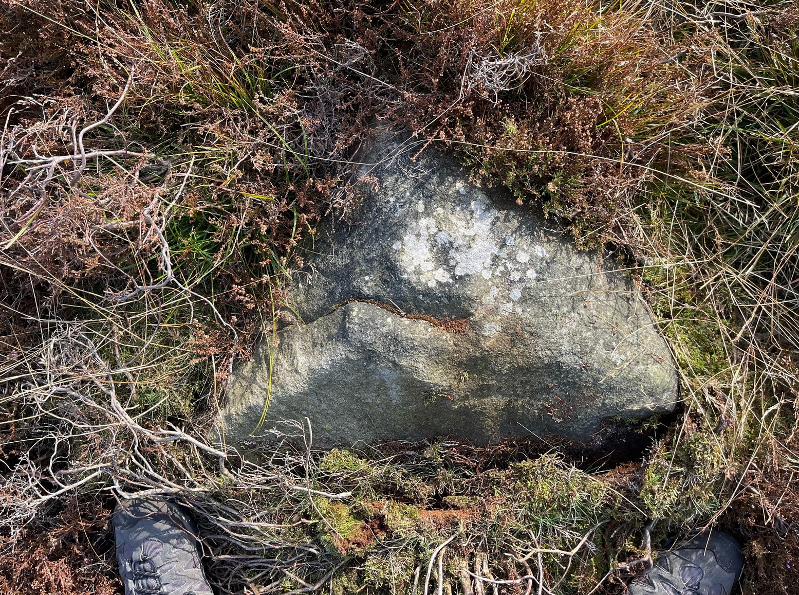
Same direction as for cup-and-ring carving 581. This small pyramidal stone (easily missed if you aint careful) is a yard or two away beneath the heather. You might have to scrabble round on the ground, but you’ll find it.
Archaeology & History
Faint cup-and-ring
The first description of this little stone was by Boughey & Vickerman (2003). Found amidst the cairnfield first mentioned by Cowling (1937), he missed this in his early days — but it’s easily done! All we have here on the very top of the stone is a “cup with a gapped ring”, fading away beneath elements and poor light conditions. As you can see in this photo, it’s hard to make out (so if you can get a good photo or two stick it on our Facebook group).
References:
Boughey, Keith & Vickerman, E.A., Prehistoric Rock Art of the West Riding, WYAS 2003.
Cowling, Eric T., “Cup and Ring Markings to the North of Otley,” in Yorkshire Archaeological Journal, part 131, 33:3, 1937.
Dead easy this! (though a bittova cheat) Get to the Bristol City Museum and look inside. This Google map should help those of you who don’t know Bristol too well.
Archaeology & History
Grinsell’s drawing of the carved slab (PPS 1957)
Found amidst a large cluster of other neolithic and Bronze Age remains—with the amazing line of the Priddy henges just a few hundred yards to the southeast—this is one helluva rare relic this thing: a carved stone, with seeming cup-marks and engraved “feet” no less, which was found when dug out of a prehistoric tomb way down South. Obviously a buncha northern lads and lasses must’ve been on one helluva piss-up! (y’ never know…) Although the tomb — a round barrow by all accounts — was well-known and excavated in 1930, the carving was somehow not noticed by the archaeologists when they dug here! But it has to be said, at that period many archaeologists thought rock art to be insignificant and unworthy of study, so perhaps their ignorance stemmed from the academic myopia of the time.
But at least they gave a reasonable description of the tomb itself. It was due to be destroyed and the considerable mass of material from it was used for widening the nearby road!!! Thankfully, for some reason, “the chamber or cist was left in situ” under the ground. Leslie V. Grinsell (1957) takes up the tale:
“The barrow appeared to be about 100 feet in diameter and 3¾ feet high, but it had been spread and its height reduced by many ploughings. Excavation showed that the barrow, which was of the bowl type, was composed of fine mould throughout, and had never been enclosed by a ditch. In the centre of the barrow, there was a stone chamber or cist, the external dimensions of which were 5½ feet long, 4½ feet wide, and 2½ feet high. The floor, which was ‘crazy-paved’, was approximately on the ground-level. The cist was placed with its long axis SE-NW. The late Father Ethelbert Horne, who wrote the excavation report, stated that the south-eastern slab, which was inserted 6 inches deep into the floor, had the character of a ‘closing-slab’, and outside it were several packing stones. There was a large cover slab of Dolomitic Conglomerate. The small northwestern slab is of Carboniferous Limestone, and the south-eastern slab is of Liassic Chert, but the large south-western and north-eastern slabs are of sandstone derived from the vicinity. The essential characteristics of this structure are therefore that is was abnormally large for a stone cist, had a strong suspicion of a ‘closing slab’ (implying some kind of entrance?) at the south-eastern end, and was above ground level, with its floor on that level.
“On the floor of this chamber or cist, at the foot of the approximate centre of the south-western slab, was a heap of burnt human bones, free from any admixture of charcoal. As these bones had been broken small after being cremated, their determination was by no means easy. Prof E. Fawcett…expressed the belief that they may have comprised the remains of an adult and a young person.”
But it was in 1956 that the carvings were noticed on the cist remains — by Mr Grinsell and his friend, C.S. Taylor. At first they thought that some of the etchings were of human hands, but they later realised they were of human feet. Grinsell wrote:
“The Foot carvings: The feet shown are all single feet, no two forming a left-and-right pair of the same individual. Nos. 1,2 and 3, in a row, are large, medium and small; no.4 is oblique in form; no.5 is on a slightly recessed portion of the slab; and no.6 represents the foot of a child between about 3 and 4 years old. No.3 represents the foot of a child about 10-12 years of age. Nos. 1,2,4 and 5 appear to represent the feet of adults. No.7 is the symbol of uncertain meaning. All these foot carvings show rounded heels and toes, in contrast to those on the Calderstones which are nearly all rectangular. The toes are all splayed, and this carving is likely to be due partly to the nature of the stone and the tools with which they are carved, and partly to the fact that the feet represented are probably those of a people who did not wear shoes, or wore footwear that did not constrict the toes.
“The Cup-marks: There are nine (possibly ten) cup-marks; their diameter ranges between 0.9 inches and 1.9 inches, and their depth between 0.1 inch and 0.3 inches… They are on the average about twice as deep as the foot-carvings. The smallest cup-mark (no.17) is beside the smallest foot-carving; but there is no noticeable relationship between the other cup-marks and foot-carvings…”
Earliest known photo of the carving by R.A. Whiteford
An intriguing carved slab at the very least! We can say with some certainty that this old tomb was of considerable importance to the people who built and lived around it in the centuries that followed (ancestral spirits and all that). It may have been a tomb of an important tribal elder, shaman or queen — though we may never truly know. But one thing which local archaeologists and antiquarians need to keep their eyes open for when opening any more burial sites in and around this region, are other examples of rock art, for the rule tends to be: where there’s one carving, others are close by! So wherefore art the others…?
References:
Coles, J., Gestsdottir, H. & Minnitt, S., “A Bronze Age Decorated Cist from Pool Farm, West Harptree: New Analyses,” in Proceedings of the Somerset Archaeological and Natural History Society, 144, 2000.
Grinsell, Leslie V., “A Decorated Cist-Slab from Mendip,” in Proceedings of the Prehistoric Society, volume 23, 1957.
From Askwith village go up the Moor Lane and at the crossroads go straight across, down and along Snowden Carr Road until the road levels out and, watch carefully, for a small crag of rocks in the fields above on your left. Keep a keen eye out for the gate into the field immediately below these rock, right by the roadside (it’s easily missed). This carving is the large rock sticking out on the slope in front of you thru the gate (carving 613 is lower down to the right).
Archaeology & History
When seen in the right light, this carving’s a beauty! What you could call, an archetypal cup-and-ring stone. But the toll of time has played its part — on the uppermost section of the rock in particular. It seems as if the top, higher section of the boulder has always been exposed to the elements, whereas the slightly lower part of the rock has only been unearthed and exposed to the elements in more recent decades — perhaps by Stuart Feather, who made notes of some carvings in this region in 1973. This assumption is especially apparent when we look at the excellent, well-preserved multiple ringed design near the southern edge of the stone…and from where the carving gets its title, the Naked Jogger Stone.
Faint cup-and-ringsBoughey & Vickerman’s sketch
But let’s deal with the uppermost section of the stone first. There are various natural undulations and cracks over its surface and, at first sight, they can interfere or confuse some of the man-made carved aspects to this stone. But the main feature here — which becomes more and more noticeable the more you gaze and look — are at least two very faded multiple-rings surrounding faded central cups. It’s unknown whether or not these rings ever completely surrounded the cups, or whether they were actually left deliberately unfinished. The more faded of these two multiple-rings has between three or four cups around the outer ring at selected intervals (visible in the photo here). A few feet away from this we can also make out the faded remains of another cup-and-half-ring design. Several other cups have also been carved along this upper portion of the stone. When you sit above and look across this from the grass to the side, one may be forgiven for adding a solar interpretation to this section of the carving!
Lower section of carvingJogging male with large erection?
But another, more extrovert interpretation can be forgiven for the most notable aspect of this cup-and-ring stone. Near the southern edge of this large rock is the well-preserved multiple-ring design, surrounding a single cup. It’s impressive! And when you first see this you get the impression that it was uncovered in the very recent past (turf dug away obviously) as it is in such an excellent state of preservation. But there are other, odd-looking aspects below this primary feature: of cracks and lines and deep cups along this same level of the rock. The majority of the cups and lines on this part of the stone are in a much better state of play than the artistic elements on the upper layer of the stone. And one section of the carving in particular here gave me at least (pervert that I am!) the impression of a man running, with a distinctive hard-on sticking out in front as he’s jogging away! Keep looking at it in the photo here and see if that’s what you see as well. Note that the torso section of the ‘body’ (between his cock and the multiple-ringed head) is made-up primarily of a natural crack in the rock, but this should not be seen as unusual; for in rock art across the world, many of the natural cracks and markings on stones are regularly utilized. We know that such ‘cracks’ in rocks have been used by shamans as entrance points for their spirit to enter the rock itself.
Early carvings of humans in other parts of the world show bloke’s with hard-ons, either dancing or hunting — so why not here aswell, in deepest Yorkshire!? (check Dennis Slifer’s Serpent and the Sacred Fire for many North American examples) It could, of course, be little other than my very simple minds response to non-linear etchings in the old Rorscharch ink-blot style. Either way, it doesn’t really matter — unless of course you’re some academic or witchy character who’s after isolating early prehistoric fertility carvings for your thesis or religion. Oh – and there’s the more renowned Tree of Life carving a bit further up this hill, about 150 yards away: alleged in folklore to have been a place for Beltane rites—wholehearted fertility no less!
In the important archaeo-academia files, little has ever been written of this fine, ornate petroglyph. It was described by Boughey & Vickerman (2003) thus:
“About twenty cups, two very large, one cup having three rings and two more also having traces of three rings, with at least four others having parts of single rings, all very worn.”
Simple and to-the-point I suppose. But this old carving has much more grace and mythic history embedded within its scarred surface. It clearly speaks to other aspects of the landscape (as do some of the other carvings further up the hill, where oracular aspects predominate), but much more work is needed here before any archaeoholistic framework can be moulded. Nonetheless, this is an excellent meditation site!
References:
Boughey, Keith & Vickerman, E.A., Prehistoric Rock Art of the West Riding, WYAS 2003.
Slifer, Dennis, The Serpent and the Sacred Fire: Fertility Images in Southwest Rock Art, Museum of New Mexico Press: Santa Fe 2000.
From Askwith village go up the Moor Lane and at the crossroads go straight across, down and along Snowden Carr Road until the road levels out and, watch carefully, for a small crag of rocks in the fields above on your left. Keep a keen eye out for the gate into the field immediately below these rock, right by the roadside (it’s easily missed). This carving is the first rock on your right 10 yards through the gate.
Archaeology & History
Cup-marks on CR613
This relatively large, two-tier rock, has simple cup-markings on the topmost level of the stone: thirteen of them according to Boughey & Vickerman (2003). We looked at this last week, in poor daylight and were unable to ascertain how many cups were on the stone; and again yesterday when the conditions were excellent, and found there are at least fifteen cups carved on the rock. However, we didn’t really give this stone too much attention (bad of us, I know) as the calling of the adjacent Naked Jogger carving was sticking out demanding our attention!
References:
Boughey, Keith & Vickerman, E.A., Prehistoric Rock Art of the West Riding, WYAS 2003.
Start at the Askwith Moor parking spot on Askwith Moor Road, then walk down the road (south) 300 yards till you reach the gate and track on the other side of the road, heading southeast. Following the track onto the moor and take the footpath on your right after 75 yards. Follow this along until you hit the gate & fence. Climb over this, then follow the same fence along (left) and down, and keep following the fence and walling all the way on until you reach the very bottom southwestern edge of Askwith Moor itself. Now, walk up the slope to your right and, near the top of this rise 200 yards or so away are 2 or 3 rocks close to each other. You’re here!
Archaeology & History
On the small, unnamed hill at the very far southwestern edge of Askwith Moor, within the unrecorded Lower Lanshaw enclosure is this previously unrecorded cup-marked stone that has been found thanks to further heather burning operations hereby. But it’s nowt much to shout about if you’re after big colourful designs. This is merely one of the many single cup-marked rocks scattering the Yorkshire uplands. The large pecked cup, nearly 2 inches in diameter, is found on the lower eastern end of a long, sloping stone. Along the same ridge are also faint remains of ancient walling.
A very faint cup-and-ring stone can be found just over the brow of the hill from here, about 30 yards northeast (at SE 16059 50875) in the northeastern edge of the Bronze Age enclosure walling.
Follow the directions to reach cup-and-ring Carving 581 and this small stone is about 10 yards above it, up the slight slope amidst the heather. You might have to look around a bit though, as it’s a small flat stone and gets easily overgrown.
Archaeology & History
Broken cup-and-ring stone
Founds amidst a cluster of what Eric Cowling called “a barrow group,” or a cluster of cairns, is this excellent little carved stone, with a number of cup-and-rings close to what is now the northern edge of the rock. But this small stone has blatantly been split off from a larger piece (perhaps split in half), but a brief scramble in the heather here couldn’t locate the other part of the stone — which is a great pity. For although we have four or five cup-and-rings linking onto each other, where the stone has been split, one of the cups has been cut away and it seems obvious that there was more carved onto the other lost section of the stone — wherever it may be! There is the possibility that this stone was thrown down from a nearby cairn and was broken in the course of its movement; but we might only find this after the heather’s been burnt back in the near future. Anyway, Boughey & Vickerman (2003) discerned this as a
“small square rock with smooth level surface. Six cups, five with incomplete rings and some running into one and other.”
It’s a good one (despite what my poor photos may infer) and well worth a look at if you’re into your rock art!
References:
Boughey, Keith & Vickerman, E.A., Prehistoric Rock Art of the West Riding, WYAS 2003.
Cowling, Eric T., Rombald’s Way: A Prehistory of Mid-Wharfedale, William Walker: Otley 1946.
")