This settlement site was found thanks to the good work of the Bromley & West Kent Archaeology Group in the 1960s, when they decided to do follow-up work to what Brian Philp (2002) described as “doubtful sites reported mainly in the 19th century.” Time and again these “doubtful sites” at least turn into something of value — and such was the case here! The group commenced digging selective trenches in July 1964 in a small wooded area near to Baston Manor and they soon came across “a stratified deposit of late-Neolithic (2500 BC) pottery and flint.”
In successive returns to the site over two years, 5630 items—primarily fire-cracked stones, flints and more than 200 pieces of pottery, some of which was highly decorative—were unearthed and the site was recognised as an important settlement arena many thousands of years ago. In Kent, this was a rarity! Philps’ resumé of the site and its many remains told,
“Sometime about 2500 BC, a group of late-Stone Age farmers had selected this quiet hillside (now just in Hayes) to settle and live. Here they must have farmed small cultivated areas close to their huts and herded sheep and cattle to fresh areas and nearby streams. These were the first occupants of the West Wickham valley over 4000 years ago…”
On the east side of Warrengate Road, approached from Welham Green via Dixons Hill Road, or from Brookmans Park via Bradmore Lane.
Archaeology & History
1920 photo of the Public House. The Maypole is thought to have been in the grounds to the rear
The exact position of the pole is not marked on the 1896 25″ OS map, as it is probable that it had been removed by the middle of the nineteenth century (like the majority of the permanent Hertfordshire maypoles), but local belief in the 1950s and 60s was that it had been in the garden of the Old Maypole (originally known as ‘The Maypole’) public house, which adjoined the smithy in Warrengate Road, Water End. The public house is stated to have been built around 1520, with later additions, but is now a private house.
The population of Water End and nearby Welham Green was predominantly employed in agriculture, domestic service and straw plaiting, but the area’s proximity to London probably speeded the demise of the ancient traditions like maypole dancing .
The 1896 OS-map showing the grounds to the rear of the pub
Doris Jones-Baker writes: “The old Hertfordshire maypoles, on May Day decorated with ribbons and a bunch of spring flowers at the top, were described as being ‘as high as the mast of a vessel of a hundred tons, painted often in a diagonal or spiral pattern from bottom to top in yellow and black, or often in vertical stripes of red, white and blue’”
Interestingly, the rear of the public house garden adjoins the Swallow Holes, a geological feature where the intermittent flowing waters of the Mimmshall Brook disappear into the chalk in as many as 15 sink holes. Hertfordshire has an ancient tradition of ‘woe-waters’ related to the local geology, where the flowing or not of a stream or spring was seen to herald ‘sorrow to come’. From personal memory the Mimmshall Brook is normally a dry stream bed which can in winter suddenly turn into a raging torrent, flooding the land behind The Old Maypole. Any tradition of it having been a woe-water has though been lost. But it is just possible that long ago the coming of May Day was also seen to herald the end of flooding of the Mimmshall Brook and may explain the siting of the pole.
The last year that people danced is not recorded, but the local maypole tradition continued; this writer remembers ribbon dancing as a very small child to a fiddle accompaniment around a maypole erected at the nearby, but long demolished Waterend C.E. Primary School, which closed in 1960.
Folklore
As well as Maypole dancing, Hertfordshire had a rich tradition of May day ritual and song, which despite the county’s proximity to London, survived long enough for some of it to be recorded for posterity. While there does not seem to be any ritual recorded for North Mymms, the following was recorded at nearby Hatfield. “On may morning, dressed in white and holding bunches of Hawthorn or, in late seasons, blackthorn blossoms the children sang door to door a local version of the May song, which began:
‘A bunch of May I bring unto you
And at your door I stand,
Come pull out your purse,
You’ll be none the worse
And give the poor Mayers some money….’”
References:
North Mymms Local History Society, North MymmsPictures From The Past, Welham Green, 2002
Jones-Baker, Doris, The Folklore of Hertfordshire, B.T.Batsford, London, 1977
Kingsford, Peter, North Mymms People in Victorian Times, Brookmans Park, Hertfordshire, Privately Published, 1986
Barrow (destroyed): OS Grid Reference – SU 6018 5013
Archaeology & History
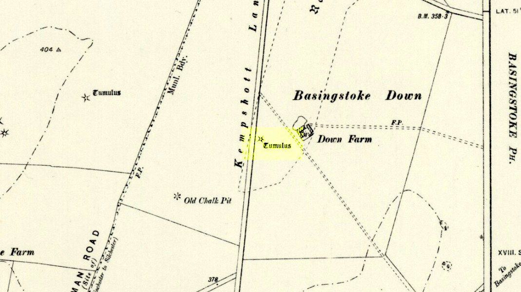
Downs Farm tumulus on 1897 map
On the western edges of Basingstoke, at Kempshott, could once be found this ancient site—destroyed many decades ago. It was one of number of similar prehistoric burial mounds in the area. First described in a listing of tumuli by Mr Andrews (1898) who told us that it was “oval” in shape, the monument was completely destroyed in 1939 and according to the Royal Commission (1979) lads,
“its site now lies beneath a house at the southwest corner of Kempshott Lane and Homesteads Lane.”
When the house where it once stood was being constructed, a collared urn was recovered from the tomb, which the Royal Commission thought indicated “that the monument (was) likely to have been of early Bronze Age date”—but obviously we cannot be sure. The site was listed in Leslie Grinsell’s (1979) extensive survey of prehistoric tombs in the area, in which he suggested it may have been a long barrow.
References:
Andrews, S., “A Short List of Some Tumuli in North Hampshire,” in Proceedings of the Hampshire Field Club & Archaeological Society, volume 4, 1898.
Grinsell, Leslie V., “Hampshire Barrows – part 3,” in Proceedings of the Hampshire Field Club & Archaeological Society, volume 14, 1940.
Royal Commission on Historic Monuments, England, Long Barrows in Hampshire and the Isle of Wight, HMSO: London 1979.
Willis, G.W., “Bronze Age Burials round Basingstoke,” in Proceedings of the Hampshire Field Club & Archaeological Society, volume 18, 1953.
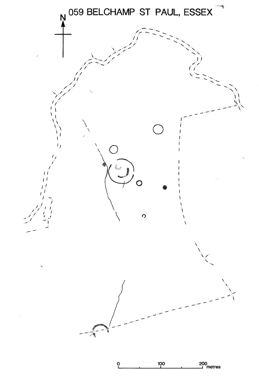
Several hundred yards northeast from Hickford Hill, a cluster of prehistoric sites could once be seen close to each other just south of the River Stour below line of the Essex-Suffolk county boundary. Several of these were tombs and are accounted for in Priddy’s (1981) essay on the prehistoric Barrows of Essex; but adjacent to them were also found faint traces of a large circular enclosure of some sort, which Harding & Lee (1987) included in their definitive survey of British henge monuments. Their account of it was brief and simple, saying:
“Enclosure defined by the cropmark of a sub-circular rather narrow ditch broken by two entrances. No trace of a bank. Internal traces of a concentric innner ditch in part of the circuit… Internal diameter range 56-57m…; width of outer ditch c.1.5-2.5m; width of entrances, c.7m (E) and 16m (NW); width of inner ditch c.2.5-5m.”
Although this large ringed enclosure was thought by the Haverhill & District Archaeology Group to “be a henge-type monument,” Harding & Lee (1987) thought it unlikely that these remains “belong to the henge class” of monuments. A brief archaeological dig into one of the trenches here in 1997 showed the site to be Bronze Age; but finds by the local archaeology team have also come across finds in the fields hereby dating from the Mesolithic and Neolithic periods.
References:
Harding, A.F. & Lee, G.E., Henge Monuments and Related Sites of Great Britain, BAR 175: Oxford 1987.
Priddy, D., “The Barrows of Essex,” in A.J. Lawson’s The Barrows of East Anglia, Norfolk Museums Service 1981.
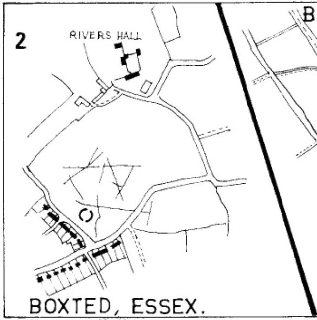
As with many sites in Southern England, intensive agriculture has taken its toll on the archaic monuments. The Boxted Cross henge is no exception and hardly any elements of it remains today. But it seems that it was an impressive fella in our more ancient heathen past.
The site was only rediscovered in the 1970s and was first described in Mrs Ida McMaster’s (1975) survey of crop-marks that had been revealed by aerial surveying in Essex and Suffolk counties. Her brief account of the monument told it to be,
“A Class II henge with a wide somewhat ploughed out ditch. Various linear ditches are near, together with prolific variegated ‘field outlines’ of glacial subsoil cracking which extends into the next field southwards. The ditch terminals of the southwest entrance to the henge appear to be wider than the general run of the ditch, say 4-5 metres.”
When Harding & Lee (1987) examined the site, they were a little more cautious in their interpretation of it being a definite henge, citing that there was “insufficient information, but cannot be ruled out as henge-related,” adding that it “could also be a mill.” This latter element seems unlikely, though a windmill may have been built onto the site at a later date.
More recently however the site has been categorized by Historic England as “a Late Neolithic henge.” The monument itself was defined by a broad circular ditch with two large opposing entrances to the north and south. The total diameter of the enclosure is 44 yards (40m) across; but with the surrounding ditch measuring 5½ yards (5m) across all around, the inner level of the henge was about 33 yards (30m) in diameter. Plenty of room for partying old-style!
References:
Harding, A.F. & Lee, G.E., Henge Monuments and Related Sites of Great Britain, BAR 175: Oxford 1987.
This much disturbed Iron Age ‘hillfort’ is effectively a large enclosure of Iron Age origin, much ruined by farming and subsequent landscape alterations through the centuries, with much of it re-fashioned as a medieval moat more than a thousand years after first being built. Even when the site was visited and described in Mr Wadmore’s (1920) fascinating work he told of the variants in its apparent construction phases:
“This large earthwork is situated on flat level ground, a few yards off the Bedford-Kimbolton Road, at the VIIth milestone out of Bedford. In shape it is very irregular and presents little to aid one in arriving at an estimate of its original form, except the construction of its defensive lines, which are of two totally different characters and suggest that a comparatively modern manor has been added to an older work.
“The portion which I take to be the older, lies to the south, and is contained on this and the western side, as far as and including the great sweep bending east, by a strong vallum with a parapet and external fosse.
“The modern portion appears to me to commence between the east and west faces where the lines run north, and are purely the remains of a fosse without any indication of a parapet. The extension of these lines, so far as can be traced, would tend to prove that the work occupied both sides of the road; but such a fact should not prejudice one’s view concerning the work as a whole….”
Section of the earthworks drawn by Wadmore
Adding with a good sense of humility that, “I am quite willing to admit that I may be mistaken, as the matter is entirely speculative.” But modern archaeological analysis tends to prove that much of Wadmore’s words were correct and the remaining northern section of these earthworks is where the medieval moated section was built. Roman remains and other period artifacts have also been unearthed in and around the site.
A few hundred yards southwest of the hillfort we find a place called Greenbury Farm. This place was known in the 14th century as ‘Grymesbury’, which has been taken by some students as relating to the Norse deity, Grim. However, Mawer & Stenton (1926) point out that in this instance,
“The Grym family had a holding in Bolnhurst in 1302 and bury is here used in the manorial sense. Hence ‘Grym’s Manor.’”
References:
Mawer, A. & Stenton, F.M., The Place-Names of Bedfordshire and Huntingdonshire, Cambridge University Press 1926.
Wadmore, Beauchamp, The Earthworks of Bedfordshire, Bedfordshire Standard: Bedford 1920.
Long Barrow (destroyed): OS Grid Reference – TL 086 268
Archaeology & History
Aligned east-west, a large neolithic long barrow could once be seen to the west of Galley Hill, on where now we find a golf course. It was sadly destroyed sometime around 1900 AD and its demolition was witnessed by a Mr A. Cumberland of the Dartford Antiquarian Society, who reported there being no archaeological finds of note in the tomb. Curious…
Equally curious was the view of archaeologist James Dyer (1964) in his assessment of the site, who wrote how
“Air photographs suggest that the barrow was 300 ft long, but this is much larger than normal in the Chilterns, and 150 ft is more reasonable.”
The neolithic and Bronze Age burial specialist Paul Ashbee (1984) maintained the “300 feet” measurement.
Other tumuli can still be seen on the slopes either side of Galley Hill a few hundred yards to the east; and a henge monument has also be found in the area.
References:
Ashbee, Paul, The Earthen Long Barrow in Britain, Geo: Norwich 1984.
Dyer, J.F., “A Secondary Neolithic Camp at Waulud’s Bank, Leagrave,” in Bedfordshire Archaeological Journal 2, 1964.
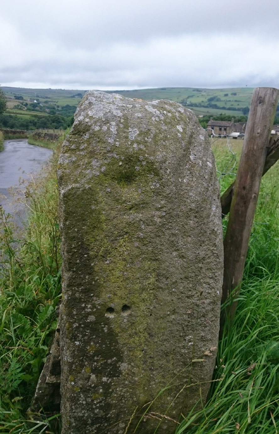
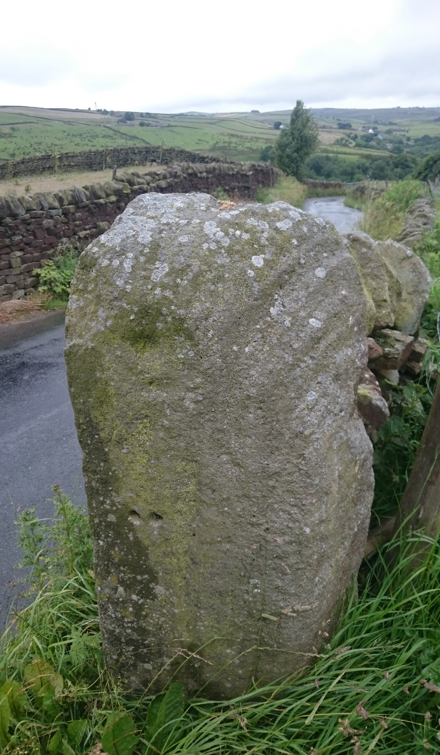
This Stone is situated on Old Lane, Cowling, North Yorkshire. To get here coming from Crosshills, you come straight through the village and past the shops. About 250 yards after the shops you will come to a sharp left hand bend, and once you have gone round this corner you will see a sign pointing to Oakworth (Old Lane). You need to turn left here (up by the cemetery) and continue for about half a mile up that lane until you come to a sharp left-hand bend. Once you have gone round that left-hand bend you will see a driveway on the right, the stone is situated opposite, in the gateway. Hope you can find it and enjoy it like I do every time I pass it.
Archaeology & History
…and from another angle
I’ve driven past this stone many times, almost every day and never previously noticed any markings. Then, one particular day, the weather was a bit miserable but the lighting was just right to illuminate this little gem. Was this lump of rock a standing stone, or have modern day folk took advantage and moved it here to be used as a gatepost? I don’t think we ever will know.
(Editor’s Note – When Chris first informed us of this carving, I wondered whether or not it had anything to do with a cup-and-ring found on a gatepost in the 1950s or ’60s by Stuart Feather or Sidney Jackson, but this was not the case. This petroglyph therefore, is yet another one that our users have discovered and it has to be classified as a new find. Keep up the good work sir! PB)
‘Standing Stones’: OS Grid Reference — TL 1395 9839
Also Known as:
St. Edmund’s Stones
Archaeology & History
1885 OS-map of the site
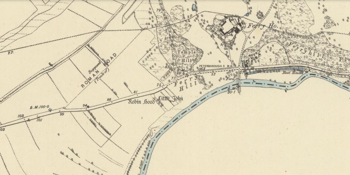
A curious and intriguing site with as many questions about its nature as there is its folklore. Moved around by the conniving fuckwit politicians from Huntingdonshire, to Northants to Cambridge nowadays, one wonders where those fools will place it next! Listed by a number of archaeologists as prehistoric standing stones, it seems pretty obvious from photos and the descriptions of many amateur students that—unless some original monoliths have been reworked a few centuries back—the narrative given by local historian W.H.B. Saunders (1888) outlines their more probable origin and history. That’s not to say that the stones aren’t old—just not that olde…. Mr Saunders reasoned that they were dug and transported from more than 5 miles northwest of their present spot, telling that:
“Nothing can rob the stones of their undoubted antiquity. The Barnack quarries have been exhausted for the last 600 years at least. It is evident therefore, that the stones were placed in their present position at a time when the Barnack quarries were being worked. That would be in the days of Robin Hood, and also when the Abbey of St. Edmund’s Bury, built of Barnack stone, was being erected.”
His words make sense when you look at the stature of the monoliths in question. They’re cut and squared to the edges, with Robin Hood being the taller of the two stones, about 30 feet southwest of the Little John stone. They have been written about quite extensively by historians down the centuries, from William Camden onwards. One early account of the stones was written by Symon Gunton (1686) who told:
“I find in the charter of King Edward the confessor…that the abbot of Ramsey should give to the abbot and convent of Peterburgh 4000 eeles in the time of Lent, and in consideration thereof the abbot of Peterburgh should give to the abbot of Ramsey as much freestone from his pitts in Bernack, and as much ragstone from his pitts in Peterburgh as he should need.
“Nor did the abbot of Peterburgh from these pits furnish only that but other abbies also, as that of St. Edmunds-Bury: in memory whereof there are two long stones yet standing upon a balk in Castor-field, near unto Gunwade ferry; which erroneous tradition hath given out to be draughts of arrows from Alwalton church-yard thither; the one of Robin Hood, and the other of Little John; but the truth is, they were set up for witnesses, that the carriages of stone from Bernack to Gunwade-ferry, to be conveyed to S. Edmunds-Bury, might pass that way without paying toll; and in some old terriars they are called St. Edmund’s stones. These stones are nicked in their tops after the manner of arrows, probably enough in memory of S. Edmund, who was shot to death with arrows by the Danes. The balk they stand upon is still call’d St Edmund’s Balk. They are supposed to be the petrify’d arrows of those two famous archers.”
Thom’s sketch showing his midwinter alignment
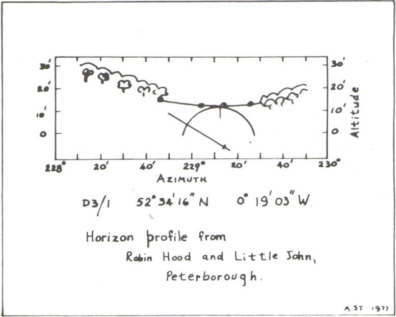
These traditions have subsequently been copied by all local historians. So it is something of a curiosity to find our archaeologists—from Clarke (1960) and F.M. Pryor (1972) to Aubrey Burl (1993)—to cite these as prehistoric monoliths. My suspicions as to their reasons relates to the folklore of the stones which are echoed at many truly prehistoric places like the Devil’s Arrows, etc. The nature of the tale is an aboriginal creation myth, relating to the formation of sites as understood in animistic mythic structures. But this archaeological misunderstanding brought the more scientific mathematical mind of Alexander Thom (1990:1) here in the 1980s where coincidence showed a common astronomical alignment. Thom wrote:
“Clearly visible from the site, at an azimuth of 229°.22 is the lowest point of a low saddle on the horizon. The col, Fig.1 (above), subtends an arc of about 0°.67 of azimuth, observed minimum altitude 0°.21. For an estimated temperature of 44°F, correction for refraction at sunset is about 0°.54, and for solar and semi-diameter and parallax of respectively 0°.27 and 0°.002, the ‘observed’ declination is found to be -23°.92, which indicates a date of about 1860 BC.
“No presently obvious horizon marker was evident upon inspection of the open fields forming the horizon, but this does not mean that a foresight was never erected. Without the evidence of a foresight it cannot be claimed that the two stones were placed for accurate calendrical reasons, but undoubtedly they indicate by themselves the winter solstice.”
The folklore may indicate the possibility that these two medieval standing stones replaced earlier ones, but no remains of such relics exist today.
References:
Burl, Aubrey, From Carnac to Callanish, Yale University Press 1993.
Clarke, R. Rainbird, East Anglia: Ancient Peoples and Places, Thames & Hudson: London 1960.
Gover, J.E.B., Mawer, A. & Stenton, F.M., The Place-Names of Northamptonshire, Cambridge University Press 1975.
Grinsell, Leslie V., Folklore of Prehistoric Sites in Britain, David & Charles: London 1976.
Gunton, Symon, TheHistory of the Church of Peterburgh, Richard Chiswell: London 1686.
Mee, Arthur, Bedfordshire and Huntingdonshire, Hodder & Stoughton: London 1973.
Morton, John, The Natural History of Northampton-shire; with Some Account of the Antiquities – 2 volumes, R. Knaplock: London 1712.
Pryor, F.M., Prehistoric Man in the Nene Valley, Nene Valley Research: Peterborough 1972.
Saunders, W.H.B., Legends and Traditions of Huntingdonshire, Simpkin Marshall: London 1888.
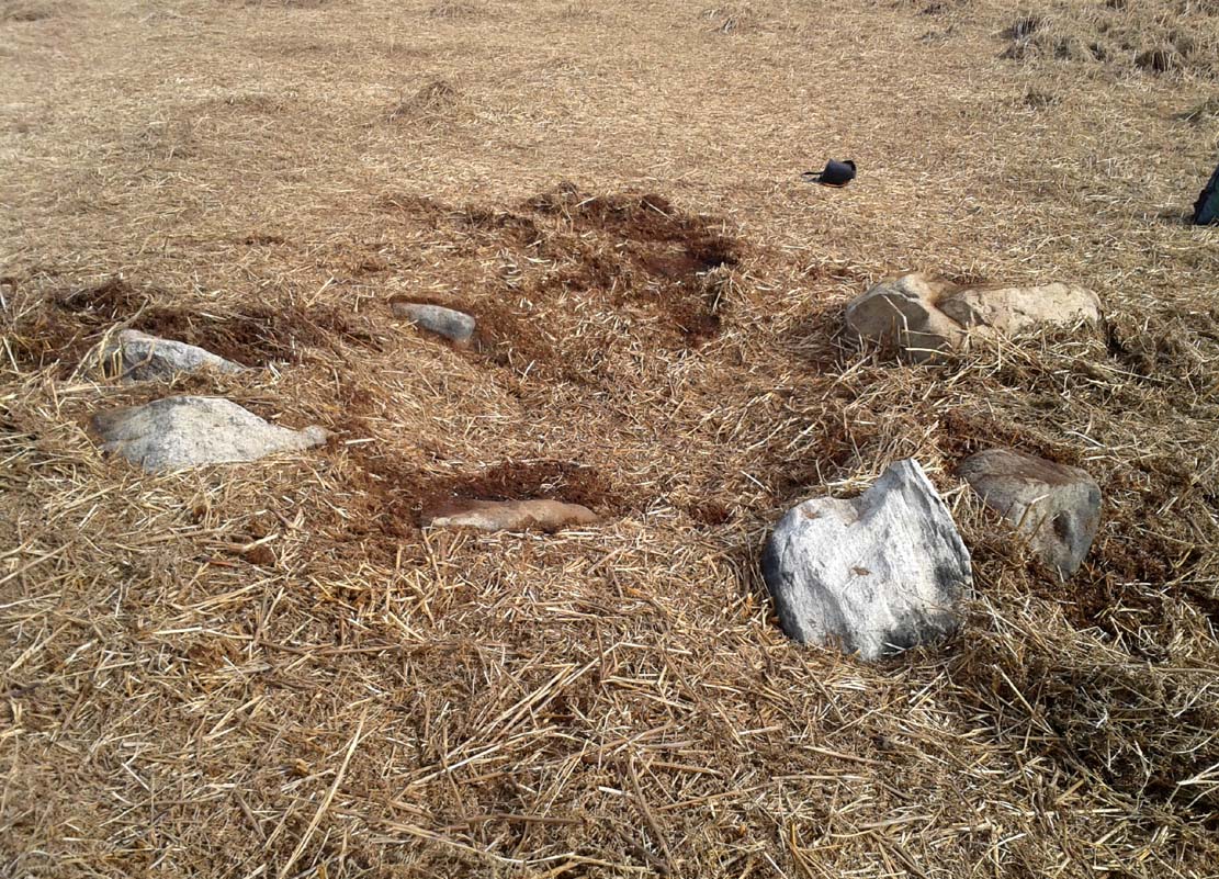
From the double-ring that is the Brackenhall Circle at Shipley Glen, go up the road towards the hills and seek out the cup-marked Glovershaw Quarry Stone. Shortly before this, notice the small trees close the quarry edge. From here, walk straight east, as if you’re going toward Baildon Hill. Barely 10 yards into the bracken you’ll notice this small ring of stones (best looked for in winter before the bracken grows back – otherwise you’ve no chance!).
Archaeology & History
This site was explored when James Elkington, Paul Hornby and I came across it on Wednesday, 11 March 2015, after returning from a short excursion to look at some of the petroglyphs on Baildon Hill.
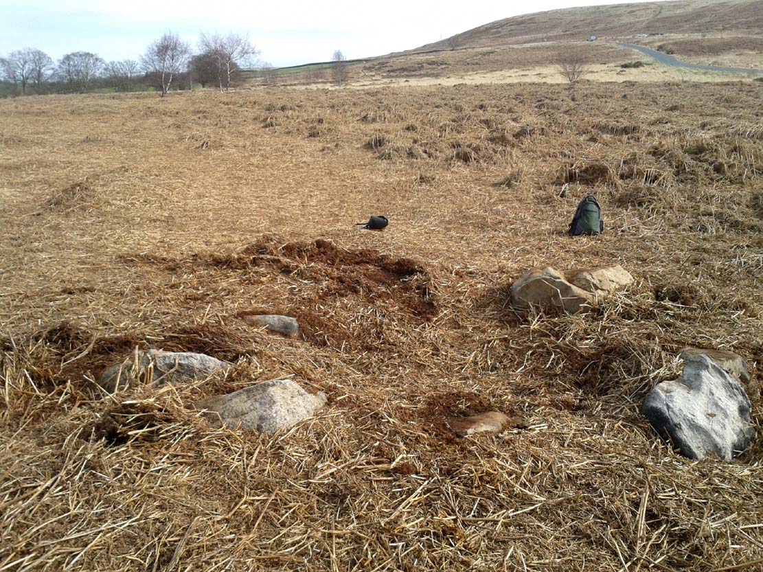
Ostensibly it is a small ring of stones comprising of at least 7 large rocks that are set deeply into the peat and bracken-mass, with a small eighth movable stone on the northern side. It seemed likely that another, larger rock was beneath this small portable rock, but we didn’t dig into the vegetative mound to explore this. The most curious thing about the ring of stones was that it measured barely 4 yards in diameter. My initial thought was that this was a previously unrecorded cairn, but there seemed to be no internal mass of rocks in the centre that characterize such monuments and which you’d expect in a ring of this size – meaning that it may be, perhaps, the smallest stone circle in Britain. It’s a pretty good contender at least! (the stone circle known as “Circle 275” at Penmaenmawr in Wales is of similar size to this one, but with less stones in that ring)
Close-up of the stones
It would be good if the regional archaeologists could give this site their attention and clean it up to see exactly what lays beneath the boscage. Close by are several cup-marked stones and a couple of other larger cairn circles.
The name of the site came after I almost stood on a hibernating toad, found beneath the bracken-mass right at the edge of one of the stones. I carefully picked him up and reburied him in another spot close by, leaving him (perhaps) to ponder his venture into the bright daylight of consciousness! Mr Hornby promptly declared – “these are the Toad Stones!” – and it stuck.