Holy Well: OS Grid Reference – NO 5835 6623
Also Known as:
- Canmore 34976
- The Lady’s Well, Chapelton of Dunlappie
- The Ladywell, Chapelton of Dunlappie
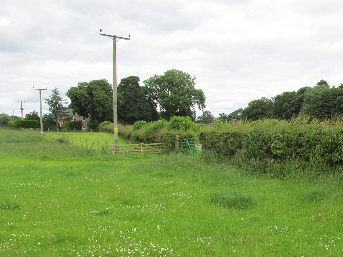
Travelling north along the minor Little Brechin to Reidhall road, take the left fork at the Drumchapel Estate Company sign towards Chapelton Farm, take a sharp left then right turn and the site of the well is through the green metal gate on the left of the road behind the cottage.
Archaeology and History
Andrew Jervise, in 1853 describing the ‘Hermitage of the Chapel of the Blessed Virgin Mary of the Forest of Kilgery’ quotes in his The History and Traditions of the Land of the Lindseys:
“This old chaplainry stood in a field near the farmhouse of Chapelton of Dunlappie. The stones of the chapel were taken to build the farm-steading, and a fine spring, about a hundred and fifty yards south east of the site of the chapel, still bears the name of Ladywell, in honour of the Virgin.”
William Fraser, writing about the Chapel in 1867 wrote:
“The ruins of the Forest Chapel of the Virgin existed till lately in the vicinity of a fine spring, still known as the Lady’s Well.”
This chapel was subsidiary to the Hermitage Notre Domine Maria de Kilgery, situated almost 1½ miles due west on the southern slope of the Brown Caterthun hill-fort.
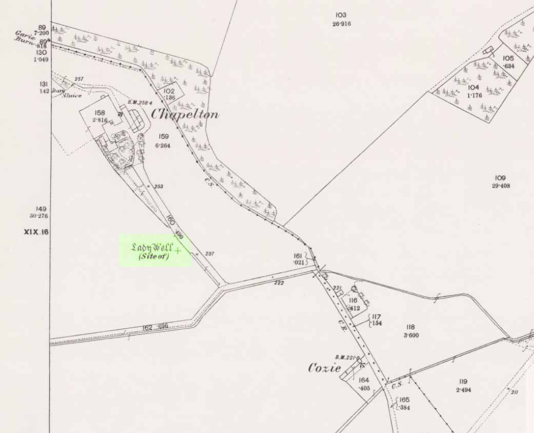
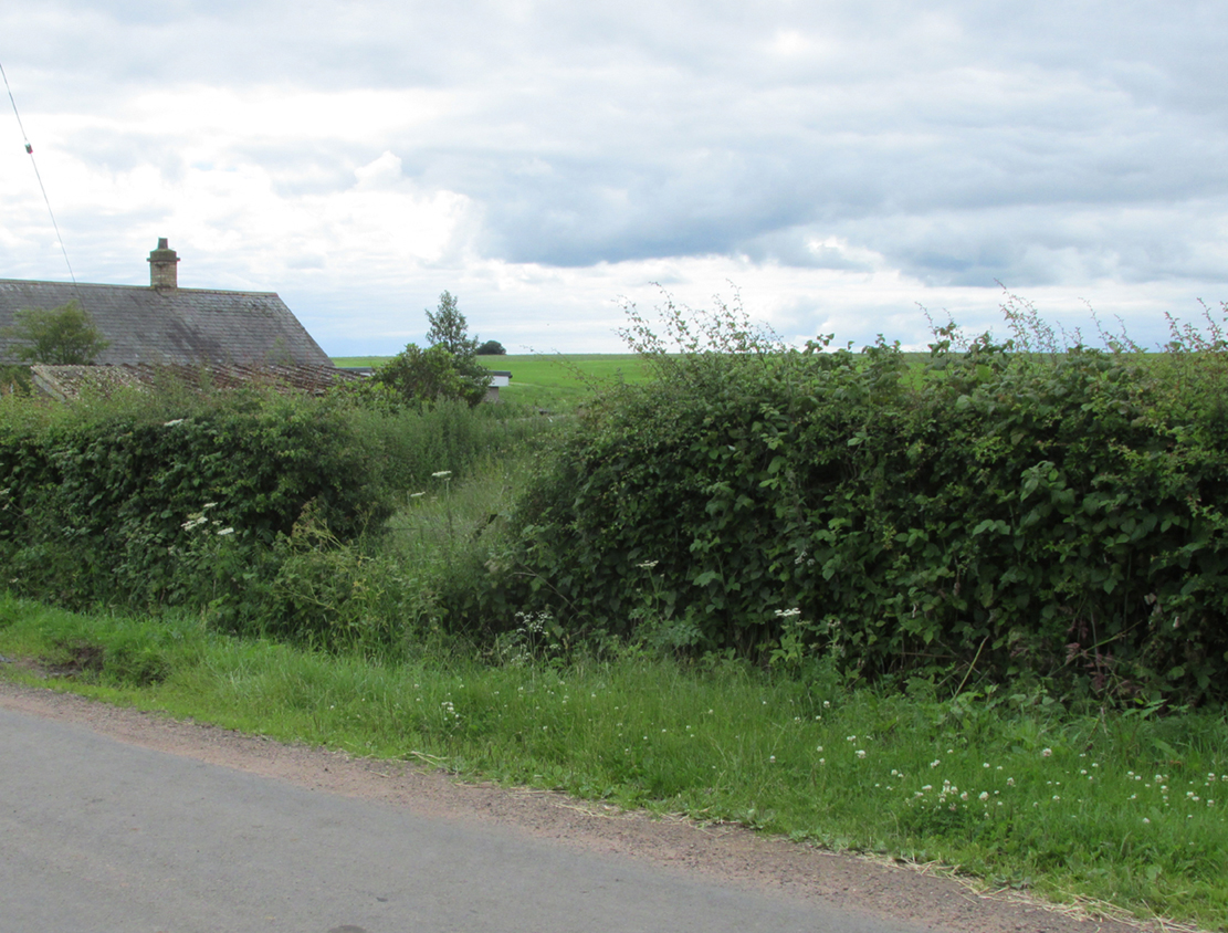
The Lady Well is shown on the 1868 Ordnance Survey map as being in the field, with the spring issuing at the roadside as a ‘spout’. Where the Lady Well stood, there is now just a lush patch of grass by the metal gates. On my field visit, I met the farmer, who was totally unaware that there had ever been a holy well. He said that a brick cistern with a wooden lid had been built on the site of the ‘spout’, and that the water was pumped from there to supply the adjoining cottage. He said the water flowed into the cistern from a pre-existing pipe, and never dried up, but he had no idea where the supply originated. So perhaps the flow from the spring was diverted from the site shown on the map when the ruins of the chapel were taken down.
There is now nothing to see above ground of the Chapel or the original Holy Well, and while the nineteenth century quotation above refers to the Well being at Chapelton of Dunlappie, it is now known as Chapelton of Menmuir.
References:
- Andrew Jervise, The History and Traditions of the Land of The Lindsays in Angus and Mearns, 2nd Edition, Edinburgh, David Douglas, 1882.
- William Fraser, History of The Carnegies, Earls of Southesk, and of Their Kindred,Volume One, Edinburgh, Privately Printed, 1867.
- Jervise, A, Notices of the Localities of the Sculptured Stone Monuments at St Vigeans, Inchbrayoch, Pitmuies, and Menmuir, in Angus, and of Fordoun in the Mearns. Part IV. (pp 458-66), Proceedings of the Society of Antiquaries of Scotland, Volume 2, 1855-56.
© Paul T. Hornby 2016, The Northern Antiquarian