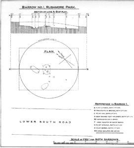
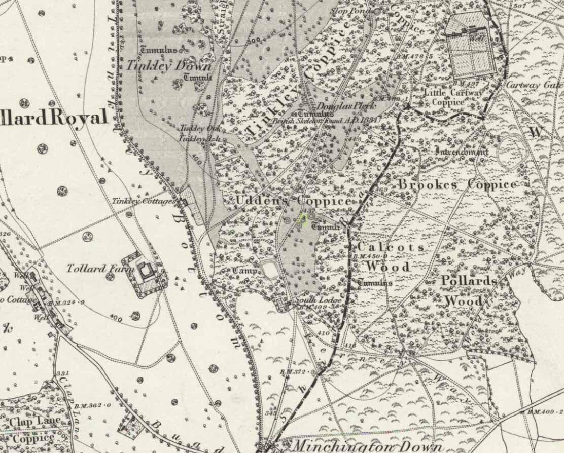
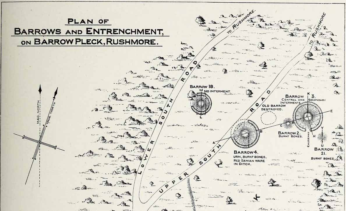
This long-lost burial mound was one in a large group of prehistoric tombs that were explored in the 19th century by the legendary antiquarian, General Pitt-Rivers. It had already been destroyed before the General came to live on his Rushmore estate in southern Wiltshire, but thankfully, his diligence as an inquirer prevailed and he was able to recover at least something of the old site. Shown on the 1889 OS-map of the area (despite already having been destroyed), in Pitt-River’s (1888) extensive writings he told how, in the scattered woodlands hereby, was
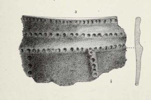
Pitt-Rivers 1888 site-mapOld Pleck Barrow urn
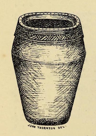
“a collection of large barrows near the South Lodge. They were covered with a thick grove of hazel and other underwood. One of the barrows—marked by a dotted circle (see sketch-map, left, PB)—had been destroyed before my arrival at Rushmore in 1880. The earth of the barrow had been removed and a good urn found in it, which had been broken and scattered, but I was fortunate enough to recover one of the fragments which had been preserved by the estate carpenter.”
From a sketch that was made of the urn remnant, Pitt-Rivers told how “the character of its ornamentation” resembled that on another urn found in one of the nearby tumuli.
References:
Pitt-Rivers, A.H.L.F., Excavations in Cranborne Chase, near Rushmore – volume 2, Harrison & Sons: London 1888.
Along the moorland road between Cow & Calf and The Hermit pub, park up at the small wooded bit by the right-angle bend and cross over the Coldstone Beck. Walk up onto the moor itself and stick to the path that runs roughly parallel with the slowly-drying stream, towards Lower Lanshaw Dam. About 100 yards before it, walk left, into the heather, for about 50 yards. You’re damn close!
Archaeology & History
Lower Lanshaw Dam carvingClose-up of cupmarks (by James Elkington)
This is another neolithic or Bronze Age carving I first came across during one of my weekly rambles across these hills as a child, and upon revisiting the place a few days ago with James Elkington, found it associated with nearby cairns and what looks to be the remains of prehistoric walling – none of which I noticed when I was a kid. The petroglyph is a simple design, primarily consisting of two rows of three cup-marks: one row of three along the top or spine of the rock, and another one immediately beneath it, an inch or so below. The topmost line of cups runs into a natural crack in the rock, which runs down the northwest edge of the stone. A possible faint cup and partial ring emerges on the southeast side of the topmost row of cups, but this is difficult to make out. On the sloping northwest face of the rock is another single cup-marking.
References:
Bennett, Paul, Of Cups and Rings and Things, unpublished: Shipley 1981.
Acknowledgements: Many thanks to James Elkington for use of his photo to illustrate this petroglyph
Take the same directions as if you’re visiting the Lanshaw Dam 2 petroglyph, then keep walking directly towards the Lanshaw Dam, 130 yards east. Halfway between the two, closer to the footpath, look out for a stone of similar shape and dimensions to Lanshaw 2, just by a prehistoric cairn. You’ll find it!
Archaeology & History
Cup-marked stone & cairnClose-up of cup marking
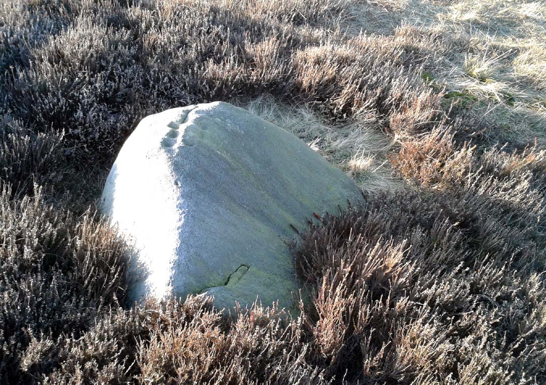
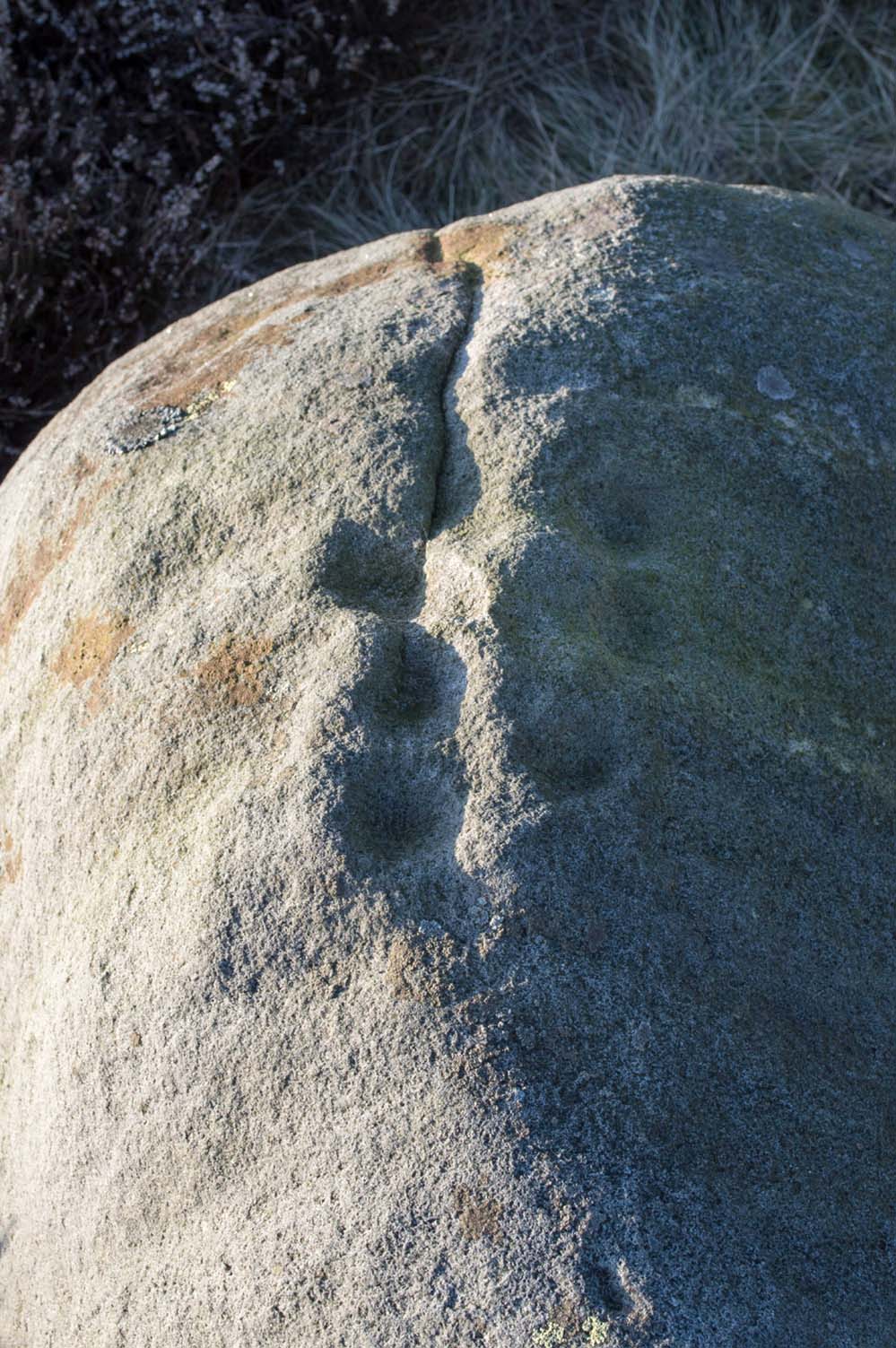
As with a great number of petroglyphs in and around Yorkshire, this large single cup-marked rock is found in close association with a reasonably large prehistoric cairn (several others are close by), some 3 yards in diameter. The cup-marking here is larger than yer average cup-mark on these moors, being four inches across. It can clearly be seen on the southern vertical face of the rock and doesn’t appear to have been recorded before. On the whole, it’s nothing special to look at and is probably just one for the petroglyphic purists amongst you.
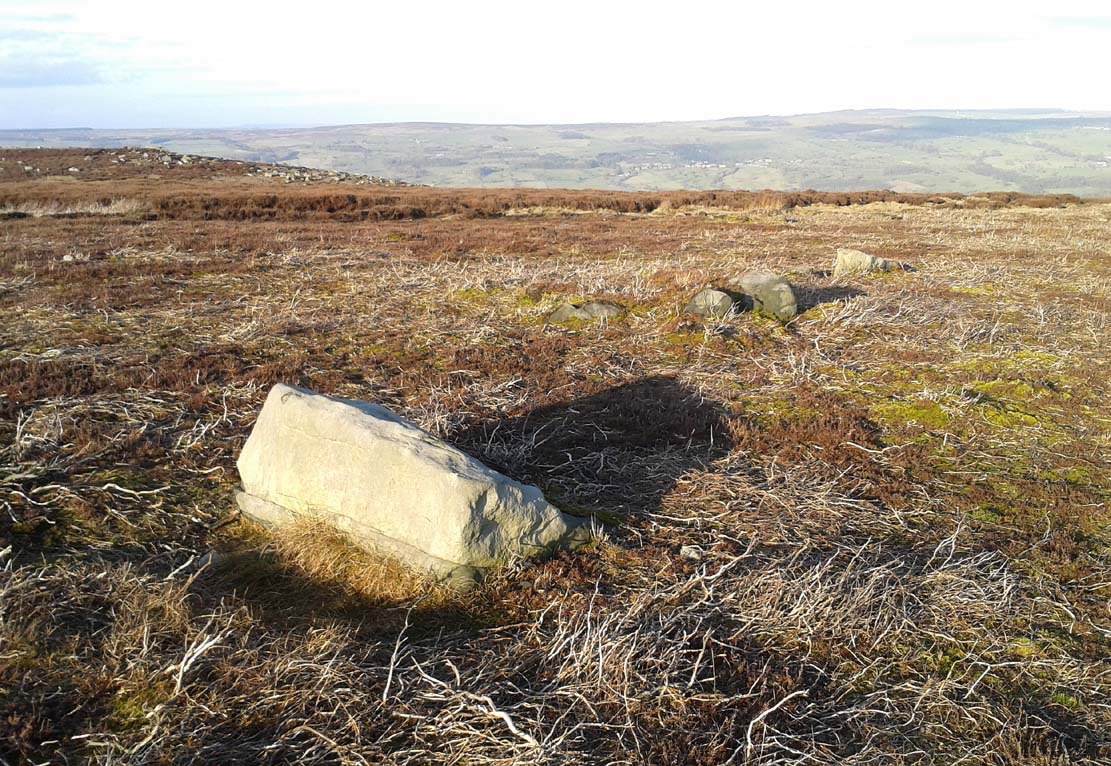
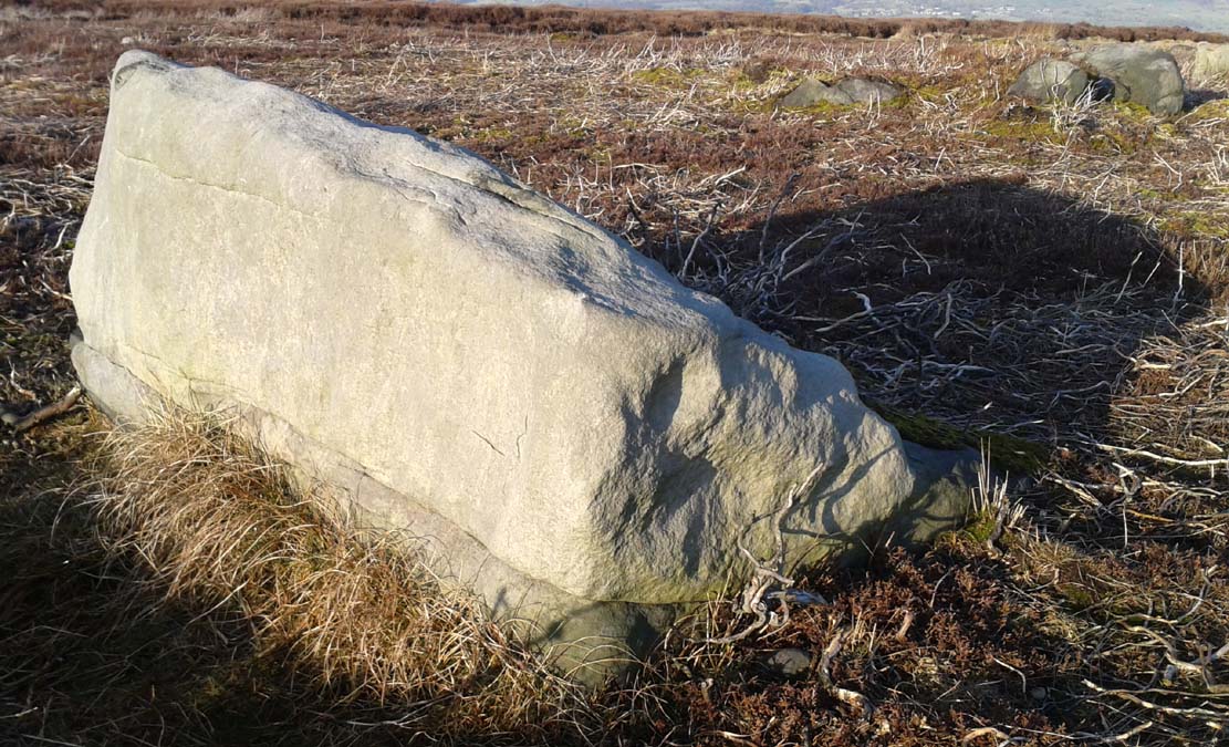
There are no previous literary references to this small portable cup-marked rock, relocated recently by Paul Hornby during one of his various antiquarian meanderings. Found in association with a much later architectural structure, it position in the landscape (near the top of a hill) would suggest that is was most probably located in a prehistoric cairn in earlier days—all traces of which have vanished. But we cannot be sure of this and I’m merely speculating.
Moonzie cup-marked stone
Site of carving
The thin, fairly flat stone is about 18 inches across, by a foot wide, and consists of what seems to be 10 cup-marks (no rings, sadly), of which six of them are the real deal. No other carvings officially exist anywhere near it and its isolation is an enigma… such as it is with petroglyphs…
Due to the fact that the stone can literally be picked up and moved by anyone, we’re hoping that it can be seen by local archaeologists and perhaps placed into a museum for safe-keeping.
Cup-and-Ring Stone: OS Grid Reference – NT 714 275
Archaeology & History
Kalemouth carving (after R.W.B. Morris 1981)
Now housed in the National Museum of Antiquities in Edinburgh, this little-known petroglyph was rediscovered in 1957 by a Mr G.F. Ritchie, not far from the once-large Kalemouth neolithic tomb. It’s a carving that seems to be quite isolated (no others are known about in the immediate area), comprising of an incomplete four-ringed design which, in all probability, is a stray rock that came out of a nearby prehistoric cairn—although we don’t know this for sure.
The carving was described in Ron Morris’ (1981) petroglyph survey, where he told us that,
“In the field “not far from the cairn” (just E of the farm), was a small convex gritstone boulder 25cm by 15cm by 15cm (¾ft x ½ft x ½ft). On its fairly smooth surface is:
a cup-and-four-rings with 2 parallel grooves from the inner ring (which is incomplete) through the others (which are gapped)—the outer two being now incomplete also—a form of ‘keyhole pattern’.”
A near-identical carving on a similiar-shaped portable stone can be seen in Galashiels museum, whose history has seemingly been forgotten.
Morris, Ronald W.B., “The Cup-and-Ring and Similar Early Sculptures of Scotland; Part 2 – The Rest of Scotland except Kintyre,” in Transactions of the Ancient Monuments Society, volume 16, 1969.
Morris, Ronald W.B., The Prehistoric Rock Art of Southern Scotland, BAR: Oxford 1981.
Tumulus (destroyed): OS Grid Reference – SE 099 321
Archaeology & History
Headley Farm urn
There are no longer any remains of the prehistoric burial site that once stood in one of the fields by Lower Headley Farm. We don’t know whether the site was a cairn, a tumulus, or just a stone-lined cist; but in all probability it would have been a low rounded hillock whose existence had long since fallen out of oral tradition. All that we do know is that in one of the fields by the farm, some very well preserved urns—either neolithic or Bronze Age by the look of it—were unearthed, indicating a site of prehistoric provenance.
The finds were described only briefly in the first edition of the Bradford Antiquary (1888) journal, where it was reported:
“During the spring of 1880 an interesting discovery was made by Mr. Abraham Craven, quarryman, of Thornton. The ‘find’ comprised three funeral urns, which Mr. Craven turned up while baring a portion of a field in Lower Headley Farm, the property of the trustees of Sowerby Grammar School. The discovery was made within a short distance of the surface, the pottery presenting undoubted indications of pre-Roman origin. From evidence collected upon the spot, and the appearance of the pottery, two of the urns were about 14in in height, 9in across the top, 11½in at the widest portion of the bowl, and 6in at the foot. One of the urns was of sun-burnt clay, with rude markings, the other having evidently been subjected to fire. No coins, personal ornaments, or other indications of civilisation, were found in the urns, but each one contained human dust and bones. From the fact that several other urns have been met with in the immediate vicinity, equally rude in type, evidence is not wanting that the picturesque mound upon which Headley is situate was inhabited at a very early period of British history.”
References:
Anonymous, “Valuable ‘Find’ at Headley, near Thornton,” in Bradford Antiquary, volume 1, 1888.
Tumulus (destroyed): OS Grid Reference – TQ 288 726
Archaeology & History
This long lost prehistoric tomb is one of many that has fallen under the destructive hammer of the christian Industrialists in this part of the country. Located somewhere in the parkland grounds of Bedfordhill House (also destroyed), its memory was thankfully preserved by the renowned folklorist and historian Walter Johnson (1903) who wrote of it in his work on prehistoric Surrey, where he told:
“A few years ago a supposed barrow was levelled in Bedford Park, Bedford Hill, Tooting, and no record taken of the results. The mound was enclosed in the Park for several centuries, but when the grounds were laid out for building purposes ten or a dozen years since, it suffered rough usage, and was finally destroyed. It was nearly 100 yards long, and about 20 feet in breadth in its highest part. It ran East and West, and had several trees growing on it before its desecration…. A moat had been made round the mound for about two-thirds of its circuit. This moat was supplied with water by the Ritherdon, a small stream rising in Streatham. The name is preserved in the adjacent Ritherdon Road. The material of the mound was gravel and gravelly loam, which, in the neighbourhood, occurred only in a thin layer, thus forbidding the conclusion that the structure was merely composed of the soil dug out in making the moat. The excavated material would largely be London Clay. As the genuineness of this barrow was, we believe, called in question after its demolition, when the subject was beyond reconsideration, we mention two shreds of collateral evidence. The ground on which the tumulus stood was about the highest in the district. The name Tooting may also have some bearing, for Mr. Clinch thinks that it was a Celtic settlement where was worshipped the deity known as Taith. (Compare also toot-hill, as exemplified in Tot Hill, Headley, Tothill Fields, Westminster, famous for fairs and tournaments, also Tutt Hill, near Thetford.)”
The ‘toot’ in Toothill however, is ascribed by Gover, Mawer & Stenton (1934) as being the usual “look-out hill”. Although they do make note of the fact “that there is no hill in Tooting which would make a good look-out place.” But if this was a large barrow of some type, it would explain the etymological oddity. Any further information on this site would be welcome.
References:
Gover, J.E.B., Mawer, A. & Stenton, F.M., The Place-Names of Surrey, Cambridge Univserity Press 1934.
Johnson, Walter, Neolithic Man in North-East Surrey, Elliot Stock: London 1903.
Smith, A.H., English Place-Name Elements – volume 2, Cambridge University Press 1954.
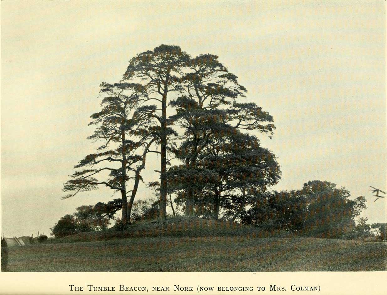
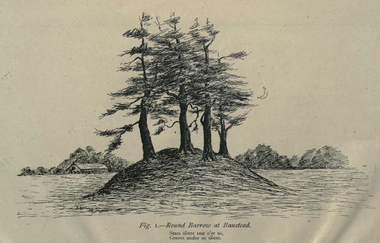
This ancient “bowl barrow” as the modern archaeo’s are wont to describe it, is a Bronze Age tumulus that has seen better days. But at least it’s still there – albeit slightly damaged and enclosed by modern housing, in the back of someone’s garden. I expect that if you were to ask the owners, it would be OK to see this 4000 year old burial mound (in Scotland at least, we always find people very amiable when it comes to asking such things). It’s quite a big thing too, so you can’t really miss it! Standing more than 12 feet high, it rises like an archetypal fairy mound—now out of place—measuring some 38 yards east-west and roughly 44 yards north-south.
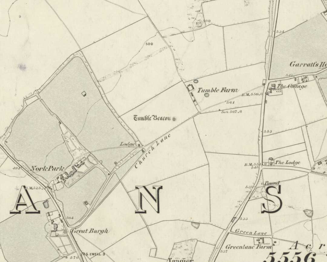
Highlighted on the early OS-map of the region, the name of the site indicates its multi-period usage, with the ‘beacon’ element derived from when, in 1594, a fire was lit upon it to tell of the arrival of the Spanish Armada. Whether it had been used as a beacon prior to that, I can find no historical accounts. One of the early archaeological descriptions came from the pen of the old historian and folklorist, Walter Johnson (1903), who told us simply:
Tumble Beacon on 1871 mapWalter Johnson’s 1903 sketch
“About a mile South-west of Banstead Church, in a field close by Tumble Farm, on the outskirts of Nork Park, is an eminence marked on the map as Tumble Beacon. A picturesque clump of pines stands on the mound, which, from its general character, and from the flint scraps we have found there, we have every reason to believe is a round barrow, despite the local tradition that it is a ‘sea-mark.’ The Scotch pines, in such positions as we find here, may probably, Mr. Grant Allen thought, be the descendants of trees put in by human hands when the barrow was first raised.”
Whilst this latter idea might be very hard to prove, the assertion that it’s prehistoric certainly gained favour as more antiquarians examined the site. Johnson later told that when examining this and other sites nearby (sadly destroyed) he came across a variety of prehistoric stone utensils in the area.
References:
Gover, J.E.B., Mawer, A. & Stenton, F.M., The Place-Names of Surrey, Cambridge Univserity Press 1934.
Grinsell, Leslie V., The Ancient Burial Mounds of England, Methuen: London 1936.
Johnson, Walter, Neolithic Man in North-East Surrey, Elliot Stock: London 1903.
Lambert, H.C.M., History of Banstead in Surrey, Oxford University Press 1912.
Described in the Field Lore of Timble village by William Grainge (1895) are the names and short histories of some of the local place-names—with this in particular standing out like a veritable sore thumb! Quite plainly, as Grainge told us,
“The name ‘Longbarrows’ is indicative of some burial mounds of a very early day. None exist at present. The land is under the plough, and is about the best in the township.”
But I cannot locate the position of this long-lost site and it’s not shown on any of the early OS-maps hereby. Grainge said that the land on which it once stood was owned by a local farmer called Charles Dickinson, who leased it out to others. He wrote:
“Dickinson had in Longbarrows 3 roods* and 23 perches*, and William Jackson’s share in Longbarrows was 1 acre, 3 roods and 21 perches. Besides these, John Ward of Nether Timble had 1 rood and 17 perches int he same field, a long narrow slip without fence, between Dickinson’s and Jackson’s lots.”
Does anyone know where this was? One of my suspects is the gathering place of the Fewston witches, a half-mile south of the village; but no remains of anything can be found there today and I may just be barking up the wrong tree.
The area south and west of here is rich in little-known prehistoric heritage, from the cairn-fields of Askwith Moor, the cairn circle at Snowden Crags, the settlements of Snowden Carr and the extensive petroglyphs all over the place! Giants cairns of the early Bronze Age and neolithic period were also once more numerous upon the moors to the west and south, so the former existence of a long barrow in Timble wouldn’t necessarily be too unusual. But where was it?!
References:
Grainge, William, The History and Topography of the Townships of Little Timble, Great Timble and the Hamlet of Snowden, William Walker: Otley 1895.
* A rood is an English unit of area, equal to a quarter of an acre or 10,890 square feet; a perch was a more variable unit of measure, being lengths of 161⁄2, 18, 21, 24 and 25 square feet.
Along the B818 road that runs between Fintry and Denny, get to the western end of the Loch Carron reservoir and park up at the entrance to the forest. Across the road, walk up the track towards the (planned) wind farm. Nearly a mile along watch out for the walling of derelict buildings on the slope above the track—but instead of walking up to them (west), walk up the slope on the other side of the track (east), over the annoying fence, then another one barely 50 yards away. The large fairy mound on the moorland plain barely 100 yards ahead is the site in question.
Archaeology & History
Todholes Cairn looking north
On the day that Paul Hornby, Nina Harris and I visited this site, Nature had been watering Her ground excessively and the moorland was becoming an immense bog. The daylight was fading fast too, so we didn’t get much time to sit and play and take in the colourful panorama that unfolds its vision as She normally would—and it would be a magnificent view on a clear bright day! Instead, Her grey carpets and skies darkened quickly, leaving only a bare meander around this old prehistoric tomb before us. It’s quite a big thing too…
Records of it are scant, both in archaeology accounts and popular culture. In 1952 the Royal Commission (1963) lads visited the site and subsequently wrote that:
“This cairn…consists of a grass-covered mound of stones which stands to a height of 8ft and measures about 55ft in diameter. Two large boulders which lie at the foot of the mound to the south may represent the remains of a peristalith. Three small holes caused by quarrying or by excavation appear on the surface of the cairn.”
Another cairn can be found a short distance northwest and what seems to be the remains of a prehistoric hut circle was visible on the moorland plain a few hundred yards south. The word ‘todholes’ derives from ‘the abode of foxes’—and I saw two dead foxes recently shot by local land-owners hereby, showing that the place-name is valid.
References:
Royal Commission on the Ancient & Historical Monuments Scotland, Stirlingshire – volume 1, HMSO: Edinburgh 1963.
Royal Commission on the Ancient & Historical Monuments of Scotland, Archaeological Sites and Monuments of Stirling District, Central Region, Society of Antiquaries of Scotland 1979.