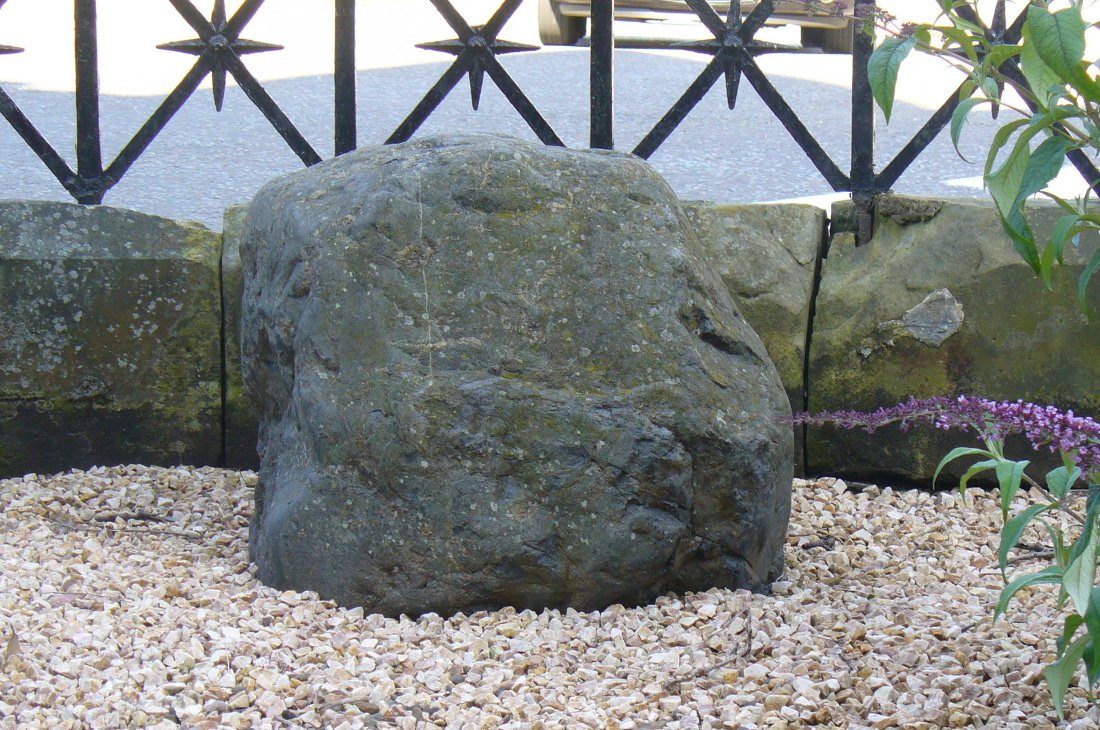
From the bus station in town, walk across the road and to your right, as if you’re heading into the town centre. Barely 100 yards on where you turn left, you’ll see the Blue Stane Hotel across the road right in front of you. The stone in question sits in a small forecourt on the other side of the metal fence (as the plaque describing the stone tells).
Archaeology & History
Although the Blue Stane is well known to local people in the ancient coastal town of St. Andrews, outside of the area little seems to be known of the place. Even the Royal Commission (1933) report for Fife didn’t include the stone in its survey – and the site is east enough to miss it if you walk past too quickly and don’t have an eye for all things megalithic! When Paul Hornby and I came here, it was pretty easy to find. It helps with there being a small plaque in front of the aptly-named hotel, giving a small history of the stone.
The plaque that tells the taleThe Blue Stane
Standing—or rather, resting—in front of the Blue Stane Hotel, the stone has obviously seen better days. Cut in half from its original size, the small upright block certainly has a very blue haze to it and was probably a prehistoric memorial stone, perhaps attached to a long forgotten tomb somewhere close by. Nowadays the little fella is only 2 feet high … and is somewhat reminiscent of a petrified Tyrion Lannister: proudly assertive despite his shortcomings! And long may he reign…
Folklore
The historian and folkorist, A. Lindsay Mitchell (1992) told that the stone here was “more of a reddish sandstone colour”, which passed me by, as I’m brilliantly colourblind! But the fine lady also gave us one of the little known creation myths of the stone, saying:
“Legend has it that an angry giant threw this substantial block of whinstone at the missionary, St. Rule, who had usurped the giant’s influence. However, legend also records that the giant was not one of life’s bolder characters. He made sure that he remained far enough away frm this upstart, St. Rule, and threw the stone from the safe vantage point of Blebo Craigs, about 5 miles away.”
In Robertson’s (1973) fine work on the history of St. Andrews, he tells how the Blue Stane,
“comes down in the annals as having been a stone altar of pagan times. It was used for long as a meeting or trysting place, and was regarded with superstitious awe by passers-by. Men would give it placatory pat and women a cautious curtsey in the way-going. It is said that the pikemen of St. Andrews touched it assurance before departing in 1314 for (the battle of) Bannockburn.”
References:
Mitchell, A. Lindsay, Hidden Scotland, Lochar: Moffat 1992.
Robertson, James K., About St. Andrews – and About, J. & G. Innes: St Andrews 1973.
Acknowledgments: Huge thanks to Paul Hornby for use of his photos for this site-profile.
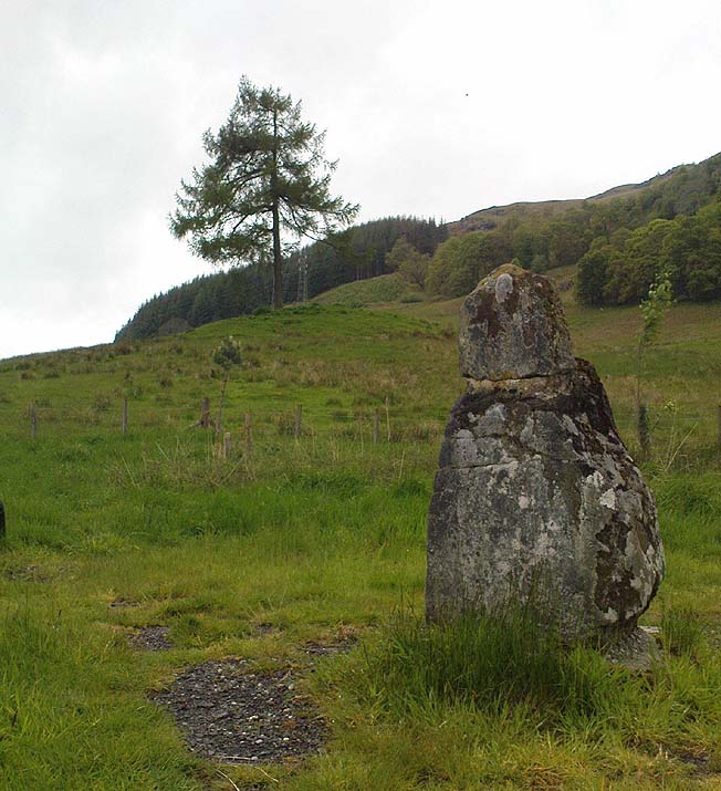
Less than 100 yards up the road from the Co-op in Killin, take the footpath on the same side of the road into the park at the back of the buildings. Keep following the footpath round the back of the buildings and you’ll see the stone in front of you soon enough.
Archaeology & History
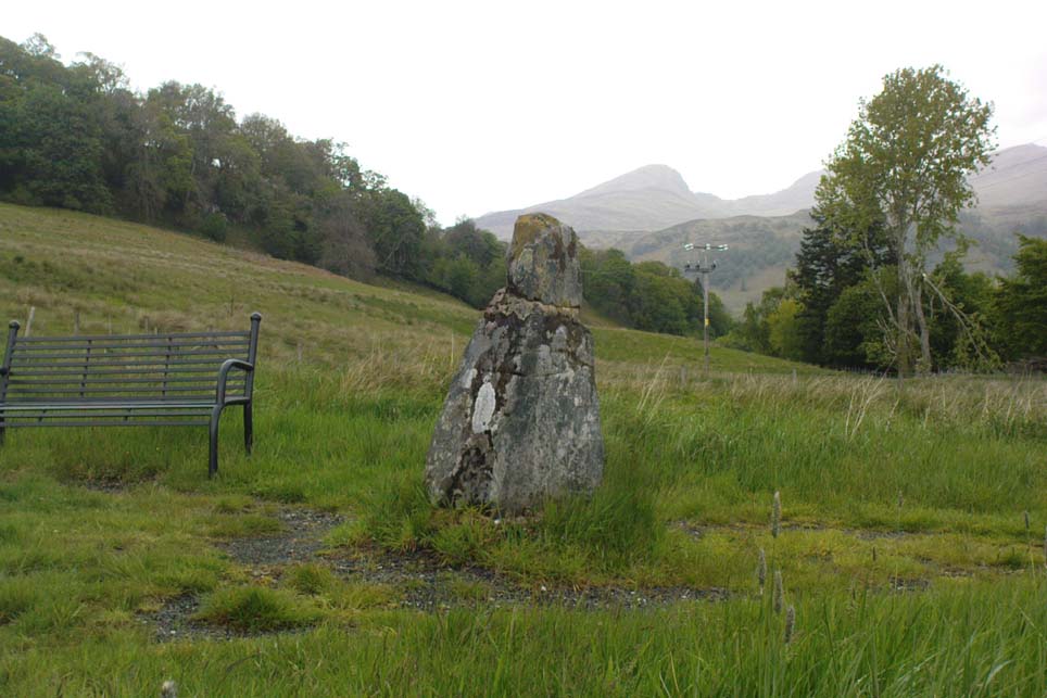
Another curious site in this quite beautiful mountainous arena. Thought to have originally stood by the rounded fairy knoll a bit further up the hill, no one knows for sure when the stone was moved to its present position—but locals will tell you how the curious knob-end atop of the stone was also a later addition to the fallen original, when it was resurrected in the latter half of the 19th century. C.G. Cash (1912) also found the fairy mound and its companions on the slope above to be of interesting, wondering, as I have, that “they might have been burial mounds.” The local historian William Gillies (1938) said of the stone:
“Both the Old and New Statistical Accounts of the parish of Killin make reference to a site near the village that had been pointed out from time immemorial as the burial place of Fingal, the hero of Celtic folk stories. At this point, which is in the middle of a field immediately behind the schoolhouse, there is a standing stone 2 feet 8 inches high and 5 feet in girth. The stone had fallen, but in 1889 it was re-erected by Mr Malcolm Fergusson, a patriotic native of Breadalbane. Without any reference to the original arrangement, a smaller stone was fixed on the top, and others were placed near it. The lands in the vicinity of Fingal’s Stone used to be called Stix. The name suggests that here, as at Stix between Kenmore and Aberfeldy, there were a number of standing stones, of which this one alone remains.”
And it certainly smells that way… Yet no further monoliths have been found hereby or on the slopes above.
Folklore
Reputed to be a stone that marks the grave of the hero-figure, Fionn. Local historian Duncan Fraser (1973) told that:
“Killin is steeped in history and one of its memorials of the past is a standing stone in a field behind the school, that is said to mark the spot where the mighty Fionn lies buried. He is believed to have died about the end of the Iron Age, in 283 AD.”
Gazing N, to the Cailleach
William Gillies (1938) also reported how tradition said that an early church and graveyard was once to be found at the original site of Fingal’s Stone. Legends of Finn, his magick and his encounters with both faerie and men are found all over the landscape in this neck o’ the woods….
References:
Cash, C.G., “Archaeological Gleanings from Killin,” in Proceedings of the Society of Antiquaries of Scotland, volume 46, 1911-12.
Fraser, Duncan, Highland Perthshire, Standard Press: Montrose 1973.
Gillies, William A., In Famed Breadalbane, Munro Press: Perth 1938.
Wheater, Hilary, Killin to Glencoe, Appin Publications: Aberfeldy 1982.
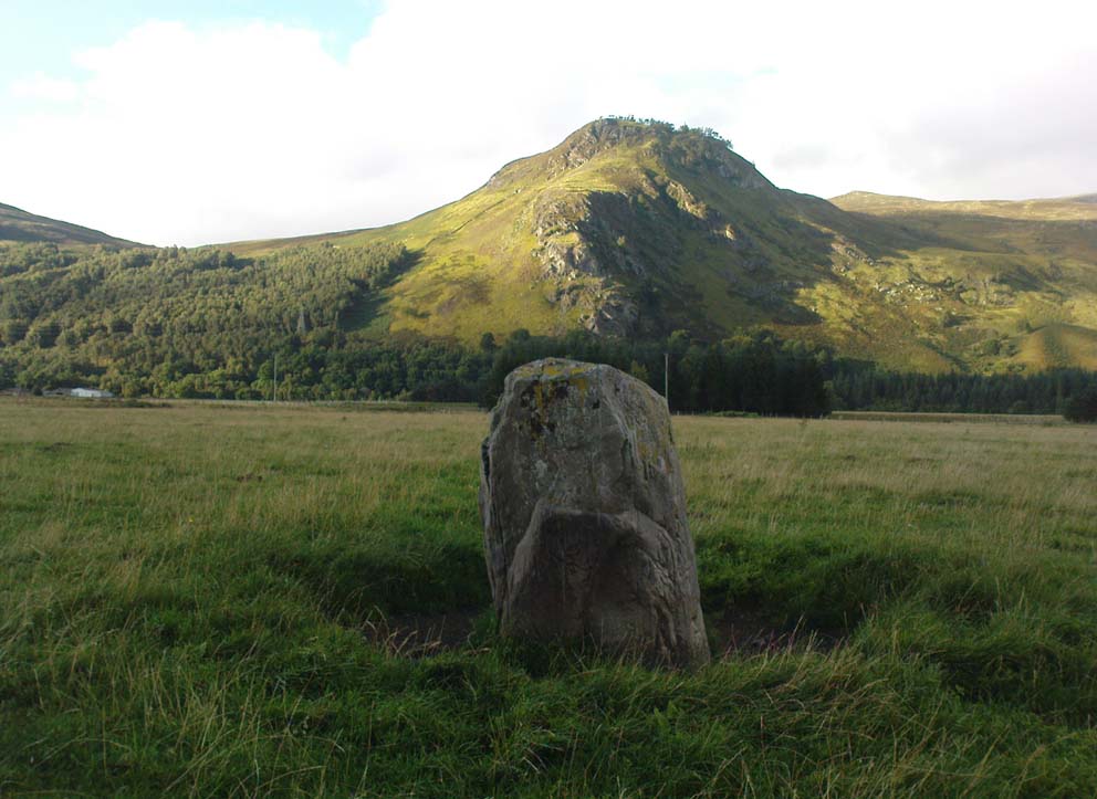
From the lovely village of Kinloch Rannoch, take the south road over the river that heads (eventually) to Aberfeldy. 3-400 yards along, another small road meets with the one you’re on, on your right. Stop here! Then look across at the field ahead of you, on your left, and you’ll see a small standing stone amidst the green. That’s it!
Archaeology & History
This is a small, squat but impressive standing stone, less than 4 feet tall, set amidst a beautiful landscape which catches the eye in every direction. Found close to the remains of several prehistoric cairns, it seems probable that funerary associations would have happened here, although direct evidence is lacking.
Folklore
Clach na Boile, looking south
Although I can find nothing specific to account for the Gaelic meaning (“stone of fury”) of the monolith, on the other side of the road in the trees is the old house of Innerhadden, where a curious ghost story told how an old inhabitant there was helped by the spirit of one who died in the Battle of Culloden. (Cunningham 1989)
References:
Cunningham, A.D., Tales of Rannoch, Perth & Kinross District Library 1989.
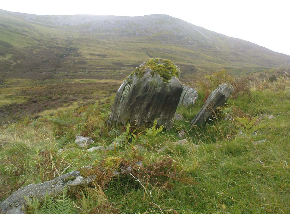
Follow the same directions to reach the Allt Leathan enclosure and hut circles. Walk along the eastern side of the hill on which the enclosure mainly sits, and as it slopes down the hill, you’ll note an odd-shaped stone leaning at an angle less than halfway down.
Archaeology & History
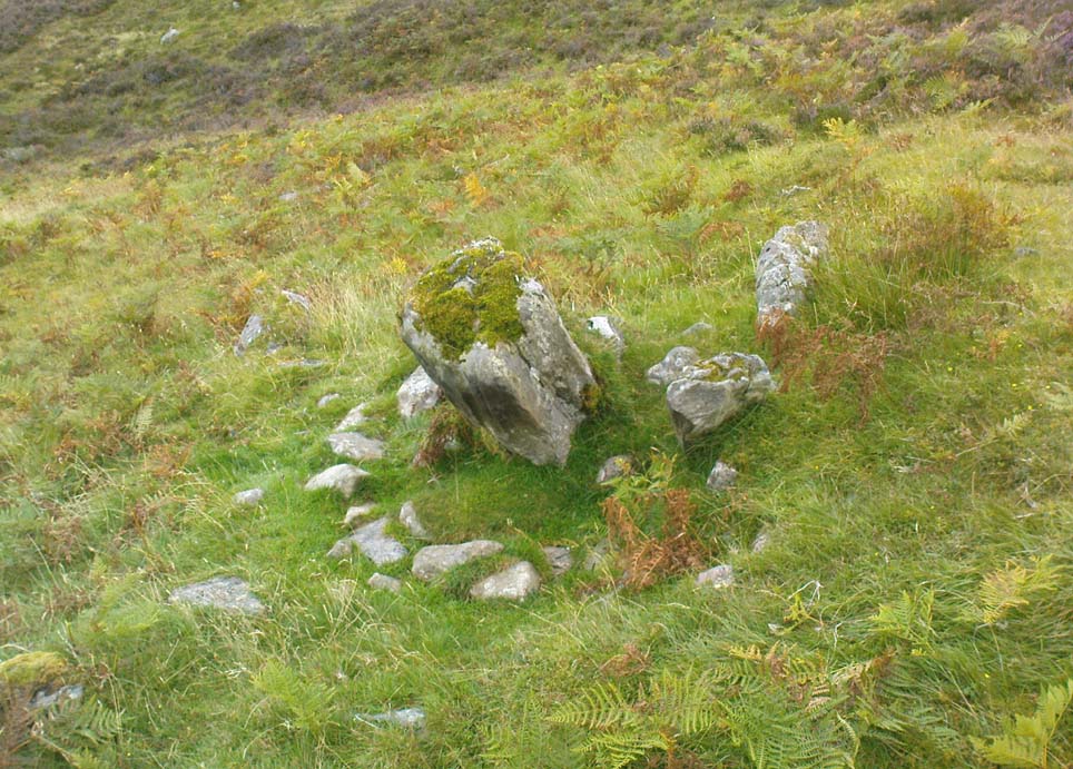
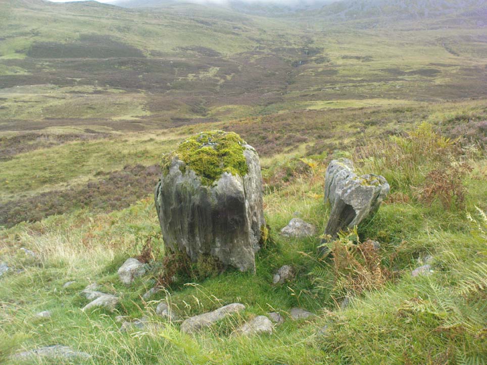
A truly curious and fascinating site, not previously recorded, but found by Paul Hornby on August 7, 2012, during a venture to explore the nearby settlement and hut circles around Meall Dubh. On the eastern slope over the edge of the Allt Leathan enclosure, with its hut circles and possible cairns, we see this upright worn stone, leaning at an angle, which would stand nearly 5 feet high if pushed properly upright. It is found in association with two other smaller stones, all of which stand and lean in the same direction.
Possible cairn remnants surrounds base of stone…and again
Around the base of the main stone is a scatter of small rocks, as if suggesting that a cairn was once next to the standing stone, perhaps inferring that the stone marked a tomb. There is also a very distinct line of walling running along the axis of the upright stones, meaning that we cannot discount the possibility that the monoliths here were connected with a walled enclosure in some capacity. And considering the excess of other prehistoric remains close by, this may be more likely than not!
‘Stone Circle’ (destroyed): OS Grid Reference – NS 86 95
Archaeology & History
In Alex Wilson’s (1901) rare work he gives the only reference of what may have been a stone circle once found in the township of Tullibody. On a talk given at the Alloa Archaeology Society in the 19th century, the site was mentioned by one of the speakers in his talk on the standing stones of Stirlingshire and district. Mr Wilson told us:
“…at a meeting in November 1871, Rev. Mr Bryson made one of his first speeches before the Society, and spoke of Boulders found in the district, and how these were gradually disappearing owing to the utilitarian spirit of the age. Mr Bryson related how that he had been informed that about 60 or 70 years ago there existed seven or eight boulders round about the Boulder at Tullibody, which Mr Duncan had spoken of.”
This is a brief but intriguing account! Whether we can ascribe the “seven or eight boulders” in the description as merely glacial erratics, or whether the ruins of a stone circle were here as the description seems to imply, we don’t know. If anyone has any additional information they can add to this account, please let us know.
References:
Wilson, Alex, Review of Proceedings since Inauguaration, Alloa Society of Natural Science and Archaeology, Buchan Bros: Alloa 1901.
Chambered Cairn (destroyed): OS Grid Reference – NS 58 76
Also Known as:
Blochairn 2
Canmore ID 44421
STR 3 (Henshall)
Archaeology & History
Close to the ruined Craigmaddie Muir cairn could once have seen a companion, of roughly the same size and structure and made up of thousands of small stones, covering a long internal chamber. It was described in David Ure’s (1793) early history work on the area which, even then, thanks to “frequent dilapidations, will soon be annihilated.” The cairn was included in A.S. Henshall’s (1972) magnum opus in which she wrote:
“There was a second cairn in the vicinty of Craigmaddie Muir I. It was also ‘of an elliptical shape.’ Writing in 1793, Ure says that it ‘was laid open last year, and, though not so large as the other, was of the same construction, which seems to be Danish. Some of the stones placed in the rows at the bottom are considerably large… Among the contents, upon opening…were urns… One of the fragments of an urn is ornamented, near the mouth, with two shallow grooves. The diameter of the circle of which it is a segment seems to have been at least 20in.”
Fragments of human bones were also found within the site, but the entire cairn was sadly destroyed a long time ago. In the Stirlingshire Royal Commission report (1963:1) it was speculated that the urn found herein,
“must have been either a neolithic vessel or a cinerary urn. In view of the method of construction of the chamber it may be assumed that both cairns were related to the Arran or Clyde-Carlingford types.”
References:
Henshall, Audrey Shore, The Chambered Tombs of Scotland – volume 2, Edinburgh University Press 1972.
Royal Commission on the Ancient & Historical Monuments, Scotland, Stirlingshire – volume 1, HMSO: Edinburgh 1963.
Ure, David, The History of Rutherglen and East Kilbride, Glasgow 1793.
Balbirnie stone circle – with Marion checking it out!
Take the A92 road running north out of Glenrothes towards Freuchie and, after a couple of miles out of town, you’ll hit the B969 road on your left. Across from here on the other side of the road, you’ve just passed a small B-road that takes you to Markinch. That’s where you need to be! Go along there for less than 100 yards and turn first right, swerving along the tree-lined road for 200 yards or so. Watch out, just before the first house on your left, for a footpath which leads into the woods. Walk down it, barely 10 yards!
Archaeology & History
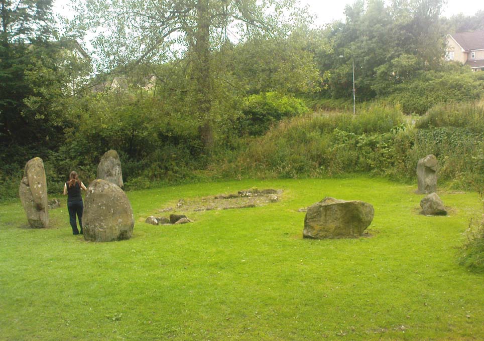
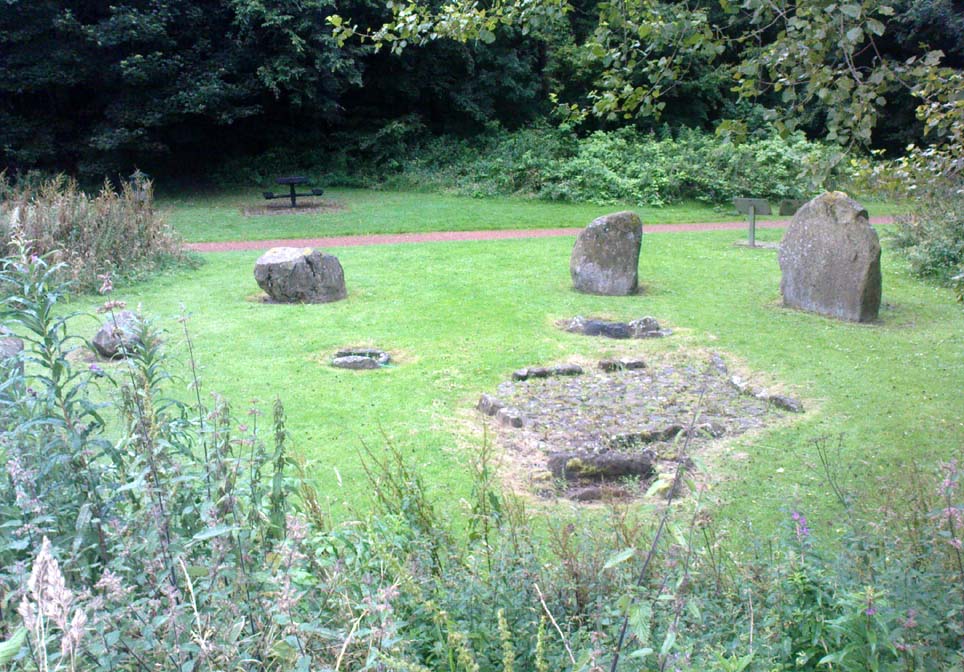
This is a lovely megalithic ring in a lovely setting – albeit a new one. The circle was originally positioned some 125 yards northwest of here and would have been destroyed, but was thankfully reconstructed by Fife Council before road-widening of the A92 was done. And the job’s a good one! But as Burl (2005) tells, this wasn’t the first time Balbirnie had been threatened with damage:
The southeast stones & cistsBalbirnie from the roadside, looking SE
“With some stones removed in the eighteenth century, dug into in 1883 when bones and sherds were found, damaged by trees, it was finally excavated and restored in 1970-71,” before the main road was built. Thankfully it’s still here – and an excellent stone circle it is! However, the reconstructed site here doesn’t show the circle in its entirety. Originally there were ten standing stones making up the ring, as opposed to the seven you can see today.
The site was built amidst the scatter of other larger, and once more impressive, mythically important monuments than the circle – but it’s as likely that the circle added more to the sacred dimensions of the region as a whole when it first came to be built. For on the other side of the A92 we can still see the denuded remains of the Balfarg Riding School Henge, with imitations of its internal upright posts resurrected into position to give an idea of what once stood inside the sacred enclosure. And then about 200 yards west of that, the gigantic Balfarg Henge is impressively surrounded by a modern housing estate, built with the henge in mind, with its outlying megaliths and internal level surface area graciously intact. It’s a truly impressive prehistoric area all round, although the Balbirnie stone circle was built some considerable time after the two henges had been done, many centuries later…
Before the circle was moved, the consensus profile of the site was that given by the Royal Commission (1933) lads following their visit here in June 1925, when they told it looked like this:
Royal Commission ground-plan, c.1933
“At the southern end of a small wood on the east side of the main road from Kirkcaldy to Falkland, about 180 yards south of Balbirnie Lodge, are the remains of a large circular cairn and of the setting of standing stones by which it was once surrounded… The circle, which has had a diameter of some 48 feet, has been composed of sandstone boulders. Four of these are still in place, but one other on the southeast has been slightly displaced, while against the stone on the northeast lie two large boulders, which apparently have been transferred to this position. Any other stones that may once have existed have been removed or destroyed. The greatest height above ground of any of those that survive is 5 feet 6 inches, while one, which rises no more than 2 feet, measures in circumference as much as 9 feet 9 inches at the base. The cairn itself seems to have been broken into at two points. No record of these excavations appears to be extant, but a number of fragments of cinerary urns from the site are preserved in the National Museum. These indicate that, as might have been inferred from its general character, the monument was sepulchral and dates from the Bronze Age.”
Sepulchral indeed. When the stone circle was excavated at the beginning of the 1970s by J.N.G. Ritchie (1974) and his mates, it was discovered this was a primary function of the site. As Burl (2000) wrote:
“At Balbirnie patches of cremated bone lay underneath some circle-stones. Whatever the ceremonies here they were interrupted when the site was converted into a cemetery. Four or five cists associated with a late beaker and a jet button were constructed within the ring. The date of about 1650 BC came from wood alongside the beaker. Stretches of low walling were put up between the stones forming a continuous barrier…analogous to the embanked stone circles elsewhere in Britain that seem generally to belong to a period in the mid-second millennium… But the first cists did not long remain undisturbed and were seemingly rifled when later cists were built that contained the cremations of women and children… One of these later cists held a food-vessel and a flint knife.
“The stone circle was further abused. A low cairn was piled over all the cists. Sherds of deliberately broken urns, one with barley impressions, were scattered amongst the boulders, intermingled with small coagulations of burnt human bone. This last phase at Balbirnie occurred late in the second millennium BC, for a C-14 determination of…1200 to 900 BC came from the land surface that had built up within the ring during the centuries while the stone circle remained open to the weather.”
Measuring 49 feet across at the widest, this flattened ellipse also possessed a curious rectangular section of laid stone, near the middle of this circle, almost ‘Roman-road’ like in appearance and covering about a quarter of the internal arena. It’s visible today at the reconstructed site and looks almost intrusive! Measuring some 11 feet by 9 feet, the flat stone surface has been suggested as a place where corpses were rested.
Also found within two of the tombs inside the circle were the cup-and-ring marked stones of Balbirnie 1 and Balbirnie 2, showing yet again the relationship that some of these carvings have with spirits of the dead.
References:
Burl, Aubrey, “Intimations of Numeracy in the Neolithic and Bronze Age Societies of the British Isles (c.3200-1200 BC),” in Archaeological Journal, volume 133, 1976.
Burl, Aubrey, Rings of Stone, BCA: London 1979.
Burl, Aubrey, The Stone Circles of Britain, Ireland and Brittany, Yale University Press 2000.
Burl, Aubrey, A Guide to the Stone Circles of Britain, Ireland and Brittany, Yale University Press 2005.
Denston, C.B., “The Cremated Remains from Balbirnie, Fife,” in Archaeological Journal, volume 131, 1974.
Ritchie, J.N.G., “Excavation of the Stone Circle and Cairn at Balbirnie, Fife,” in Archaeological Journal, volume 131, 1974.
Royal Commission on the Ancient & Historical Monuments, Scotland, Inventory of Monuments and Constructions in the Counties of Fife, Kinross and Clackmannan, HMSO: Edinburgh 1933.
Acknowledgements: Huge thanks to Marion Woolley for getting us out to see this and the related neolithic monuments. Cheers m’ dears!
Take the same directions as if you’re going to Dave’s Stone, to the eastern end of Rivock Edge itself. Then take less than 10 steps further onto the moor itself and you’ll see the stone pretty low down in the heather. (please note that grid-reference above needs revising)
Archaeology & History
…and looking straight down!
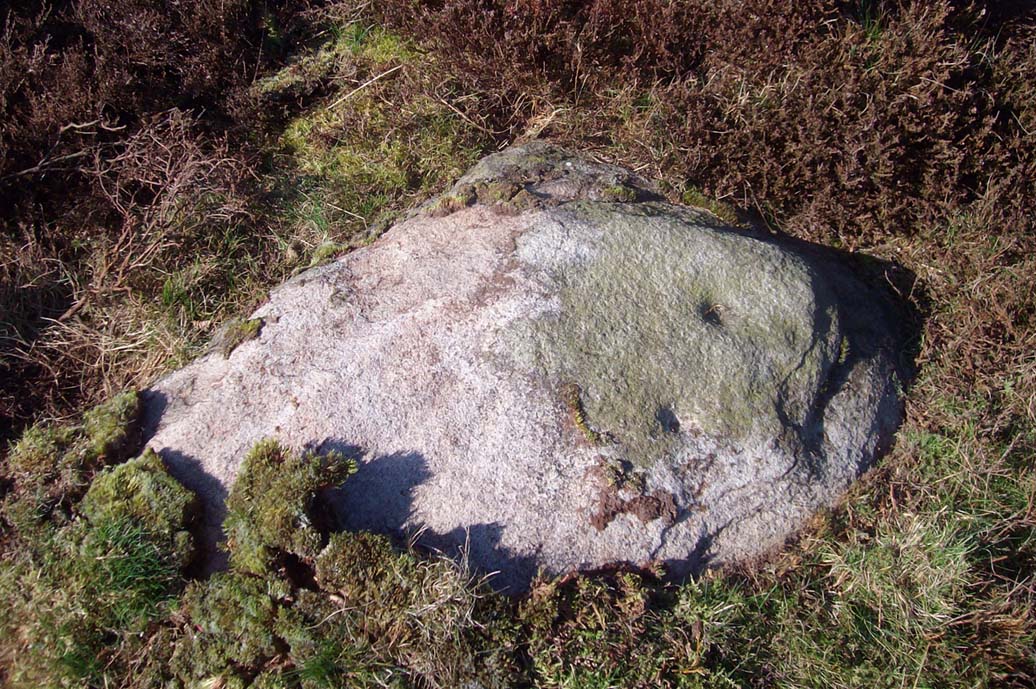
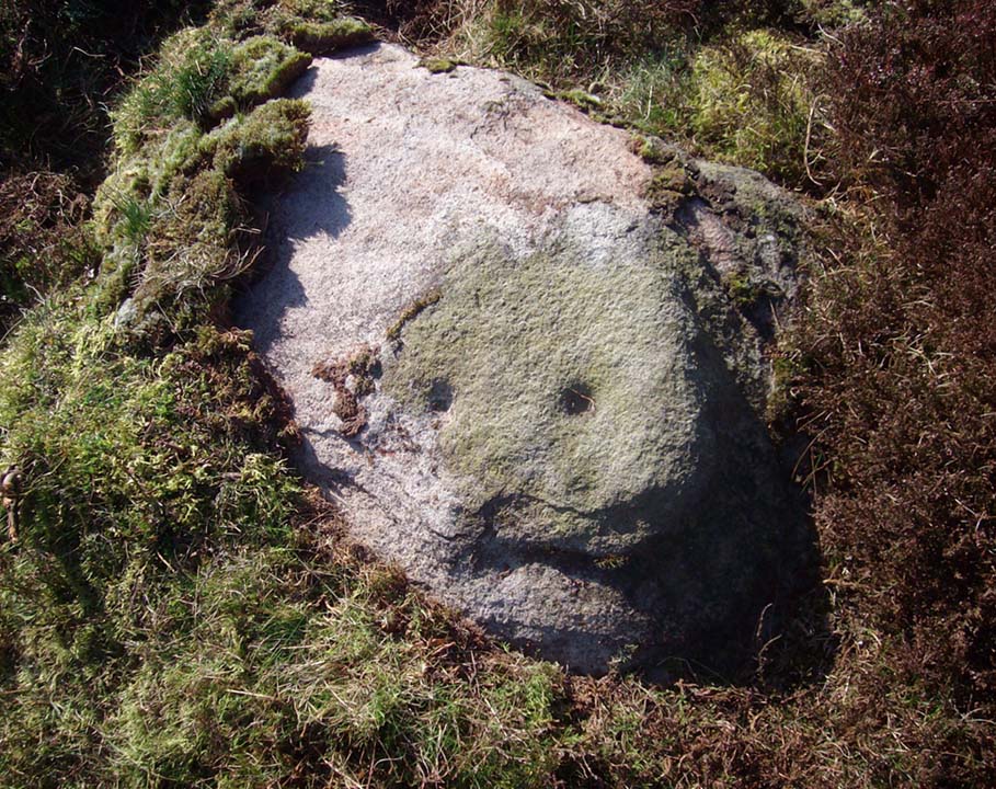
Found about 10 yards onto the flat ridge south of Dave’s Stone cup-marked stone, the vegetation covering this carving had only recently been brushed off when we revisited the place in 2012, by members of the Ilkley CSI team in their own survey of the area. As you can see, it’s a simple design of just two well-preserved cups on a small rounded stone. What may be the remains of a very faint ring arc is possible over one of the two cups. Nowt much more to say really!
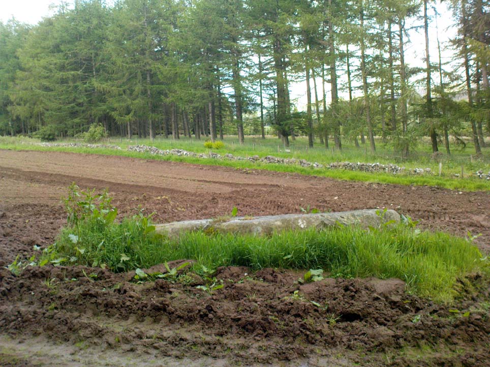
From Blackford on the north side of the A9, cross over and take the small B-road which quietly runs up and over Sheriffmuir towards Dunblane. After a mile, keep your eyes keen for the approaching woodland on your right-hand side; for in the field just before the woods, you’ll see a patch of grass near the corner of the field with a long stone poking out of it. That’s it!
Archaeology & History
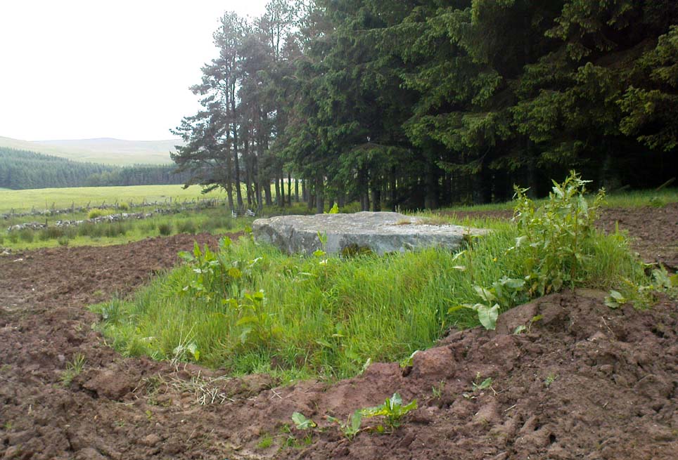
It seems that very little has been written about this monolith in any of the archaeology texts, but it’s ascribed locally to be a fallen standing stone. The site’s described in Finlayson’s (2010) fine local megalith guide where he points out how it’s in line with other nearby standing stones at Gleneagles and the White Stone – and the line is damn close!
…and from another angle…
With a quartz vein running through it, the stone lays some thirteen feet long and was, at some time in the not-too-distant past, readied to be quarried, as evidenced by the chisel-marks cut into it, prior to the usual destruction. But this time, for some reason, someone must have come to the rescue and prevented its demise…thankfully…
The farmer annually cuts around the fallen stone, shaped like a long boat (hence the name), near the top corner of the field. It would have looked damn good when stood upright, standing about ten feet in height and visible for a good distance. But today it’s quite forlorn laid here, seemingly alone, in this quiet part of the country, and is probably only one of interest to hardcore megalithomaniacs amongst you!
References:
Finlayson, Andrew, The Stones of Strathearn, One Tree Island: Comrie 2010.
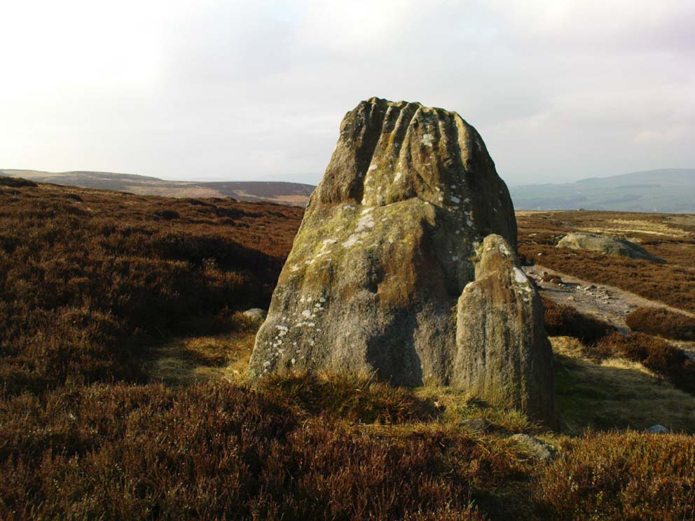
From Cow & Calf Hotel head onto the moor above you, following the same directions to reach the ornately carved Idol Stone (and its immediate companions). Ahead of you on the same footpath, about 100 yards along, as it begins to slope up the hill further onto the moor, you’ll see a large upright pyramid-shaped stone, about 8 feet all, right at the side of the path. Y’ can’t miss it!
Archaeology & History
Deep cups & lines on top
Although ascribed as a cup-marked stone in usual surveys, the cup-markings on top of this rock are seemingly Nature’s handiwork. There is a possibility that cup-markings were carved into the top of the stone, many thousands of years ago, but due to the centuries of wind and weathering, we cannot in anyway assess the curvaceous bowls and lines running across and from the top of this rock to be artificial.
Folklore
The name ‘Idol Stone’ seems to have come about as a result of the judaeo-christian Victorian obsession of satanic idolatry in all things natural – which many of them still fear. Sadly there are no early accounts of practices of idolatry at this rock, until it was used by chaos magickians in the formative years of that Current in the 1980s.
References:
Bennett, Paul, The Old Stones of Elmet, Capall Bann: Milverton 2001.
Boughey, K.J.S. & Vickerman, E.A., Prehistoric Rock Art of the West Riding, WYAS: Leeds 2003.
Forrest, C. & Grainge, William, A Ramble on Rumbald’s Moor, among the Dwellings, Cairns and Circles of the Ancient Britons, W.T. Lamb: Wakefield 1868-9.
Hedges, John (ed), The Carved Rocks on Rombald’s Moor, WYMCC: Wakefield 1986.
Holmes, J., “A Sketch of the Prehistoric Remains of Rombald’s Moor,” in Proceedings of the Yorkshire Geological Society, volume 9, 1887.
Speight, Harry, Upper Wharfedale, Elliott Stock: London 1900.