Ashlar Chair, Burley Moor, West Yorkshire

Legendary Rock:  OS Grid Reference – SE 12075 44833
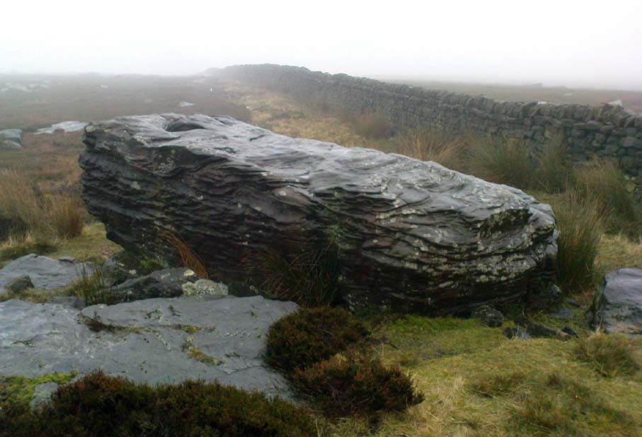
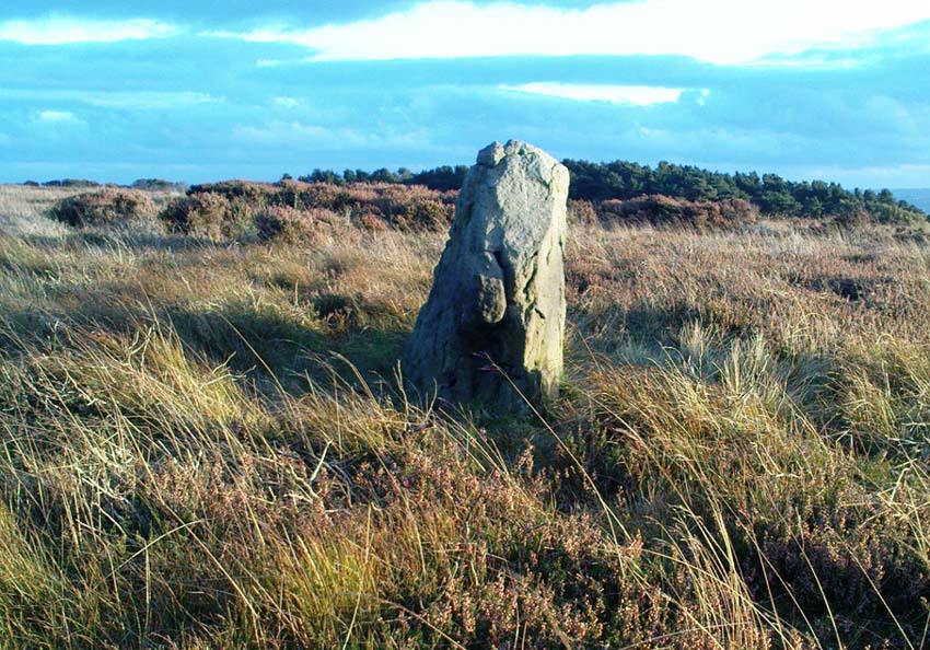
Ashlar Chair, looking southeast

Also Known as:

  1. Carving no.111 (Hedges)
  2. Carving no.115 (Boughey & Vickerman)
  3. Druid’s Chair
  4. Etching Stone

Getting Here

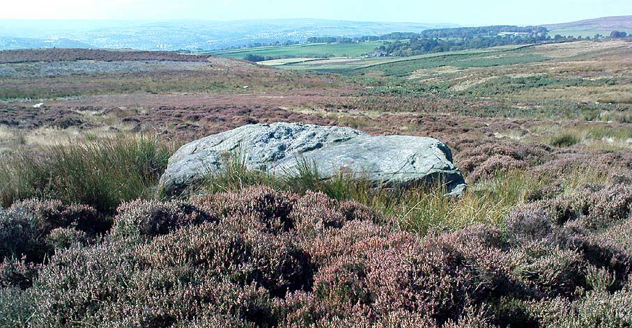
There are two large boulders here, one of which was deemed the Ashlar many moons back. You can approach it from the lazy way: park y’ car at the top of the road by the Whetstone Gate TV masts and walk east right along the boundary path till you get here. The better way is from Twelve Apostles: from there walk a coupla hundred yards north to the Lanshaw Lad boundary stone, where a small path heads west. Along here for another coupla hundred yards, then hit the footpath south for the roughly the same distance again. You’ve arrived!

Archaeology & History

The Ashlar Chair is ascribed in folklore, said Harry Speight (1892), “to be a relic of druidism,” as one of its titles in ages past was the Druid’s Chair.  In the nineteenth century it also became known as the Etching Stone, (Smith 1961-63) but it has retained its present title for more than two hundred years.  Shaped more like a couch than a chair, its present title—the Ashlar—is important in ritual Freemasonry, which has two aspects to it: the ‘rough’ and the ‘perfect’.  The first represents the neophyte; the latter, the illumined one.  Oaths are sworn on the ashlar, and laws are spoken from it.  In its higher aspect it is representative of the spiritual maturity  of evolved man.
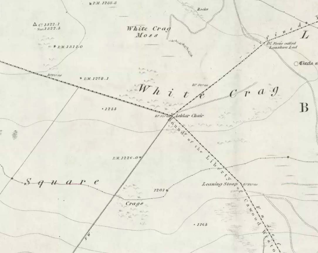
Ashlar Chair on 1851 map

Although there are no public records as to who gave the site its present name, the land which lays before it, The Square, is an even greater indicator that this rock was was considerably more than just a curious place-name, for the open moorland that is overseen from Ashlar Chair—The Square — is 396,000 square yards of flat open heathlands that have never been archaeologically explored.  The Square is also one of the most important elements of Freemasonry: representing the manifest universe, its laws are spoken from the Ashlar. (Jones 1950)

Between the two of them, represented here in the landscape near the very tops of these moors, we have a form of late geomancy, although the names of our geomancers are nowhere to be found.  It is obvious though, simply from the name of the land, that dramatic ritual of some form was enacted here.  In recent times, ritual magickians from differing Orders have found the place most effective, as have wiccan folk and other pagans who have frequented it at the summer solstice.  The possibility that some members of the Grand Lodge of ALL England (a legendary Masonic Order, said by the modern London masons not to have existed until the eighteenth century) gave this place its name is not unreasonable.  Records show that in the fourteenth century at least one member of the Order, Sir Walter Hawksworth, frequented ritual circles on these moors; and another member of the same Lodge from the nearby Washburn valley was an ally to the Pendle and Washburn witches who, we know, met on these moors at Twelve Apostles stone circle and probably the Ashlar.  But it proves nothing I suppose. (I tend to believe (not a necessarily healthy viewpoint) that the Grand Lodge did use the Ashlar as one of their moot points, along with the Pendle and Washburn witches.)

Its primary geomantic attribute is as an omphalos.  Geographically the Ashlar Chair is the meeting-point of Bingley, Burley, Morton and Ilkley moors and, metaphorically speaking, when you stand here you are outside the confines of the four worlds yet still a purveyor of them.
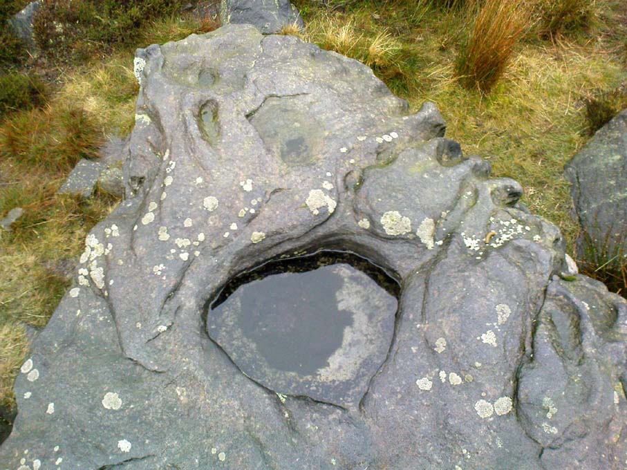
Nature’s cups-and-grooves on the Ashlar

Upon the large rock itself it are carved the faint initials, “MM, BTP, ISP and IG, 1826.”  Several early records described cup-and-ring designs on the Ashlar: firstly in Forrest & Grainge’s (1868) archaeological tour; then in Collyer & Turner’s Ilkley (1885); and lastly by the great Yorkshire historian and topographer Harry Speight (1892, 1900), who said “it bears numerous cups and channels.”  Although we can see some of these on top of the Ashlar, they are mainly Nature’s handiwork.  It is possible that some man-made cup-and-rings once existed on the rock, but if so they have eroded over time.

References:

  1. Bennett, Paul, The Old Stones of Elmet, Capall Bann: Milverton 2001.
  2. Collyer, Robert & Turner, J.H., Ilkley Ancient & Modern, William Walker: Leeds 1885.
  3. Forrest, C. & Grainge, William, A Ramble on Rumbald’s Moor, among the Dwellings, Cairns and Circles of the Ancient Britons in the Summer of 1867 – Part 1, W.T. Lamb: Wakefield 1868.
  4. Jones, Bernard E., Freemason’s Guide and Compendium, Harrap: London 1950.
  5. Speight, Harry, Chronicles & Stories of Old Bingley and District, Elliott Stock: London 1892.
  6. Speight, Harry, Upper Wharfedale, Elliott Stock: London 1900.

© Paul Bennett, The Northern Antiquarian
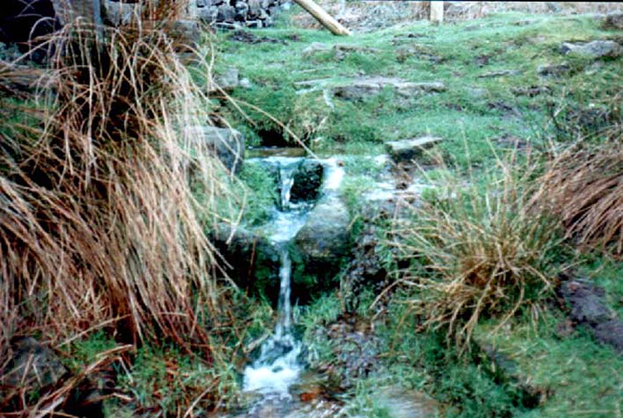

Horncliffe Well, Hawksworth Moor, West Yorkshire

Healing Well:  OS Grid Reference – SE 13214 43326

Also Known as:

  1. Horncliff Well

Getting Here

Horncliffe Well – as it once was

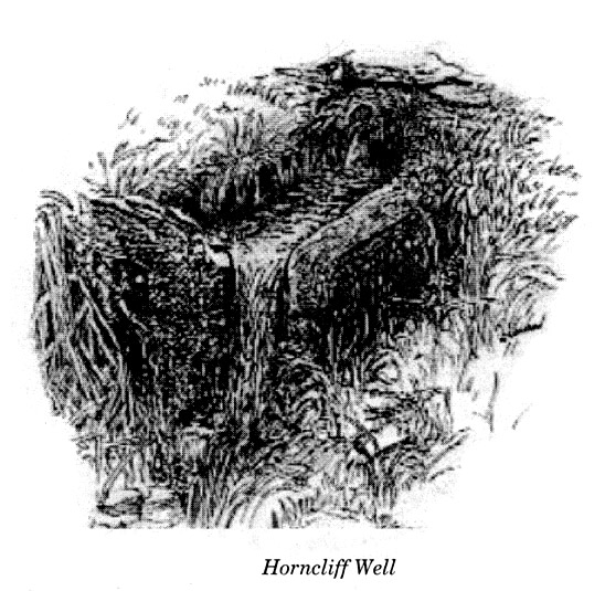
From the famous Dick Hudson’s pub on the south side of Ilkley Moor, take the road right (east) for a half-mile until you reach the large Weecher Reservoir just off the roadside on your right.  Less than 300 yards past the reservoir, a footpath takes you onto the moor itself.  Walk up the path for about ⅔-mile — crossing one wall, then walking roughly parallel with another on your right — until you reach a crossing of paths where there are 2 gates or stiles.  Take the lower of the two stiles, through the wall, but below the fence.  You’ll see an awful Yorkshire Water cover, which has just about destroyed the once-fine well that had always flowed here.  Below this, by the wallside, are the trickling remains of our old healing spring.

Archaeology & History

When I was a young boy, Horncliffe Well was the site we would visit every weekend as our first stopping-spot on our regular ventures exploring these moorlands — “from Wrose to Rombalds,” as we use to call it!  The old well was always very plentiful, strong-flowing, cold and truly refreshing.  It was undoubtedly the best water source on the entire Rombalds Moor region, never drying up.  Even in the great droughts of 1976 and 1995, after all others had just about failed, the waters at Horncliffe were still flowing as strong as ever, as they had always done.  But not anymore…

Edna Whelan’s old drawing

First described in land records of 1273 CE, this has always been a well of great repute and oral tradition told that this great old well never ran dry. It marked the ancient boundary point where the moorlands of Hawksworth, Burley and Bingley all meet.  By name alone it is associated with the nearby and curious Horncliffe Circle, whose status itself is unclear (the circle seems more a place of refuge or living than a true ritual site).

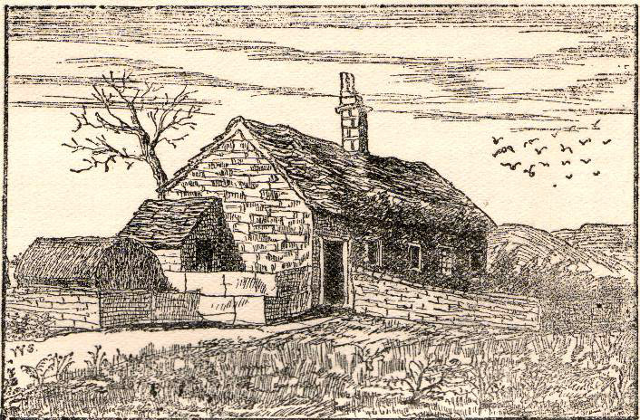
Horncliffe House around 1801

The remains of old buildings on the flat just above where the waters once flowed were built in much more recent centuries.  The building appears to have been started around 1799, for E.E. Dodds (1985) told that in 1800 it was used as a school for several years by local teacher Joshua Briggs.  J. Horsfall Turner (1907) published a copy of an old drawing of the school, as it was soon after construction.

Horncliffe Well was dug into by the privatized water company known as Yorkshire Water (owned by rich greedy fuckers) in the 1990s, who channelled most of its endless supply away for commercial benefit.  When their company was stealing the water from the moors, the workmen snapped an old markstone at its base next to the adjacent Horncliffe House (in ruins).  The waters had always flowed fast and freely, but after Yorkshire Water had finished their ‘work’ here, the great majority of Horncliffe’s water supply subsided considerably, leaving walkers, birds and animals to suffer from its demise.  In all sincerity, it’s to be hoped that good people someday will visit this once-fine site and return it to its previous healthy status.

Folklore

When we were kids we came here every weekend and got to know the old ranger who we’d meet either here or at the adjacent Horncliffe Circle, 250 yards NNE, where we’d sit and eat.  In the mid-1970s, he told us that the old well was once a site where the fairy-folk would play, around Mayday (beltane).  And though in later years I’ve sought for any information about this in all early antiquarian books that cover this area, I’ve never found any mention of this tale in print.  The old ranger knew the moors and its history better than anyone I’ve ever known and many old stories died with him after his death.

References:

  1. Bennett, Paul, The Old Stones of Elmet, Capall Bann: Chieveley 2003.
  2. Dodd, E.E., Bingley: A Yorkshire Town through Nine Centuries, M.T.D. Rigg: Guiseley 1985.
  3. Laurence, Alastair, A History of Menston and Hawksworth, Smith Settle: Otley 1991.
  4. Turner, J. Horsfall, Idle Upper Chapel Burial Registers and Graveyard Inscriptions, Harrison & Son: Bingley 1907.
  5. Whelan, Edna, The Magic and Mystery of Holy Wells, Capall Bann: Chieveley 2001.
  6. Whelan, Edna & Taylor, Ian, Yorkshire Holy Wells and Sacred Springs, Northern Lights: Dunnington 1989.

© Paul Bennett, The Northern Antiquarian

Harden Moor Cairnfield, Bingley, West Yorkshire

Cairns:  OS Grid Reference – SE 0757 3869

Getting Here

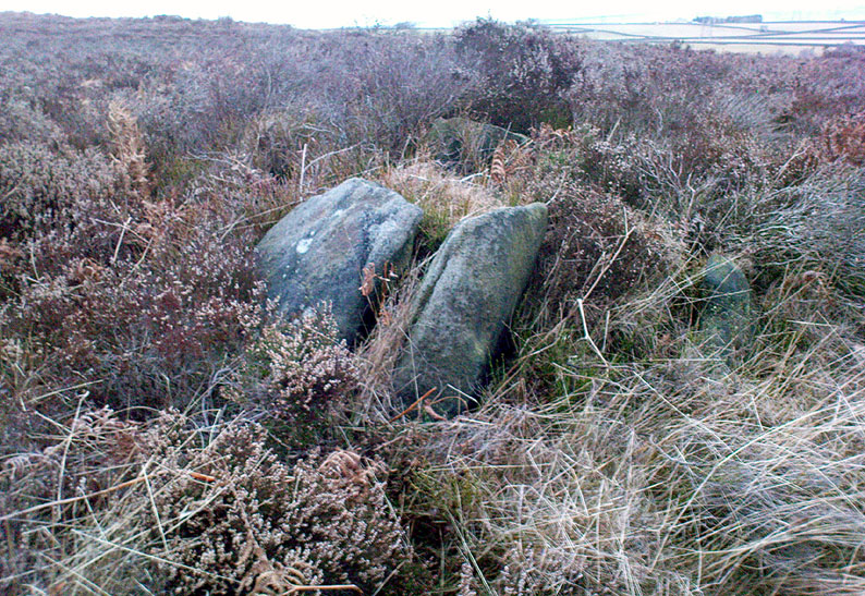
Overgrown cairn, looking north

Follow the same directions to reach the Harden Moor circle.  From here, walk down the footpath at its side down the slope for 100 yards and take the first little footpath on your left for 25 yards, then left again for 25 yards, watching for a small footpath on your right.  Walk on here for another 100 yards or so, keeping your eyes peeled for the image in the photo just off-path on your left, almost overgrown with heather. 

Archaeology & History

This is just one of several cairns in and around this area (I’ll probably add more and give ’em their own titles and profiles as time goes by), but it’s in a pretty good state of preservation.  Nothing specific has previously been written about it, though it seems to have been recorded and given the National Monument number of 31489, with the comment “Cairn 330m north of Woodhead, Harden Moor.” (anyone able to confirm or correct this for me?)

It’s a good, seemingly undisturbed tomb, very overgrown on its north and eastern sides.  Three pretty large upright stones, a couple of feet high, remain in position with an infill of smaller stones and overgrowth (apart from removing a little vegetation from the edges to see it clearer, we didn’t try disturbing it when we found it).  It gives the impression of being a tomb for just one, perhaps two people and is more structured than the simple pile-of-stone cairns on the moors north of here above Ilkley and Bingley.  Indeed, the upright stones initially gave the impression of it once being a small cromlech of sorts!  Other cairns exist close by, but until we get heather-burning done up here, they’re difficult to find – or at least get any decent images of them!

© Paul Bennett, The Northern Antiquarian

Harden Moor Stone Row, Bingley, West Yorkshire

Standing Stones (lost):  OS Grid Reference – SE 07 38

Getting Here

This site hasn’t been located. However, if it hasn’t been destroyed by the quarrying on the SW side of the moor, remains of it should still be found amidst the heather and would be a good discovery for any enthusiast.

Archaeology & History

The first notes I found about this place were those by archaeologist Sydney Jackson in 1956, who wrote:

“It would be interesting to know what Dr Richard Richardson, of Bierley Hall, Bradford meant when, writing about 1709, he said that Mr Benjamin Ferrand show him a ‘skirt of stones’ on Harden Moor, near to a row of stones placed in a line nigh two hundred paces in length some two feet above the heath, others hidden beneath it.” (my italics)

The undoubted man-made nature of this row of stones was emphasized by Dr Richardson when he wrote,

“That these stones were placed here by design, no person can doubt; but for what I end cannot conjecture, having never seen anything of this kind before.”

The great Yorkshire historian Harry Speight (1898) also came across the same antiquarian notes many years before and speculated how,

“it may be inferred from this that it had been a double row of stones, like the avenue of Maiden Castle in Swaledale.”

The ‘skirt of stones’ that were described here may be the well-preserved Harden Moor Circle.  However in recently finding the short essay of Peter Craik (1907) of Keighley, this idea may need re-assessing, as Craik clearly shows in his survey of the the nearby Catstones Ring earthwork, what he described as the “remains of a cairn” on the northern edge of that ring, giving us a different location for this lost stone row.

However, another potential position for our lost stone row that needs exploring is the one described by Butler Wood following an exploratory visit here with the Bradford historian, William E. Preston, at the beginning of the 20th century.  Mr Wood (1905) told of them both coming across some sort of earth-and-stone line “half-a-mile north of” the Catstones Ring, telling:

“Mr W.E. Preston and myself traced a short time ago on Harden Moor, remains of an entrenchment for a distance of 80 or 90 yards.  It faces south, and lies near Spring Head Heights.  The wall consisting of boulder and earth rising three feet above the soil, but there is no trace of a ditch.”

This is obviously half the length described by Richardson and Ferrand in 1709, but nearly two centuries separate the two accounts (the position of Mr Woods’ line is roughly SE 072 387; whilst that nearer to the Catstones Ring would be nearer SE 069 383).

I’ve searched the tops of this moorland a number of times hoping to locate this seemingly important megalithic stone row, obviously without success.  Further searches on the moor are needed after the heather’s been burnt back.

References:

  1. Craik, Peter, “Catstones Ring,” in C.F. Forshaw’s Yorkshire Notes & Queries, volume 3 (H.C. Derwent: Bradford 1907).
  2. Jackson, Sidney, “Harden Circle Found,” in Cartwright Hall Archaeology Group Bulletin, 2:1, July 1956.
  3. Speight, Harry, Chronicles and Stories of Old Bingley, Elliott Stock: London 1898.
  4. Wood, Butler, ‘Prehistoric Antiquities of the Bradford District,’ in Bradford Antiquary, volume 2, 1905.

© Paul Bennett, The Northern Antiquarian

Catstones Ring, Harden, West Yorkshire

Earthworks:  OS Grid Reference – SE 0680 3808

Also Known as:

  1. Blood Dykes

Getting Here

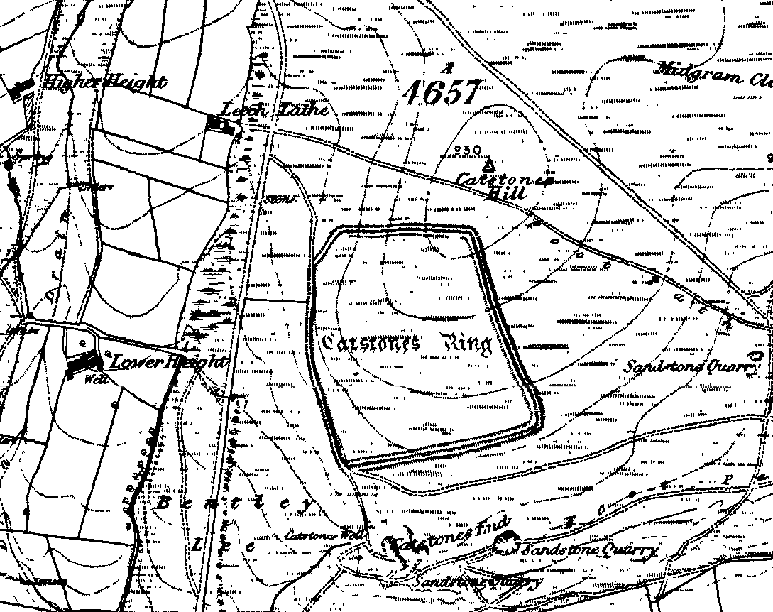
Catstones Ring on 1852 OS-map

Various ways here. From Keighley, go up the Halifax Road, first left after the Ingrow West train station, uphill, then up the long zizaggy road till you hit the pub at the crossroads.  Park up and walk along the road in front of the pub for 1-200 yards and look at the hill above you! Alternatively, from Bingley go up to Harden on the B6429 and literally just where the village ends, there’s a small right-turn (if you’re going past the fields on either side, you’ve just missed the turning!). Go up there till the road reaches the top and stop! Catstones Hill is in the heather over the wall on your left!

Archaeology & History

A somewhat anomalous earthwork site, with lots of archaeohistorical speculation behind it, but no firm conclusion as to its precise nature as yet.  Defined variously as an earthwork, an enclosure (for both people and cattle!) and a settlement by respective archaeologists over the years, there is little to be seen of the place on the ground and it doesn’t tend to bring raptures of delight to the common antiquarian. When William Keighley (1858) described this place, Catstones Ring was,

“enclosed on three sides by a considerable bank of earth, and bears evident marks of the plough. The country people believe it to have been an intrenchment or camp.”

Mrs Ella Armitage (1905) thought this site may have been “a prehistoric fort,” but said little more about it.  In the same year however, Mr Butler Wood (1905) gave us a much better account of the place, describing Catstones Ring as “the most striking earthwork in the neighbourhood of Bradford.”  His broader description told that:

“It encloses the crest and slope of a hill, and measures 266 yards on the east side (which is perfect), and 100 yards on the north side; the latter, however, being traceable at least 100 yards further across cultivated fields.  The south side is almost obliterated by quarries, while the western portion has disappeared altogether.  The fosse which surrounded this fine fortification is still visible on the eastern side.”

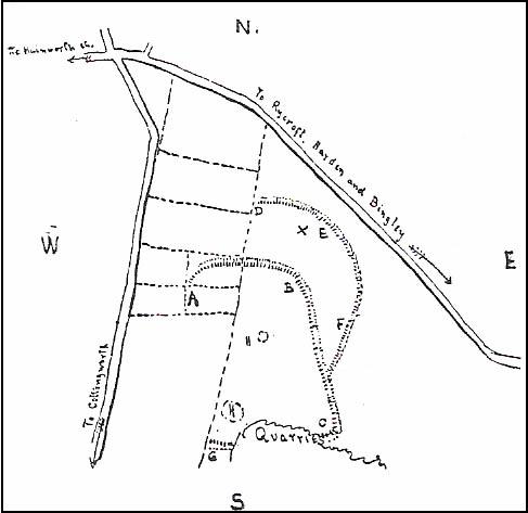
A couple of years later two short notes were made of the site in Forshaw’s Yorkshire Notes and Queries.  Peter Craik (1907) of Keighley described the dimensions of the main ring as being “110 x 320 yards (rough guess),” and he also described finding the remains of a cairn in the outer dyke section (marked as ‘X’ on Craik’s diagram, below).  On the nature of the site, he wrote:

“Catstones would appear to have been built as a defence against invasion from the south, for in contrast to the early defensible approach from that direction is the fact that to the  north lies the undulating expanse of Harden Moor, which for the most part is on a level with the ring, even the highest point in the immediate vicinity being without the main circle, though enclosed in a minor outwork.  The large extent of the ring makes it rather difficult to believe that enough men could be collected in the immediate neighbourhood to man the lines satisfactorily; and again as a shelter for cattle, etc, in time of war it does not appear to be well designed, for most of the interior would be commanded within easy range of arrows.  Certain old excavations exist within the ring; probably they were made in search of gravel or some such material, but is this conjecture certain?  Can they possibly mark the site of dwellings?”

J.J. Brigg (1907) followed up Craik’s short piece with the suggestion that the site was Roman in origin, saying:

“In showing the 6in map to Professor Bosanquet of Liverpool…he said there was no reason why it should not be Roman, merely because there is no masonry.  The Roman legions went into laager* every night, and it is quite possible that some very large body of soldiers halting there for the night might have thrown up an earthwork and planted thereon the stakes which they always carried with them for that purpose.”

But I think this is most unlikely.  Very little has been found here to give us a better idea of dates and function; and in a limited excavation here in 1962, no artifacts of any kind were located.  A little more recently, J.J. Keighley (1981) has suggested the site to be Iron Age in date, describing it as one of the most impressive sites of its kind in the region. The Catstones Ring is “a 6.5 hectare quadrangular ditched enclosure,” he wrote, which he thought had been much destroyed by the adjacent quarrying.

“Aerial photographs taken by the County Archaeology Unit in 1977 however, shows that the southeastern corner of the enclosure and parts of its southern ditch survived the quarrying. Villy (1921) observed an outwork to the north of the main enclosure, which was visible on aerial photographs taken in 1948, and the 1977 aerial photographs…show a possible annexe attached to the outside of the northeastern corner of the main enclosure.”

P. Craik’s 1907 drawing

This extended section of Catstones’ main earthworks were, in fact, first described in the article by Peter Craik (1907), as shown in the hand-drawn plan of the site here.  And in all honesty, virtually nowt’s been done since these early antiquarians diggings and essays.  The information from the present day Sites and Monuments Record says that the site is a “late prehistoric enclosed settlement” and that quarrying has destroyed much of the west side.

Folklore

Harry Speight (1892) reported the earthworks here to have been a site where a great battle once took place, between the local people and the early Scottish tribes.

References:

  1. Armitage, E., ‘The Non-Sepulchral Earthworks of Yorkshire,’ in Bradford Antiquary, New Series 2, 1905.
  2. Bennett, Paul, The Old Stones of Elmet, Capall Bann: Milverton 2001.
  3. Brigg, John J., “Catstones Ring,” in C.F. Forshaw’s Yorkshire Notes & Queries, volume 3 (H.C. Derwent: Bradford 1907).
  4. Craik, Peter, “Catstones Ring,” in C.F. Forshaw’s Yorkshire Notes & Queries, volume 3 (H.C. Derwent: Bradford 1907).
  5. Keighley, J.J., “The Prehistoric Period,” in Faull & Moorhouse’s, West Yorkshire: An Archaeological Survey to AD 1500 (WYMCC: Wakefield 1981).
  6. Keighley, William, Keighley, Past and Present, R. Aked: Keighley 1858.
  7. Speight, Harry, Chronicles and Stories of Old Bingley, Elliott Stock: London 1892.
  8. Villy, Francis, Some Intrenchments of Large Size in the Keighley District, Keighley 1908.
  9. Villy, Francis, “The Slag-Heaps of Harden,” in Bradford Antiquary, volume 6, 1921.
  10. Wood, Butler, ‘Pre-Historic Antiquities of the Bradford District,’ in Bradford Antiquary, New Series 2, 1905.

* a formation of armoured vehicles used for quick resupply or refueling.

© Paul Bennett, The Northern Antiquarian

Fenny Shaw Cup-Mark, Bingley Moor, West Yorkshire

Cup-Marked Stone:  OS Grid Reference – SE 11271 43565

Also Known as:

  1. Carving no.112 (Boughey & Vickerman)

Getting Here

Close-up of 'cup-mark'
Close-up of ‘cup-mark’
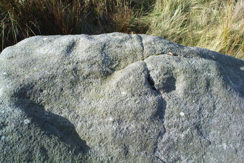
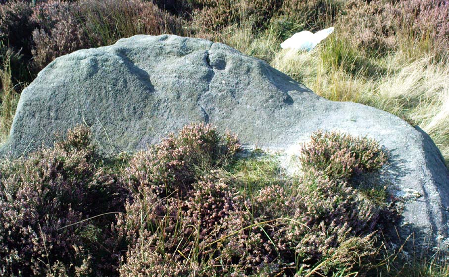
Fenny Shaw Cup-Marked Stone

Follow the same directions to reach the Big Rock carving.  From here walk less than 100 yards up the slope, veering to your left and where you reach the rushes (Juncus grasses), walk up and keep your eyes peeled for the singular upright rock.  Or as ‘Redkiteyorks’ said, go “up the slope 82.4 metres, 54.5 degrees(True) from IAG108 (Big Rock).” It aint hard to find really…

Archaeology & History

Another stone mainly for the purists amongst you.  Little has been written on this possible carving.  Boughey & Vickerman (2003) said simply:

“Large rough rock. Two possible cups on top and one further possible cup on W vertical face. Doubtful”.

References:

  1. Boughey, K.J.S. & Vickerman, E.A., Prehistoric Rock Art of the West Riding, WYAS: Leeds 2003.
  2. Hedges, John (ed.), The Carved Rocks of Rombald’s Moor, WYMCC: Wakefield 1986.

© Paul Bennett, The Northern Antiquarian

Todmor Stone, Bingley Moor, West Yorkshire

‘Standing Stone’:  OS Grid Reference – SE 1096 4261

Getting Here

From East Morton village, take the moorland road, east, and up the steep hill.  Where the road levels out there’s a right turn, plus (more importantly!) a trackway on your left which leads onto the moor.  Go up here, past the top of the tree-line; on for another 100 yards or so, then turn left into the heather.  You’ll notice the upright stone from the path, even if the heather’s deep.  Check it out!

Archaeology & History

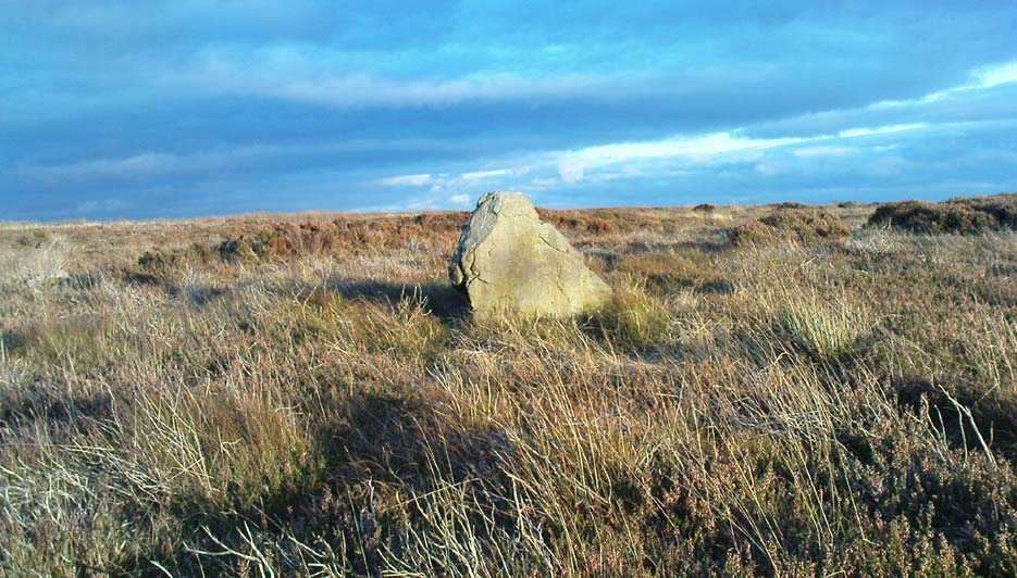
Todmoor Stone - looking east
Todmoor Stone – looking east
Todmoor Stone, looking south
Todmoor Stone – looking south

Nowt’s been said of this stone elsewhere — probably cos it’s in that halfway height between being classed as an authentic monolith, and that other of ‘dubious status’ (hence the reason I’ve highlighted this in inverted commas!).  But an additional reason that this three-foot-tall stone needs describing is the close association it has with cup-and-ring stones very close by; along with some previously unrecognised prehistoric walling and at least one Bronze Age cairn some twenty yards to the north.  We even find two distinctly archetypal ‘standing stone’ characters laid down in the heather 10 yards to the north, more than 4-feet long.  It’s a good looking stone and has a chunkier upright bedfellow in the heather some twenty yards to the west.  Along with the adjacent prehistoric remains here, the stone’s worth checking out!

The word Todmor was earlier spelt as ‘Todmerstones’ (1849) and is thought to relate to it being, in some form or another, ‘the boundary stones of the fox/es’.  The nearest boundary line is about 100 yards west of here.

References:

  1. Smith, A.H., The Place-Names of ther West Riding of Yorkshire – volume 4, Cambridge University Press 1961.

© Paul Bennett, The Northern Antiquarian

Elm Crag Well, Bingley, West Yorkshire

Healing Well:  OS Grid Reference – SE 1028 3907

Getting Here

From Bingley, take the B6429 road up to Harden.  After going up the wooded winding road for a few hundred yards, stop where it levels out.  Cross onto the right-hand side of the road and walk up the slope a little, veering to your right.  You’ll notice a small disused building just off the roadside, in overgrowth, with a pool of water.  You need to be about 100 yards up the slope above it!

Archaeology & History

Elm Crag Well, Bell Bank Wood, Bingley

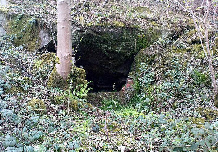
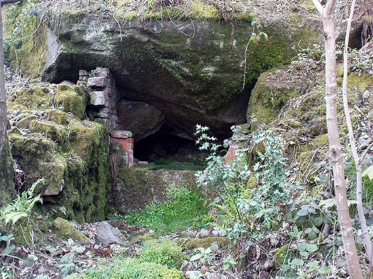
This is a beautiful old place.  If you walk straight up to it from the roadside, past the derelict building, you have to struggle through the brambles and prickly slope like we did – but it’s worth it if you like your wells!  However, if you try getting here in the summertime, expect to be attacked on all sides by the indigenous flora!  The waters here emerge from a low dark cave, in which, a century of three ago, someone placed a large stone trough.  When I first came here about 25 years ago, some halfwits had built an ugly red-brick wall into the cave which, thankfully, someone has had the sense to destroy and rip-out.

Shown on the 1852 Ordnance Survey map and highlighted as a ‘spring,’ Harry Speight (1898) gives a brief mention to this site, though refers us to an even earlier literary source when it was first mentioned. In John Richardson’s 18th century survey of the Craven area, he makes reference to an exceedingly rare fern, Trichomanes radicans, which was later included in Bolton’s classic monograph on British ferns of 1785.  In it, Bolton wrote that the very first specimen of this plant was “first discovered by Dr. Richardson in a little dark cavern, under a dripping rock, below the spring of Elm Crag Well, in Bell Bank.”

Elm Crag Well
Elm Crag Well

The waters from here come from two sides inside the small cave and no longer run into the lichen-encrusted trough, seemingly just dropping down to Earth and re-emerging halfway down the hillside.  But the waters here taste absolutely gorgeous and are very refreshing indeed!  And the old elms which gave this old well its name can still be seen, only just hanging on to the rocks above and to the side, with not much time left for the dear things.

References:

  1. Bolton, James, Filices Britannicae: An History of the British Proper Ferns, Thomas Wright 1785.
  2. Speight, Harry, Chronicles and Stories of Old Bingley, Elliott Stock: London 1898.

© Paul Bennett, The Northern Antiquarian

Big Rock, Fenny Shaw, Bingley Moor, West Yorkshire

Cup-and-Ring Stone:  OS Grid Reference – SE 11203 43517

Also Known as:

  1. Carving no.95 (Hedges)
  2. Carving no.108 (Boughey & Vickerman)

Getting Here

Big Stone Carving - looking SW
Big Rock Carving – looking SW

The best and easist way to get here is to drive west past Dick Hudson’s pub along the moor road for about a mile till you reach the left turn of Heights Lane. Stop here! (if you’re now going downhill to East Morton, you’ve gone past it) On the opposite side of the road is a gate and a footpath onto the moor at the spot called Fenny Shaw Low Well (small copse of woods adjacent to your right). Walk a quarter-mile up the path, bearing left where the path diverges (ignoring the ‘Private’ sign) and head for the derelict building. Less than 100 yards before it, notice the large boulder to your right, on the slope – that’s it!

Archaeology & History

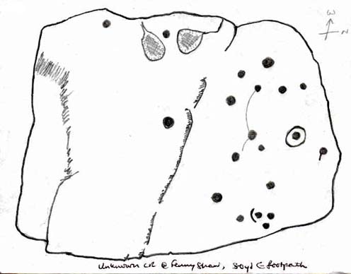
Old inaccurate drawing of the cups, c.1982
Old inaccurate drawing, c.1982

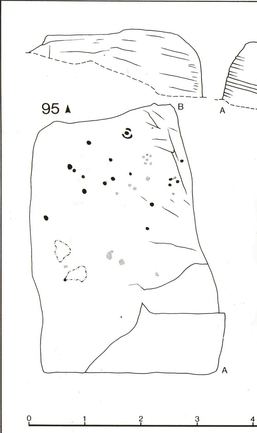
I first came across this on one of my countless ambles on these moors as a teenager.  It was a cold, windy day as I recall – hence the reason for my sketch of the stone being a bit vague!  The bit of paper on which I drew it, was included in one of my unpublished hand-written booklets.  A few years later an image of the carving appeared in Mr Hedge’s (1986) fine collection, in much better detail than my scratty little pic!

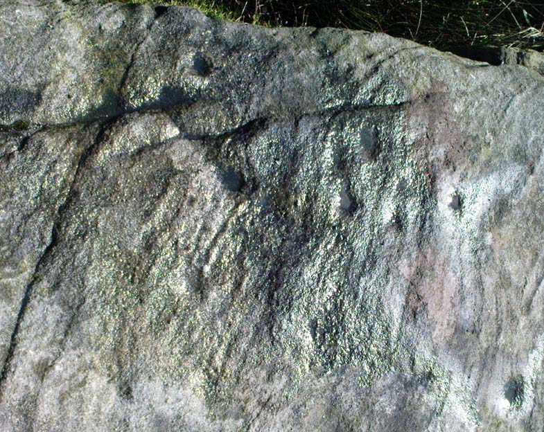
Some of the cups highlighted
Some cup-marks highlighted

It’s a ‘big rock’ and stands out on the slope here.  There’s at least one complete cup-and-ring which is visible on the northern edge of the rock and there are between 17 and 30 other cups scattered across its surface, which has been greatly eroded by our timely forces of wind, rain, ice and snow.

Hedges’ 1986 sketch

In ambling around looking at the other stones in the vicinity, along with finding the small Littlestone cup-marked rock further up the slope, we also found, just below the faded old Big Stone, another quite large rock upon which, quite recently, someone has decided to etch four complete cup-and-ring symbols.  These appear to have been done either to,

i) assess degrees and speed of erosion on rock carvings;

or,

ii) pure artistry.

Whichever it may be (and there’s been various cries of “vandalism” when such carvings have been etched by some folk on otherwise virgin rock over the years), let it be known that the Big Stone’s partner was etched c.2008-9.  Does anyone out there know who did this ‘new’ carving?

References:

  1. Boughey, K.J.S. & Vickerman, E.A., Prehistoric Rock Art of the West Riding, WYAS: Leeds 2003.
  2. Hedges, John (ed.), The Carved Rocks of Rombald’s Moor, WYMCC: Wakefield 1986.

© Paul Bennett, The Northern Antiquarian

Horncliffe Circle, Hawskworth Moor, West Yorkshire

Stone Circle:  OS Grid Reference – SE 13335 43532

Getting Here

Get to the famous Dick Hudson’s pub on the south-side of Ilkley Moor and go east for about 700 yards till you get to Weecher reservoir (posh doods go yachting there).  From here cross the road and walk on for 150 yards till you reach the stile which takes you onto the moors. Walk!  Follow the footpath and you’ll go over another wall before eventually hitting the beautiful fresh waters of Horncliffe Well (this has never dried up – even in the summers of ’76 and ’95).  Sit here for a while before heading for the circle which is on the east-side of the moorland fence just a coupla hundred yards up onto the moor (you’ll cross a coupla streams before reaching the site).  You’ll know you’re close when, to your left by the fence, you’ll see a boundary stone with the name ‘Thos. Pulleyn’ engraved on it.

Archaeology & History

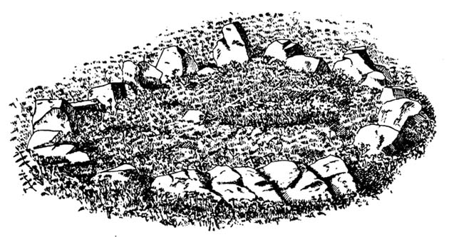
Early drawing of Horncliffe Circle (Speight 1898)

Horncliffe is a bittova strange site, inasmuch as we don’t honestly know precisely what it is, nor its age.  It used to be categorized as a ‘stone circle’, but this was abandoned many moons ago.  The inner circle of this ellipse-shaped monument was thought to have perhaps contained a burial, but Victorian excavations here found no such evidence; no burials have ever been found, though fires were evidently burned in the small central ring.

Nowadays I’m of the opinion that this was more for living-in, than any ritual site.  It ‘smells’ like that anyway (modern OS-maps now term it as an ‘enclosure’); and this may be borne out by the ancient name of the trackway travelling north from here called ‘Castle Gate’, meaning ‘entrance or path by the fortification.’  Faint ‘cup-markings’ reported by Harry Speight (1898) on the outer edge of the ring are very likely Nature’s handiwork.

Horncliffe is a double-ringed ellipse structure, surrounded on its northern side by a natural embankment of earth.  It was first mentioned in J.N.M. Colls’ (1846) survey, but more was said of it by James Wardell in 1869, who told that,

“there is a circle of stones of various sizes, from three-feet to five-feet in height; they are chiefly set upon their edges and are of sandstone grit.  This circle is forty-three feet in diameter and within it there is a smaller circle, composed of stones of the same composition…and set in the same manner.”

A few years later, the Yorkshire literary giant Harry Speight (1898) penned his first words about this curious circle, saying:

“The best example of a stone circle in the vicinity of Bingley lies on the moor close to the parish boundary, on land belonging to Mr Fawkes, of Farnley Hall.  It is a complete circle, consisting of about twenty stones, placed close together (a very unusual arrangement), from two to four feet high, the circumference being about 35 yards.  An excavation was made in the middle of it some years ago, when bits of flint were found, but no trace of burial.  It is built on a slight slope of the moor, facing the south, and is now much concealed by heather.  It is, doubtless, the oldest known evidence of man’s handiwork remaining in the neighbourhood of Bingley, and there is small doubt that it was originally intended to fence a burial, such “Druids’ Circles” being primarily meant to enclose places of sepulchre in the same way that walled enclosures came to be adopted round our churchyards.  A large flat stone on the top side, about three yards distant, is marked with cups and channels, and probably was in the centre of the circle originally.”

When Arthur Raistrick (1929) visited the circle, his measurements differed somewhat from those of Mr Wardell, telling the site to have diameters of 25 feet (east-west) and 32 feet (north-south), with 46 stones in the outer ring and 17 in the inner circle.

This is one of many sites on these moors that I slept at over the years when I was a kid.  It used to be a really peaceful spot that was rarely troubled by other visitors (not sure if it’s still the same though).

Folklore

Although we have nothing specific to the circle, around the nearby Horncliffe Well a coupla hundred yards away we had accounts told us by the old warden whose job it was to look after this moorland, that will-o-the-wisps had been seen here.  There is a seeming alignment to the equinoxes from here to Reva Hill – though this is more fortuitous than deliberate.  A dowsing survey found aquastats in and around the circle, but no plan of these were ever made.

References:

  1. Bennett, Paul, The Old Stones of Elmet, Capall Bann: Milverton 2001.
  2. Colls, J.N.M., ‘Letter upon some Early Remains Discovered in Yorkshire,’ in Archaeologia 31, 1846.
  3. Raistrick, Arthur, ‘The Bronze Age in West Yorkshire,’ in YAJ 1929.
  4. Speight, Harry, Chronicles and Stories of Old Bingley, Elliot Stock: London 1898.
  5. Wardell, James, Historical Notices on Ilkley, Rombald’s Moor, Baildon Common, etc., Leeds 1869.

© Paul Bennett, The Northern Antiquarian