This is one of at least fourteen petroglyphs in this parish that have been either lost or destroyed since their initial description in the 19th century. It was described in George Kinihan’s (1884) survey as a “flat irregular stone, sloping slightly towards the east: the cups are seven in number”, in a design similar to that of the constellation of Cassiopeia. When the Archaeological Survey of Ireland looked for the carving in 1990 it could not be located. Corlett (2014) suggests that a collection of rocks in a hollow to the north may conceal this and some of the other carvings in this cluster.
References:
Corlett, Christiaan, Inscribing the Landscape: The Rock Art of South Leinster, Wordwell: Dublin 2014.
Kinihan, George H., “Proceedings: Cup-marked and Inscribed Stones in the Counties of Wicklow and Wexford”, in Journal Royal Society Antiquaries Ireland, (4th series) volume 6, 1884.
Cup-Marked Stone (lost): OS Grid Reference – SG 21584 42271
Also Known as:
Ballykean ‘Stone K’ (Kinihan 1884)
Archaeology & History
This is one of at least fourteen petroglyphs in this parish that have been either lost or destroyed since their initial description in the 19th century. It was described in George Kinihan’s (1884) survey as being, “a small peaked stone, having on the western side two small cups.” The carving has not been seen since then and he seems to have made no sketches of the stone. When the Archaeological Survey of Ireland looked for the carving in 1990 it could not be located.
References:
Corlett, Christiaan, Inscribing the Landscape: The Rock Art of South Leinster, Wordwell: Dublin 2014.
Kinihan, George H., “Proceedings: Cup-marked and Inscribed Stones in the Counties of Wicklow and Wexford”, in Journal Royal Society Antiquaries Ireland, (4th series) volume 6, 1884.
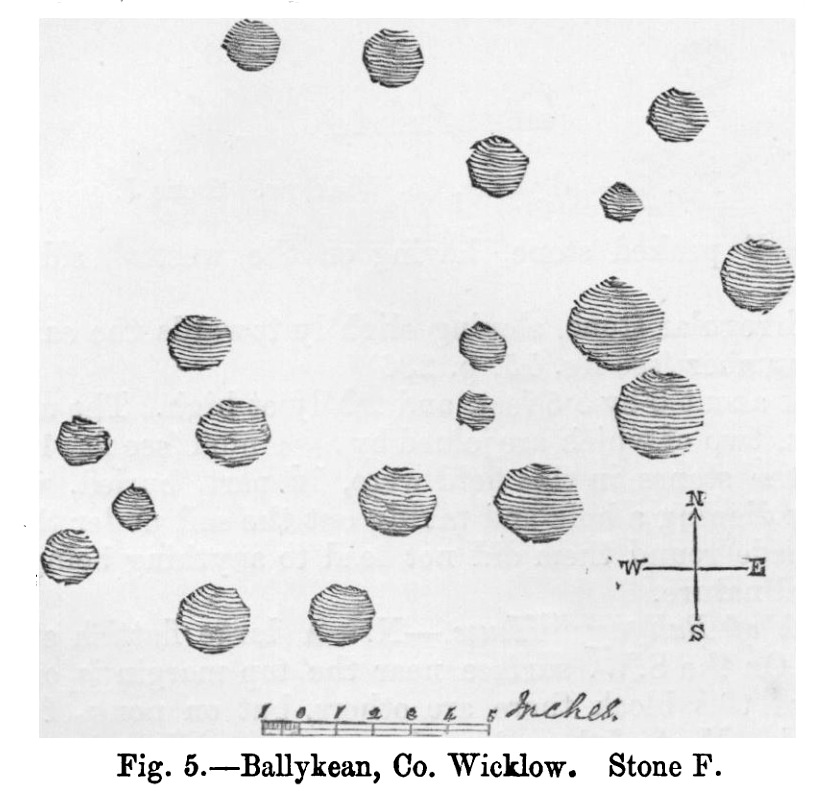
Cup-Marked Stone (lost): OS Grid Reference – SG 21537 42375
Also Known as:
Ballykean ‘Stone F’ (Kinihan 1884)
Archaeology & History
Kinihan’s 1884 rubbing of the stone
This is one of at least fourteen petroglyphs in this parish that have been either lost or destroyed since their initial description in the 19th century. It was described in George Kinihan’s (1884) survey as being, “a slightly dome-shaped stone, its surface being nearly level with that of the ground. The cups are both numerous and deep…although bits of the surface have been flaked off by fire.” He took a rubbing of the stone which showed nineteen cup-marks on its upper surface. When the Archaeological Survey of Ireland looked for the carving in 1990 it could not be located; and when Christiaan Corlett (2014) described this and the other carvings in this cluster, he thought that a group of stones dumped “in a hollow area north of the field” might possibly be where it had been moved to—although no such carvings have been identified there.
References:
Corlett, Christiaan, Inscribing the Landscape: The Rock Art of South Leinster, Wordwell: Dublin 2014.
Kinihan, George H., “Proceedings: Cup-marked and Inscribed Stones in the Counties of Wicklow and Wexford”, in Journal Royal Society Antiquaries Ireland, (4th series) volume 6, 1884.
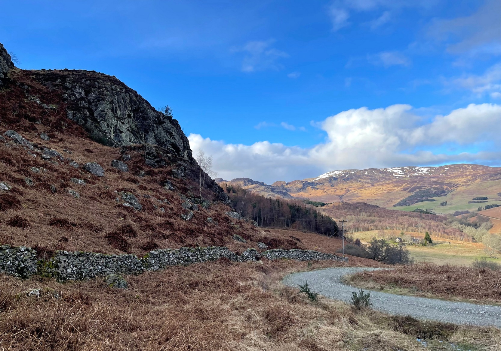
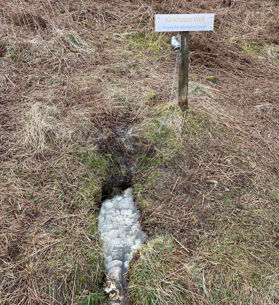
From Comrie village, take the long winding steep road up past the Devil’s Cauldron towards Glen Lednock. After 1½ miles the road begins to level-out and you come out from the trees and about 400 yards along there’s a dirt-track on your left. Park here! OK, now walk further along the road (not the dirt-track) for less than 100 yards and take the footpath up the slope (if this is blocked—it shouldn’t be!—you can walk further along until your reach the next track on your left). Go up this footpath for 200 yards till you reach the track by the large bend; and then walk up it for another 200 yards where there’s another large bend. On your right, past the solitary big rock, you’ll see the sign…
Archaeology & History
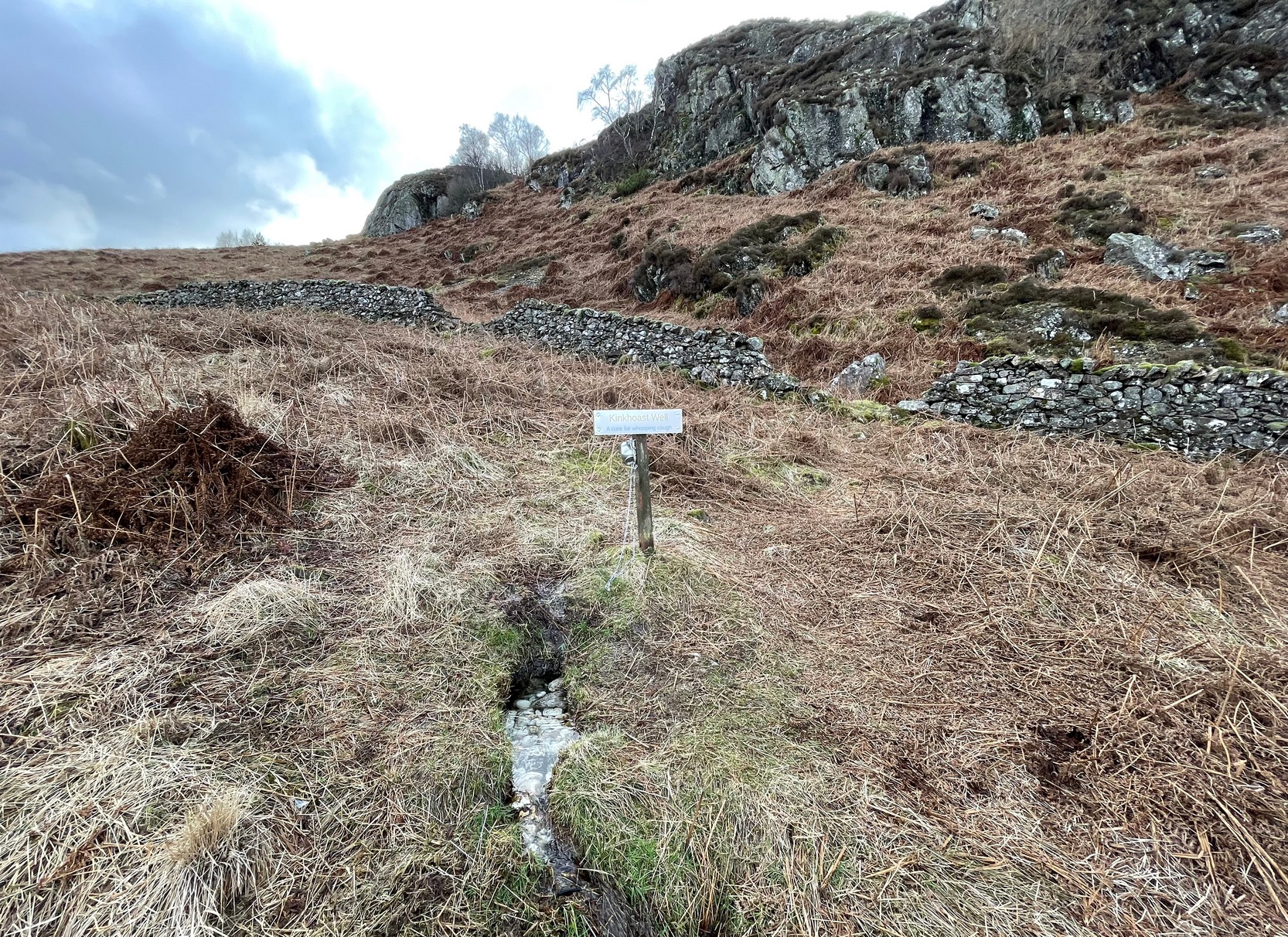
Sign of the Kinkhoast Well
A little-known healing well that all but fell out of existence until, thankfully, some local folks recently decided to revive it. A sign stands above the back of this spring of water as it emerges from the Earth telling you that it’s the Kinkhoast Well. Its clear waters form into a very small pool, wherein are dozen of small white pebbles and and quartz pieces, very smooth and obviously worn by decades, if not centuries, of local folk giving the spirit of these waters—the genius loci—and offering in exchange for its healing virtues in the hope that it cures them of the whooping cough, of which this well is renowned.
It’s one of many whooping cough wells that are found in the Perthshire hills—and most are actually large boulders with hollows into which the rainwater collects and it is this that is used medicinally and not necessarily the spring water. A curious thing indeed…. and I’ve come across Highland folk who were taken to them when they were young children who’ve told me that their whooping cough was subsequently cured! Intriguingly, there is a large boulder just below this well, upon whose top is a natural bowl in which rainwater collects—and although I can find nothing specific telling of such a tradition here, above Comrie, it’s possible that the relationship between stones and wells, found at other places in the Highlands, also existed here.
Small pool full of white offering stonesWell & stone in close attendance
The name Kinkhoast itself (and variables thereof) is a Scottish dialect word, found from Galloway and into the Highlands. Jamieson (1880) describes it as literally “hooping cough”, with a brief note on the disease being cured by water drank from a shell. Meanwhile, in Grant & Morison’s (1960) massive work, they give numerous examples of the term, most of which relate to the same “whooping cough”, with some examples of folk remedies to abate the disease, including one of parents sending their children to take a drink from the “Kinker Steen Wall”—in that case from the parish of Logie. Examples of the very same tradition are known at other kinkhost sites. Check the place out when you’re in the area—and rest for a while to drink in the beautiful views…
References:
Anonymous, “Comrie Folklore – Kingcough Well,” in Crieff & District Post, no.31, August 2012.
Grant, William & Morison, David D. (eds), The Scottish National Dictionary – volume 5, SNDA: Edinburgh 1960.
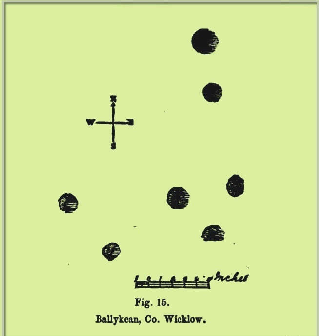
Cup-Marked Stone (lost): OS Grid Reference – SG 21640 43035
Also Known as:
Ballykean Stone A (Kinihan 1884)
Archaeology & History
Kinihan’s rubbing of the stone
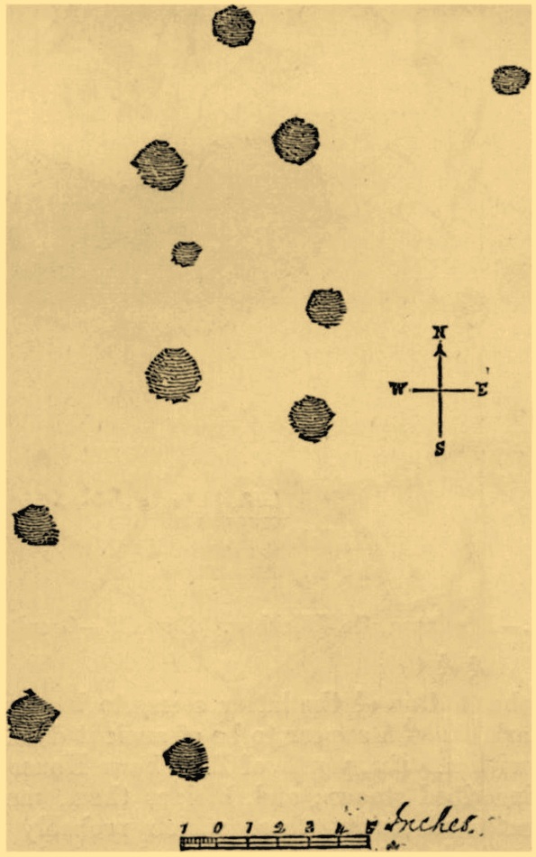
This is one of at least fourteen petroglyphs in this parish that have been either lost or destroyed since their initial description in the 19th century. First noticed by a Mr Hugh Jones of Ballykean House, it was the northernmost carving in the cluster. When the Archaeological Survey of Ireland looked for the carving in 1990 it could not be located—although they did note a stone of similar size in the field boundary to the north-east, but could find no cup-marks on it.
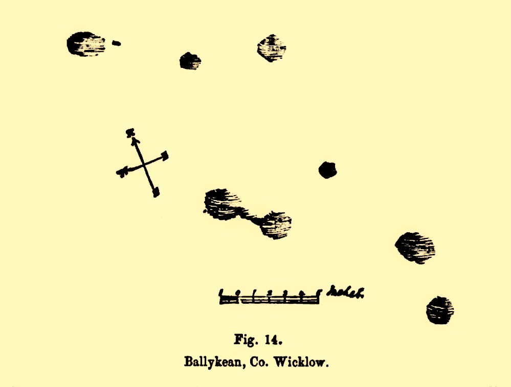
Ballykean (14 ) stone
When George Kinihan (1884) described the stone, he told it to be a block of granite, “about 5 feet by 5.3 feet, and standing 3.3 feet high” in a field known as the Fort Field (although there are no remains of a fort here). Kinihan took a rubbing of the carving, which highlighted eleven cup-marks on its upper surface, as illustrated here. More recently, in Corlett’s (2014) rock art survey, he told that there were “several large dumps of granite boulders” north of the field and wondered whether these might be where this, and the other stones, had been moved. Does anyone know…?
References:
Corlett, Christiaan, Inscribing the Landscape: The Rock Art of South Leinster, Wordwell: Dublin 2014.
Kinihan, George H., “Proceedings: Cup-marked and Inscribed Stones in the Counties of Wicklow and Wexford”, in Journal Royal Society Antiquaries Ireland, (4th series) volume 6, 1884.
Cup-Marked Stone (lost): OS Grid Reference – SG 21584 42230
Also Known as:
Ballykean ‘Stone M’ (Kinihan 1884)
Archaeology & History
Ballykean (2) or “Stone M”
This is one of at least fourteen petroglyphs in this parish that have been either lost or destroyed since their initial description in the 19th century. When the Archaeological Survey of Ireland looked for this carving in 1990, it could not be located. It was first described by George Kinihan (1884), who told that it was, a “block about 6 by 5.5 feet, and 2.25 feet high. The upper surface has eight cups, two of which are joined by a channel.” The site was included in Corlett’s (2014) fine survey, who could add no additional data about the stone.
References:
Corlett, Christiaan, Inscribing the Landscape: The Rock Art of South Leinster, Wordwell: Dublin 2014.
Kinihan, George H., “Proceedings: Cup-marked and Inscribed Stones in the Counties of Wicklow and Wexford”, in Journal Royal Society Antiquaries Ireland, (4th series) volume 6, 1884.
Cup-Marked Stone (lost): OS Grid Reference – SG 21648 42072
Also Known as:
Ballykean ‘Stone N’ (Kinihan 1884)
Archaeology & History
This is one of at least fourteen petroglyphs in this parish that have been either lost or destroyed since their initial description in the 19th century. The carving was, wrote Kinahan (1884) in his day, “in the field south of Ballykean House.” But when the Archaeological Survey of Ireland looked for the stone in 1990, it could not be located. Kinihan told that it was,
“a large flattish stone, which slopes SW. On the SW surface near the top margin is one cup. In the vicinity of this block there are others, but on none of them were cups remarked. Most of these have been split, while others are said to have been broken up to build Ballykean House, with the farm buildings and walls.”
References:
Kinihan, George H., “Proceedings: Cup-marked and Inscribed Stones in the Counties of Wicklow and Wexford”, in Journal Royal Society Antiquaries Ireland, (4th series) volume 6, 1884.
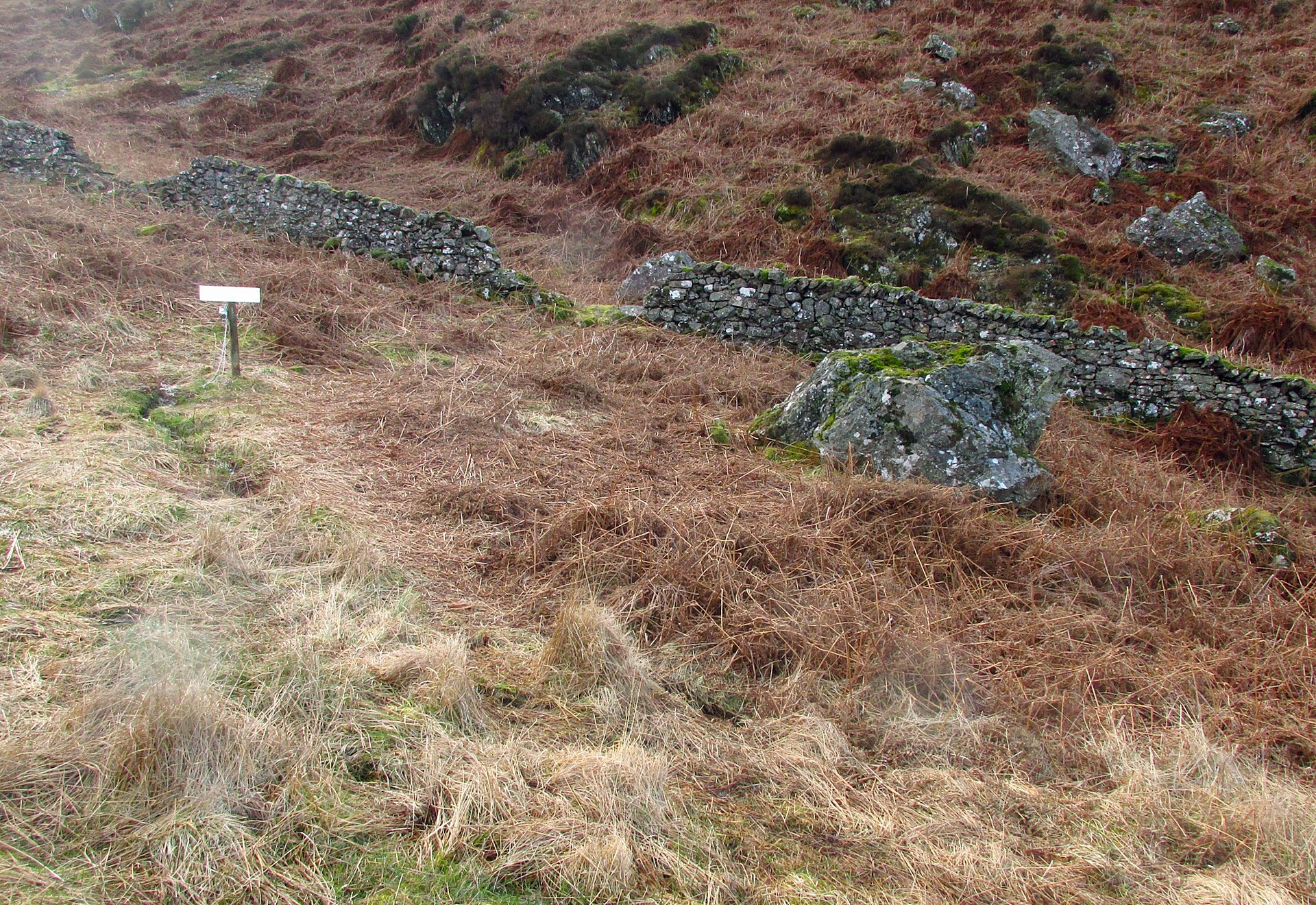
Along the A85 road between Comrie and St Fillans, just over a mile out of Comrie, on the right-hand side (north) of the road is the small farm-track into the fields where the ruined stone circle of Tullybannocher lives. Walk up this track (known as Maam Road), past the stones, and keep going uphill for more than a mile (literally 1 mile up, another track turns sheer right, but ignore it) where the track eventually levels-out; keep walking for another 600 yards, slightly downhill, until you reach a distinct fork in the track where you need to veer right, uphill, and keep walking up the track for ⅔-mile (1km) where you’ll eventually see a cottage ahead of you. 150 yards before this, to your left, down the slight slope and just as it begins to slope back up again on the other side, there’s some olde walling with a coupla big stones in it. It’s there!
Archaeology & History
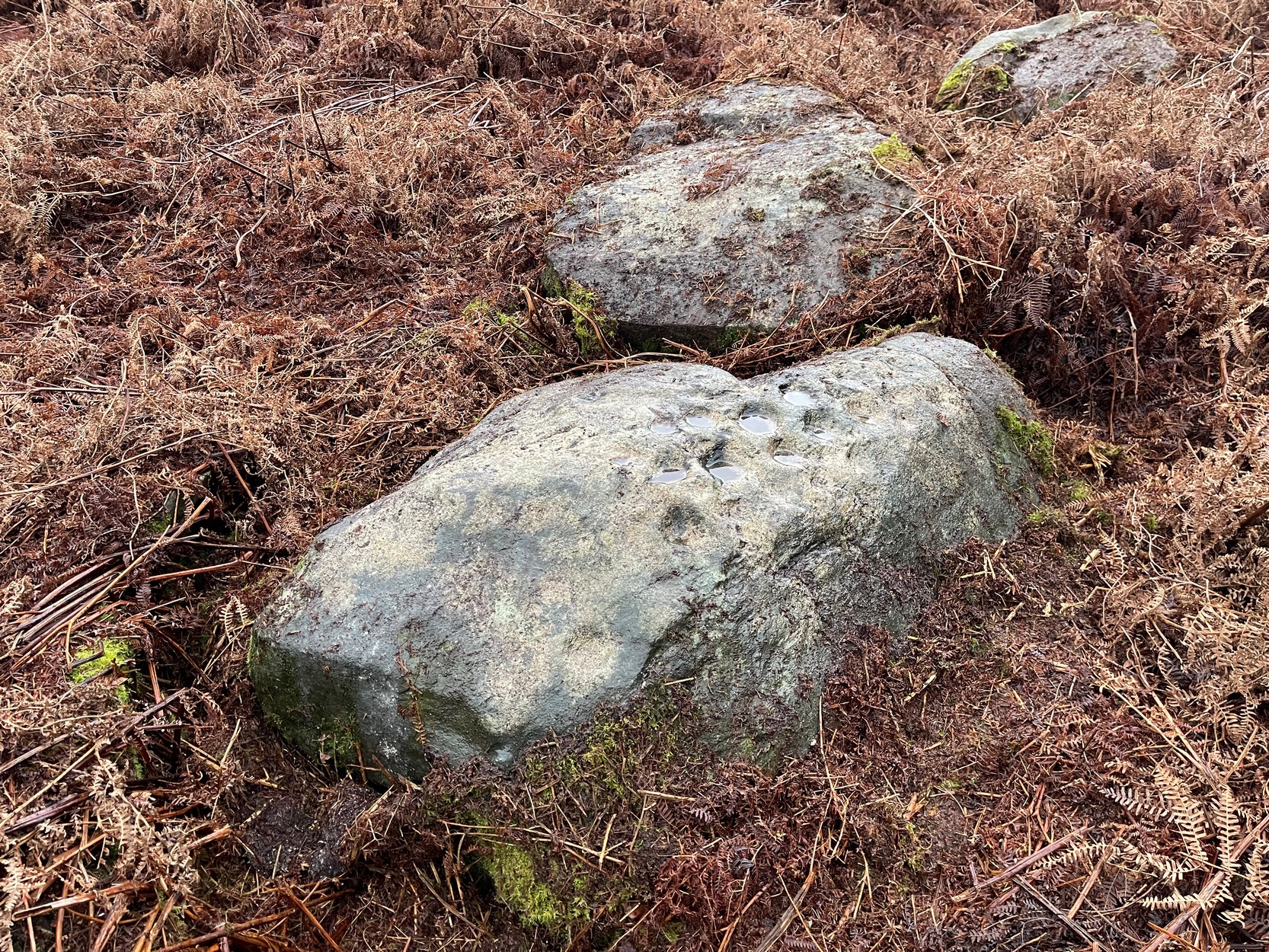
When James MacIntosh (1888) first visited this carving in the 19th century—which is close to the curious cairn of Druim na Cille just 75 yards to the west—he described there being a group of seven large stones forming, what he thought, might have been a large enclosure. I think he was right. Several of these stones can still be seen: each of them along some ancient walling that swerves in an arc to the east. One of these stones has a number of cup-marks on it.
Fred Coles’ 1991 sketchThe carving, from the track
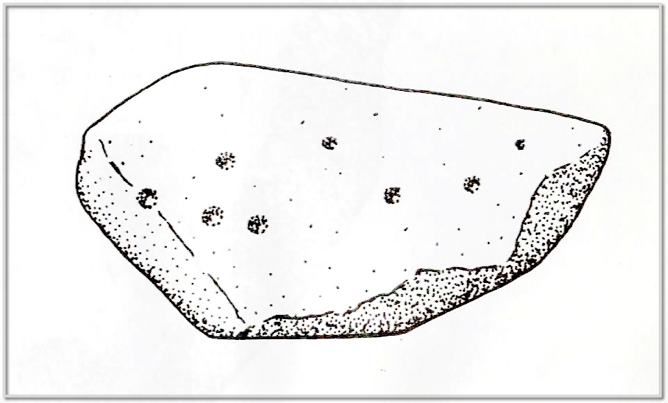
The design isn’t too impressive when compared to others in this neck o’ the woods, but they’re very distinct. We visited the place on a truly dark grey day: conditions that don’t usually allow for good visibility regarding cup-marks; but thankfully the cups along this stone are quite deep and hard to miss. Running along one section of the stone are what Gow called, “eleven beautifully formed cups, varying from 2¼ to 4 inches in diameter and from half an inch to an inch in depth.” When Fred Coles (1911) came here he counted thirteen cup-marks. There may be fourteen.
The stone does possess some more recent groove marks made by a metal instrument, possibly a tractor or perhaps when local workmen stuck up a microwave tower close by. Thankfully it hasn’t directly affected the cups on the stone. Check it out when you visit the nearby ring cairn.
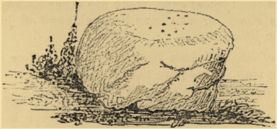
Cup-Marked Stone (missing): OS Grid Reference – SK 7618 0095
Archaeology & History
P.M.Vine’s 1982 sketch
In this neck o’ the woods, cup-marked stones are very rare. This one was described in Phil Vine’s (1982) regional archaeology survey as consisting of eight cup-marks on a piece of stone three-feet across. The carving, he told, could be found outside of a “former blacksmith’s shop, immediately south of Chestnut Cottage”, but was removed some time ago and is now in “private possession.” Very little else seems to be known about it and there are no other prehistoric sites in close attendance that could help us contextualise it (eg, hut circles, cairns, standing stones, etc). It was mentioned in passing in Gwilym Hughes’ (2000) short piece on the Netherfield cup-marked stone 25 miles to the north-west, but he doesn’t appear to have seen it in the flesh, so to speak. So what has become of it…?
References:
Hughes, Gwilym, “The Cup Marked Stone,” in The Lockington Gold Hoard, Oxford 2000.
Vine, Philip M., The Neolithic and Bronze Age Cultures of the Middle and Upper Trent Basin, BAR: Oxford 1982.
Cup-Marked Stone (lost): OS Grid Reference – SP 3245 9752
Archaeology & History
Witherley’s cup-marked stone (P.M.Vine 1982)
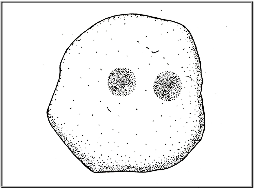
In his survey of prehistoric sites in the Trent basin area, archaeologist Philip Vine (1982) described a cup-marked stone that was “found in a rockery at Witherley Hall, formerly the Rectory, during the 1970s… along with medieval stone work of the chancel of the village church.” Two distinct cup-markings that he described as “deepish” had been carved into a large ‘portable’ stone of coarse-grained diorite rock, measuring 53 by 51 cm — making it somewhat larger than your standard portable. It looks like it may have come from a cairn (was there one nearby?). Vine told that the carving was held in “private possession.” What has become of it…?
References:
Vine, Philip M., The Neolithic and Bronze Age Cultures of the Middle and Upper Trent Basin, BAR: Oxford 1982.