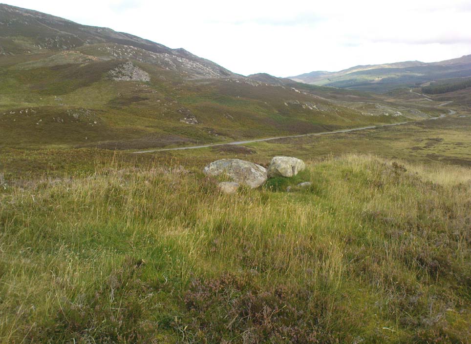
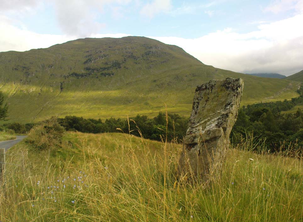
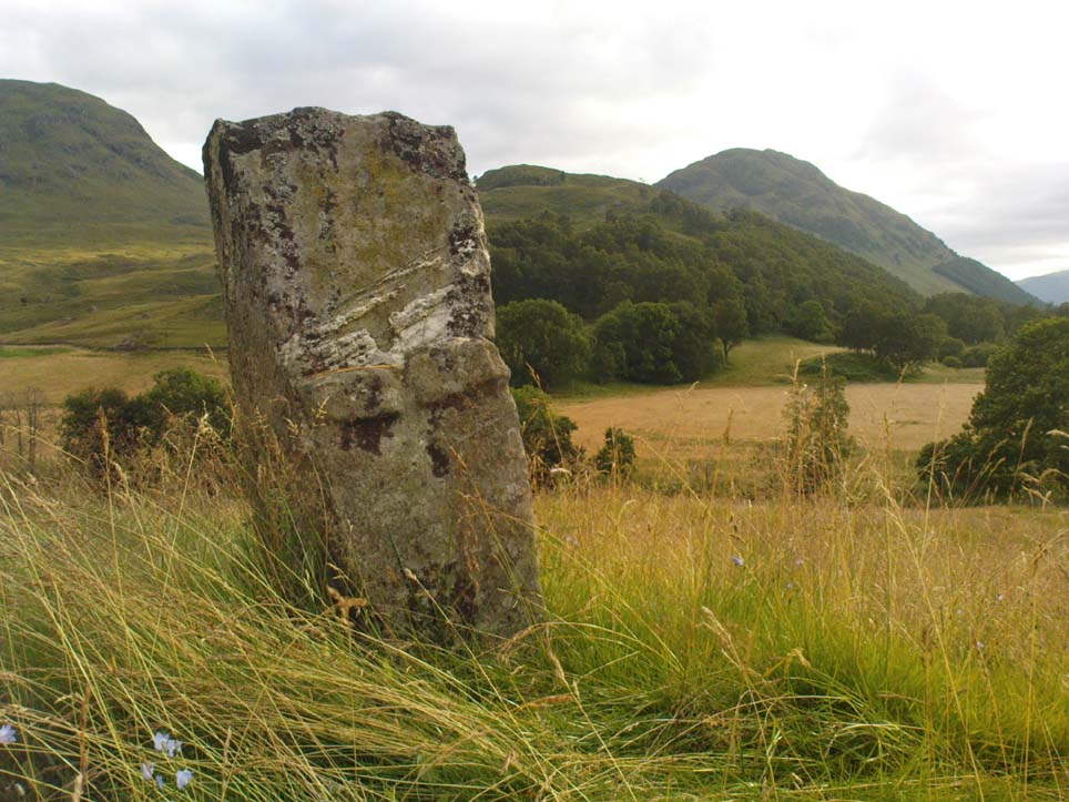
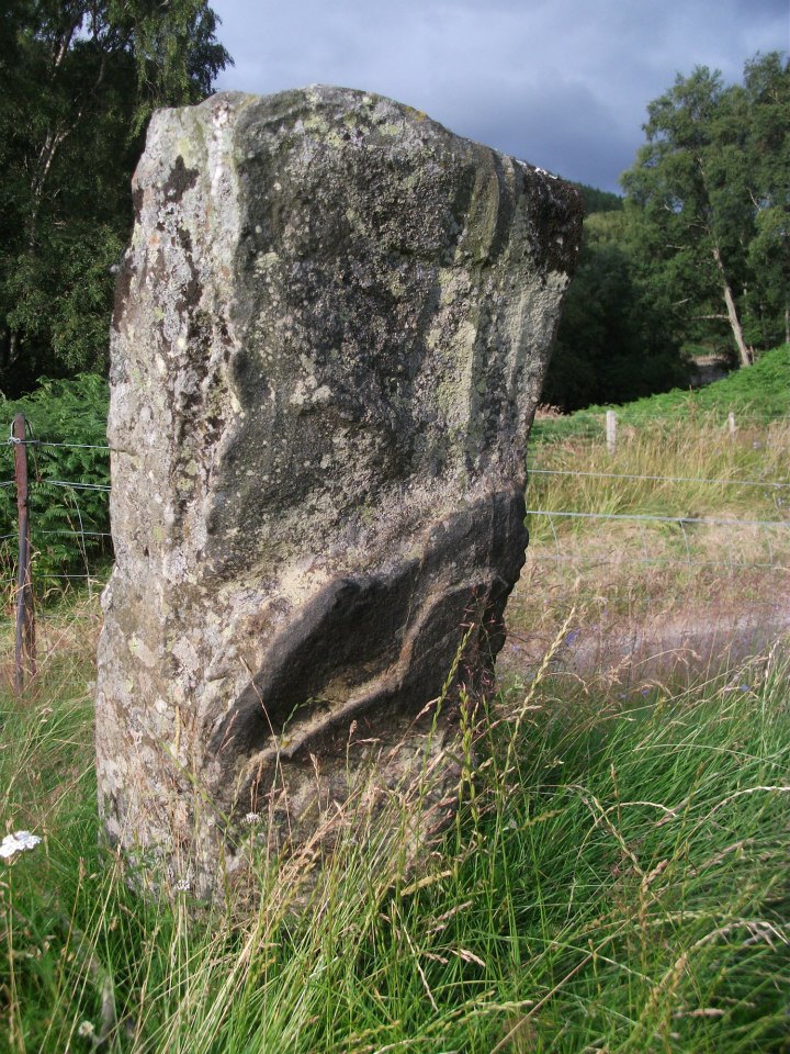
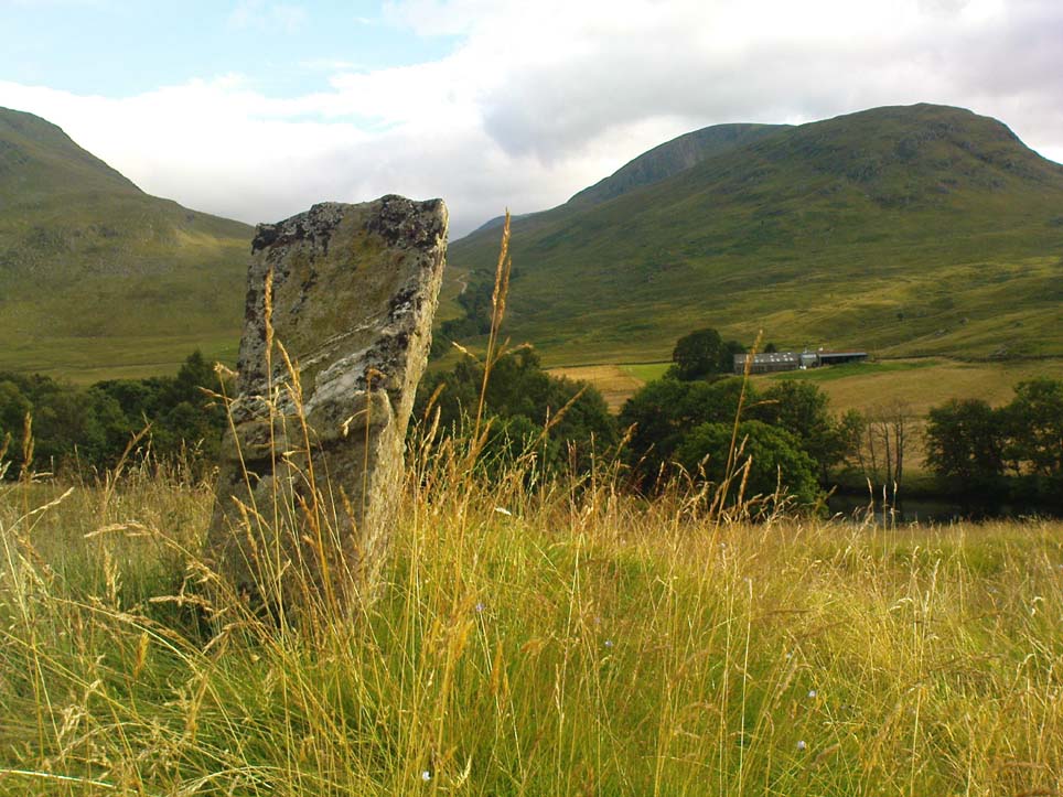
Although found within the parish of Fortingall many miles to the south, this site is much closer to Kinloch Rannoch, just a few miles northwest. From Kinloch Rannoch, take the south road, heading east for about 5 miles, till you go past the small Lochan an Daim on the left (north) of the road. As the moorland opens up ahead of you, about a half-mile further on, watch for the dirt-track running up onto the hills on your left. Cross the road from here, over the stream and bogs, onto the small hill ahead of you. You’re getting very close!
Archaeology & History
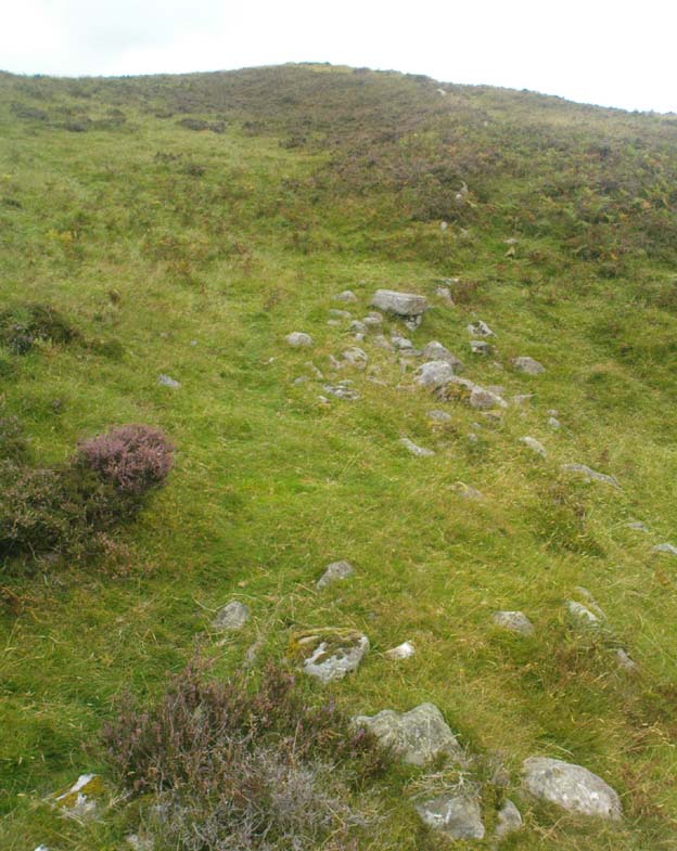
The Canmore entry for this site tells of just a large single hut circle being here, 13.5m by 12m across, but this is in fact part of a much larger enclosure system with extensive walls rising to heights of up to 3 feet in places and covering a very wide area indeed across the sloping grass-covered ridge above the streams on either side. The walling is typically Iron Age in structure and there are remains of other internal features that we gave only cursory attention to (other sites were calling out for us!).
This shows walling of another nearby enclosureAllt Leathan enclosure walling
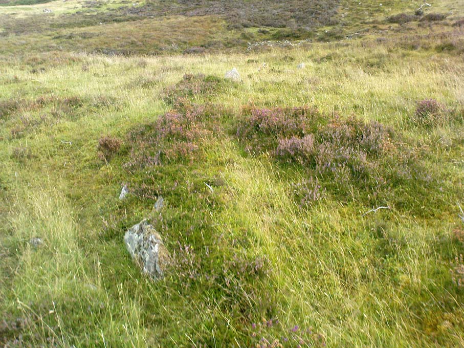
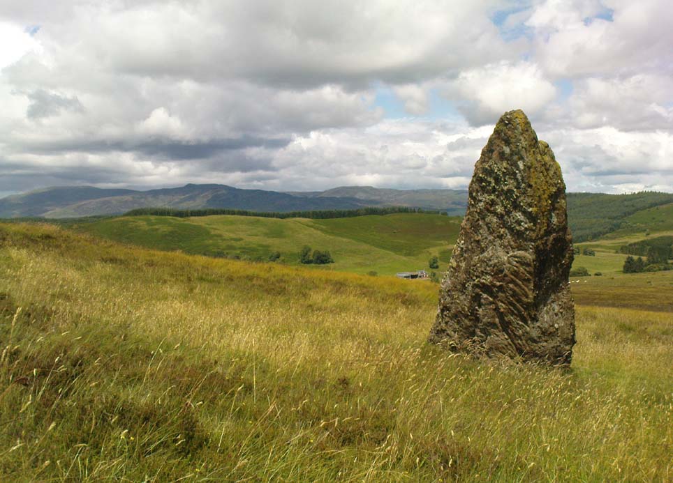
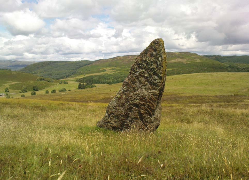
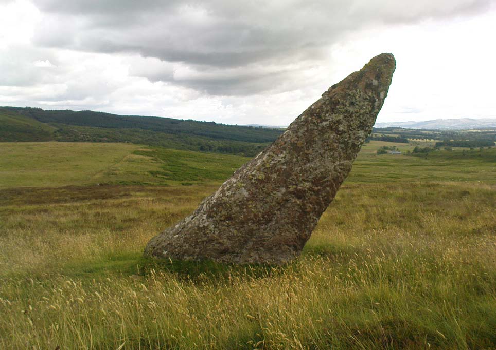
What seem to be a cluster of several very overgrown cairns, roughly 20 feet across and 3 feet high, are evident on the south side of the enclosure walling. These need examining in greater detail. Also, on the eastern slope below the edge of the main walled enclosure, Paul Hornby found what seems to be a prehistoric standing stone, leaning to one side, which if completely upright would be about 5 feet tall. There are also the remains of at least two other large walled enclosures further onto the hillside, just before you start walking up the slopes to Schiehallion. They appear to be similar in nature and structure to this one at Allt Leathen, but I can find no account of them in any records.
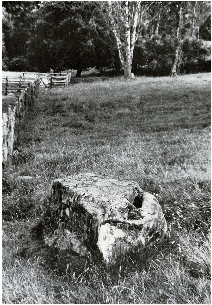
Up the A9 past Blair Atholl, a few miles later there’s the turning for Struan. Scarcely a mile east of old Struan Church, head past the old farmhouse of Old Kindrochat and keep going eastwards along the edge of the trees for about 200 yards until you reach the sheepfold. There you’ll see a singular rock sitting alone by the fence. That’s it!
Archaeology & History
This little known healing stone was, at one time last century, of great repute in the Highlands. Today, very few people even know it exists. One of many rocks that were said to possess healing abilities, this one (obviously) was of great repute in the curing of whooping cough. But it wasn’t the rock alone that did the work here, for upon its edge was a small basin into which rainwater collected and this, when used correctly and in due accord with ancient ritual tradition, could enact the cure. Mr Duncan Fraser said of this fascinating healing stone:
“The grey water-worn stone is about 4ft 6in long, 2ft 6in broad and 2ft high, with a deep gash on top, where the water lingers even in long dry spells. When full it holds about half-a-gallon. People were still coming here with their sick children as late as 1860 — and bringing a spoon made from the horn of a living cow. There was no cure without that.”
The ritual “spoon made from the horn of a living cow” was an important ingredient at another site with the reputation for curing whooping cough about 50 miles south of here, near Balquhidder. (see Whooping Cough Well, Killin) What truly fascinates me is the origin of this stone and its medicinal virtues. When did the healing rites first start here – how long ago…?
References:
Fraser, Duncan, Highland Perthshire, Standard Press: Montrose 1969.
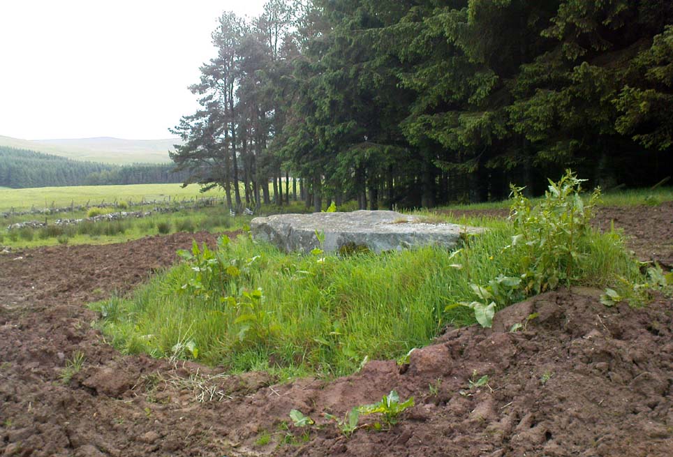
From Blackford on the north side of the A9, cross over and take the small B-road which quietly runs up and over Sheriffmuir towards Dunblane. After a mile, keep your eyes keen for the approaching woodland on your right-hand side; for in the field just before the woods, you’ll see a patch of grass near the corner of the field with a long stone poking out of it. That’s it!
Archaeology & History
It seems that very little has been written about this monolith in any of the archaeology texts, but it’s ascribed locally to be a fallen standing stone. The site’s described in Finlayson’s (2010) fine local megalith guide where he points out how it’s in line with other nearby standing stones at Gleneagles and the White Stone – and the line is damn close!
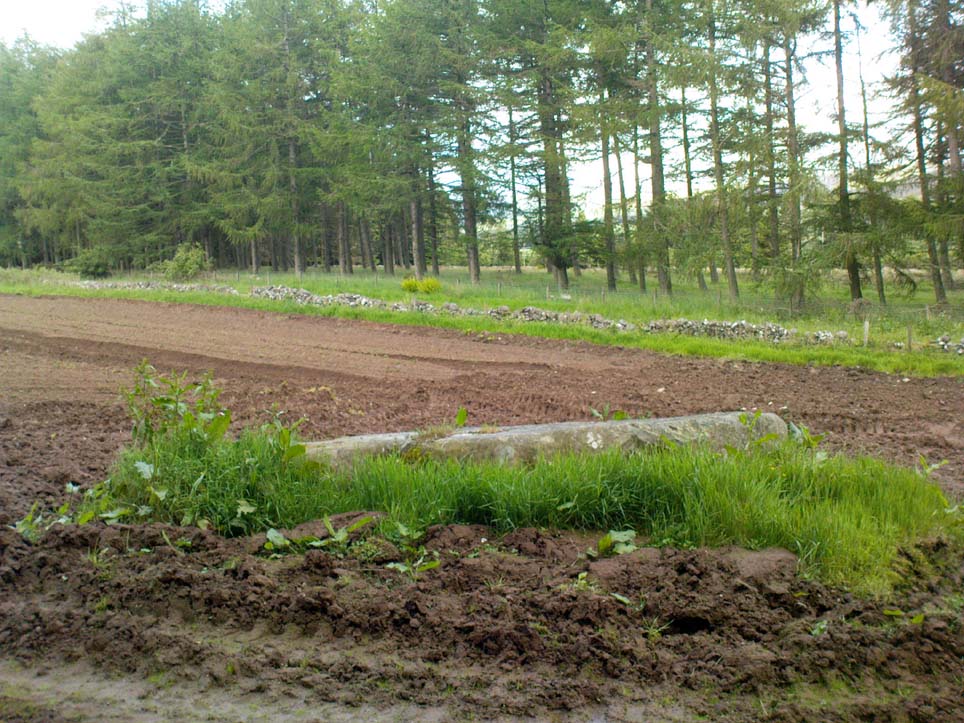
…and from another angle…
With a quartz vein running through it, the stone lays some thirteen feet long and was, at some time in the not-too-distant past, readied to be quarried, as evidenced by the chisel-marks cut into it, prior to the usual destruction. But this time, for some reason, someone must have come to the rescue and prevented its demise…thankfully…
The farmer annually cuts around the fallen stone, shaped like a long boat (hence the name), near the top corner of the field. It would have looked damn good when stood upright, standing about ten feet in height and visible for a good distance. But today it’s quite forlorn laid here, seemingly alone, in this quiet part of the country, and is probably only one of interest to hardcore megalithomaniacs amongst you!
References:
Finlayson, Andrew, The Stones of Strathearn, One Tree Island: Comrie 2010.
Not to be confused with the ‘fort’ shown on modern OS-maps on the wooded slopes a few hundred yards to the south, the denuded remains of this site were shown on an 18th century map of the area (the Breadalbane estate plans). Probably Iron Age in nature, the local historian William Gillies (1938) described the place in his fine work,
“According to the atlas of 1769 there were ruins of an ‘Ancient Castramentation’ at Firbrush Point on the farm of Auchmore. An examination of this little peninsula revealed the foundation of a very thick wall that at one time ran across its neck, and formed a defence on the landward side. It is probable that the stones were removed for the erection of the small pier and harbour close by.”
An assessment of the site by some of the Scottish Royal Commission lads in the late 1970s found no remains of the thick walling and it seems all remains of this fort have sadly been destroyed.
References:
Gillies, William A., In Famed Breadalbane, Munro Press: Perth 1938.
Royal Commission on the Ancient & Historical Monuments of Scotland, Archaeological Sites and Monuments of Stirling District, Central Region, Society of Antiquaries of Scotland 1979.
Follow the directions to reach the standing stone of Dunruchan D, and there on the moor immediately to your south, 100 yards or so away, it stands before you!
Archaeology & History
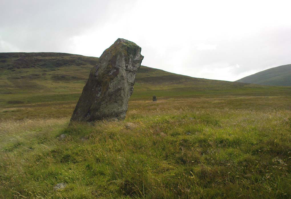
Dunruchan E stone, with Dunruchan D to rear
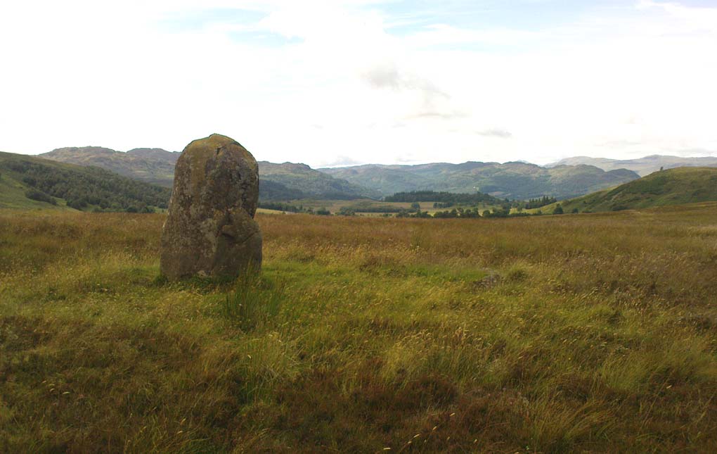
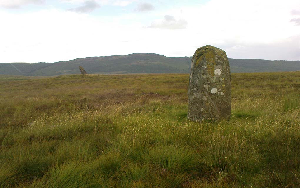
This is the southernmost of the impressive standing stones on the plain below Dunruchan Hill. Notably more ’rounded’ at the top than most of its associates—giving a more distinct ‘female’ nature to the stone than its companions—we find again, scattered around the base of this 7-foot tall monolith, a number of smaller rocks that gives the impression an old cairn was once here. Certainly there are a scatter of several other cairns nearby and we get the distinct impression with all of the Dunruchan stones, that a prehistoric cemetery was once in evidence here.
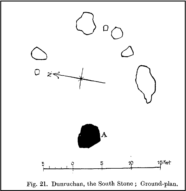
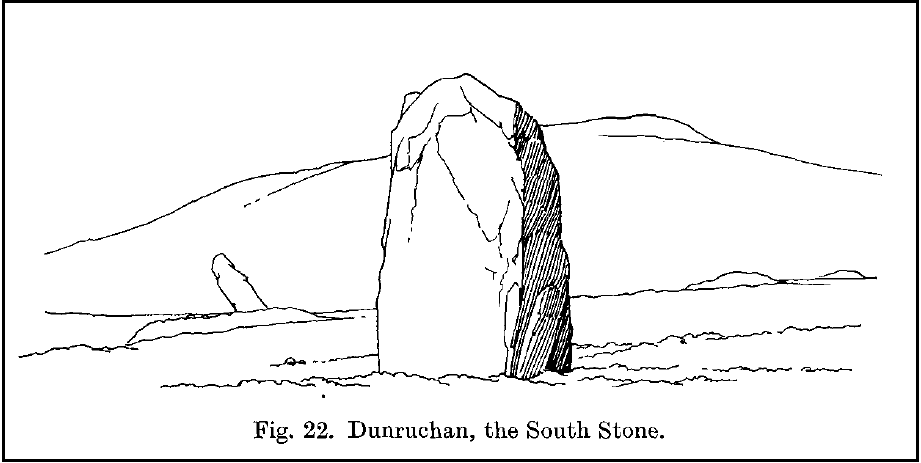
Ground-plan of stone & cairnCole’s drawing of Dunruchan E
Although this is the last of the known standing stones in this area, there is every probability of other prehistoric remains hidden amidst the heathlands—perhaps even more large standing stones that have fallen and are overgrown with vegetation. When Fred Cole came here one time with the great rock art writer, Sir James Simpson, one such fallen standing stone was reported a short distance tot he east, but it has yet to be recovered. There may be more.
In Fred Cole’s (1911) report of this particular “south stone”, or Dunruchan E, he wrote:
“This monolith, in respect of position, somewhat resembles the last, because it stands on the west arc of a rudely circular setting of small stones, which, however, are not placed on a mound (as in the case of Stone D), but merely lie on the flat of the moor. Five of these blocks are large enough to be noticeable, and they occupy the positions shown by the outlined stones in the ground-plan (fig. 21), the farthest to the east being 15 feet distant from the inner face of the standing monolith A. The dimensions of this Stone are: height 6 feet 9 inches, basal girth 16 feet 1 inch. In the illustration (fig. 22) I show this Stone with the other great one near set on its platform, and to the right two of the numerous small, low cairns which are scattered about this part of the moor. ”
Folklore
According to an account in the Ordnance Survey Name Book of 1860, “these stones are believed to mark the graves or commemorate the death of Roman soldiers who fell in a battle fought here between the Romans and the Caledonians.”
References:
Burl, Aubrey, From Carnac to Callanish, Yale University Press 1993.
Cole, Fred, “Report on Stone Circles in Perthshire, Principally Strathearn,” in Proceedings of the Society of Antiquaries, Scotland, volume 45, 1911.
Finlayson, Andrew, The Stones of Strathearn, One Tree Island: Comrie 2010.
Hunter, John, Chronicles of Strathearn, David Phillips: Crieff 1896.
Thom, A., Thom, A.S. & Burl, Aubrey, Stone Rows and Standing Stones – 2 volumes, BAR: Oxford 1990.
Up the B827 road (south) from Comrie, just follow the directions to reach the Craigneich standing stone, and from here go across the road and up the dirt-track past the Dunruchan B standing stone. Keep going further uphill, past the leaning Dunruchan C standing stone and onto the moorland plain just behind it. A few hundred yards in front of you you’ll see two large standing stones on the moor to the south. The nearest one is Dunruchan ‘D’.
Archaeology & History
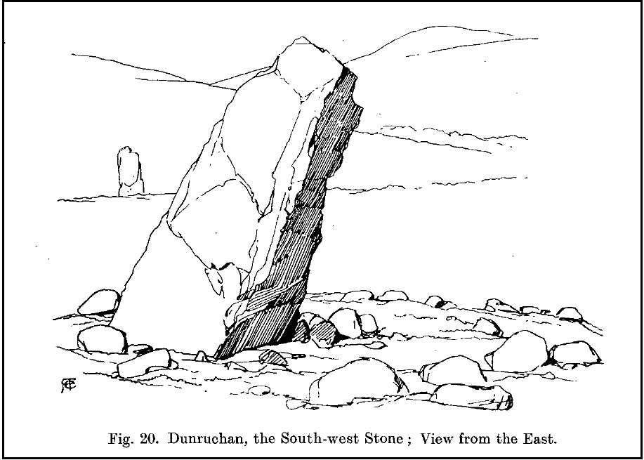
Fred Coles’ 1911 drawing
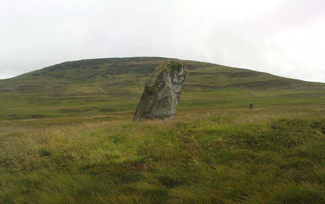
Another fine large standing stone in this curious but excellent megalithic complex on the hills south of Comrie. This great monolith leans at a slight angle, and would be some 10 feet tall if the ages had kept it perpendicular. It’s truly impressive; and it emerges from the edge of a large raised cairn which almost surrounds it. The cairn is overgrown yet some 3-4 feet tall and made up of thousands of small stones. It’s the most notable of the cairns scattering the plains of Dunruchan, and gives the best impression of the standing stones here being memorials to some ancient chief, queen or shaman. As far as I know, this cairn has not been excavated, so we know not yet who or what lies beneath it.
Carved parallelogram
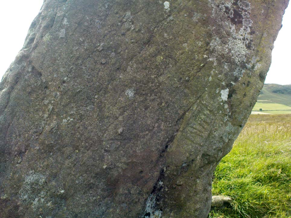
A small section of the standing stone has some faded carving on its eastern side. These seem to be relatively recent, though a curious parallelogram design echoes the carving (albeit larger) on the Gleneagles B standing stone, 10 miles southeast, and which is thought to be Pictish. The carving here, however, doesn’t have that feel to it.
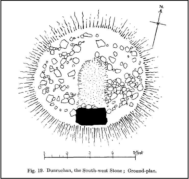
The stone and the cairn were noted in Fred Coles’ (1911) survey, in which he called this the “south-west stone” and wrote:
“New features are presented in combination with this Stone. In lieu of being set absolutely solitary on the heath, there are, extending for a considerable area almost around its base, many stones and boulders laid in the form of a flattish circular cairn or platform (see ground-plan). The monolith, which leans over towards the north, is set to the south of the crest of the cairn, and there is a considerable fall from the crest to the level of the moor around it, indicating that a very great quantity of small stones must have been employed in making the cairn. The interior, shown dotted on the plan, bears signs of having been partially excavated, probably the cause of the Stone being so much out of the vertical. The stony cairn or platform measures 15 feet in diameter, and consists of moderate sized stones. The base of the great Standing Stone is oblong, and measures in girth 14 feet 2 inches. Down the slope of its back the length is 10 feet, and its present vertical height 8 feet 6 inches. The longer axis is almost exactly due east and west. From this spot the next Stone in order can be easily seen…”
Coles’ groundplan of cairn & stone
Several other small cairns scatter this grassy and heathland plain, all of them overgrown and none of them excavated.
Dunruchan D, looking south
As with the other Dunruchan monoliths, this one has been included in the megalithic stone row surveys by both Alexander Thom (1990) and Aubrey Burl (1993), but the staggered alignment this has with the other standing stones is more likely fortuitous than deliberate. But this doesn’t detract from the magnitude of the megalithic cluster on this small section of moorland. A truly brilliant site!
Folklore
According to an account in the Ordnance Survey Name Book of 1860, “these stones are believed to mark the graves or commemorate the death of Roman soldiers who fell in a battle fought here between the Romans and the Caledonians.”
References:
Burl, Aubrey, From Carnac to Callanish, Yale University Press 1993.
Cole, Fred, “Report on Stone Circles in Perthshire, Principally Strathearn,” in Proceedings of the Society of Antiquaries, Scotland, volume 45, 1911.
Finlayson, Andrew, The Stones of Strathearn, One Tree Island: Comrie 2010.
Hunter, John, Chronicles of Strathearn, David Phillips: Crieff 1896.
Thom, A., Thom, A.S. & Burl, Aubrey, Stone Rows and Standing Stones – 2 volumes, BAR: Oxford 1990.
Dun (lost): OS Grid Reference – NN 539 386 (approximation)
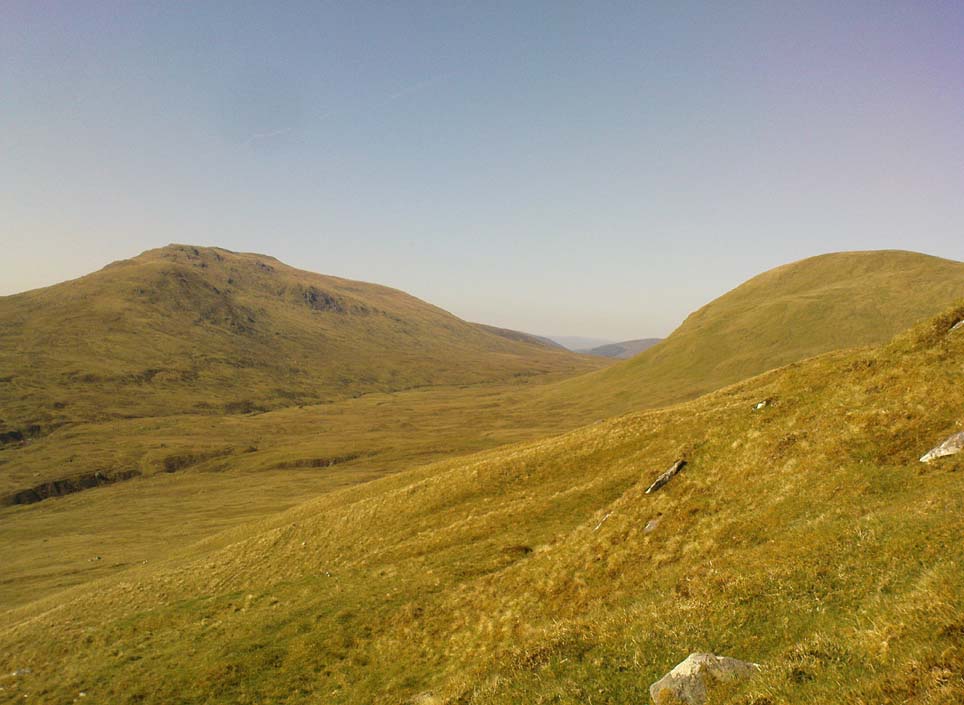
Looking towards Laraig Bhreislich, from the south
Also Known as:
Dun croisgh
Lairig Breisleich
Laraig Bhreislich
Archaeology & History
Although this site doesn’t appear in the modern records, the remote situation of the place suggests that some remains of the site could remain and be uncovered by diligent explorers and students. It is one of several lost “circular forts” that were described in William Gillies’ (1938) detailed historical text, that were first highlighted on a map of 1769. His brief description of this old fort told,
“The name ‘Duncroisg’ in Glenlochay, bears witness to the fort that once stood at the southern entrance to Laraig Bhreislich, the pass leading over the mountain to Glenlyon.”
There is is the possibility that some of the remote shielings clustered on the level at Airigh Allt an Eilein and Riabhaich used stones from this ancient site for their construction. On the level to the south of here are the overgrown remains of a prehistoric cairn, not included in archaeological surveys.
Note – Huge sections of prehistoric man-made walling have been located in the area, comprised of gigantic boulders, more reminiscent of enclosure walling. The remains are extensive and huge, but severely overgrown in this remote landscape. Watch This Space!
Folklore
Although not named specifically, this site would have been another of the Forts of the Fiann, or tribes of the hero-figure, Finn. The valley immediately adjacent to the location of the fort is still known as Fionn Ghleann, with the waters of Allt Fionn Ghleann strongly flowing through.
References:
Gillies, William A., In Famed Breadalbane, Munro Press: Perth 1938.
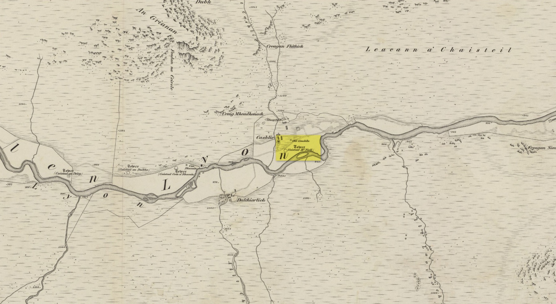
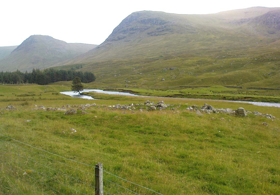
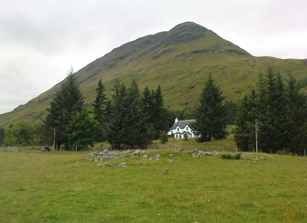
Truly remote, but easy to find once you’re nearing the western end of Glen Lyon. Going upstream, past Cashlie Dam, watch out for the well-preserved stone kiln on the left-hand side of the road, just before Cashlie house. 50 yards or further along, cross the road and in the field by the riverside, the circular mass of stones sorta gives the game away.
Archaeology & History
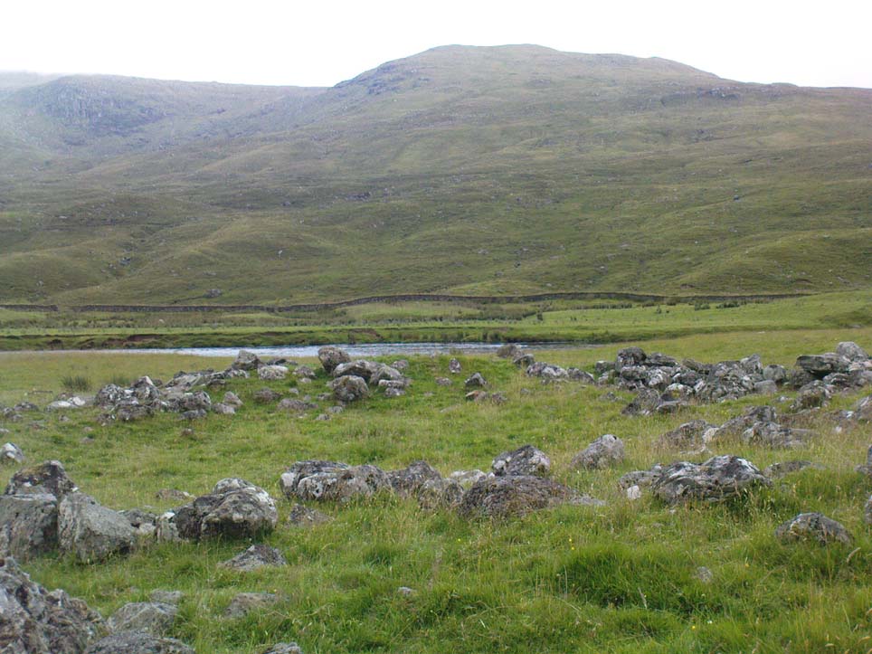
Shown on modern OS-maps as a ‘homestead’ and described variously by archaeologists and historians as a fort or a round-house, this is just one example of around twenty large prehistoric constructions that scatter the stunning mountainous Glen Lyon region which legend tells were the forts of the great hero-figure, Finn. Three other constructions of the same nature are found just a few hundred yards further up the Glen from here. Each is of roughly the same age and nature by the look of things. Their walls are extremely wide and made up of very large rocks, which would have taken huge efforts to construct.
Caisteal Mhic Neill ruins, looking eastCaisteal Mhic Neill, with An Grianan behind
Highlighted on the 1867 OS-map as a “Tower”, the exact nature of this and its adjacent sites has yet to be academically ascertained, with the Canmore website ascribing the monument as a “settlement” – although, tradition tells them to be Scottish forts or duns, so we’ll stick with that until excavations tell otherwise!
The great Gaelic place-name master W.J. Watson (1912) told that:
“The fourth of the Cashlie towers is a few yards south of the road, right in front of Cashlie farmhouse, now a shooting lodge. Though a quantity of large stones marks the site, the structure has been so badly knocked about that we found it impossible to take measurements sufficient for a plan. It was, however, apparently not circular, but rather oval. Its walls appeared to vary from about 9 feet to 12 feet 6 inches in thickness.”
Close-up of Caisteal walling
This is one of several other duns (or homesteads as the OS-map calls them) close to each other.
Folklore
Ascribed as one of Glen Lyon’s Caisteilean nam Fiann, or “castles of the Fiann”, Mr Watson (1912) again told how “there is a widely known saying, the earliest notice of which occurs in Pennant, who got it doubtless from the Rev. J. Stewart:
‘…Twelve castles had Fionn,
In the dark Bent-glen of the stones.'”
References:
Gillies, William A., In Famed Breadalbane, Munro Press: Perth 1938.
Watson, W.J., “The Circular Forts of North Perthshire,” in Proceedings of the Society of Antiquaries, Scotland, volume 47, 1912.
ACKNOWLEDGEMENTS: Many thanks to Andy Sweet of Stravaiging Around Scotland, for pointing me to the W.J. Watson article. And of course, a huge thanks to Marion—”I don’t have a clue where I am!”—Woolley, for getting us here….
Take the road from Fortingall into the Glen. About 4 miles down, past the farmhouse of Slatich, then Craigianie, watch carefully as you round the small bend in the road, where you’ll see a small standing stone on top of a rounded mound, right by the south side of the road, just over the fence. Go through the gate to enter the field less than 100 yards further on and walk back onto the hillock.
Archaeology & History
In this magnificent landscape down the longest of Scotland’s glens, standing atop of a knoll known as Tom a’ Mhoid, or “the moot hill” (Watson 1926), is this small standing stone about 4 feet tall which has long been ascribed as an important relic of the early christian period. They may be right – but it could as much be a more archaic monolith, onto which the carved crosses on either side of the stone were later etched, in the light of the myths of St. Adamnan whose name scatters this great glen and after the legend cited below was ascribed to him.
Close-up, showing large cross
The stone ‘cross’ stands atop of what at first sight seems a natural knoll; but all round it we find an excess of man-made remains and walling, all but constituting the hill itself. These are clearly visible on the aerial imagery of GoogleEarth. Antiquarian dogs here would be invaluable to ascertain the correct age and nature of the structures around this ‘cross’.
Faint cross near top of stone
Of the crosses carved onto the stone: the one on the southern face is a small faint one near the top of the upright; whilst the other is much larger and is easily visible, cutting right across the northern face of the monolith. They are clearly of differing styles and would seem to have been carved by different people, perhaps a few centuries apart. Curiously—as Marion Woolley pointed out—the smaller, fainter cross is carved above a ridge on the upright stone, mimicking the position of the stone on the knoll in its landscape setting. Whether this is just a coincidence, or has been done on purpose, we might never know.
In Duncan Fraser’s (1969) excellent local history work, he names the stone here Eonan’s Cross and he too strongly suspects “the stone itself was probably erected at least a thousand years earlier” than the coming of the saint, making this a christianized standing stone – which it certainly looks like. Mr Fraser said that,
“His cross stone, we can be fairly sure, was a Bronze Age standing stone long before it acquired its unusual cross.”
He may well be right…
Folklore
The mythic history of this cross-marked standing stone was told eloquently in one of Hilary Wheater’s (1981) fine short works. After giving a brief story of the tale of St. Adamnan, she went on to tell:
“A terrible plague swept through Scotland in the seventh century. It reached the Vale of Fortingall and so violent was its ravages that all the inhabitants were wiped out. Slowly the sickness began to infiltrate the Glen and in a panic the people of Glenlyon went to their preacher and beseeched him, “Eonan of the ruddy cheeks, rise and check the plague of thy people. Save us from the death and let it not come upon us east or west.”
“Adamnan rose to the occasion and gathered the people of the Glen to a hillock where he usually preached to them. In a house not forty yards away it is said that a child was already dying of ‘the Death.’
“There on the rock, with the people gathered round him, Adamnan prayed. When he was finished he raised his right arm, exhorted the devil body of the pestilence to come to him and, pointing to a large round rock lying on the ground, ordered the plague to enter it. A large circular hole appeared in the rock as the plague bored into it and Adamnan followed up this apparent miracle by the very sensible act of sending all the healthy people of the Glen up to the shielings until all signs of the pestilence disappeared…
“Thus were the people of the Glen saved from the plague. When they came back from their mountain retreat they erected a stone slab with two crosses on it to commemorate their deliverance. The rock itself they called Craig-diannaidh, the ‘rock of safety’, and the round stone with the hole through which the plague descended into the bowels of the Earth lies to this day at the side of the road near the stone slab.”
Adamnan’s Cross
The rocky slope immediately above the stone, on the other side of the road, was once the home of an old urisk who, sadly, long-since left the area – though his spirit can still be felt there. Accounts of many other supernatural creatures are found scattering this part of Glen Lyon…
References:
Barnett, T. Ratcliffe, The Road to Rannoch and the Summer Isles, Robert Grant: Edinburgh 1924.
Fraser, Duncan, Highland Perthshire, Standard Press: Montrose 1969.
Watson, W.J., The history of the Celtic Place-Names of Scotland, Edinburgh 1926.
Wheater, Hilary, Aberfeldy to Glenlyon, Appin: Aberfeldy 1981.
ACKNOWLEDGEMENTS: Massive thanks to Marion—”I don’t have a clue where I am!”—Woolley, for getting us here….and for her photo of the faint cross, above.
Follow the directions to get to the Dunruchan B standing stone, on the slopes south of Craigneich. Once there, on the hillside further above you, you’ll see a large upright stone on the moor about 300 yards to the south, standing just below the rise of a small hillock. That’s it!
Archaeology & History
Fred Coles’ 1911 drawing
The second biggest of the Dunruchan monoliths is what Fred Coles (1911) described as “the Middle Stone,” or Dunruchan C. Standing just below the rise of a large natural mound of earth, obstructing any immediate view of the western hills, it too has a long upright shape with a pointed end to the stone, leaning at a considerable angle. The massive stone of Dunruchan A is clearly visible on the grassy cairn-scattered plain 543 yards to the east and the smaller Dunruchan B to the north on the slopes below. Dunruchan C was deemed as one of the central stones in this unlikely megalithic stone row by both Aubrey Burl (1993) and Alexander Thom (1990). Mr Coles’ description of the site told:
“This huge block…rugged and irregular…makes, from the extraordinary angle at which it leans over southwards, a surprisingly picturesque object amid the heather and the various small boulders that lie scattered about in its vicinity. Of oblong basal section, the Stone tapers sharply up to a small narrow edge, which is at present 9 feet 4 inches in vertical height above the grassy ledge surrounding the base. In girth it measures over 17 feet, and the slope of its upper surface is over 12 feet in length. Intervening undulations in the moorland prevent one seeing the two Stones which stand farther down south-wards. The main axis of its base is N. 18° W. by S. 18° E. ”
Dunruchan C, looking eastThe leaning pillar of Dunruchan C
Once you walk onto the mound above this stone, the landscape opens up all round you. The southernmost monoliths of the Dunruchan complex awake to the south; what seems to have been another significant boulder sits low down a few hundred yards to the west; the faint outline of a large man-made enclosure of some sort is another 100 yards west of that; and the rocky mountains west and north of here captures you with a relaxing exultation, typical of the Scottish hills. This arena is an absolute must for all megalith fanatics!
Folklore
According to an account in the Ordnance Survey Name Book of 1860, “these stones are believed to mark the graves or commemorate the death of Roman soldiers who fell in a battle fought here between the Romans and the Caledonians.”
References:
Burl, Aubrey, From Carnac to Callanish, Yale University Press 1993.
Cole, Fred, “Report on Stone Circles in Perthshire, Principally Strathearn,” in Proceedings of the Society of Antiquaries, Scotland, volume 45, 1911.
Finlayson, Andrew, The Stones of Strathearn, One Tree Island: Comrie 2010.
Hunter, John, Chronicles of Strathearn, David Phillips: Crieff 1896.
Thom, A., Thom, A.S. & Burl, Aubrey, Stone Rows and Standing Stones – 2 volumes, BAR: Oxford 1990.