Take the B824 road that runs between Dunblane and Doune and, whichever direction you’re coming from, watch out for the large statue of David Stirling by the roadside (y’ can’t really miss it!). Stop here. Then, walk along the dirt-track into the field by the side of the statue, keeping your eyes peeled 50 yards along, for the upright stones in the field on your right, at the top of the brow of the hill.
Archaeology & History
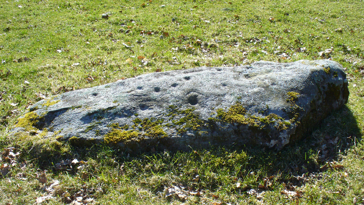
Glenhead Farm standing stones
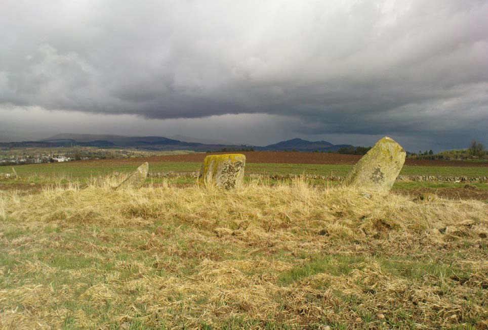
A few hundred yards south of the large Glenhead Standing Stone, we come across this curious small row of three reasonably large standing stones which — the more you look at them — give the distinct impression that they may be the remains of a large prehistoric tomb. But archaeology records are silent on this matter and we must contend with what we can see. At the northernmost end of the row, a fourth stone lays amongst the vegetation: it may have once stood alone, or maybe been snapped from its fellow monolith. 20 yards south is a large mass of stone; perhaps from an old building, perhaps cairn spoil (does anyone know?)
The local historian Moray Mackay (1984) thought that the line of stones here were once a part of something larger, saying:
“Originally it was probably a circle of six stones, with a seventh in the middle, and this central stone can still be identified by its flat top on which are the mysterious and well known cup-marks, much weathered but plainly visible. Close to the site, urns and stone hammers were unearthed last century.”
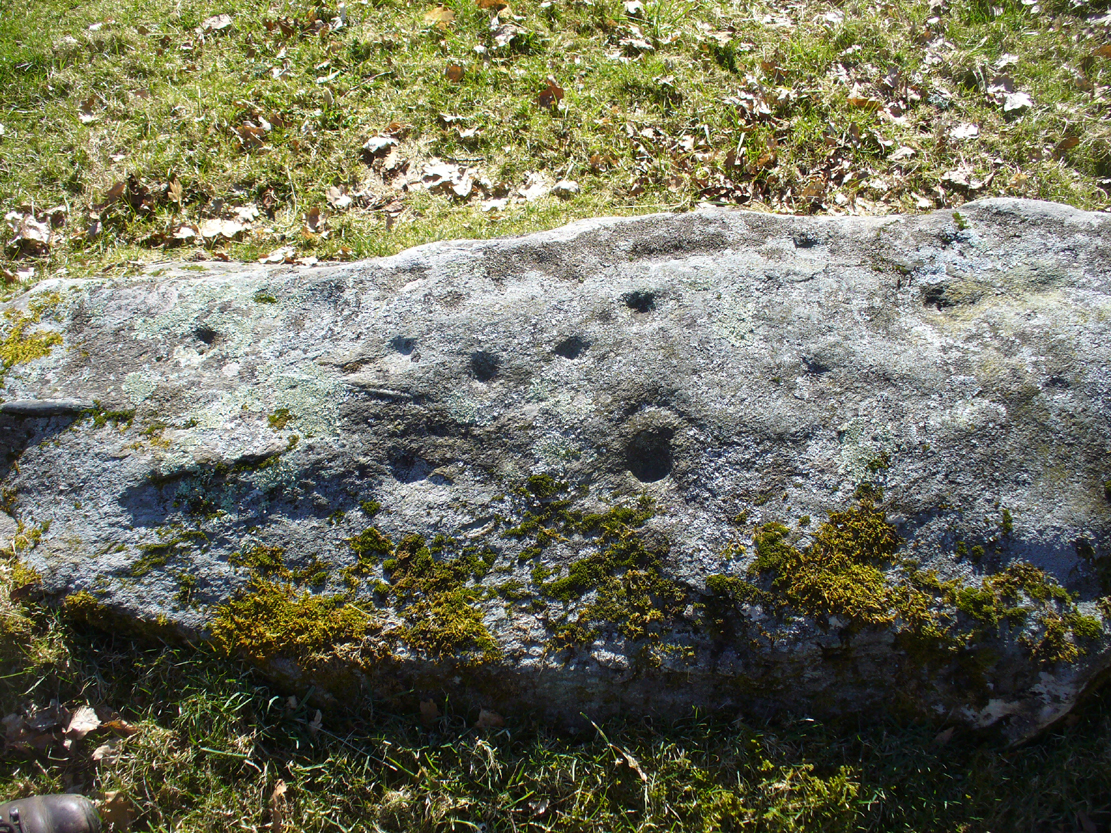
Glenhead stone row, looking north
Of the three remaining upright stones, it is the central one which has the cup-markings visible on its top and side (Allen 1882), with a lovely covering of almost luminous lichen giving it extra effect! (a separate TNA Site Entry for the cup-marked stone will be written in due course)
The famous astroarchaeologist Alexander Thom and his son (1990) described the place as,
“A three stone alignment showing about 33° N declination in one direction and 31° S in the other, but the azimuth comes from the stones only and so cannot be accurate. Perhaps the line is lunar to the hill in the SW…”
In Thom’s (1967) earlier work he posited that the alignment may relate to the rising of the star Capella around 1760 BC, but this is untrue. Thom’s error however, was not of his making, but due to the false dates that archaeologists ascribed to megalithic ruins at the time – dates which Thom used in his research, believing that the archaeological fraternity would know what they were talking about! In their collaborated text, Aubrey Burl added how,
“these stones stand on a hill summit at 360ft (110m) OD. The row is on a north-facing slope. Three stones stand. A fourth, prostrate, 6ft 6 in (2m) long, lies against the NE pillar. The row has a NNE-SSW axis. The northernmost stone is 3ft 6in high, the centre 4ft, and the SSW, characteristically the tallest, 6ft 6in… The line is about 27 feet (8.3m) long. The central stone has 23 cupmarks on its top and 4 more on its western side.”
…to be continued…
References:
Allen, J. Romilly, “Notes on some Undescribed Stones with some Cup-Markings in Scotland,” in PSAS 16, 1882.
Burl, Aubrey, From Carnac to Callanish, Yale University Press 1993.
A helluva climb to get here. Take the last road up towards Mill Burn at the west end of Tillicoultry and go to the picnic area & carpark, just below the footpath that takes you up the eastern slopes of the gorge. Walk up and up the steep footpath for nearly a mile and, as the landscape begins to level out a bit and turns more into a slope, watch out for a split in the paths and make sure you hit the one that veers you to the right, towards King’s Seat instead of the one that runs alongside the edge of the Gannel Burn valley below you. Walk along this path for a few hundred yards and you’ll come across a large pile of rocks placed atop of a much older and overgrown mass of stones, right by the path side. .
Archaeology & History
View of the green cairn, looking north
Due northwest of the curiously named Elistoun Hill, is this seemingly isolated overgrown prehistoric cairn. Measuring some 8 yards across and more than a yard tall, this compacted fairy-mound of a hillock has the crown of many large, more recent blocks on top, thankfully highlighting it making it much easier to find! But its isolation here is truly curious – as is the location halfway along hillside, quietly hidden away, calling out for no attention to any ancient traveller. It was listed as an ancient monument when surveyed by Ordnance Survey in the 1970s, although I have to be honest in saying that I doubt the prehistoric prevenance of the site. I may be wrong, but an excavation here would prove worthwhile.
Along the main street running through Alva, towards Tillicoultry, watch out for the roman catholic church on your left, then shortly past it the house of St. Serfs. Just next to this is the small road called Lovers Loan. Walk up here and just before the graveyard, walk right, into the overgrown boggy marshlands. The first presence of the holy waters here are about 12-15 yards into the grasses, where you’ll walk right into it!
Archaeology & History
A sacred well that was named after the little known character of St. Serf, who was said to have been the hermit and tutor of the more renowned St. Mungo.
Highlighted on the 1866 Ordnance Survey map of the area as St. Servanus’ Well, 100 yards southeast of the church, it was included in MacKinlay’s (1893) fine survey, though without comment. However it was said by Mr & Mrs Morris (1982) to be “near the south entrance of the churchyard.” The boggy remains of the spring can indeed be found at the southern edge of the graveyard, up Lovers Loan, just below the edges of a large mound. In Mrs Drummond’s (1936) survey of Alva, she too told that the “Well of St Servanus”,
“contained healing waters and was still to be seen in St. Serf’s Glebe in 1845, nbut it is now just a marsh on the west wisde of the lower cemetrary gate.”
The original waters have in fact been completely capped and the well is now covered by a modern concrete block, standing right next to the resurrected remains of one of Alva’s remaining standing stones.
References:
Drummond, Mrs A., The History of Alva and District from the Early Christian Period to 1900, in Transactions Stirling Natural History & Antiquarian Society, volume 58, 1936 (reprinted by Clackmannan District Libraries 1981).
MacKinlay, James M., Folklore of Scottish Lochs and Springs, William Hodge: Glasgow 1893.
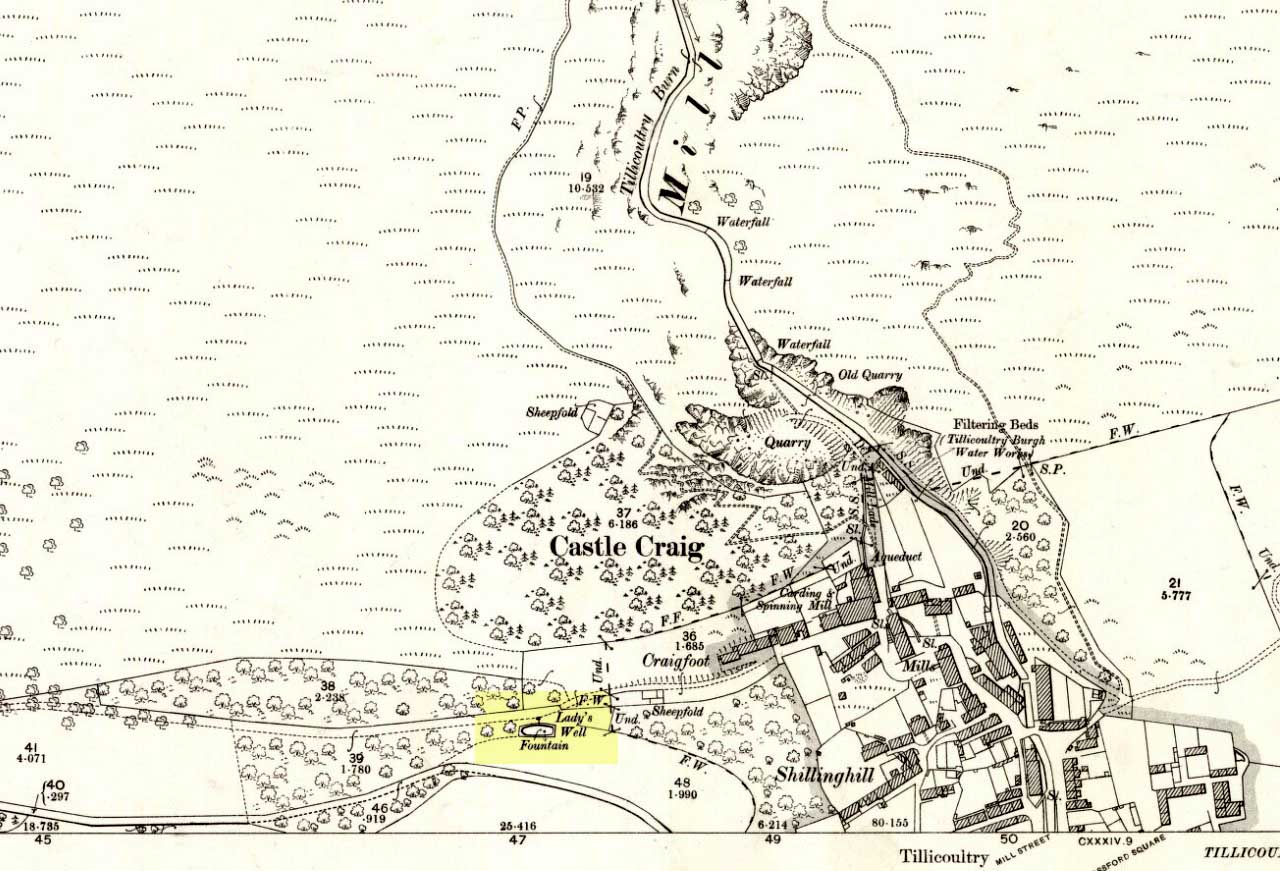
From the main road running through the town, head west towards Alva, and where the golf course begins, take the footpath uphill at its edge which heads towards the giant quarry. Where the dirt-track begins, keep walking along the edge of golf course, noting that where the open field starts, a gate on your right. Go through this, and walk up the side of the fence for some 30 yards, then go through the large gate. 10 yards in front of you, note the small stream crossing the track, and a scatter of overgrown rocks just on the other side of the wire fence. You’re here!
Archaeology & History
Thought by Angus Watson (1995) to have been possibly dedicated to ‘Our Lady’: in this context it’s difficult to know whether the dedication was to the christian Virgin, or to the heathen ‘Lady Alva’, whose web of snow and other natural garments clothe the mountains and glens of the Ochils hereby.
The first account of the place seems to be in William Gibson’s Reminiscences (1883) where he told that,
“In the year 1839, a Mr John Henderson built the only woollen mill…the water for the steam engine of which was got from the Ladies Well”,
Ladys Well on 1899 map
which was barely 100 yards to the west. It was later highlighted on the OS-map in 1899 with an associated ‘fountain’, right by the track-side. A water-pumping station shown at the same time on another map was, of course, the one that was built to supply the mill with water.
The present water source is slightly higher in the field than when it was shown on the early OS-maps, and it does still flow continuously—although the source is much neglected and could do with being recovered: as the photo here shows, an ugly pipe appears to be taking much of the healing waters which are now mainly feeding a large pond in the garden just below.
References:
Gibson, William, Reminiscences of Dollar and Tillicoultry, Andrew Elliot: Edinburgh 1883.
Take the A820 road from Dunblane to Doune. About a mile west of the motorway, keep your eyes peeled for where the small road on your right is signposted to Argaty and Kilbryde. Stop here and walk up the footpath on the left-hand side of the road. A couple of hundred yards up, take the right turn on the track and where the small copse of trees is, go through the gateway, keeping yourself to the left edge of the trees running parallel to the field. About 100 yards or so up, you can’t miss him!
Archaeology & History
Quite a huge fella this one! Standing more than 6 feet high, the monolith is nearly as broad, giving an impression of great size to the old stone. The stone’s nature and date is troublesome: although ostensibly labelled as Bronze Age, alongside the walling which runs down from here we see a great number of other large stones, some of which give the distinct impression of being length of Iron Age walling — but without excavation, its nature remains a puzzle. The monolith stands close to being on top of a rise in the land, which geomancers understand as being important sites of spirit, or places where the dead were rested — but we have no record of any tombs here, so are left with the options of walling or a spirit site.
…and from another angle
On its east-face, the stone has a number of what appear to be curious large cup-markings, but they appear to be little more than the effect of weathering and erosion. There’s also a solid piece of long metal sticking out of the same side, which was obviously done by someone in recent centuries — so maybe a local farmer and his mates stood this one up? Or they were planning on using it as a gatepost…
The site is well worth looking at, best in the winter months when access is easier. It has the feel of other sites close by, hidden from the record books, though probably long gone.
References:
Royal Commission on the Ancient & Historical Monuments Scotland, Stirling – 2 volumes, HMSO: Edinburgh 1963.
Royal Commission on the Ancient & Historical Monuments of Scotland, Archaeological Sites and Monuments of Stirling District, Central Region, Society of Antiquaries of Scotland 1979.
One helluva climb to reach this little fella. I simply started at Dalgirdy cottage, some 5 miles along Glen Lochay, on the right-hand side of the road. Then, walk right up the burnside, all the way up until it begins to level out and the old shielings appear. When you’ve got to where they just about finish, about 50-70 yards on the east side of the burn, you’ll see the small stone standing upright, all alone. You can’t really miss it!
Archaeology & History
Allt Ghaordaidh, looking south-ish!
No previous written records exist that describe this small standing stone, whose nature and age may be akin to that at nearby Tirai, found amidst the derelict village a couple of miles east, lower down the slopes — i.e., it may have simply been part of some of the ancient village remains and shielings found close by, either side of the rushing burn. But whether it’s only medieval or much more ancient than that, its position in the landscape alone (much like Tirai’s uprights), deserves to be known about.
There are considerable amounts of ancient remains scattering the mountains slopes all round here: some have been catalogued, but a lot of it has not. This little standing stone is at last alive again! (take good food and kit when visiting here)
The stone is situated on the north-facing slope of Carrot Hill (almost equidistant with neighbouring Dodd Hill actually) at 225 m OD. Use of a GPS and the co-ordinates above are very definitely recommended for finding this stone which lies flat on a heather covered hillside. You most likely won’t locate it without them. There is ample car parking space at the popular viewpoint car park on Carrot Hill (NO 464 408), walk to the summit trig point and follow your GPS from there.
Archaeology & History
This cup-marked stone was first noticed in February 2012. Remarkably, this stone seems to have been previously unrecorded despite lying just metres from a small path through the heather.
There are at least 15 cup marks on this sandstone boulder which was measured to be 1.2 x 0.7 x 0.2 m in size. There is no evidence of any rings around any of the cups.
The closest known examples of more rock art are just over four kilometers away to the west at Huntingfaulds where there is a cup and ring marked boulder.
This fascinating looking carving (in my personal Top 10 of all-time favourites cup-and-rings in the UK!) was unfortunately destroyed sometime between 1918 and 1920. A huge pity, as the design on the rock is almost unique in its ‘linear’ system of cups running a considerable length across the surface of the stone (like the similar design found at Old Bewick in Northumberland).
Wilson’s 1851 drawing of the Witches’ StoneSimpson’s 1866 drawing of the Witches Stone
Shown first of all on Kirkwood’s Environs of Edinburgh map in 1817 (above), this legendary rock was found amidst a cluster of other cup-and-ring stones at Tormain (some are still there) and was initially said by Daniel Wilson (1851) to have been the giant capstone of a cromlech that once stood here, but whose structure had fallen away. This idea is implied in the earliest drawing we have of the stone in Wilson’s magnum opus (above); Sir J.Y. Simpson (1867) gave us a similar impression with his drawing a few years later. But upon visiting the Witches Stone just as his book was going to the press, Mr Wilson visited the site and proclaimed that he “altogether doubted if they are the remains of a cromlech”, and what rested here were more probably just fascinating geological remains, with even more fascinating carvings on top!
In the years that followed Wilson’s initial description, the Witches Stone was visited and described by a number of eager antiquarians. Simpson (1867) gave us a quite revealing account, telling:
“On the farm of Bonnington, about a mile beyond the village of Ratho…are the remains of ‘this partially ruined cromlech’…with the capstones partially displaced, as if it had slid backwards upon the oblique plane of the huge stones or stone which still supports it. Two or three large blocks lie in front of the present props. Its site occupies a most commanding view of the valley of the Almond, and of the country and hills beyond. The large capstone is a block of secondary basalt or whinstone, about twelve feet long, ten in breadth and two in thickness. Its upper surface has sculptured along its median line a long row of some twenty-two cup-cuttings; and two more cup-cuttings are placed laterally: one, half a foot to the left of the central row and at its base; the other, two feet to the right of the tenth central cup and near the edge of the block. The largest of the cups are about three inches in diameter and half an inch in depth; but most of them are smaller and shallower than this…”
A few years later another early petroglyph authority, J. Romilly Allen (1882), visited the Witches Stone and found “an Ordnance bench mark (had been) cut on the stone itself”! He then continued with his own description of this once-important megalithic site:
“The Witch’s Stone is a natural boulder of whinstone, rounded and smoothed by glacial action, whoso upper surface slopes at an angle of about 35° with the horizon. The length of the sloping face is 8 feet and at the top is a flat place 2 feet wide. The breadth of the stone is 11 feet 3 inches at the upper end, and 4 feet at the lower end. The thickness varies from 2 to 3 feet. The highest part of the stone is 6 feet 6 inches above the ground, and the lowest 1 foot 6 inches. It rests on what has originally been a portion of the same boulder, but is now a mass of whinstone broken up into several fragments, which serve as supports to prop up the stone above. Viewed from the north side the whole presents the appearance of a cromlech, the upper stone forming the cap, and the disintegrated portion below the supports. This notion, however, will be clearly seen to be erroneous on looking at it from the opposite side, as shown on the accompanying sketch…where the crack separating the two portions of the boulder is very apparent… The sculpturings consist of twenty-four cups varying in diameter from 1½ to 3 inches. Twenty-two of these cups are arranged in an approximately straight line along the sloping face of the stone, and divide it into two almost equal parts. The two remaining cups lie, one 7½ inches to the left of the lowest cup of the central row, and the other 2 feet 3 inches to the right of the ninth cup up the stone… The field in which the Witch’s Stone is situated is called “Knock-about.” The sloping face of the stone has been much polished by the practice of people climbing on to the top and sliding down. Some of the cups are almost obliterated in consequence. The stone forms a very prominent feature in the view, and must always have attracted attention from its peculiar shape.”
Some twenty years after Allen, the megalithomaniac Fred Coles (1903) came and checked the Witches Stone out for himself and, as happens, had a few additional things to say about the place:
“Although this huge boulder and its cup-marks have been more than once figured and described, I found, on a close examination of the broad surface of the Stone, that none of the illustrations showed the cup-marks in their exact relation to each other, nor in their true relation to the contour of the Stone. The drawing shown above…was made after a careful measurement by triangulation of the Stone; and it is claimed to be the first that shows that the cups, two and twenty in number, are not disposed in one continuous line, but that thirteen follow each other from the high south edge of the stone for a distance of exactly 6 feet, and nine others lie a few inches to the west, occupying a space 3 feet long of the overcurving edge of the north end. It is further shown that, at a point 2 feet 3 inches west of the ninth cup-mark, there is another one quite as large as the largest in the rows near the middle of the Stone. The south edge (A B) has slipped a little down from its original height, the boulder being frost-split horizontally; its height there above ground is 8 feet. The northern and narrower end is about 2 feet above ground, and does not touch the ground, as it rests upon its lower portion, beyond which it projects a few inches. The cup-marks run due north.”
Fred Coles 1903 drawing
If the Witches Stone was in fact a natural outcrop stone and not a cromlech, this very last point telling that “the cup-marks run due north” probably had much greater importance than a mere compass-bearing to the people who etched this carving. For in pre-christian religious structures across the northern hemisphere, north is commonly representative of death and the land of the gods. In magickal rites “it is the place of greatest symbolic darkness,” as neither sun nor moon ever rise or set there. Additionally, north is the place where, in shamanic traditions, the heavens are tied to the Earth: the cosmic axis itself that links heaven, Earth and underworld. In early neolithic traditions this mythic structure was probably endemic. Whether its magickal relevance was intended here, at this stone, we will probably never know…
Folklore
Folklore tells that the Witches Stone was one of the sites used in magickal rites by the Scottish occultist, Michael Scot. J.R. Allen’s (1882) description of “the sloping face of the stone has been much polished by the practice of people climbing on to the top and sliding down,” may relate to folk memory of fertility rites once practiced here, as found at similarly carved rocks in the UK and across the world.
McLean, Adam, The Standing Stones of the Lothians, Megalithic Research Publications: Edinburgh no date (c.1978).
Morris, Ronald W.B., The Prehistoric Rock Art of Southern Scotland, BAR: Oxford 1981.
Royal Commission on the Ancient & Historical Monuments of Scotland, Inventory of Monuments and Constructions in the Counties of Midlothian and West Lothian, HMSO: Edinburgh 1929.
Simpson, James, Archaic Sculpturings of Cups, Circles, etc., Upon Stones and Rocks in Scotland, England and other Countries, Edmonston & Douglas: Edinburgh 1867.
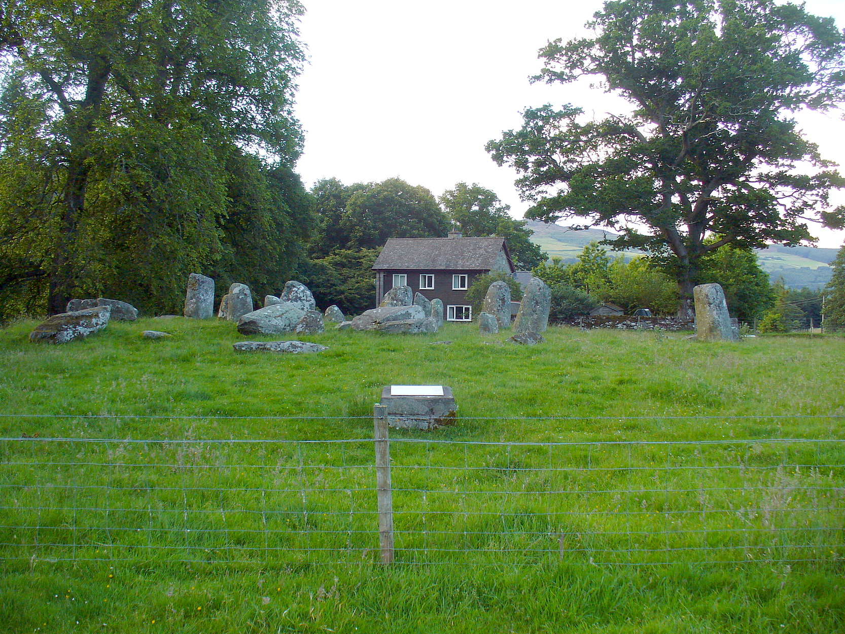
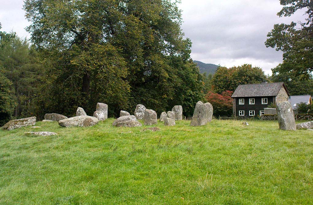
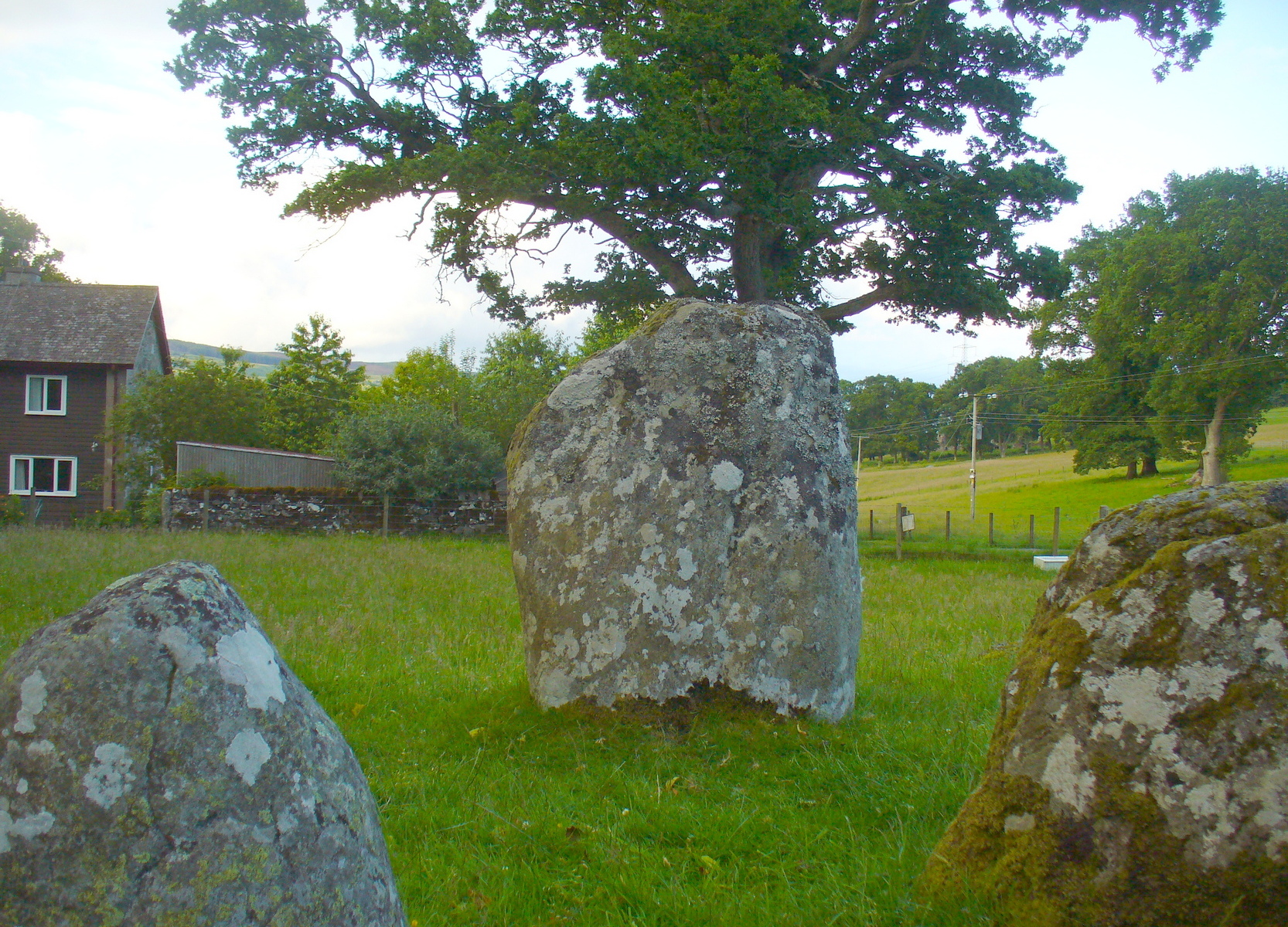
Take the A827 road that runs from Kenmore (top-end of Loch Tay) to Aberfeldy, and about 2 miles outside Kenmore, once you come out of the woodland (past the hidden standing stones of Newhall Bridge) and the fields begin on the east-side of the road, a small dirt-track leads you slightly uphill to the farm and house of Croftmoraig. The stone circle is right in front of the house less than 100 yards up the track (you can see it from the road).
Archaeology & History
A truly fascinating site, whose history is much richer than its mere appearance suggests. It has mythic associations with both moon and sun, a cup-marked stone to the southwest, and an earlier structure that had Aubrey Burl (1979) suggesting was possibly “the dwelling-place of a priest, a witch-doctor, a shaman.” Not bad at all!
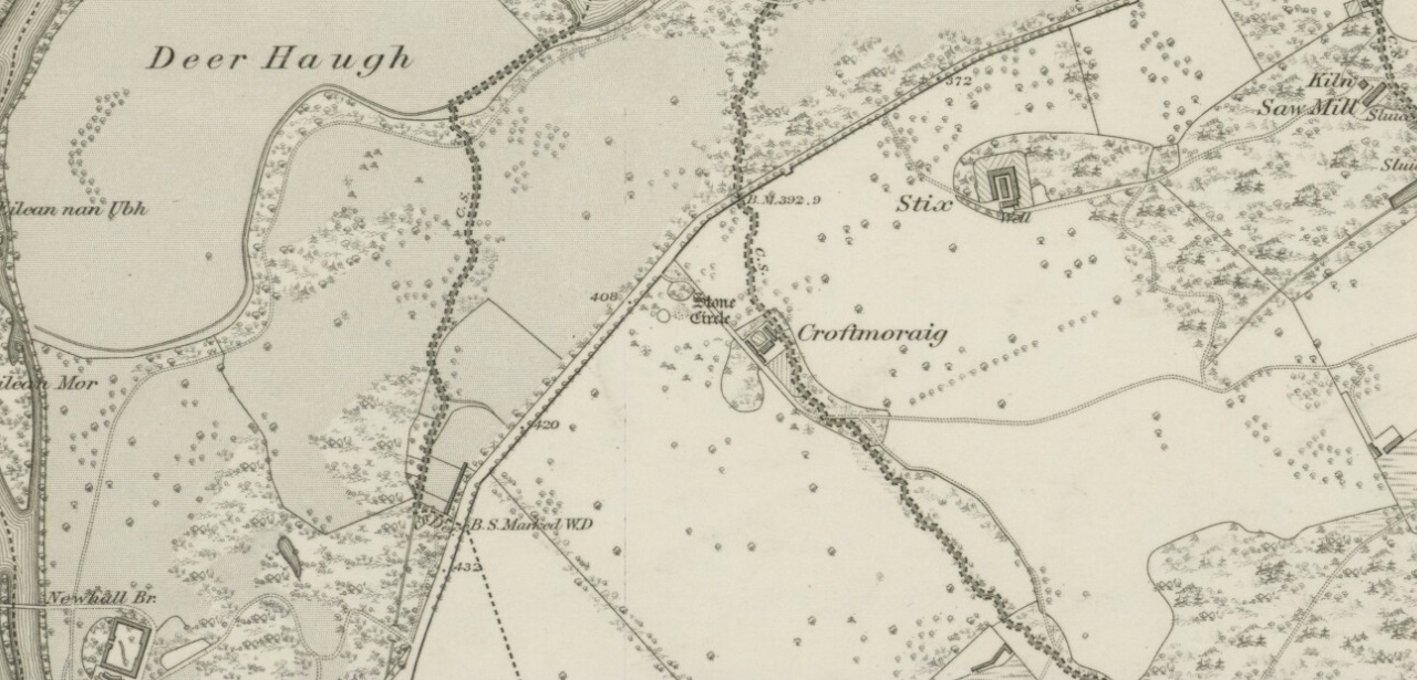
Croft Moraig on 1867 map
The sad thing today is its proximity to the increasingly noisy road to Aberfedly whose begoggled drivers care little for the spirit of place or stones. Here sits a feel of isolation and tranquility broken. But at least the cold information of its architecture is available for tourists and archaeologists alike; at least their depersonalized appreciations are served!
Described first of all (I think) in the old Statistical Account by Colin MacVean (1796), he told Croft Moraig to be one of “several druidical temples” in the area, “perhaps the largest and most entire of any in Scotland,” he thought:
“It is about 60 yards in circumference, and consists of three concentric circles. The stones in the outermost (ring) are not so large as those in the inner circles, and are not, like them, set on end.”
Hutcheson’s 1889 planCroft Moraig, looking N
The first decent archaeocentric evaluation of Croft Moraig was done in the 19th century by Alexander Hutcheson (1889), who gave us not only the first decent ground-plan of the site, but was also the first person to note that there were some faded cup-and-ring markings at the circle. After first directing his antiquarian readers to the site, he described the multiple rings of stones here, that had been built on top of an artificial platform of earth and stones:
“The circles are concentric, three in number, and occupy a little plateau which may be artificial, as the outer circle just covers it, on the gentle slope which here rises towards the south from the public road.
“I have prepared and exhibit a plan of the circles, and for reference have distinguished the stones by numbering them in the plan. The inner circle consists of eight stones all standing, with one exception, No. 3, which presumably has fallen inwards. The next or second circle consists of thirteen much larger stones, nine of which stand erect; Nos. 3 and 5 have presumably fallen in, while Nos. 7 and 9 have fallen outwards. The outer circle is formed by a number of smaller stones placed so as to form a sort of rampart. These are recumbent, and lie generally with their larger axes in the direction of the rampart. The circle measures, over the stones, as follows:
“Inner circle, West to East, 25 ft. 6 ins., North to South, 22 ft. 6 ins.
“Second circle, West to East, 40 ft North to South, 41ft 3in
“Outer circle, West to East, 58 ft North to South, 58ft
The stones are all rounded or water-worn boulders of dolerite, granite, schist, &c. The stones marked A and B are large blocks, 6 feet 6 inches high, 4 feet broad, and 2 feet 6 inches thick, standing upright. C seems to be a large (section) which has fallen from B, and lies flat on the ground.
“At the south-west side and in the line of the outer circle lies the cupmarked stone… If, as has been suggested, the two large blocks A and B formed the entrance to the circles, then the entrance faced towards the south-east. The blocks vary in height from 3 feet to 7 feet above ground, while of those which I have supposed to have fallen, their dimensions are, naturally from the ground-hold having to be added, much greater, amounting in one of them to 9 feet 6 inches long. There is a longish low mound of small stones, like an elongated cairn, which might yield something if it were to be searched. It lies just abreast of the cup-marked stone. I have referred to the recumbent stones in the two inner circles as having probably stood at one time erect. This I have presumed for several reasons, the principal being that one end of each of these stones corresponds in position with the circle formed by the standing stones; and while this is the case the recumbent stones do not preserve a uniformity of direction, but lie indifferently outwards and inwards from the lines of circularity, and at differing angles from these lines…”
Fred Coles’ site planOne of the cup-marked stones
Some twenty years later, the legendary northern antiquarian Fred Coles (1910) brought his lucidity to Croft Moraig and with it, even greater attention to detail. In a lengthy description of each and every aspect of the circle that has yet to be equalled he gave the reader the most detailed description we have. I hope you’ll forgive me adding Mr Coles’ prolonged description, but it is most valuable for anyone wanting to explore the site in greater detail. He wrote:
“As will be seen from the plan…the structural portion of Croft Morag consists, first, of a roughly circular, earthen mound (lettered in small type a-t), some 3 feet high, which is marked off by several stones of a more or less slab-like character, set irregularly upon a circumference of, approximately, 185 feet. This outermost setting, or revetment of stones is visible now only at certain fragments of the arcs; i.e., it is well-defined on the SW at a, where a long Stone, 6 feet 5 inches by 2 feet lies flat, and bears numerous cup-marks…; on the S arc there are five small Stones (b, c, d, e, f) all earthfast and flattish; on the SE are three similar Stones (g, h, i); on the E arc, four (j, k, l, m); on the N arc, very slightly to the west, one very large Stone (n) flush with the ground at the edge of the bank and a good deal overgrown with grass, measuring 8 feet 6 inches by 3 feet 3 inches; farther to the NW are five stones more (o, p, q, r, s), the last three having only very small portions visible; and, still farther round, is the last of what I consider to be these ridge-slabs (t) close under the edge of the great fallen sloping stone D. Thus the total number of measurable and separate stones now resting on the outermost ring is twenty.
“The stones of the intermediate ring constitute the imposing feature of the circle. They are thirteen in total number in the present condition of the circle, but they probably numbered eighteen when the circle was complete. Nine of them are the tallest in the whole group; four of these are prostrate on the W arc. By striking a radius from the common centre of the circle through the centres of these great stones which are erect, to the outermost circumference, the following measures are obtained: from centre of E, the NNW stone, to the ridge 14 feet 6 inches; from F, NNE stone to the ridge 13 feet 4 inches; from G to ridge 14 feet 4 inches; from H to ridge 13 feet 4 inches; and from I, the SE stone, only 10 feet 6 inches. The four fallen blocks, lying as shown A, B, C, D, no doubt stood on this intermediate ring, the diameter of which measured from centre to centre is 38 feet. Now, it must be observed that between A and B and A and I there are Stones (shaded in the plan); these two are erect, the one near B measuring 3 feet in length, 2 feet in breadth, and 3 feet 4 inches in height; it is quite vertical, and is undoubtedly in situ. The other small erect Stone midway between A and I has much the same size’ and features. Between B and C there is shown in outline another of these small stones ‘in line’ with the great pillars which remain on the E arc; and it is quite clear that if this remarkable and novel feature of alternating each tall stone with a very small but vertical block was originally carried out all round this intermediate ring, there would have been eighteen stones in all. Without the most arduous and careful excavation in these interspaces however, it would be extremely difficult, if not impossible, to prove that these small blocks did once stand on the eastern semicircle.
“As illustrating the general size of the great stones, when fully exposed to view, the dimensions of the four fallen blocks are here given: A, 7 feet 7 inches by 4 feet 10 inches, and fully 2 feet thick; B, 9 feet 2 inches by 3 feet 9 inches (on the upper face), and 2 feet 9 inches thick; C, 8 feet by 4 feet, and 3 feet fi inches thick; D, 7 feet by 4 feet 6 inches, and 3 feet thick at its vertical outer edge.
“The five upright stones of the intermediate ring measure as follows: I, the SE stone, 5 feet 6 inches in height, and in girth 11 feet; H, the east stone, 5 feet 8 inches in height, pyramidal in contour, and in girth 11 feet 4 inches; G, the NE stone, 5 feet 3 inches in height and 11 feet in girth; the next stone, F, 5 feet 7½ inches in height and 13 feet 6 inches in girth; and stone E, nearest to the north on the W arc, stands 6 feet 3 inches in height and measures round the base 9 feet 3 inches.
“The stones forming the inner ring, which is a broad oval in form, are eight in number, quite erect, with one exception; the fallen one (shown in outline) is due south of one set at the north point and the distance between these two is 23 feet 8 inches. If however, the distance between the N Stone and the E one at the SSE be taken, this diameter is 26 feet, as against one of 21 feet taken between the NW and SE stones. Measured from the centre of the fallen stone a space of 10 feet 3 inches divides that from the centre of the erect stone on the east, and an equal space divides it from the centre of the stone on the west. Between the N stone and that on its southwest an equal space of 11 feet 3 inches exists as between that stone and its SE stone; but between these last two there is a third almost exactly midway. The fallen stone measures 5 feet 10 inches by 3 feet 9 inches; the NW stone is 4 feet 6 inches in height, the SW stone 3 feet 6 inches, the N stone 3 feet 4 inches, the NE one 2 feet 6 inches, and the stone between it and the fallen block 3 feet 4 inches in height.
“In addition to the feature above noticed, of tall stones alternating with much smaller ones, Croft Morag possesses another noticeable arrangement in the presence of two great massive monoliths (U and V on the plan) standing like the remains of a portal, nearly eight feet outside of the boundary ridge on the SE. Neither of these stones is now absolutely vertical, stone U leaning considerably out towards the SE, and V having a very slight lean inwards to the circle. The former is 6 feet 2 inches in vertical height with a basal girth of nearly 12 feet, which is probably an under-estimate, for there are two large fragments (w and x) which appear to have been severed from this stone, the edges of which nearest the fragments are rough and sharp. The latter (V) stands 6 feet 4 inches in height and girths 11 feet 8 inches…
“…Besides its complexity of arrangement and the great number of measurable stones, forty-two in all, this circle is emphasised by the existence of a cup-marked stone set in a portion of its structure…on the SW arc… There are nineteen cups in all, only two of which differ much in diameter and depth from the rest, and there does not appear to be anything in their design to suggest a meaning or lend a clue to their symbolism.”
When the monument was excavated by Stuart Piggott and his mates in 1965, it was found to have been built over many centuries. As Aubrey Burl told:
“The first phase, of the late neolithic, consisted of about 14 heavy posts arranged in a horseshoe shape about 25ft 10in x 22ft 10in (7.9 x 7m) with a natural boulder at its centre. Burnt bone was found near this. Outside was a surrounding ditch and at the E was an entrance composed of 2 short rows of posts.
“In the second phase the timbers were replaced by 8 stones graded in height towards the SSW, also erected in a horseshoe 29ft 10 x 21ft (9.1 x 6.4m). A rubble bank was heaped up around it. On it at the SSW was a prostate stone with over 20 cupmarks carved on it. Other cupmarks were ground into the NE stone.
“Finally a circle of 12 stones, about 40ft (12.2m) is diameter, was erected around the megalithic horseshoe with a pair of stones forming an entrance at the ESE. Graves may have been dug at their bases later.”
Fred Coles mentioned a couple of other local names given to the site, one of which – Mary’s Croft – he thought may point “to a dedication to the Virgin.” Another curious place-name next to the site is called Styx,
“which appears to be the modern abbreviated form of the Gaelic word stuicnean. This, Mr Dugald McEwan affirms, meant ground full of overturned forest-trees; and it is therefore probable that in the remote past all the land surrounding the Stone Circle was a deep forest, and perhaps because of its seclusion, this site was selected as the most fitting for the erection of the principal Circle of the district.”
Alex Thom’s ground-plan
When the engineer and archaeoastronomer Alexander Thom (1967) came to examine Croft Moraig, he found the outlying stones to the southeast could have been solar alignment indicators, albeit poor ones. However, the geometric structure of the ring appeared to further confirm the use of his Megalithic Yard by those who built the circle. Thom’s illustration shows his finding, which he described briefly as follows:
“Two concentric circle and an ellipse. The circle diameters drawn are obviously too large and could be as small as 58.5ft outer circle and 41.0ft inner. Outer circle diameter58.5ft = 21.5 MY. Perimeter 67.5 MY = 27 MR. Inner circle diameter 41.0ft = 15.1 MY. Perimeter 47.3 MY = 18.9 MR. Ellipse drawn has major axis 11 MY, minor axis 8 MY, distance between foci is 7.5 MY. Perimeter is 30.0 MY = 12 MR. This ellipse looks slightly large but the triangle on which it is based and the perimeter are almost perfect.”
Folklore
Old lore told that the standing stones of Newhall Bridge 850 yards away (777m) were once connected with the Croft Moraig circle. William Gillies (1938) told this tradition saying,
“that at one time there was a paved way connecting the circle, of which these stones are the remains, with the great Croftmoraig circle.”
Croft Moraig, looking W
Fred Coles also noted that one of the stones in the circle (stone D in his plan) had “been polished by the sliding of generations of children”. This playful action on stones elsewhere in the UK and around the world sometimes relates to fertility rites (i.e., the spirit of the stone could imbue increased fertility upon the practitioner), but Coles made no mention of such rituals here.
References:
Burl, Aubrey, Rings of Stone, Frances Lincoln: London 1979.
Burl, Aubrey, The Stone Circles of Britain, Ireland and Brittany, Yale University Press 2000.
Follow the same directions for the Croft Moraig stone Circle. Then check out the elongated stone lying in the grass on the southern edge of the circle. It’s not that hard to find!
Archaeology & History
Nearly 13 yards (11.75m) south of the faded Croft Moraig 2 carving, this cup-and-ring stone on the SSW edge of Croft Moraig is one of at least four that have been found in this megalithic ring. It has been suggested that the stone on which the carving is found once stood upright. The earliest account I’ve found of it comes from Alex Hutcheson’s (1889) essay in which he wrote:
“At the south-west side and in the line of the outer circle lies the cupmarked stone. It is a recumbent stone, and like the others in that circle lies with its larger axis in the direction of the encircling line. It measures 6 feet 6 inches long by 2 feet broad, and bears on its surface 23 cups. Two of these are connected by straight channels. The largest cup is 2 inches in ‘diameter and f inch deep. Two of the cups are encircled, each with a concentric ring. None of the other stones exhibit any cups or other artificial markings.”
Cup-marks pointed outFred Coles 1910 drawing
…Although other cup-marks have subsequently been found on other stones within the circle. Consistent with the location of cup-and-ring marks elsewhere in the country, Hutcheson found the carved rock to be just in front of “a longish low mound of small stones, like an elongated cairn, which might yield something if it were to be searched.” Very little of this cairn remains today.
When Fred Coles (1910) came to explore Croft Moraig about 20 years later, he could only discern 19 cups on the stone, most of them the same size, “only two of which differ much in diameter and depth from the rest.” The cup-and-ring that Hutcheson described and the other missing cups had been overgrown by the grasses, Coles said. When Sonia Yellowlees described the carving in 2004, she said that 21 cups were visible, “one of which is surrounded by a single ring”—which you can clearly see in the photos below.
Carving 1 with cup-and-ringClose-up of design
When archaeologist Evan Hadingham (1974) looked at this site, he found deposits of quartz here and thought that their presence may have been relevant to the placement of the carving, noting how such a relationship is found at other circles in Scotland. In more recent years, rock art students Richard Bradley and others have found similar quartz deposits in or around some petroglyphs a few miles from here; as have fellow students Jones, Freedman and o’ Connor (2011) at some of the rock art around Kilmartin. In my own explorations of the carvings near Stag Cottage, hundreds of quartz chippings were found that had been pecked into the cups and rings.
References:
Burl, Aubrey, Rings of Stone, Frances Lincoln: London 1979.


002")


")
")
sm")
")
sm")
sm")
")


")