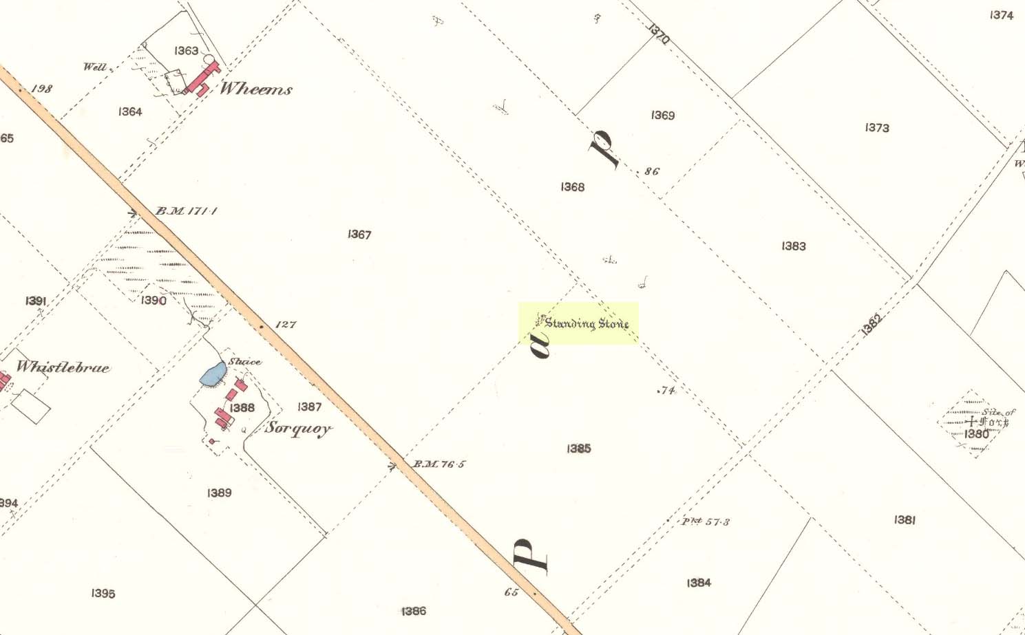
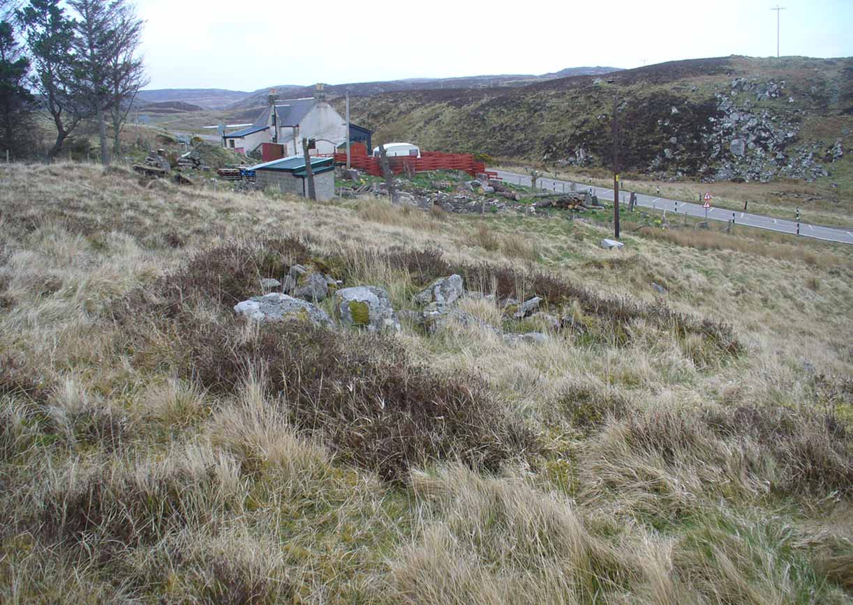
Take the third left road off the A961 past St Mary’s Hope, travelling south, taking the right fork at Lythes, and continue down to the end of the metalled road. From there, walk up the slope to your right (south) and follow the fence on your left into the next field and the stone will be seen in a fenced enclosure.
Archaeology & History
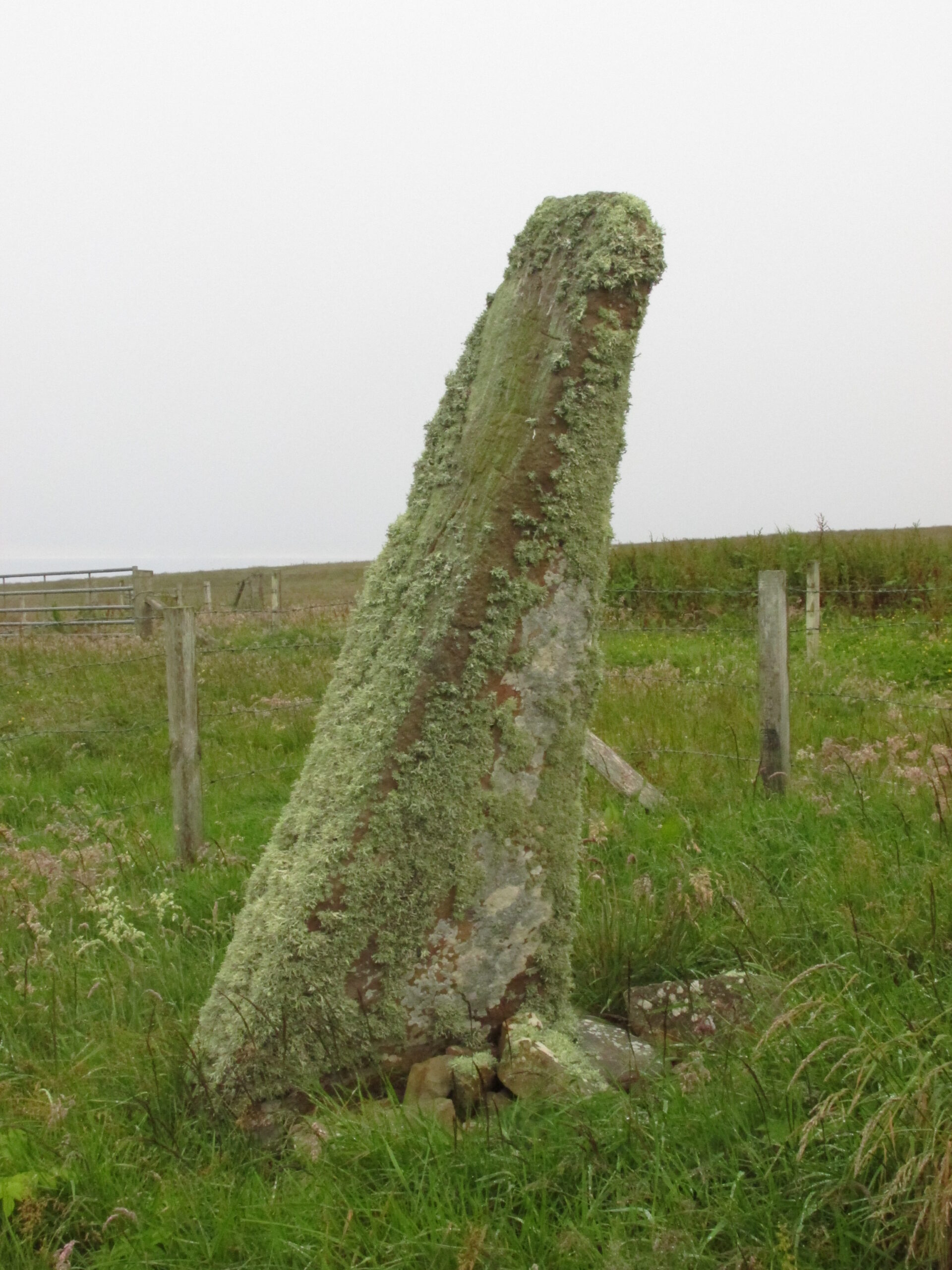
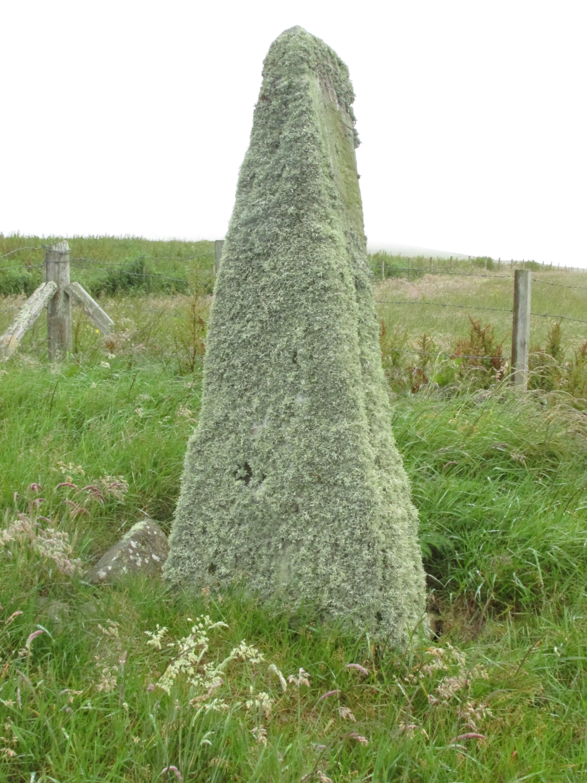
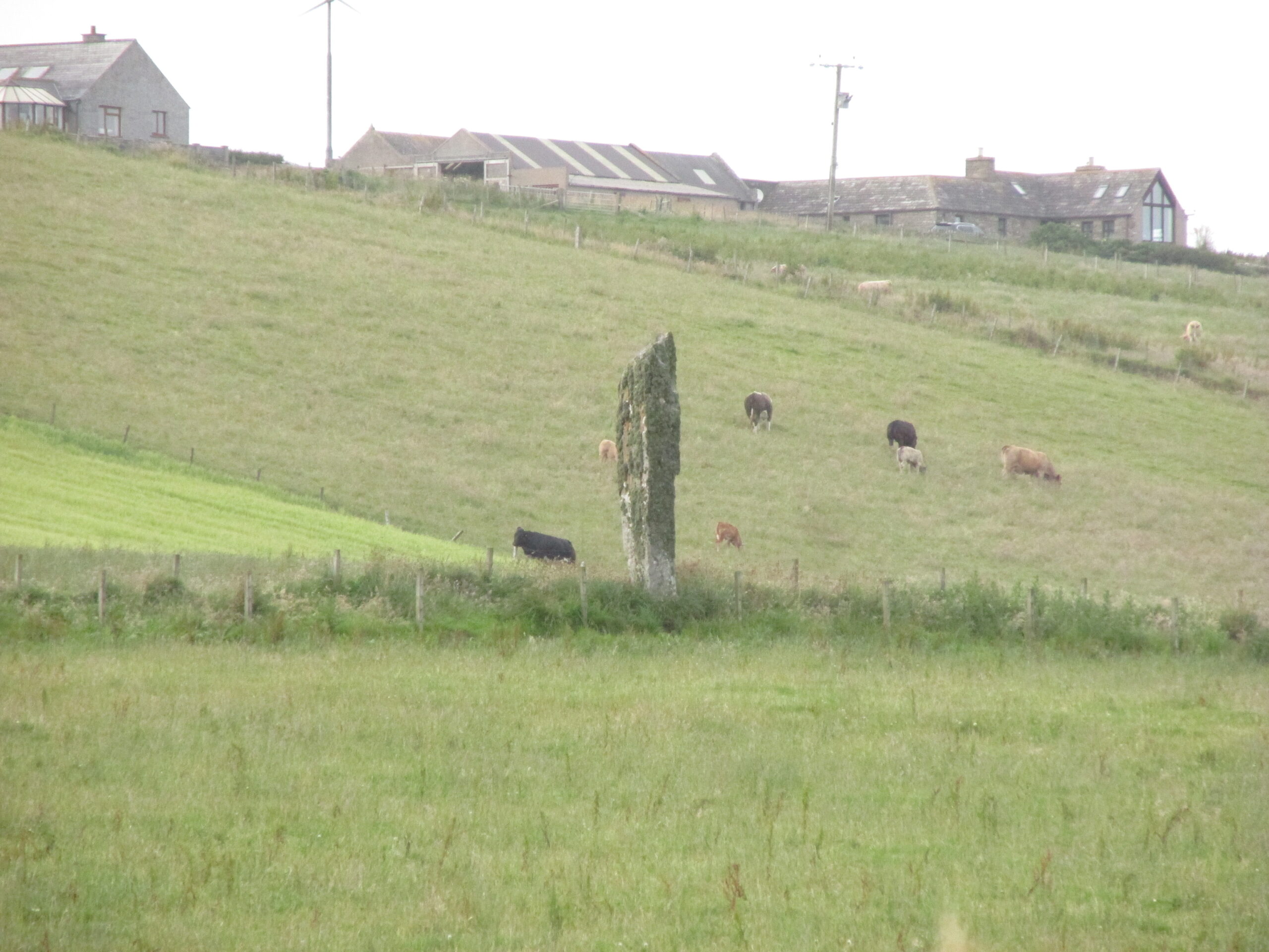
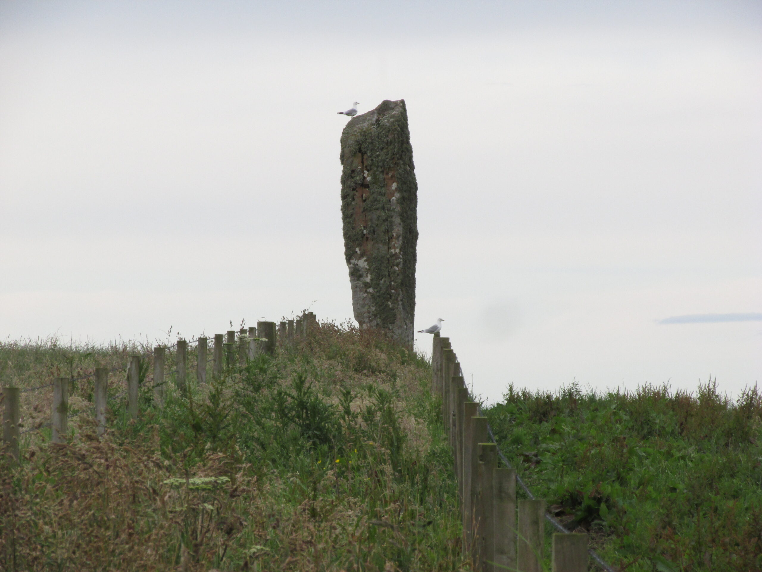
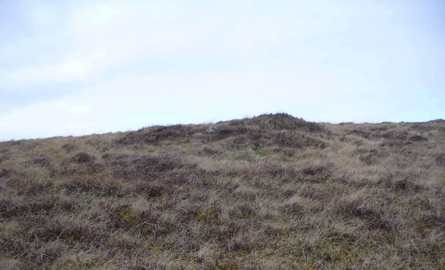
Two things strike you when you first see this stone, the triangular shape of the east facing side, and the lichen which covers this face and much of the rest of the stone giving it the distinct illusion of having a green velvet coat! From another angle it has a distinct lean and there are quite a few packing stones around its base. The Royal Commission inventory (1946) describes it thus:
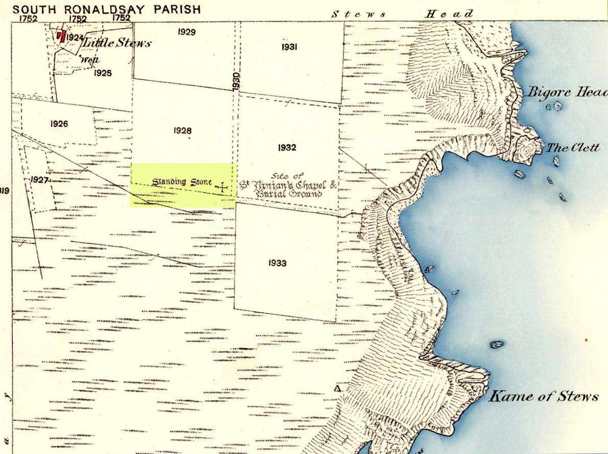
Stone on 1881 map
“On a ridge barely a quarter of a mile S of the farmhouse of Stews is a triangular block of red sandstone nearly 6 ft high, set with a packing of small stones at the base and with its axis N-S. At the bottom where it is widest it measures 2 ft. 6 in. across and is from 12-13 in. thick. As it rises it tapers gradually to a pointed top, which is slightly inclined towards the W.”
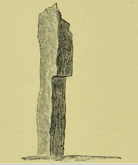
George Low on his 1774 tour wrote:
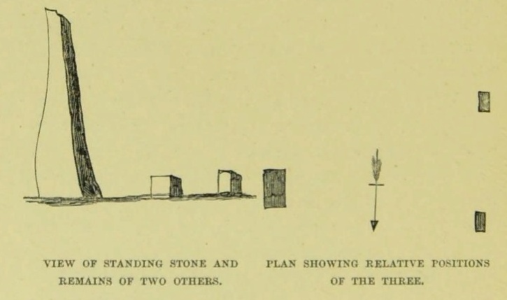
“Left this spot, and May 12th, proceeded southward by Stowse head; observed on the hill the remains of a tri-angular monument, but very much defaced, and two of the stones broke to the stumps. Tradition is there none as to the reason &c. of its erection. The figure with a plan follows…”
George Low’s 1774 sketchA coat of lichen
There is now no trace on the surface of the other two stones of this group so we are fortunate to have Mr Low on the spot sketch to record them. The stones would have been visible to the seafarers of times past who may have used them as navigation landmarks in pre-literate times, this being one of a number of surviving coastal stones on the Orkneys but whether they were erected for this purpose cannot be known. If you’ve been to see the Sorquoy stone up the coast, the surviving Stews stone is worth the journey if only for its ‘velvet’ coat.
References:
RCAHMS, Twelfth report with an inventory of the ancient monuments of Orkney and Shetland, 3v. Edinburgh. 1946
Low, George, A Tour Through the Islands of Orkney and Schetland…collected in 1774, William Peace & Son: Kirkwall 1879.
Acknowledgements: Big thanks for use of the 1st edition OS-map for this site profile, Reproduced with the kind permission of the National Library of Scotland.
Travelling south on the A961, take the first road left past St Margaret’s Hope, and follow it over the cross roads, and down the hill towards the sea, and it’s visible on the left hand side. You can’t miss it! It’s accessed by a narrow pathway which has been partly ditched – be careful!
Archaeology & History
View from the SEView from the track – SW
One of the less well known but most impressive of the Orkney standing stones, and seemingly one of the least visited. On my visit in July 2019, it was clear no one had walked the path for several months. The Royal Commission Inventory describes it as being, “14′ – 14′ 6″ high with some packing at the base. At 3′ above ground level, it is 2′ 6″ wide and 18″ thick, thickening to 21-22″ as it rises.”
It has a distinctly top-heavy look, and although invisible from the west above the brow of the hill, it can be clearly seen from the sea.
George Low visited the stone on May 11th 1774, saying:
‘In this beautiful hollow, in a cornfield, saw a large erected stone about 16 feet above ground, probably monumental, tho’ tradition is silent about it, and by digging nothing was found that could certainly prove this’.
Described by local historian George Barry (1748 – 1805):
George Low’s 1774 drawing
‘To the north (of South Ronaldsay), – at no great distance, is a most beautiful vale, with the ocean on one side, and gently declining hills on the other; which, for the production of every sort of beneficial crop, is far superior to any other part of the island. In the middle of this pleasant spot, on the brow of a hill, is a monumental stone, sixteen feet high, which, like many others through the country, bears no marks of human art, in carving, figures, or inscription. The whole delightful dale is known by the name of Paplay’ .
If you’re in the islands, this impressive stone is certainly worth a detour!
References:
Barry, Dr George, History of the Orkney Islands, Longman,Hurst,Bell & Orme: London 1808.
Low, George, A Tour Through the Islands of Orkney and Schetland…collected in 1774, William Peace & Son: Kirkwall 1874.
Royal Commission Ancient & Historical Monuments, Scotland, Inventory of the Ancient Monuments of Orkney and Shetland, HMSO 1946.
Acknowledgements: Big thanks for use of the 1st edition OS-map for this site profile, Reproduced with the kind permission of the National Library of Scotland.
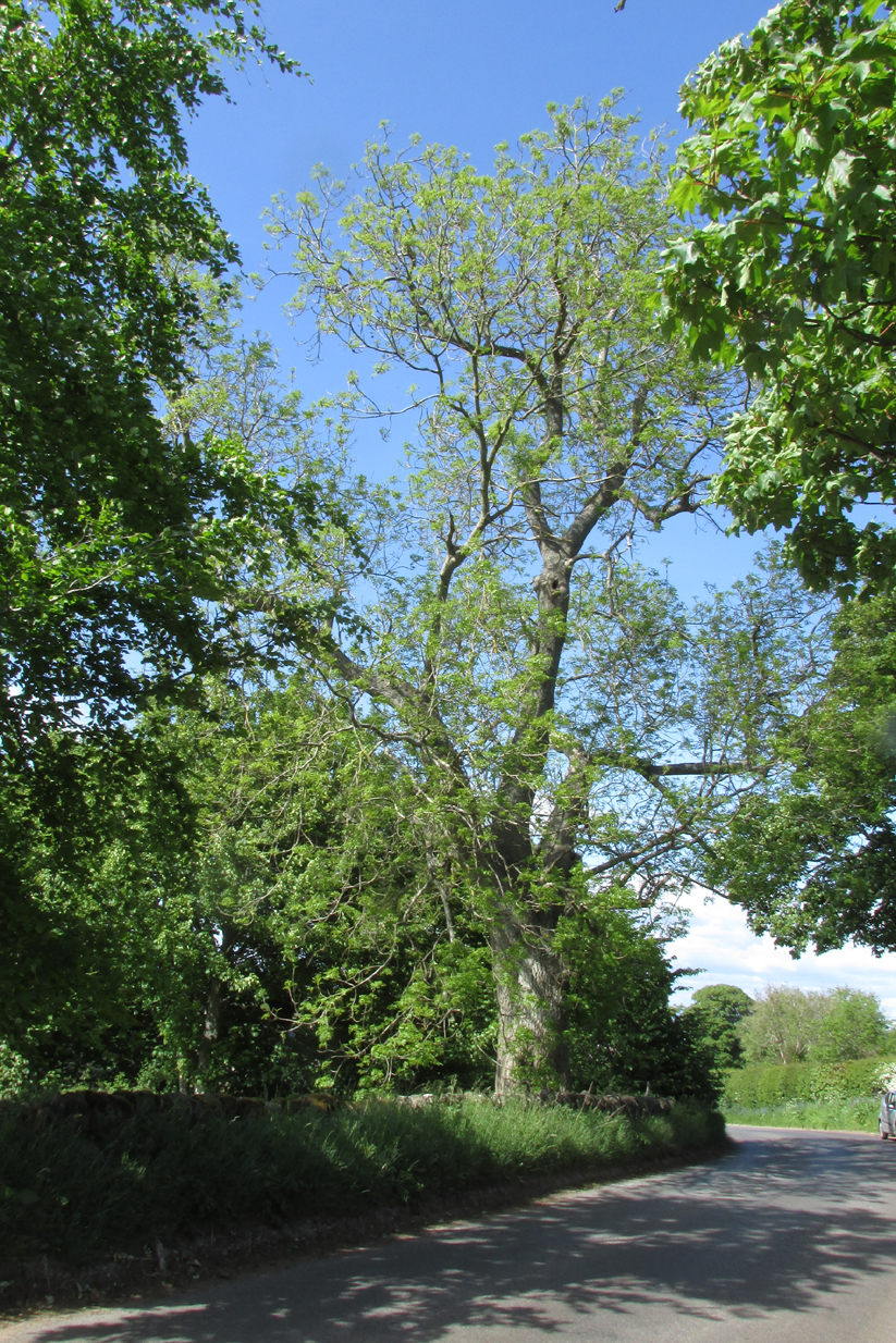
The tree is at Templeton on the west hand side of the Newtyle to Balkeerie Road travelling north, just before the bend in the road at Templeton Farm.
Archaeology & History
The only written record of the tree is in Strathmore Past and Present by the Reverend J.G. M’Pherson (1885):
Standing Proud
“After driving two miles eastward from the village of Newtyle along a most excellent level road, we enter the united parishes of Eassie and Nevay. The time-honoured boundary-mark is a conspicuous old ash, which popularly goes by the name of the Temple-tree. Tradition cannot guess its age. It is of considerable diameter, but quite hollow from the ground upwards for twenty feet. The bark is stripped off in several parts, and the thin shell of wood exposed is quite worm eaten; here and there being quite worn through, forming a rude door and rugged windows for the weird like interior.
“Large branches spread out, half dead-and-alive, with some foliage, scantily furnished with the life-giving root-sap. Could it speak it would tell of many a strange incident in its vicinity or underneath its arms. Its appearance might almost take one back to the time when the Templars left the neighbourhood; thus fixing its curious appellation”.
Sadly the tree described in the above quotation from 1885 has perished, but, just as it was not growing at the time of the Knights Templars’ local involvement, it is not unreasonable to speculate that it was a daughter of an ash tree that had formed a parish boundary marker of the original estate at the time of the Templars or even before. And now a daughter tree of that venerable 1885 tree grows in its place, the Temple-tree of the present day.
Various writers have attested to the Templar presence in Meigle, indeed M’Pherson writes:
“When the Knight Templars were in pomp…they had considerable interest in Meigle, several lands in the parish still being known as the Temple Lands. We prefer this derivation to the common one of templum, any religious house”.
In describing the now famous Meigle Pictish stones in the New Statistical Account, the Reverend William Ramsay (1845) writes;
“…A more satisfactory account of them has been suggested by Captain T.P. Mitchell, …He considers them as neither more nor less than the monuments of the Knights Templars, who unquestionably had a burying-ground at Meigle”.
While Mitchell was wrong in his attribution of the carved stones, he was clearly aware of the continuing memory of the Templars.
Modern research has shown that many of the Templar estates and lands in Scotland remained as separate fiscal entities within the Hospitaller lands up until at least the Reformation, which may explain the enduring Templar nomination of our tree.
Note: The tree formed the 19th century boundary of the parishes of Eassie and Nevay to the north, and Newtyle, both in Angus. We must assume the Templar lands boundary has been incorporated into the later parish system.
Note: This is not a clooty tree – please treat her with respect.
References:
Rev William Ramsay, Parish of Alyth, The New Statistical Account of Scotland, 1845.
Rev J.G. M’Pherson, Strathmore Past and Present, S. Cowan & Co: Perth, 1885.
Robert Ferguson, The Knights Templar And Scotland, The History Press: Stroud 2010
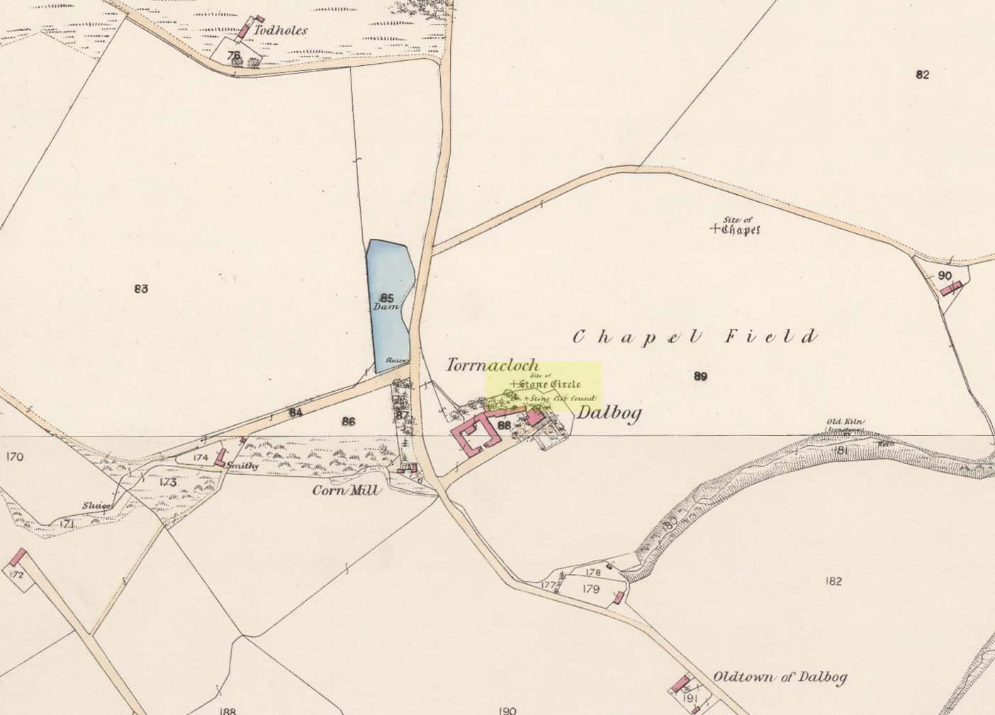
When the Ordnance Survey lads visited this area in 1860, they stood upon this small knoll that was known as Torrnacloch – or the Knoll of the Stone. They were informed that a ring of stones had stood here, but had been destroyed about 1840, apparently by a local farmer. The stones were described as being about 3 feet high. They subsequently added it on the earliest OS-map of the area, but also made note that a cist was found within the site. The circle was included and classed as a stone circle in Aubrey Burl’s (2000) magnum opus, but had previously been classed as a cairn with “a kerb of large boulders” by the Royal Commission doods. (1983) They based their assessment on the appearance of some of the stones found on a gravel mound behind the farm which had apparently been removed from the circle when it was destroyed. Andrew Jervise (1853) gave us the following account:
“The Chapelry of Dalbog was on the east side of the parish, due west of Neudos. The time of its suppression is unknown; and though no vestige of any house remains, the site of the place of worship is still called the “chapel kirk shed” by old people, and, in the memory of an aged informant, a fine well and hamlet of houses graced the spot. This field adjoins the hillock of Turnacloch, or “the knoll of stones,” which was probably so named, from being topped in old times by a so-called Druidical circle, the last of the boulders of which were only removed in 1840. Some of them decorate a gravel mound behind the farm house; and, on levelling the knoll on which they stood, a small sepulchral chamber was discovered, about four feet below the surface. The sides, ends, and bottom, were built of round ordinary sized whinstones, cemented with clay, and the top composed of large rude flags. It was situate on the sunny side of the knoll, within the range of the circle; but was so filled with gravel, that although carefully searched, no relics were found.”
The emphasis on this place being where a stone circle stood is highlighted in the place-name Torrnacloch, or the hillock of stones/boulders. Both Dorwood (2001) and Will (1963), each telling it to be where a stone circle stood; with Will adding that parts of the circle “may yet be seen in rear of the steading of Dalbog.” If this had been where a cairn existed, some variant on the word carn would have been here.
References:
Burl, Aubrey, The Stone Circles of Britain, Ireland and Brittany, Yale University Press 2000.
Dorwood, David, The Glens of Angus, Pinkfoot: Balgavies 2001.
Jervise, Anrew, The History and Traditions of the Land of the Lindsays in Angus and Mearns, Sutherland & Knox: Edinburgh 1853.
MacLaren, A. et al, The Archaeological Sites and Monuments of Central Angus, RCAHMS: Edinburgh 1983.
Will, C.P., Place Names of Northeast Angus, Herald: Arbroath 1963.
Acknowledgements: Big thanks for use of the 1st edition OS-map in this site profile, Reproduced with the kind permission of the National Library of Scotland.
This was an impressive site by the sound of things. Sadly destroyed, its exact whereabouts isn’t clear but should—if the description of the site is anything to go by—be on one of the highest points of land around Langside Farm. In Irving & Murray’s description (1864), they tell the cairn to have been one amidst a cluster of tombs that could once be seen “a mile to the south of his residence”, but this seems to be contested by the definitive pen of the Lesmahagow historian, John Greenshields. (1864) He told us:
“The late Lord Corehouse had an excavation scientifically made of a karn or cairn on his farm at Longside. It is to be regretted that information cannot now be obtained of so accurate a nature as the subject merits; but there were stones so arranged in the centre as to have been evidently intended for sepulchral purposes. Two rude urns of baked clay, one very large, the other smaller, were found inside a stone coffin. The small urn contained bones partially calcined and broken or pounded, some of them perfectly fresh. It has been erroneously stated in Swan’s “Views of the Clyde,” that there were eighteen small urns around the large chest, in the form of a circle, which gave rise to the idea that the remains of the chief had been surrounded by those of his family or warriors. One of the urns has been lost sight of: the smaller one, about 6 inches in diameter at the top, and 4 in height, is now in the possession of Miss Edmondstoun Cranstoun, as well as a still smaller funerary urn, recently restored by kiln-burning it with some fresh clay.”
Royal Commission on the Ancient and Historical Monuments of Scotland, Lanarkshire: An Inventory of the Prehistoric and Roman Monuments, HMSO: Edinburgh 1978.
Swan, Joseph, Views on the Clyde – Historical and Descriptive, Joseph Swan: Glasgow 1830.
When the local historian John Greenshields (1864) wrote his definitive history of Lesmahagow parish, the book was just going to press when the remains of an ancient tomb was unearthed. We are fortunate that he held publication of the book before adding the brief information about the findings. He told us:
“When these pages were passing through the press, a stone cist was discovered on the farm of Eastwood, by the hollow sound emitted when the ploughshare struck its lid. It was of the usual dimensions (about three feet by two), and contained fragments of bones, and a cinerary urn. There were no indications that a cairn had ever been heaped on its top, but the stones may have long since been removed, as the field was in a high state of cultivation. The bones were much decayed, and the urn was shivered to fragments by the finder, in his anxiety to discover hidden treasures of gold or silver.”
No further information is known to exist about this site. In all probability the cist was Bronze Age in nature, possibly earlier. We surmise this from the rapid rate of decay of artefacts upon it being unearthed.
References:
Greenshields, John B., Annals of the parish of Lesmahagow, Caledonian: Edinburgh 1864.
Royal Commission on the Ancient and Historical Monuments of Scotland, Lanarkshire: An Inventory of the Prehistoric and Roman Monuments, HMSO: Edinburgh 1978.
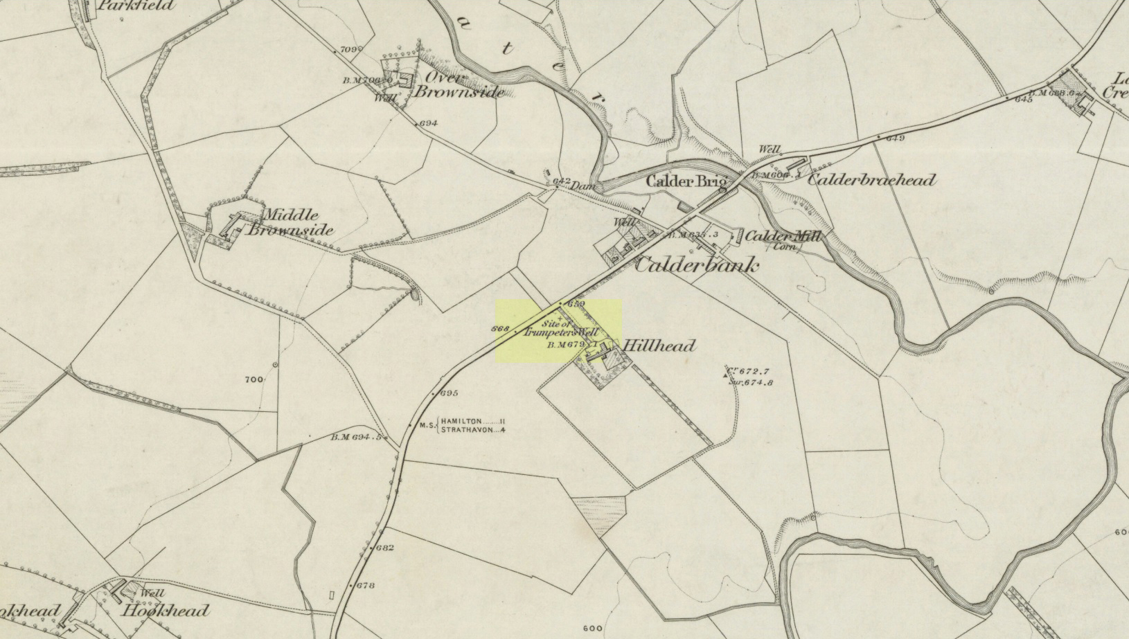
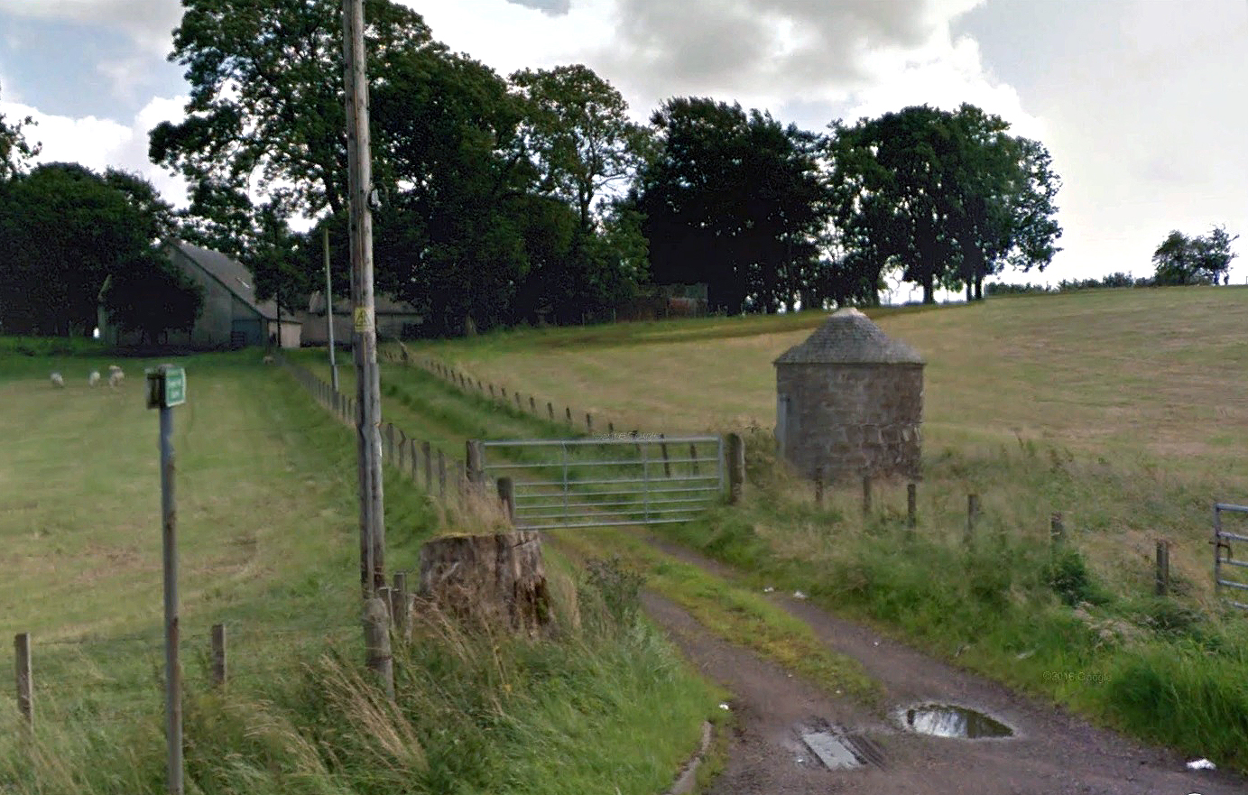
Take the A71 road southwest out of Strathaven as if you’re heading to Kilmarnock. After 2½ miles (4.1km) you reach the tiny hamlet of Caldermill (be careful or you’ll truly miss it!). As you go out of the hamlet, on your left there’s a track up to Hillhead Farm with the small but tell-tale signpost saying ‘Trumpeter’s Well’ and the small dome-shaped stone monument in the field is what yer looking for. If you’re coming from the Kilmarnock side, when you reach the Caldermill sign, it’s in the field immediately to your right. Y’ can’t really miss it.
Archaeology & History
When the site was surveyed by the Ordnance Survey lads in the 1850s, the water supply had completely run dry. It was later revived and the nine-foot tall circular stone building built to commemorate its history. The water apparently now runs within the building, being supplied from Hillhead Farm.
Trumpeters Well, Caldermill
Folklore
The well is said to have gained its name after the local Battle of Drumclog (1679), when one rich Tory known as John Graham of Claverhouse was retreating for fear of his life; and because his own horse had been killed, the coward stole the horse of his young fourteen-year-old trumpeter. In doing so, the young lad was subsequently killed and his body was thrown down the well. Tradition also tells that other soldiers were buried in the same field.
References:
Campbell, J. Ramsey, My Ain, My Native Tour – Stra’ven, J.M. Bryson: Strathaven 1943.
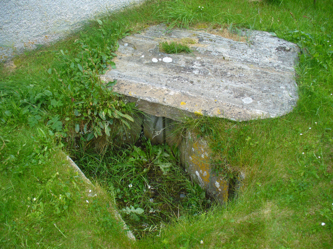
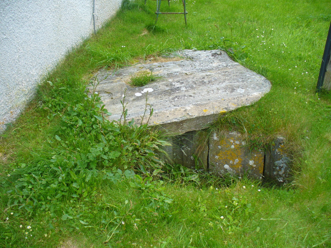
Holy Well (destroyed): OS Grid Reference – NS 6983 4138
Archaeology & History
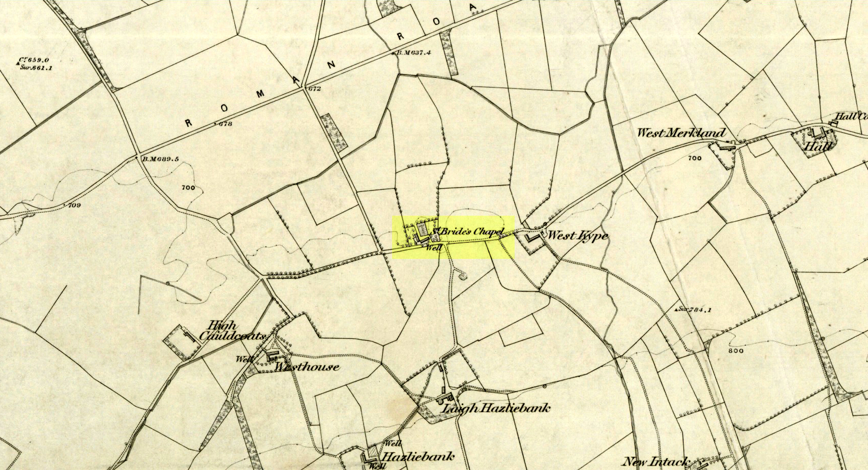
St Brides Chapel & Well on the 1864 OS-map
Shown on the 1864 OS map of the area as a ‘Well’ just at the front of St Bride’s Chapel—now a very pleasant old cottage—peasants and pilgrims would stop for both refreshment and ritual here as they walked down High Kype Road. Although the chapel was described in church records of January 1542 as being on the lands of Little Kype, close to the settlement of St Bride, there seems to be very little known about the history or traditions of the well. If anyone has further information on this site, please let us know.
Folklore
Bride or Brigit has her origins in early British myth and legend, primarily from Scotland and Ireland. Her saint’s day is February 1, or the heathen Imbolc (also known as Candlemas). Although in christian lore St. Bride was born around 450 AD in Ireland and her father a Prince of Ulster, legend tells that her step-father (more probably a teacher) was a druid and her ‘saintly’ abilities as they were later described are simply attributes from this shamanic pantheon. Legends—christian and otherwise—describe Her as the friend of animals; possessor of a magickal cloak; a magickian and a healer; and whose ‘spirit’ or genius loci became attached to ‘sacred sites’ in the natural world, not the christian renunciation of it. St Bride was one of the primal faces of the great prima Mater known as the Cailleach: the greater Gaelic deity of Earth’s natural cycles, whose changing seasons would also alter Her names, faces and clothes, as Her body moved annually through the rhythms of the year. Bride was (and is) ostensibly an ecological deity, with humans intrinsically a part of such a model, not a part from it, in contrast to the flawed judaeo-christian theology.
References:
Paul, J.B. & Thomson, J.M., Registrum Magni Sigilli Regum Scotorum: The Register of the Great Seal of Scotland AD 1513 – 1546, HMGRH: Edinburgh 1883.
Dead easy. From the top of the hill at Bettyhill, take the road east out of the village along the A836 Thurso road. At the bottom of the hill, on your left, you’ll see the white building of Farr church Museum. Walk to it and instead of going in the door, walk past it and round the back, or north-side of the church where, up against the wall, you’ll see this small stone-lined hole in the ground. Y’ can’t really miss it.
Archaeology & History
Originally located 7½ miles (12.1km) to the south at Chealamy (NC 7240 5017), in the prehistoric paradise of Strathnaver, it was uncovered following road-building operations in 1981 and, to save it from complete destruction, was moved to its present position on the north-side of Farr church museum. It was fortunate in being saved, as it was covered by a large boulder which the road operators tried to smash with a large jack-hammer; but in breaking it up, they noticed a hole beneath it. Thankfully, old Eliot Rudie of Bettyhill—a well respected amateur historian and archaeologist in the area—was driving past just as it had been uncovered by the workmen. He recognised it as being a probable cist and so further operations were stopped until it was investigated more thoroughly.
The relocated cist
The cist—measuring some 4 feet long by 3 feet wide and about 1½ feet deep—contained the burial of what was thought to be a man in his mid- to late-twenties. The remains were obviously in very decayed state and it was thought by archaeologist Robert Gourlay (1996), that the body itself had been “deposited in the grave (when it was) in an advanced state of decomposition.” Also in the cist they found a well-preserved decorated beaker, within which Gourlay thought “probably contained some kind of semi-alcoholic gruel for the journey of the departed to the after-life.”
References:
Gourlay, Robert, Sutherland – An Archaeological Guide, Birlinn: Edinburgh 1996.
Gourlay, Robert B., “A Short Cist Beaker Inhumation from Chealamy, Strathnaver, Sutherland”, in Proceedings Society Antiquaries Scotland, volume 114, 1984.
Gourlay, Robert & Rudie, Eliot, “Chealamy, Strathnaver (Farr) Beaker Cist”, in Discovery Excavation Scotland, 1981.
Acknowledgments: To that inspiring creature Aisha Domleo, for her bounce, spirit and madness to get me up here; and for little Lara too, for meandering to the church museum where this cist can be seen; and to Eliot Rudie, who pointed it out to us.
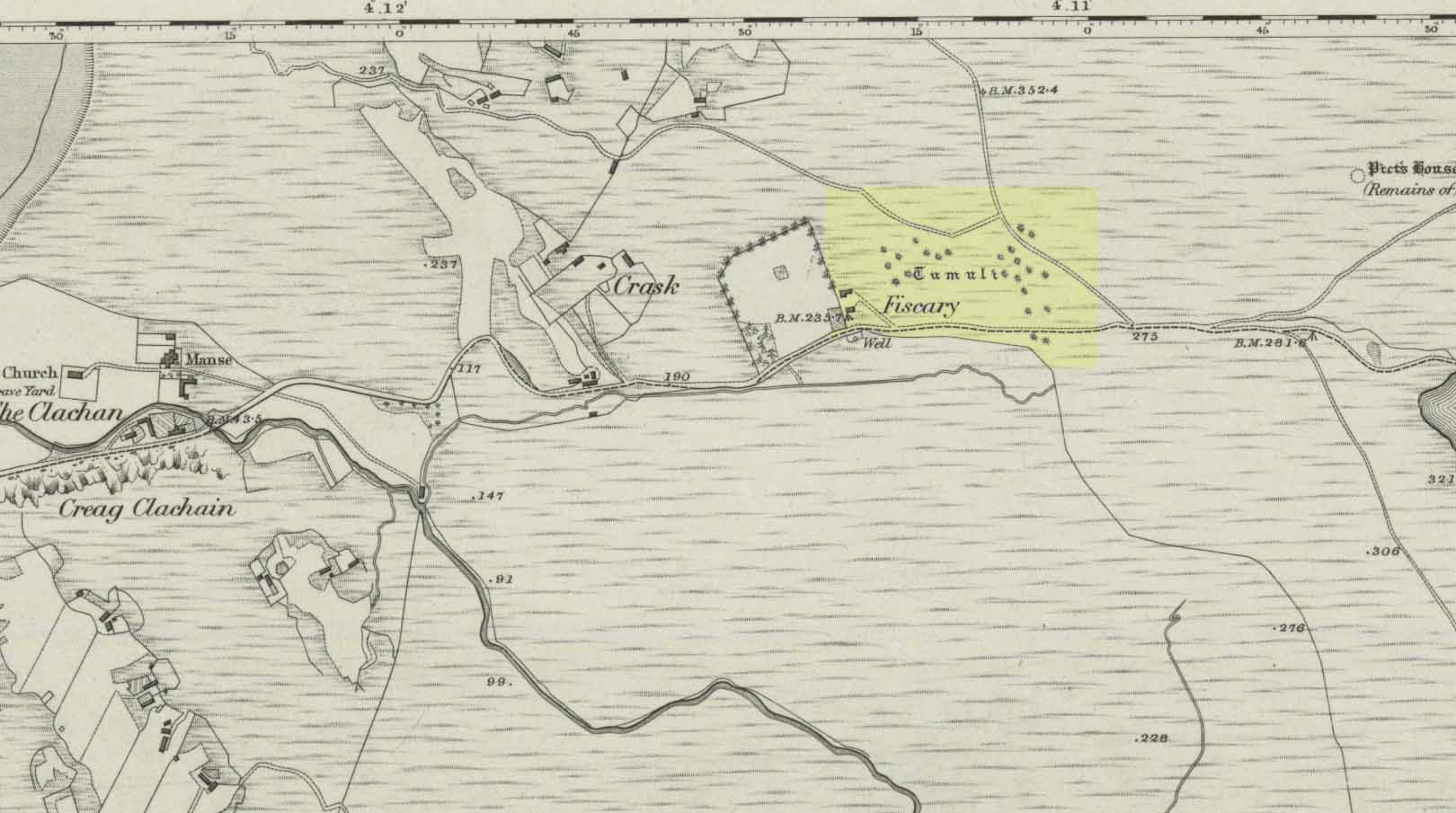
From Bettyhill, go out of the village along the A836 Thurso road for just over a mile. You go uphill for a few hundred yards and just as the road levels-out, there’s the small Farr Road on your left and the cattle-grid in front of you. Just before here is a small cottage on your left. In the scrubland on the sloping hillside just below the cottage, a number of small mounds and undulations can be seen. That’s it!
Archaeology & History
Although this place was highlighted on the first OS-map of the area in 1878, I can only find one modern reference describing this somewhat anomalous cluster of sites. It’s anomalous, inasmuch as it doesn’t have the general hallmark of being a standard cairnfield or cluster of tumuli. For one, it’s on a slightly steep slope; and another is that amidst what seems to be cairns there are other, more structured remains. As I wandered back and forth here with Aisha, I kept shaking my head as it seemed somewhat of a puzzling site. As it turns out, thankfully, I wasn’t the only one who thought this…
One of the ‘cairns’ from above
Profile of a typical cairn
In R.J. Mercer’s (1981) huge work on the prehistory of the region, he described the site as a whole as a field system comprising “enclosures, structures, cairns and field walls” and is part of a continual archaeological landscape that exists immediately east, of which the impressive Fiscary cairns are attached. In all, this ‘cairnfield’ or field system is made up of at least 23 small man-made structures, with each one surviving “to a height of c.0.5m and are associated with 11 cairns from 2-6m is diameter.”
In truth, this site is probably of little interest visually unless you’re a hardcore archaeologist or explorer.
References:
Mercer, R.J., Archaeological Field Survey in Northern Scotland – volume 2: 1980-1981, University of Edinburgh 1981.
Acknowledgments: To the awesome Aisha Domleo, for her images, bounce, spirit and madness – as well as getting me up here to see this cluster of sites.