Market Cross, Halesowen, Worcestershire

Cross:  OS Grid Reference – SO 9666 8356

Archaeology & History

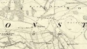
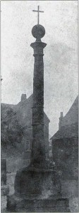
Halesowen Cross, when it stood in the village

Halesowen Cross, when it stood in the village

The history of this probable late-medieval monument is fragmentary.  It presently stands in the southeast corner of St John the Baptist churchyard, but used to be in the middle of the old village (when the town actually was a village!).  First erected in 1540 CE, the Victoria County History survey suggested that it may have marked an old boundary.  David Eades (1999) gives the most decent account of the monument, which stands more than nine-feet high and has been re-positioned onto stone steps.  He told:

“It marked the town’s market and fair and may once have come originally from Halesowen Abbey.  It was once possibly more ornate, but religious symbols may have been removed during the Reformation.  After a gale on 22 February, 1908, during which the cross blew down, it was dumped on a rubbish tip.  A local solicitor and clerk to the justices, Mr Alfred Homfrey, rescued it, and Mr Job Garratt, the owner of New Hawne Colliery, paid for its recovery and resurrection in the churchyard.”

References:

  1. Eades, David L., Halesowen, Sutton: London 1999.
  2. Frederick W. Hackwood, Oldbury and Round About in the Worcestershire Corner of the Black Country, Cornish Brothers 1915.

© Paul BennettThe Northern Antiquarian 2016


Mercat Cross, Clackmannan, Clackmannanshire

Cross:  OS Grid Reference – NS 91109 91890

Also Known as:

  1. Burgh Cross
  2. Canmore ID 48318
  3. Clackmannan Cross
  4. Market Cross
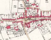
Cross on the 1886 map

Getting Here

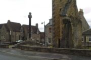
Take the A907 road between Alloa and Kincardine, and up the B910 into Clackmannan.  To get into the village, depending on which route you’re heading in, go up the Kirk Wynd or the Cattle Market—both of which lead you to the Main Street where, right next to the huge erection known as the Stone of Mannan you’ll see the old Cross on its steps.Getting Here

Archaeology & History

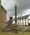
When the Royal Commission (1933) lads wrote about the site in their early survey, they called it the Burgh Cross, telling:Found in association with the village Tolbooth and the more famous Stone of Mannan, this probable 16th century cross stands at the meeting of the four lanes at the centre of the village in the heart of Clackmannanshire.  It was the focal point of an annual market fair which, said Craig Mair (1988), “could last up to eight days”.  It was the meeting place of local villagers where legal issues were called and settled, where bonds and deeds were made and, in all probability, replaced an earlier non-christian monument.

The Mercat Cross
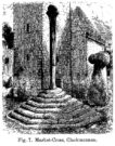
Millers 1889 sketch

“Although the stepped base has been renewed, the shaft is original.  It is 9 feet 6 inches in height and is octagonal in section, measuring 11 inches in diameter.  The capital is moulded and has on the east side a shield enclosed by swags and bearing a saltire and chief, for Bruce.  A second shield, carved on the west side, has apparently been similarly charged, but is now very weatherworn.  The ball finial on the capital was removed in 1857, but replaced in 1897.”

The reference to the chief, Bruce, is said by tradition to be that of Robert the Bruce.  This element in the cross’ history has been transposed mistakenly by early english writers onto the adjacent Stone of Mannan.

Cross & Mannan’s Stone

In recent times both the cross and the Stone of Mannan were repaired, at a staggering cost of £160,000.  How the hell it cost that much is anybody’s guess – but it certainly sounds as if someone’s pockets would have been bulging!

References:

  1. Mair, Craig, Mercat Cross and Tolbooth, John Donald: Edinburgh 1988.
  2. Royal Commission on the Ancient & Historical Monuments, Scotland, Inventory of Monuments and Constructions in the Counties of Fife, Kinross and Clackmannan, HMSO: Edinburgh 1933.
  3. Royal Commission on the Ancient & Historical Monuments, Scotland, The Archaeological Sites and Monuments of Clackmannan District and Falkirk District, Society of Antiquaries of Scotland 1978.
  4. Simpkins, John Ewart, County Folklore – volume VII: Examples of Printed Folk-Lore Concerning Fife, with some Notes on Clackmannan and Kinross-Shires, Folk-Lore Society: London 1914.
  5. Small, John W., Scottish Market Crosses, Eneas Mackay: Stirling 1900.

© Paul BennettThe Northern Antiquarian


Strand Cross, Westminster, London, Middlesex

Cross (destroyed):  OS Grid Reference – TQ 3077 8093

Also Known as

  1. Stone Cross of the Strand

Archaeology & History

First mentioned in Latin manuscripts from 1274 CE, the best description of this long lost monument, curiously, appears to be in Gover’s Place Names tome.  In a slightly edited format he told us the following:

“There was a stone cross “without the bar of the New Temple” traditionally supposed to have been erected by William Rufus “in devotion to the Holy Cross and for the health of the souls of himself and his mother, Queen Maud… It was in the Strand, possibly on the site of the present church of St. Mary.  It is referred to as crucem lap’ in 1274; la Crois de Piere in 1293; …Stonecrouch in 1337; crucem fractum in 1342…”

In subsequent notes Gover et al (1942) tell of a man they found in historical records to be Thomas le Barber, “described alternatively  as being Thomas le Barber atte Stonecourche” in the Calendar of Rolls records of 1337, and again in the 1339 accounts.

Of the cross itself, information is minimal and scattered.  It was destroyed several centuries ago but is mentioned in a number of old books on the history of the city.  The historian Thomas Allen (1829), for example, told that

“opposite to Chester Inn stood an ancient cross.  On this cross in the year 1294, the judges sat to administer justice, without the City.”

It was also a site where legal pleas for the county of Middlesex were to be held, at “the Stone Cross of lad Straund” as it was then known.  Due to the early administrative function delivered from this cross, it strongly implies the place to have been a moot site prior to the erection of the cross, probably dating from the period in which tribal elders met here.

A Mr Newton tells in his London in the Olden Time that the top of the cross was damaged and knocked off by the crazy christians around the time of the Reformation and that for many years stood headless.  When Vallance (1920) came to describe it, he told merely that,

“the Strand Cross, near Covent Garden.  This cross was hexagonal on plan, and comprised four stages.  It was standing in 1547, but was ultimately removed, its site being occupied by the Maypole, which was spoken of in 1700 as new.”

The Strand Cross would have been on the ancient ley (not one of those ‘energy lines’ invented by New Age fantasists) described first of all by Alfred Watkins (1925)—running from St. Martins-in-the-Field to St. Dunstan’s in Fleet Street—but he seems to have been unaware that the monolith ever existed.  The alignment was subsequently described in more detail in Devereux & Thomson’s (1979) work on the same subject, but its existence seems to have evaded them too!  Chris Street (2010) did include it in his much more detailed walk down the same ley.   A maypole was also known to exist close to the site of the cross; with one account showing that the two monuments existed at the same time in 1543.

As the site seemed to have been an early moot spot, the Strand Cross may have been an omphalos in early popular culture (before the christians of course), or at the very least, a site of popular animistic tradition.

References:

  1. Allen, Thomas, The History and Antiquities of London – volume 4, Cowie & Strange: London 1829.
  2. Anon., Rotuli Hundredorum – 2 volumes, G. Eyre and A. Strahan: London 1812.
  3. Aungier, George James, Croniques de London, Camden Society: London 1854.
  4. Devereux, Paul & Thomson, Ian, The Ley Hunter’s Companion, Thames & Hudson: London 1979.
  5. Gover, J.E.B., Mawer, Allen & Stenton, F.M., The Place-Names of Middlesex, Cambridge University Press 1942.
  6. Newton, William, London in the Olden Time, Bell & Daldy: London 1855.
  7. Stevenson, W.H. (ed.), Calendar of the Close Rolls Preserved in the Public Record Office, HMSO: London 1900.
  8. Street, Christopher E., London’s Ley Lines, Earthstars: London 2010.
  9. Vallance, Aymer, Old Crosses and Lychgates, Batsford: London 1920.
  10. Watkins, Alfred, The Old Straight Track, Methuen: London 1925.

© Paul Bennett, The Northern Antiquarian


Cow Cross, Finsbury, London, Middlesex

Cross (destroyed):  OS Grid Reference – TQ 3180 8181

Archaeology & History

Site of Cow Cross on 1896 map

Site of Cow Cross on 1896 map

Not far from the long lost Fag Well could once be seen this old stone monument.  Although not illustrated on the first Ordnance Survey maps of the inner city, it is highlighted on the 1896 edition (as shown here), just where Cow Cross Street meets Charterhouse Street—right by the boundary line—and is marked as ‘Site of Cow Cross’.

The cross gained its named from the cattle market that was held here from very early times, on the boundary of the lands of the Knights Hospitallers in the 12th century.  Cattle itself–both horses and cows—were actually slaughtered at the market by the cross: a practice that has thankfully stopped (in public at least).  Despite the place-name being referenced in many early accounts, actual descriptions of the cross are few and far between due to it being destroyed at quite an early date.  When John Stow came to write his history of London in 1603, he told that it was no longer standing.  Whether the cross replaced an earlier standing stone, we simply do not know…

References:

  1. Gover, J.E.B., Mawer, Allen & Stenton, F.M., The Place-Names of Middlesex, Cambridge University Press 1942.
  2. Temple, Phillip (ed.), Survey of London – volume 46, LCC: London 2008.
  3. Vallance, Aymer, Old Crosses and Lychgates, Batsford: London 1920.

© Paul Bennett, The Northern Antiquarian


Broken Cross, Westminster, London, Middlesex

Cross (destroyed):  OS Grid Reference – TQ 322 812

Archaeology & History

In truly that most unholy of places in England—Westminster, London—there was, in bygone times, a slightly more sacred site which, earlier still, might have been where a standing stone stood…. Might….  But such days are long gone down there.  A gathering place of local people in very early times, the Broken Cross was, according to Vallance (1920),

“erected by the Earl of Gloucester in the reign of Henry III (1216-1272), but it did not stand very long.  Its site is said to have been ‘the place of the meeting of the Folkmote…near St. Martin’s-le-Grand, about midway between the Northgate of the precinct (of St. Paul’s) and the church of St. Vedast.’  On 5th September 1379, agreements were drawn up for letting the stations about the Broken Cross to five divers persons.  The cross was bodily taken down in 1390.”

Yet its name was maintained in street-names for many years later, simply as ‘Broken Cross’.  Its position would have been very close to Cheapside.

George Gomme (1880) pointed out that such early folk moots were the development of tribal gatherings grafted from megalithic meetings onto early christian assemblies, pointing out how such assemblies for laws and councils were made at nearby St. Paul’s as early as 973 AD.

References:

  1. Gomme, George Laurence, Primitive Folk-Moots, Sampson Low: London 1880.
  2. Gover, J.E.B., Mawer, Allen & Stenton, F.M., The Place-Names of Middlesex, Cambridge University Press 1942.
  3. Vallance, Aymer, Old Crosses and Lychgates, Batsford: London 1920.

© Paul Bennett, The Northern Antiquarian


Reap’s Cross, Heptonstall Moor, West Yorkshire

Cross:  OS Grid Reference – SD 94360 30269

Also Known as:

  1. Long Stoop
  2. Ralph’s Cross

Getting Here

Reaps Cross on 1851 OS-map

Reaps Cross on 1851 OS-map

From Hebden Bridge go up the Heptonstall road, going round the village and onto and through Slack, keeping straight on the road until it goes uphill for a short distance, then levels out; then watch out for the small right-turn at Colden and the single-track road heading to a dead-end.  Go right to the end, the very end, and go through the gate and walk up the track onto the moor.  As you reach the ridge and the moorlands open up before you, note the small ‘standing stone’ on your right, about 10 yards off-path— and there, 100 yards the opposite direction to your west, the tall upright Reaps Cross is sat on the moortop.  Y’ can’t miss it!

Archaeology & History

Found in the middle of a beautiful nowhere not far from the prehistoric standing stone on Standing Stone Hill, this old tall monolith was said to have stood as a marker beside the old road which ran from Halifax over the moors to Colne, until the more recent Widdop Road became the more preferred route.  Known locally as the Long Stoop, in 1900 George Tyack said of it,

“This stone, which is composed of millstone grit, lay for a long tine broken and overthrown, but has in recent years been replaced on its original site and restored.  It is a simple Latin cross standing twelve feet high amidst the heather of the Yorkshire moors.”
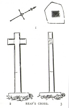
Longbottom's 1897 sketch

Longbottom’s 1897 sketch

Waddington's 1884 sketch

Waddington’s 1884 sketch

Shortly before Tyack’s description, the local historian John Longbottom (1897) wrote a series of articles on the old stone crosses of the region and gave us this old sketch of the site (right).  Even in his day the cross had been “wilfully thrown down” (probably by the screwy Puritans at that time), but a short time later it had been “repaired and restored to its original position.”  In Longbottom’s day there were short ‘arms’ extending outwards from near the top of the obelisk, defining it as a distinct ‘cross’, but these have subsequently been lost following further local demolition attempts. He told how,

“Reaps Cross is known locally to shepherds, gamekeepers and farmers at ‘T’ Long Stoop’, and…apart from its religious associations, it forms an important landmark, now as in ancient times, to many a poor weary traveller crossing the dreary and lonesome hills between Lancashire and Yorkshire.”

The cross keeps getting knocked over, by both lightning and idiots of various persuasions; but thankfully the old fella keeps getting resurrected and put back in its place. It’s history is a curious one.  When Clifford Byrne (1974) wrote about the site in his unpublished survey, he told how

“This cross appears to be of medieval origin and…in 1973 the monolith lay broken, one section lying in the grass, whilst the other section still stood in the pedestal.  It is seen to have been broken once before, for the remains of iron clamps are seen on both sections.  The arms have been broken off in some age… A local farmer insisted that the correct name was Ralphs Cross not Reaps Cross, and it should be noted that a section of moor at Widdop (the valley with the high cliffs) is named after a Ralph.”

Standing some 12 feet tall, this is the highest of all the crosses in West Yorkshire and obviously some considerable work went into its creation all those centuries ago.  Nobody is sure when it was first made, but the educated guess is 12th century.  Why it was erected here, way off from anywhere in the middle of the wild moors, is equally puzzling.  It may have had something to do with the nearby medicinal springs; it may have been as a guide-post to travellers—”to Rastric Greave”, according to Waddington (1884); it may have marked an ancient religious route; or it may have distracted people away from the prehistoric upright that gave its name to Standing Stone Hill, a short distance to the west  We simply don’t know.  It’s well worth visiting though, as the moorland landscape up here is truly expansive and civilization seems thankfully centuries away…

Folklore

Local tradition told that the cross marked an old corpse route, along which the dead were carried before being buried at Heptonstall.  Here at Reaps Cross, the bodies were rested by the weary travellers.  If this is true, it is probable that the ancient standing stone more than half-a-mile to the west once had something to do with such old rites and routes.

References:

  1. Bennett, Paul, The Old Stones of Elmet, Capall Bann: Milverton 2001.
  2. Byrne, Clifford, A Survey of the Ancient Wayside Crosses in North-East Lancashire, unpublished MS, 1974.
  3. Longbottom, John, “Ancient Crosses in Halifax Parish – Part 2,” in Halifax Naturalist, 2:8, June 1897.
  4. Taylor, Henry, The Ancient Crosses and Holy Wells of Lancashire, Sherratt & Hughes: Manchester 1906.
  5. Tyack, George, The Cross in Ritual, Architecture and Art, William Andrews: London 1900.
  6. Waddington, J. Arthur, “The Crosses in and Around Burnley,” in Transactions of the Burnley Literary & Scientific Club, volume 1, 1884.

© Paul BennettThe Northern Antiquarian


Town Cross, Alloa, Clackmannanshire

Cross:  OS Grid Reference – NS 88559 92686

Also Known as:

  1. Burgh Cross
  2. Canmore ID 47169
  3. Market Cross
  4. Mercat Cross

Getting Here

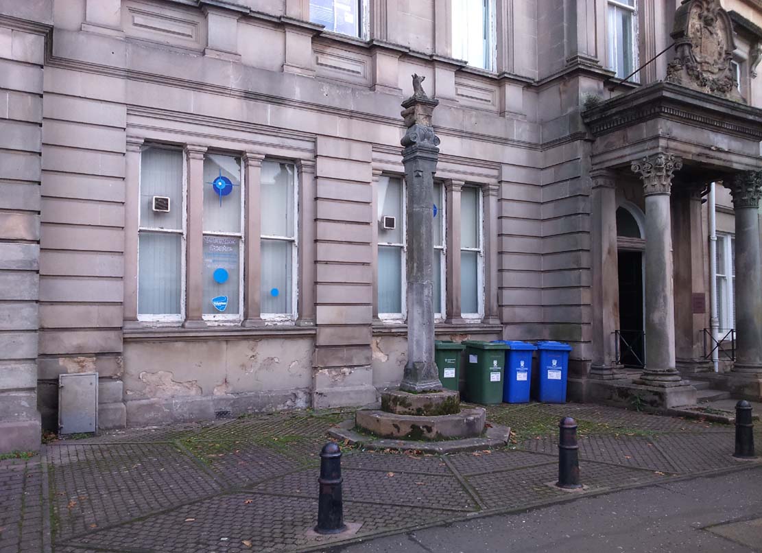
Alloa Cross, Bank Street

Get into the small town of Alloa, where the buses stand at Shillinghill.  From here walk southwest down Mill Street, which runs into Bank Street.  Keep your eyes peeled on your right-hand side, where outside one of the old municipal buildings you’ll see it standing upright.

Archaeology & History

Although now standing against the old buildings halfway down Bank Street, Alloa’s Mercat or Burgh Cross was initially set up at the crossroads 162 yards (148m) away, where Mar Street meets Mill Street and Bank Street.  It was moved to its present position sometime in the 1880s and knowledge of its early history is scant.

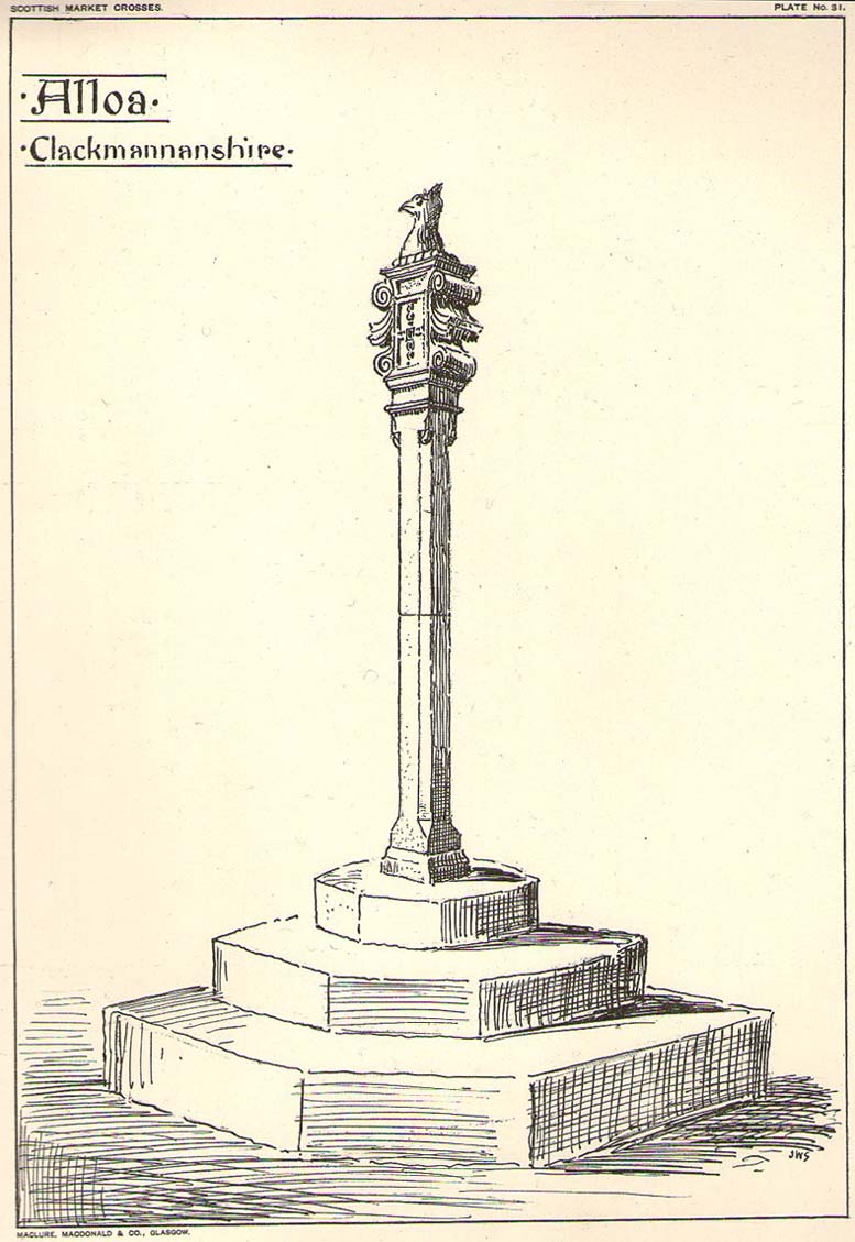
John Small’s sketch of Alloa Cross

Standing some 10 feet tall, the monument was described in John Small’s (1900) rare magnum opus, where he details the architectural features of the monument, telling:

“The shaft, which rests on a base and three steps, is of the usual square section, with splayed angles, stoped at top and bottom, the top stop being rather peculiar.  The head of the Cross is composed of an oblong stone set upright, characteristic of the late type seen in Keikleour and Kinrossie.  The oblong is ornamented at the sides with debased volutes and acanthus leaves, the whole crowned by a wreath from which rises a griffin’s head, part of the supporters of the Arms of the Lords of the Manor, Lord Mar and Kellie.”

References:

  1. Anonymous, The Alloa Illustrated Family Almanac, MacGregor & Steedman: Alloa 1887.
  2. Mair, Craig, Mercat Cross and Tolbooth, John Donald: Edinburgh 1988.
  3. Royal Commission on the Ancient & Historical Monuments, Scotland, Inventory of Monuments and Constructions in the Counties of Fife, Kinross and Clackmannan, HMSO: Edinburgh 1933.
  4. Small, John W., Scottish Market Crosses, Eneas Mackay: Stirling 1900.

© Paul BennettThe Northern Antiquarian

Barton Cross, Barton, Preston, Lancashire

Wayside Cross: OS Grid Reference – SD 53502 37332

Also Known as:

  1. Historic England Grade II Listed Monument 1073555

Getting Here

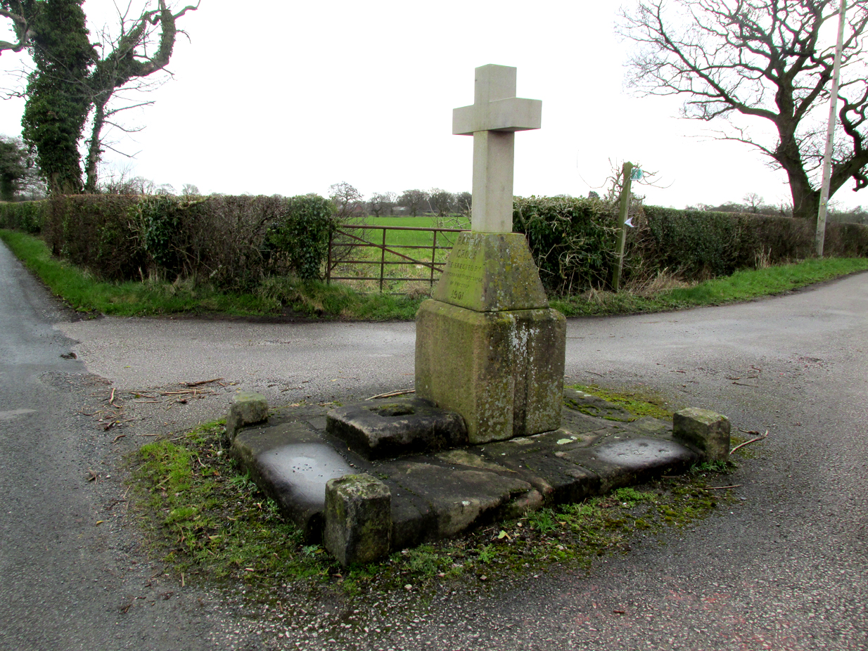
The Barton Cross from the road, showing the original socketed base and the cup marked paving stone to the right.

The cross is at the roadside on the south side of Barton Lane at the cross roads with the minor road between Cross House Farm and Barton House.

Archaeology and History

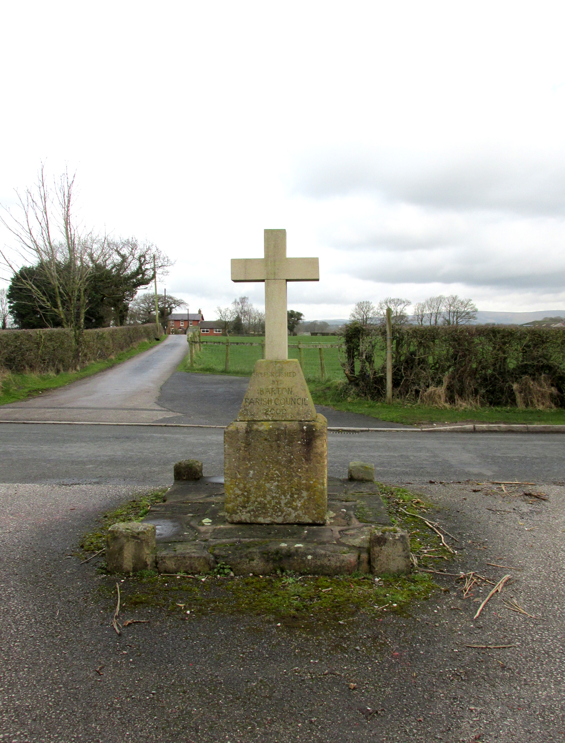
All that survives is the socketed base of a mediaeval cross on a raised paved platform with low raised square section pillars at each corner. Behind the original cross socket stands a large stone block (Described in the Historic England citation as “probably part of a cheese press“) surmounted by a pyramidal block upon which a modern carved stone cross has been placed.

Henry Taylor (1906) writes in his Ancient Crosses and Holy Wells of Lancashire:

The South face of the Cross

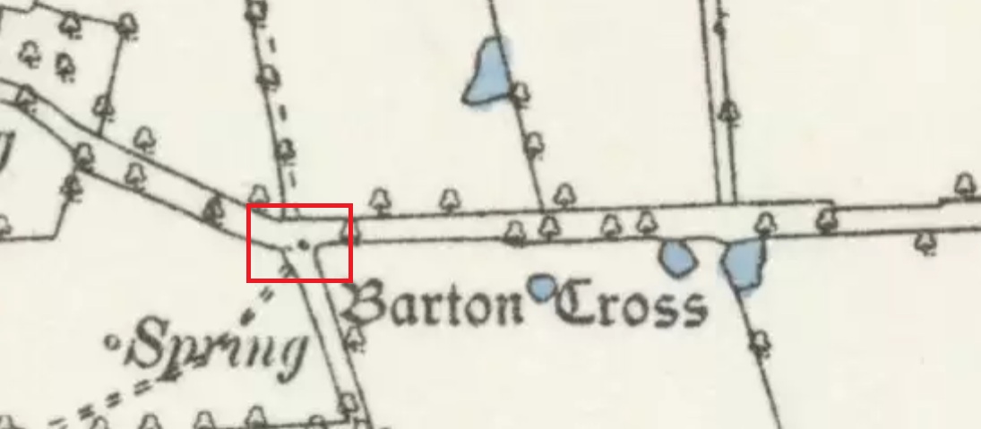
Barton Cross. These words occur on the map in ancient Gothic letters in Barton Lane, one and a half miles in a westerly direction from Goosnargh Church, showing that in the year 1848 a complete cross stood here. The site is at the intersection of country lanes, and the map shows a small recess or lay-bye in which the cross was planted. Mr. Collinson [Reverend S.E. Collinson, Vicar of Broughton] writes that the base was thrown into a neighbouring pit at the time Daniel’s pedestal was buried. The base and part of the shaft of the Barton Cross have lately been restored to the old site. A new cross has been erected just behind by Mr. Myerscough.
Mr. Collinson tells me that in going through some of the old parish registers he found an entry referring to ‘Barton Christ’. He not unnaturally thinks that there must have been a figure on the Cross giving rise to the name. Nothing else would account for it. The neighbourhood of Barton (a pre-Norman settlement) is interesting and deserves a thorough investigation.

The ‘Daniel’s pedestal’ refers to Daniels Cross, near Broughton, of which Taylor writes:

The base was removed about sixty years ago. It is now in a neighbouring pit. The facts were obtained from an old man who helped at the destruction of this landmark.”

The 1895 6″ map showing the Cross, with the nearby marl-pits coloured blue

The pyramidal stone block upon which the modern cross stands is inscribed on the northern face: “Barton Cross re-erected by Councillor R. Myerscough of Preston 1901” while the southern face is inscribed: “Refurbished by Barton Parish council 2000“.

One of the paving stones that surround the cross has pre-historic cup markings on it, and is the subject of a separate site profile.

Bearing in mind what was written about the original cross having been ‘thrown into a neighbouring pit’, it may be worth probing the nearby marl pits to see whether the original could be found.

Reference:

  1. Taylor, Henry, The Ancient Crosses and Holy Wells of Lancashire, Manchester, Sherratt and Hughes, 1906

© Paul T. Hornby, The Northern Antiquarian 2017

Lytham Cross, Lytham, Lancashire

Wayside Cross: OS Grid Reference – SD 3603 2718

Getting Here

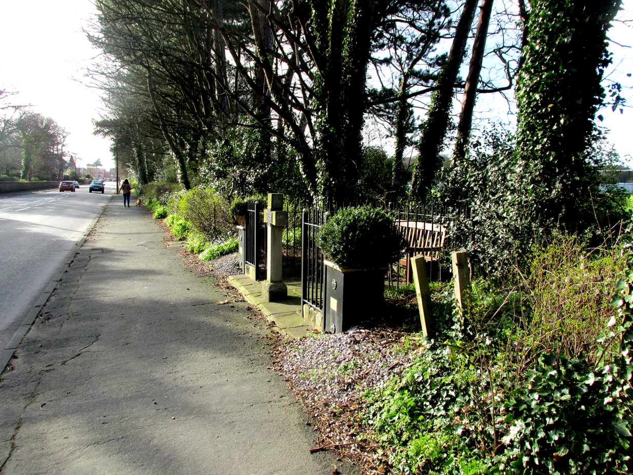
Roadside position of the cross

The cross is situated in a small railed enclosure adjoining the pavement on the North side of Church Road on the west side of Lytham, opposite Lowther Gardens.

Archaeology & History

Henry Taylor (1906), author of The Ancient Crosses And Holy Wells Of Lancashire, writes:

“The old market place of Lytham is triangular in shape…Church Road leads out of it, and not far from the church the pedestal of an ancient cross was at one time to be seen. The words ‘Site of Benedictine Priory’ occur on the map close to Lytham Hall, indicating the position of this small religious house, dedicated to SS Mary and Cuthbert, and subject to Durham.”

The mediaeval base set into the pavement in 2009

Lieutenant-Colonel Fishwick writes in his History of the Parish of Lytham:

“Not far from the Parish church on the road to Blackpool is still to be seen the stone socket of a cross, and tradition says that it marks one of the resting places of the body of St. Cuthbert when carried to Durham”

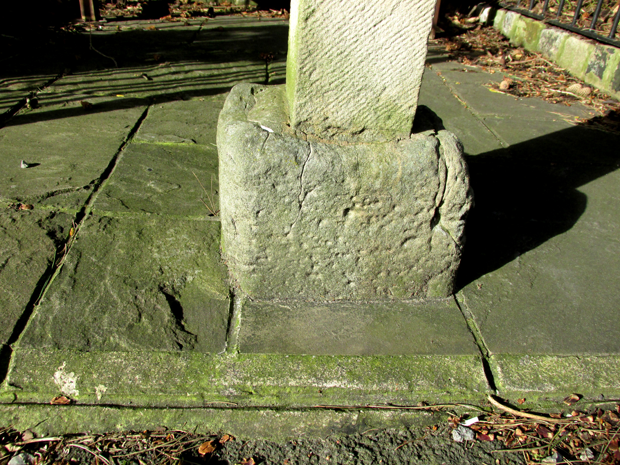
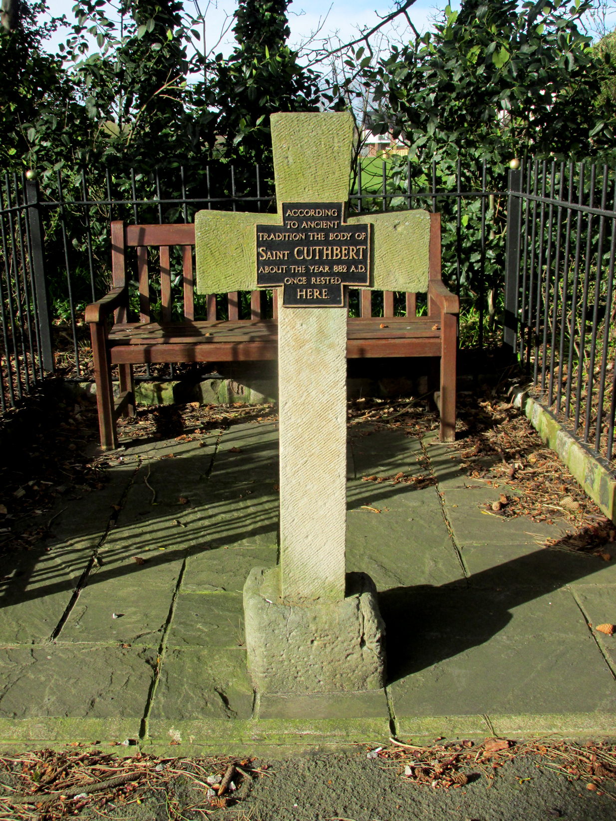
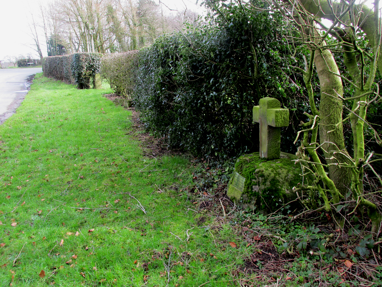
All that survives of the mediaeval original is the socketed base, into which a modern carved stone cross has been inserted. A bronze plaque attached to the cross reads:  “According to ancient tradition the body of St Cuthbert about the year 882AD once rested here.”

The modern cross with its bronze plaque.

It is not known whether the destruction of the original cross was the handywork of the local ‘Cross Smasher’ Rev. Richard Wilkinson.

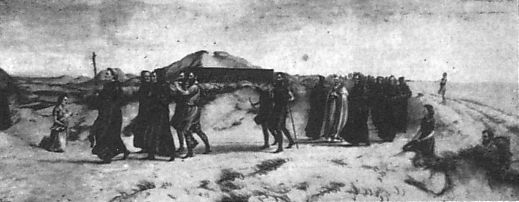
According to an online source, The Very Reverend Monsignor Gradley commissioned a painting by Charles E. Turner entitled: ‘The Monks of Lindisfarne arriving at Lytham with the body of St. Cuthbert, A.D. 878’, intended to be hung in St Joseph’s Seminary, Upholland.  Gradley wrote in the October 1889 edition of Merry England magazine:-

” In 875 Halfdene invaded Bernicia, the northern portion of Northumbria, . . . Lindisfarne was no longer a safe place for the monks, and they dared no longer expose their great treasure, the relics of St. Cuthbert, to the ruthless impiety of the northern hordes, With their Bishop Eardulf they set out on a weary pilgrimage of seven years.… From Yorkshire they proceeded to Lancashire, and as we find that the holy relics rested at Mellor, near Blackburn, we may suppose they would journey through Ribblesdale, passing on their way the ruined city of Bolmetonacae, the modern Ribchester. They were a numerous company, for besides the venerable Bishop Eardulf there were the Abbot of Carlisle, the monks of Lindisfarne, and many of the natives of that island. In going to Lytham it is probable the party would pass through Preston, where a few houses had gathered about the church built in honour of St. Wilfrid, the great contemporary of St. Cuthbert.

‘The Monks of Lindisfarne arriving at Lytham with the body of St. Cuthbert, A.D. 878’, by Charles E. Turner.

Their way from Preston to Lytham lay through a country abounding in forest and fen. But they would have the advantage of the old Roman road as far as Kirkham. However, the pilgrims met with a hospitable reception, and to this day Lytham is the seaside home of St. Cuthbert on our western coast.”

A small plaque on an adjacent bench records that the cross was re-dedicated by the Very Reverend Michael Sadgrove, M.A., Dean of Durham on Sunday 6th September 2009.

References:

  1. Taylor, Henry, The Ancient Crosses and Holy Wells of Lancashire, Manchester, Sherratt and Hughes, 1906.
  2. Fishwick, Lieutenant-Colonel, The History of the Parish of Lytham in the County of Lancaster, Manchester, The Chetham Society, 1907.
  3. Gradley, Most Reverend Monsignor, Article in the October 1889 edition of Merry England magazine, abstracted by www.amounderness.co.uk

Acknowledgements:  With thanks to Sue Ybarras for directing me to this site.

© Paul T. Hornby, The Northern Antiquarian 2017

Stump Cross, Goosnargh, Lancashire

Wayside Cross:  OS Grid Reference – SD 57287 37421

Also Known as:

  1. Historic England Grade II Listed Building No. 1165108

Getting Here

The Position of the Cross near the road junction.

The cross is situated on the verge at the west side of the B5269 road near its junction with Ashley Lane at Stump Cross, north-east of Goosnargh.

Archaeology & History

All that survives is the socketed base of the mediaeval cross, into which a small modern carved stone cross has been inserted. A bronze plaque attached to the base informs the reader that the cross gives its name to the locality, and that the base was discovered during excavations in 1931.

Richard Cookson (1888), in his Goosnargh Past & Present, writes:

“We have the remains of several upright crosses in this township called “cross stones” all being placed near to some public road or path. The corpses of the Roman Catholics are rested at those stones on their way to internment, and those funeral attendants who are of that persuasion kneel down and offer up a short prayer for the repose of the soul of the departed individual whose body they are conveying to the grave.”

Further to the destruction of crosses in the township, Cookson writes:

“…the Reverend Richard Wilkinson, late minister, of anti-Romanistic notoriety, in his frenzied hostility to the Roman Catholics, caused [the cross] to be broken up and removed…”

The site is listed by Henry Taylor, in his 1906 magnum opus on Lancashire crosses, and speaking generally on the destruction of wayside crosses in the Hundred of Amounderness, he writes:-

The bronze plaque
Modern cross inserted into the Mediaeval socket

“The destruction of so many crosses, which at one time existed in this part of the Hundred, is due to the vandalism early in the nineteenth century of a vicar of Goosnargh, named Wilkinson. He was a vehement Protestant, and owing to his notoriety as a Prophet, was allowed to do much as he liked with these ancient monuments. Many crosses, indeed, it is said, were pulled down with his own hands. His prophesies foretelling the deaths of various persons often unfortunately came true, and he was thus, in this superstitious part of England, dreaded as a wizard. As this work of demolition took place before the date of the Ordnance Survey, there were in all probability many more crosses erected in Mediaeval times in this district than we have now any knowledge of, and it is quite possible that some of the crosses so recklessly destroyed may have been, like those at Halton and Heysham, of pre-Norman date and of great historical value. Fragments of them might even now be found were a diligent search be made.”

Further to this speculation as to the antiquity of these destroyed crosses, it is interesting to note the approximately parallel orientation of roads and field boundaries to the east of the Stump Cross. This may point to the area having been subjected to Roman survey, and the site of the Stump Cross having once been a shrine to the gods of the agrimensores (Roman surveyors) that had been Christianised.

References:

  1. Cookson, Richard, Goosnargh: Past and Present, Preston, H.Oakey, 1888.
  2. Taylor, Henry, The Ancient Crosses and Holy Wells of Lancashire, Manchester, Sherratt and Hughes, 1906.
  3. Richardson, Alan, The Roman Surveyors in Cumberland, P3 Publications: Carlisle 2008.

© Paul T Hornby, The Northern Antiquarian 2017