Holy Well (destroyed?): OS Grid Reference – SO 9609 8284
Archaeology & History
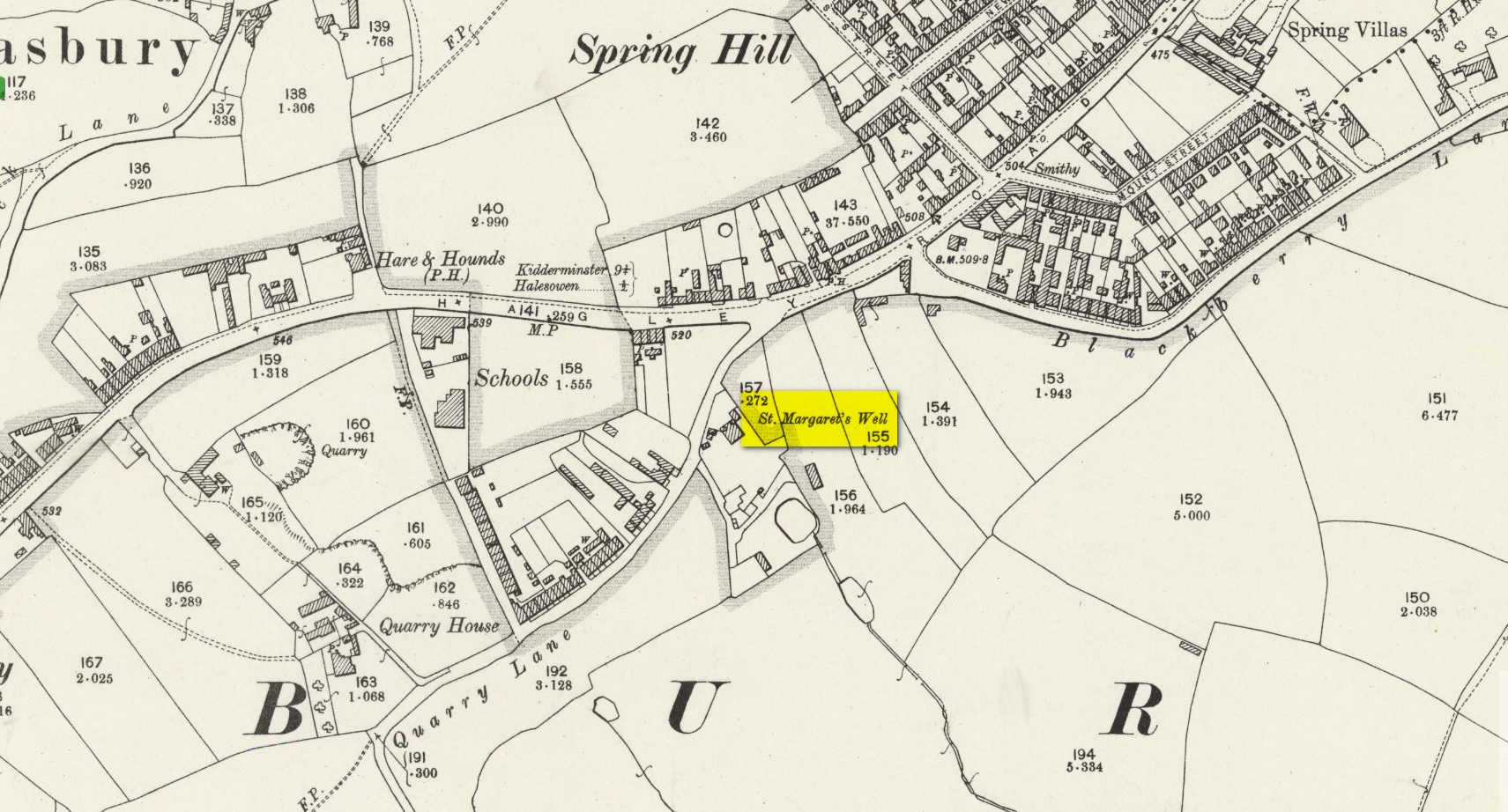
Shown on the 1904 OS-map, beneath the aptly-named St Margaret’s Hill on its northern side, we can see where the holy well of St Margaret used to be, not too long ago. Although it seems to have fallen pray to industrial destruction, there are a number of old references to the site, mainly gathered together in Jeremy Harte’s (2008) magnum opus on the subject. It was also mentioned in a survey by the British Geological Society (Richardson 1930) where we were told that it was,
“in the private grounds of a house recently erected, and is a spring issuing from the Halesowen Sandstone at the junction of two faults (shown west of the ‘H’ of Hasbury on the new series Geological Map, Sheet 168) about 100 yds SW of the point where Blackberry Lane joins Hagley Road. It is referred to, as a well of good cold unmineralised water, by T. Nash in 1781.”
And it was Mr Nash who gave us the earliest description of the place, saying:
“In the hamlet or township of Hasbury is an ancient holy well, called St Margaret’s Well, which formerly had much good stonework about it; but that was wholly removed in the year 1747. One of these stones contained some curious sculpture, the figure of a man in a posture of hasty walking, and in the next compartment that of another man leaning on crutches… This place is called Margaret’s Hill and the water of the well supplies a small brook, which runs below the Grange, and falls into a piece of water at the end of the town, called Cornbow Pool.”
It’s more than probable that the old carvings he described—of one man on crutches and the other of a figure walking speedily—represents one of the main curative allegations that these waters possessed. Cases of people walking on crutches to sacred wells, drinking the waters, then walking away without them (and in many cases leaving their crutches at the well-side as testament to its properties) are commonplace. And, aptly enough, the curative elements of this ancient site has been maintained in modern times with the medical centre of St Margaret’s Well Surgery being built by this very spot!
References:
- Harte, Jeremy, English Holy Wells – volume 2, HOAP: Wymeswold 2008.
- Nash, T.R., Collections for the History of Worcestershire – volume 1, John White: London 1781.
- Richardson, L.R., Wells and Springs of Worcestershire, HMSO: London 1930.
© Paul Bennett, The Northern Antiquarian