To search for any sites in the northern counties of England (previously known as Brigantia), click on the list of relevant counties, below. Please note that not all these english counties were truly in Brigantia, but they came close to its southern edges; and as parts of them tickle the edges of the southern Pennines, I thought they should be included. Hope that’s OK with everyone!
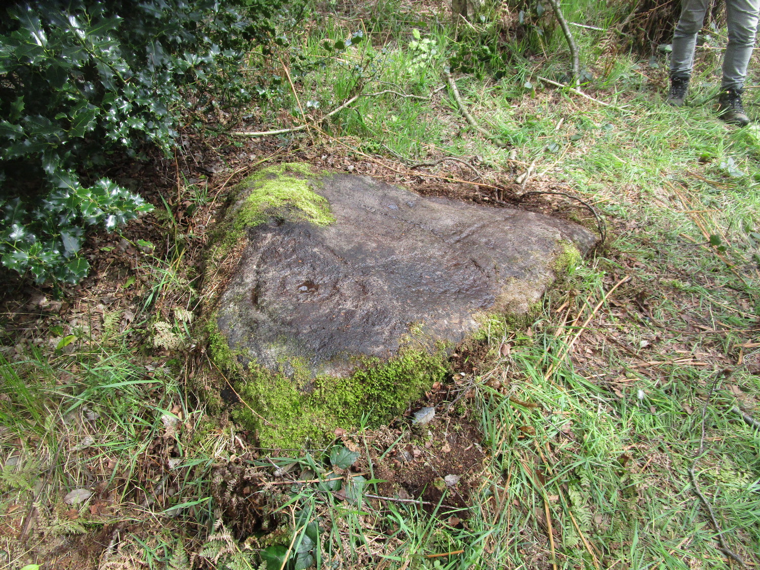
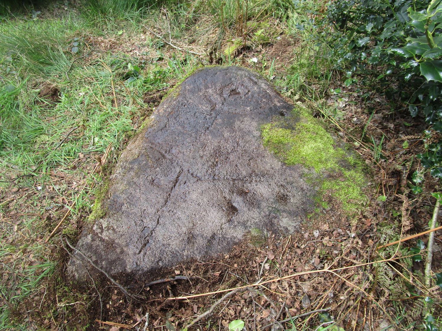
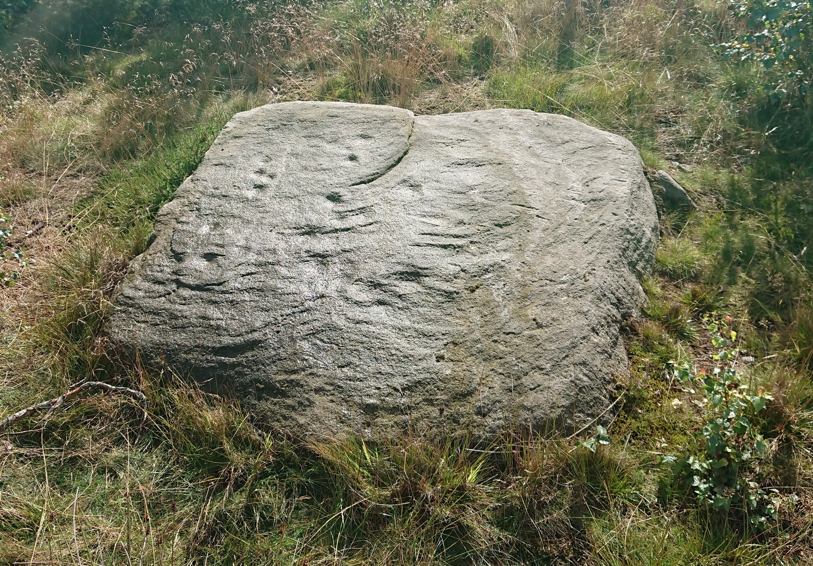
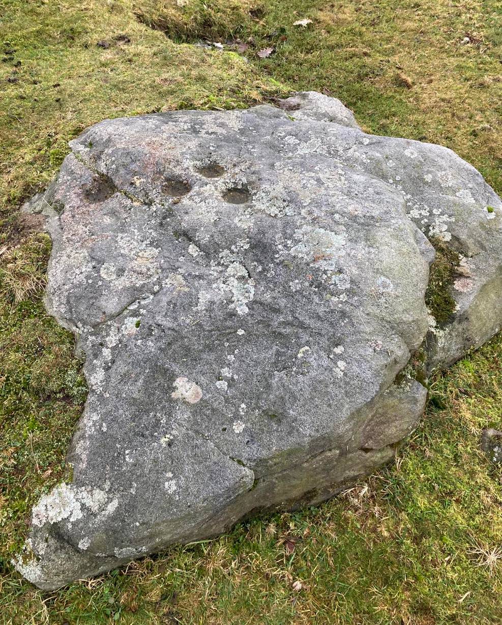
An intriguing find, made not too long ago by Jeff Wallbank of Silsden. Simplistic in design, it’s found on a small ridge of rocks adjacent to an old quarry (so there may have been other carvings here in times gone by), rising up immediately south of Haw Farm about 20 yards away, from where you can ask permission of the kind land-owner to have a look at the stone.
It’s pretty basic: consisting of a distinct triangle of three plain cup-marks on one side of a natural crack that runs across a section of the stone. Immediately adjacent and on the other side of this crack, is another singular cup. This appears to have a carved line running from it and possibly an elongated semi-circular element around the cup itself. It’s not too special when compared to the much more ornate petroglyphs further east, but is worth checking out if you’re walking in this gorgeous western edge of Rombalds Moor.
Acknowledgements: HUGE thanks to Sarah Walker, without whose help and permission to use her photos, this site profile could not have been written.
Sacred Well (destroyed): OS Grid Reference – SE 3953 1570
Archaeology & History
The precise whereabouts of this site isn’t known with absolute certainty, but, following research by the respected folklorist and pagan historian Steve Jones of Wakefield, the grid-reference cited here has a high degree of probability about it. I certainly agree with Steve about its location.
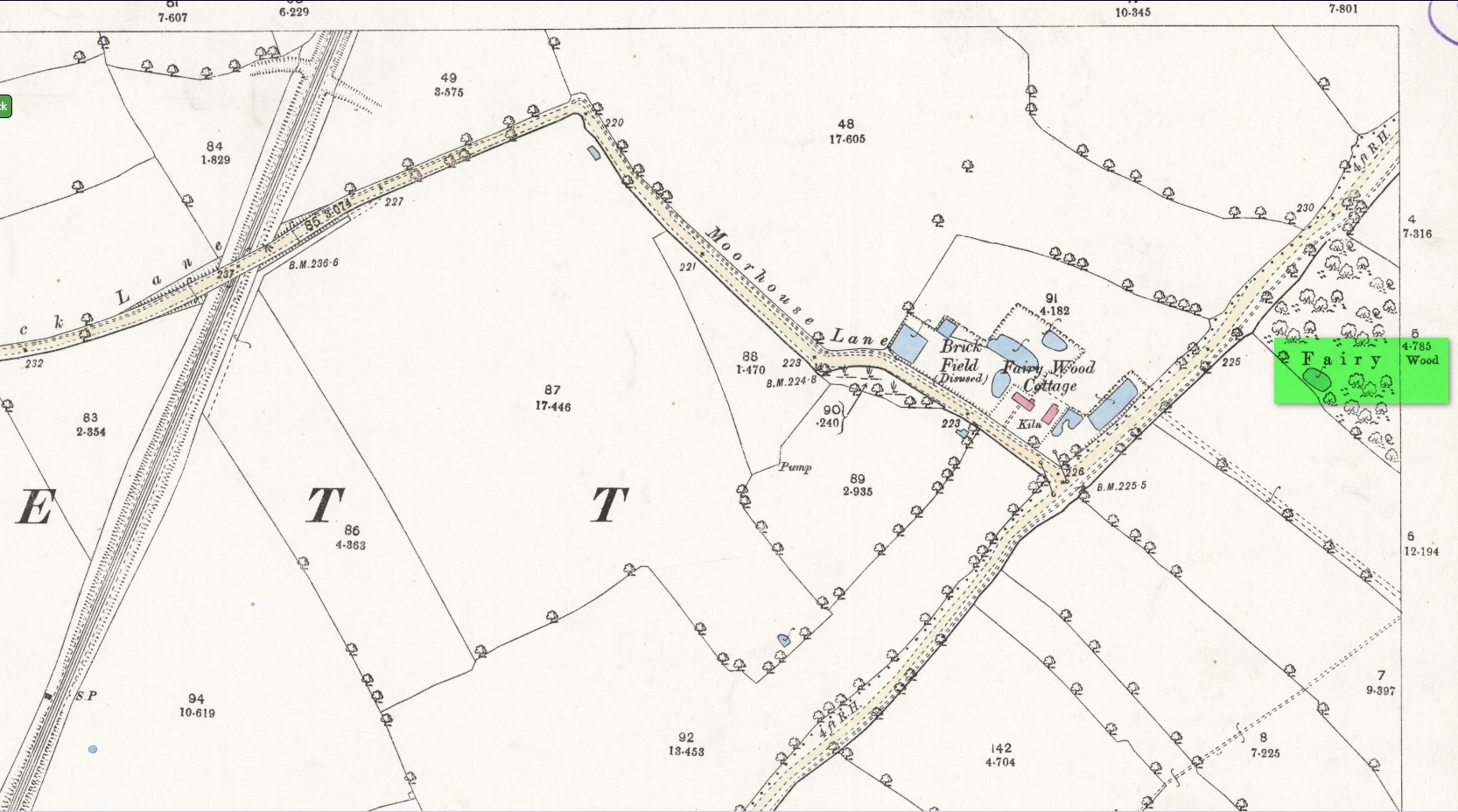
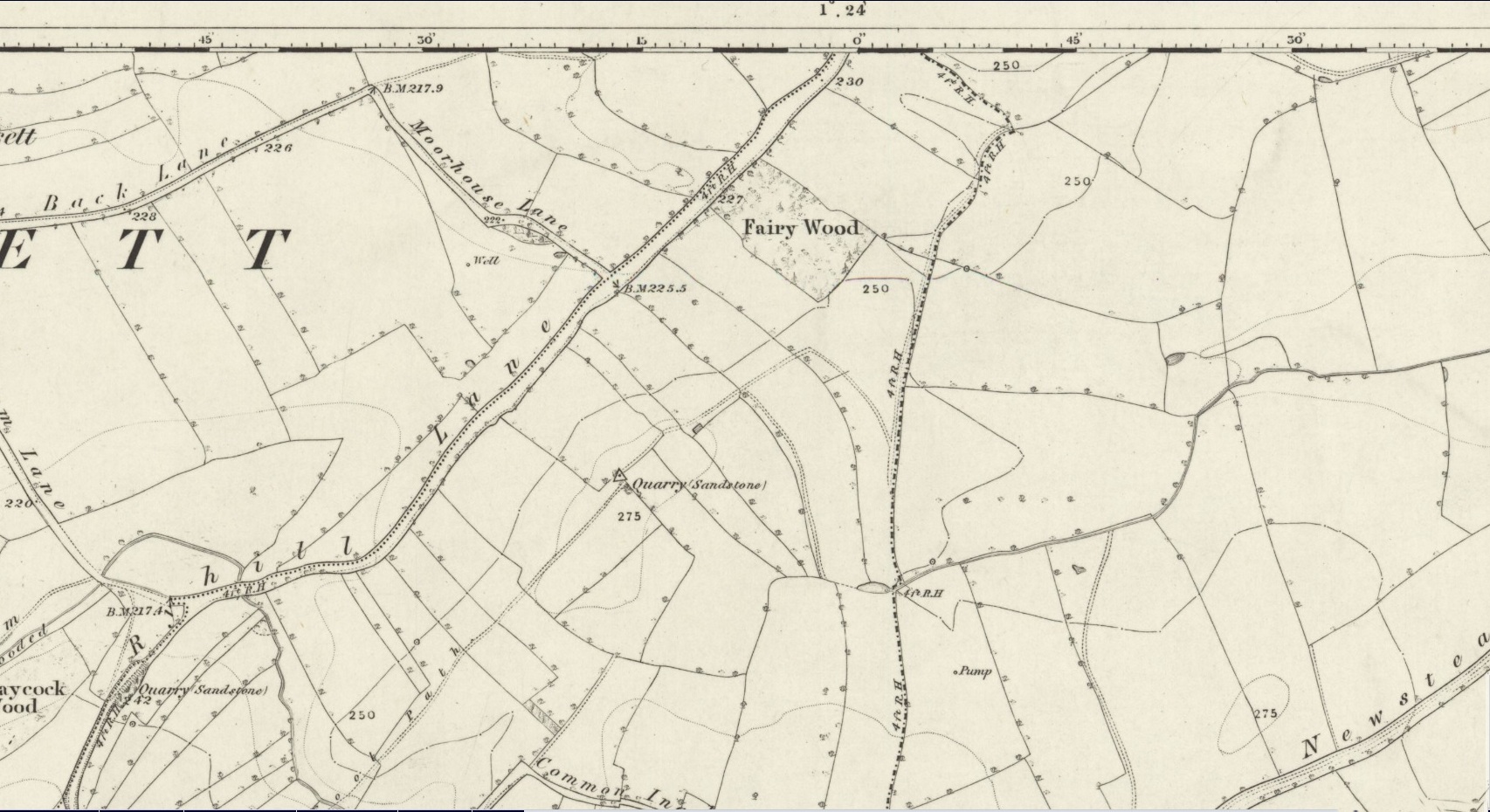
Pond in Fairy Wood, shown on the 1893 OS-mapFairy Wood near Nostell, probable home of the Well
Known about in the 19th century, I was fortunate in coming across what seems to be the only reference to the place whilst perusing the scrapbook notes of local historian John Wilson (1903). Were it not for him we would have lost all knowledge of its existence and the local tale told of it, albeit watered into a dying belief in these supernatural creatures, would have faded completely before its final physical demise. Wilson was described as a “diligent a student of local history,” who possessed a great collection of rare booklets and pamphlets on Yorkshire history and was a “careful an observer and recorder of all pertaining to past times.” Of this Fairy Well, Wilson scribed the following poem:
At Nostell is a Fairy Well,
Hard by the margin of a wood
Wherein once dwelt, as old men tell,
The little folks of fickle mood ;
Till smoke and steam denied the dell
And made them quit both wood and well.
Blythe Henry Carr, mine ancient friend,
— So bravely keeping on his feet ;
May death long spare him,
still to wend His way along the village street,
Within the cobbler’s shop to spend
A pleasant hour — mine ancient friend.
The woodman at the Priory
In old Sir Rowland’s halcyon days
Was Thomas Watson, gay and free,
Who roused with song the woodland ways
A friend of Henry Carr’s was he,
—The woodman at the Priory.
This Watson many a tale could tell
Of fairies red and fairies green,
That in the wood and by the well
On summer evenings he had seen:
Of elves that thereabouts did dwell
This Watson many a tale could tell.
Whoever heard of such a thing!
He said that persons, known to him,
At eve would flasks of liquor bring,
And leave them, lying near the brim
Of this — the wondrous Fairy Spring —
Whoever heard of such a thing !
Was ever such a tale yet told ?
He said, that, when the morning came,
Each flask lay empty, and, behold !
Near each a drunken elf. O, shame !
The vice of those of mortal mould :
— Was ever such a tale yet told ?
Then question I mine ancient friend:
“Did no one seize the tipsy sprites? ”
“Not they ! for sudden is his end
On whom the fairy vengeance lights.”
With solemn eyes that fear portend
Thus answers me mine ancient friend.
Steve Jones already knew of the Fairy Wood, which was highlighted on the 1841 and 1854 6-inch-to-the-mile OS-map of the area—but no “Well” is shown in the woods. However, as Steve discovered, following a subsequent visit by the Ordnance Survey lads in 1891, they showed on their 25-inch-to-the-mile map of the woods a distinct small pond in the trees not far from the roadside. This, he thought, was probably the Fairy Well referred to by Wilson. It would seem so. Adjacent to the woods, the 1853 Tithe Award cite the existence of a field also dedicated to the fairy folk, known simply as Fairy Close.
References:
Smith, A.H., The Place-Names of the West Riding of Yorkshire – volume 1, Cambridge University Press 1961
Huge thanks to the research by Steve Jones of Wakefield, without whose work the location of the Fairy Well would have remained a mystery. Also, thanks as always for use of the early edition OS-maps, Reproduced with the kind permission of the National Library of Scotland.
Follow the same directions as if you’re visiting the Gab Woods (1) carving—which you’re probably visiting if you’re checking this one out. Walk south into the middle of the woods and you’ll soon notice the road/houses on the other side of the trees. Once here, staying in the woods, follow the walling down for about 100 yards, keeping your eyes peeled for a reasonably large flat stone about 15 yards from the wall in the trees. If you can’t find it at first, patiently zigzag back and forth until it eventually appears!
Archaeology & History
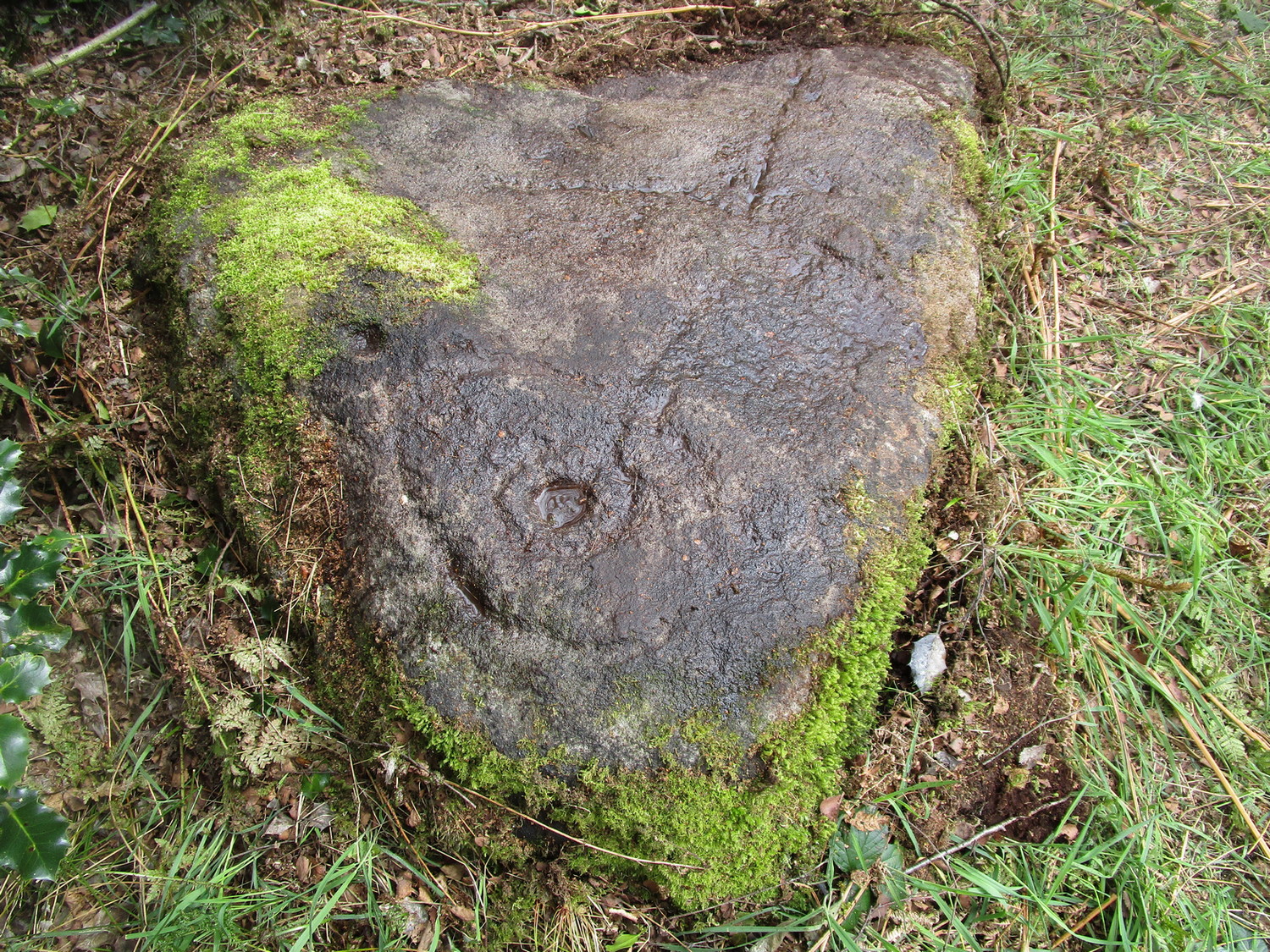
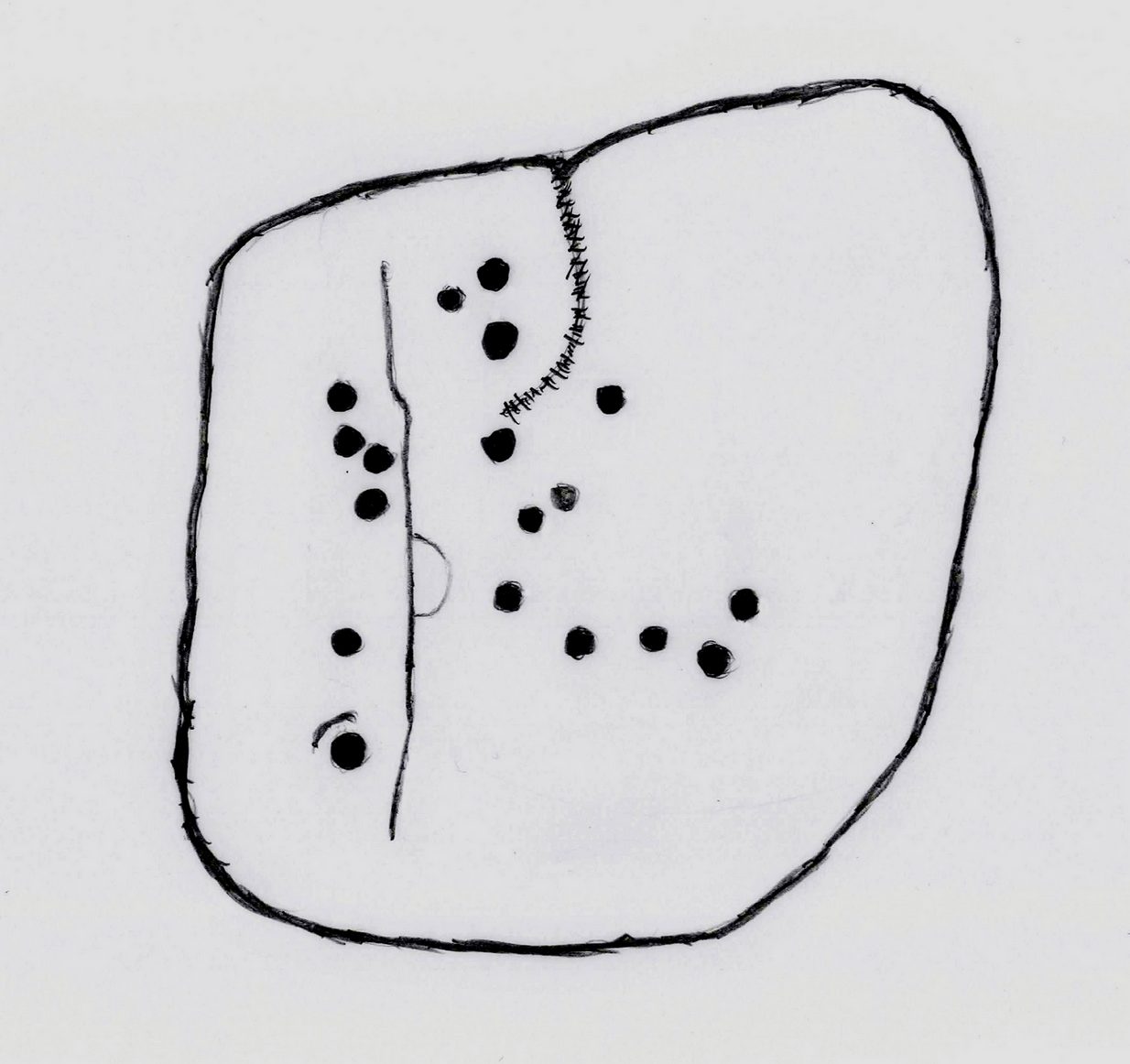
One of two known petroglyphs in this woodland (there may be more hidden away) that was first found in the 1940s by Dan Cole. The main feature here consists of a cup-mark encircled by two large, well-defined oval-shaped “rings”, a bit like a large eye. From the central cup, a long carved line runs down the gently sloping surface of the stone and, roughly halfway down from the cup-and-ring to the edge of the stone, another carved line cuts across at rough right-angles, giving the carving a slight anthropomorphic (human-like) appearance when looking up the stone. This humanesque figure may have been the intention—though for my part I have to say that I’m slightly skeptical about it. We may never know either way. Several other single cups are on the stone: one to the side of the large “eye” and two or three below the elongated “arms.”
Vague humanesque figureLarge eye-shaped element
An additional, interesting non-petroglyphic feature is the name of the woodland in which the stone resides. In Thomas Wright’s massive dialect work, Gab is a northern dialect word meaning “to talk”, or “idle chatter” (and variants thereof); this is echoed in Blakeborough’s (1911) Yorkshire survey; and Wilkinson’s (1924) local study tells simply it’s “idle talk…able to talk glibly and with much plausibility—a Town Hall Square orator for instance.” This makes the place as something akin to being “the woodland that talks”, “the chattering woods” or “the talking woodland”, etc. You can make up your own mind as to what this might mean… *
References:
Blakeborough, Richard, Wit, Character, Folklore and Customs of the North Riding of Yorkshire, W. Rapp: Saltburn 1911.
Acknowledgements: Huge thanks must go to Peter Murphy for recovering this impressive carving from the archives, and from beneath the carpet of soil and vegetation, so enabling it to see the light of day once again. Also big thanks to the usual culprit of James Elkington, as well as Sarah Walker and Sarah Jackson.
* a Scottish dialect variant of gab relates to the mouth, tongue, taste.
Cup-and-Ring Stone: OS Grid Reference – SE 0845 4529
Archaeology & History
Discovered by Stuart Feather in the late 1950s, this was one of two carvings found very close to each other (see Bucking Hill 2) whose exact location are unknown (the grid-reference cited here is a reasonably accurate approximation). In his short article where he mentions the Bucking Hill 2 carving, he then told of,
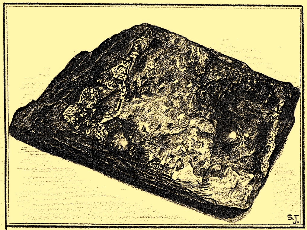
Sid Jackson’s vague drawing of the carving
“the discovery a few yards away of a small stone bearing a cup-and-ring mark providing evidence for at least one other symbol from this small hill. This stone, only 14in long, 8in wide, and 6½in thick, has a cup 1¾in in diameter, ⅞in deep with a shallow channel 1½ long running from it.
“Round the cup, which is very symmetrical and has the pecking clearly defined, is part of a concentric channel which, if it were a complete circle, would have a diameter of 4in. The channel, which starts near to the small channel that runs from the cup, goes only halfway round the cup and is obviously unfinished. It is irregular in width and depth and in marked contrast to the workmanship of the cup.”
He then queries as to whether this small carved stone could have come off the larger cup-marked Bucking Hill (02) boulder close by. We may never know, but when we consider the lack of general erosion on this cup-and-ring (the pecking was still visible), it would obviously have remained upside-down in the peat for a few thousand years! There was an old cairn a short distance away on the top of Bucking Hill and it may have come from there. Anyhow, Mr Feather subsequently took this portable carving home with him and it’s subsequently been donated to the Ilkley Manor House Museum where it should be visible. (can someone send us a photo so we can add it to the site profile?)
References:
Boughey, Keith & Vickerman, E.A., Prehistoric Rock Art of the West Riding, WYAS 2003.
Feather, Stuart, “Mid-Wharfedale Cup-and-Ring Markings – Nos 21 and 22: Bucking Hill, High Moor, Rombald’s Moor,” in Bradford Cartwright Hall Archaeology Group Bulletin, 9:5, 1964.
Hedges, John (ed.), The Carved Rocks on Rombalds Moor, WYMCC: Wakefield 1986.
Cup-Marked Stone: OS Grid Reference – SE 0844 4529
Also Known as:
Carving no.87 (Boughey & Vickerman)
Carving no.217 (Hedges)
Archaeology & History
This was one of two carvings reported by Stuart Feather (1964) that were very close to each other (see Bucking Hill 3), both of which consisted of simplistic designs but which, he thought, may once have been part of the same rock. Its precise whereabouts are not known (the grid-ref is an approximation). He wrote:
“On the southern slopes of Bucking Hill, a fine gritstone rock 5ft 6in by 4ft 6in by 1ft 6in high, has a very clear cup-mark 2in in diameter and ½in deep carved 8in from the straight eastern edge of the rock.”
Feather thought that the edge of the rock had been cut and quarried for use in the boundary wall to the east. He may have been right.
References:
Boughey, Keith & Vickerman, E.A., Prehistoric Rock Art of the West Riding, WYAS 2003.
Feather, Stuart, “Mid-Wharfedale Cup-and-Ring Markings – Nos 21 and 22: Bucking Hill, High Moor, Rombald’s Moor,” in Bradford Cartwright Hall Archaeology Group Bulletin, 9:5, 1964.
Hedges, John (ed.), The Carved Rocks on Rombalds Moor, WYMCC: Wakefield 1986.
Cup-and-Ring Stone (lost): OS Grid Reference – SE 0828 4507
Also Known as:
Carving no.84 (Boughey & Vickerman)
Archaeology & History
Described by Boughey & Vickerman (2003) as being located somewhere “below Dirk Hill Sike” in the Rivock woods plantation, this is (or was) a “medium, upstanding rock lying NW-SE (with) one possible heavily weathered large cup-and-ring: cup 75mm diam. and ring 200mm diam.” However, the authors give no references to this site, nor images, or notes as to who rediscovered this stone. In their survey they also included one of the Bucking Hill carvings twice, giving the impression that there was more here than had previously been reported. These errors have subsequently been repeated elsewhere on-line. In saying this, there are a number of rocks scattered in this area which may have had carvings on them, but it’s been heavily forested and, recently, the trees have been felled and so many of them will have been damaged, turned over, or simply destroyed as a result of the forestry shennanigans.
References:
Boughey, Keith & Vickerman, E.A., Prehistoric Rock Art of the West Riding, WYAS 2003.
Coming via the Keighley-Bingley (Airedale) B6265 road, go up to Riddlesden and then up the winding Banks Lane until you reach the T-junction. Turn left here and about 330 yards along, on the right-side of the road is a dirt-track. Walk up here, sticking to the track (not the footpath) towards the cliffs of Rivock ahead of you, going through the gate and into the Rivock woods area. 450 yards on from the gate, on your right you’ll pass the long straight line of walling running uphill and literally 275 yards further along the track from here, walk straight up into the trees for 20 yards where, just before the slope begins to truly veer into an “uphill” state, you’ll see the stone in question!
Archaeology & History
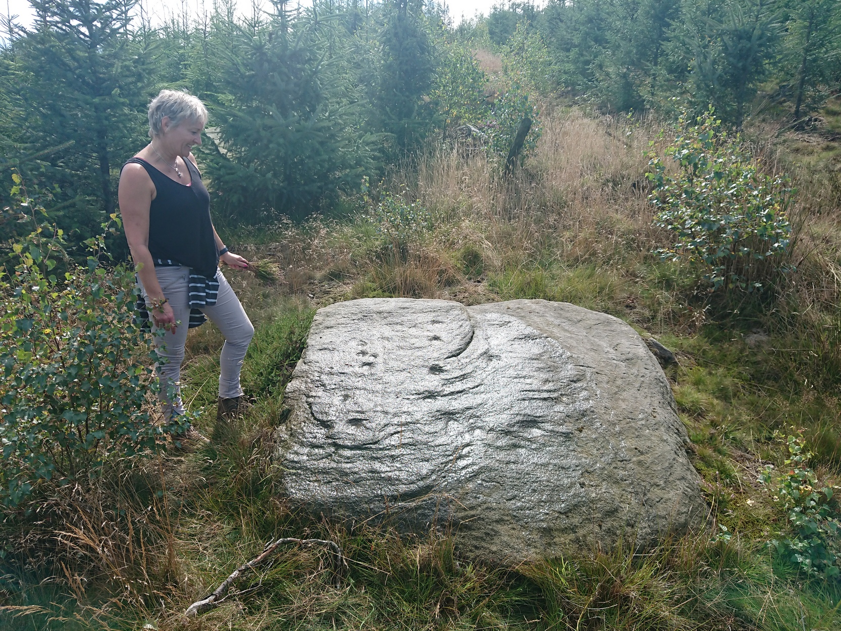
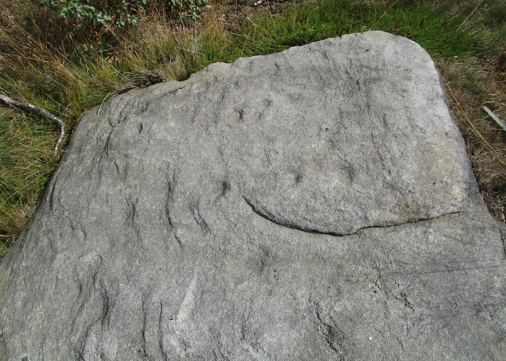
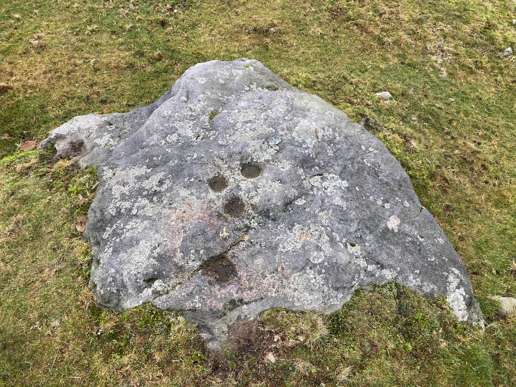
Cups on east-side of stone
In 1961 when Stuart Feather rediscovered this carving, the “rock was almost completely covered by a six-inch layer of peat and vegetation.” But, like all good rock art explorers, he slowly and carefully peeled it all back and brought back to light another one of Rivock’s olde stories. We know not what the story on the rock might tell, but it looks good nonetheless! Feather counted “several cups carved on it”, but a few more have ben discerned since then. When Boughey & Vickerman (2003) described it in their typically minimalist way, they told it be a “large square rock with surface in slope of hill. About nineteen cups.” Evocative stuff!
Sketch of basic designFaint line visible, left-side
When I first saw visited this carving as a young lad, the thing which stood out to me more than anything was the long but faint line that ran down one section of the stone. Added to this was an equally faint arc attached to the side of the line, like a “D” form. A few months later I did a sketch of it on my second visit, but I’ve looked and looked and seem to have lost it. (not good) The one I’ve done here is a recent one. As we can see, a series of cup-marks straddle each side of the D-line and are plainly visible, which implies that the line was carved much earlier than the cups. Of course, it’s possible that the cups were repeatedly forged over and over many times over a century or more and the D-line, for whatever reason, left untouched.
Another interesting aspect of this D-line is its repetition in the much more ornate petroglyph 35 yards to the east (presently known as Rivock 67 until we devise something more appropriate). The recently rediscovered Slinger Stone 100 yards south may also have the same feature, but this needs further surveying before we can say for sure.
References:
Bennett, Paul, ‘The Prehistoric Rock Art and Megalithic Remains of Rivock & District (2 parts),’ in Earth, 3-4, 1986.
Boughey, Keith & Vickerman, E.A., Prehistoric Rock Art of the West Riding, WYAS 2003.
Feather, Stuart, ‘Mid-Wharfedale Cup-and-Ring Markings: No. 14, Rivock,’ in Cartwright Hall Archaeology Group Bulletin, 7:1, 1962.
Hedges, John (ed.), The Carved Rocks on Rombald’s Moor, WYMCC: Wakefield 1986.
Acknowledgements: With thanks to Andy Roberts for giving this stone its modern name.
Holy Well (destroyed): OS Grid Reference – SE 6900 2841
Archaeology & History
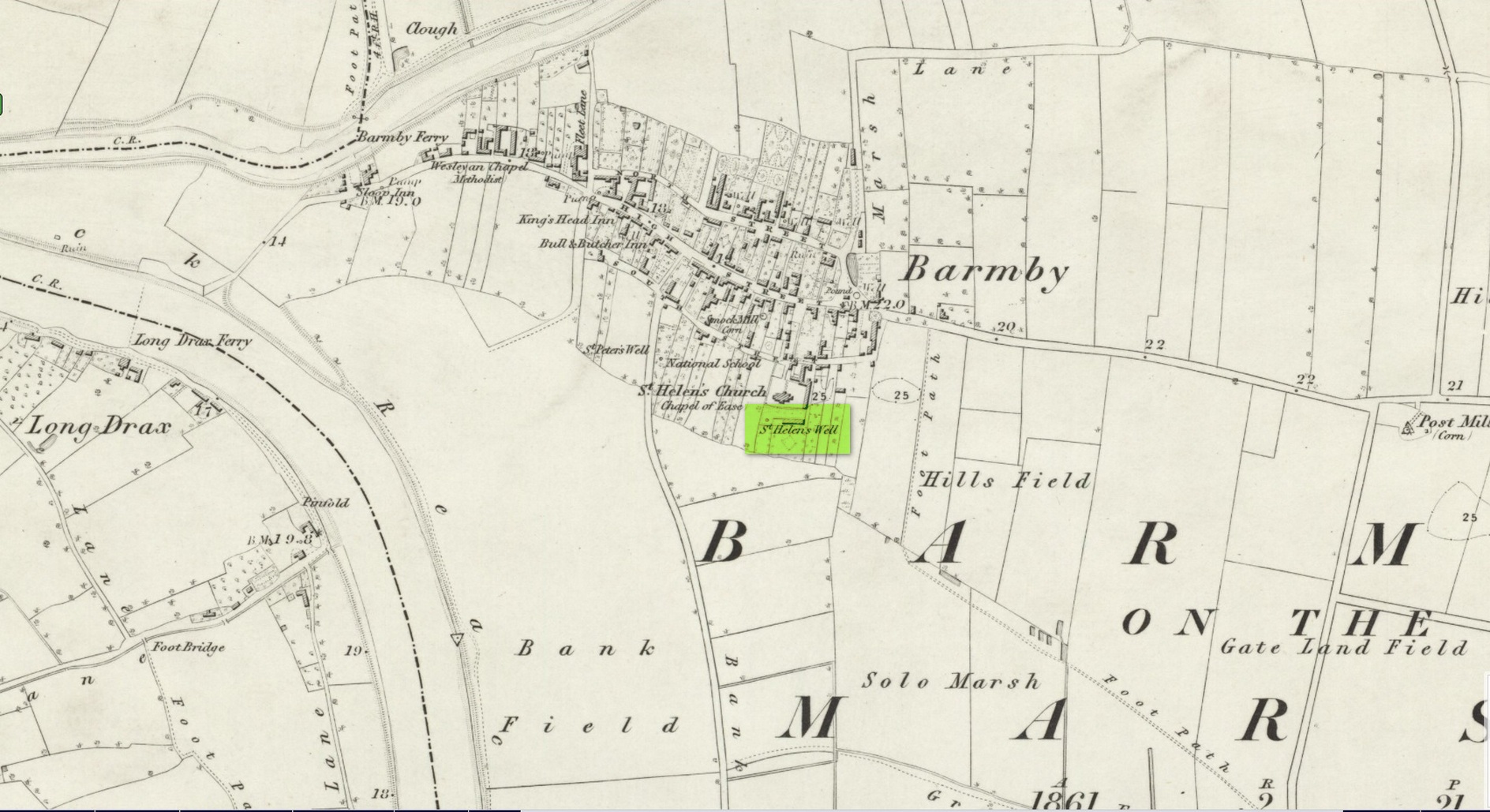
Site shown on 1853 map
One of two holy wells in Barmby village which, like its compatriot St Peter’s Well, was destroyed sometime in the 19th century. Not good! It was located in the southwest section of the graveyard of St Helen’s Church and was apparently alive and running when the Ordnance Survey lads visited here in 1851 (as shown on their 1853 map). But when the site was revisited by them in 1905, it seems to have gone. However, as with the neighbouring St Peter’s Well, there are conflicting reports as to when it was destroyed, for although the Ordnance Survey lads spoke of it in the present tense when they went there, Thomas Allen (1831) told that “within the last six years (it has) been wantonly filled up.” Despite this, less than ten years later William White mentioned it in the present tense, also saying how it was “said to possess medicinal properties.” These healing qualities were, according to Allen, due to its iron-bearing or chalybeate nature, meaning that it would revive a weak and feeble constitution. Iron-bearing wells are damn good for such things!
As the years passed, St. Helen’s Well fell into folk memory. When William Smith (1923) surveyed the many holy wells in this part of the world he found how “old parishioners have said that as school-children they both drank of and washed in its water”, but little else.
References:
Allen, Thomas, A New and Complete History of the County of York – volume 2, I.T. Hinton: London 1831.
Gutch, E., Examples of Printed Folk-lore Concerning the East Riding of Yorkshire, Folk-Lore Society: London 1912.
Harte, Jeremy, English Holy Wells – volume 2, Heart of Albion press: Wymeswold 2008.
Smith, William, Ancient Springs and Streams of the East Riding of Yorkshire, A. Brown: Hull 1923.
White, William, History, Gazetteer and Directory of the East and North Ridings of Yorkshire, R. Leader: Sheffield 1840.
Cross (destroyed): OS Grid Reference – SJ 2534 7208
Archaeology & History
Actual location of the cross
This long-gone site, described in the Domesday Record of 1086 as Atiscros Hund, (or “hundred”, which is the word given to an administrative division of land which, at that time, was on the western edge of Cheshire bordering Wales), gained its title from an old English personal name, Æti. The fact that it stood on an ancient boundary and was included in Domesday, means it would have been a stone cross. Its location was shown on the 1871 Ordnance Survey map (and several subsequent ones), based on traditional accounts about its position. The site is still preserved in local street-names.
Referring to the monument itself, Thomas Pennant (1796) said that it still existed in his day, telling that,
“A cross stood there, the pedestal of which I remember to have seen standing. There is a tradition that, in very old times, there stood a large town at this place; and, it is said, the foundations of buildings have been frequently turned up by the plough.”
References:
Dodgson, J.M., The Place-Names of Cheshire – volume 4, Cambridge University Press 1972.
Pennant, Thomas, The History of the Parishes of Whiteford and Holywell, B. & J. White: London 1796.
Taylor, Henry, Historic Notices, with Topographical and other Gleanings Descriptive of the Borough and County-Town of Flint, Elliot Stock: London 1883.
Tumuli (destroyed): OS Grid Reference – NU 273 046
Archaeology & History
In a lengthy letter describing the cist burial at Cliff House, its author, Mr W. Dunn (1857) told that there were additional prehistoric remains nearby, that had only recently been destroyed. He told:
“It appears that, a few years ago, in the immediate proximity of the present discovery (at Cliff House, Ed.) two or more tumuli were found which contained urns and bones; and flint arrow heads of elaborate finish have been occasionally met with.”
I can find no additional information about these sites.
In the same article, a Mr Kell told that during the construction of the Amble piers a half-mile to the west, “some years ago, he was sojourning in the neighbourhood, and …human remains were found on the removal of sand by the waves in a violent gale from the East.” What else is known of this place?
References:
Dunn, W., “Ancient Sepulchral Remains,” in Proceedings Society of Antiquaries Newcastle-upon-Tyne, volume 1, no.34, 1857.
 It’s pretty basic: consisting of a distinct triangle of three plain cup-marks on one side of a natural crack that runs across a section of the stone. Immediately adjacent and on the other side of this crack, is another singular cup. This appears to have a carved line running from it and possibly an elongated semi-circular element around the cup itself. It’s not too special when compared to the much more ornate petroglyphs further east, but is worth checking out if you’re walking in this gorgeous western edge of Rombalds Moor.