The easiest way to see this is to reach the Nether Glenny 2 Cairn, looking north to the slope a coupla hundred yards away, where you can see a long rock halfway up. If you can’t see it from here, walk to the impressive Nether Glenny 35 Carving, where the large long slab is much more obvious on the hillside. Walk through the gates to the Nether Glenny 37 carving and then diagonally up to the rock itself. You can’t really miss it.
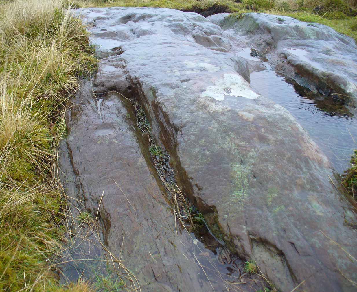
This 15-foot long stone halfway up the slope was said by the Royal Commission lads to have “four possible cup-marks” on it, whereas there are at least nine of them and maybe as many as eleven! Most of them are dead certs as prehistoric etchings, not just ‘possibles’.
Small faint cluster of cupsSome of the faint cups
The more visible cup-marks here are found on the more western end of the stone, just below the grass-line. The cups here are quite distinct, measuring some two-inches across and nearly half-an-inch deep in two of them. The others in this section are a little smaller and further down the slope of the rock. Seemingly not noticed for a long long time however is a small cluster of very faded cups, gathered like a very faint 4-star Pleiades cluster more than halfway along out in the photo here (I hope!).
The biggest of the cups
This entire area is covered with cup-and-ring stones, possessing one of the greatest densities of carvings anywhere in Scotland.When we visited the place last week, Nature was pouring with rain, so we weren’t able to sketch the design. Something that we’ll hopefully amend in the near future!
About 1 mile west of where the B8034 meets the A81, between the Port of Menteith and Aberfoyle, a small road on the right (north) at Portend takes you up the single-track road to Upper Glenny. Go 2-300 yards up past Mondowie Farm and take the next track, left. Walk up through the gate for nearly 300 yards, going through the gate on your left and onto the fields. Follow the fence for 300 yards then go through the gate into the next field—past one of the Nether Glenny cairns—and walk across it until you reach an open gate at the far side, just where the hillside goes up. It’s nearly under your feet!
Archaeology & History
Close-up of the cup&ring
This single cup-and-ring carving, found amidst the massive cluster of both simple and highly complex petroglyphs between Ballochraggan and Upper Glenny, doesn’t seem to have been included in any previous surveys. It was located during the incredible rains yesterday on Sunday 7 February, wetting this and other rocks, enabling better visibility of otherwise invisible symbols faintly remaining here and on other stones. The carving appears to have been etched into naturally occurring notches and fissures. Certainly worth looking at when exploring the other incredible carvings on this hillside.
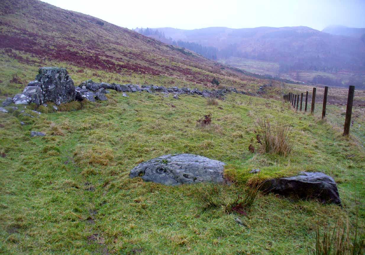
Take the same directions as if you’re visiting the nearby Nether Glenny 2 cairn. Once here, walk less than 100 yards further down into the same field, north, roughly parallel with the fencing. You’ll reach several large rocks, and the elongated one on the slight rise closer to the fence is the one you’re after. You’ll find it!
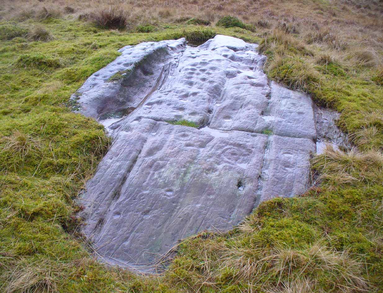
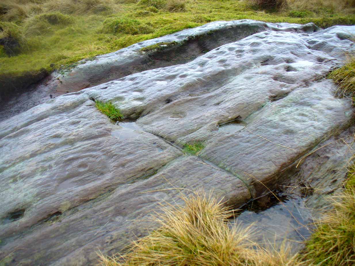
This is one in a number of impressive cup-and-ring stones scattered along this grassy ridge overlooking the Lake of Menteith and the Gargunnock Hills to the south. Petroglyph lovers amongst you will love it! And it seems that with each and every analysis, the carvings gives up more and more of its ancient symbolism. When it was first described (in a literary sense) by Maarten van Hoek (1989) he told it to be:
“Irregular outcrop with at least 72 single cups; 3 cups with 2 rings; 6 cups with 1 ring and 2 possible horse-shoe rings only.”
But when Kaledon Naddair (1992) visited the site a few years later he amended this initial description, telling us how,
“Further temporary turf removal extended the total to 124 solo cups, and 9 cups with 1 ring, and 5 cups with 2 rings.”
Cups & rings & cups….Western side of carving
Naddair’s description is closer to our own inspection, although I think that a small number of the ‘cups’ are natural. Other features that we’ve found occur on the more western side of the rock. A faint partial-double-ringed cup is accompanied a few inches away by a carved element that seems to have been unfinished. An initially indistinct circle, faintly pecked, has internal lines at the quadrants, akin to an early cross form. A line emerges from this symbol which also seems to have been slightly worked.
Subsequent investigations of this carving has uncovered much more which, to be honest, requires almost an entire re-write of this profile……
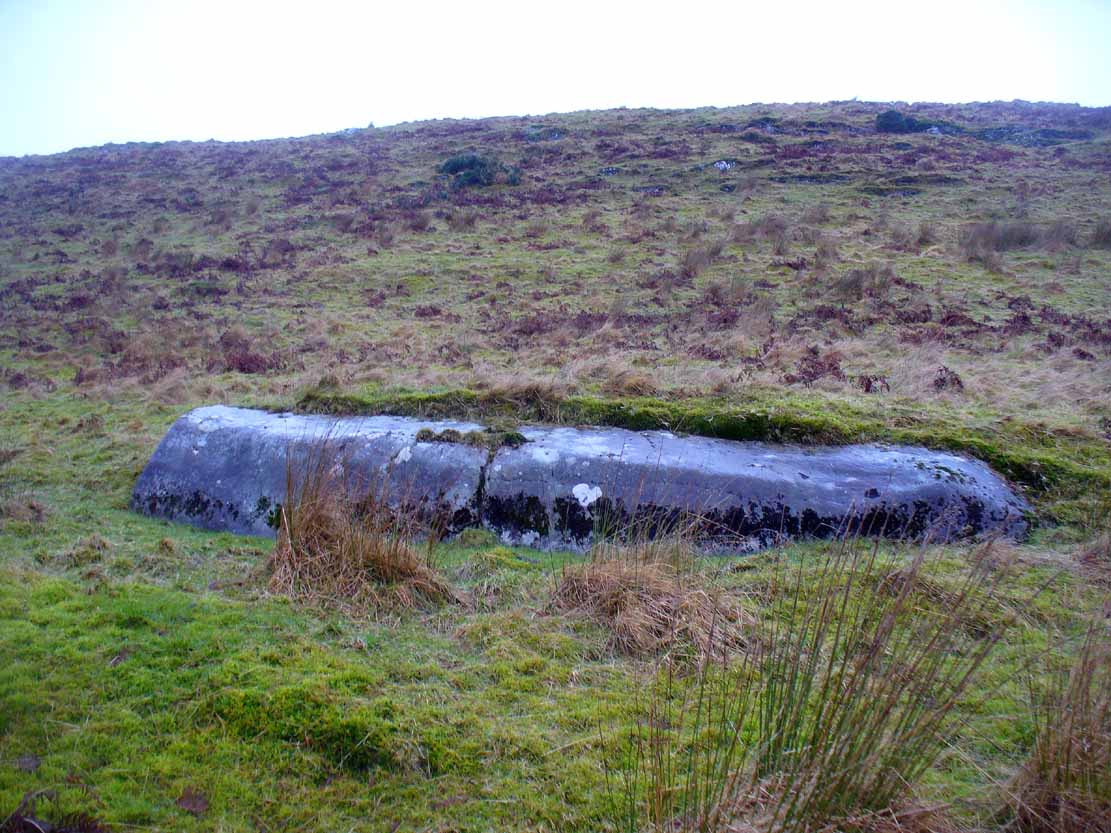
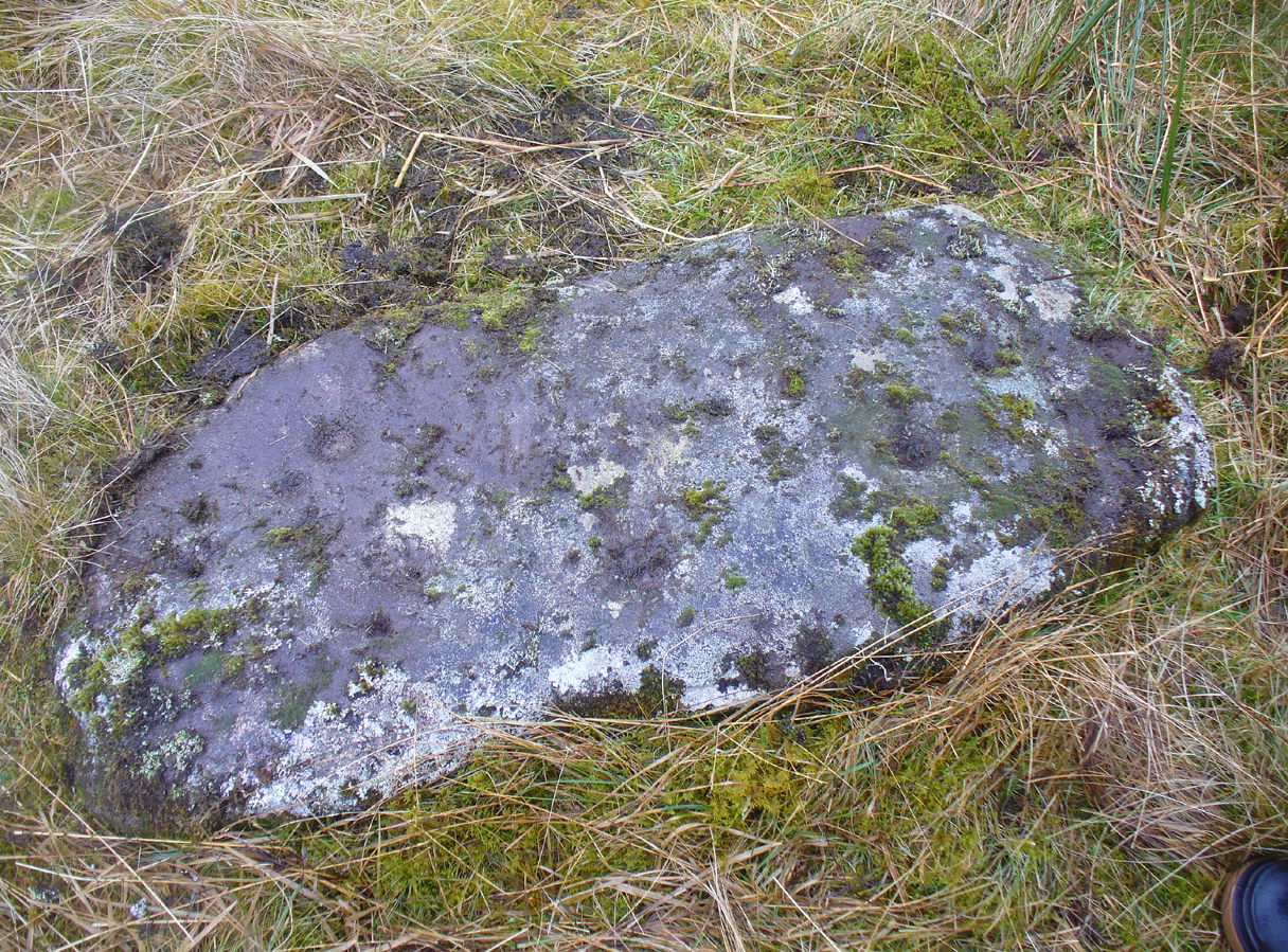
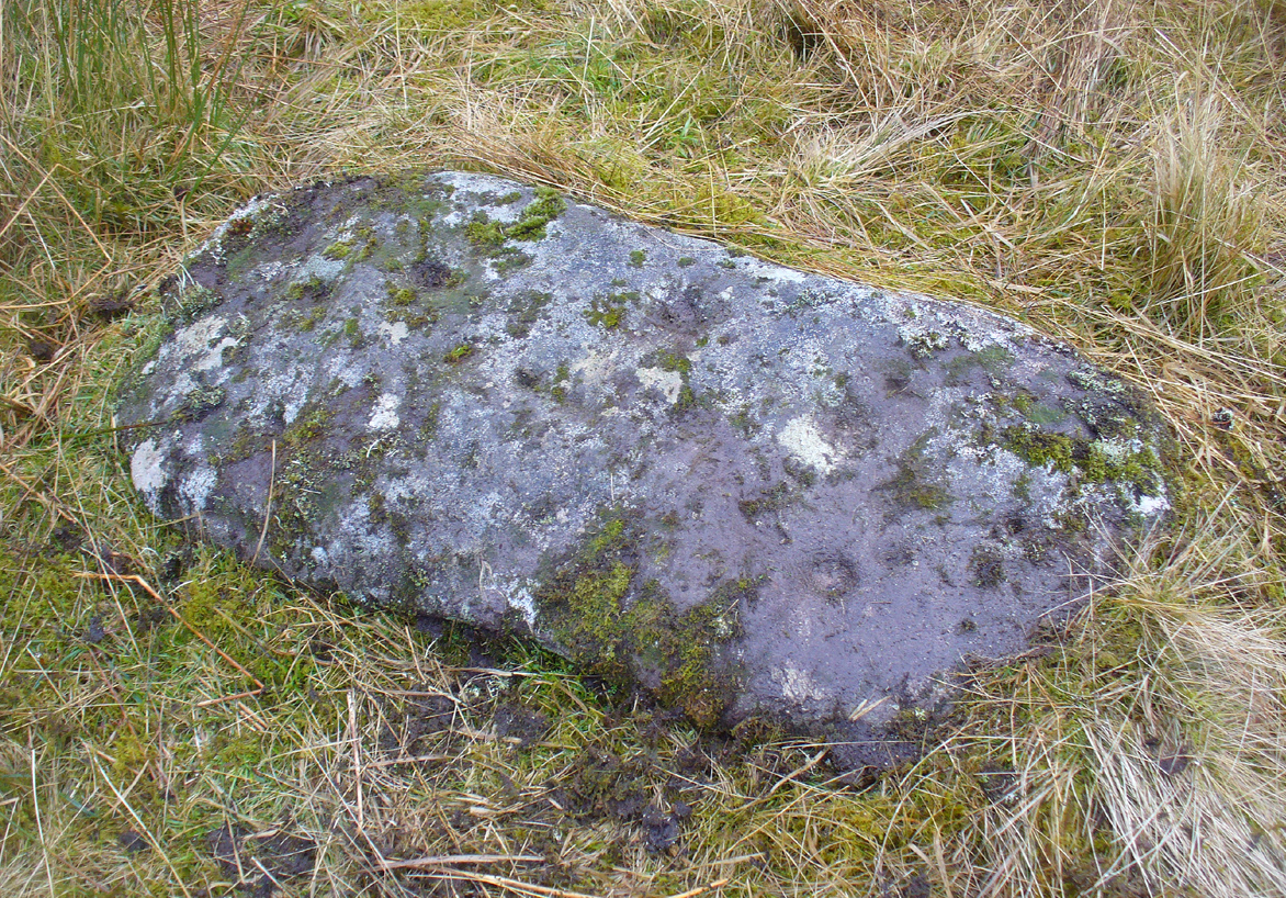
Take the same directions to reach the Nether Glenny cairn (about 1 mile west of where the B8034 meets the A81, between the Port of Menteith and Aberfoyle, up a small road on the right [north] at Portend) and walk to its companion cairn 100 yards north. From here, walk west across the field towards the nearby forest. Nearly 20 yards from the wall and about 35 yards from the corner of the field where it meets the forest, this elongated stone lies amidst the grasses and reeds. You’ll find it.
Archaeology & History
…and from another angle
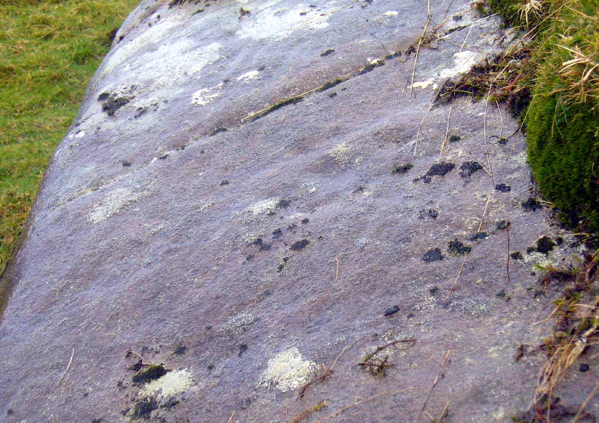
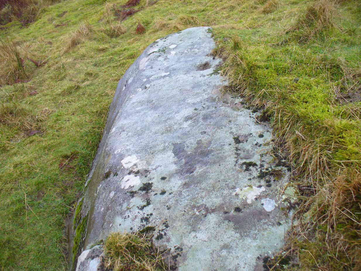
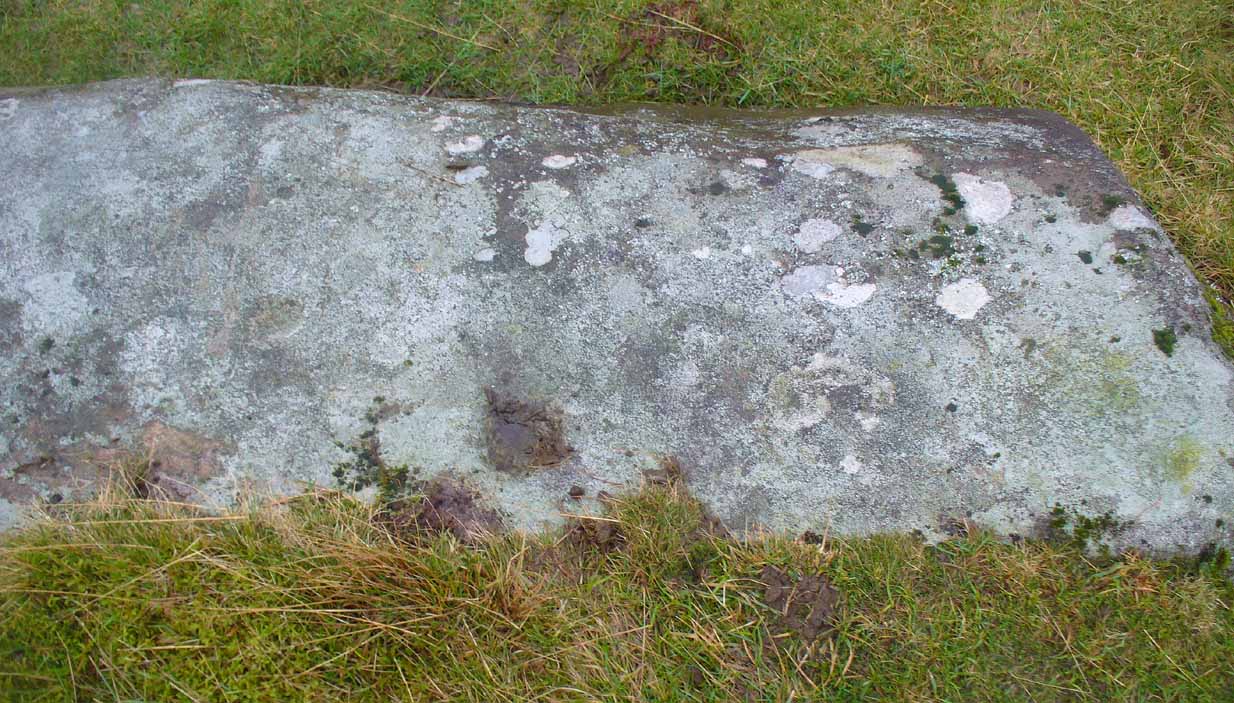
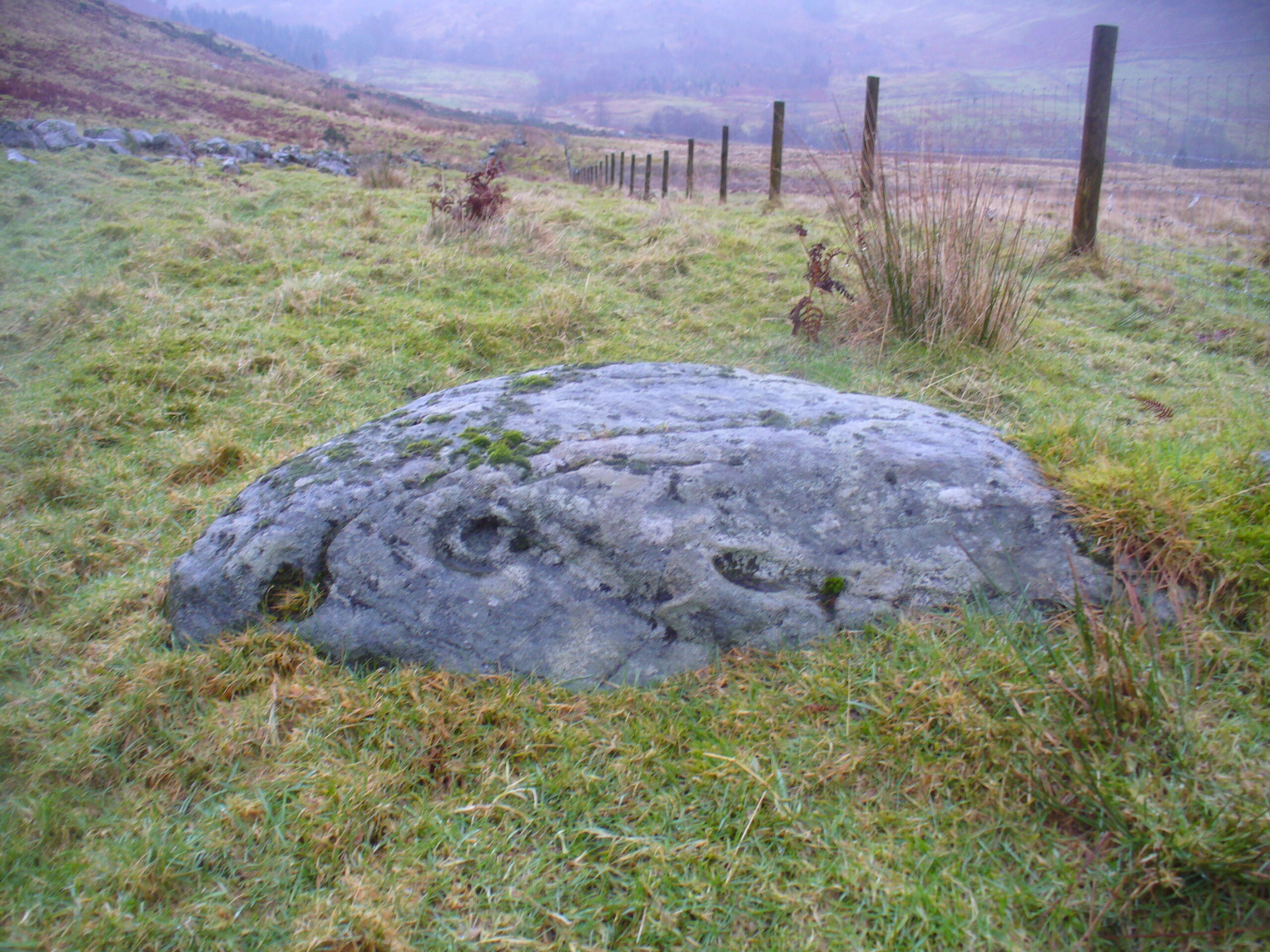
Looking somewhat like a small fallen standing stone (the Royal Commission list just such a stone nearly 200 yards east), this slim elongated rock was first described in Maarten van Hoek’s Menteith (1989) survey where he told it to be a “loose slab north of the…burn, bears at least thirteen cups.” But of the “thirteen cups”, only five of these (seven at the most) appear to be man-made. The others are, quite distinctly, geophysical in origin (and in all probability, the other cups were forged from the geological nicks and dimples). One of them may have the faint remains of a ring around it, but this is uncertain. When we visited the site yesterday, the light was poor and although this ‘ring’ seems to show up on a couple of photos, I’m erring on the side of caution.
van Hoek, Maarten, “Menteith (Port of Menteith parish) Rock Art Sites,” in Discovery & Excavation Scotland, 1989.
Acknowledgements: Huge thanks to Paul Hornby and Nina Harris for their help and endurance at this site, amidst healthy inclement Scottish February weather! Another damn good day!
Along the A84 Callander road, just going out on the east side of town, take the signposted road up and up and towards the car-park for the Bracklinn Falls. Another mile past here, keep your eyes peeled for the Wishing Well sign on the right-hand side of the road. From here, walk straight up the hillside for 150 yards (137m) and zigzag about. You’ll see it!
Archaeology & History
This small standing stone (not previously recorded) hides away up on the hillside not far from the old Tobhar na Cailleach (nowadays demoted as a just a Wishing Well), with its history and traditions seemingly long forgotten. About 3 feet high and barely a foot thick, it may once have had a companion standing just a few yards away by its side, where now lays a moss-covered stone. It reminded me a little of the stone pairing called the Cuckoo Stones near Wuthering Heights at Haworth, West Yorkshire.
Possible fallen stone
Druim Mor stone, looking N
Slightly higher up the grassy slope, 15-20 yards away, we find a low line of ancient walling that runs slightly uphill and then across a slightly level piece of land for about 40 yards, before turning back down the hillside and towards the road below.
Folklore
Although we have no recorded traditions of this stone, it needs to be highlighted that the waters, the woods and the slopes below this stone are dedicated to the Cailleach – the great prima Mater of Scottish and Irish traditional history.
Acknowledgements: Many thanks to Nina Harris and Paul Hornby for their help on the day of this find.
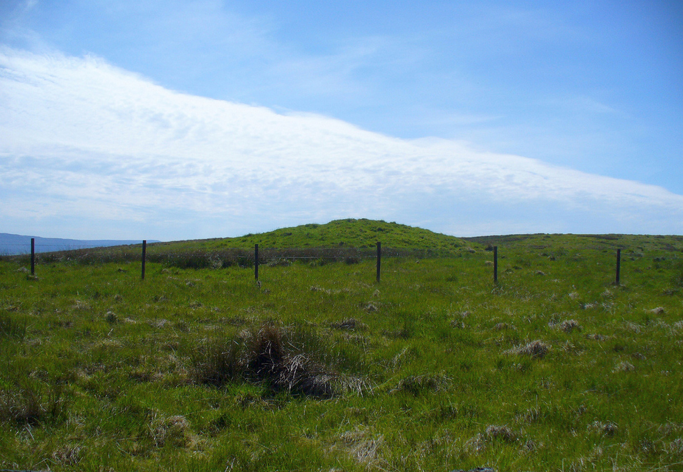
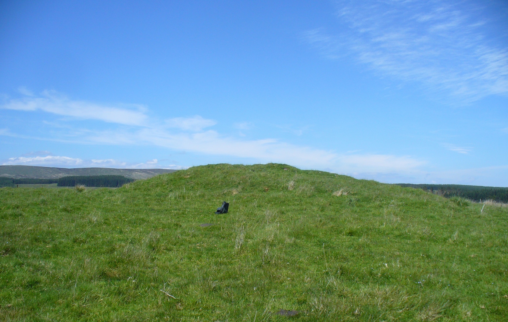
Along the A820 road between Dunblane and Doune, from the Dunblane-side, take the very first minor road on your right a few hundred yards after you’ve come off (or over) the A9 dual-carriageway. Go all the way to the very top of this long and winding road for several miles, until you reach the gate which prevents you going any further. Walk up the slope on your left (west) and you’ll see the large grassy mound a coupla hundred yards ahead of you. That’s it!
Archaeology & History
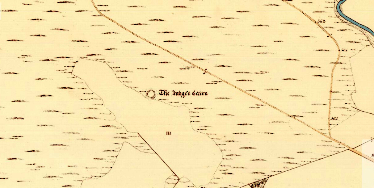
Highlighted on the first Ordnance Survey map of the area in 1862, this is a large rounded prehistoric cairn of some considerable size, whose position in the landscape allows for an impressive 360° view way into the distance in several directions—a deliberate ingredient, no doubt, when it came to building this probable tomb. I say “probable”, as there has never been a dig (not an ‘official’ one anyway) into the heart of this overgrown rocky mound.
Looking SE into the OchilsJudges Cairn on 1862 map
More than 60 feet in diameter at its greatest and 6 feet high, with a circumference of 67 yards (61m), the top of the mound has been disturbed and, clearly, has been dug into at some time in the distant past—but archaeohistorical accounts are silent on this matter. The first description of the Judge’s Cairn seems to have been in Peter Stewart’s (1839) notes on the local antiquities of Dunblane, where he described it most simply as:
“The Judges Cairn, yet undispersed, a circular heap of rough mountains stones covered with furze, on the farm of Bowie, barony of Kilbride.”
Along with the Ordnance Survey lads who came here in 1862, all subsequent visits gave rise to only short notes about the place. Odd, considering its size and distinct vantage point. And yet it remains hidden from view unless you come from the north, from whence that archetype of a fairy mound raises itself above Nature’s fair body into the eyes of any ambling wanderer…. A wonderful place to sit and dream for a while…
Folklore
Judges Cairn, looking NE
We enquired with a local whose family had been resident here since the mid-18th century about the name and folklore of the site, but he said he knew of nothing. However, in earlier times it was said to be a place where the local sheriff held court and dispensed justice. Mr Mackay (1984) told that the site “has been connected with the Judge’s Seat at Severie” nearby. It seems possible that, as “it is just outside the parish boundary” between Doune and Dunblane, this may have been a moot site in ancient times, from whence laws were dispensed. Old perambulation records may, perhaps, prove fruitful…
References:
Barty, Alexander, The History of Dunblane, Eneas MacKay: Stirling 1944.
Royal Commission on the Ancient & Historical Monuments of Scotland, Archaeological Sites and Monuments of Stirling District, Central Region, Society of Antiquaries of Scotland 1979.
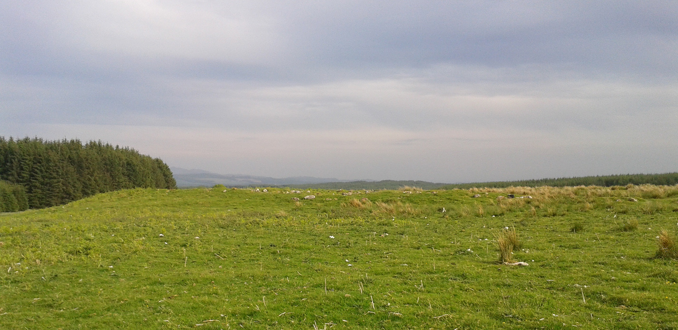
Take the B8033 north out of Dunblane and, immediately out the other side of Kinbuck, as you cross the river, take the first track on your left to Cromlix. Keep right along here to Cullings and beyond, till you reach the edge of the forestry plantation. Go left instead of going into the trees and, instead, follow the edge of the woodland for about 750 yards. You’ll see the land rise up on the other side of the stream and the huge length of stones thereby. That’s it!
Archaeology & History
Main axis of the cairn
Not included in any major archaeology tomes, this giant long prehistoric pile of rocks—probably constructed in neolithic times—sits along the edge of a natural ridge, out of sight of all but the lone wanderer and the birds. Aligned ESE to WNW, this huge monument measures more than 61 yards (56m) in length and is 12 yards across at its present widest section. Much of the tomb has been severely robbed for stone in making the local walling: two of which emerge out of the structure itself—one running directly downhill from its larger eastern edge, and a more extensive wide line of walling running west and northwest for quite some distance. This western section of walling has the hallmarks of being constructed as far back as the Iron Age, which may be when the initial destruction of the chambered cairn first started. But, until we get an excavation here, we won’t know for sure.
Portion of the central mass of stones
Western wall leads to the cairn
The next closest tomb of any great size is the Judge’s Cairn, 1½ miles (2.4km) to the southwest. Clusters of smaller single cairns exist about nearly a mile northwest, with prehistoric settlement traces accompanying them—but nothing seems in immediate attendance to this Cromlix giant.
Other sites, obviously, await discovery in this area. We know that a spring of water roughly 50 yards east of here was used by so-called ‘witches’ in earlier centuries, for both healing and sympathetic magick. Whether this tradition ever had any relationship with the cairn is difficult to say.
References:
Royal Commission Ancient & Historical Monuments of Scotland, Braes of Doune: An Archaeological Survey, Edinburgh 1994.
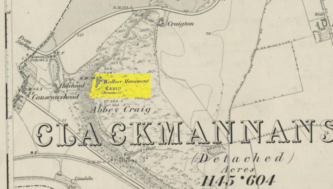
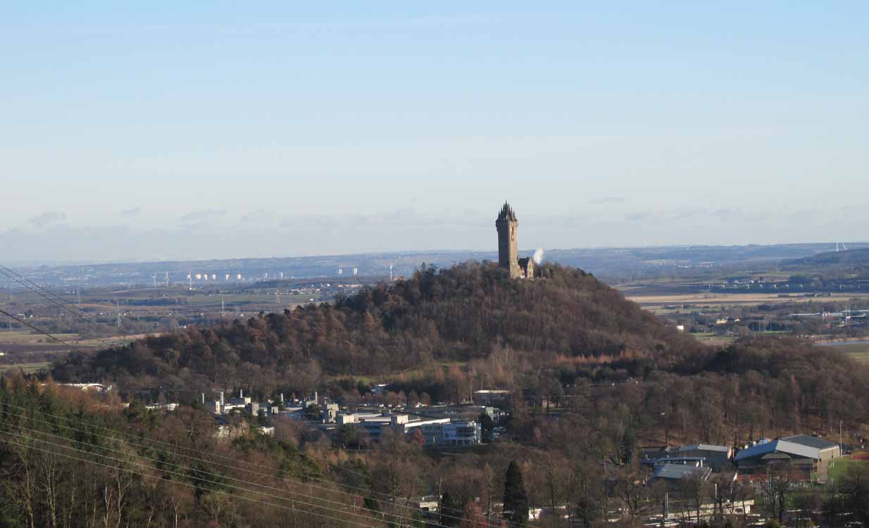
Most folk visiting here are coming from Stirling city. There are various buses to get here, which head out over Stirling Bridge along Causewayhead Road (the A9) for half-a-mile where, at the roundabout and the William Wallace pub, go straight across up the minor road, zigzagging back on itself, until you reach the signs for the Wallace Monument. Follow the well-defined footpath and, once on top of the hill, walk round the back of the mightily impressive tower.
Archaeology & History
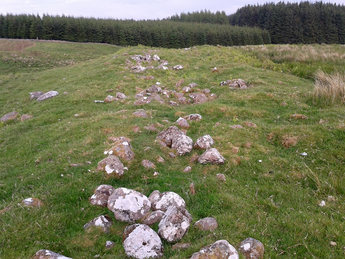
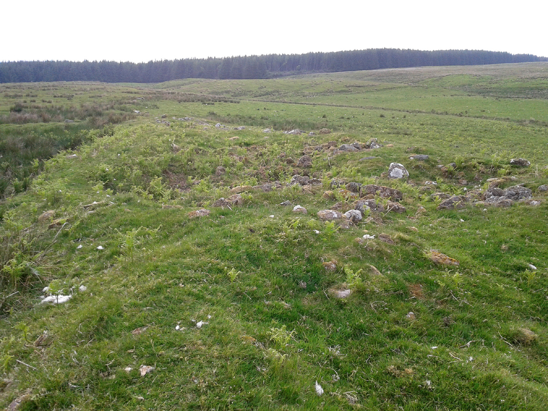
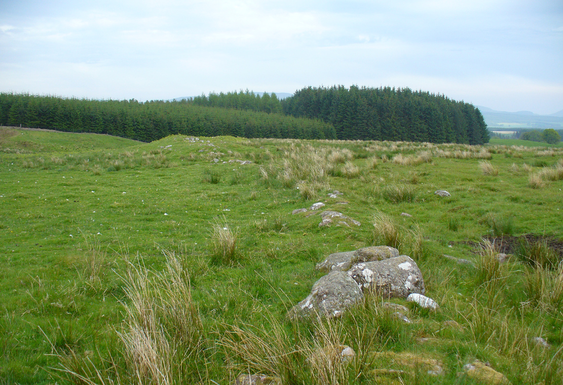
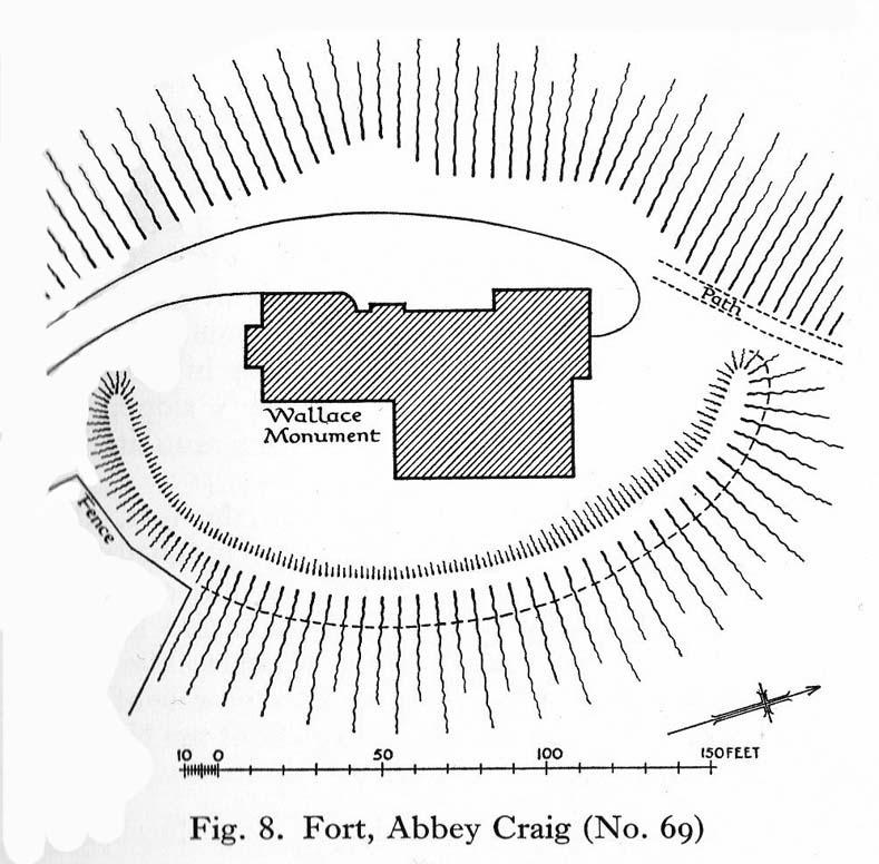
Located right where the impressive Wallace Monument proudly stands, this prehistoric precursor to Sir William Wallace’s memory was where Scotland’s legendary hero and his men cast a clear and easy view over Bannockburn, where the halfwit english came for a fight—and deservedly lost! The structures that used to be inside the now denuded hillfort would, no doubt, have been used by Wallace’s men; but much of those prehistoric remains have now been destroyed. The visible remains of the fort can be seen round the back of the Wallace Monument: elongated rises of overgrown walling that run almost all the way round, getting slightly higher as you approach the more northern edges, like a semi-circular enclosure.
Royal Commission planAbbey Craig – and the great Wallace Monument
The site was described very briefly in William Nimmo’s (1880) early survey of the area, where he told that in 1784, “eleven brazen spears were found on the Abbey Craig, by a Mr Harley”, which he thought came from the time when the earlier ‘castle’ stood here. He was probably right. Many years later, the prehistoric remains were included in the county survey of archaeological sites by the Royal Commission lads (1963), who told that, near the north end of the summit of Abbey Craig,
“there is a fort which has been damaged by the construction within it of the Wallace Monument. All that remains is a substantial turf-covered bank, cresentic on plan and 260ft in length, the ends of which lie close to the brink of the precipice that forms the west face of the hill. The bank stands to a maximum height of 5ft above the level of the interior and presumably represents a ruined timber-laced wall, since numerous pieces of vitrified stone have been found on the slopes immediately below it.
The entrance to the fort presumably lay between one end of the bank and the lip of the precipice, but both the areas concerned have been disturbed by the construction of the modern approaches. The interior of the fort measures about 175ft from north to south, by about 125ft transversely and the interior is featureless.”
The fort was probably built sometime in the early Iron Age; so the next time you visit this fine spot, check the remains out round the back of the tower—and remember that our ancestors were living up here 2500 years ago!
Feacham, Richard W., Guide to Prehistoric Scotland, Batsford: London 1977.
Hogg, A.H.A., British Hill-Forts: An Index, BAR: Oxford 1979.
Nimmo, William, The History of Stirlingshire – volume 1 (3rd edition), T.D. Morison: London 1880.
Royal Commission on the Ancient & Historical Monuments Scotland, Stirling – volume 1, HMSO: Edinburgh 1963.
Royal Commission on the Ancient & Historical Monuments of Scotland, Archaeological Sites and Monuments of Stirling District, Central Region, Society of Antiquaries of Scotland 1979.
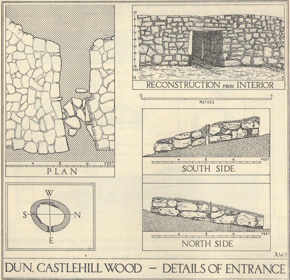
Take the Gateside Road from St Ninians or Polmaise Road out of Torbrex across the M9, heading out west onto the southern moors of Touch Hills, passing the Wallstale dun in the trees and then the Castlehill dun just off the road. Keep going uphill for just over half-a-mile, keeping your eyes peeled on the right for where the MOD lads play some of their war-games. Walk along the track here, following the line of the woods, until it gets to the spot where it doubles back on itself. Just here, about 30 yards in front of you, a rounded walled knoll gives the game away!
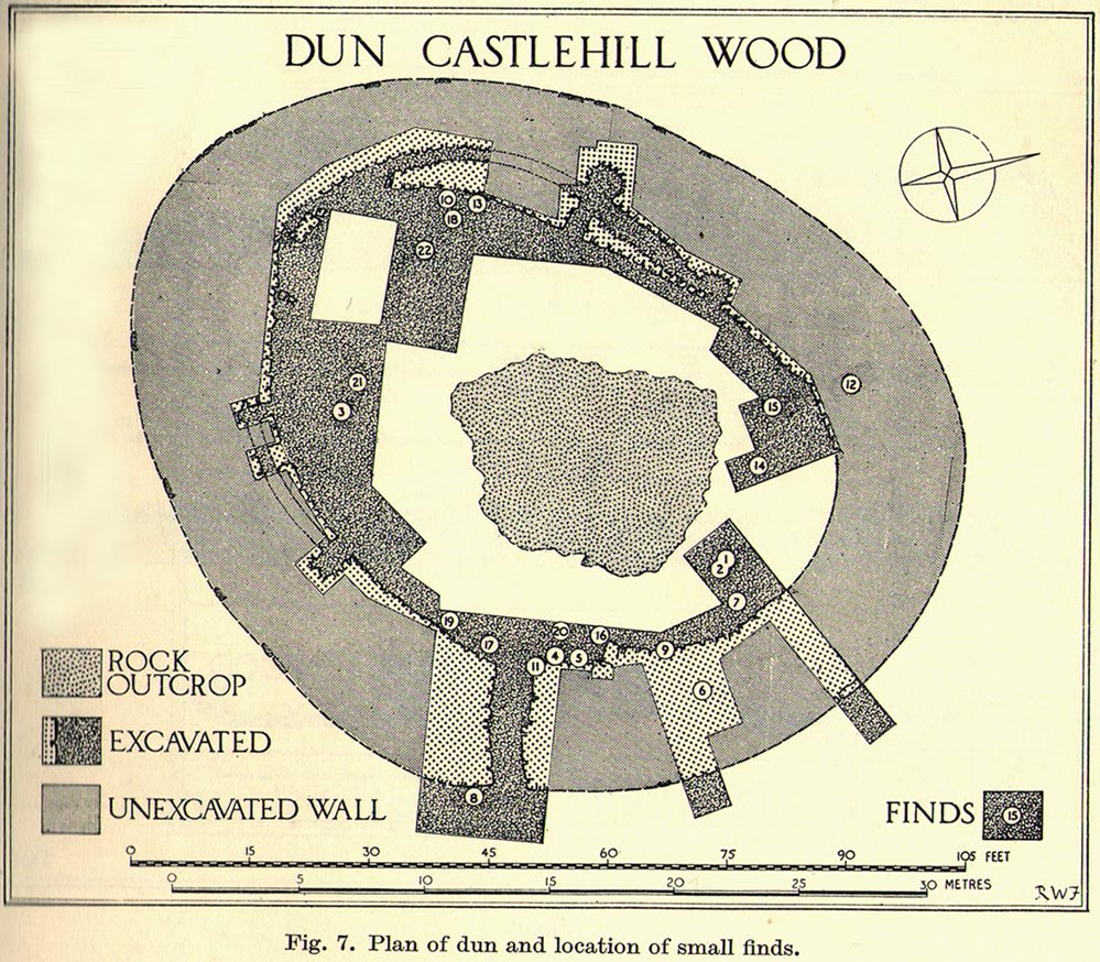
Archaeology & History
Artists impression of the reconstructed site (PSAS 1959)
An impressive-looking site, not too far off the moorland road, it is one of more than half a dozen hillforts and duns found to the west of Stirling, all of them relatively close to each other—showing that a lot of human activity was going on here in the Iron Age and, probably, much earlier. Looking like a cross between a broch and a traditional hillfort, the site is best visited in the Winter and Spring months before the bracken starts to encroach and cover it.
Officially rediscovered in 1952 and excavated three years later, it was thought to have been built in the 1st century AD and used for a few hundred years thereafter. As you walk up to the eastern edge of the monument, a large entrance, 4½ feet wide, allows you into the large open space within. From here, and walking around both the inner and outer walls, you get an idea of the huge amount of work it must have taken to build this structure. The walls alone which constitute the main of Castlewood Dun are, on average, 16 feet thick! The Royal Commission report for the area (summarizing the archaeological work of F.W. Feacham in the ’50s) gives the basic architectural features of the place:
“The dun is oval in plan…and measures 75ft from NE to SW, transversely within a drystone wall 16ft thick. The faces of the wall are composed of large, angular blocks, and the core of boulders, small rubble and earth. The entrance in the E arc, is provided with door-checks. Within these, the passage measures 4ft 6in in width, and outside them 3ft 9in. A few paving-stones were laid to level the rough rock surface of the passage-floor. Traces of what might have been the bottom step of a stair, rising up the inner face of the wall, were found at a point 8ft N of the entrance. The dun had no mural stair or galleries, but two sets of mural chambers were located, one in the W and the other in the S acr of the wall. The former consisted of an entrance-passage, 6ft in length, which varied in width from 2ft at the outer to 3ft at the inner end, where it opened into a circular chamber 4ft in diameter. From either side of the passage a narrow duct or flue, about 19ft in length and 1ft 6in in width, led off obliquely through the core of the wall to debouch into the interior of the dun. The construction in the S arc consisted of a similar passage, one flue and a smaller chamber. Ash and a clinker of very light weight were found in the form of deposits in both passages and all the flues. …The excavator suggested they might have been corn-drying installations.”
Groundplan of site (PSAS 1959)Entrance details (PSAS 1959)
Apart from a small piece of Roman glass, quern fragments, anvils stones and a pot lid, the excavators found very little inside the dun—not even any hearths. The walling on the southwest and western edges was built onto a small cliff, making access slightly difficult from that side.
From the site itself, views are excellent, particularly in an arc through the north, east and southeast, with the western skylines being only a short distance away. This enabled relatively easy tribal communication with people at the other brochs, duns and forts in the area, across an otherwise large but difficult landscape in prehistoric times. A few hundred yards to the northeast, on the other side of the recently planted tree-farm (forestry plantation), a large D-shaped structure—possibly Iron Age, possibly medieval— is accompanied by lines of ancient walling running down the slopes.
Holy Well (destroyed?): OS Grid Reference – NS 7787 9252?
Archaeology & History
A small but ancient chapel once existed in Cambusbarron, long ago, located about one hundred yards east of the Chapel or Christ’s Well. William Drysdale (1904) told that, apart from the Chapel Well and nearby St. Thomas’ Well, “several other wells in the locality were believed to possess healing virtues.” It was J.S. Fleming (1898) who said that, “attached to Cambusbarron Chapel two other holy but nameless wells are stated to have been in existence in 1866, on the brink of Glenmoray Burn, near the chapel itself.”
A writer for the Stirling Observer in 1871 told that one of these holy wells was in fact to “be seen near the brink of a little burn which trickles from the miniature glen of Glenmoray, visible on the hillside, just below the lowest reservoir” above Touch, more than a mile away (heading up towards St Corbet’s Well). The other was said to be near Johnnie’s Burn, a mile to the west. In Fleming’s (1898) opinion however, neither of these sites were feasible, as he walked all along the course of both burns and could find no other wells. Does anyone know any different?
References:
Drysdale, William, Auld Biggins of Stirling, Eneas Mackay: Stirling 1904.
Fleming, J.S., Old Nooks of Stirling, Delineated and Described, Munro & Jamieson: Stirling 1898.