When the Scottish Royal Commission lads came here in 1963, they reported seeing
“the remains of a short cist…set into the west side of a small turf-covered knoll some 18 metres north of the schoolhouse at Ardminish.”
It was first found during quarrying operations here, and was thankfully kept pretty well preserved, apart from the western slab, which was dislodged and fell to the foot of the knoll. The cist aligns roughly north-south (the airt, or cardinal virtue of ‘death’ is north) and measured about 3 feet long by 2 feet wide.
References:
Royal Commission on the Ancient & Historical Monuments, Scotland, Argyll: volume 1 – Kintyre, HMSO: Edinburgh 1971.
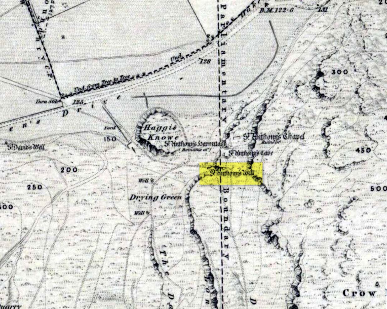
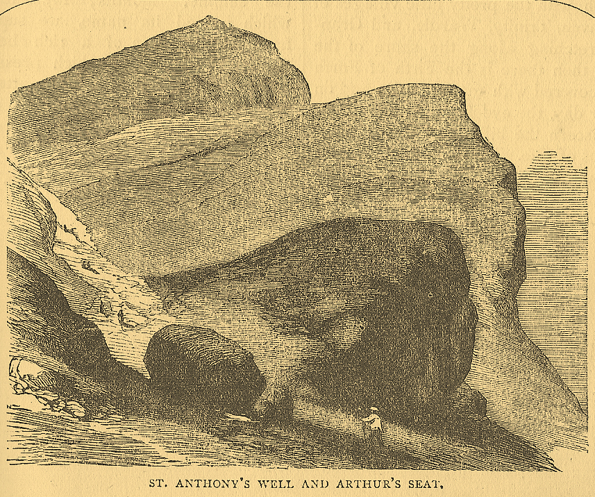
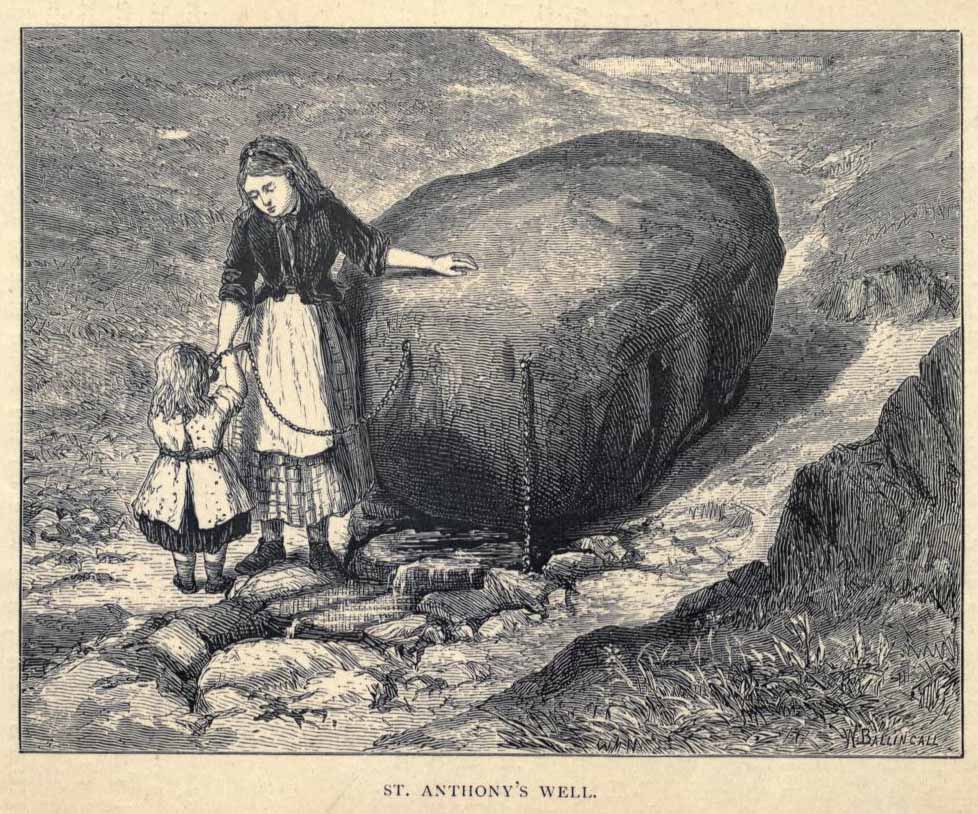
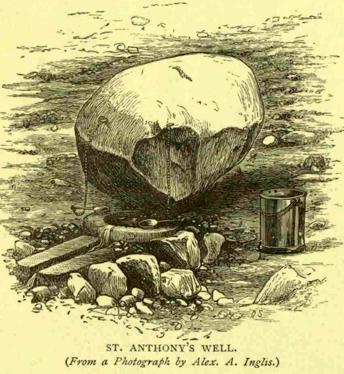
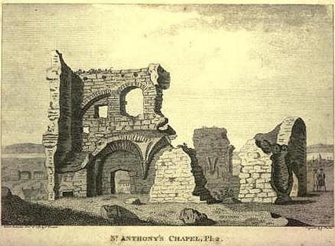
Not too difficult to find really. Get to the northern part of the road which encircles Arthur’s Seat and when you get to St. Margaret’s Loch (near St. Margaret’s Well), look up the slopes on your right where you see the remains of St. Anthony’s Chapel. You need to head up the footpath here until you reach a large-ish ovoid boulder, with a small circular trough into which the waters run (the drawing of the place here, with the rock in the lower-left, just in front of the fella walking towards it, is just right!). You’re here!
Archaeology & History
St Anthony’s Well, Arthurs Seat
Tradition tells that the remains of St. Anthony’s Chapel was built on the northern ridge by Arthur’s Seat, “mainly for guardianship of the holy well named after the saint” — which sounds rather like the christianization story of a heathen site. Francis Grose (1797) told that “this situation was undoubtedly chosen with an intention of attracting the notice of seamen coming up that Frith; who, in cases of danger, might be induced to make vows to its tutelar saint.” If this was the case, it sounds even more like a site that had prior heathen associations. Grose also told us that just a short distance from the chapel, were the remains of an old hermitage:
“It was partly of masonry worked upon the natural rock. At the east end there are still two niches remaining; in one of which formerly stood a skull, a book, an hour-glass, and a lamp, which, with a mat for a bed, made the general furniture of the hermitage.”
I like the sound of the place! Just up my street! Little other archaeological info has emerged from this tiny spot — but the healing waters of the well would obviously have been of importance to our indigenous inhabitants (anyone who wants to think otherwise is simply a bit dim!) as there is a wealth of archaeological sites and relics all round Arthur’s Seat.
Folklore
A number of writers have described this old well, which has sun-lore, healing properties, and Beltane rites surrounding its past. Local people of all social classes frequented this ancient spring, particularly on that most favoured of heathen days, Beltane. The site was of considerable mythic importance with a certain order about it. As Hone (1839) said:
“…the poorer classes in Edinburgh poured forth at daybreak from street and lane to assemble on Arthur’s Seat to see the sun rise on May-morning. Bagpipes and other musical intruments enlivened the scene, nor were refreshments forgotten. About six o’ clock a crowd of citizens of the wealthier class made their appearance, while the majority of the first-comers returned to the town. At nine o’ clock the hill was practically deserted.”
Another early account describing St. Anthony’s Well is from an article in the great PSAS journal of 1883. Here, J.R. Walker wrote:
St Anthonys Well
To an incident which showed that the faith and belief in the healing virtues of the wells is still strong, the writer was but a few months ago an eye-witness. While walking in the Queen’s Park about sunset, I casually passed St. Anthony’s Well, and had my attention attracted by the number of people about it, all simply quenching their thirst, some possibly with a dim idea that they would reap some benefit from the draught. Standing a little apart, however, and evidently patiently waiting a favourable moment to present itself for their purpose, was a group of four. Feeling somewhat curious as to their intention, I quietly kept myself in the back ground, and by and by was rewarded. The crowd departed, and the group came forward, consisting of two old women, a younger woman of about thirty, and a pale, sickly-looking girl — a child of three or four years old. Producing cups from their pockets, the old women dipped them in the pool, filled them, and drank the contents. A full cup was then presented to the younger woman, and another to the child. Then one of the old women produced a long linen bandage, dipped it in the water, wrung it, dipped it in again, and then wound it round the child’s head, covering the eyes, the youngest woman, evidently the mother of the child, carefully observing the operation, and weeping gently all the time. The other old woman not engaged in this work was carefully filling a clear flat glass bottle with the water, evidently for future use. Then, after the principal operators had looked at each other with an earnest and half solemn sort of look, the party wended its way carefully down the hill
Earlier still we find more lore of the place in Wilson’s Edinburgh [1848] where he told:
St Anthony’s Chapel 1785
“The ancient Hermitage and Chapel of St. Anthony, underneath the hangings of Arthur’s Seat, are velieved to have formed a dependency of the preceptory at Leith, and to have been placed there, to catch the seaman’s eyes as he entered the Firth, or departed on some long and perilous voyage; when his voews and offerings would be most freely made to the patron saint, and the hermit who ministered at his altar. No record, however, now remains to add to the tradition of its dedication to St. Anthony; but the silver stream, celebrated in the plaintive old song, ‘O waly, waly, up yon bank,’ still wells clearly forth at the foot of the rock, filling the little basin of St. Anthony’s Well, and rippling pleasantly through the long grass into the lower valley.”
Votive offerings made here eventually turned the waters into a simply wishing well for incomers, even in Victorian times (oh how the locals must have hated such trangression…). The great Scottish holy wells writer J.M. MacKinlay (1893) told in his day the tale of,
“a little girl from Aberdeenshire, when on a visit to Edinburgh, made trial of the sacred spring. She was cautioned not to tell anyone what her wish was, else the charm would have no effect. On her return home however, her eagerness to know whether the wish had…been fulfilled, quite overcame her ability to keep the secret. Her first words were, ‘Has the pony come?’ St. Anthony must have been in good humour with the child, for he provided the pony, thus evidently condoning the breach of silence in deference to her youth.”
In the middle of the 20th century, the great folklorist F.M. MacNeill (1959) wrote:
“Even in Edinburgh, little bands of the faithful may be seen making their way through the King’s Park to Arthur’s Seat, and, as in the eighteenth century:
On May-Day, in a fairy ring,
We’ve seen them round St. Anton’s spring,
Frae grass the caller dew-drops wring,
To weet their een,
And water clear as crystal spring,
To synd them clean.”
And when Ruth and Frank Morris (1982) got round to their excellent survey, they found that this old well was still being used “by youths and maidens, who come to wash their faces with the dew on May Day mornings, a wish at St. Anthony’s being a part of the ritual.” But this final remark may have the simple prosaic coincidence of them observing people like I, when younger, who frolicked with girlfriends around May morning, in the grasses near the old well — though at the time I knew nothing about the old sacred waters on the slopes just above us!
Standing Stone (destroyed): OS Grid Reference – NS 829 442
Archaeology & History
No longer here, but about 200 yards north of the old farmhouse of Blackhill (with its ancient tumulus still in attendance across the road) could once be seen a decent standing stone, “fully six feet high.” It seems that this was sadly uprooted sometime before 1954.
References:
Royal Commission on the Ancient & Historical Monuments of Scotland, Lanarkshire: An Inventory of the Prehistoric and Roman Monuments, HMSO: Edinburgh 1978.
Sadly gone, there have been several literary reports of this once fine megalithic ring. It was to be seen “on the right hand side of the main roadway from Edinburgh to Carlops, as it approaches the farm of Marchwell.” When the site was described by the Scottish Royal Commission in 1929, some of the stones were apparently still standing. They described it as occupying a site “at an elevation of between 800 and 900 feet above sea-level,” but told that the main reason for its destruction appeared “that it was broken up by the making of the highway, which cuts the knoll on its east side.” They continued:
“Two of the stones, showing a height of about 15 inches above ground, remain in their original positions, while five others lying in close proximity are probably units that have been moved. These five blocks, which are not earth-fast, are of similar character to the two remaining in situ, and all seven, judging from their basaltic character, appear to have been brought from a distance.”
A brief account of the circle in the 1845 New Statistical Account description of the Glencorse parish told that the site was 40 feet in diameter. In 1941, two fragments of a food vessel were found in close proximity to where the circle had been; and in a visit here in 1970 by members of Ordnance Survey, two possible monoliths were reported in the walling which they thought might have originally come from the stone circle. Unfortunately I’ve not been able to locate any early drawings or photos of the site – yet!
References:
Royal Commission on the Ancient & Historical Monuments & Constructions of Scotland, Midlothian and West Lothian, HMSO: Edinburgh 1929.
Pretty easy to get to. Go south through the village for a half-mile until you reach the hall by the fire station, sat back on the left-hadn side of the road a few hundred yards past Loch a’ Mhuillinn. Stop here and walk up the slope behind the hall for a hundred yards or so. Walk about!
Archaeology & History
The OS-coordinate here is a loose one. It centres on the notable hillock of Torr Mor, around which are a number of hut circles (at NG 7097 4293; NG 7139 4303; NG 7087 4309; NG 7088 4310 and NG 7090 4320) which are each in a relatively good condition and are thought to date from at least the Iron Age. When I visited them, the bracken had encroached on all but one of them (the last in the list above), which was about 30 feet across.
North of here are several curious-looking heaps of stones which need closer examination when the vegetation has died away. At first glance they would seem to be cairns, i.e. tombs. No such prehistoric graveyard has been found anywhere on the peninsula as yet – but considering the existence of the settlements in the area at Sand, you’d think there’d be one somewhere!
The Cambridge biologist J. Havelock Fidler described finding three standing stones in the gorgeous little remote hamlet of Toscaig in his book Ley Lines (1983), which neither the Applecross Local History Society, myself, nor anyone else has been able to locate (the OS grid reference cited above is simply an approximation of their locality). In an updated version of his work, Mr Fidler seems to indicate they can be found a short distance south-east of the village, at the end of an alignment which is supposed to start at Fearnmore (NG 724 605), at the northern edge of the peninsula. If they exist, could anyone perhaps enlighten us as to their whereabouts…?
References:
Fidler, J. Havelock, Ley Lines – Their Nature and Property, Aquarian: Wellingborough 1983.
Marked on the earliest 6-inch Ordnance Survey map of this area (1875), this 4ft tall standing stone (now gone) once stood on the east bank of the River Euchar. The prehistoric cairn 400 yards to the west on the other side of the river would seem to have had some relationship with the stone, as they aligned to the equinoxes.
References:
Royal Commission on the Ancient & Historical Monuments of Scotland, Argyll – volume 2: Lorn, HMSO: Edinburgh 1974.
The old Scottish folklorist, A.A. MacGregor, described this legendary rock, “by the Bridge of Luib, on the River Don,” in his classic Peat Fire Flame. (1937) One of the numerous ‘holed stones,’ it was one of countless rocks in our isles imbued with animistic spirit essence, akin to similar rocks found in all of the other cultures in the world. MacGregor told how,
“It happened that a man summoned to the death-bed of a relative came to this crossing-place just after torrential floods had carried away the bridge. When he was on the point of abandoning all hope of reaching the opposite bank, a tall man appeared from nowhere and volunteered to carry him across. The distracted homecomer accepted the assistance proffered. But, when he and his carrier reached mid-river, the latter reverted to the form of the river kelpie and endeavoured to drag him down to the river’s bed. The victim managed to escape. As he scrambled to the bank, the infuriated kelpie hurled after him the huge boulder that to this day goes by the name of the Kelpie’s Stane.”
But the stone was also known to possess healing and magickal properties, as evidenced from MacPherson’s (1929) chronicle, which told:
“Somewhere near Dinnet was the Kelpie Stone. Childless women passed through its 18 inch (46cm) hole to concieve. A noble lady performed the task to no avail; only when she repeated it in the same direction as the river flow did the charm work.”
Close by are several other intriguing place-names which may at some time have had some archaeo-mythic relevance to this legendary rock. On the hill above is the old Carn Lian; the water course nearby is the Allt na Ciste; but most intriguingly we find the Bog of the Old Woman, or the Moine Cailleach a half-mile to the east.
References:
MacGregor, Alisdair Alpin, The Peat-Fire Flame, Ettrick Press: Edinburgh 1937.
McPherson, Joseph M., Primitive Beliefs in the North-East of Scotland, Longmans, Green & Co: London 1929.
Cup-and-Ring Stone: OS Grid Reference – NT 499 403
Archaeology & History
The Scottish Royal Commission reported how,
“in 1936 a cup-marked boulder measuring 3ft 10in in length, 3ft 8in width and 1ft 8in in thickness, was found in a cultivated field half a mile southeast of Hawksnest and 75 yards north of the road from Hawksnest to Ladhopemoor.”
The carved stone had been scarred a little by the plough, but had “23 shallow cup-marks on its upper surface varying from 1in to 1.75in diameter.” This carving is curiously omitted from Ronald Morris’ Prehistoric Rock Art of Southern Scotland (1981), so perhaps the carving has been lost. Does anyone know owt more about it?
References:
Royal Commission on the Ancient & Historical Monuments of Scotland, Roxburghshire – volume 2, HMSO: Edinburgh 1956.
Stone Circle (destroyed): OS Grid Reference – NJ 2691 5985
Also Known as:
Haerstanes
Harestones
Archaeology & History
Haer Stanes on the 1871 map
This site had already passed into memory when the Ordnance Survey lads visited the area in 1870, but at least they included it on their early survey. Fred Coles (1906) described this site in his essay on the megaliths of Banffshire, where once could be found perhaps five stone circles close to each other – but all are now gone! Bloody disgraceful really. When Coles explored here, although the site was still shown on maps, little could be seen of the place.
“On the farm,” he wrote, “we heard long-handed-down tradition of the Circle, and the site was, rather vaguely, pointed out.” But there was nothing there. He described one reference to the place written by a Mr James Morrison, who said, “We have remains of two so-called Druid Circles, and during the last half-century three others have been swept away. One of these was in horse-shoe form and was called the Haer Stanes.” The same writer later says, “These stones were unfortunately found to lie in the line of a road then formed (1830) and were ignominiously tumbled down the slope on which for ages they had rested, and buried in a gravel pit by the side of the road.”
References:
Cole, Fred, ‘Report on Stone Circles Surveyed in the North-East of Scotland…’, in Proceedings of the Society of Antiquaries, Scotland, volume 40, Edinburgh 1906.