A beautiful place found along the roadside towards Seil Island, on the B844 a few miles south of Oban. When you get near the south end of the loch right by the road, have a gander! If the waters are low you can sometimes see the ghostly island appear above the waves…
Archaeology & History
You’re lucky to see anything here – as the crannog has all but submerged. This old artificial island could once be clearly seen less than 400 yards south of Duachy farmhouse, near the southwestern edge of the loch. It measured roughly 10 yards by 8 yards, was built of stones, seemingly “with a boat-slip on the west side and a ‘square place’ on the east as if for a landing stage.” All trace of the causeway linking it to the shore has apparently vanished. But if you do stop here, check out the Duachy Standing Stones on the hillside behind you!
References:
Royal Commission on the Ancient & Historical Monuments of Scotland, Argyll – volume 2: Lorn, HMSO: Edinburgh 1974.#
This is another standing stone whose days are seemingly long gone. It was last recorded in 1878 as being about 300 yards northwest of the old farmhouse at Neriby. The old stone stood more than six-feet tall, but appears to have gone. Anyone journeying this way might wanna scour the ground to see if the fella’s remains can be seen lying around anywhere – though the fact that an old quarry was dug hereabouts doesn’t bode well for a successful hunt. If we’re lucky, the stone may have been buried or laid into nearby walling. There is, however, remains of an old tumulus a bit further up the way…
References:
Royal Commission on the Ancient & Historical Monuments of Scotland, Argyll – volume 5: Islay, Jura, Colonsay and Oronsay, HMSO: Edinburgh 1984.
Somewhat out of the way with seemingly nothing left of the site, from Clachan Strachur, take the A886 road southwest along Loch Fyne for a few miles until you turn right (make sure you don’t drive past it!) towards Garbhallt. Go through here and on for another mile until you see a rounded knoll in the forest to your left (if you hit Barnacarry house, you’ve gone too far). Tis upon this hill where our old stone once stood.
Archaeology & History
Nowt much to write really. A description many moons back told there was an old stone standing ‘pon this hill. It was only a small creature compared to many of Argyll’s monoliths, only three-and-half feet tall, all alone, looking across the loch and speaking with the hills a gentle voice. I found it a little odd (though aint been here for many years) and seemed to tell that a tomb was in attendance, but this too seemed long gone. The Royal Commission chaps thought that some of the other slabs of stone lying about here may have been relevant, but we may never know. I reckon a few good days ambling hereabouts would produce some new finds. And the fact that only a half-mile away we find an old cross and holy well seems to indicate a christian rendering of something heathen close by…..
References:
Royal Commission on the Ancient & Historical Monuments of Scotland, Argyll – volume 6: Mid-Argyll and Cowal, HMSO: Edinburgh 1988.
Standing Stone (destroyed): OS Grid Reference – NT 038 456
Archaeology & History
This standing stone used to be positioned on the old boundary line between the Carnwatch and Dunsyre parishes. It might be a good idea to check out the perambulation records to see if owt went off here, before its destruction. About five-feet tall, it was positioned on a small rise in the ground, 500 yards south of Todholes.
References:
Royal Commission on the Ancient & Historical Monuments of Scotland, Lanarkshire: Prehistoric and Roman Monuments, HMSO: Edinburgh 1978.
Standing Stone (destroyed): OS Grid Reference – NS 759 351
Archaeology & History
The name of the place sort of gives the game away, but sadly we’ve got nowt to see anymore as the forest has covered it. The Royal Commission lads came here in 1971 and couldn’t find it, but later told that it “formerly stood on the summit” of the said hill. An important geomantic spot without any shadow of a doubt, probably having some relationship with an old tomb, either here or around the tree-covered summit of Tod Law, due east of here.
There’s a great deal more that’s been forgotten about up and about this region which will come to light as visits unfold.
References:
Royal Commission on the Ancient & Historical Monuments of Scotland, Lanarkshire, HMSO: Edinburgh 1978.
Standing Stone (destroyed): OS Grid Reference – NS 681 490
Archaeology & History
This is another Lanarkshire monolith that’s gone, but which was described first of all in the 19th century in the Ordnance Survey place-name book for the county. The Scottish Royal Commission (1978) lads—who tried locating the site in September, 1973—told that,
“no trace now survives of the stone, 1.4m in height (i.e., about four-and-half feet tall – Ed.), that once stood in a field beside the public road about 120m northeast of Shawton Farmhouse.”
References:
Royal Commission on the Ancient & Historical Monuments, Scotland, Lanarkshire: Prehistoric and Roman Monuments, HMSO: Edinburgh 1978.
Standing Stone (destroyed): OS Grid Reference – NS 832 426
Archaeology & History
The first reference I found of this once-proud standing stone was in the early pages of the Glasgow Archaeological Society’s Transactions, from 1897; but when the Royal Commission lads came to look for the site in 1971, it had long-since been destroyed. Thankfully we have various folklore relics to tell us more!
Folklore
In Robert Chambers’ Popular Rhymes (1826), he told us several intriguing pieces of folklore about this once great monolith, writing:
“On the farm of Clerkston, in the parish of Lesmahagow, there had existed since creation an immense stone, or saxum, which, being deeply bedded in the middle of a good field, at a great distance from any other rocks, was productive of infinite inconvenience to the husbandman, and defrauded the proprietor of a considerable portion of territory.
“Beneath this stone, it was believed by the country people of the last generation, that there was secreted a vast treasure, in the shape of “a kettle-full, a boot-full, and a bull-hide-full,” of gold; all which got the ordinary name, reason unknown, of “katie Neevie’s hoord.” The credibility of this popular tradition was attested by a rhyme to the following effect:
Between Dillerhill and Crossfoord,
Here Lies Katie Neevie’s Hoord.
“Many efforts had been made, according to the gossips, to remove the stone, and get at the treasure; but all were baffled by the bodily appearance of the enemy of mankind, who, by breathing intolerable flame in the faces of those making the attempt, obliged them to desisted. Thus well guarded, the legacy of Mrs. Katherine Niven lay for centuries as snug as if it had been deposited in Chancery; and it was not till at least an hundred years after the last despairing effort had been made that the charm was at length broke.
“Mr James Prentice, the present farmer of Clerkston, had the address to convince several Irishmen, who had served him during the harvest, of the truth of the said rhyme; and, by expatiating upon the supposed immensity of the treasure, wrought up their curiosity and their cupidity to such a pitch, that they resolved, with his permission, to break the stone in pieces, and make themselves master of whatever might be found below. On the day after the kirn, therefore, the poor fellows provided themselves with a well-loaded gun, for the protection of their persons from the Devil, and fell to work, with punches and mallets, to blow up and utterly destroy the huge stone which alone intervened between them and everlasting affluence.
“They laboured the whole day, without provoking any visit from Satan, and at last succeeded in fairly eradicating the stone from the field which it had so long encumbered; when they became at once convinced of the fallacy of the rhyme, of the craft of Mr. Prentice, and of their own deluded credulity.”
References:
Chambers, Robert, The Popular Rhymes of Scotland, William Hunter: Edinburgh 1826.
Royal Commission for the Ancient & Historical Monuments of Scotland, Lanarkshire: Prehistoric and Roman Monuments, HMSO: Edinburgh 1978.
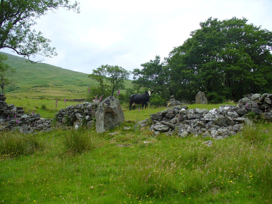
From Killin, travel down Glen Lochay, past Stag Cottage or Duncroisk and over the shallow river of Allt Dhun Croisg. If you’re in a car you can park up a 100 yards past the river bridge and walk up the track from here. After a 10 minute walk, above the trees you come to the derelict village of Tirai* where, until recently, you were greeted by a tall totem-pole of a gnarled tree (it was superb!) which is now Earth-lain, and a fine view of the evolving hills. Here amidst the ruins we also find a standing stone or two.
Archaeology & History
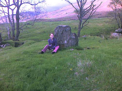
The village of Tirai was deserted sometime in the 19th century (due to the disgusting clearances of the English), but at least two standing stones still live amidst its ruins. The tallest is nearly four-feet tall in the middle of the grassy patch and is much used by grateful cattle to rub themselves against when midges and horseflies drive them mad! The Scottish Royal Commission lads reckon the megaliths here are,
“possibly a survivor of a stone circle as a similar stone is used nearby as a gate-post to an enclosure and several other large stones have been incorporated in the walls of the surrounding buildings.”
This may well be so – but it is equally possible that these are merely the remains of standing stones which once stood along this ridge and which were taken for use in the village.
One of the Tirai standing stones
Of the remaining standing stones in this idyllic setting – the Royal Commission fellas counted possibly four of ’em – all are roughly the same size, between 3 and 4 feet high. Johnstone & Wood (1996) also think the stones here may once have related to a prehistoric cairn in the village.
This is an utterly beautiful arena, even in the heights of winter. The village sits on the rear slopes behind the old cailleach, and there are plenty of cup-and-ring carvings, both known and unknown scattering the rocks and nearby hills. The curious Duncroisk Crosses carving is just visible from here, on the other side of the rocky gorge. Lost tales and lost sites abound here also. I did sit and wonder though… Considering that the villagers here left the old standing stones in place until very recent centuries at the heart of their hamlet, what uses did they make of it, or what tales did it speak? Or had the purge of the Church already taken its toll…?
References:
Gillies, William A., In Famed Breadalbane, Munro Press: Perth 1938.
Johnstone, A.S.K. & Wood, J.S., ‘An Archaeological Field Survey of Deserted Townships at Tirai, Glen Lochay, Killin,’ Association of Certificated Field Archaeologists (Glasgow University) Occasional Paper no 9 (1996).
* The place-name Tirai means ‘land of good luck or joy,’ which truly speaks well of its spirit and setting to me.
Another silly-sounding directional pointer! Get to the now tourist-infested town of Killin (best in Winter, when the town is quiet and you get to know the locals a lot better) and travel through it as if you’re going to follow Loch Tay up its western side. As you’re going out of the village towards the Bridge of Lochay Hotel (an excellent place), you’ll see an amphitheatre of mountains in the background. The tallest of the hills on the left is where you’re heading. Go straight up the hillside and follow your nose!
Creag na Cailleach, Killin
The hill guards the entrance to the legendary Glen Lochay (Valley of the Black Goddess). There are many ways to climb her, but my first venture here took me up the waterfalls and steepish burn of Allt na Ceardaich. Once on the level, I found myself surrounded by that amphitheatre I mentioned, from where – on my first visit – I took up the sheer face of this great mountain. (to be honest it’s nowt special if you’re into mountaineering) From the tops you’ve got a damn good view all round. But respect this old hill, as danger awakens to idiots who would think themselves champions.
Folklore
Here, where axes were quarried by ancient man from beneath Her rocky slopes, this ‘Hill of the Old Woman’, or ‘Hag’, was one of the abodes of the primal Mother Goddess in olden times, so says her name. Her ‘dark’ aspect seemed manifest one time when I climbed her with a rather stupid man in tow. Following one of the streams back into the valley below, he thought it wise to copy my gazelle-nature as I sprang without thought, quickly, from rock to rock, bouncing at speed down the fast-flowing stream (which takes a lotta weird practice and very strong ankles!), in spite of the advice to do otherwise – and in doing so he broke his leg in three places and, to make it worse, had to spend the night there in complete agony!
Don’t tell me there’s no ‘dark’ goddess to some of these great places!
Axe production has been found to have occurred as early as 2500 BC. There have been numerous flint finds hereabouts aswell – but considering this is a mountain, you’d expect to find something on or about Her slopes!
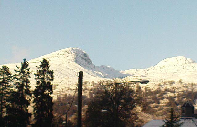
I’ve just been back up here as the first good snow fell upon the hills and the white cover brought the elements out of her form in a way I’d not seen before. Tis a wonderful place the Creag na Cailleach; and, it seems, a site that played a now forgotten part in the ancient name of the glen, Lochay, which was the living abode of the Black Goddess in more archaic days. Twouldst be good to hear some of the authentic old stories from old locals that were once known of this ancient deity in the glens. If anyone knows of such tales, let us know before they are lost forever…
References:
Ritchie, P.R., ‘The Stone Implement Trade in Third Millenium Scotland,’ in Coles & Simpson’s, Studies in Ancient Europe, Leicester University Press 1968.
Acknowledgements: Huge thanks to Lindsay Campbell for her hospitality, food and roof hereby.
Not too hard to find really. On the far western edge of the King’s Park golf course, head for the highest point where the small cliffs drop down. From here, walk down the footpath on the slight slope south, just below where the small copse of trees are, and you’ll see the singular small flat stone in the grasses near the footpath you’re walking along. If you can’t find it – look around!
Archaeology & History
A little-known but fascinating isolated carving, first described by David Morris at the sixth meeting of the Stirling Natural History and Archaeological Society in 1901. It is found on the western edge of the town, above the rocky edges not far from the pond of St. Thomas’ Well on the far edge of the golf course. Morris’ finding was written up in their fine journal, where he wrote:
“In the King’s Park, about 50 yards east of the cliff where a seat overlooks the Douglas Terrace sand quarry, there is a smooth surface of rock showing through the turf, measuring two-and-half feet by one-and-half feet… On it is a cup-shaped hollow, outside the rim of which is a well-marked hollowed ring, beyond which is another faintly marked, concentric circular groove. The cup-mark measures one-and-a-half inches across; the inner rim of the first circle is 4 inches, and the outer rim is 6 inches in diameter. The outer circle, if complete, would be 9 inches in diameter. The depth of the central hollow is half-an-inch, and of the inner groove fully one-quarter of an inch. The markings are plainly artificial…”
King’s Park CR – central design, pointing to northernmost cup
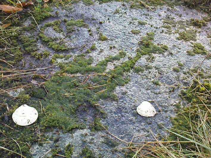
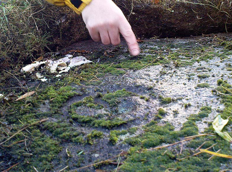
In good sunlight, it is obvious that the carving is a fine example of a double-ringed cup-and-ring carving – though the outer ring may not be complete. The Scottish Royal Commission lads told that “this rock outcrop bears three cup marks” – one of which has the rings surrounding it. In the first photo here, the southernmost cup-marking is highlighted in the centre of the two shells which were on the rock when we arrived.
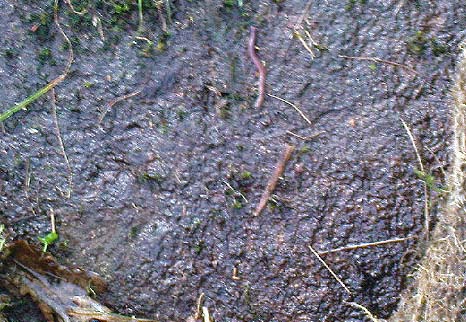
However, there’s definitely more to this carving than previous investigations have outlined. It seems that the northernmost cup-mark has a ring and a possible outer-ring. There is also a distinctive linear carving, which at first seems like a primitive triangle, just below the southernmost cup – as we’ve tried illustrating here in the photo which Mikki Potts took. It’s faint, but once you see it, it’s obvious that it’s there. Other faint lines of similar nature also seem apparent near the northernmost cup-marking, but we will have to wait for rubbings and further visits in better light to ascertain the full image on this rock. Well worth checking out if you like your rock art! (can any of you Scottish rock-art fanatics have a closer look at this? – take a rubbing of it and see what other aspects are on this design)
Faint linear carvings on southern end of the rock
One other thing which seemed apparent when we were here: this site has all the geomantic hallmarks of accompanying a burial at some time in the ancient past. Its isolation here is unusual and the carving is only 50 yards from the highest point hereabouts, where you have 360-degree views all round, typifying the position of many prehistoric tombs.* Does anyone know about such features, or have records of any field-name surveys taken, which might confirm or deny this thought? Twouldst be good to know!
References:
Feachem, Richard, Prehistoric Scotland, Batsford: London 1963.
Morris, David B., “Cup and Ring Marked Rock Surface in King’s Park,” in Stirling Natural History & Archaeology Society Transactions, 1900-1901.
Morris, Ronald W.B., The Prehistoric Rock Art of Southern Scotland, BAR 86, Oxford 1981.
Royal Commission on the Ancient and Historical Monuments of Scotland, Stirlingshire – 2 volumes, HMSO: Edinburgh 1963.
Royal Commission on the Ancient & Historical Monuments of Scotland, Archaeological Sites and Monuments of Stirling District, Central Region, Society of Antiquaries of Scotland 1979.
* Since writing the above, thanks the correspondence of Paddybhoy, we’ve learned that there definitely were prehistoric tombs close by; one being just at the bottom of the ridge below the carving, on Douglas Terrace. Records describe several other prehistoric tombs nearby at Birkhill House, the Birkhill Sandpit and Coneypark Nursery. However, I still think it most probable that there were other tombs and more rock art, probably along the edges of King Park, aswell as the Cambusbarron plain. These need locating.