Healing Well (covered): OS Grid-Reference – NT 23894 63346
Archaeology & History
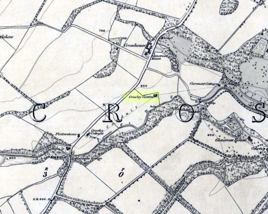
Site of Crawley Spring on the 1854 map
Once found flowing freely beneath the shadow of the prehistoric hillfort of Castlelaw, this all-but-forgotten site was thankfully recorded in Hope & Telford’s (1813) survey of Edinburgh’s natural water supply. Mr Telford said how “This noble spring rises from the bottom of a bank, at the foot of the Castlelaw Hill, at the edge of a small, low, almost marshy meadow close by the Glencorse Burn, a little way below the bridge.” Twelve years after writing this, the well had been blocked and a cistern built over it.
It was proclaimed by local people to be medicinal (though to what ailments, I cannot find), but there was an effective confirmation of some medicinal qualities in the waters following an analysis in 1810 when very tiny mineral elements were found. Mr Telford (1813) explained:
“The water is perfectly transparent and colourless, free from every smell and taste and is of excellent quality. It has, as is the case with almost all spring water, some matters dissolved in it, though in smaller quantities than common… This foreign matter consist of carbonate of lime, muriate of soda, and sulphate of lime, with an excessively minute portion of magnesium salt. The proportions of these ingredients, in each pound, are nearly:
Carbonate of Lime – 0.43 of a grain
Muriate of Soda – 0.10 of a grain
Sulphate of Lime – 0.90 of a grain
Sulphate of Magnesia – 0.05 of a grainThe carbonate of lime is dissolved by means of carbonic acid, which is not in greater quantity than is barely sufficient for the purpose. All of these ingredients are in themselves innocent to the human body; and in the quantity in which they are present in the water, do not affect its goodness. The water is perfectly soft and fit for washing, infusing tea and other domestic purposes. The water, therefore, is exceptional in every respect.”
When it came to the Crawley Spring waters being used to feed the habits of Edinburgh city, there was considerable opposition by the land-owner and local people who were, correctly, concerned that that ecosystem here would be adversely affected if the waters were to disappear. And so it was that Earth’s blood was taken from the land and the people and the animals, to benefit and feed the religion of Industrialism and ‘progress’ once more…
References:
- Bennett, Paul, Ancient and Holy Wells of Edinburgh, TNA: Alva 2017.
- Hope, Thomas C. & Telford, Thomas, Reports on the Means of Improving the Supply of Water for the City of Edinburgh, A. Constable: Edinburgh
© Paul Bennett, The Northern Antiquarian
