Cup-and-Ring Stone (lost): OS Grid Reference – SE 0828 4507
Also Known as:
Carving no.84 (Boughey & Vickerman)
Archaeology & History
Described by Boughey & Vickerman (2003) as being located somewhere “below Dirk Hill Sike” in the Rivock woods plantation, this is (or was) a “medium, upstanding rock lying NW-SE (with) one possible heavily weathered large cup-and-ring: cup 75mm diam. and ring 200mm diam.” However, the authors give no references to this site, nor images, or notes as to who rediscovered this stone. In their survey they also included one of the Bucking Hill carvings twice, giving the impression that there was more here than had previously been reported. These errors have subsequently been repeated elsewhere on-line. In saying this, there are a number of rocks scattered in this area which may have had carvings on them, but it’s been heavily forested and, recently, the trees have been felled and so many of them will have been damaged, turned over, or simply destroyed as a result of the forestry shennanigans.
References:
Boughey, Keith & Vickerman, E.A., Prehistoric Rock Art of the West Riding, WYAS 2003.
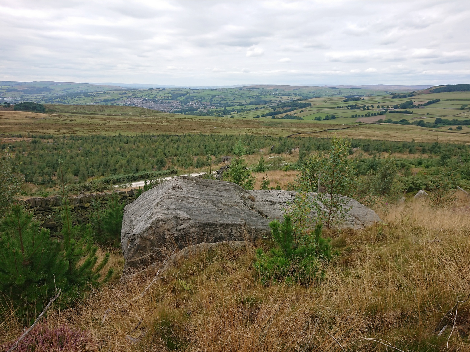
Coming via the Keighley-Bingley (Airedale) B6265 road, go up to Riddlesden and then up the winding Banks Lane until you reach the T-junction. Turn left here and about 330 yards along, on the right-side of the road is a dirt-track. Walk up here, sticking to the track (not the footpath) towards the cliffs of Rivock ahead of you, going through the gate and into the Rivock woods area. 450 yards on from the gate, on your right you’ll pass the long straight line of walling running uphill and literally 275 yards further along the track from here, walk straight up into the trees for 20 yards where, just before the slope begins to truly veer into an “uphill” state, you’ll see the stone in question!
Archaeology & History
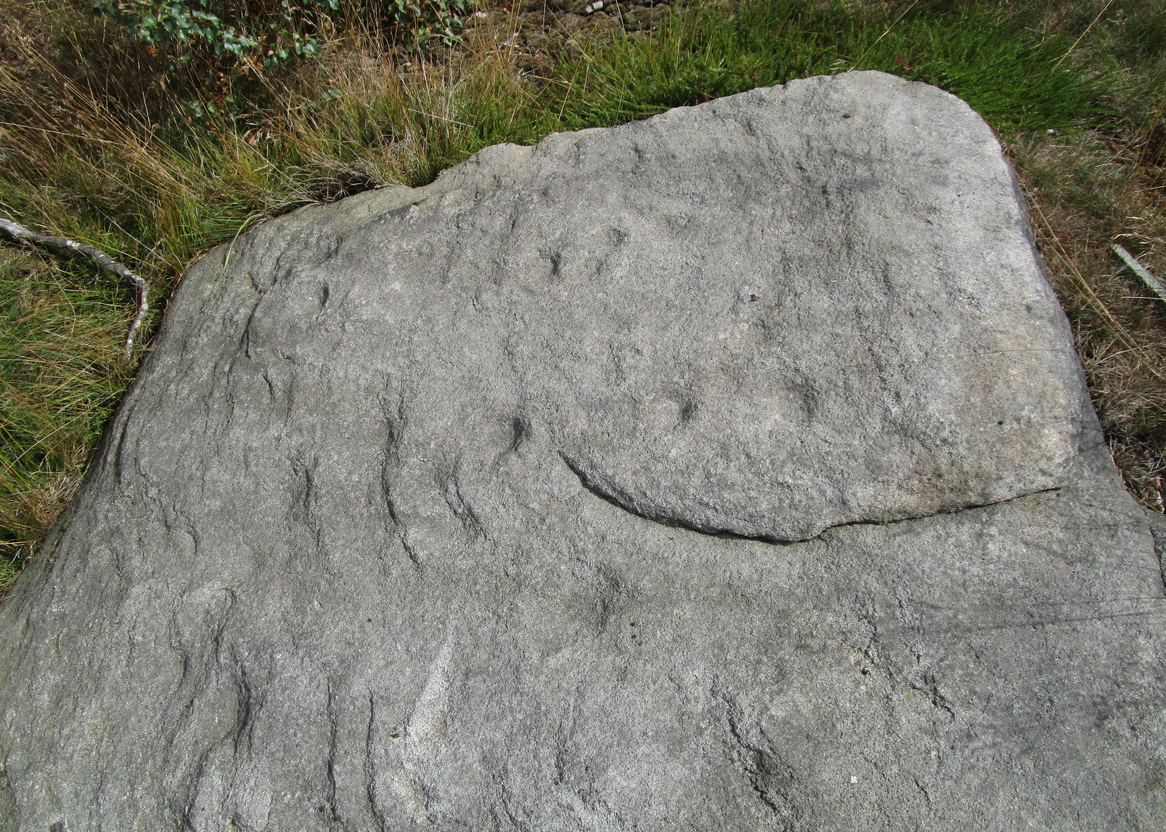
Cups on east-side of stone
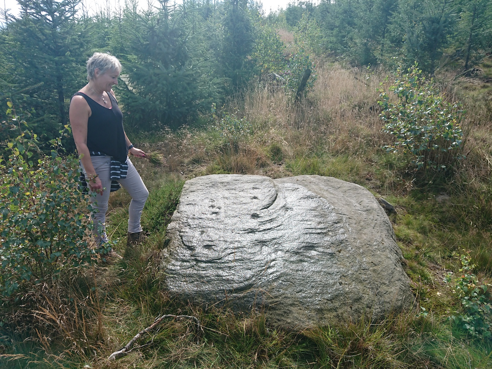
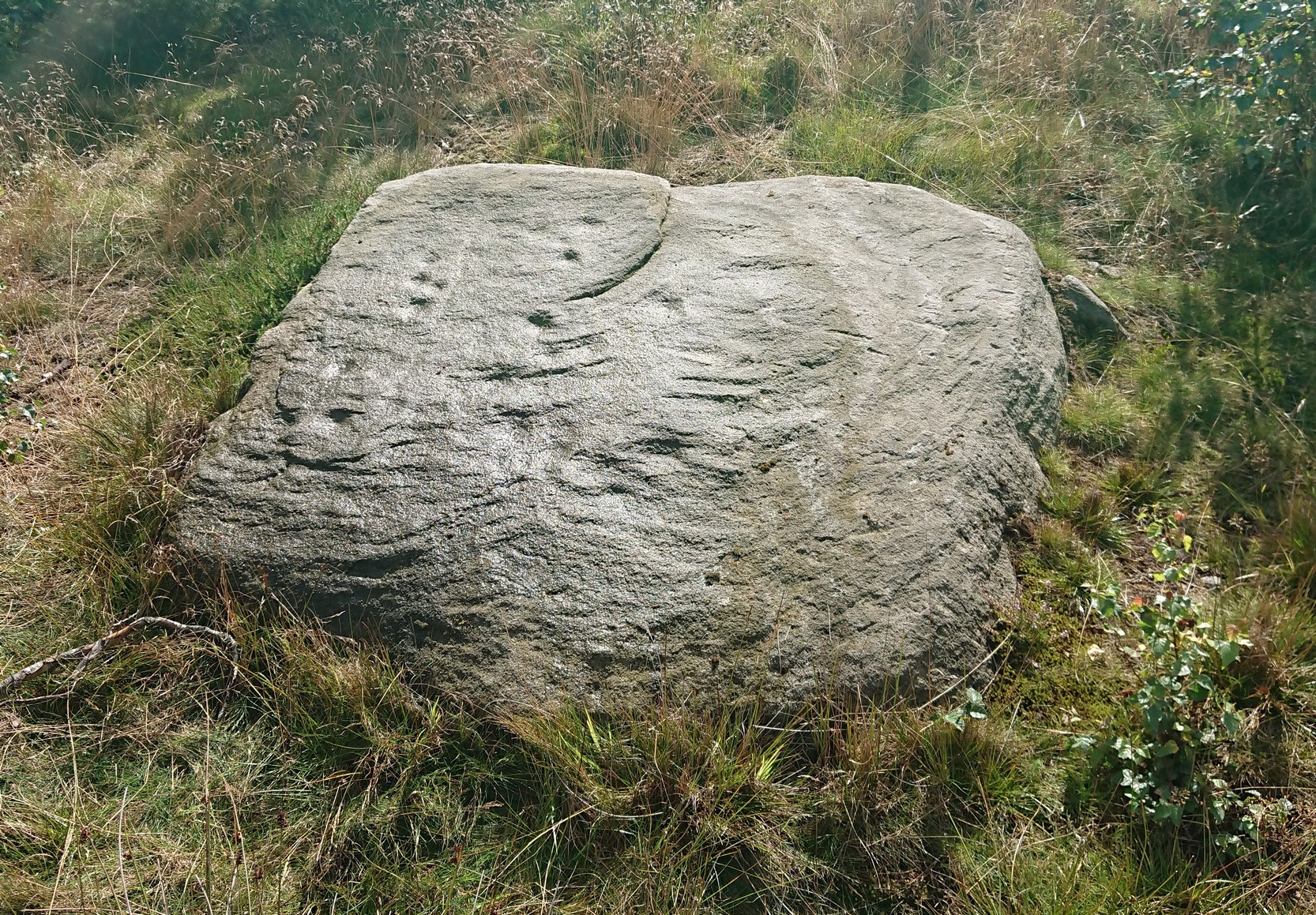
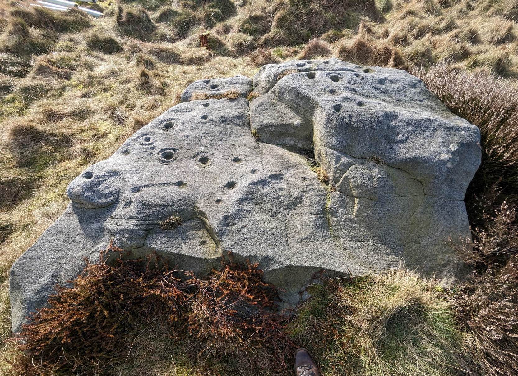
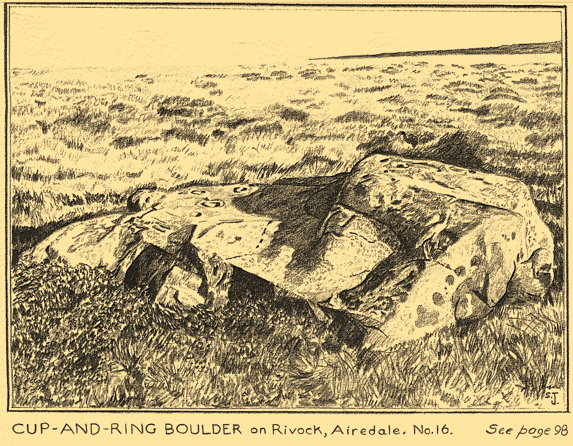
In 1961 when Stuart Feather rediscovered this carving, the “rock was almost completely covered by a six-inch layer of peat and vegetation.” But, like all good rock art explorers, he slowly and carefully peeled it all back and brought back to light another one of Rivock’s olde stories. We know not what the story on the rock might tell, but it looks good nonetheless! Feather counted “several cups carved on it”, but a few more have ben discerned since then. When Boughey & Vickerman (2003) described it in their typically minimalist way, they told it be a “large square rock with surface in slope of hill. About nineteen cups.” Evocative stuff!
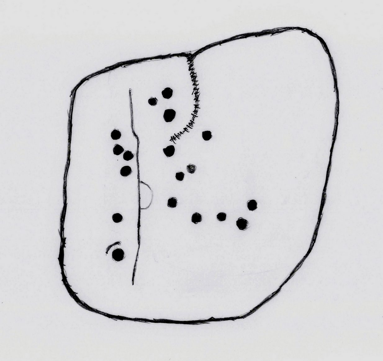
Sketch of basic designFaint line visible, left-side
When I first saw visited this carving as a young lad, the thing which stood out to me more than anything was the long but faint line that ran down one section of the stone. Added to this was an equally faint arc attached to the side of the line, like a “D” form. A few months later I did a sketch of it on my second visit, but I’ve looked and looked and seem to have lost it. (not good) The one I’ve done here is a recent one. As we can see, a series of cup-marks straddle each side of the D-line and are plainly visible, which implies that the line was carved much earlier than the cups. Of course, it’s possible that the cups were repeatedly forged over and over many times over a century or more and the D-line, for whatever reason, left untouched.
Another interesting aspect of this D-line is its repetition in the much more ornate petroglyph 35 yards to the east (presently known as Rivock 67 until we devise something more appropriate). The recently rediscovered Slinger Stone 100 yards south may also have the same feature, but this needs further surveying before we can say for sure.
References:
Bennett, Paul, ‘The Prehistoric Rock Art and Megalithic Remains of Rivock & District (2 parts),’ in Earth, 3-4, 1986.
Boughey, Keith & Vickerman, E.A., Prehistoric Rock Art of the West Riding, WYAS 2003.
Feather, Stuart, ‘Mid-Wharfedale Cup-and-Ring Markings: No. 14, Rivock,’ in Cartwright Hall Archaeology Group Bulletin, 7:1, 1962.
Hedges, John (ed.), The Carved Rocks on Rombald’s Moor, WYMCC: Wakefield 1986.
Acknowledgements: With thanks to Andy Roberts for giving this stone its modern name.
The best/easiest way to approach this and the Rivock carvings as a whole is to reach the Silsden Road that curves round the southern edge of Rombalds Moor (whether it’s via East Morton, Riddlesden, Keighley or Silsden) and keep your eyes peeled for the singular large windmill. About 200 yards east of this is a small parking spot, big enough for a half-dozen vehicles. From here walk 450 yards east along the road till you hit the dirt-track/footpath up towards the moor. Follow the track up for about 400 yards and you’ll see the crags a half-mile ahead of you. Get up there to the Wondjina Stone and follow the walling east for about 175 yards where you’ll see a track-cum-clearing in the woods. Walk along and the first large stone on your left is what you’re after.
Archaeology & History
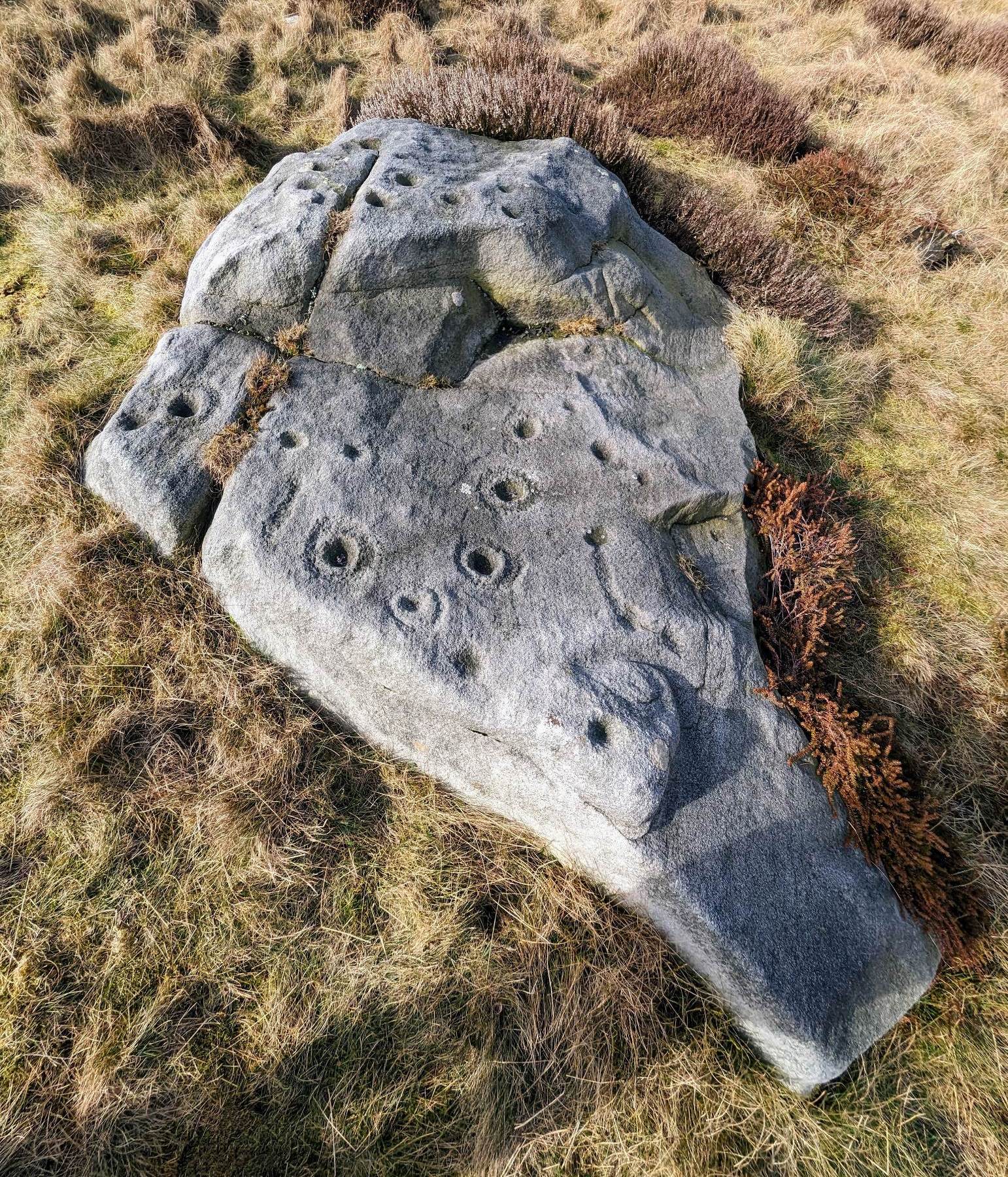
I first visited this carving in my teenage years in the 1970s, before the intrusive so-called “private” forest covered this landscape and when its petroglyphic compatriots were easier to find. Thankfully this one’s still pretty accessible and possesses a damn good clear design. It was rediscovered in the 1960s by Stuart Feather and his gang, zigzagging their way across the open moors, pulling back the heather to see what they might find. His description of it told how the stone,
“has two roughly level areas, one 18ins and the other 2 feet above ground level. Both (levels) have several well-preserved cup-and-ring markings on them. There are eight single cup-and-rings and 18 cups, two of the latter being joined by a clear channel seven inches long and 1½ inches wide. Nearly all the markings are unusually well preserved and the pocking marks are very clear.”
Note the line running down
He also had “the impression that all the markings on this stone and possibly one other similar stone in the Rivock area have been carved by the same hand, as all the symbols are nearly identical in in type, size and execution.” (this other carving he’s referring to seems to be one about 170 yards to the north, where occasionally “offerings” have been found)
The design from E-W
When John Hedges (1986) and his team checked the stone out he could only make out “seven cups with single rings, twenty two other cups”; whilst the ever descriptive Boughey & Vickerman (2003) saw “twenty-nine cups, eight with single rings.” Eight cup-and-rings is what most people see when the light’s right. There’s also a long, bent carved line on the lower level of the rock, running from near the middle of the stone out to the very edge. It seems to be man-made (although I may be wrong) – and I draw attention to it as this same feature exists on at least three of the other large and very ornamental cup-and-rings hereby within 300 yards of each other – and on these other carvings the long “line” is definitely artificial. Tis an intriguing characteristic…
Stuart Feather’s old sketch
When visiting this petroglyph you’ll notice how some of the carved elements on top of the stone are more eroded than those on the lower section. This is due to the fact that the lower section was only revealed by Feather and his team in the mid-20th century, after it had been covered in soil for countless centuries. As a result you can still see the peck-marks left by the implements that were used to make the carving, perhaps 5000 years ago!
The name of the stone was inspired by a local lady who saw an astronomical function in the design (I quite like it as well). Examples of petroglyphs representing myths of heavenly bodies have been described first-hand in some tribal cultures and, nowadays, even a number of archaeologists are making allusions about potential celestial features in some carvings in the British Isles. That doesn’t mean to say that it’s correct, but the idea’s far from unreasonable…
Anyhow – check this one out when you’re next up here. You’ll like it!
References:
Bennett, Paul, “The Prehistoric Rock Art and Megalithic Remains of Rivock & District (parts 1 & 2),” in Earth, 3-4, 1986.
Boughey, Keith & Vickerman, E.A., Prehistoric Rock Art of the West Riding, WYAS 2003.
Deacon, Vivien, The Rock Art Landscapes of Rombalds Moor, West Yorkshire, ArchaeoPress: Oxford 2020.
Feather, Stuart, “Mid-Wharfedale Cup-and-Ring Markings – no.16 – Rivock,” in Cartwright Hall Archaeology Group Bulletin, volume 8, no.10, 1963.
Hedges, John (ed.), The Carved Rocks on Rombalds Moor, WYMCC: Wakefield 1986.
Morris, Ronald W.B., “The Prehistoric Rock Art of Great Britain: A Survey of All Sites Bearing Motifs more Complex than Simple Cup-marks,” in Proceedings of the Prehistoric Society, volume 55, 1989.
Acknowledgments: Huge thanks to Collette Walsh for use of her photos.
If you’re coming via the Keighley-Bingley (Airedale) road, go up to Riddlesden and then up the winding Banks Lane until it meets the edge of the moors. At the T-junction, turn left and about 330 yards along on your right there’s a dirt-track. Walk up here, sticking to the track (not the footpath) towards the cliffs of Rivock ahead of you, going through the gate and into the Rivock woods area. About 450 yards on from the gate on your right-hand side you’ll see the long straight length of walling that runs uphill—and about 60 yards up here, on the left-hand side of the wall you’ll see a very large boulder. Y’ can’t really miss it!
Archaeology & History
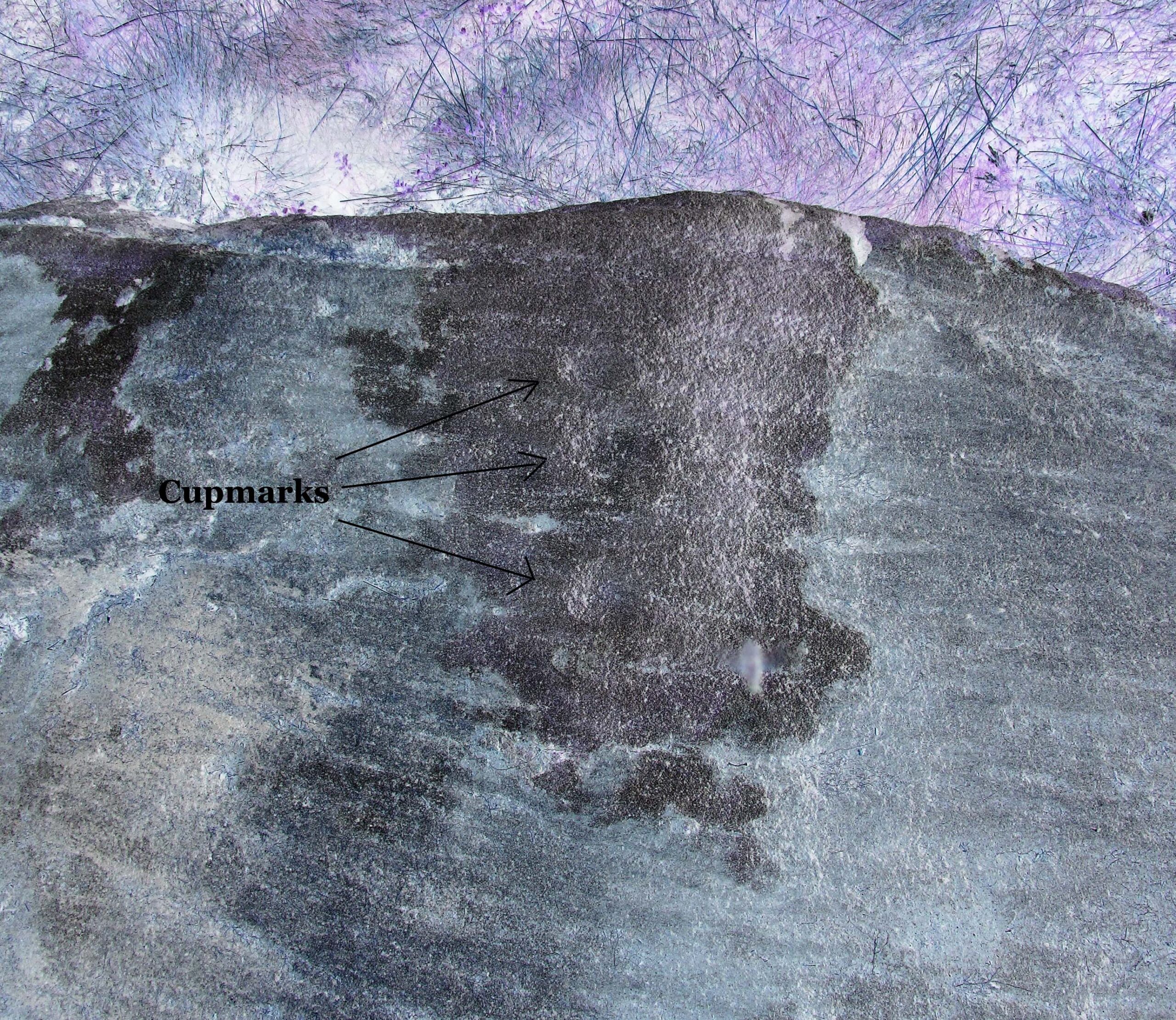
2 of the several cups here
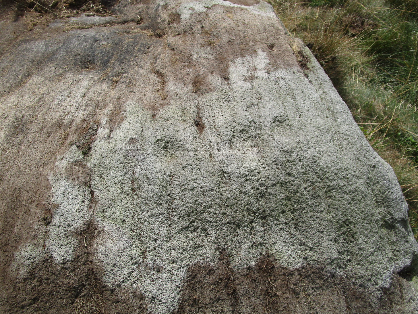
This large natural block, embedded into the hillside about 80 yards below the Wondjina Stone and its companions, is nothing much in the petroglyphic visual scale of things, but is worth checking out for a break if you’re checking out the other good designs in the Rivock cluster. Upon its sloping flat two-tiered surface there are just a small number of randomly spaced cup-marks of varying sizes: six at least, but perhaps as many as nine altogether. In times gone by (many years ago) we thought one of them might have had a very faint ring around it, but on my last couple of visits here I couldn’t see anything.
References:
Boughey, Keith & Vickerman, E.A., Prehistoric Rock Art of the West Riding, WYAS: Wakefield 2003.
Hedges, John (ed.), The Carved Rocks on Rombalds Moor, WYMCC: Wakefield 1986.
Cup-Marked Stone: OS Grid Reference – SE 0745 4470
Getting Here
Rivock Top stone
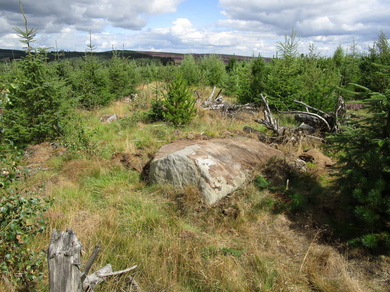
Best approached via the Wondjina Stone, then over the wall and follow the geological ridge that bends into the trees. It’s difficult to find amidst the dense forest and is another one of those carvings that’s probably only for the purists amongst you.
Archaeology & History
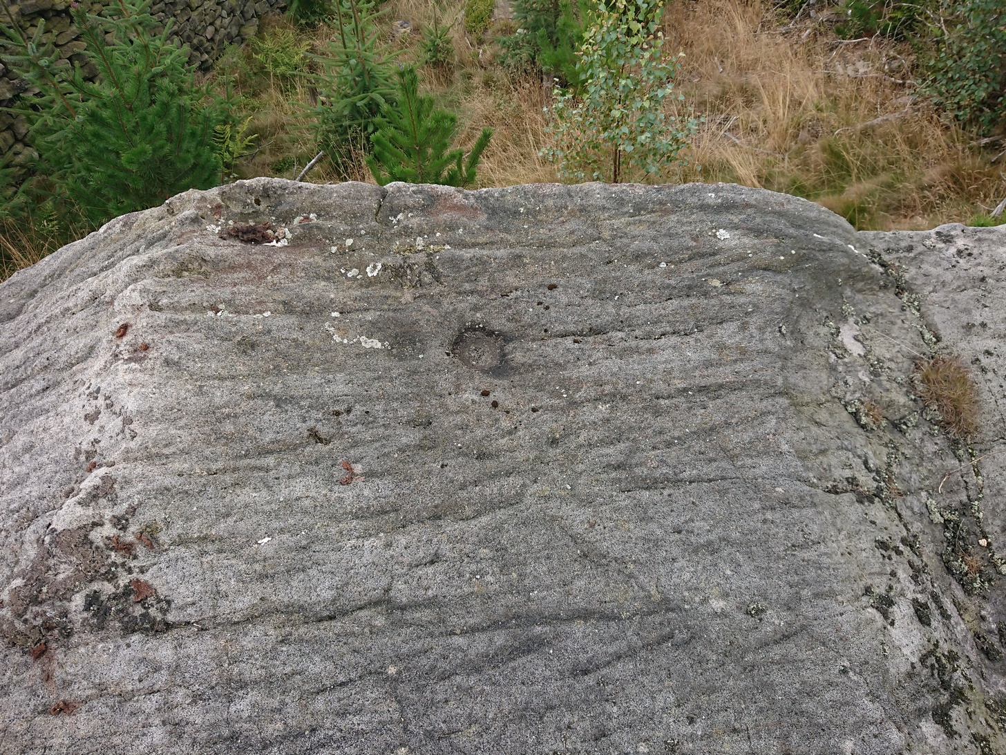
If you’re doing the Rivock rock art tour, you might as well give this a go once you’ve checked ou the decent ones nearby. Here, on a rather large stone we find, on its uppermost ridge, three faint cup-marks next to each other in a very slight curve. The cup-mark in the middle is slightly larger than its two compatriots and might be natural. If you were to wet the rock when the sunlight is just right, you’ll probably get a better idea of its real appearance—otherwise we’ll have to let the computer-gadget lads suss it out!
Sacred Well (destroyed): OS Grid Reference – SE 0973 4091
Archaeology & History
Lund Well on 1852 map
Once found in a cluster of three little wells all very close to each other near the top of the field where the Crossflatts roundabout joins up with the Aire-Valley trunk road, this is an intriguing site if you happen to be a pagan, or have an interest in druidism — and for one main reason: its name. When I first came across a reference to the place about 25 years ago, the only piece of information I could find about it came from the arduous detailed researches of the Victorian industrial historian J. Horsfall Turner who, unfortunately, neglected to record much of the fading folklore in the region at his time. Marked on the 1852 6-inch Ordnance Survey map, ‘Lund’ was a bit of an etymological curiosity, and Mr Turner (1897) thought the well’s name was little other than that of a local mill owner, whose nickname was ‘Lund’ Thompson. He was guessing of course…and I thought little more about it…
Years later when looking through A.H. Smith’s (1961-63) magnum opus on the place-names of West Yorkshire, I found that he didn’t include the Lund Well in his survey. However, an eventual perusal of Kenneth Cameron’s (1996) work told that in Old Norse place-names (and there is a preponderance of such places scattering Yorkshire and Lancashire), lund or lundr was a “‘small wood, grove,’ also had a meaning, ‘sacred grove’.” The word is echoed in old French, launde, meaning ‘forest glade’. In A.H. Smith’s (1954) earlier etymological magnum opus he said that the word derives from a “small wood, grove, also a sacred grove, one offering sanctuary.” However, Margaret Gelling (2000) urged caution on the origin of lund as a sacred grove and erred more to the usual English tendency of depersonalizing everything, taking any animistic attribution away from its root meaning; but we must urge caution upon her caution here! Neither Joseph Wright (English Dialect Dictionary, vol.3 1905) nor William Grant (Scottish National Dictionary, vol.6, 1963) have entries for this word, so we must assume the Scandinavian root word origin to be correct.
One vitally important ingredient with the Lund Well is its geographical position. For across the adjacent River Aire the land climbs uphill—and a few hundred yards above we reach the well-known and legendary Druid’s Altar, with its Druid’s Well just below. This association is what suggests our Lund Well may have had a real association with a “sacred grove of trees”, as—despite us knowing very little about them—we do at least know that druids performed rites in sacred groves. In Greenbank’s (1929) historical analysis of the Druid’s Altar, he was left perplexed as to the origin of its name as all early accounts and popular culture assigned it this title, and so he opted for the probability that the druids did indeed once perform rites here. If this was true, then our seemingly innocuous Lund Well once had a much more sacred history than anyone might have thought. Sadly, through their usual ignorance of such matters, the industrialists destroyed it….
References:
Cameron, Kenneth, English Place-Names, Batsford: London 1996.
Gelling, Margaret, Place-Names in the Landscape, Phoenix: London 2000.
Greenbank, Sydney, The Druid’s Altar, Bingley, R.G. Preston: Bingley 1929.
Smith, A.H., English Place-Name Elements – volume 2, Cambridge University Press 1954.
Smith, A.H., The Place-Names of the West Riding of Yorkshire – 8 volumes, Cambridge University Press 1961-63.
Legendary Rocks (destroyed): OS Grid Reference – SE 0886 4479
Archaeology & History
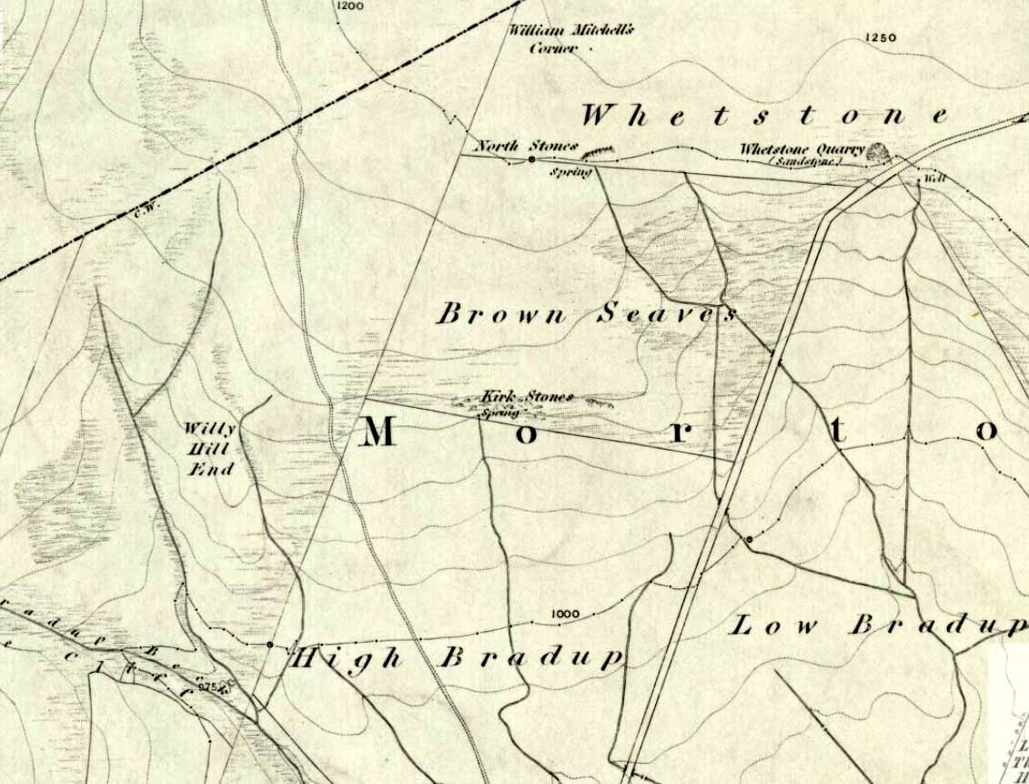
Kirk Stones on 1851 map
A place-name that is still recognised on modern Ordnance Survey maps, even though the original site giving rise to it was all but destroyed some one hundred-and-fifty years ago. Derived from the old word kirk, meaning a church or sacred site, no christian remains of any kind have ever existed here and so we must presume an earlier, more heathen site of sanctity (an abundance of prehistoric petroglyphs exist very close by). The singular reference detailing the nature of these Kirk Stones is in J.A. Busfield’s (1875) rare tract on the history of Upwood, in the parish of Bingley. Upwood Hall was built by the Busfield family and, as the author tells,
“one of the most striking features in the vicinity at this age [c.1800, PB] was the fine range of magnificent rocks called Kirkstones, which had existed for countless ages. These grand rocks, towering one above another, extended along the whole southern boundary of the [Whetstone] Allotment on the left of the road to Ilkley, and were really a fine object, but alas!, through the ignorance or stupidity of the agent Colonel Bence, the “Crags of Kirkstone” were broken up and disposed of in the construction of the Bradford Water Works about the year 1854.”
Sadly we have neither illustrations nor other references to these fine sounding sentinels.
Undoubtedly the Kirkstones were a natural feature, despite their venerated title. It would have been their very appearance that gave rise to their revered title, as in the great and contorted rock masses seen at Brimham Rocks which, from Bensons’s description, these Kirk Stones seem reminiscent. The only piece of extant lore to these stones is that the uprights that went into making the recently destroyed Bradup stone circle a short distance south of here, came from this sacred outcrop. It seems reasonable to assume that they played an important role in the magickal history of these hills when they were scattered with forest.
The Kirk Stones aligned along the equinox axis to the Black Knoll standing stone less than a mile [1.4km] due east.
References:
Bennett, Paul, The Old Stones of Elmet, Capall Bann: Milverton 2001.
Busfield, Johnson Atkinson, Fragments Relating to a History of Bingley Parish, Bradford 1875.
Smith, A.H., English Place-Name Elements – Part 2, Cambridge University Press 1956.
Follow the directions to reach the small Rivock East Carving just on the level of the small moorland. From here, walk less than 100 yards east, staying just on the edge of the moor, keeping your eyes peeled for the irregular shaped rocks running in lines roughly parallel with the footpath above the edge of the crags.
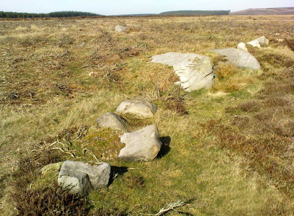
Archaeology & History
Recent explorations in and around the Rivock Edge area found, not only a number of undiscovered cup-and-ring stones, but the overgrown remains of an undoubted prehistoric enclosure on the ridge of moorland above the rock escarpment which has not previously been reported in archaeological surveys. Much of the time the area is covered in deep heather, but thanks to this small section of moor being burnt back a short while ago, the lines of walling that mark the enclosure are there for all to see. It’s obvious that some sections of the old walls have been removed in the not-too-distant past for use in more modern walling and, nearby, old quarries and farming have probably been responsible for other destructive elements.
Easternmost line of Rivock enclosure walling
This enclosure is of a rough, rounded, scalene triangular formation, with the main piece of extant walling running roughly northeast-southwest. The walling is typical of other settlements and enclosures in the region, probably Bronze Age in nature, Iron Age at the latest, with some natural earthfast boulders marking parts of the outline and many smaller pieces of rock and packing stones being added to build up the structure. The same layout is found at other nearby prehistoric enclosures at Crow Well, Dumpit Hill, Snowden Moor, Woofa Bank and many others.
Of the larger upright stones in the Rivock Enclosure, several of them stand about three feet high, with some of them having been knocked down. The longest line of walling, running roughly east-west, is less than 50 yards long; whilst the enclosure wall running roughly north-south on its eastern side is 30 yards long. Much of the walling along its northern side appears overgrown and sections of it are missing.
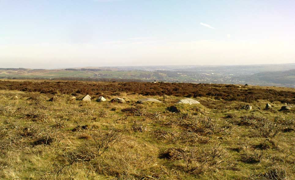
For a long time I puzzled as to whether there had been any settlements on this part of Rombald’s Moor, rich in cup-and-rings stones — and at last we find that there was at least one such site. Forays back and forth across the level ground all around here failed to locate any other similar enclosure remains; but it may be that some have been covered (or were destroyed) in the adjacent forestry plantation to the west. Further explorations by fellow antiquarians may prove worthwhile when the forest is cut down in the next few years.
A little-known early christian relic found in the driveway to East Riddlesden Hall was saved and propped up in the stable floor at the back. In 1984 however, the National Trust got round to moving it and bringing the relic to greater public attention by putting it on display in the great hall of the building. (I think you’ve gotta pay to go in and see the stone these days – which is a bittova pain if you just want to examine the carving)
Old photo of the carved stone (after Margaret Faull)
Measuring just 1 foot across and 2 feet high and carved on all sides, the design is all too familiar to those of you exploring early christian or late-Celtic art forms. Executed sometime between the 5th-10th century, on the main face of the cross we have the traditional ‘Celtic’ interlacing, with a bird-figure emerging on or around an early ‘cross’ symbol. There are a variety of interpretations of this, but none relate to any modern christian mythic structures. Indeed, we should cautiously reflect on the more pre-christian nature of this design: carved as it was at a time when the spirit of the natural world (animism) was endemic amongst all people. This carving would in some way reflect such implicit subjectivity, though perhaps have had emergent ideals relevant to the christian cult within it. However, we should be cautious about this christian idea, despite it being much in vogue by prevailing groups of consensus trance historians.
References:
Faull, Margaret L., “The Display of the Anglo-Saxon Crosses of the Keighley Area,” in Transactions of the Ancient Monuments Society, New Series no.30, 1986.
Take the same directions as if you’re going to Dave’s Stone, to the eastern end of Rivock Edge itself. Then take less than 10 steps further onto the moor itself and you’ll see the stone pretty low down in the heather. (please note that grid-reference above needs revising)
Archaeology & History
…and looking straight down!
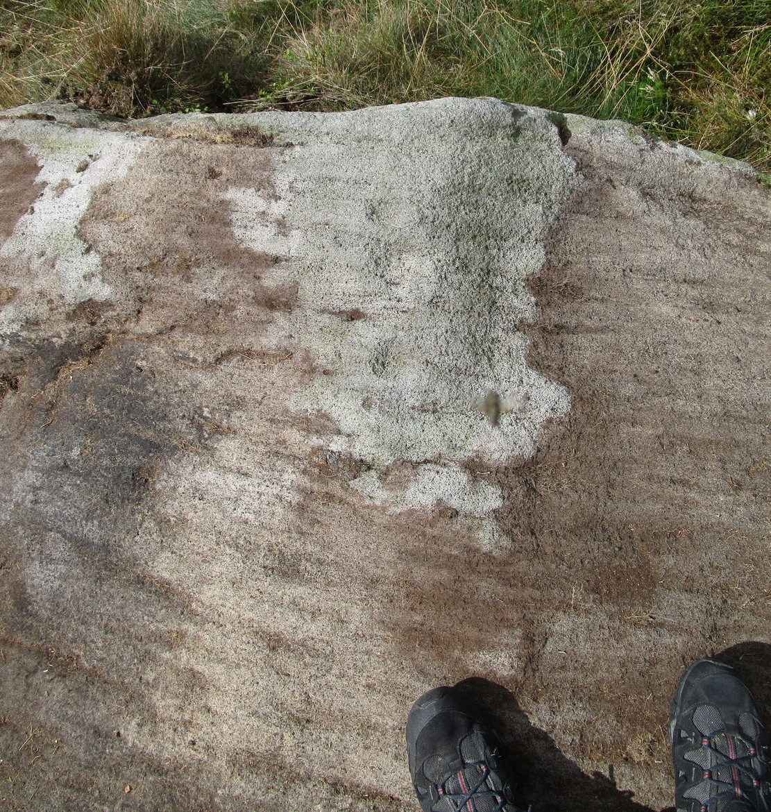
Found about 10 yards onto the flat ridge south of Dave’s Stone cup-marked stone, the vegetation covering this carving had only recently been brushed off when we revisited the place in 2012, by members of the Ilkley CSI team in their own survey of the area. As you can see, it’s a simple design of just two well-preserved cups on a small rounded stone. What may be the remains of a very faint ring arc is possible over one of the two cups. Nowt much more to say really!