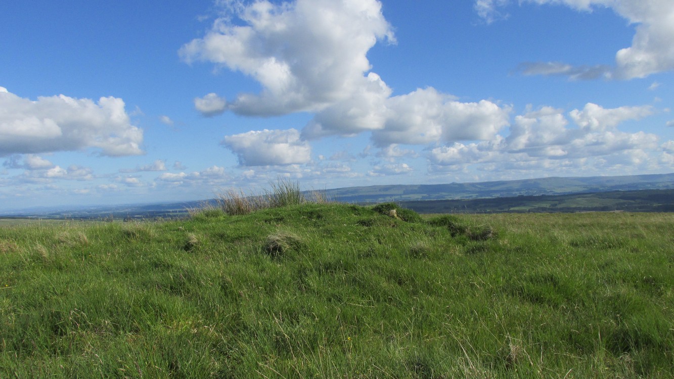
This is a helluva long way to walk to find such a small site, but the landscape makes it all the worthwhile. So… From Callander, head up the Bracklinn Falls road, going past the car-park there and on for 1½ miles, watching for the track on your left where you park-up. Walk down the track, over the river, then uphill until another track veers to your left. Follow this for nearly a mile until meeting another track that veers right. 4-500 yards along, on the same side as the burn on your left, the hill slopes up where a small grassy mound sits on its ridge. That’s it.
Archaeology & History
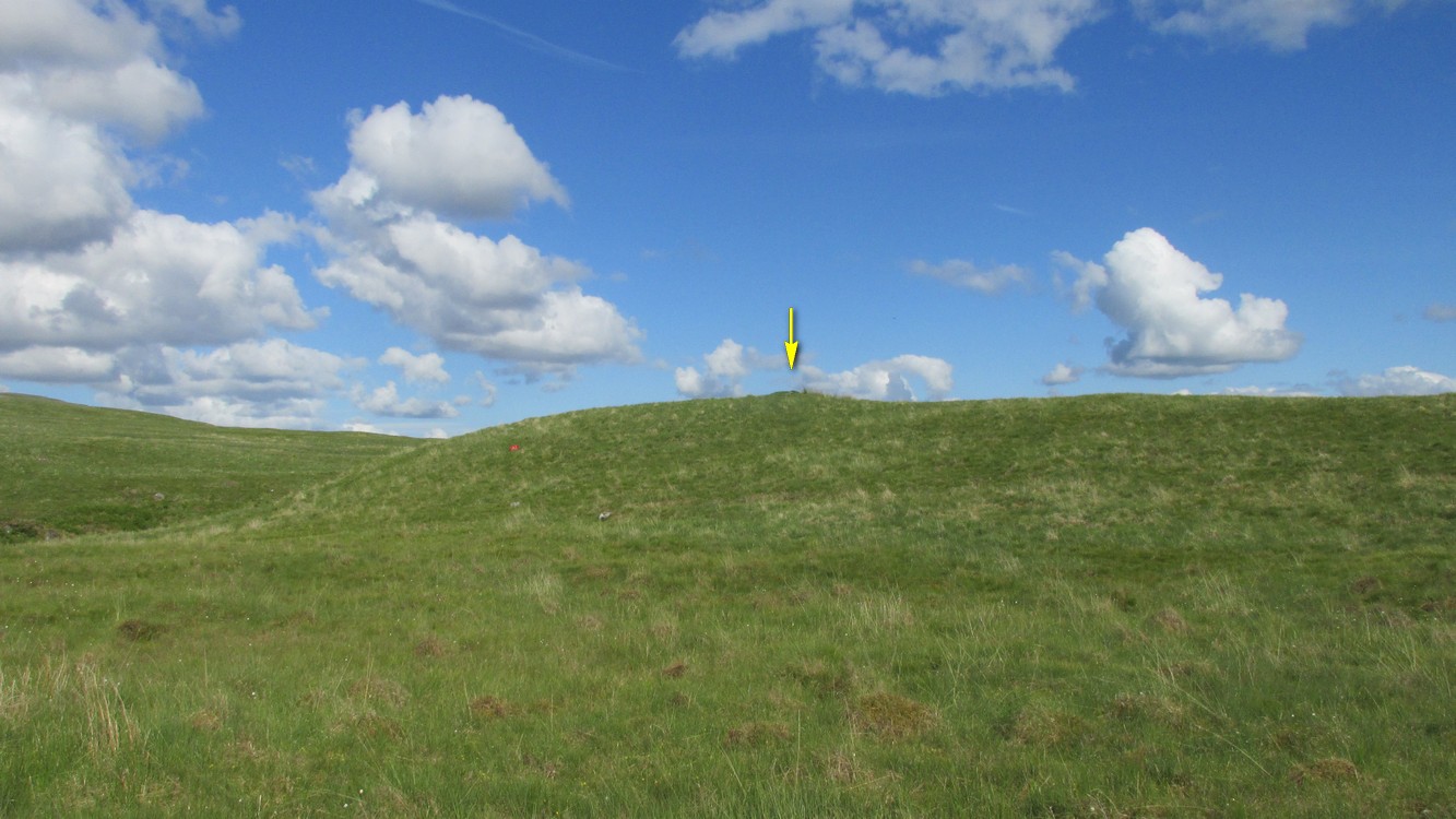
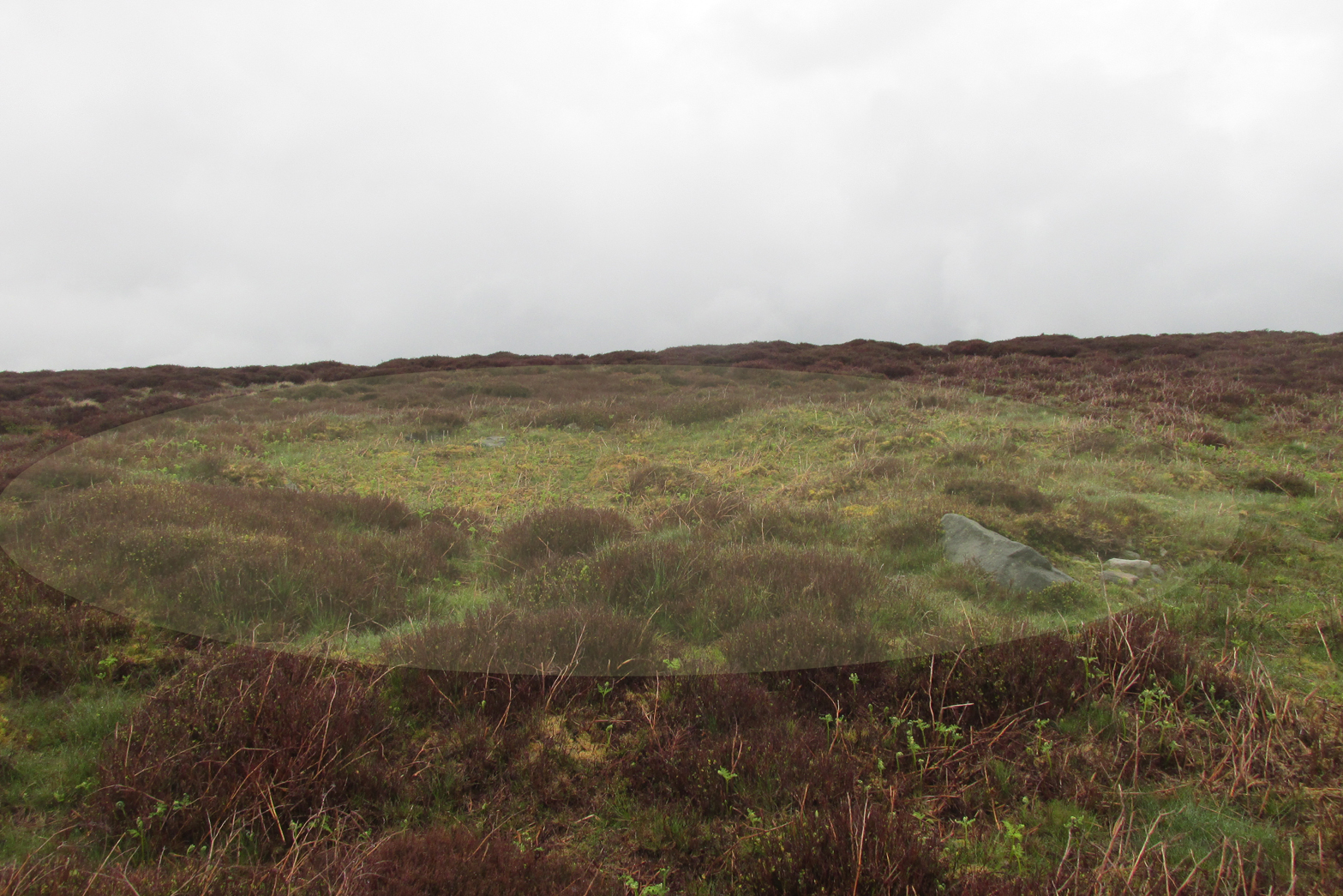
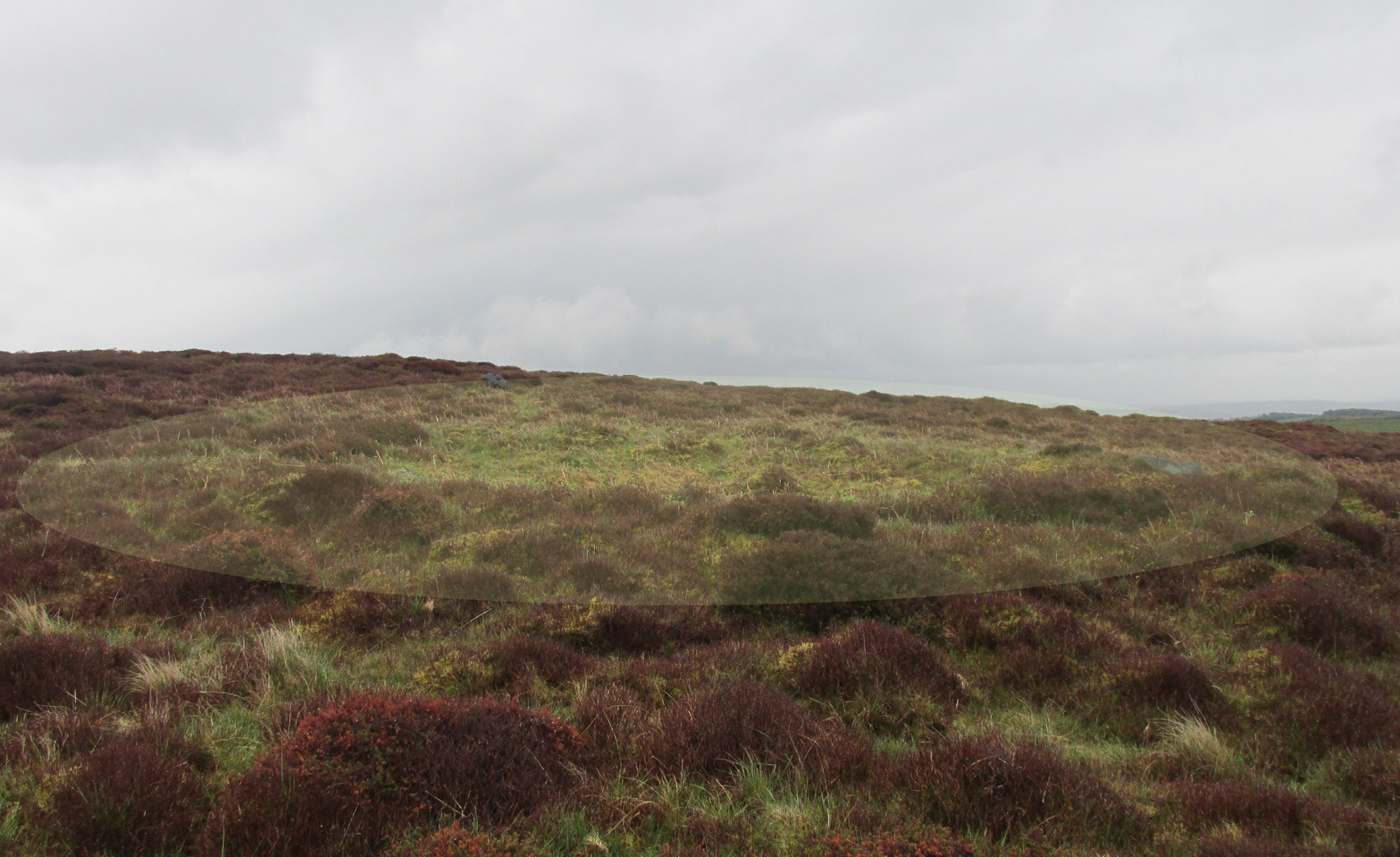
From the cairn to the SE
This site is likely to be of interest only to the hardcore antiquarians amongst you. It’s a small singular cairn sitting on a small hillock of once woodland-clad grasslands, a few hundred yards east of the much-ruined chambered cairn of West Bracklinn. Much of it is covered in vegetation, but sections of its stone structure are visible mainly on its south sides. Measuring 6 yards across and less than a yard high, it has been classed by Historic Scotland as Bronze Age in nature, although no excavation has been done here.
Reference:
Royal Commission Ancient & Historical Monuments of Scotland, Braes of Doune: An Archaeological Survey, RCAHMS: Edinburgh 1994.
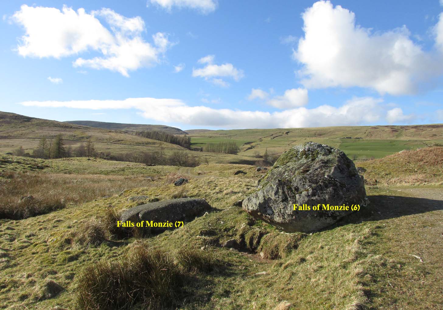
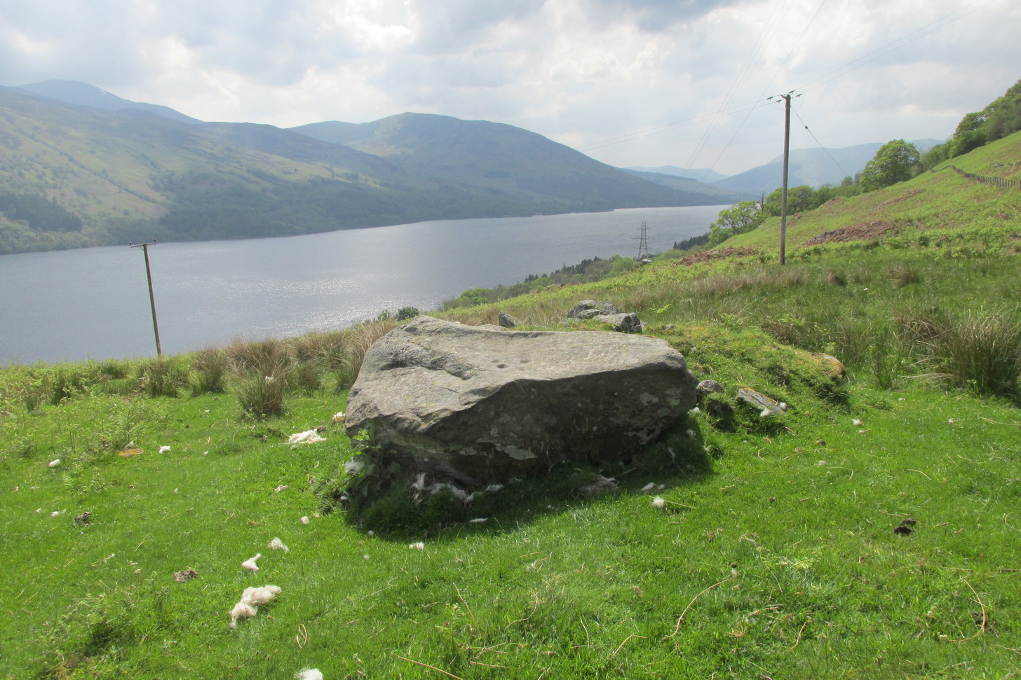
A couple of miles east of Crieff, take the A822 road from the Gilmerton junction towards the Sma’ Glen. After literally 1¾ miles (2.8km)—just 100 yards before the track up to Connachan Farm—you’ll reach a dirt-track on your left that leads into the hills. Go on here and after an easy walk of 400 yards or so, you’ll reach the conspicuous boulder known as the Falls of Monzie (6) stone. Two or three yards to its side is a large flat stone. That’s it!
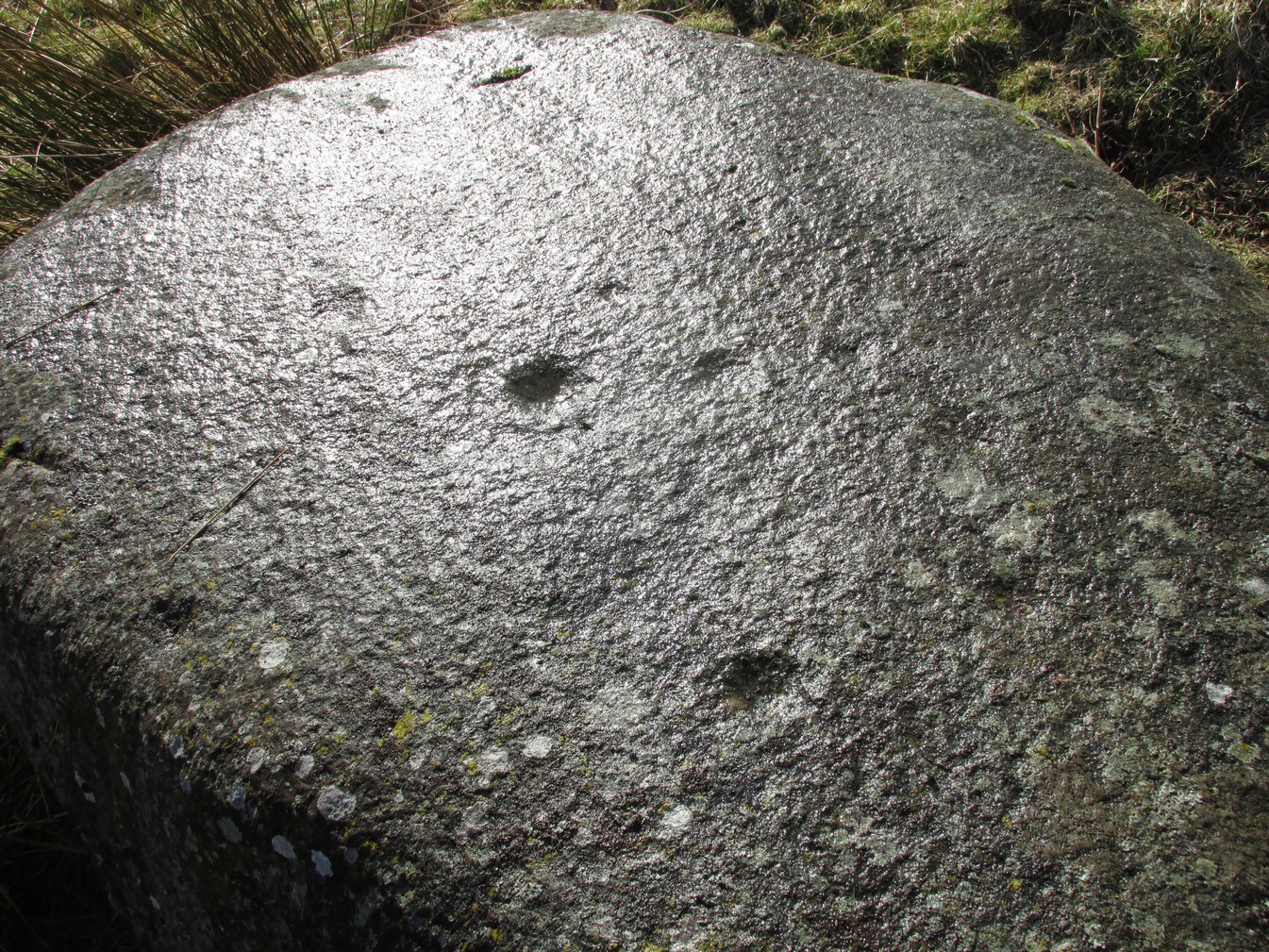
Archaeology & History
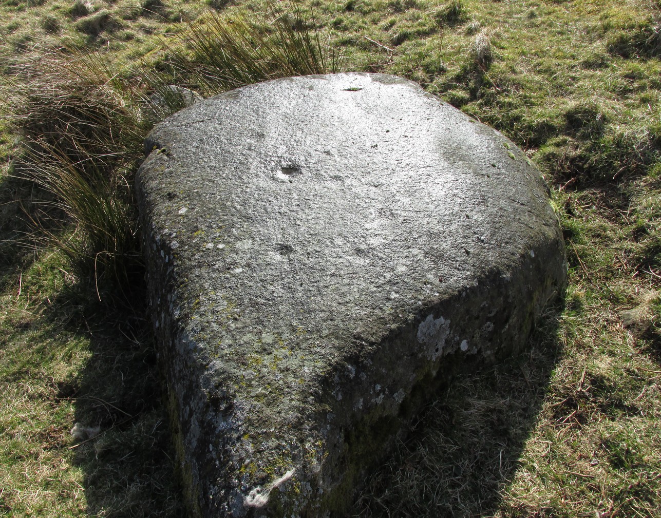
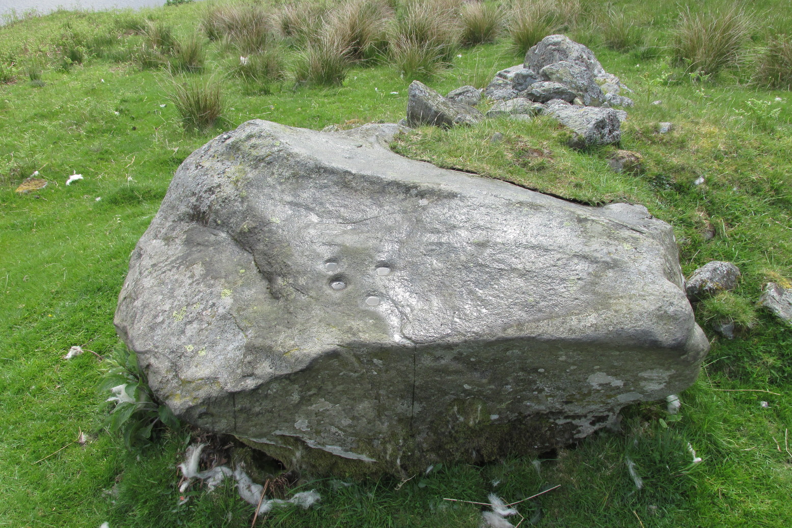
This large flat smooth earthfast rock, is possessed of a number of very faint cup-marks. Altogether there are at least nine cup-marks, most of which are closing in to the middle of the stone, with other single cups near the western and southern edges.
The faint cupmarksClose-up of cups
Near the middle of the rock, one cup has an equally faint semi-circular arc, just visible on the photos here. Close-up photos of this semi-circle seem to suggest it was more complete in ages gone by, but the erosion is such that it’s difficult to say with any certainty. (possibly the computer-tech kids could give us a bit more certainty). The nearest other carving with more definite cup-and-rings can be found on the Falls of Monzie (8) stone, about 200 yards to the west.
A small and seemingly prehistoric grave, or cist, destroyed sometime around 1840, once existed on the top of a large hillock close to the River Carron where the bridge leads from Dunipace to Denny. Thankfully, memory of its existence was preserved by Robert Watson (1845) in his short description of Dunipace parish. He first began by talking of some large natural mounds on the eastern side of the township which, folklore told, gave rise to the place-name Dunipace; but from those mounds,
“About two miles to the westward of these hills, there was a very beautiful one about forty feet in height, and covering nearly three roods of ground, said also to be artificial. This hill was mutilated, from time to time, for the purpose of repairing roads and other purposes. It was entirely removed about six years ago, to form an embankment on the turnpike road near Denny bridge. The strata of which this hill was composed, were carefully observed during its removal. These were so regular, and as if rising out of, and gradually returning again to similar strata in the circumjacent level ground, as to afford conclusive evidence that the hill was not the work of man. On the top of this hill, and about three feet below the surface, was found a coffin or tomb, composed of five large un wrought stones, in which were the bones of a human body, scull and teeth not much decayed. Along with these, was a vase of coarse unglazed earthenware, containing a small quantity of material resembling the lining of a wasp’s nest, probably decayed paper or parchment, which in the lapse of ages had assumed that appearance. No conjecture could be formed about the individual here interred, tradition being entirely silent on the subject ; but this circumstance corroborates the opinion of some writers, that the hills of Dunipace might have been used as burying-places for ancient chiefs.”
The site was included in the Royal Commission’s (1963:1) Inventory, but they found no additional data about it.
References:
Royal Commission on the Ancient & Historical Monuments Scotland, Stirling – volume 1, HMSO: Edinburgh 1963.
Royal Commission on the Ancient & Historical Monuments of Scotland, Archaeological Sites and Monuments of Stirling District, Central Region, Society of Antiquaries of Scotland 1979.
Watson, Robert, “Parish of Dunipace,” in New Statistical Account of Scotland – volume 8, William Blackwood: Edinburgh 1845.
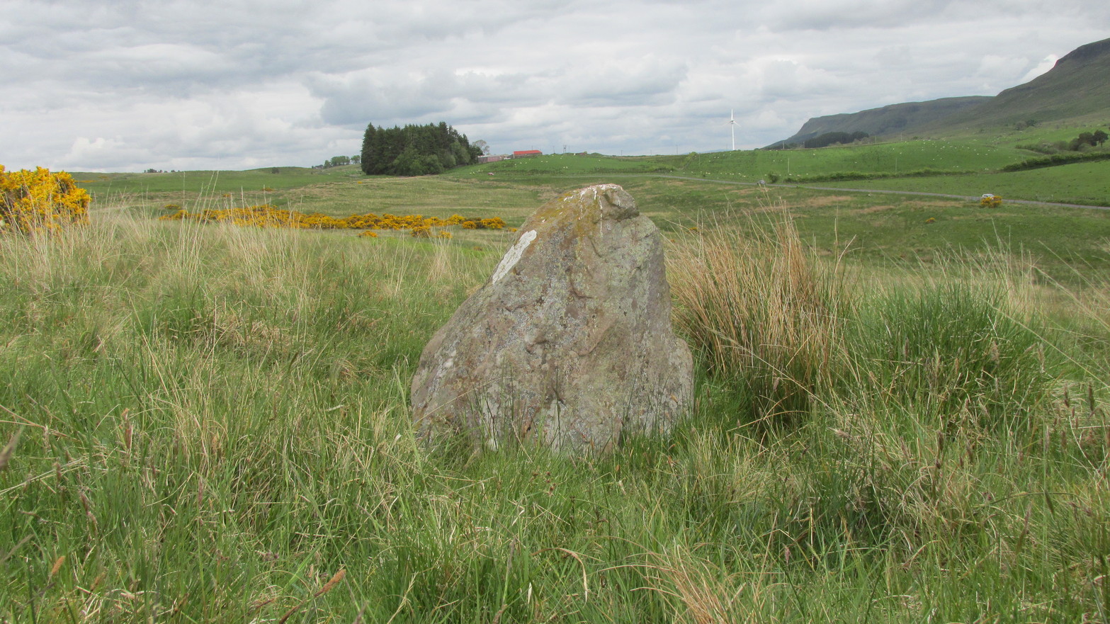
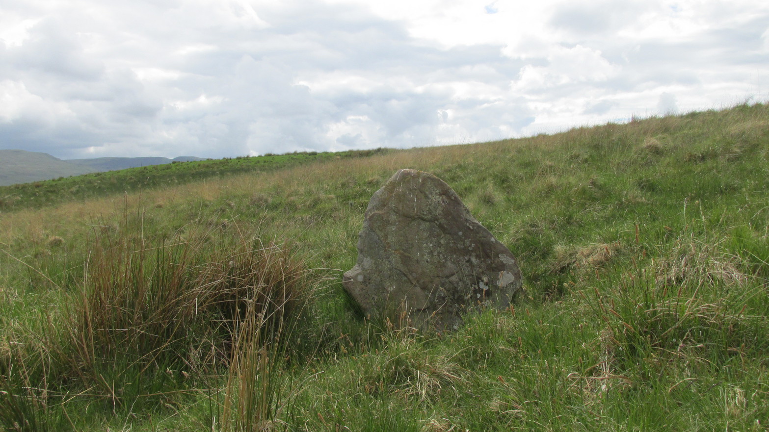
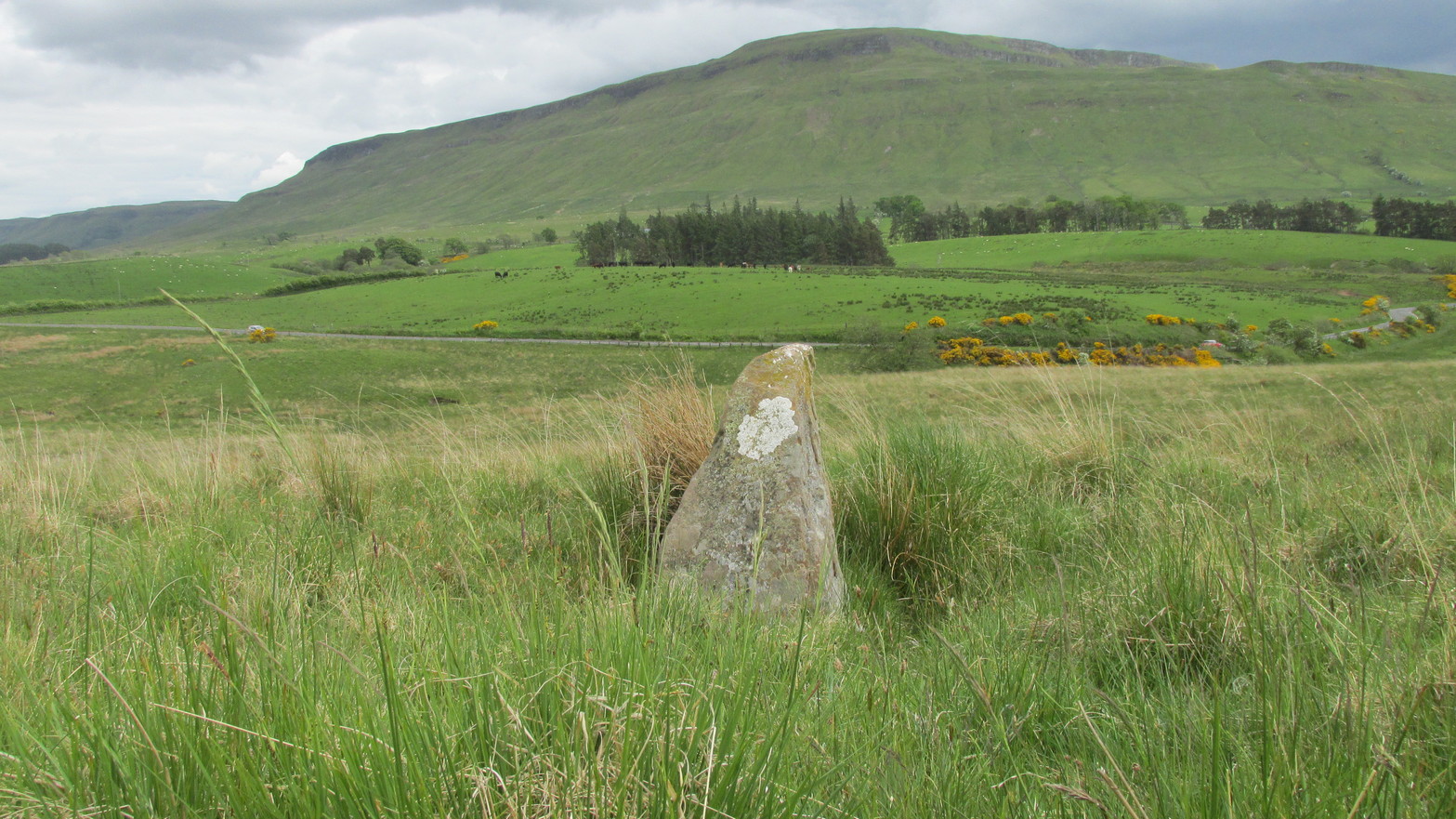
Go up the B822 road from Fintry for literally 2.5 miles (about 500 yards below the small copse of trees that almost hide Balafark Farm above you) and at a very small ‘parking’ spot are 2 farm-gates. Go through the lower of the two and head downhill, crossing the small burn and up the other side for just over 100 yards where you’ll meet a very low, old and very overgrown wall. Keep your eyes peeled for it! Walk left along this wall, uphill, for another 100 yards till you meet a a dried-up dyke that runs downhill. 10-15 yards down this, a small stone greets you…
Archaeology & History
It’s difficult to call this a ‘standing stone’ and, as far as I’m concerned, is even more troublesome to cite it as a legitimate prehistoric monument. Nevertheless it is shown on the modern OS-maps as such and was listed by the Royal Commission (1963:1) lads in their standing stones inventory. But it’s really pushing it to be honest! They told us:
“This stone stands about 180 yds NW of a gate which opens off the Fintry-Kippen road, 340 yds N of its crossing of the Lernock Burn. It is triangular in profile and wedge-shaped in section, measuring 3’3″ both in height and breadth along its base, by 1’7″ in greatest thickness. It may well have been a boundary stone as it is near the corner of some ground which is enclosed by a turf dyke and has been cultivated.”
Looking southwestLooking up to the ancient cairn of Stronend
In truth, if we call this a standing stone, then there are hundreds of others that I’ve come across over the years—frobbling off-path across huge swathes of moorland—that must also be added to our prehistoric inventories, as the height of this isolated rock is echoed in countless others which are off the archaeological listings. One such stone ‘stands’ 100 yards northeast of here—although there are many others with much greater potential. …I think the only thing that may sway this as being a possible prehistoric upright is the fact that the top of the stone appears to have been broken off, albeit a few hundred years ago if the weathering is owt to go by. But a cursory look for any broken top-piece found nothing.
References:
Royal Commission on the Ancient & Historical Monuments Scotland, Stirling – volume 1, HMSO: Edinburgh 1963.
Follow the same directions as if you’re visiting the Wester Glentarken (1) carving, but some 10-15 yards before reaching it, you’ll notice this smaller rock with a series of curious naturally-eroded features on it.
Archaeology & History
This rounded stone has a series of natural deep cracks and undulating geological features on its surface, some of which look like elongated man-made cup-marks—but they’re not! The only man-made ingredient on this stone is the deep single cup-mark close to the centre of the stone, as you can see in the photo. That’s it—nowt else!
1½ miles out of St Fillans on the A85 road to Lochearnhead you’ll reach the boating marina by the lochside. A hundred yards or so past this, park up. Cross the road and walk 50 yards to your right then follow the dirt-track up into the trees. After ⅓-Mile (0.5km) turn left to the old house on your left and follow the green path around it, then around the right-side of the rocky knoll in front of you. Once you’re on the level ground around the knoll, walk forward for less than 100 yards. Y’ can’t really miss it!
Archaeology & History
4 of the 5 main cups
A simple design, but a clear one, of four deep cup-marks which can be seen on the eastern side of the stone, with a solitary one—much more faint—just over the rise on the more western section of the rock.
There are a number of other large sections of rock around the knoll with what appear to be cup-markings of various forms, but apart from perhaps one or two exceptions, the vast majority of them—as Currie (2005) also noted—seem to be natural.
References:
Currie, George, “Wester Glentarken, Perth and Kinross (Comrie parish), cup-marked rocks,” in Discovery & Excavation Scotland, vol. 6, 2005.
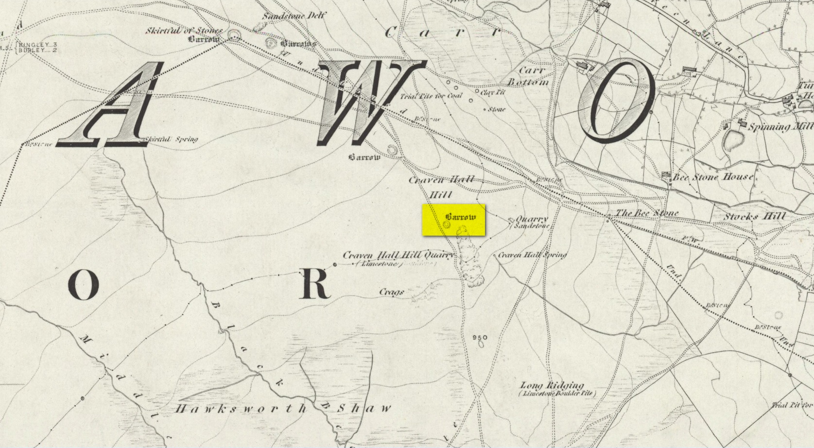
Unless the heather’s been burnt back, this takes a bitta finding. Direction-wise, the easiest is from the moorland road above Menston. Go up Moor Lane and then turn right along Hillings Lane. 350 yards on is a dirt-track on your right marked as Public Footpath. Walk up here for two-thirds of a mile—going past where the track goes left to the Shooting Range—to where the track splits. Bear left and after 250 yards you reach a fence on your left where the moorland proper begins. Follow this fence SW for 300 yards until it does a right angle turn. Just before this, you’ll see a large worn overgrown trackway or path running north into the moorland. Walk up here for nearly 100 yards and look around. Best o’ luck!
Archaeology & History
Western arc of earth & stone
Shown on the 1851 OS-map adjacent to the long prehistoric trackway that runs past Roms Law, the Great Skirtful and other prehistoric sites, the antiquarian wanderings of Forrest & Grainge (1868) came past here and, although didn’t mention the Craven Hall cairns directly, they did write of “a group of barrows” hereabouts, and this may have been one of them. James Wardell (1869) gave an even more fleeting skip, only mentioning “pit dwellings” hereby. A little closer to certainty was the literary attention Collyer & Turner’s (1885) pen gave, where they described, “near the adjoining old trackway, which runs from East to West, will be seen a small barrow”—but this could be either of the Craven Hill sites. And the usually brilliant Harry Speight (1900) gave the place only more brevity….
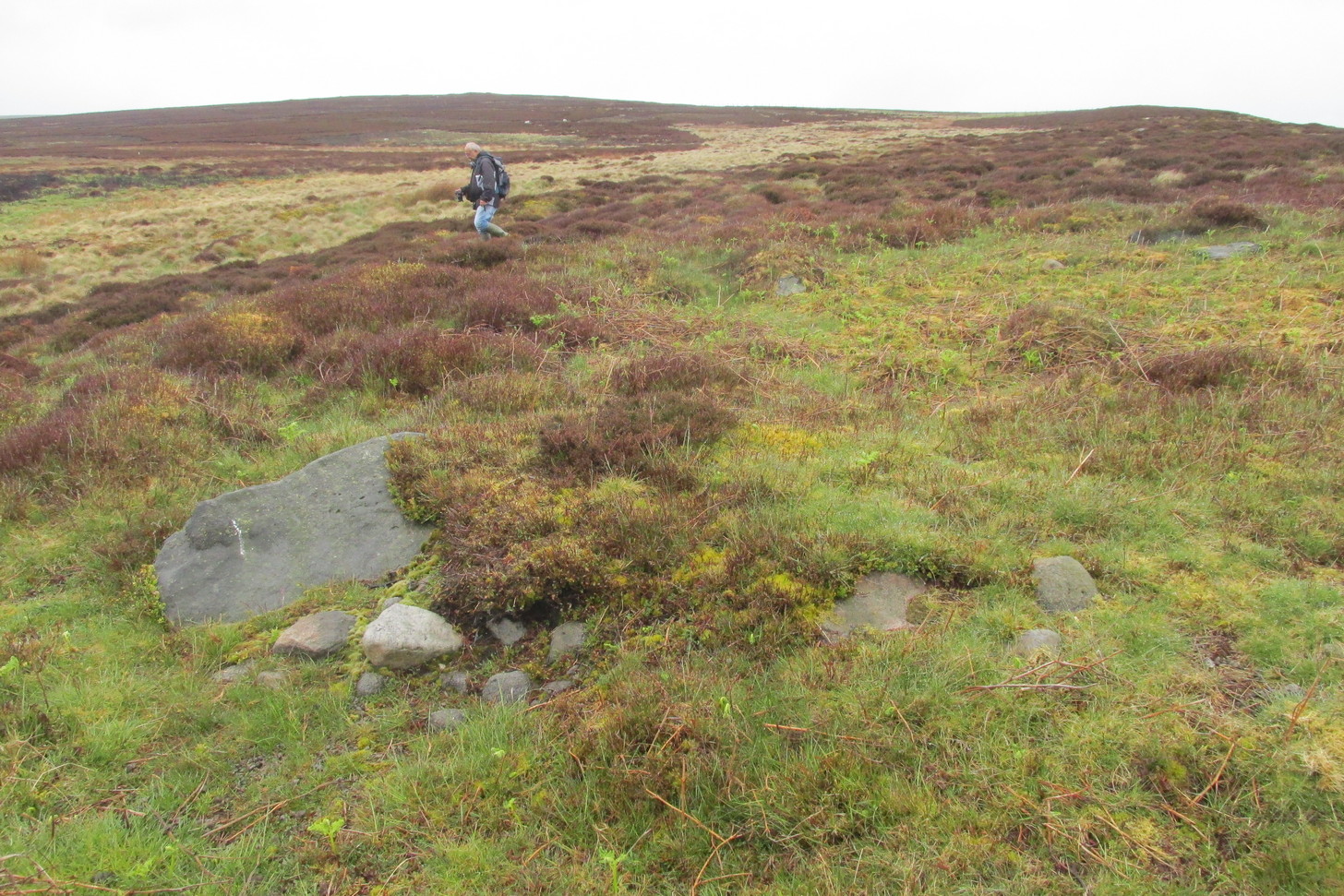
Structurally similar to Roms Law nearly ¾-mile northwest of here, this little-known and much denuded prehistoric tomb has seen better days. It is barely visible even when the heather’s low—and when we visited recently, the heather was indeed low but, as the photos here indicate, it’s troublesome to see. It’s better, of course, with the naked eye.
Highlighted ring cairn, looking NEHighlighted ring cairn, looking SE
It’s the most easterly cairn in the large Bronze Age necropolis (burial ground) on Hawksworth Moor. Measuring some 12 yards across and roughly circular in form, the ring is comprised mainly of many small stones compacted with peat, creating a raised embankment barely two feet high above the heath and about a yard across on average. A number of larger stones can be seen when you walk around the ring, but they don’t appear to have any uniformity in layout such as found at the more traditional stone circles. However, only an excavation will tell us if there was ever any deliberate positioning of these larger stones. It would also tell us if there was ever a burial or cremation here, but the interior of the ring has been dug out, seemingly a century or two ago…
References:
Collyer, Robert & Turner, J.H., Ilkley: Ancient and Modern, William Walker: Otley 1885.
Faull, M.L. & Moorhouse, S.A. (eds.), West Yorkshire: An Archaeological Guide to AD 1500 – volume 1, WYMCC: Wakefield 1981.
Forrest, C. & Grainge, William, A Ramble on Rumbald’s Moor, among the Rocks, Idols and Altars of the Ancient Druids in the Spring of 1869, H. Kelly: Wakefield 1868.
Speight, Harry, Upper Wharfedale, Elliott Stock: London 1900.
Wardell, James, Historical Notes of Ilkley, Rombald’s Moor, Baildon Common, and other Matters of the British and Roman Periods, Joseph Dodgson: Leeds 1869.
Tumulus (destroyed): OS Grid Reference – SE 234 336
Archaeology & History
Today, Hough Hill has almost completely given way to modern housing; but in bygone centuries, this hilltop once housed a prehistoric burial mound—albeit an inconspicuous one. It was mentioned briefly in Faull & Morehouse’s (1981) magnum opus, but we know very little of its overall appearance and stature. Its existence was recorded posthumously thanks to the antiquarian John Holmes, without whose notes it would have been lost to history.
During quarrying operations at Hough Hill in December 1879, an ornamental urn was found,
“filled with calcined bones (that) was placed on a dish shaped hollow, some two or three feet deep, with charcoal and burnt earth.”
Holmes compared some markings that were upon this urn to one that was uncovered in Acrehowe Hill above Baildon by J.N.M. Coll in 1845. Unfortunately the Hough Hill urn was broken into fragments shortly after being uncovered. All remains of the burial mound have been completely destroyed.
References:
Faull, M.L. & Moorhouse, S.A. (eds.), West Yorkshire: An Archaeological Guide to AD 1500– volume 1, WYMCC: Wakefield 1981.
Holmes. John, “A Sketch of the Pre-Historic Remains of Rombalds Moor,” in Proceedings of the Yorkshire Geological & Polytechnic Society, volume 9, 1886.
Wardell, James, Historical Notes of Ilkley, Rombald’s Moor, Baildon Common, and other Matters of the British and Roman Periods, Joseph Dodgson: Leeds 1869. (2nd edition 1881).
Take the directions to the Balnasuim (1) carving, then up and across to Balnasuim (2). From here, walk diagonally uphill to your right (NE) for about 150 yards and head to the the very top-corner of this field. You’ll see the large embedded rock emerging out of the ground, just ten yards away from a small stream. You’re there!
Archaeology & History
As Officer Barbrady likes to put it, “move along people, there’s nothing to see here!“—and that’s really the case with this, another of Balnasuim’s petroglyphs. This lichen-encrusted rock has just two simple cup-marks, barely visible when the daylight’s poor – and it’s almost as disappointing when the day is good! In all honesty, in wilfully visiting this site and its geographical compatriots, I can sincerely understand how people can tell us petroglyph-nuts that we “really have nothing better to do” with our time!
From Killin, take the A827 road to Kenmore. 6 miles along, on your right, is the track down to the Big Shed at Tombreck. Keep on the A827 for exactly ⅓-mile (0.53km), and opposite the driveway to Craggantoul is a small parking spot. A few yards on the road, over the burn, go thru the gate on your left. From here, follow the straight line of walling uphill and 20 yards before reaching Cragganester (9) carving, follow the line of fencing right (ENE) until you hit the wall more than 350 yards away. From here, follow the walling uphlil 350 yards where it turns a right-angle west. About 50 yards east of the right-angled wall, look around…
Archaeology & History
3 faint cups in an arc
As with the other carvings up here at Balnasuim, there is little to look at unless you’re one of the ardent petroglyphic crazies! On this small rounded stone, cushioned beneath the skylines of Ben Lawers and Meall Odhar, are at least three cupmarks in a rough arc running from the northern part of the stone, with the most pronounced of them being close to the northern edge of the rock. The others are very shallow and can be difficult to make out in poor sunlight. A possible fourth cupmark with a short protruding line may exist close to the SE part of the stone. The Balnasuim (2) carving is 305 yards (279m) to the NE.