Cup-and-Ring Stone: OS Grid Reference – NN 65965 39521
From Killin, take the A827 road to Kenmore. 6 miles along, on your right, is the track down to the Big Shed at Tombreck. Keep on the A827 for exactly ⅓-mile (0.53km), and opposite the driveway to Craggantoul is a small parking spot. A few yards on the road, over the burn, go thru the gate on your left. From here, follow the straight line of walling up past Cragganester (9) carving, following the burn uphill parallel to the copse of trees until, after about 800 yards, you reach the wall. From here, walk towards the rounded hill of Meall Odhar and, after about 450 yards, you’ll notice it meets a line of walling that runs downhill. Keep walking along, past this, but after 150 yards, go into the field on your right and walk downhill for about 100 yards. Look around!
Archaeology & History
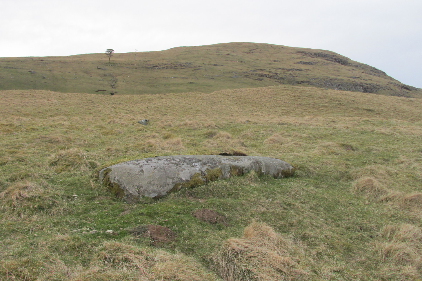
Despite the climb, plus its description as a ‘cup-and-ring’ stone, this petroglyph is somewhat of a disappointment. An elongated stone, half-covered in earth faces south towards Loch Tay and the mountains across, with a series of very eroded cup-marks.
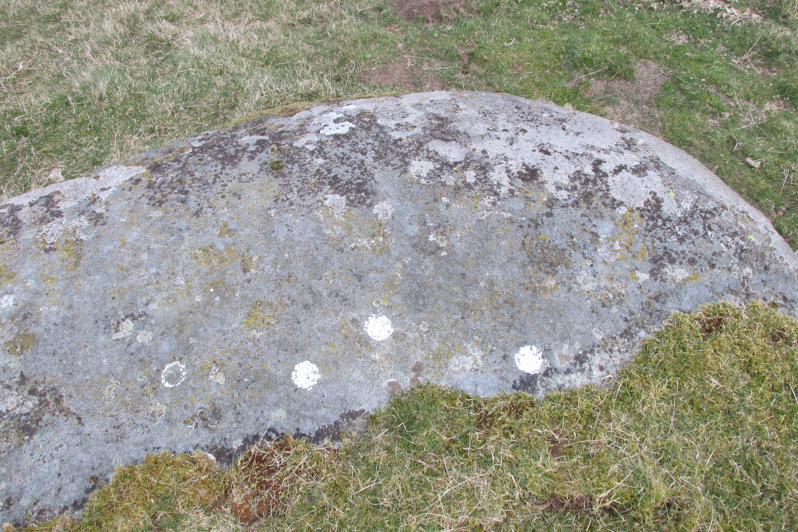
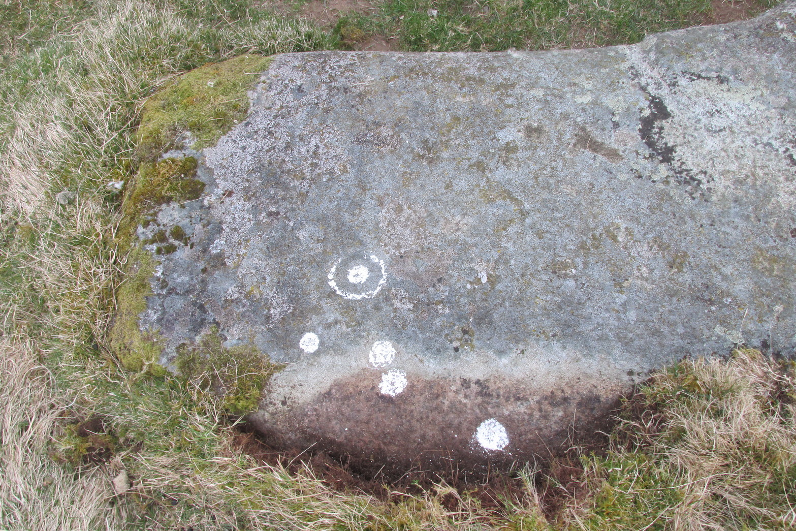
They are separated into two small groups. At the southwest side of the rock we can see three or four faded cup-marks. The middle of the rock seems devoid of anything, but on its more northeastern side we find four more cups in close attendance to a standard cup-and-ring motif. That’s about it! The Balnasuim (1) carving can be found 305 yards (279m) to the southwest.
© Paul Bennett, The Northern Antiquarian