Cup-Marked Stone: OS Grid Reference – ST 1269 9744
Also Known as:
- Gelli-Gaer carving
- Maen Catwg
From Gelligaer, take the northernern road up Heol Adam for 2-300 yards, where you’ll see a footpath on your left taking you into the fields. Walk up the path and as it crosses the wall and bends due east, you’ll see the boulder in the middle of the field. That’s it!
Archaeology & History
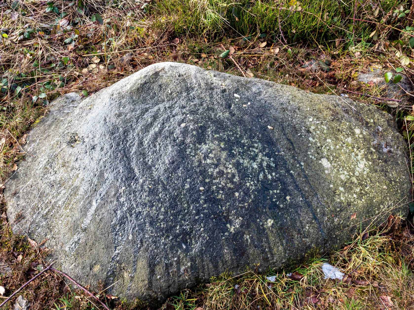
Across the road from Tir-y-Rhen is this singular flat boulder, measuring about 10ft x 6ft, with at least 33 full cup-markings etched on it. Described briefly in Chris Houlder’s (1974) Welsh Archaeological guide, then more recently in John Sharkey’s (2004) Welsh rock-art book where he told there to be perhaps another seventeen cups on its surface, the Royal Commission (1976) lads gave us the surity of definition in their survey of neolithic sites in the region. A kilometre north of Gelligaer, some 260m above sea level, we find this well-preserved carved rock:
“An approximately rectangular block…much weathered at at the corners…2.6m long NE-SW, by 1.7m wide, and about 0.6m thick. The upper surface is covered with a haphazard series of 33 cup-marks varying from 40 to 115mm in diameter, and from 5 to 60mm deep… There are also 17 more cup-marks which are too weathered for precise measurement, but whose presence is certain. Other may have been completely worn away. Two more slabs of stone are just visible under the west corner of the main stone, suggesting the possibility that the cup-marks were made on the capstone of a cromlech, now collapsed.”
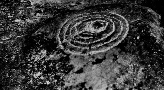
An earlier account by Wheeler (1925) described a number of lines or channels linking some cup-marks to each other, but these are now very difficult to see. I’ll hopefully get some decent images of this carving sometime soon!
References:
- Houlder, Chris, Wales: An Archaeological Guide, Faber: London 1974.
- Royal Commission on the Ancient & Historical Monuments, Wales, An Inventory of the Ancient Monuments in Glamorgan – Volume 1: Pre-Norman, Part 1: The Stone and Bronze Ages, HMSO: Cardiff 1976.
- Sharkey, John, The Meeting of the Tracks, Gwas carreg gwalch: Llanwrst 2004.
- Wheeler, R.E.M., Prehistoric and Roman Wales, Oxford University Press 1925.
© Paul Bennett, The Northern Antiquarian


")


