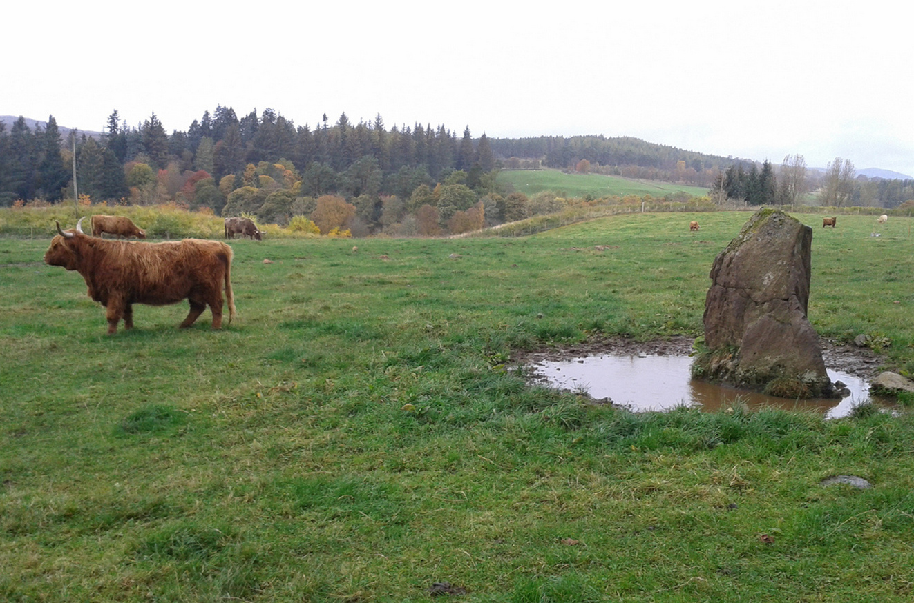
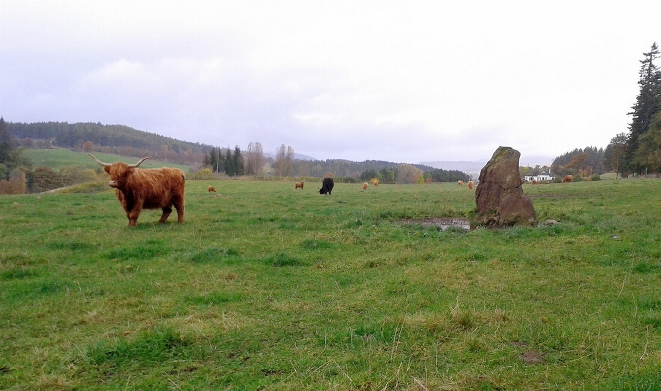
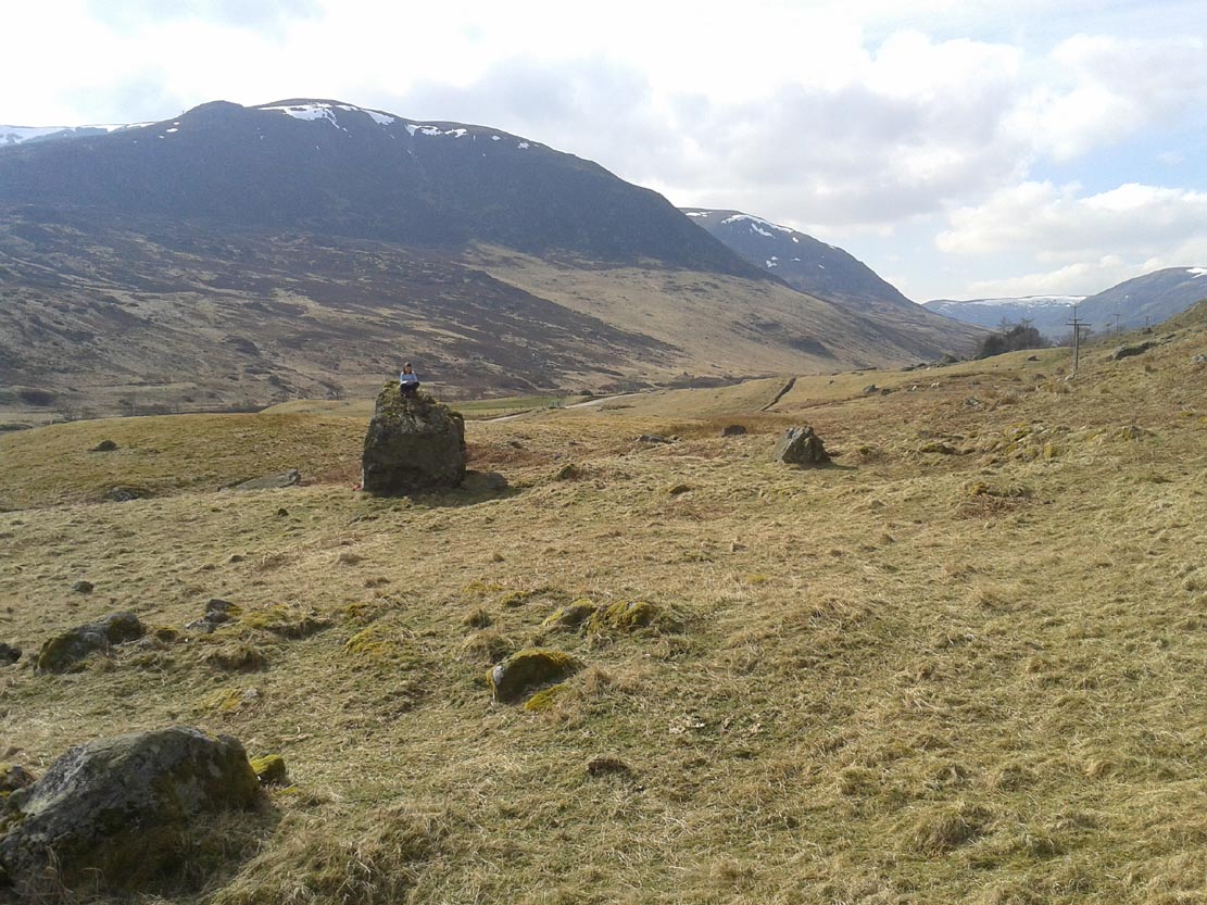
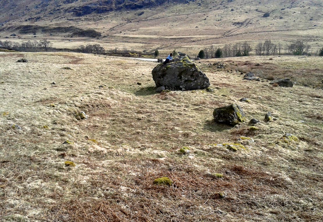
Temple of Anaitis, Lusta, Waternish, Skye

‘Stone Circle’: OS Grid Reference – NG 2725 5273

Also Known as:

  1. Annait
  2. Temple of Annait

Getting Here

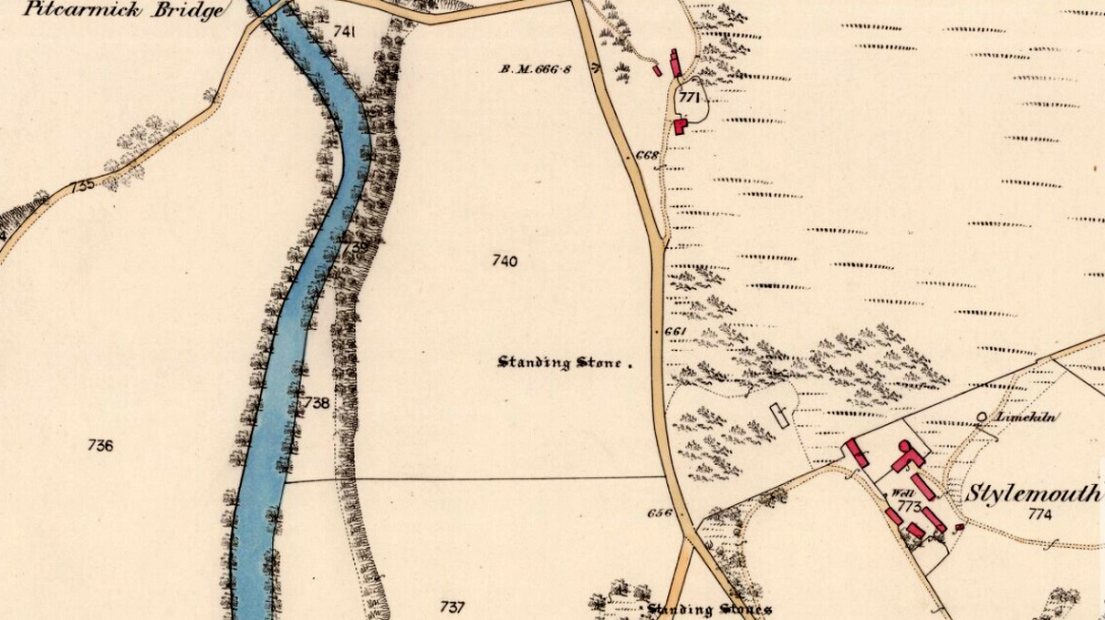
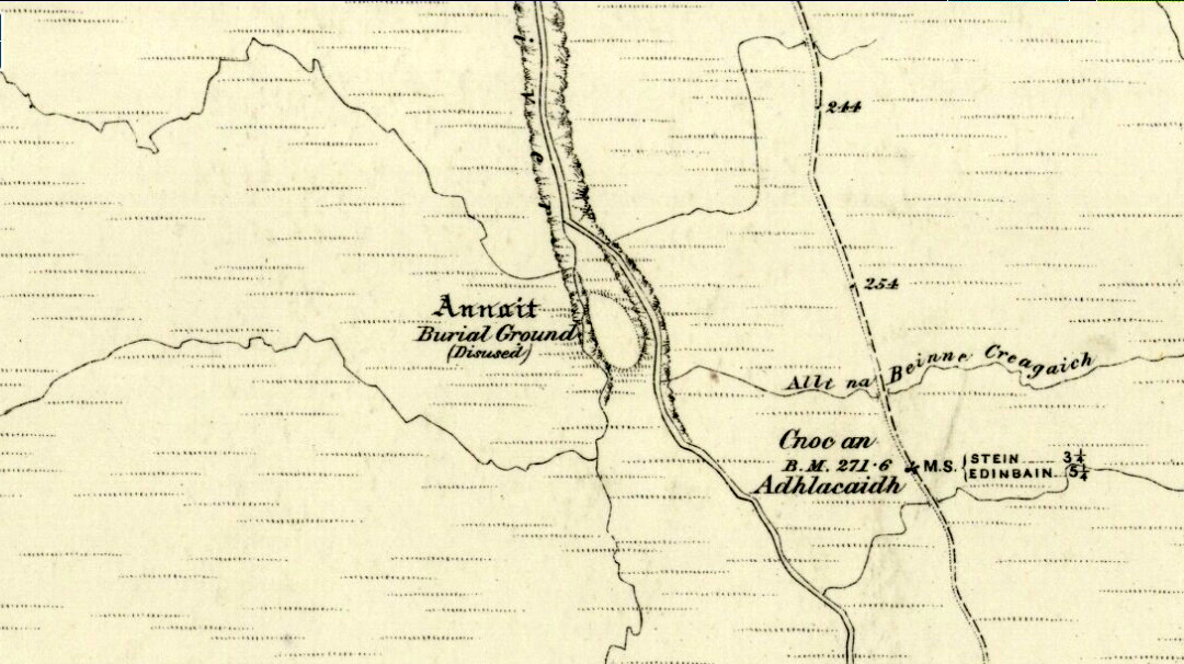
1880 map of Anaitis

1880 map of Anaitis

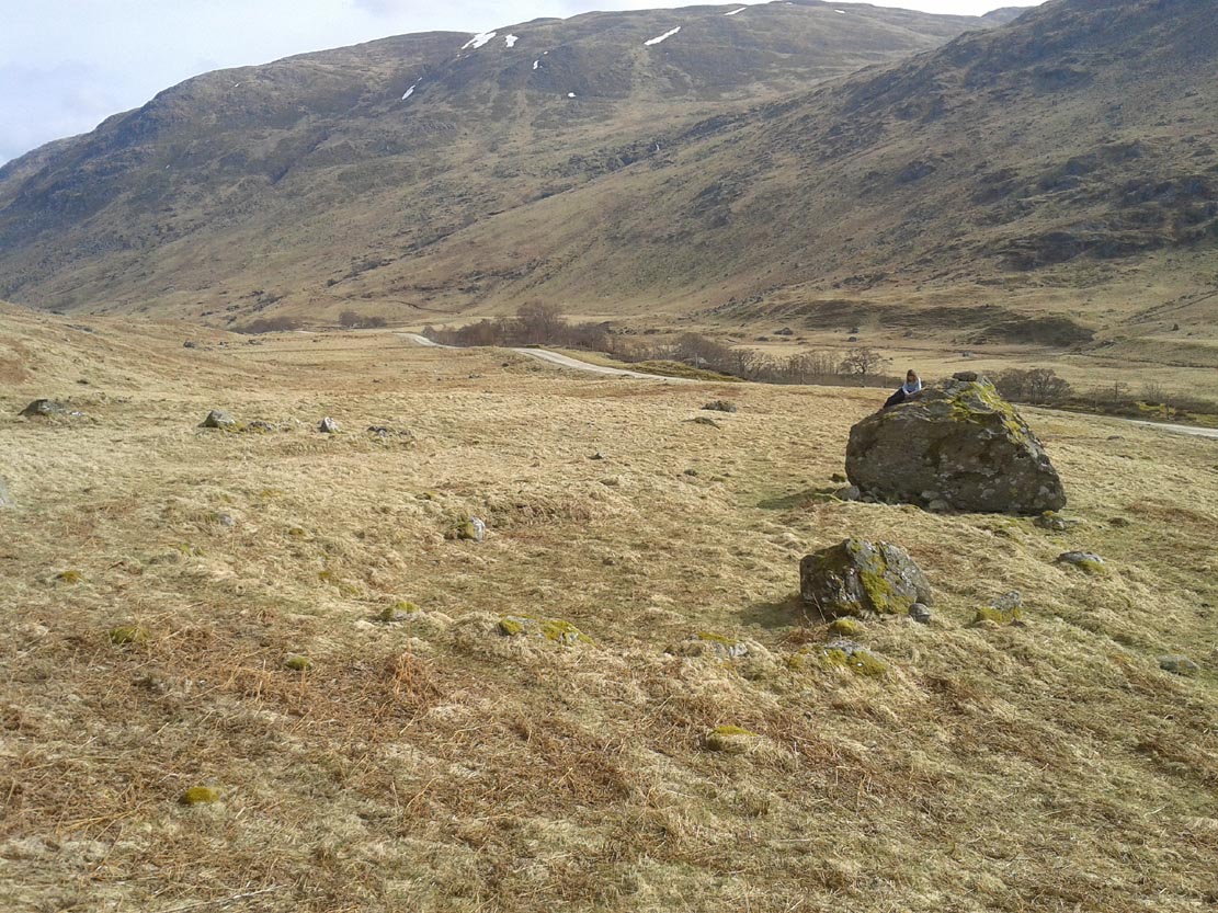
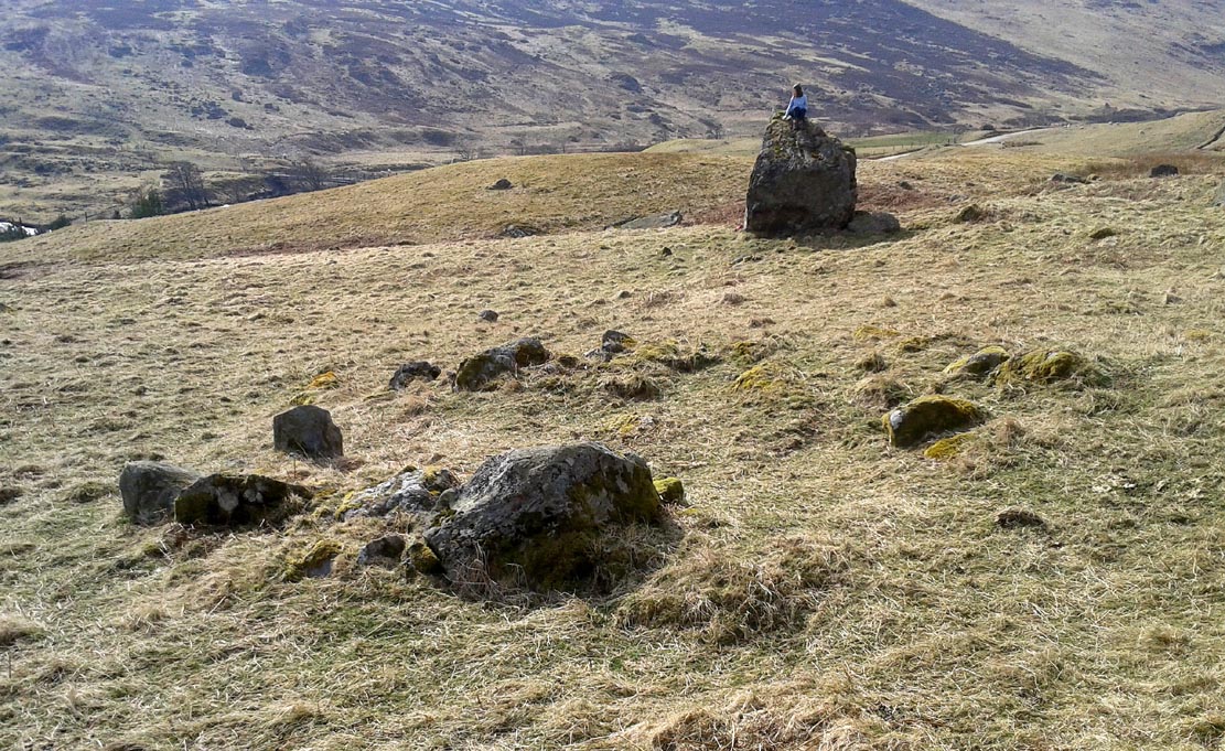
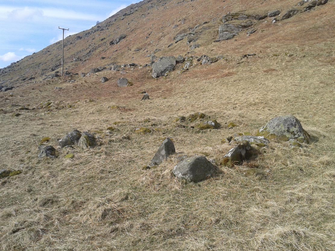
Otta Swire (1961) told how to find this place, thus: “The Waternish road turns off to the north at Fairy Bridge, whence it runs along the valley of the Bay river. On the left of the road, though at some little distance from it, where the river cleaves its way through a gorge to the sea, stands the mound which is now all that remains of the ‘Temple of Anaitis’ (so called).”

Archaeology & History

This is a curious place, full of archaeological potential if the folklore and history records are owt to go by, yet little of any substance remains to substantiate what may have been an important stone circle or other heathen site in earlier times. It seems to have been described first of all in the famous Hebridean journeys of Boswell and Johnson in the late 18th century.  Amidst his insulting description of both the landscape and local people, on Friday 17th September 1773, James Boswell visited the site and told:

“The weather this day was rather better than any that we had since we came to Dunvegan. Mr M’Queen had often mentioned a curious piece of antiquity near this which he called a temple of the goddess Anaitis.  Having often talked of going to see it, he and I set out after breakfast, attended by his servant, a fellow quite like a savage.  I must observe here, that in Skye there seems to be much idleness; for men and boys follow you, as colts follow passengers upon a road. The usual figure of a Sky boy, is a lown with bare legs and feet, a dirty kilt, ragged coat and waistcoat, a bare head, and a stick in his hand, which, I suppose, is partly to help the lazy rogue to walk, partly to serve as a kind of a defensive weapon. We walked what is called two miles, but is probably four, from the castle, till we came to the sacred place. The country around is a black dreary moor on all sides, except to the sea-coast, towards which there is a view through a valley, and the farm of Bay shews some good land. The place itself is green ground, being well drained, by means of a deep glen on each side, in both of which there runs a rivulet with a good quantity of water, forming several cascades, which make a considerable appearance and sound.  The first thing we came to was an earthen mound, or dyke, extending from the one precipice to the other.  A little farther on, was a strong stone-wall, not high, but very thick, extending in the same manner.  On the outside of it were the ruins of two houses, one on each side of the entry or gate to it. The wall is built all along of uncemented stones, but of so large a size as to make a very firm and durable rampart. It has been built all about the consecrated ground, except where the precipice is deep enough to form an enclosure of itself. The sacred spot contains more than two acres. There are within it the ruins of many houses, none of them large, a cairn, and many graves marked by clusters of stones. Mr M’Queen insisted that the ruin of a small building, standing east and west, was actually the temple of the goddess Anaitis, where her statue was kept, and from whence processions were made to wash it in one of the brooks. There is, it must be owned, a hollow road visible for a good way from the entrance; but Mr M’Queen, with the keen eye of an antiquary, traced it much farther than I could perceive it. There is not above a foot and a half in height of the walls now remaining; and the whole extent of the building was never, I imagine, greater than an ordinary Highland house. Mr M’Queen has collected a great deal of learning on the subject of the temple of Anaitis; and I had endeavoured, in my journal, to state such particulars as might give some idea of it, and of the surrounding scenery” —

But in all honesty it seems Mr Johnson was either too lazy to write about the place, or simply didn’t actually get there, in spite of what he alleged!  But later that evening, Boswell dined with the same Mr MacQueen, who told him more of this site.  In the typically pedantic tone of english supremacy (which still prevails in some idiots who visit these lands), he continued by saying:

“Mr Macqueen had laid stress on the name given to the place by the country people, Ainnit; and added, ” I knew not what to make of this piece of antiquity, till I met with the Anaitidis delubrum in Lydia, mentioned by Pausanias and the elder Pliny.”  Dr. Johnson, with his usual acuteness, examined Mr Macqueen as to the meaning of the word Ainnit, in Erse, and it proved to be a water-place, or a place near water, “which,” said Mr. Macqueen, “agrees with all the descriptions of the temples of that goddess, which were situated near rivers, that there might be water to wash the statue.”

There ensued a discussion between Mr MacQueen and Samuel Johnson about the etymology of ‘Anaitis’, with one thinking it was of a goddess, and another that it represented an early christian site.  To this day it is difficult to say what the word means with any certainty.  In W.J. Watson’s (1993) fine work he tells us,

Andoit, now annaid, has been already explained as a patron saint’s church, or a church that contains the relics of the founder.  This is the meaning in Ireland and it is all we have to go upon.  How far it is held with regard to Scotland is hard to say… They are often in places  that are now, and must always have been, rather remote and out of the way.  It is very rarely indeed that an Annat can be associated with any particular saint, nor have I met any traditions connected with them.  But wherever there is an Annat there are traces of an ancient chapel or cemetery, or both; very often, too, the Annat adjoins a fine well or stream…”

The great Skye historian and folklorist Otta Swire (1961) also wrote about this mysterious site, mainly echoing what’s said above, but also adding:

“This name of Annait or Annat is found all over Scotland. It has been interpreted as meaning the ‘Water-place’ from Celtic ‘An’ = water, because many are near water. Others suggest ‘Ann’ = a circle (Celtic) and claim that most Annats are near standing stones. The most-favoured derivation seems to be from Ann, the Irish mother of the Gods, and those who hold this view claim that the Annats are always near a revered spot, where either a mother-church or the cell of a patron saint once stood. Probably Annat does, in fact, come from an older, pre-Celtic tongue, and belongs to an older people whose ancient worship it may well commemorate. The curious shape of the Waternish Temple of Anaitis and its survival make it seem likely that it was something of importance in its day, built with more than usual care and skill. Perhaps the Temple tradition is correct – but whose, if so, and to what gods? One cannot help wondering if cats played any part in its ritual, and if so, if any faint memory remains, for the nickname of the people of this wing was ‘Na Caits’ = The Cats, and not far off, by one of the tributary burns on the right of the roadway, there stands a small cairn, crowned by a long, sharp stone somewhat resembling a huge claw. This is the ‘Cats’ Cairn’.”

The Cats’ Cairn (NG271526) is said to mark the grave of a young boy from the 18th century, who was buried where he died and its story is told elsewhere on TNA.  Another example of the Annait place-name can be found elsewhere on Skye at the megalithic site, Clach na h’annait.

References:

  1. Boswell, James, The Journal of a Tour to the Hebrides with Samuel Johnson, National Illustrated Library: London 1899.
  2. Swire, Otta F., Skye: The Island and its Legends, Blackie: Glasgow 1961.
  3. Watson, W.J., The History of the Celtic Place-Names of Scotland, Birlinn: Edinburgh 1993.

© Paul BennettThe Northern Antiquarian


Dunvarich, Tongue, Sutherland

Souterrain (lost):  OS Grid Reference – NC 59 57

Also Known as:

  1. Canmore ID 5341

Archaeology & History

Site of the lost souterrain

There are a number of souterrains—or “earth houses” as they used to be known—in Sutherland that have been lost.  Many have simply fallen prey to being filled-in or covered over.  This is one such site, found in the fields between Tongue village heading out towards the sea-bridge crossing the Kyle.  In a brief excursion I made to the area a few days ago, I couldn’t locate the site and no one I spoke to seemed to know anything about it.  I’m assuming that the site has simply been blocked-up and overgrown, hiding beneath the green pastures above the sea-line.

Its exact whereabouts is difficult to ascertain, for when it was described in Mr Horsburgh’s (1870) excursion to the area, the location he gave for it was somewhat vague, telling:

“Between Tongue House and Kirkiboll, in a field on the right of the road, there is an Eirde house, which I opened for examination (it had often been opened before); it is now about 25 feet long, 2½ feet broad at the entrance, and widens to 4 feet at the far end, where it terminates in a circle; the sides are built with small stones without mortar, and the top covered with large flat slabs.”

This places the location of the souterrain anywhere in the fields between grid-references NC 5904 5815 to the north (near Tongue House) and NC 5901 5678 to the south.  If anyone knows anything about this site, please let us know.

References:

  1. Horsburgh, James, Notes of Cromlechs, Duns, Hut-circles, Chambered Cairns and other Remains, in the County of Sutherland“, in Proceedings Society of Antiquaries, Scotland, volume 7, 1870

© Paul BennettThe Northern Antiquarian

Fiscary (2), Farr, Sutherland

Chambered Cairn:  OS Grid Reference – NC 73112 62604

Also Known as:

  1. Canmore ID 6445
  2. Carn Chaoile

Getting Here

A mile east of Bettyhill along the A836 road, watch out for the large piles of rocks up on the hill on your left (north).  Go through the gate, past the Fiscary 3 cairn and 150 yards northwest you’ll reach the crowning cairn on the hilltop itself – the Fiscary 2 cairn.

Archaeology & History

Fiscary 2 cairn, looking NW

The second of the three giant chambered cairns on this moorland hillside is the largest (only just!) of them all.  Positioned right on top of the small hill, this great mass of rocks stands out from the roadside a quarter-mile to the south quite blatantly, yet it somehow evaded the eyes of the early Ordnance Survey lads in their visit here in 1873 (though the nearby Fiscary 3 cairn was plotted).  Odd…

Aish by the side o’ the cairn

When I came here with Aisha and her clan a few weeks ago Nature was blasting us with full gales and so half her bunch returned after a short while, leaving us to get thrown about in the winds!  Even just trying to stand upright on this and its associated tomb proved difficult.  But despite this and the low grey clouds—typical of northern Scottish weather—it was obvious that the views from here would be superb, seeing far into the distance with a 360º view.  I have little doubt that other important prehistoric sites would be speaking with this giant neolithic cairn, but there is nothing in the archaeology accounts to help us on such matters.

The giant tomb is almost linked to its companion—Fiscary 1—by a low scatter of rocks running between them, with only a yard or two separating their disturbed masses.  Several archaeology students have posited that the two seemingly separate sites were, many thousands of years ago, perhaps one elongated chambered tomb, just like the ones found nearby at the Coille na borgie and Long Skelpick cairns; but it seems unlikely in this case…

Fiscary (2) on 1908 map
Fiscary (2), looking SE

Although Adam Gunn (1893) mentioned the “four large cairns” at Fiscally (the fourth and smallest is 262 yards to the west), the first real description I can find of the place comes from an article by a local man called Cathel Kerr (1892) who told us it was “about 220 feet in circumference, and 15 or 16 in height”; but most of his article dealt with his excavation into the adjacent Fiscary 1 tomb, which he noticed was connected by a stone platform that ran between the two sites.  This was the first mention of such a connecting platform—and a curious feature it is indeed.  When the Royal Commission lads came here in May 1909 they also noted this connecting platform.  They found that the cairn itself,

“does not appear to have been excavated.  It is circular with a diameter of about 52ft and is some 10ft high to the top of the modern pile of stones on its apex.  It presents a peculiar feature.  At the north end is clearly visible a broad platform of stones extending to a distance of 25ft from the base of the cairn and, though largely overgrown with turf, traceable by the outline of stones almost entirely around it.  This platform has been described as a neck connecting the two cairns (Fiscary 1 and 2, PB), but in reality it stops 7ft distant from the adjacent cairn.”

In strong gales at Fiscary 2
Henshall’s plan of Fiscary 1 & 2

Indeed, this “platform” seems to have been either deliberately constructed with the hilltop cairn positioned on top of it, or has been set around the tomb.  It’s difficult to say with any certainty without further excavation.

The great Audrey Henshall (1963; 1995) wrote extensively about this ancient monument in her works, finalizing her site entry in The Chambered Cairns of Sutherland (1995).  After describing in some detail the obvious archaeological association this site has with Fiscary 1, she gave us a detailed description on this one and wrote:

“The larger south cairn (Fiscary 2, PB) is bare, steep-sided, and has been little disturbed.  The diameters are between 19.5 to 21.5m, and the height is 5.5m measured from the NW.  The edge is clear for about half of the circuit.  The surrounding platform is quite low and is partly covered with peat and deep heather which in places obscure the edge.  The platform varies in width from 4.8 to 7.3m.  On the SE side the cairn edge is clear and there is no sign of the platform.  It appears on the NE side where it is largely free of heather, and the cairn material merges into its stones.  This part of the platform is edged by a rough kerb which fades away westwards into the spread of stones which links the two cairns.  In the area between the cairns the stones are mainly covered by peat on which grow turf and heather.  The spread of stones appears to be thin, but on the NW side of the cairn, where there is evidently a drop in ground level, breaks in the peat cover show that here the stone spread has considerable depth.  Round the W side the platform is heather-covered, and along the SW part, where the hill drops away steeply, there is a rough kerb at a lower level than elsewhere, within which the surface of the platform rises to the base of the cairn.  The S end of the platform, which here is bare stones, seems to turn sharply towards the S edge of the cairn, though the actual edge of the platform is indefinite.”

The likelihood is that this cairn is the oldest of the cluster of three found here, most likely constructed in the neolithic period.  Its position in the landscape would indicate that the site would have been built to commemorate the spirit of a local tribal elder, a King or Queen.  It’s a superb site and I’ll be visiting it again very soon indeed!

Folklore


Bouncy elven sprite flies by

The folklorist Otta Swire (1963) told that this region was once peopled by giants who created the landscape itself around here (a common attribute of giants the world over), and they also played a part in the creation of this and other giant tombs in the area.  The one time local school-teacher at Bettyhill, Alan Temperley (1977), also told us that the fairy folk lived close to the giant tombs of Fiscary.

References:

  1. Gourley, Robert, Sutherland: An Archaeological Guide, Birlinn: Edinburgh 1996.
  2. Gunn, Adam & Mackay, John, Sutherland and the Reay Country, John Mackay: Glasgow 1893.
  3. Henshall, Audrey S., The Chambered Tombs of Scotland – volume 1, Edinburgh University Press 1963.
  4. Henshall, Audrey S., “The Distant Past,” in The Sutherland Book (edited by Donald Omand), Northern Times: Golspie 1991.
  5. Henshall, Audrey S., The Chambered Cairns of Sutherland, Edinburgh University Press 1995.
  6. Kerr, Cathel, “Notice of the Excavation of a Chambered Cairn in the Parish of Farr, Sutherlandshire,” in Proceedings Society of Antiquaries, Scotland, volume 26, 1892
  7. Lelong, Olivia C., “Writing People into the Landscape: Approaches to the Archaeology of Badenoch and Strathnaver,” University of Glasgow 2002.
  8. o’ Reilly, Kevin & Crockford, Ashley, What to See Around Bettyhill, privately printed 2009.
  9. Sutherland, George, Folk-lore Gleanings and Character Sketches from the Far North, John o’ Groats Journal: Wick 1937.
  10. Temperley, Alan, Tales of the North Coast, Research Publishing Company: London 1977.

Acknowledgments:  To the beautiful Aisha Domleo, for her images, bounce, spirit and madness – as well as getting me up to see this cluster of sites. And a Huge thanks for use of the Ordnance Survey map in this site profile, reproduced with the kind permission of theNational Library of Scotland

© Paul BennettThe Northern Antiquarian

Deanside, Tongue, Sutherland

Souterrain (destroyed):  OS Grid Reference – NC 591 556

Also Known as:

  1. Canmore ID 5343
  2. Dionaite

Archaeology & History

Location of Deanside souterrain

Nothing now remains of the prehistoric underground chamber, “eirde House” (as they were called) or souterrain, that was reported by the northern antiquarian James Horsburgh when he was exploring the sites here in the 1860s.  Found near Deanside a couple of miles south of Tongue, alongside the edge of the Allt an Dionaite (Deanside Burn), even in his day there wasn’t much of it left.  It was one of a number of souterrains in the region that he was shown, presumably by local people, telling us briefly that,

“Near Deanside, there were remains of the end of another (souterrain) on the bank of the burn, but it has since been washed away in a flood.”

In an exploration up the side of the burn today, I could find no remains whatsoever; although I didn’t walk too far up and have a feeling that its position would have been further up than where I got to.  In a brief chat with some of the old people living in the neighbourhood, they told me they had no memory of the site.

References:

  1. Horsburgh, James, Notes of Cromlechs, Duns, Hut-circles, Chambered Cairns and other Remains, in the County of Sutherland“, in Proceedings Society of Antiquaries, Scotland, volume 7, 1870

© Paul BennettThe Northern Antiquarian

West Strathan, Melness, Sutherland

Cup-and-Ring Stone: OS Grid Reference – NC 56428 64071

Getting Here

West Strathan Petroglyph

Along the A836 road between Durness and Tongue, take the minor road north to Melness. Keeping to the right all the way along, drive almost to the very end, shortly before which is a double right-hand bend uphill. Park here and walk back along the road, north, past the cottage of Dun Bhuidhe for about 100 yards until you see the large sloping rock face with the telegraph post sticking out of it. That’s the place!

Archaeology & History

Not previously recorded, this cup-and-ring stone is right by the roadside up the far, lonely but beautiful glen west of Melness, which runs to a dead-end and into the heart of the silent moors high up in Sutherland’s remote landscape — and it’s a damn good one!  It’s also the most northern example known of a Neolithic or Bronze Age petroglyph on the British mainland.   The carving has been etched onto a large easterly sloping rock, fractured into several sections, with the decayed broch of Dun Bhuidhe rising to its immediate southwest. The setting alone is outstanding!

Sketch of the carving
3 cups on the lower-east side

It was rediscovered on 25 August, 2015, after Prof Hornby and I had analysed the chambered tomb south of Dalvaid about half-a-mile away. In walking back to explore the aforementioned broch, I cut across the bottom of a nearby rock and found three distinct cup-markings etched near the bottom of its sloping face. Calling out to Prof Hornby, he retreated in his direction to the broch and came back to look at the top of this very large rock surface.

“There are some more cups on this section of the stone!” he called – and began to count them. “At least ten in this little section,” he said. There were indeed!

Carving, looking west

Carving, looking west

Carving, looking south

Carving, looking south

By the time we’d finished counting, drawing and assessing the design etched onto the rock surface, amongst at least two cup-and-ring elements we found at least 67 cup-markings, mainly carved onto the northwest portion of the stone. The first three that I’d seen were on the much lower eastern part and were etched in deliberate isolation from the primary design.  However, of these three isolated cups, it looks as if one of them may have a spiral element curving out of it. This needs assessing in much better lighting conditions, because when we found it the skies were very grey and overcast, making an accurate survey very difficult (cup-marks on rocks can be hard to see unless daylight conditions are just right) – and, after a short while, the legendary Scottish midges appeared and began to feast on us, which stopped us in our work. The little buggers!

On a subsequent visit here with Sarah MacLean of Borgie in the summer of 2018, she found several more cup-marks beneath the lower arc shown in the above drawing (which I need to update, obviously).

Central features of the carving

Central features of the carving

Scatter of central cups

Scatter of central cups

The most notable feature to this carving is the arrangement of the great majority of the cup markings. They were quite deliberately carved along the very top of the stone, close to its edge, in two contiguous lines of nine with a small gap separating them. At the northwestern end of this, a very notable feature occurs: a natural crack in the rock runs down the stone and, almost all the way down, we find a line of cups have been pecked onto the stone along the natural crack, with some of them near the top that are unfinished. These cup-marks are more elongated in form than the usual circular status; but this is due to them being etched into the cleft itself. From top to bottom there are 13 such cups. At the bottom of this line, another linear stretch of cups change direction and move back onto the main rock surface, just above another large long natural crack cutting across the rock.  This gentle arc of cups (with two other possible cups beneath these) ends at a cup-and-ring, above which are two extra cups next to each other. Above these are a number of other cups of roughly similar size and depth, with a notably large one that gives the impression that the smaller cups around its edges are satellites to its larger parent body.

Line of cups on western edge

Line of cups on western edge

Row of cups etched into natural crack

Row of cups etched into natural crack

Without any doubt there are other faint features that have been carved onto the stone, but due to the poor visibility factor at the time of its discovery we could not see anything other than the elements highlighted in the rough sketch.  In looking through the many photos we took of this carving, there seem to be other faint lines, rings and cups within the overall design, but until we revisit the site (or someone else does!) such further features cannot be added to the drawing.

As the images of this petroglyph clearly shows, the primary feature defining it is the extensive line of continuous cup-markings running along the edges and enclosing a smaller number of internal cups. It’s an unusual element. Sequential line features such as these, defined by cups, are not common. My impression of this feature is that it was a pictorial representation of the horizons, inside which is played the story of….. something… But horizons they seem. Of course, this is a simplistic interpretation and is open to criticisms of any form. I care not!  Much more importantly as far as I’m concerned is the fact that we’ve uncovered yet another unrecorded carving – and according to the official records, no such carvings exist here; but where one such carving exists, others are close by!

Watch this space…..

Acknowledgements: Considerable thanks must be given to Prof Paul Hornby, for use of his photos and without whose help this carving might never have been located. Cheers dood!

© Paul BennettThe Northern Antiquarian


Croc-tigh-goil, Ribigill, Tongue, Sutherland

Standing Stones (destroyed):  OS Grid Reference –  NC 582 541

Also Known as:

  1. Canmore ID 5349

Archaeology & History

Large stones in field to the north

When I visited this place last year, I had a good look all around for any trace of what James Horsburgh (1870) told us about 150 years earlier, i.e., monoliths that had been broken up and used in the making of the road.  Sadly I found nothing.  When I enquired about the stones amongst local people, they were unaware of any such site and it had fallen out of oral tradition amongst them.  Mr Horsburgh told us simply:

“Near Ribegal there used to be three upright stones, called by the old people a Teampul.  They were broken up by Mr Mitchell, the late farmer, and are now built into the dyke at the road side; the hillock on which they stood is still called Croc-tigh-goil, the ‘hillock of the school-house’.”

However, in the fields 300 yards to the north, three large stones are visible—almost in a straight line—but they seem to be Nature’s handiwork; although the southernmost stone looks like it might once have stood upright.  But I think I’m being more hopeful than realistic!

References:

  1. Horsburgh, James, Notes of Cromlechs, Duns, Hut-circles, Chambered Cairns and other Remains, in the County of Sutherland“, in Proceedings Society of Antiquaries, Scotland, volume 7, 1870.

© Paul BennettThe Northern Antiquarian


Skelpick Long, Strath Naver, Sutherland

Chambered Cairn: OS Grid Reference – NC 72245 56745

Also Known as:

  1. Canmore ID 6276
  2. Long Skelpick
  3. Skelpick Burn

Getting Here

The huge cairn, looking east

The huge cairn, looking east

From the delightful village of Bettyhill, take the A836 road west. A mile out, just as the tiny road bridge crosses the sea-river, take the tiny road on your left. Go past the roadside lochan until you reach the first Skelpick house several miles down. Walk across the fields on your left (east) until you reach the wobbly wooden tidgy-widgy-bridgey that crosses the Skelpick Burn. Across on the other side – you can’t miss it!

Archaeology & History

The overgrown northern face

The overgrown northern face

As you wander down the poetic geoscapes of Strathnaver, meandering back and forth along the tributaries and Her tiny primal forest remains, on the edges of Her marshes, rivulets and rocky moorlands, tomb after tomb raise themselves to the eyes and feet of the wanderer.  They’re everywhere it seems!  But this one, above all others, hits the eyesight with an unexpected magnitude.  This is a giant–one helluva giant!–and typical of the structure and status of many of the immense prehistoric chambered tombs in this remote northern region of our entrancing heathen isles.

Rising out of the moorland heather to a height of sixteen feet in parts, tens of thousands of rocks make up this elongated artificial ridge, running like a spine NNW-SSE down the direction of the glen, pointing to the lowest dip in the distant southern horizon several miles away.  And although overgrown when we visited the site, at each extremity the elongated cairn has curious stretches of stones projecting out of its sides, like a pair of horns at each end.  Weird!

The long cairn, heading south

The long cairn, heading south

The giant cairn, heading north

The giant cairn, heading north

Once you get on top of the cairn, its northern end is the most impressive section. Wider than the rest of the monument, this is where, some ten feet below the top of the rock-pile, a large internal opening was covered over, hiding an impressive chamber (two birch trees mark the spot).  This is in incredibly good condition when you remember that you are looking at something that was built in the neolithic period some 6000 years ago!

Spider guards chamber of bones

Spider guards chamber of bones

Little Lara at the entrance

Little Lara at the entrance

On my first visit, I sat inside the shelter of the chamber for around an hour, either inside the main ‘tomb’ section, or beneath a huge intact covering stone 12 feet outside the entrance (hiding from both rain and midges) that stretches from one side of the cairn to the other; noting, on its underside, two cup-marks: one is definitely crustacean in nature, whilst the other may be man-made (though we cannot discount it too having a crustacean origin). But we can safely say that this long stone was dragged some considerable distance from the coast to its present position and positioned into this giant cairn.  This covering stone rests precariously on a collection of many small well-placed rocks, themselves held up on two rigid solid standing stones, deeply embedded god-knows-how-deep in the solid Earth. They stand about 3 feet high in their present position above the ground.

Central stone in chamber

Central stone in chamber

Gordon gives idea of its size

Gordon gives idea of its size

The well-preserved ‘tomb’ section at the northern end of the cairn was opened sometime in the middle of the 19th century by James Horsburgh (1870)—although its description as a ‘tomb’ could be questionable here, as no funerary remains have ever been found inside it.  Horsburgh described the site as a,

“long cairn, 80 or 90 yards in length, which I opened and came upon a polygonal-shaped chamber, 11 feet in diameter, the sides consisting of large stones 6 feet high, one of them 7 feet by 4 and 1½ feet thick, placed at a distance from each other of 3 or 4 feet, the intervals being built up with long square stones.  The roof had been formed with very large flags overlaying each other.  The chamber had been opened from the top and the whole inside was filled with stones and rubbish, so that I only cleared it out.  Before I commenced operations, however, there was no appearance of it having been meddled with, and I dug it by chance where the cairn appeared to be highest.  Nothing whatever was found in it.”

This lack of funerary remains may simply be due to the collapse of stones destroying any evidences at the time Horsburgh dug into the cairn—or it may have had other functions instead.  Shortly after Horburgh’s analysis, John Stuart (1870) came to visit the site in his grand tour of the megaliths of the region, telling that,

“on the waterside is a long cairn with a chamber at its north end, of about 12 feet across, formed of six slabs, with the space between them carefully filled up with masonry.  Some of the slabs are of great size.  A passage leading to another chamber is blocked up.  The walls of the chamber begin to converge at a height of 6 feet, and were probably covered by flags.”

Stuart's 1874 ground plan

Stuart’s 1874 ground plan

Skelpick Long on 1878 map

Long Skelpick on 1878 map

Highlighted on the first Ordnance Survey map in 1878, it was Mr Stuart (1874) who gave us our earliest ground-plan of Long Skelpick, as illustrated here.  But since then the site has been described by a number of antiquarians and archaeologists.  However, the most detailed account is given in the legendary Audrey Henshall’s (1995) updated site profile.  I make no apologies for reproducing her lengthy account of this cairn almost in its entirety, as it is an astonishing megalithic monument.  She wrote:

“…The cairn is 72m long overall, including the horns which define a forecourt at each end… The cairn is about 20m wide across the chamber, narrowing to 14m wide at a little south of centre, and expanding slightly to about 16m wide at the south end.  At the north end the forecourt is difficult to define, though the ends of the horn are clear.  Between them there is loose rubble which rises steeply to merge with the cairn material covering the passage, and which northwards merges into the downward slope of the ground.  The passage entrance is hidden beneath this stony material; presumably there is deliberate blocking immediately in front of the entrance…but this has been covered by cairn material removed from the chamber area when it was investigated. The forecourt is about 13.5m wide by about 7m deep.  The chamber is exposed in a deep hollow in the cairn, but south of it the cairn remains to a height of 3.4m (measured from the chamber floor), and from here to near the south end it continues as a ridge of bare irregular stones.  Except for a few superficial hollows, it appears to be undisturbed, neither robbed nor substantially distorted, and it retains the steep pitch of its long sides.  The cairn gradually diminishes in height southwards to about 2.8m high at about 12m north of the south forecourt.  At this point there is a transverse hollow across the cairn 2.7m wide and about 0.7m deep, which may be an original feature (though in this area a relatively recent deep hollow has been made into the cairn from the east side reaching almost to the median line).  The cairn has clearly been robbed from the south end to within 1.7m of the transverse hollow, presumably to build the square enclosure just to the south.  The southeast horn is clear and the southwest horn can just be traced though it has probably been truncated.  Between them, the edge of the forecourt is rather vague except for two laid slabs near the centre which appears to be part of an edging wall-face.  The south forecourt has been about 10m wide and probably about 3.5m deep.  The west edge of the cairn is clear though overgrown with heather, except for 20m at the north end where it is overlaid with bare stones evidently thrown down when the chamber was opened, and north of this the cairn merges into the natural slope.  All along the east side the cairn merges with the slope of the ridge and has deep heather growing almost to the crest, so that the cairn edge is difficult to trace.

“The axis of the passage and chamber is nearly NNW to SSE, skew by about 13° by the axis of the cairn.  The entrance can only be seen from the roofed passage.  A pair of transverse stones set 0.56m apart forms the portal at the outer end of the passage. They are over 0.7m and 0.4m long, 0.25m and 0.18m thick, and 0.7m and 0.65m high.  The original blocking, a neat stack of six horizontal slabs reaching to within 0.2m of the roof, is in place between them, with the south edges of the stones flush with the south faces of the portal stones.  To the north of the slabs there can just be seen loose stones, smaller than those of the cairn material.

“The passage os 1.8m long and 1.15m wide at the outer end increasing to 1.3m wide at the inner end.  A slab forms most of each wall.  The slabs are 1.36m and 1.31m long by 0.5m and 0.45m high with two or three courses of walling above them, though this is displaced inwards and in a precarious state.  Walling fills the short gaps at the ends of the stones, though missing from the NE corner.  At the inner end of the passage a pair of portal stones forms the entry into the ante-chamber.  They are 0.94m and 0.78m long by 0.26m and 0.44m thick, and 0.86m and 0.77m high, set 0.8m apart.  At the outer end of the passage a lintel rests on the east portal stone and passes a little above the west portal stone, and the north edge of the lintel projects a little north of their outer faces.  The lintel is 0.8m wide by 0.3m thick, 0.7m above the floor, tilted slightly down to the south.  The next tow lintels rise in inverted steps, each overlapping the upper surface of that to the north with the third lintel 1m above floor level.  The fourth lintel is missing and a gap of 0.5m is spanned by rubble; it is likely that a substantial stone at the top of each side wall is an end portion of this lintel, the centre part of which has broken away.  The innermost lintel is lower, 0.86m above the floor, resting directly on the east portal stone and on a corbel stone over the shorter west portal stone at the chamber entrance.  The lintel is over 2m long, 0.65m wide and 0.75m thick in the centre, and the face to the chamber is triangular.

“The chamber walls are constructed of spaced orthostats linked by panels of walling.  All the orthostats are intact.  The walling is of quite large quarried rectangular slabs, in general 0.07m to 0.02m thick, and where well-preserved can be seen to have been carefully built.  At a height of about 0.7m the walling changes to courses of large corbel stones, often 0.23m to 0.4m thick, up to 0.9m wide, and 1m or so long.  They are laid with their long axes running back into the cairn and their inner ends generally slightly oversailing; their appearance is rougher and heavier than the walling below.  There is a considerable amount of displaced stone on the chamber floor, but all vertical measurements are taken from approximately floor level.

“The ante-chamber is about 2.5m long by 2.5m wide at the south end.  The east wall consists of an orthostat 1.3m long by 0.36m thick, and 1.1m high, with a horizontal upper surface.  The spaces between it and the outer and inner east portal stones of the chamber are filled with walling about 1.15m high, and above this and the orthostat are two courses of corbel stones giving a total height of 1.7m with a considerable overhang, at the southeast corner as much as 0.5m though possibly there has been some displacement.  Only a short length at the south end of the west wall is visible.  An orthostat set close to the west outer portal stone was visible in the 19th century…but this is hidden by rubble.

“The entrance between the ante-chamber and main chamber has been spacious, 1.06m wide and probably about 1.4m high.  The portal stones are 0.85m and over 1.06m long, 0.42m and 0.25m to 0.4m wide, and 1.1m and 0.9m high, and their upper edges slope down into the cairn.  The lintel above them is somewhat displaced with its wider face tilted down from south to north.  Its east end rests on a corbel stone supported by displaced walling to the southeast of the portal stone, and its west end rests on displaced walling on the shoulder of the west portal stone and on the panel of walling to the southwest.  The lintel is about 3m long by 1m wide and 0.35m thick.

“The main chamber is 3.5m long by about 3.25m wide.  There are five orthostats in the wall.  That on the axis has a horizontal upper surface and the others are rounded and rather irregular in shape.  From the northeast, clockwise, they are 0.7m, 0.77m and 0.84m (at maximum 1.14m), over 1.3m and 0.86m long and, as far as can be seen, they vary from 0.1m to 0.4m thick.  They are all of similar height, between 1 and 1.22m; the tallest is the northwest orthostat.  Most of the linking walling remains.  Between the east portal stone and the east orthostat only the upper courses are visible; between the east and southeast orthostats there are six neat courses of walling and above them three courses of corbel stones oversailing by 0.3m at a height of 1.7m (though the lowest courses of walling at the north end have been pulled away and the upper part of the wall is in danger of collapse).  The walling between the southeast and the south orthostats has fallen away, but was intact in 1955… Between the south and southwest orthostats walling remains almost level with their tops and butts against the face of the latter, the south end of which is hidden.  The last two panels of walling on the west side of the chamber survive to half the height of the adjacent orthostats.

“Part of the chamber was evidently visible in 1800 (Cardonnel …) and subsequently it must have been filled in.  Horsburgh investigated the main chamber in 1866… His descriptions and measurements are fairly accurate except that he gave the height of the orthostats as 6ft and one as 7ft (1.8m and 2.1m); this seems to be an exaggeration as the present floor level, also extending down the passage, appears to be at approximately at the original level.  He estimated that the roof height of the main chamber had been 10ft (3m)…

Old lichen upon the cairn-stones

Old lichen upon the cairn-stones

Of mosses and lichens hereon...

Of mosses and lichens hereon…

Much of the length of the cairn is very overgrown in a living repertoire of medicinal mosses and lichens which, of themselves, are centuries old in places.  Their profusion is a great indicator, not only of the cleanliness of the air betrayed in the cities of homo-profanus, but also a telling sign that visitors to this distant realm are few and far between.  Tis a beautiful site in a spectacular ancient arena…

…to be continued…

Folklore

There is great superstition amongst some locals even today that this immense cairn should not be tampered with and it is said to be haunted.

References:

  1. Gourley, Robert, Sutherland: An Archaeological Guide, Birlinn: Edinburgh 1996.
  2. Henshall, Audrey S., The Chambered Tombs of Scotland – volume 1, Edinburgh University Press 1963.
  3. Henshall, Audrey S., “The Distant Past,” in The Sutherland Book (edited by Donald Omand), Northern Times: Golspie 1991.
  4. Henshall, Audrey S., The Chambered Cairns of Sutherland, Edinburgh University Press 1995.
  5. Horsburgh, James, Notes of Cromlechs, Duns, Hut-circles, Chambered Cairns and other Remains, in the County of Sutherland“, in Proceedings Society of Antiquaries, Scotland, volume 7, 1870
  6. Lelong, Olivia C., “Writing People into the Landscape: Approaches to the Archaeology of Badenoch and Strathnaver,” University of Glasgow 2002.
  7. Mackie, Euan W., Scotland: An Archaeological Guide, Faber: London 1975.
  8. o’ Reilly, Kevin & Crockford, Ashley, What to See Around Bettyhill, privately printed 2009.
  9. Royal Commission on Ancient & Historical Monuments, Scotland, Second report and inventory of monuments and constructions in the county of Sutherland. HMSO: Edinburgh 1911.
  10. Stuart, John, “Report to the Committee of the Society of Antiquaries of Scotland, Appointed to Arrange for the Application of a Fund Left by the Late Mr A. Henry Rhind, for Excavating Early Remains,” in Proceedings Society of Antiquaries, Scotland, volume 7, 1870
  11. Stuart, John, “Notice of Excavations in Cairns in Strathnaver, Sutherlandshire,” in Proceedings Society of Antiquaries, Scotland, volume 10, 1874.

Acknowledgements:  Huge thanks to the beautiful Aisha Domleo for not only getting me up here, but also for the use of photos in this site profile.

© Paul BennettThe Northern Antiquarian

Allt a’ Chaisteil, Bettyhill, Farr, Sutherland

Stone Circle:  OS Grid Reference – NC 7251 5756 

Getting Here

Allt a' Chaisteil 4-poster, Bettyhill

Allt a’ Chaisteil 4-poster remains

From Bettyhill village, take the A836 road west, down the hill from the village. Just before crossing the metal bridge over the River Naver at the bottom, go down the tiny road on the left. A mile or so along, go past the small loch by the roadside for another few hundred yards until you reach a quarry on the right. From here, cross the road and walk along the track towards the impressive Allt a’ Chaisteal Broch up the gorge.  About 100 yards above this, on the south-side of the fence, keep your eyes peeled for two small standing stones. You’ll find ‘em!

Archaeology & History

There seems to be no previous mention of this site in any of the archaeology records.  We were fortunate in venturing upon the place when Aisha, Lara and I were doing a typically circuitous meander to what I call the ‘Queen’s Cairn‘ of Strathnaver, above Skelpick Long.

Allt a' Chaisteil012

The southernmost stones

The site on its raised platform

The site on its raised platform

Approximately 10 yards in diameter, a raised platform 2-3 feet high consisting of thousands of small rocks in a roughly circular formation, is set on the edge of a slope above the Allt a’ Chaisteal Burn.  Two small upright standing stones are set near the southern edge of the platform, with a third on the northwestern bank of rubble, leaning or fallen into the stone mass.  A fourth stone to the northeastern edge is almost covered in rubble.

When we found the site, much of the heather had been burned away; if this had not been done, the site would not have been visible.  Even with this however, accurate visibility was troublesome as the heather had began to grow back and the infestation of bracken was raising its tick-infested fronds.

Close-up of the southern stones

Close-up of the southern stones

The site seems to be a good example of what Aubrey Burl (1988) calls a “four poster stone circle” – a number of which seem to be architectural ritual developments between cairns and stone circles.  It exists within the immense Strathnaver prehistoric complex – a literal ‘Valley of the Kings’ – where dozens of large cairns, and a number of immense megalithic tombs exist. It is very similar in size and lay-out to the recognized four-posters at Druid’s Altar in Yorkshire, the Glenshervie Burn in Glen Almond, etc.  It seems in relative isolation from other four-posters, the nearest known one being at Balnakeil (which Burl terms as being “uncertain”), more than 20 miles west of here; and the next being the Aberscross site some 35 miles away.   However, the remote landscape would explain its seeming isolation, as many more prehistoric sites remain unrecorded in the area.

References:

  1. Burl, Aubrey, Four Posters: Bronze Age Stone Circles of Western Europe, BAR 195: Oxford 1988.

Acknowledgements:  Huge thanks to the big heart of Aisha Domleo – and her sproglett Lara – for gerrin us up here, enabling its rediscovery.

© Paul BennettThe Northern Antiquarian

Achamore Hut Circles, Bettyhill, Farr, Sutherland

Hut Circles:  OS Grid Reference – NC 74219 58055

Also Known as:

  1. Canmore ID 6262

Getting Here

Achamore's NE 'hut' circle, looking E

Achamore’s NE ‘hut’ circle, looking E

Along the A836 road a mile east of Bettyhill, a track goes south onto the moors just before Loch Salachaidh. Walk along here for several miles, past the windmills and past the Achadh Thaibstil Cairn, until you reach the remote green fields that are the remains of the clearance village of Achamore.  As you walk into the green grasses, a ruined building is to your left.  In front of you, a large raised round structure almost entirely covered in grass.  You’re here!

Archaeology & History

This is a curious structure – and were it not for being labelled as a ‘hut circle’ by the lads at Ordnance Survey, on first impression I’d be more tempted to classify it as either a collapsed broch, or a large cairn circle.  This is entirely due to the size of the thing, as it’s big for a hut circle!

NW arc of the circle

NW arc of the circle

Eastermost embankment

Eastermost embankment

Circular in form, the sides of the structure on its eastern face are nearly three feet high, piled at an angle of nearly 45 degrees, and several feet across before you reach the internal section of the said ‘hut circle.’  As you walk around it, the height of the piled stones diminishes to between 1-2 feet, but the diameter of the walling all round is consistently wide – increasing the thought of it being a collapsed or robbed-out broch.  The diameter of the structure is some 20 yards across, with an approximate circumference of 64 yards.

'Hut circle' atop of nearby hill

‘Hut circle’ atop of nearby hill

Another “hut circle” is immediately visible some 80 yards to the south, on top of the nearby grassy hilltop.  The majority of this is also covered in meadow grasses, with edges and upper surfaces all but hidden.  On its southeastern edge is what looks like a structural stone ‘entrance’ some two yards across and three yards long.

Other smaller hut circles in the area indicate that this region – like others nearby – was a place of consistent human habitation from prehistoric (probably Neolithic) times, unbroken all the way through until the 18th century.

© Paul BennettThe Northern Antiquarian 

Gough’s Barrow, Long Compton, Warwickshire

Tumulus (destroyed):  OS Grid Reference – SP 2946 3090

Archaeology & History

Only known drawing of Gough’s Barrow

In days of olde there were heathen sites around the edges of the beautiful Rollright Stones complex that have sadly fallen prey to the intensive agriculture of more modern ‘civilized’ times.  It’s become the way of things….. One site of importance in this geomythic  pantheon was the ‘Gough’s Barrow’—so named after a drawing was done of the site by Richard Gough, editor of the 1789 edition of Camden’s Britannia.  As far as I’m aware, it is the only one ever done of this monument.  The Oxford archaeologist George Lambrick (1988) saw “every reason to accept the position and details of the barrow”, upon which stood at least two large stones—one of which gained the description of a ‘druidical pillar.’

Stukeley's 1743 drawing

Stukeley’s 1743 drawing

The same barrow may have been recorded in one of drawings of the great William Stukeley, who visited the Rollright Stones in 1710 and then again in 1723.  On the left-side of the adjacent drawing you can see a denuded mound close to the edge of the picture, similar in shape and form to that drawn by Richard Gough.  It is probably the same tumulus or barrow.  Trial excavations at the site in 1983 looked for any remains of the old tomb, but nothing significant was uncovered.  Lambrick estimated that the site probably measured “about 18m wide and 20m long east-west,” and “was a megalithic barrow and was therefore probably Neolithic in origin.” 

References:

  1. Bennett, Paul & Chanter, James, The Complete Rollright Stones, forthcoming
  2. Bennett, Paul & Wilson, Tom, The Old Stones of Rollright and District, Cockley Press: Chipping Norton 1999.
  3. Burl, Aubrey, Great Stone Circles, Yale University Press 1999.
  4. Lambrick, George, The Rollright Stones, English Heritage 1988.
  5. Peters, Frances, “An Antiquarian Visit to the Rollright Stones,” in Wiltshire Archaeological & Natural History Magazine, volume 94, 2001.
  6. Stukeley, Willliam, Abury – A Temple to the British Druids, London 1743.

© Paul Bennett, The Northern Antiquarian