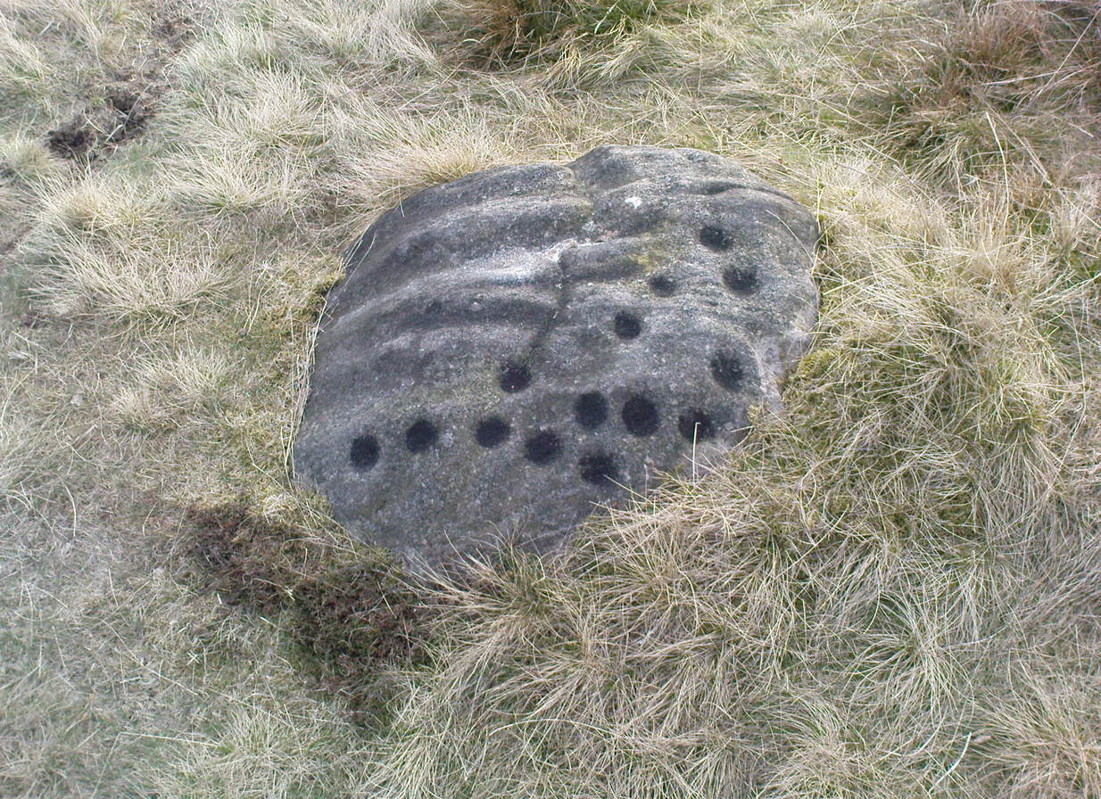
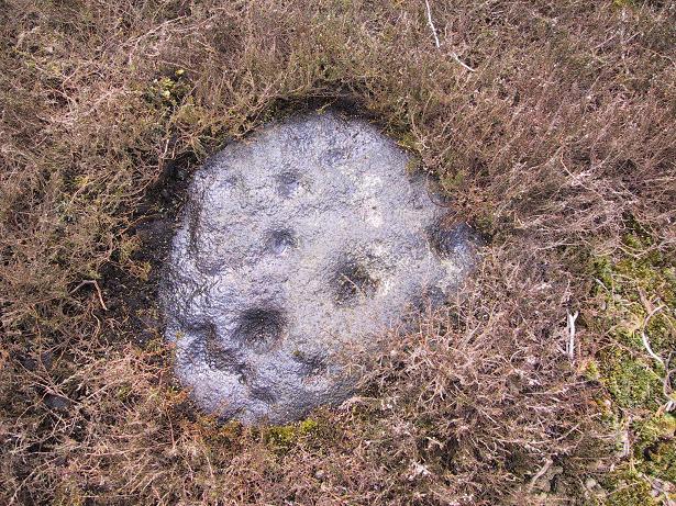
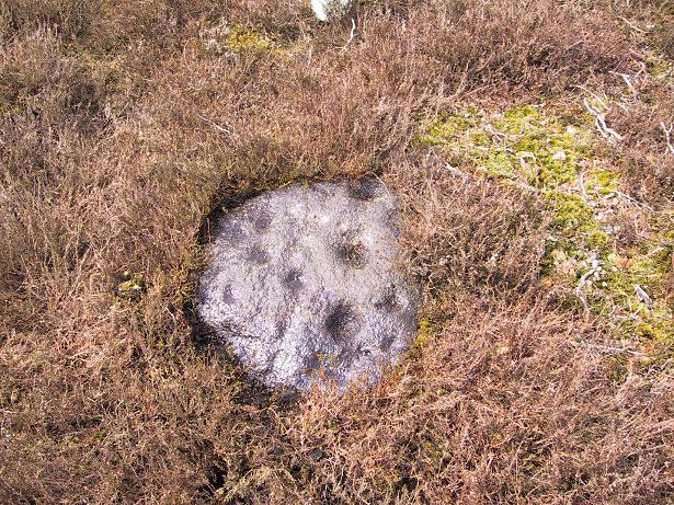
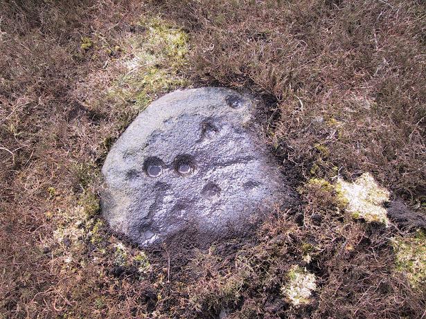
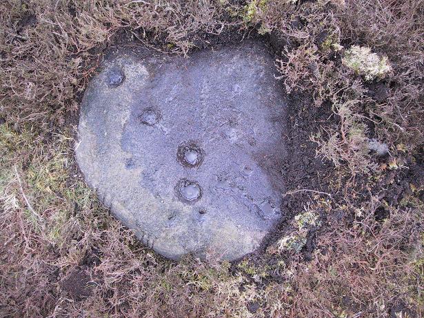
About 10 yards north of the old boundary stone on the Middle Ridge heading to the western end of Dryas Dike and about 10-15 yards east of the Middleton 453 carving, is this small rounded rock with between 12 and 15 cup-markings on its north and north-eastern sides. Several curious deep ridges run down across the rock which some ascribe as being man-made – but to me they’re Nature’s fine handiwork, although I may be wrong…
References:
Boughey, Keith & Vickerman, E.A., Prehistoric Rock Art of the West Riding, WYAS 2003.
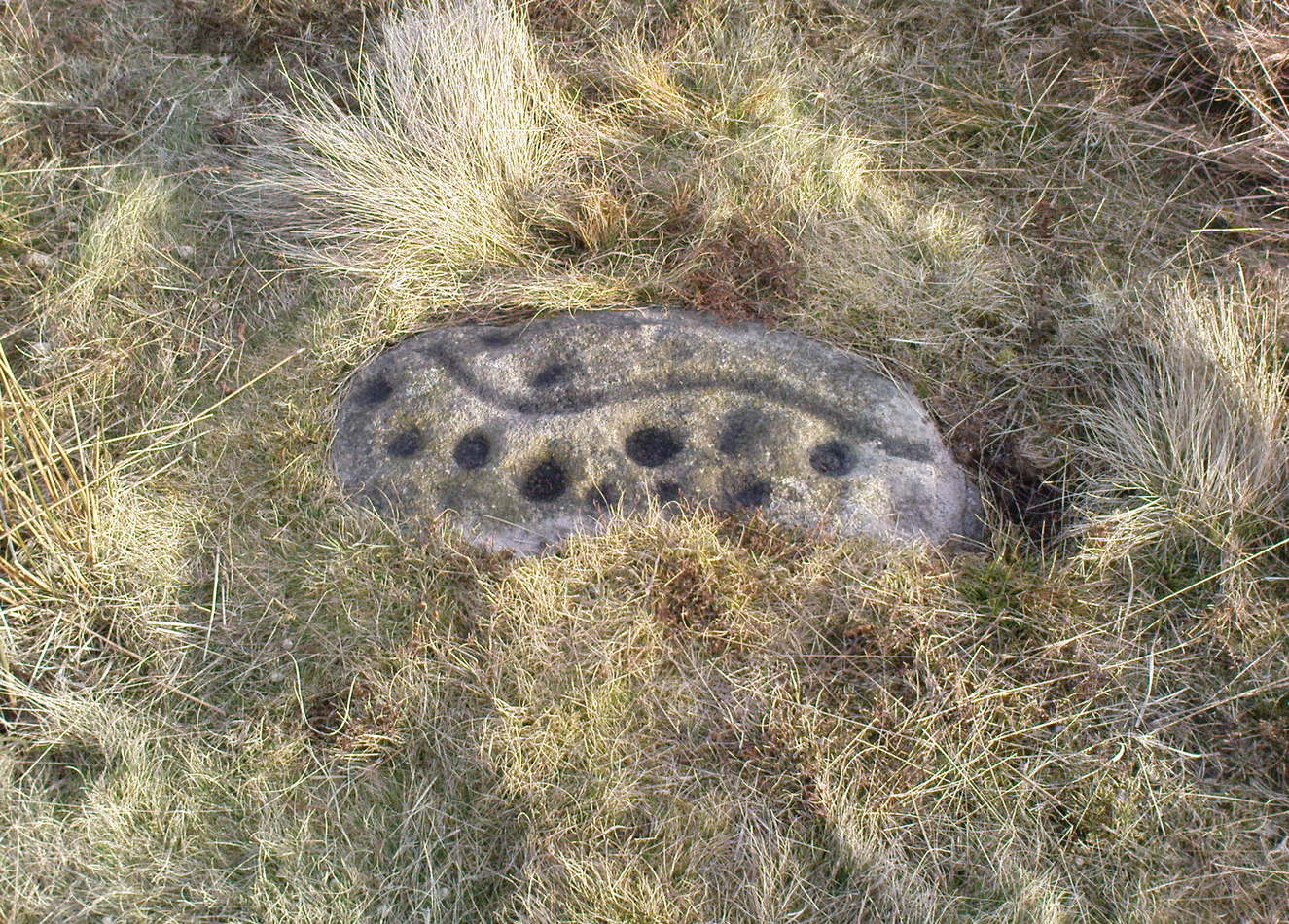
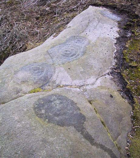
Named boringly after the catalogue number given it in Boughey & Vickerman’s (2003) survey, this is another of the many small cup-marked stones clustered at the western end of the ridge between Delves Beck and Dryas Dike, below the moorland slope up to the Old Pike and Beamsley Beacon. It’s one of the more impressive of the carvings in this locale, albeit when it’s highlighted, as in the photos shown here (apparently done by one of the photographers in the Ilkley rock art group, I was told). It’s perhaps better seen when the sun is low and the stone’s been wet, which shows the shallow undulations of the cup-marks and wavy line that seems to split the main group of twelve cup-marks at the top northern side of the stone, from the two on its south side. There seems to be another wavy line carved above the main cluster, but this is difficult to make out.
References:
Boughey, Keith & Vickerman, E.A., Prehistoric Rock Art of the West Riding, WYAS 2003.
In the middle of the moors, with no footpaths close by. Unless you’re a rock-art freak I guess there aint gonna be too many people searching for it! From the Ilkley-to-Langbar road, take the track (Parks Lane) onto the moor where the road bends right. Follow it up for about a mile (though it doesn’t seem that far) and where the cup-marked stone at the edge of the wall where the spring appears (Middleton Moor carving 483), walk west (left) into the heather for a coupla hundred yards below Foldshaw Ridge. Look around!
This is one of a small cluster of carvings Richard Stroud found on a few average-sized stones prettty close to each other in April 2005 — and one which the West Yorkshire Archaeology Service told him couldn’t be there cos the region had already been surveyed. Hmmm…
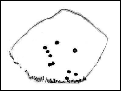
Crap drawing!
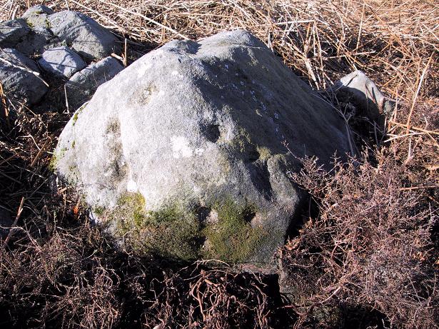
Well, my first impression of this when I saw it was a absolute thumbs-up! Simple to look at, I know – but a bloody good little carving. It’s primary characteristic is that most of the ten or eleven cups occur on the vertical and near-vertical face, which aint too common. In traditional societies (though not all) where carvings occur on vertical faces, they’re deemed to be ‘male’ in nature (those on rounded smooth surfaces, female). The carving is well worth checking out — especially as there’s probably more to be found up here, hiding beneath ages of peat and heather.
To find this, follow exactly the same directions as that of the Middleton Moor Carving 001, which is just a few yards away. Both of these stones may take some finding when the heather’s deep — but when we first discovered them, the heather had recently been burnt back.
Archaeology & History
This small rounded stone had a covering of vegetation on it when Richard Stroud and I first discovered it in April 2005, with just a couple of cups visible, but once the heather’d been carefully rolled back, another fine carving greeted our keen-eyed petroglyphic senses!
Drawing of the carving…and again!
At least eight cups seem apparent here, though once Richard had the photos processed there appeared to be a couple of things on the stone which we hadn’t noticed when in the field (a common cup&ring dilemma). One of the most curious parts of the stone seems to be the winding line near the bottom of the stone. Make of it what you will!
Just a couple of yards east of this carving we find the rounded remains of a single burial cairn, probably for just one person, just like as with Middleton Moor 001. This site could do with excavating, as we may have a small neolithic or Bronze-Age cemetery hiding under the heath.
Go up the long winding Ilkley-Langbar country moorland road. A coupla miles along there’s a sharp bend in the road, left, with a dirt-track here that takes you onto the moors. Walk up here to the shooting house just east of Black Hill in the Middleton Moor enclosure and, once there, walk up the steepish slope to the left (west). Once on the level, head to the wall and about halfway along, look around. If the heather’s long and deep you’ll be lucky to find it. Good luck!
Archaeology & History
Photo by Richard StroudSketch of the carving
The carving was first discovered by Richard Stroud and I in April, 2005, amidst one of several exploratory outings to records known sites and, aswell, to keep our eyes peeled in the hope that we might find some new ones! This was the first we came across; but when we found it, just one faint cup seemed noticeable on the southern edge of the small rounded stone; but after fifteen minutes of carefully rolling back the vegetation, this very well-preserved carving was eventually unveiled before us. It’s in quite excellent condition! The most notable part of the design are the two deep cup-markings, with the topmost cup looking half-surrounded by smaller cups on its southern edge.
There is also a well-preserved, though overgrown burial cairn (probably for one person) just a few yards west of this stone. This is just about impossible to see unless the heather’s been burnt back.
Various ways to get here (being in the middle of the moor n’ all). I s’ppose the best way is to go from Langbar village, up hill to The Old Pike giant cairn, then follow the footpath on about 100 yards before dropping down the slope to your right, south (NOT the other way!). You’ll notice some walling and an old path near the bottom of the slope SE from you – head in that direction, but before you get there, a coupla hundred yards before, stop and look around. Good luck!
Archaeology & History
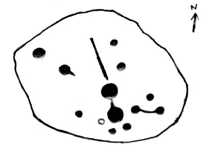
Found halfway up the southern slope beneath The Old Pike giant cairn, we find this large, flat earthfast stone, on which are the very faded remains of archetypal cup-and-ring motifs. At the top-end of the stone are slightly more pronounced cup-markings – seemingly more than is shown on the drawing, with the multiple-rings halfway along the stone. On the southeastern part of the stone, Richard Stroud found another previously unseen aspect of the carving, consisting of one large ring, with perhaps a line running out to the east. This can be seen in the water-highlighted photo.
Langbar Stone, with extra single ring not previously noted
If you visit this carving, try and get to the Middleton Moor CR-482 stone half-a-mile southwest – where I for one got the distinct impression that whoever carved that stone, also carved this one! Barmy p’raps — but if we don’t allow subjective interface here and there, we never learn a damn thing!
Listed as stone 459 in Boughey & Vickerman’s (2003) survey, they erroneously ascribe Eric Cowling to have found it in Rombald’s Way (1946), whereas the first mention of it appears to have been by Stuart Feather in 1966 (though Cowling does mention a ‘Langbar Stone’, but illustrates another one nearby).
References:
Boughey, Keith & Vickerman, E.A., Prehistoric Rock Art of the West Riding, WYAS 2003.
Cowling, Eric T., Rombald’s Way, William Walker: Otley 1946.
Feather, Stuart, ‘Mid-Wharfedale Cup-and-Ring Markings. No.41, Langbar Moor, Ilkley,’ in Bradford Cartwright Hall Archaeology Group Bulletin, 11, 1966.
Using the OS-map as a guide, from Denton village head up the road northwest, past Moorside Farm and onto the moor. Before you reach the rise of Lippersley Pike you’ll reach the Crow Well itself (completely covered over by Yorkshire Water’s handiwork, stopping anyone from drinking the previously fresh waters here). In the middle of nowhere, just above the completely ruined well, is the old shooter’s cottage and from here, Eric Cowling (1946) told us to look in the heather immediately east. When Richard Stroud and I ventured here a few years back (2.8.5) we couldn’t find a thing — though a vaguely reminiscent structure seemed possible 300 yards away.
Archaeology & History
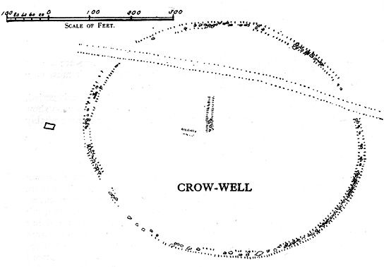
If the heather’s deep, you’ll have little chance of seeing the site as Eric Cowling (1946) obviously did! He described and illustrated this place — so was fortunate enough to have ventured here following the heather-burning.
The site is not a stone circle, but what Cowling thought to be an Iron Age settlement: ellipsoid in shape and nearly 400 feet across; it’s obviously an impressive archaeological site when visible (akin to the Snowden Carr settlement a couple of miles east). In all probability the site is much earlier than Iron Age.
An aerial image of the site indicates its size to be very close to Cowling’s initial measurements. The ‘settlement’ is quite huge, with the walling or defining edges being between 4 and 6 yards across in places, with double-walled sections akin to that found at the Brackenhall circle on Shipley Glen, just over 8 miles (13km) to the south. However, it’s probably much older than its Brackenhall compatriot. Its maximum diameters measure 130.5 yards (119.3m) roughly east-west and 98.5 yards (90m) roughly north-south, with an external circumference of about 345 yards (315m). This is a big fella! Near its centre is a well-defined ring, or ellipse, measuring approximately 20 yards (18.3m) north-south and 18 yards (17.5m) east-west.
It’s difficult to say what this might be without a site analysis, and we need the heather burning back at this site to enable a good inspection of the place! We may be looking at Denton Moor’s equivalent of the Woofa Bank Enclosure just over 4 miles (6.5km) to the south, above Ilkley, with its host of cup-and-rings and surrounding cairns. A good inspection of this site is long long overdue…
Hereabouts Cowling also found other remains dating from the neolithic period, including walling, cairns, hut circles and cup-and-ring stones. He thought that “the name Crow-well appears to be the modern equivalent of ‘the circle of the well'” — and although I doubted this in my Old Stones of Elmet, I have since come to realise the truth of his words!
Two main ways to get here. Hmmmm….on second thoughts, one main way. My preferred route would be from Addingham (east-side) where the foot-bridge crosses the Wharfe. Walk up the path and, eventually, onto the tidgy road and bear left till you hit the trees. On the right-hand side of the road you’ll see the trees covering the crop near the edge of the river. …Otherwise, come from Ilkley, cross the river, take the first left, on a few hundred yards and left again on Nesfield Road. From here, keep walking about a mile and when you hit the village, you need to look into the field behind the first farmhouse on your left.
Archaeology & History
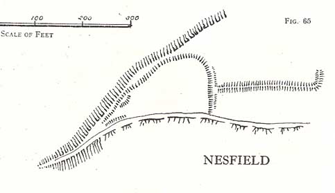
You’ll see the more visible embankments on the western edge of these old earthworks. But unless you’re a real archaeomaniac into depleted field remains, this might not tickle your neurons too much. However, it’s a gorgeous little hamlet is Nesfield – and I think that alone makes it worthy of a visit!
Cowling’s 1946 plan
Described variously over the years as an enclosure, a hillfort, a camp, a settlement – aswell as being ascribed to periods from the medieval, Roman, Iron Age and Bronze, the consensus opinion at the moment edges to it being late Bronze- to early Iron Age in origin.
The fortifications themselves seem to have been first mentioned by T.D. Whitaker in 1812, who said the following:
“Castleberg is in a commanding position, on the brink of a steep slope washed by the Wharfe, about two miles above Ilkley. This post is naturally strong, as the ground declines rapidly in every other direction. But it has been fortified on the more accessible sides by a deep trench, enclosing several acres of ground, of an irregular quadrangular form. At a small distance within the enclosure, an urn with ashes was lately found, but what seems to evince beyond a doubt, the Castleberg was a Roman work, is the discovery of a massy key of copper, nearly two feet in length, which,” he thought, “had probably been the key of the gates.”
This ‘key’ that Whitaker mentioned (if memory serves me right) has been lost and therefore its nature/function lost aswell. E.T. Cowling (1946) thought the key “may refer to a bronze article of a size which must belong to the Late Bronze Age, when the metal became more plentiful”; thinking it perhaps to be part of a sword. Twouldst be good to find this artifact and know for certain. Cowling also posited that the urn found here was of Bronze Age origin – an opinion echoed by later archaeologists.
The great Harry Speight (1900) meanwhile, told that the hamlet itself was locally called Castleberg and told us a bit more of the details of the finds, saying:
“I am disposed to think it was a winter-station of the old Britons of Howber, and afterwards of the Teutonic settlers. An urn containing ashes has been found on the site, and Mr James Pickard, who has long occupied the adjoining farm, tells me he has excavated several parts of it and found human bones, but no relics. This premises Anglo-Saxon interments and the urn late British…”
References:
Cowling, E.T. Rombald’s Way, William Walker: Otley 1946.
Howson, William, An Illustrated Guide to the Curiosities of Craven, Whittaker: Settle 1850.
Keighley, J.J., ‘The Prehistoric Period,’ in Faull & Moorhouse’s, West Yorkshire, An Archaeological Guide, vol.1, Wakefield 1981.
Speight, Harry, Upper Wharfedale, Elliott Stock: London 1900.
Whitaker, T.D., History and Antiquities of the Deanery of Craven, J. Nichols: London 1812.
This place is one of the first things you see when roving the northern edge of Ilkley Moor. Tis the small white house, perched on the hillside, which you can reach via the old track bending round to it on the west side, or the steep footpath which goes roughly straight uphill from the road, just above Ilkley Town centre, up (both) Wells Walk or Wells Road. If you go just a few hundred yards up these roads, as the road bends and the moor opens up ahead, you’ll see the white building above you. But if you’re truly useless at finding your way about, ask anyone of them there locals…
Archaeology & History
The White Wells, Ilkley Moor
The White Wells have been described by countless writers over the centuries and attested as one of the great healing wells of the region. It was, without doubt, one of the most important water supplies to the indigenous Britons living on the moors here. One of their settlement sites is above the cliffs behind the modern position of the wells — though archaeological work has yet to be undertaken been. Cup-and-ring marked stones scatter the edge of the ridge right above where the waters originally appeared (a few hundred yards further up the slope on the hillside, just below the trees); and the folk-memory of our ancestors living here is found in several adjacent sites known by ‘fairy’ place-names.
But today it looks nothing like it would have done when the ancient people of the moors drank these waters, nor even when the Romans came here. For the white building which today houses the well was built around 1760 by the local Squire Middleton and originally contained three plunge baths in which folk would take the ‘cold water cure.’ (These were looked after by William Butler and his wife and were typically used by the gentry of the period, who it seems didn’t mind too much having to walk up the hillside to bathe in the “mellifluent, diaphanous, luminous waters.”)
Carved ‘celtic’ head, from which the water now emerges
The water in the house (you can go in and have a look), which now empties into a plunge pool, pours gently from the open mouth of a ‘celtic head’ – thought by some modern pagans to be ancient, but in fact is barely 200 years old. The water at White Wells originally emerged from the Earth several hundred yards further up the slope, above the present position of the house, much closer to the moor edge near the bottom of the steep slope where the pine trees cling, amidst rocks, moss and lichen. Here is where the original waters were first borne.
Long held as being curative, the first detailed description of the place was in Thomas Short’s (1734) magnum opus, where he said:
“Ichley-spaw springs out of the middle of a mountain, a mile high, and consists chiefly of lime stone and freestone. The water is very clear, brisk and sparkling; has no taste, colour nor smell different from the common water, is of the same weight. Its bason and course are of no other dye than that of a common spring. About thirty-five years ago, there were a house and a bath built, about a furlong below the original spring, which spring was brought down in stone-pipes. The first spring, near the top of the hill was very weak and small; this, very large and strong; whereby there appears to be a large mixture of other springs with this; since which time, it has fallen much sort of its former great success. Twenty yard above the drinking well (over which is built a small house of a yard square on the inside) they have cut thro’ an original spring of common water. There are several old lime-kilns a little above this. The water is first whitish, then blackish purple with solution of silver; it’s very clear, and has a purplish pellicle, with solution of sublimate; it was first white, then clear in the middle, and a white mucus at the sides and bottom of the glass, with solution of Sugar of Lead; very clear, with Oil of Tartar; whitish, with Spirit of Hartshorn; and the same as common water, with all the other trials. Five pints of this liquor exhaled left seven grains of sediment, the salt whereof dissolved in distilled water, turned solution of silver purple; was white with Spirit of Hartshorn: therefore tho’ this water is of the greatest esteem and repute of any in the north of England, in the King’s Evil and other old ulcers; yet it derives these effects neither from its fixt nor volatile parts; but wholly from the coldness and purity of the element, its drying nature from the lime-stone it washes, tho’ a great part of it comes from blue clay.”
In 1830, one Thomas Shaw said of the place,
“The water is, perhaps, for its purity, tenuity and coldness, the best qualified to be of utility for relaxed and sedantry habits of any water in this part of the country. It has frequently been analysed, but the decomposition always proved that it contains no medicinal quality. In my opinion, it is its purity and softness only, which makes if more efficacious, by passing sooner and to the utmost and finest limits of the circulation than any water known.”
But although many cures were claimed of the waters here, as Kathleen Denbigh (1981) wrote:
“According to a 1977 analysis, it is simply a clear, colourless spring water of moderate hardness, organically pure and free from metallic contamination and coliform organisms.” — i.e., it’s good clean water!
When the place gained a reputation as a spa, it was frequented by such notaries as Charles Darwin, Frederick Delius and Prof. David Baldwin. But even before this, in 1709, Dr Richard Richardson of Bradford—a reputable naturalist but also with considerable interest in ancient and occult matters—wrote that the site “has done very remarkable cures in scrofulous cases by bathing and drinking of it.”
Folklore
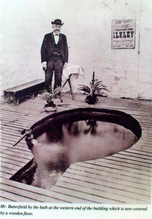
Old photo of Mr Butterfield, who saw fairies here
Popularly believed in local lore to have been a place held as sacred to the Romans, I’m of the opinion that the local ‘goddess’ Verbeia was resident here. A thought also mentioned by G.T. Oakley (1999) in his book on the subject.
Legend tells that the medicinal properties of the waters were first discovered hundreds of years ago when an old shepherd, walking over the moors, damaged his leg. Upon bathing it in the waters here, it soon healed.
In the Folklore Record of 1878 we find a fascinating tale about these waters, alleged to have happened to the old keeper of the place, told by a local man John Dobson, and which cannot go untold:
“William Butterfield…always opened the door first thing in the morning, and he did this without ever noticing anything out of the common until one beautiful, quiet, midsummer morning. As he ascended the brow of the hill he noticed rather particularly how the birds sang so sweetly, and cheerily, and vociferously, making the valley echo with the music of their voices. And in thinking it over afterwards he remembered noticing them, and considered this sign attributable to the after incident. As he drew near the wells he took out of his pocket the massive iron key, and placed it in the lock; but there was something “canny’ about it, and instead of the key lifting the lever it only turned round and round in the lock. He drew the key back to see that it was alright.and declared, “It was the same that he had on the previous night hung up behind his own door down at home.” Then he endeavored to push the door open, and no sooner did he push it slightly ajar than it was as quickly pushed back again. At last, with one supreme effort, he forced it perfectly open, and back it flew with a great bang! Then ‘whirr, whirr, whirr’, such a noise and sight! All over the water and dipping into it was a lot of little creatures, all dressed in green from head to foot, none of them more than eighteen inches high, and making a chatter and jabber thoroughly unintelligible. They seemed to be taking a bath, only they bathed with all their clothes on. Soon, however, one or two of them began to make off, bounding over the walls like squirrels. Finding they were all making ready for decamping, and wanting to have a word with them, he shouted at the top of his voice—indeed, he declared afterwards, he couldn’t find anything else to say or do—”Hallo there!” Then away the whole tribe went, helter skelter, toppling and tumbling, heads over heels, heels over heads, and all the while making a noise not unlike a disturbed nest of young partridges. The sight was so unusual that he declared he either couldn’t or daren’t attempt to rush after them. He stood as still and confounded, he said, as old Jeremiah Lister down there at Wheatley did, half a century previous, when a witch from Ilkley put an ash riddle upon the side of the River Wharfe, and sailed across in it to where he was standing.1 When the well had got quite clear of these strange beings he ran to the door and looked to see where they had fled, but nothing was to be seen. He ran back into the bath to see if they had left anything behind; but there was nothing; the water lay still and clear as he had left it on the previous night. He thought they might perhaps have left some of their clothing behind in their haste, but he could find none, and so he gave up looking, and commenced his usual routine of preparing the baths; not, however, without trotting to the door once or twice to see if they might be coming back; but he saw them no more.”
Along with sightings of ‘little people’, ghosts have been seen at the White Wells. It is thought that the strange apparition which presented itself to a householder here in 1982—the ghostly figure of a young girl, weeping at the water’s edge—was that of little Ann Harper who, in August 1793, at the age of nine, drowned in the well when bathing.
Earthlight (UFO) phenomena have also been reported here over the years—the most dramatic of which was alleged to have taken place at the top of the slope above the original source of the wells in 1989, when a police officer reported and photographed a “little green man” on the geological prominence just behind the wells. He went on to narrate a typical UFO ‘abduction’ event, but much of this was psychogenic and the mythic undertones echo precisely the medieval lore of abduction by faerie.
The Fortean researcher David Barclay found in his dowsing investigations here that there were spiral patterns all round the place. “At first these were in no order,” he wrote, “but through a period of over twenty visits to the place, I established markers which indicated the spiralling patterns of the energy” within the Earth immediately adjacent to the White Wells. These spirals were nearly always in a clockwise direction. In further studies here, he and I came to know a Mrs Elsie Hill, who had done some quite striking automatic drawings of the place. “In her pictures,” he wrote, “appear a prominence of spiral-forms and faerie creatures which, she believes, inhabit White Wells.”
Hmmmm…..
…to be continued…
References:
Bennett, Paul, The White Wells, Ilkley Moor, Heathen Earth: Keighley 2009.
Bogg, Edmund, Upper Wharfeland, James Miles: Leeds 1904.
Collyer, Robert & Turner, J. Horsfall, Ilkley, Ancient and Modern, William Walker: Otley 1885.
Denbigh, Kathleen, A Hundred British Spas, Spa Publications: London 1981.
Granville, A.B., Spas of England, Henry Colburn: London 1841.
Oakley, G.T., Verbeia: The Goddess ofWharfedale, Rooted Media: Leeds 1999.
Shaw, Thomas, The History of Wharfedale, Otley 1830.
Short, Thomas, The Natural, Experimental and Medicinal History of the Mineral Waters of Derbyshire, Lincolnshire and Yorkshire, privately printed: London 1724.
Speight, Harry, Upper Wharfedale, Elliott Stock: London 1900.
Whelan, Edna and Taylor, Ian, Yorkshire Holy Wells and Sacred Springs, Northern Lights: York 1989.
From Ilkley, head up the road towards White Wells and keep going along the road. Shortly before the road becomes a dirt-track, just over a small stone bridge with gorse all around, there’s a noticeable footpath that runs west onto the moors, going roughly parallel to the wealthy houses by the moorside. Keep going along this footpath and you’ll hit the recently unneeded modern creation of a large sandy trackway (and excessive litter that it’s created) that takes you straight to the curious railings stuck upon some rocks a quarter-mile away. That’s where you’re going!
Archaeology & History
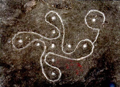
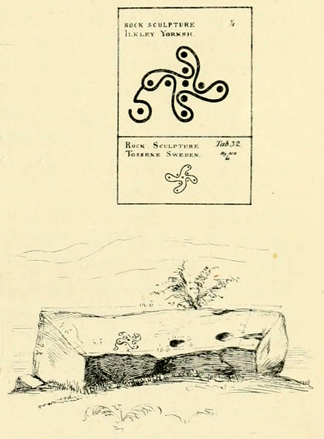
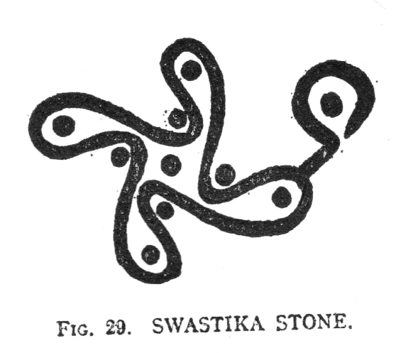
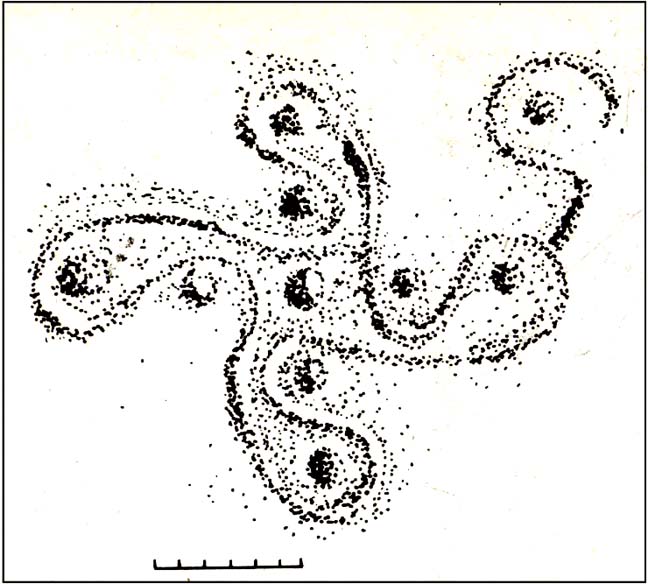
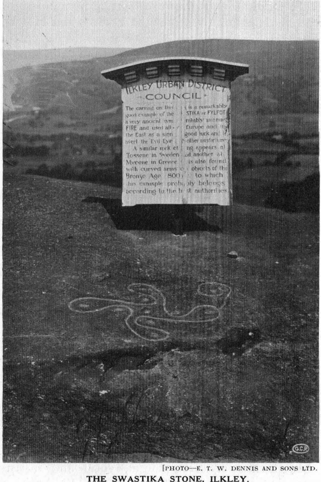
This famous carving was first described as a ‘swastika’ by a Mr J. Thornton Dale around 1880 – and the name seemed to catch on damn quick! The stone had become established with this title at the end of that decade, and seemed immortalized with the name when J. Horsfall Turner wrote about it in the very popular history book he co-authored with the reverend Collyer in Ilkley Ancient and Modern. (1885) By then, comparisons had already been drawn with the acknowledged swastika symbol in Tossene, Sweden, and by the time Harry Speight described it in his colossal Upper Wharfedale (1900), other near-identical European swastika carvings had been found in Valcamonica, northern Italy. (though these lacked the ‘tail’ found on Ilkley’s carving)
J.R. Allen’s drawing of Swastika StoneEric Cowling’s sketch of the carving
Earlier images of the swastika symbol can be found in most continents, but the earliest known example appears to be the paleolithic swastika carvings from the Ukraine, etched on pieces of ivory and dating from between 18,000-15,000 BC. Some swastikas have been found carved on mammoth tusks!
Invariably in modern history it is its mythic association of the swastika to certain political imbeciles which troubles many people, but this needs to be set into a much more ancient historical context. The symbol ostensibly relates to sacred notions of the cosmos in all the non-literate cultures where it appears. Numerous surveys by comparative religious scholars isolated the nature of the design many years ago. The Leeds Buddhist, Steve Hart, said that Ilkley’s Swastika Stone:
“to a Buddhist should be a sonorous gatha (a sutra or verse), a plenitude of transcendental boddhisattvic vision. The swirling wheel of the four arms suggests the four realms as experienced by Jains, upanishadic sages and ancient Buddists. They ARE samsara. The samsara is resolved into the nirvana at the hub. The four realms are the human realm, god realm, hell realm and the nature realm. There are no clear delineated demarcations between these realms. All interpenetrate.”
(Images of the popularised ‘modern’ swastika – a huge misnomer – can be found on several church bells in Yorkshire, where they were used as charms to protect against lightning, following in the mythic fashion of Thor. These swastikas date from the 15th century.)
Evan Hadingham’s rubbing of the carving
I first saw this carving when I was 10-years old and it had one helluvan effect on me! I stood and stared at it (or rather gazed, without thought…) for some length of time, knowing that I’d seen this somewhere before* and that it had some considerable importance – though about what, I knew not! The cups in the design align north-south and east-west. The northern line points directly at Simon’s Seat on the northern skyline. The eastern axis points directly at Almscliffe Crag, above which the equinox sun seems to rise from here.
For the real alignment fanatics, check out the alignment from Twelve Apostles to here: on the date of the last major lunar standstill (occurrent every 18.6 years), the moon set over the cairn at Lanshaw Lad. It wasn’t until I got home and checked the extension of this moonset line, that I realised if you follow it further along the course, you hit the Swastika Stone bang on! Though this is probably just a coincidence (we do have hundreds of cup-and-rings on these moors, so it’s bound to hit one or more of them).
The Swastika in 1930, with info-board
In this Swastika Stone, the curious single ‘outlying’ cup-and-ring at the edge of the four spiralling arms is very probably the point from which the four-arms originated and not the other way round. In traditional cultures and early cosmogenic patterns the world over, the cosmos itself emerged from the ’round’, the singular, the point, or uroboros — and this is what this Swastika Stone appears to represent here: the cosmos emerging from the singularity, giving birth to the world and the four cardinal points. Such an element is a simple one and is found in Creation myths the world over. (For those of you who aint into using psychedelics at sites, a good overview of this idea is in Erich Neumann’s Origins & History of Consciousness [although there’s no reference to this symbol] and which should be read by anyone pretending an interest in the nature of the archaic mind. It’s a good work on the psychology of the Dreamtime.)
As some local Ilkley folk are probably aware, a copy of the Swastika Stone carving was executed in the latter-half of the 19th century, probably by a local chap called Ambrose Collins, not far from the original swastika at the edge of the woodland. Some images and a brief history of this copied swastika and associated cup-markings will be published in due course on the Rombalds Moor Project website.
Other important cup-and-ring petroglyphs that are worth visiting on the moor with unique carved symbols in them include the Hanging Stones, the Idol Stone, Haystack Rock, Badger Stone and many many more.
Note:
A fella who used the pseudonym of ‘Pad’ suggests that the carving is only a few centuries old, and compares it to other much more recent etchings on these moors, where the erosion has been of no greater or lesser force. The suggestion has been made about other carvings on these moors and whilst I have an open mind about this, if this is the case, we would have to relate the same reasoning to countless other carving on these hills. In which case, a great deal of cup-and-ring art would have to be redesignated as medieval in nature.
References:
Bennett, Paul, The Old Stones of Elmet, Capall Bann: Milverton 2001.
Boughey, Keith & Vickerman, E.A., Prehistoric Rock Art of the West Riding, WYAS: Wakefield 2003.
Collyer, Robert & Turner, J. Horsfall, Ilkley, Ancient and Modern, William Walker: Otley 1885.
Cowling, Eric T., Rombald’s Way, William Walker: Otley 1946.
Hadingham, Evan, Ancient Carvings in Britain, Garnstone: London 1974.
Hedges, John, The Carved Rocks on Rombalds Moor, WYMCC: Wakefield 1986.
Pennick, Nigel, The Swastika, Bar Hill: Cambridge 1980.
Speight, Harry, Upper Wharfedale, Elliott Stock: London 1900.
Wilson, Thomas, The Swastika – The Earliest Known Symbol and its Migrations, Smithsonian: Washington 1896.
* although I’d never seen the carving before, I had of course seen its archetypal manifestation in the shapes in Nature: spiral galazies, polar rotation (I was a budding astronomer as a kid!), hair growth from the crown, petals, swirling clouds, etc, etc. The Swastika, as we know, is representative of the creative spark itself: the life-essence, emerging from the centre and manifesting itself in the four worlds, which are its emergent arms.
Links:
Reclaim the Swastika – A fine website which is into doing just what it says on the tin!