Holy Well: OS Grid reference – SX 3546 8252
Archaeology & History
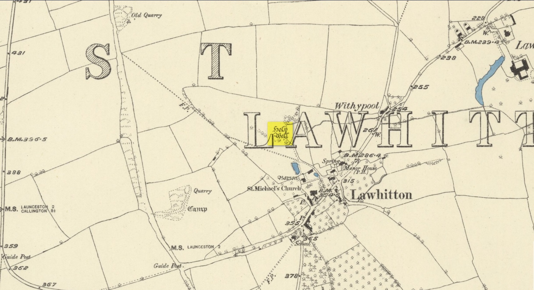
Highlighted on the 1882 OS-map several hundred yards north of St. Michael’s church, this site seems to have fallen back to Earth as no remains of it have been found in recent visits. It was described in Charles Henderson’s (1914) notes as the “holy well at Barton Farm”, and was visited by J. Meyrick (1982) in April of 1980, who told that it could be found by taking “the track immediately east of Lawhitton church which runs through the farm of Mr Lancaster… After going through the yard proceed ¼ mile down track to the valley where you reach a stream and the Well is on the right.” It was sought after by Cheryl Straffon (1998) but following her visit to find the Well she told that “there was nothing now to see except a kind of natural basin by the small bridge.”
References:
- Henderson, Charles, Notebooks of Parochial Antiquities, Unpublished MS 1914.
- Meyrick, J., A Pilgrims Guide to the Holy Wells of Cornwall, Falmouth 1982.
- Straffon, Cheryl, Fentynyow Kernow: In Search of Cornwall’s Holy Wells, Meyn Mamvro: Penzance 1998.
Acknowledgements: Big thanks for use of the early edition OS-map in this site profile, Reproduced with the kind permission of the National Library of Scotland.
© Paul Bennett, The Northern Antiquarian