Holy Well, Garenden, Loughborough, Leicestershire

Holy Well:  OS Grid Reference – SK 507 180

Getting Here
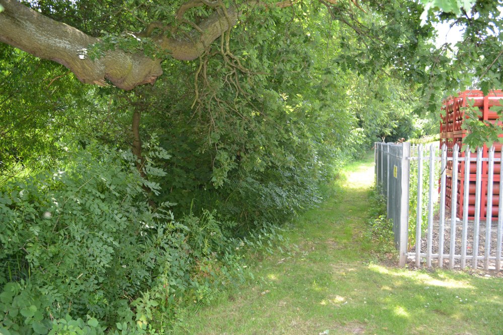
The path down to the well

On the outskirts of Loughborough is an area called Holywell, but pronounced ‘holly’. The holy well can be found at the furthest north west part of the park, behind the large Garendon block of the Holywell complex. Here behind some hydrogen cylinders (!) follow the brook on the left until you reach a stile. Climb over this and the well in front of you. It is unclear what the access rights are, but there are no private signs.

Archaeology & History
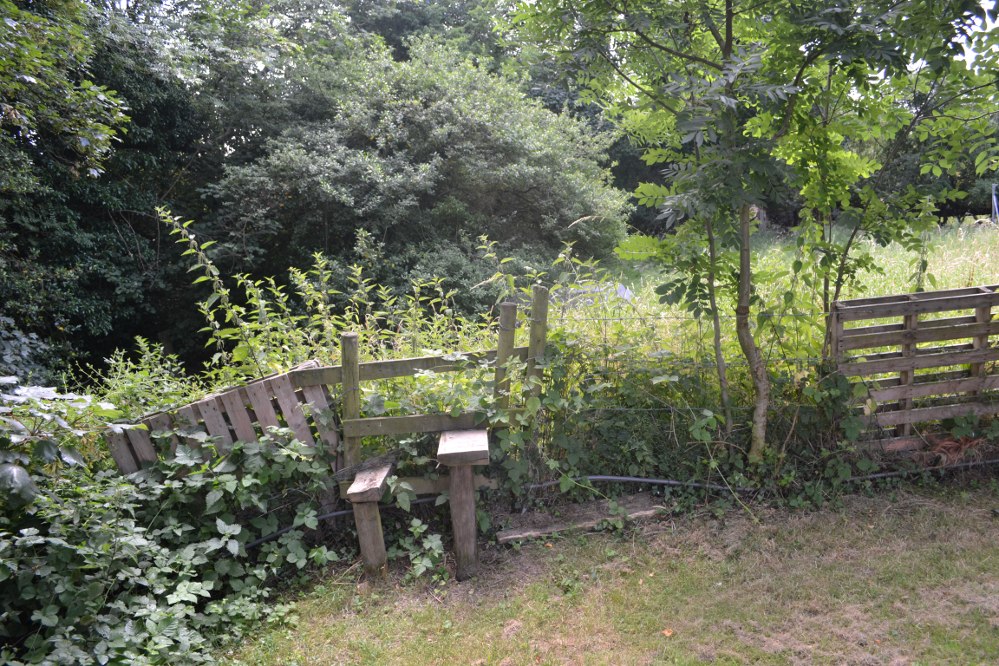
The stile with the well in the background

Virtually swallowed up by Loughborough University is the estate of Holywell Haw, the present farmhouse taking its name from a spring nearby. Of the house itself: it probably began life as a hostel for those lost in the most substantial Charnwood Forest, which has since retracted around it.  However by 1180, it had become a hermitage owned by Garendon Abbey and is then first noted by the name of ‘Holywell Haw’, the latter word deriving from haw meaning enclosure, the same origin as hawthorn.  Potter, in his History and Antiquities of Charnwood Forest (1842), notes it was mentioned in a grant by Robert de Jort to the abbey, with the site being described as heremitorium de Halliwellhaga.

Later, the 13th century Testa de Nevill, records ‘a dairy, with a small wood, called Haliwelle Hawe’, which by the 14th century the Leicester Abbey purchased from a Henry Lord Beaumont “a certain parcel of wood called Holy-well Haw for £28.”  It was they who appeared to have developed the area to what can be seen today: fishponds and moats, and probably used the site as a grange and possible a diary.  What remains today is mainly 15th century, with fragments of a medieval structure such as gothic doorways and timbers. Whether it was Holywell Haw or Hall is unclear.  This discrepancy has been blamed on the Ordnance Survey—and indeed, some blunders have been done by them in the past. However, it is possible that a 19th century owner, March Philips, had some sort of pretensions for the building and thought the name was better.  By the 18th century, the name Holywell Dyke was an eighteenth-century boundary mark for Charnwood Forest.

The spring is icy cold and never run dry, and produces—according to Bob Trubshaw (1990)—20,000 galloons a day and is one of the only non-incorporated spring in the Severn Trent catchment classed as A1 Drinkable.

The Site Today…
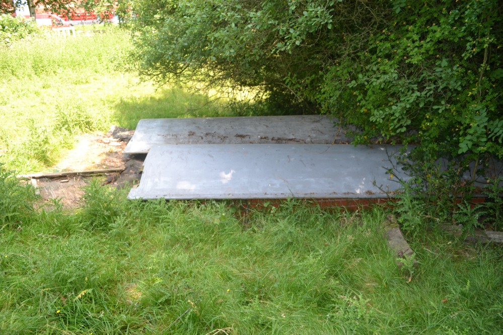
The not-very-interesting looking site today

Despite a leaflet mentioning the well from the University (available as a pdf-file), it is a little reticent as regards to whether it can be visited.  However, exploring around the back of the enormous Holywell complex, a small path passes some gas cylinders and then to a stile. No keep out signs are present so I assumed it was okay to jump over. There almost in front of me is a large brick chamber covered by two large fibre glass up turned boats. These appear to cover the well.
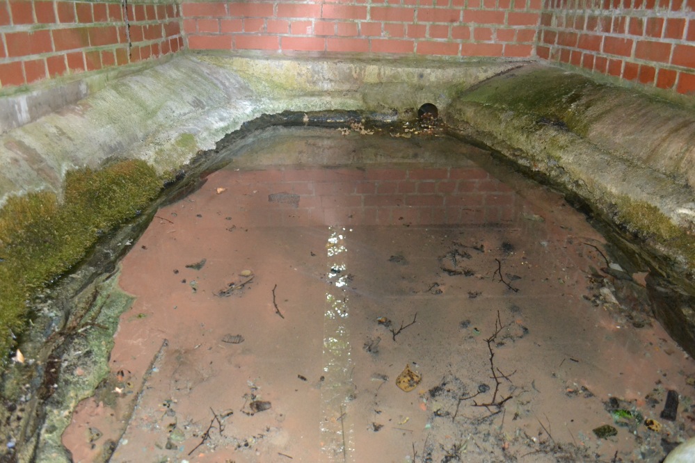
Within, with natural rock & medieval stonework?

Peering between a gap however, this rather unpromising edifice reveals something more interesting. The brick chamber encloses an elliptical natural stone or possibly medieval basin, into which a copious flow enters and fills and then flows through a pipe into the brook below. Despite the rather ugly surrounds there is still something ancient and mysterious about this most well-known of Leicestershire sacred springs. The local farm, the Holywell Haw, still apparently uses the water and it is regularly checked by the University authorities. One hopes it can get a better cover.  Surely the university could afford a metal grid more worthy of this venerable site.

Folklore

Local tradition states that it has medicinal qualities. Nichols (1795–1815) notes:

“The excellent spring is yet preserved.”

Potter (1852) notes that it:

“derives part of its name from a well, to the waters of which, even in recent times, considerable virtues have been attributed.”

However, its most famous legend is said to date from the 15th century. Potter (1852) notes that:

“The popular idea seems to be, that the Comyns (of Whitwick Castle) were great giants. One of them, said my informant, attempted to carry off one of the Ladies of Groby Castle, who left that place for security, intending to take sanctuary at Grace Dieu. Going, however, by a circuitous route, to avoid Charley and Whitwick, she was benighted, and would have perished in the Outwoods, but for one of the Monks of the Holy Well.”
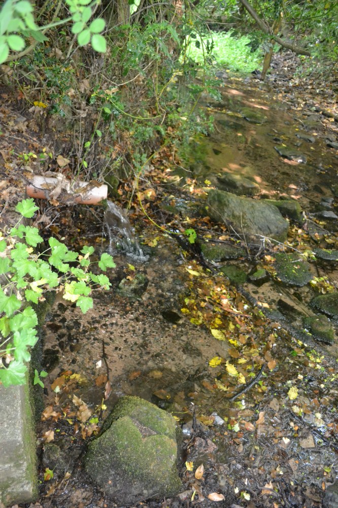
The overflow runs into a delightful brook

The legend tells how after a considerable pursuit, she upon reaching the hermitage, collapsed and died. A monk then used the water to bring her back to life. Potter (1942) tells the story in verse:

“The oaks of the forest were Autumn-tinged,
And the winds were at sport with their leaves
When a maiden traversed the rugged rocks
That frown over WOODHOUSE EAVES.

The rain fell fast – she heeded it not
Though no hut or home appears;
She scarcely knew if the falling drops
Were rain drops or her tears.

Onward she hied through the OUTWOODS dark
(And the Outwoods were darker then)
She feared not the Forest’s deepening gloom She feared unholy men.

Lord Comyn’s scouts were in close pursuit,
For Lord Comyn the Maid had seen,
And had marked her mother’s only child
For his paramour, I ween.

A whistle, a whoop from the BUYK HYLLS side,
Told Agnes her foes were nigh:
And screened by the cleft of an aged oak,
She heard quick steps pass by.

Dark and dread fell that autumn night:
The wind-gusts fitful blew:
The thunder rattled: – the lightning’s glare
Showed BEACON’s crags to view.

The thunder neared – the lightning played
Around the sheltering oak;
But Agnes, of men, not God afraid,
Shrank not at the lightning’s stroke!

The thunder passed – the silvery moon
Burst forth from her cave of cloud,
And showed in the glen “Red Comyn’s” men,
And she breathed a prayer aloud:-

“Maiden mother of God! Look down
List to a maidens prayer:
Keep undefiled my mother’s sole child
The spotless are thy care”

The sun had not glinted on BEACON HILL
Ere the Hermit of the HOLY WELL
Went forth to pray, as his wont each day,
At the cross in Fayre-Oke dell.

Ten steps had he gone from the green grassy mound
Still hemming the HOLY WELL HAW,
When, stretched on the grass – by the path he must pass
A statue-like form he saw!

He crossed himself once, he crossed himself twice,
And he knelt by the corse in prayer:
“Jesu Maria! cold as ice –
Cold – cold – but still how fair!”

The Hermit upraised the stiffened form,
And he bore to the HOLY WELL:
Three Paters or more he muttered o’er,
And he filled his scallop shell.

He sprinkled the lymph on the Maiden’s face,
And he knelt and he prayed by her side
Not a minute’s space had he gazed on her face
Ere signs of life he spied…..

Spring had invested the CHARNWOOD oaks
With their robe of glistening green,
When on palfreys borne, one smiling morn,
At the HOLY WELL’s HAW were seen.

A youth and a Lady, passing fair,
Who asked for the scallop shell:
A sparkling draught each freely quaffed,
And they blessed the HOLY WELL.

They blessed that Well, and they fervently blessed
The Holy Hermit too;
To that and to him they filled to the brim
The scallop, and drank anew.

“Thanks, Father! Thanks! – To this well and thee,”
Said the youth, “But to Heaven most,
I owe the life of the fairest wife
That CHARNWOOD’s bounds can boast.

“The blushing bride thou seest at my side.
(Three hours ago made mine)
Is she who from death was restored to breath
By Heaven’s own hand and thine”.

“The Prior of ULVERSCROFT made us one,
And we hastened here to tell
How much we owe to kind Heaven and thee,
For the gift of the HOLY WELL”.

“In proof of which – to the HOLYWELL HAW
I give as a votive gift,
From year to year three fallow deer,
And the right of the Challenge drift”.

“I give, besides, of land two hides,
To be marked from the Breedon Brand:
To be held while men draw from the Well in this Haw
A draught with the hollow hand”.

The Hermit knelt, and the Hermit rose,
And breathed “Benedicite!
And tell me”, he said, with a hand on each head,
“What heaven sent pair I see!”

“This is the lost de Ferrers’ child,
Who dwelt at the Steward’s Hay;
And, father, my name – yet unknown to fame
Is simply EDWARD GREY”.

It is thought that after being revived she gave her name to God and became a prioress and some historians link it to a  real life account of Eleanor Ferrars whose was carried off. It also has similarity to legends associated with Essex’s Running Well and Kent’s St. Thomas’s well at Singlewell.

References:

  1. Hope, R. C, 1893, Legendary Lore of the Holy Wells of England, London: Elliot Stock.
  2. Nichols, J.,1795-1810, History and Antiquities of the County of Leicester, London: Nichols
  3. Potter, C.1985, ‘The holy wells of Leicestershire and Rutland’, in Source, 1st series, 1:15–17.
  4. Potter, T. R 1852, History and antiquities of Charnwood Forest
  5. Rattue, J., 1993, ‘An inventory of ancient, holy and healing wells in Leicestershire’, Tr. of the Leicestershire Arch. & Hist. Soc. 67: 59–69. Richardson, L. R., 1931, Wells and Springs of Leicestershire, Memoirs of the Geological Survey.
  6. Trubshaw, B., 1990, Holy Wells and Springs of Leicestershire and Rutland, Heart of Albion, Wymeswold.

Links:

  1. Holy and Healing Wells

Based on the following and part of a forthcoming Holy wells and healing springs of Leicestershire.

©  Ross Parish

St Bunyan’s Well, Leuchars, Fife

Holy Well:  OS Grid Reference NO 45252 21483

Getting Here

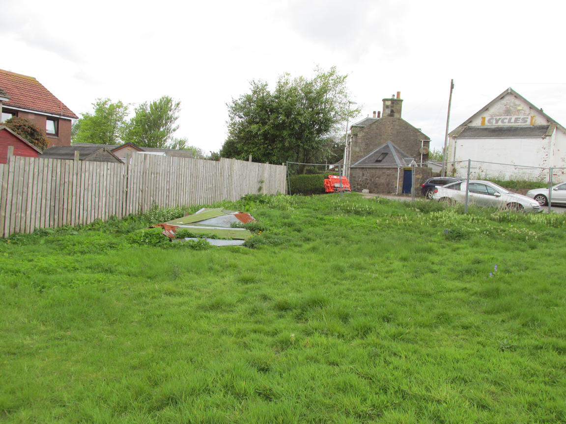
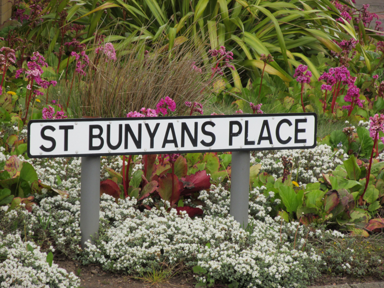
St Bunyan's PlaceIf travelling from Dundee or Newport, turn right into Meadow Road, the last turning before the roundabout in the middle of the town. On the right is a large white-painted building where bicycles are sold. The site of St Bunyan’s Well is on the patch of empty land opposite, to the left nearest the road.

Archaeology & History

Site of St Bunyan's Well
Site of St Bunyan’s Well

The Well is named in conjunction with the ninth century Culdee chapel of St Bunyan on the nearby Temple Hill, now known as School Hill.  St Bunyan has been remembered by various alternative names:  Bunoc, Bonac, Bonoc, Bonnoch, Bunan, Bernard and Bennett, and W. Reid noted in 1909,

“A crown charter of 1539 refers to a yearly market on St. Bonoc’s Day, and a further reference to the Chapel of St Bonach occurs in the confirmation of a charter by James VI.”

Forbes’ Kalendars of Scottish Saints records, under the entry for Saint Bonoc that one of the Endowments of Saint Fergus at St Andrews was the jawbone of Saint Bonoc, given by Bishop David Rhynd.

The mid nineteenth century Ordnance Survey Name Book correspondents Messrs. Pillans and Keddie described the well: “In the village of Leuchars. A excellent Spring Well in the village of Leuchars it is built round with cut stones, and is Kept in good repair by the inhabitants. the date when it was first Constructed is not known but it said to have been before the reformation, dedicated to St. Bunyan hence its name.”

The Reverend Kettle in the Old Statistical Account for Leuchars adds: “There is a most excellent well flowing with an abundant Stream of Soft water near the west en of the village (for the village is now extending westward) called by the name of the saint to whom the Chapel was no doubt consecrated.”

An elderly couple whom I met remembered a small well-house, but I didn’t ask them when it was demolished.  The Saint is remembered in Leuchars by the road name of a modern development in St Bunyan’s Place.  St Bunyan’s Well probably dried up as a result of the increased water demand following the establishment of RAF Leuchars in 1920. The Saint now has his waters extracted by Scottish Water’s Meadow Road Pumping Station.

References:

  1. Reid, William., “Notice of the Discovery of a Group of Full-Length Stone Cists at the School Hill, or Temple Hill, Leuchars“, in Proceedings Society of Antiquaries, Scotland, volume 43, 1909.
  2. Forbes, Alexander Penrose, Kalendars of Scottish Saints, Edmonston and Douglas, Edinburgh, 1872
  3. http://stat-acc-scot.edina.ac.uk/link/1791-99/Fife/Leuchars/18/585/

Link:

  1. Canmore

© Paul T. Hornby, The Northern Antiquarian


Lady’s Well, Leuchars, Fife

Holy Well :  OS Grid Reference NO 45573 21645

Also Known as:

  1. Lady Well

Getting Here

Lady's Well at Leuchars
Lady’s Well at Leuchars

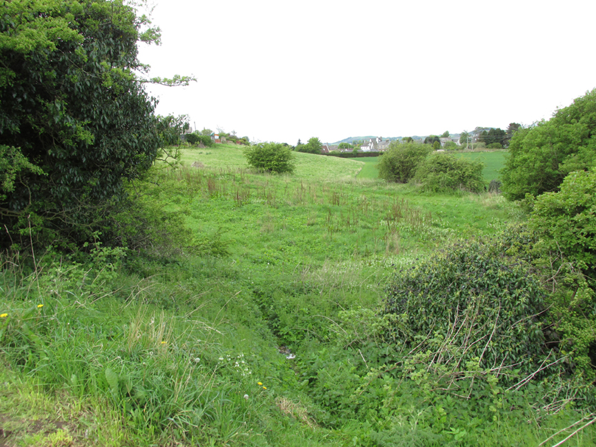
Entering Leuchars from Dundee or Newport go straight ahead through the roundabout; entering from Cupar or St.Andrews turn right at the roundabout, then up School Hill and bear left up the Pitlethie Road, then immediately past a long terrace of bungalows, turn left up an unmade road opposite the school, where you can park up.  Walk down the track, noting the Castle Knowe Motte across the fields ahead and follow the track to the right, and there at the bottom of the slope, below modern housing, is the site of the Lady’s Well.

Archaeology & History

There seems to be only minimal information about Lady’s Well. To the south lies the ancient church of St Athernase, described architecturally as the second finest Romanesque church in Britain (after Durham Cathedral) and apparently built by some of the same masons who built Durham.  Prior to the building of St Athernase, a ninth century Culdee church, dedicated to St Bonoc (also known as St. Bennet or St. Bonach or St.Bernard) stood on the School Hill which rises over Leuchars.  School Hill was anciently known as Temple Hill, perhaps indicating a connection with the Knights Templar.

Writing in the Old Statistical Account for Leuchars in the 1790s, the Reverend Kettle wrote:

“A little north of the east end of the village, to the convenience and comfort of the inhabitants, there is another well of equal excellence, called the Lady well, no doubt consecrated to the Blessed Virgin”

The mid nineteenth century Ordnance Survey name book has the following entry referring to the Lady’s Well, contributed by a Messrs Pillans and David Keddie:

“The site of a Spring Well in a small piece of open ground adjoining the Village of Leuchars. It ran dry before the year 1843 from some unaccountable reason. and in that year A New well was sunk and opened a short distance from it. which since supplys its place. This last was done by subscription by the inhabitants of the village the original well was sunk and opened for use by a Lady of the name of “Carnegie” who formerly Lived at “Leuchars Castle” hence the name “Lady’s Well” it was never resorted to as a holy Well.”

Despite this, we must bear in mind the Kirk’s powerful post Reformation antipathy to holy wells, which may be reflected in the story given by the above two correspondents.

While your writer was bimbling around Leuchars, a chance (?) meeting led to him being introduced to probably the oldest residents in the town (mid- to high-90s).  They only remember the Lady’s Well site being known as ‘The Well Green’ where the old Fife County Council waterworks were once situated, and there we may have the reason for the Well’s physical demise:  modern water extraction to serve Leuchars RAF Station and its ancillary barracks and housing has lowered the water table, leading to the spring drying up as it passes from living memory

Links:

  1. Canmore
  2. Leuchars St. Athernase, Church of Scotland
  3. http://www.scotlandsplaces.gov.uk/digital-volumes/ordnance-survey-name-books/fife-and-kinross-shire-os-name-books-1853-1855/fife-and-kinross-shire-volume-44/61
  4. http://stat-acc-scot.edina.ac.uk/link/1791-99/Fife/Leuchars/18/585/

© Paul T Hornby 2014-16, The Northern Antiquarian


Druidsfield (03), Lochearnhead, Perthshire

Cup-Marked Stone:  OS Grid Reference – NN 58760 23087

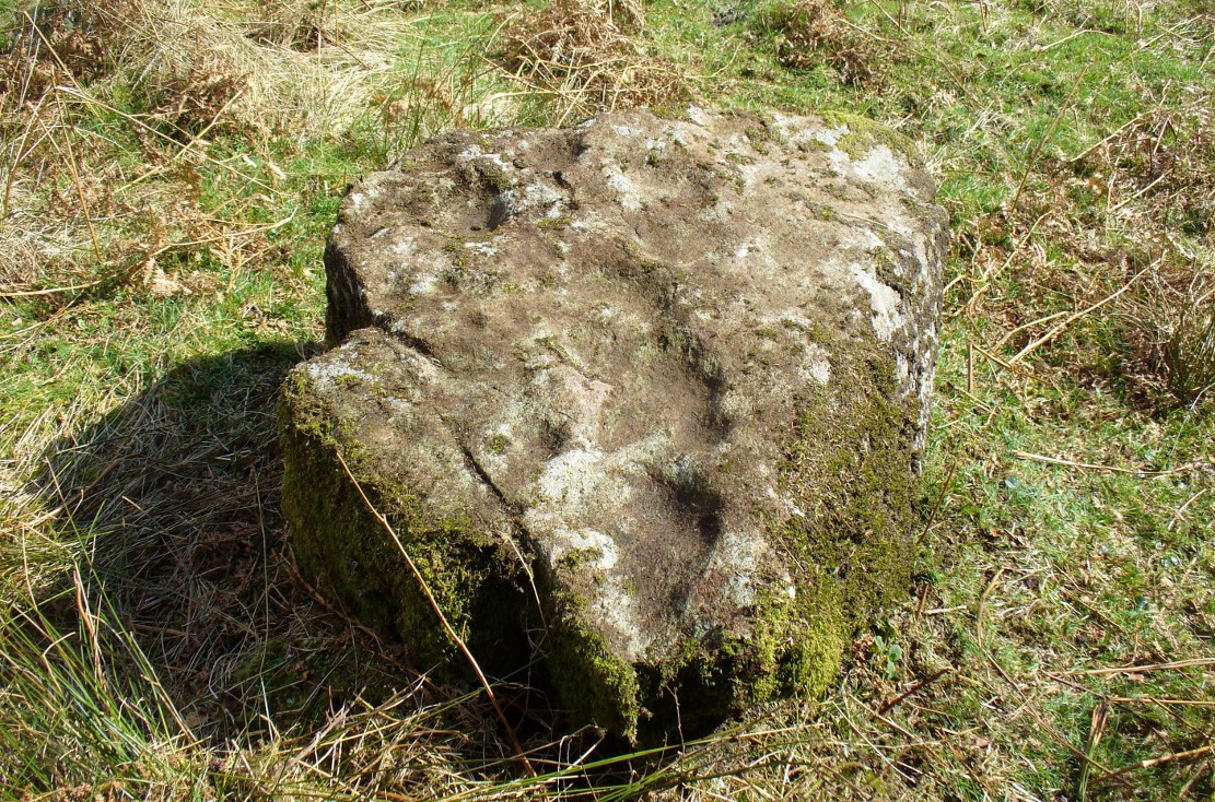
The Druidsfield-3 carved stone

Also Known as:

  1. Canmore ID 24126

Getting Here

Follow the same directions described to reach the Druidsfield 1 and 2 carvings.  This one is the larger upright block right next to them!

Archaeology & History

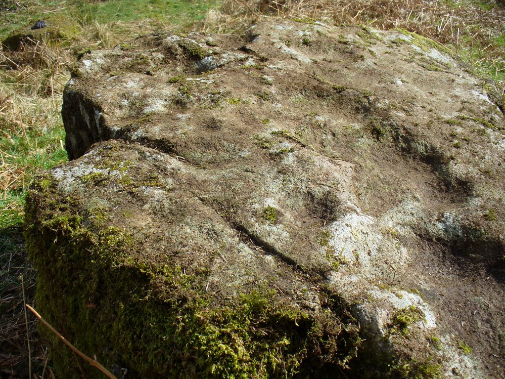
Several of the faint cups visible

Contextually relevant to the two adjacent carvings, this is the largest of the three stones and comprises of a number of natural deep marks associated with between eight or ten man-made cup-markings.  They’re not all immediately apparent, but stand out more as and when natural lighting conditions change.  All of them are on the north and northwestern section of the stone, and measure between 1-3 inches across.  This is the least visually impressive of the stones in this petroglyph cluster.

Folklore

The carvings here were said by one of the locals to have been part of a “druid’s circle, which we played in as children, and were always told had been a special place of the druids in ancient times.”

References:

  1.  Coles, F.R., “Report on stone circles in Perthshire principally Strathearn,” in Proceedings of the Society of Antiquaries, Scotland, volume 45, 1911.
  2. Haggart, D., “Notice of the discovery of a stone cup and cup-marked stones at Lochearnhead,” in Proceedings of the Society of Antiquaries, Scotland, volume 22, 1888.

Acknowledgements – Huge thanks to Paul Hornby for help and use of his photos.

© Paul Bennett, The Northern Antiquarian 


St. Mungo’s Well, Gleneagles, Perthshire

Holy Well:  OS Grid Reference – NN 9376 0719

Also Known as:

  1. Canmore ID 25905

Getting Here

St Mungo's Well, Gleneagles
St Mungo’s Well, Gleneagles

The best way here is to walk a mile to find it.  All the way up the road from Gleneagles Standing Stones to Glendevon, right at the very top where the two glens meet, there’s a small road heading to the Fishery. 100 yards along, park up. Then take the old green road back down the Glen, north towards Gleneagles, parallel with the new road. A mile or so down you’ll reach the farmhouse, but a coupla hundred yards before this, in a wooden gap in the electric fence, you can walk straight downhill to the large pool below you. Y’ can’t really miss it!

Archaeology & History

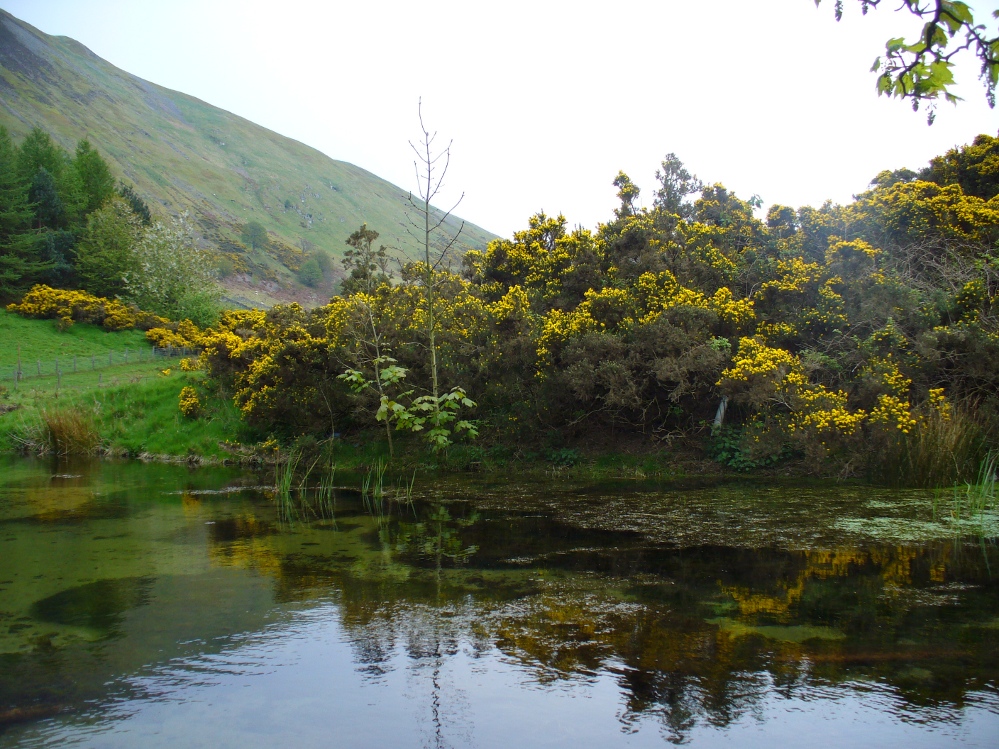
The strong cold spring of water known as St Mungo’s Well, now gathers into a large crystal clear pool and is gorgeous to drink and very refreshing!  All around the edges are the brilliant yellow masses of gorse, held amidst widespread vivid hues of green in this most rocky of landscapes.  Tis a gorgeous setting here….

St Mungo's Well, 1860 map
St Mungo’s Well, 1860 map

Unfortunately there is no literary information that tells us why this spring of water, amongst the many others all around these hills, gained the ‘blessing’ of one of those roaming christians and was deemed to be ‘holy’.  The greatest likelihood, as usual, is that the waters had some important heathen association which our peasant ancestors would have been able to tell us about if their animistic tales hadn’t been outlawed and demonized by the incoming cult — but we’ll probably never know for sure.  As a result, we know nothing now of its medicinal qualities or old stories.

The transference of its old name (whatever it may have been) to their ‘St. Mungo’ may date from when the character was wandering with his christians in the 7th century, but we have no literary account proving as such.  The name ‘St Mungo’ was an alternative name (a nickname if y’ like) of St. Kentigern — or at least that’s what the church historians tell us.  There is no history of Kentigern or St Mungo up the glen, but we do have a more prosaic account that tells of a Mr Mungo Haldane of Gleneagles, a member of the Scottish parliament in 1673 onwards; he was succeeded by another Mungo Haldane MP in 1755.  However, it’s highly unlikely that these political characters gave their name to the well.

The clear waters, looking south
Crystal clear perfect drinking water

Even the Scottish holy wells surveys are pretty silent on this beautiful site.  It was mentioned in Morris’ (1981) survey, but with no real information.  The earliest account seems to come from an article written in the Perthshire Advertiser in 1856, and thankfully reproduced in the otherwise tedious genealogical history of the Haldane (1880) family; but even here, the narrative simply mentions the presence of the well and no more.  Described in a walk up Gleneagles, it told:

“Journeying westward along the desolate moor…we soon came in front of Gleneagles, a narrow picturesque glen in the Ochils, through which the old road from Crieff leads into Kinross-shire.  The hills here, as throughout the whole range, are strictly pastoral, but in no place more so than Gleneagles.  Crowning the heights on both sides of the glen, we have craigs ragged and bare enough; but their show of beetling hard sterility is as nothing to the winding receding mass of grassy heights that bound the view. In looking on that quiet, sunny, Sabbath-like retreat, one would be apt to deem the name a misnomer, and yet it is not much above a hundred years since the monarch of birds had a home among its cliffs.  There, too, the Ruthven Water that dashes past Auchterarder has its rise — not in a scarcely seen bubbling spring almost covered with moss, but issuing at once into daylight at the bottom of yonder steep in volume sufficient to drive a mill.  In ancient times, as now, it must have been an object of mark, as it is called St. Mungo’s Well; but who this St. Mungo or St. Magnus was — whether the ghostly patron of Glasgow, Auchterarder old chapel, or the guardian saint of this particular spot, we cannot tell.  But he seems to have relished cold water; and it is satisfactory to know that he must have got his fill of it there, if his cell happened to be in the vicinity.”

The well was mentioned in passing in the Object Name Book in 1860 and shown on the earliest Ordnance Survey maps.

Folklore

Apart from the fact that the waters here never run dry, we have no other folklore. However it should be noted that St. Mungo’s Day was January 14th — which may have been when the qualities of the spring were deemed most efficacious, or when olde rites were enacted here.  However, a hundred yards down we pass the stream known as Bride’s Burn, probably in honour of the heathen Queen St. Brigit, whose name and myths are integral to our great Earth goddess, the Cailleach and whose celebration date is only two weeks later than that of Mungo.  Hmmmmmmm…..

References:

  1. Attwater, Donald, Penguin Dictionary of Saints, Penguin: Harmondsworth 1965.
  2. Haldane, Alexander, Memoranda Relating to the Family of Haldane of Gleneagles, C.A. MacKintosh: London 1880.
  3. MacKinlay, James M., Folklore of Scottish Lochs and Springs, William Hodge: Glasgow 1893.
  4. Morris, Ruth & Frank, Scottish Healing Wells, Alethea: Sandy 1982.
  5. Watson, Alexander, The Ochils – Placenames, History, Tradition, Perth & Kinross District Libraries 1995.

© Paul Bennett, The Northern Antiquarian


Lady Well, Headon, Nottinghamshire

Holy Well:  OS Grid Reference – SK 748 779

Lady Well, Headon
Lady Well, Headon

Getting Here

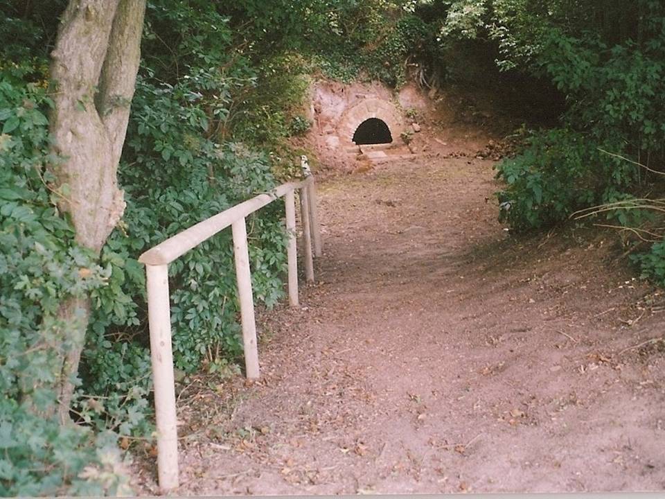
Follow the road around from Headon village to the Ladywell estate and on the left hand side is a small copse and footpath. It is near the junction of Greenspotts Lane and Lady Well Lane. Park carefully near here and walk down the small ravine to the well.

History & Archaeology

Close-up of the well

Only two dates can be confirmed of this site. One a reference in County records of mending a bridge to a ‘Ladyewell‘ in the nearby Markham parish, but this could easily be another site.  A better date is that  1718 which is carved on its arch. It was used as a source of water  until the 1930s. One of the most atmospheric and pleasantly situated sites, the spring is located in a small wooded dell and arises from the rock in a small alcove or cave.  This is fronted by a red brick arch, and the water fills a trough set partly into the ground with a small overflow lip and a channel to fill it, presumably this was for animals. On the key stone of the arch are the initials ‘HW’ and a date which possibly reads 1718.

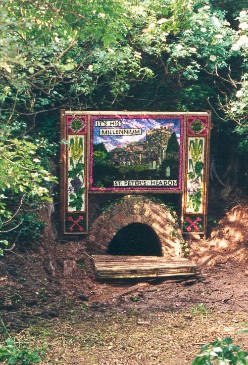
Dressed for 2000AD
Dressed for 2000AD

Folklore

I have found no traditions of healing or other folk belief. However, the site was one of the few Nottinghamshire well dressing sites.  This began in 1981 and continued until 1991, and there was a one-off occurred in 2000 AD.  It was done on the weekend of the churches Patronal festival—St. Peter’s—and was used to use to pay for the church repairs.  The well dressing boards were of a Derbyshire tradition, as can be seen here to the right.

References:

  1. Parish, R.B, (2010) Holy Wells and Healing Springs of Nottinghamshire

Copyright © Pixyled Publications


St. Alkmund’s Well, Derby, Derbyshire

Holy Well:  OS Grid Reference – SK 351 371 

Geting Here

St. Alkmund’s Well, Derby

It can be found by taking North Street off Duffield Road (A6) continuing until it joins North Parade and here a little lane, called Well Street comes off and the spring is at the junction of this and Bath Street on the left hand side.

Archaeology & History

First recorded in 1190 in a rental agreement but considering its association probably earlier. The well is dedicated to the Saxon saint who died 800 AD and whose tomb or shrine was located in church nearby (and is now located in the Derby Museum).  Little is recorded of its history however.

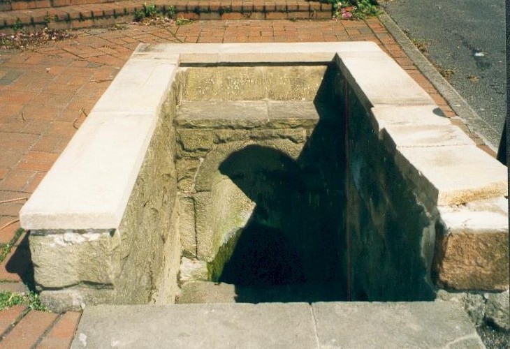
The well is below ground level with four steps to its water which flows with some force into an oval basin. A stone carving states its name. The plaque reads:

“Until the area was built up from 1814, the well was in a rural setting, part of St Helen‟s Park. The stone niche surrounding the well was built by the Rev Henry Cantrell in the early 18th century”.

It now sits rather incongruously in an area of urban landscape,  an odd juxtaposition amongst the older houses and tower blocks still exists, but is often prone to vandalism. and has suffered from it. Well dressings were discontinued due to vandalism and it was blocked off my tall metal fencing for a period recently. Now it is surrounded by a small wall and black railings which has blocked access but will protect it.

Folklore

Cox (1875–9) records that a vicar of S. Werburgh’s was cured of his low consumption, after constantly drinking its water, although the sign It has been traditionally dressed, revived in 1870 and continued infrequently until 1993, stopping because the boards were thoughtlessly vandalised. The demolishing of the St. Alkmund’s Church in the 1960s for road widening stopped the tradition of processing to the well. I was told by a local elderly lady that she still drank the water and that it was very pure…I was not sure myself!

References:

  1. Parish, R.B, (2010) Holy Wells and Healing Springs of Nottinghamshire

Copyright © Pixyled Publications


Druidsfield (02), Lochearnhead, Perthshire

Cup-Marked Stone:  OS Grid Reference – NN 58759 23087

Also Known as:

  1. The Druidsfield 2 cup-marked stone
    The Druidsfield 2 stone

    Canmore ID 24126

Getting Here

Follow the same directions as if you’re going to the much overgrown, earthfast Druidsfield 01 carving. Adjacent is an upstanding block of large rock, right next to which is the flat surface of this Druidsfield 2 carving. If it’s overgrown, rummage around. You can’t miss it!

Archaeology & History

This carving and its compatriots have almost been forgotten about it seems.  Buried beneath rolls of vegetation, this long flat rock covered in cup-markings seems to have played a part in some larger megalithic structure—but whatever it was is difficult to work out.  As you walk around the place it gives the distinct impression that some form of tomb was once in evidence, which may have been the case.  The Scottish archaeology giant Audrey Henshall is said to have found no evidence of a chambered tomb, but this may have been something smaller, less impressive.

When Mr Haggart (1888) wrote about this carving, he too thought that the carvings had been part of a tomb—this being the horizontal surface at the bottom.  He wrote that,

“the one forming the floor area of the dolmen being a square-shaped boulder of diorite, having fifty cups, varying from three and a half inches to an inch in diameter, the outlines of which look as fresh as if chiselled a year or two ago.”

The main cluster of cups

This indicates it had only recently been uncovered.  There are lots of other archaeological remains scattered all round here, from different periods of history; but the other Druidsfield 1 and 3 carvings are found right next to each other, indicating this very spot was some site of neolithic or Bronze Age importance.  An accurate excavation of the site and the adjacent Druids Circle would be worthwhile.  I counted at least 44 cups on this rock when we visited last week, many of which are still quite clear.

The most recent Royal Commission (1979) briefing of the stone added nothing of relevance. They listed the site but it seems they never visited the place.

The portable bullaun-like deep-cut rock known as the Druid’s Stone is kept in private grounds nearby.  When members of Scottish heritage came to visit an adjacent site a few years ago, the lady of the house told how they walked right past it without giving it any notice. “They didn’t even see it under their noses,” she said.  Nowt new there!

Folklore

The carvings here were said by one of the locals to have been part of a “druid’s circle, which we played in as children, and were always told had been a special place of the druids in ancient times.”

References:

  1.  Coles, F.R., “Report on stone circles in Perthshire principally Strathearn,” in Proceedings of the Society of Antiquaries, Scotland, volume 45, 1911.
  2. Haggart, D., “Notice of the discovery of a stone cup and cup-marked stones at Lochearnhead,” in Proceedings of the Society of Antiquaries, Scotland, volume 22, 1888.
  3. Royal Commission on the Ancient & Historical Monuments of Scotland, Archaeological Sites and Monuments of Stirling District, Central Region, Society of Antiquaries of Scotland 1979.

Acknowledgements – Huge thanks to Messr Paul Hornby for help and use of his photos.

© Paul Bennett, The Northern Antiquarian


Druidsfield (01), Lochearnhead, Perthshire

Cup-Marked Stone:  OS Grid Reference – NN 58761 23087

Also Known as:

  1. Canmore ID 24126

Getting Here

Druidsfield Cup-Marked Stone

From Lochearnhead village going south along the main A84 road to Callander or Stirling, take the very last road on the right just as you’re going out of the village, up o Craggan and park up by St. Angus’ Church. Walk back down onto the A84, turning right and walk along for 100 yards. Then go back up into a boggy field, where you’ll notice some walling above you. Head to the top right of this, up to the edge of a garden. Hereby is a cluster of rocks in a jumble. That’s your spot!

Archaeology & History

Cup-marks along the edge and bottom of the stone

This takes a bit of finding in the undergrowth and is best checked out at the end of Winter.  Once overgrown it truly takes some finding.  But beneath the vegetation is a slender earthfast rock with a long ridge, a little bit like a spine, running from one end of the stone to the other.  Along this topmost spinal column we find a cluster of ten cup-markings, getting smaller in size the further along the spine we travel.  It’s a curious feature.  At the widest end of the rock where the widest and deepest cup-marks occur, another four cups have been etched into the northeastern sloping face below the largest cups.

When we came here, the sunlight was blocked by the surrounding trees, so we were unable to see if other elements had been carved onto the stone.  It is found in conjunction with two other rocks—Druidsfield 2 and 3 carvings—right next to each other, with designs of quite different visual structures, seemingly unconnected in any linear sense.  There also seemed to be a possibility that this was once part of a prehistoric tomb.  Later we found that both D. Haggart (1888) and Fred Coles (1911) had made similar comments, with Haggart specifically telling there to have been a collapsed tomb here in the 19th century.  He may have been right.  Extensive walled structures abound hereby−including one which old locals told us were remains of a Druid’s Circle, which we found close by.

Folklore

The carvings here were said by one of the locals to have been part of a “druid’s circle, which we played in as children, and were always told had been a special place of the druids in ancient times.”

References:

  1.  Coles, F.R., “Report on stone circles in Perthshire principally Strathearn,” in Proceedings of the Society of Antiquaries, Scotland, volume 45, 1911.
  2. Haggart, D., “Notice of the discovery of a stone cup and cup-marked stones at Lochearnhead,” in Proceedings of the Society of Antiquaries, Scotland, volume 22, 1888.

Acknowledgements – Huge thanks to Messr Paul Hornby for help and use of his photos.

© Paul Bennett, The Northern Antiquarian


Newell’s Well, Glentham, Lincolnshire

Holy Well:  OS Grid Reference – SK 981 897

Getting Here

Newll's Well, Glentham
Newll’s Well, Glentham

Leave Glentham on the way to Caenby Corner. You pass a footpath marked on the right-hand side (it goes to Highfield farm). The road makes a bend to the right and then before a slighter turn to the left, just before this last bend there is a little lane to the right. Park safely here and then there is copse. You will need to scramble down there and follow the small stream to its source. It runs almost just under the road.

Archaeology & History

Many wells have associations with seasonal customs, but perhaps one of the most unusual traditions is that found in the Glentham Parish in Lincolnshire. Here can be found the Newell or Newell’s Well which had associated with it a rather unique custom: the ceremony of ‘Washing Molly Grime’ The tradition appears to have become confused over the centuries. A full account is recorded by a H. Winn in Notes and Queries (1888-9):

“The church of Glentham was originally dedicated to Our Lady of Sorrows, a circumstance obviously alluded to by a sculpture in stone of the Virgin supporting the dead Christ in her arms, still to be seen over the porch entrance and placed there by some early representative of the Tourneys of Caenby, who had a mortuary chapel on the north side of Glentham church. The washing of the effigy of the dead Christ every Good Friday, and strewing of his bier with spring flowers previous to a mock entombment, was a special observance here. It was allowed to be done by virgins only, as many desired to take part in the ceremony being permitted to do so in mourning garb. The water for washing the image was carried in procession from Neu-well adjacent. A rent was charged of seven shillings a year was left upon some land at Glentham for the support of this custom, and was last paid by W. Thorpe, the owner, to seven old maids for the performance of washing the effigy each Good Friday. The custom being known as Molly Grime’s washing led to an erroneous idea that the rent charge was instituted by a spinster of that name, but ‘Molly Grime’ is clearly a corruption of the ‘Malgraen’ i.e. Holy Image washing, of an ancient local dialect. About 1832 the land was sold without any reservation of the rent charge.”

The origin for the wells name is also confused.  Rudkin (1936) notes:

“They reckon it’s called Newell’s well on account of a man named Newell as left money to seven poor widow women..”

However, it is more likely to be simply new well, perhaps deriving its name from ‘eau’, a common word in the county.

When and why the tradition switched from washing the holy image to that supposedly of the Tourney (Lady Anne Tourney a local 14th century land owner) is unclear, but it is possible that the change occurred at the Reformation and that perhaps the money was given to wash both holy image and that of the benefactor and post Reformation only the benefactor washing survived. There is a similar tradition called the ‘Dusters’ in Duffield.  The name of the activity clearly survived as Rudkin that:

 “ they’d wash a stone coffin-top as in the Church; this ‘ere coffin-top is in the form of a women. ‘Molly Grime’ they calls it.”

The tradition even appears to have earned some note nationwide, for a nursery rhyme about the custom is known:

Seven old maids, Seven old maids,
once upon a time, Got when they came
Came of Good Friday, Seven new shillings
To wash Molly Grime, In Charity’s name,
The water for washing, God bless the water
Was fetched from Newell, God bless the rhyme
And who Molly was I never heard tell. And God bless the old maids that washed Molly Grime

Sadly the selling of the land appeared to killed off the tradition, except that between 2004 and 2007 a special Father’s Day race for women was established. This involved filling a balloon with water from Newell’s spring and the subsequent attempt for getting it back to the village without bursting it. In essence it remembered the tradition, but sadly it too appears to have fallen into abeyance.

Folklore

Another tradition in the village was that if one drank its waters one was said never to leave the village. A correspondent of Sutton (1997) states:

 “An old boy told me about the ‘healing well of Glentham. It was named after a saint but I can’t remember the name he used. Some folk call it Newell’s well. Many people came to take the healing waters and in the spring of the year, the Church held an annual service for ‘good water for the rest of the year’, the service marked a new year of the waters. The well was dressed in a traditional way using clay and flower petals to make some kind of picture, usually a saint. I’m told it look very impressive”

This is presumably before the site was enveloped in scrub as it is now. The report is interesting for a number of reasons; firstly because the correspondent refers to the waters as healing, secondly that it was dedicated to a saint and thirdly the account of well dressing more reminiscent of Derbyshire, and as far as I am aware it is only such example, as well dressing at Welton and Louth appeared to be more garland related. None of these observations have been made elsewhere which either casts doubt in the correspondent or more likely the patchy nature of well traditions in the county.

Despite the loss of the custom, the well still survives, the water clear and flowing arises beneath a stone built chamber of seven courses of stonework with a small square outlet through which the water flows.    However, according to recent reports boring in the vicinity has resulted in the water being drained away but I have been unable to ascertain this.

(Essay from the book by R.B. Parish – Holy Wells and healing springs of Lincolnshire)

References:

  1. Parish, R.B., Holy Wells and healing springs of Lincolnshire
  2. Reynolds, Jeff, Glentham Parish Council – Personal Comm.
  3. Rudkin, E.H., (1936) Lincolnshire Folklore
  4. Sutton, M., (1996) A Lincolnshire Calendar
  5. Winn, H (1888-9) in Notes and Queries

Links:

  1. Holy and Healing Wells
  2. In Search of Traditional Customs and Ceremonies

Copyright © Pixyled Publications