Holy Well (destroyed): OS Grid Reference – NN 9397 5770
Archaeology & History
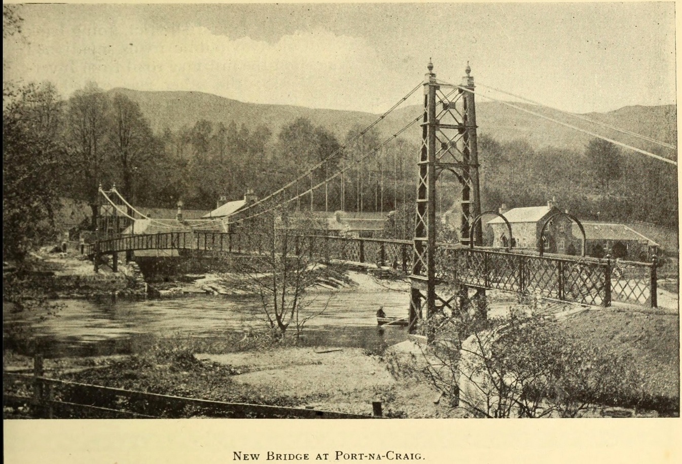
It was more than a hundred years ago that the waters of this sacred well fell back to Earth. They emerged above the eastern side of the River Tummel, close to the bridge where previous there had been a local ferry at the site known as Port-na-Craig. The mythic history of the ferry and the holy well went hand-in-hand, according to local tradition. Its lore was was spelled out by the local author and historian Hugh Mitchell in a speech he gave when a new bridge was opened here in 1913. He said:
The Well was on the far side of the bridge
“The ferry at Port-na-Craig, though not as old as many ferries in Scotland, bears the respectable antiquity of something like eight hundred years. It was established by the monks of Coupar Angus when they got a gift of the lands of Fonab, and as Coupar Angus lay on the north side of the river Tummel, they established the ferry in order to have communication. In those days the ferry boat was made of skins stretched on branches or twigs, so it was somewhat dangerous to cross in, and the monks thought that they would improve the occasion by dedicating the well near the old ferry to St. Bride, so that people, when they ventured across the ferry, might propitiate the saint. It was customary for people to drop either a small coin or a brass pin into the well. He was afraid that brass pins rather prevailed, and no doubt, St. Bride, being a lady, would find them more useful. The well remained until recent times, when it had, unfortunately, to be filled up, on account of being contaminated by neighbouring fields.”
For “fields”, read sewage—for that was the actual reason it was closed. Mr Mitchell (1923) told as much in his subsequent history of Pitlochry, saying that “sewage was percolating into it.” John Dixon (1925) echoed the same thing a few years later.
The curative and magickal properties of St Bride’s Well had considerable renown for local people. Mitchell told that:
“It had a great reputation at one time for cases of lung disease… Pins and coins were dropped into the well as votive offerings, and the bushes above it were hung with rags to call the attention of the saint to the sufferer.”
A few miles north from here, at the back of Blair Castle, an old church is dedicated to St. Bride, whose celebration date is February 1. “The day was known as Candlemas in the Highlands,” wrote Mrs Banks, saying, in commemoration of the Celtic Brigit, “Feill Bride, the festival of Bride, displaced the festival of Mary.”
References:
Dixon, John H., Pitlochry, Past and Present, L. Mackay: Pitlochry 1925.
MacKay, L., Atholl Illustrated, L. MacKay: Pitlochry 1912.
Mitchell, Hugh, Pitlochry District: Its Topography, Archaeology and History, L. Mackay: Pitlochry 1923.
On the west-side of the River Spey from Fochabers, follow the road-signs taking you south on the B9015, and near Inchberry is a tiny road on your right (careful not to miss it). Go along here to the end of the long straight road and turn right, down the track. When you reach the trees, bear left along the track to St Mary’s, Orton, marked “Private road”. 🙂 Parking is limited to one car only but very quiet.
Archaeology & History
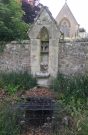
St Mary’s Well, Inchberry (21st Century Pict)
Set in a stunning location next to the river Spey with a magnificent view of Ben Aigan to the south, St Mary’s Holy Well and Pool is easy to find behind the Chapel / Mausoleum wall, dedicated to the Duff Family. There is a small stone basin in the wall which may have been the Chapel font. At the time of my visit the weather has been dry and sunny for some time. The pool below the iron grate has been recently cleared of leaves before my visit, with no standing water but the stones on the bottom of the pool looked damp. And with the cemetery above and behind the wall, perhaps it was for the better.
It was clear and running, said J.F.S. Gordon (1880) at the end of the 1700s, but when he came to write about it the flow “has ceased for many years, and is now only a feeble, filthy, stagnant Driblet for the use of cattle.” Pilgrimages were made here on the first Sunday in May, and water collected from the site was kept for a year, in return for an offering (usually a stone or other inanimate object) that enabled the magickal spirit of the well to enact cures.
Folklore
A site described by Watson (1868) as being “long held in superstitious reverence”, the well was said to cure whooping cough, eye problems and joint conditions. It had thoroughly un-christian shennanigans practised here by local folk, much to the consternation of the usual culprits! Visited extensively by people from far and wide, Mr & Mrs Morris (1981) told,
(21st Century Pict)
“The visits displeased the Kirk and there were various summonses to the Session for “going supersticiously to a Vell at Speyside” and of persons who “kneillit about the chappell and drank the water.” The minister at Ruthven reported that a large number had gone to the chapel well “thrie Saturdays before Lambas and thrie efter called the six silie Saturdayes, and that the conventions wer on the night or before day in the morning.” And “quhairas zierlie about Lambnes, the ignorantes repaired to ane wel at this kirk, called Our Ladie Wel, superstitiouslie, and kneeled about the said kirk, it is reportit that the evil is removed.” This may be the well associated with the White Witch, Dame Aliset, who cured a fairy child with simples and the well water.”
References:
Bord, Janet, Holy Wells in Britain – A Guide, HOAP: Wymeswold 2008.
Watson, J.& W., Morayshire Described, Russell & Watson: Elgin 1868.
Acknowledgements:Huge thanks for use of the Ordnance Survey map in this site profile, reproduced with the kind permission of the National Library of Scotland.
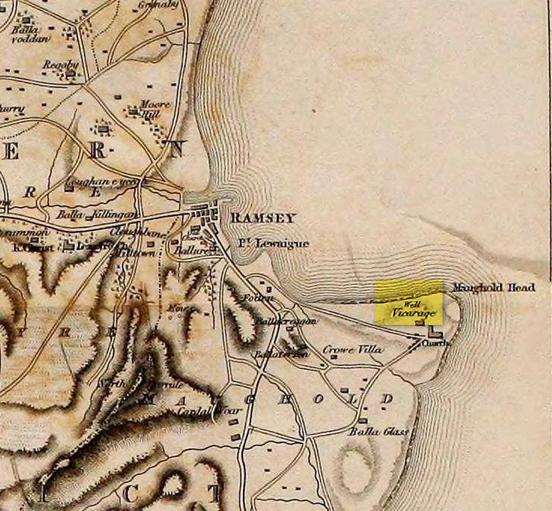
St. Maughold’s Well—also called Chibbyr Vaghal—is found on the northeast side of the headland on the cliff face about a hundred feet above the sea, a quarter mile from the St. Maughold’s church. It was a pilgrimage site which people visited on the dates of November 15 and July 31.
“…Beneath the head, under some moss clad rocks, is a deep spring, formerly much celebrated for its supposed medicinal virtues.” – George Jefferson, 1840
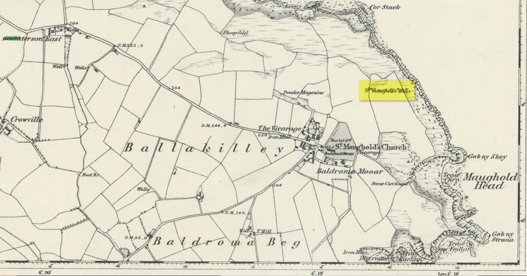
St Maughold’s on 1870 map‘Well’ on the 1836 map
Its medicinal properties are of great repute and was resorted to by many on account of its sanctity by crowds of pilgrims. The well was traditionally visited on the first Sunday in August, being the first Sunday after the Saint ‘s principal feast day, July 31 (significant in the Celtic calendar), but the devotions here have their origins in pre-christian times. The principal benefit at the well was a cure for sore eyes. After bathing the eyes or drinking the water it was/is customary to drop a coin, pin or button into it. Alternatively, a piece of cloth which had been used for bathing the eyes would be left by the well or on a nearby bush. As the cloth rotted, the ailment would be cured; while anyone who picked up the rags would himself receive the complaint associated with the offering; and to receive the full benefit of the well’s curative powers it should be visited on that first Sunday in August, and “while books were open in the church” — or in pre-reformation days, whilst Mass was being offered.
“…Where the spring gushes forth the rock has been hollowed into a small basin, and over it has been erected a simple shed of rough unhewn blocks of the rock immediately at hand. Hither the Saint is said to have resorted; nor is it altogether improbable that nearly fourteen hundred years ago at this very font he administered the baptismal rite. Certainly it was for many ages in great repute for its medicinal properties, and was resorted to on account of its sanctity by crowds of pilgrims from all parts. Nor is it yet forgotten.” – J.G. Cumming, 1848
“…A drink of its water, taken after resting in the saint’s chair close by, is supposed to be an unfailing cure for barrenness in women.” – A.W. Moore, 1890
Folklore
At Maughold churchyard above the well, ghostly whispers are said to be heard by the steps in the churchyard. This is interesting as when excavations were done here, the labourers found bones buried beneath the same steps. They were dug and exposed during the day and one worker who stayed in the church heard distant sounds, whispers and murmuring all around the church. When the bones were reinterred, the haunting stopped. (Bord & Bord 1985)
References:
Bord, Janet & Colin, Sacred Waters: Holy Wells and Water Lore in Britain and Ireland, Granada: London 1985.
Cumming, J.G., The Isle of Man: Its History, Physical and Ecclesiastical, J. van Voorst: London 1848.
Hall, John, “Earth Mysteries of the Isle of Man,” in Earth, no.17, 1990.
Moore, A.W., The Surnames and Place-Names of the Isle of Man, Elliot Stock: London 1890.
Jefferson, George, Jefferson’s Isle of Man, G. Jefferson: Douglas 1840.
Radcliffe, William & Constance, A History of Kirk Maughold, Manx Museum: Douglas 1979.
Acknowledgements:Huge thanks for use of the Ordnance Survey map in this site profile, reproduced with the kind permission of the National Library of Scotland.
OK—I’m cheating here, as I’ve not visited this site (bad of me!). The directions given here are from Harper’s 1876 Rambles in this area. He told that the stone “stands about 100 yards to the north of the march dyke betwixt Upper Ervie, now Ken-Ervie and Nether Ervie. There is little to indicate its whereabouts, but the visitor coming from Kenmure Bridge, and leaving the road on the left, opposite Ringour and Bennan farms, on the opposite side of Loch Ken, would come upon it without much trouble by following the march dyke half a mile up.” Basically, along the A713 just over 2 miles north of the bridge at Parton (½ mile before reaching the Galloway Activity Centre), 60 yards from the “Farm Access No Parking” spot, in the trees a long straight line of walling runs uphill. That’d be my route—straight up!
Archaeology & History
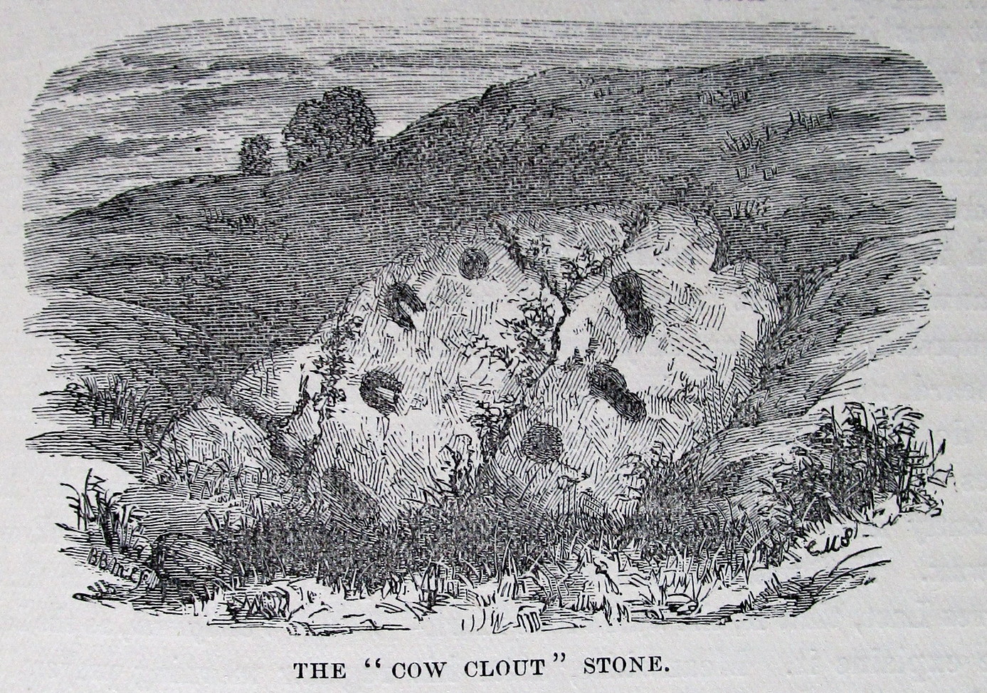
This is a curious entry that I’ve added without visiting the site; but as I might never get to see it I thought it should be displayed in the hope that others might check it out. The earliest literary reference to it is from Crosbie’s (1845) entry in the New Statistical Account, where he implies that the markings on the stone are not of Nature’s handiwork. In Malcolm Harper’s (1876) fine work exploring the history and folklore of this region, he gave us the first illustration of the stone, which looks suspiciously like elements that we find on cup-and-ring stones. Many years later when the Royal Commission (1914) lads followed up on Crosbie’s entry, they thought the markings were probably Nature’s handiwork. They told that:
“It is an irregular mass of outcropping rock about 3 feet in diameter, and bears on its surface certain depressed markings supposed to represent a cow’s foot, a horse-shoe, and impressions which might be made by a man’s foot and knee in the act of kneeling. The markings appear to be natural.”
But it’s the animistic elements and traditions here which are important and which gave the stone its very name…
Folklore
When Rev. W.G. Crosbie (1845) first wrote about this stone, he was narrating the tale told of it by local people, whose traditions were greatly neglected by the majority of writers at that time. Such stories should be preserved at all times, as they tell us more about the psychocosms of pre-industrial cultures. Here,
“On the farm of Arvie, there is a flat stone about three feet in diameter, on which are the marks of what might be supposed a cow’s foot, a horse shoe, the four nails on each side being very distinct, and the impression which might be made by a man’s foot and knee while he was in the act of kneeling, the knot of the garter being quite evident. The tradition connected with this remarkable stone, commonly called the ‘Cow Clout,’ is, that the proprietor, in order to get up arrears of rent, “drave the pun,” or in other words, carried off the hypothecated stock, while a fierce resistance was made by the people, and that over this stone, on which a man had just been praying for relief against his enemies, the cattle passed followed by an officer on horseback, and that it remains as a memorial to posterity of the cruel deed.”
If someone in that neck o’ the woods can find out if the stone’s still there and perhaps send us a photo, or stick it on our Facebook group, that’d be great! 🙂
References:
Coles, Fred, “The Recent Cup and Ring Mark Discoveries in Kirkcudbrightshire”, in Proceedings Dumfriesshire & Galloway Natural History and Antiquarian Society, volume 5, 1888.
Crosbie, W.G., “Parish of Parton,” in New Statistical Account of Scotland – volume 4, William Blackwood: Edinburgh 1845.
Harper, Malcolm M., Rambles in Galloway, Edmonston & Douglas: Edinburgh 1876.
Royal Commission Ancient & Historical Monuments & Constructions of Scotland, Inventory of Monuments and Constructions in Galloway – volume 2: County of the Stewatry of Kirkcudbrightshire , HMSO: Edinburgh 1914.
About mile south of Northchurch, on the far side of the A41 dual carriageway, somewhere past the old crossroads (or perhaps even at the crossing) an ancient tree lived—and truly lived in the minds of local people, for perhaps a thousand years or so. Mentioned in the Lay Subsidy Rolls in 1307, the Cross Oak gave its name to the old building that once stood in the trees and the hill itself, at the place now known as Oak Corner. Whether or not a “cross” of any form was set up by this old oak, records are silent on the matter. Its heathen ways however, were pretty renowned! (a plaque should be mounted here)
Folklore
The first reference I’ve found of this place is in William Black’s (1883) folklore survey where he told that “certain oak trees at Berkhampstead, in Hertfordshire, were long famous for the cure of ague”—ague being an intense fever or even malaria. But a few years later when the local historian Henry Nash (1890) wrote about this place, he told that there was only one tree that was renowned for such curative traditions, that being the Cross Oak. He gave us the longest account of the place, coming from the old tongues who knew of it when they were young—and it had it’s very own ritual which, if abided by, would cure a person of their malady. “The legend ran thus”, wrote Mr Nash:
“Any one suffering from this disease was to proceed, with the assistance of a friend, to the old oak tree, known as Cross Oak, then to bore a small hole in the said tree, gather up a lock of the patient’s hair and make it fast in the hole with a peg, the patient then to tear himself from the tree, leaving the lock behind, and the disease was to disappear.
“This process was found to be rather a trying one for a weak patient, and by some authority unknown the practice was considerably modified. It was found to be equally efficacious to remove a lock of hair by gentle means, and convey it to the tree and peg it in securely, and with the necessary amount of faith the result was generally satisfactory. This is no mere fiction, as the old tree with its innumerable peg-holes was able to testify. This celebrated tree, like many other celebrities, has vanished, and another occupies its place, but whether it possesses the same healing virtues as its predecessor is doubtful. It is however a curious coincidence, that the bane and the antidote have passed away together.”
The lore of this magickal tree even found its way into one of J.G. Frazer’s (1933) volumes of The Golden Bough, where he told how the “transference of the malady to the tree was simple but painful.”
Traditions such as this are found in many aboriginal cultures from different parts of the world, where the spirit of the tree (or stone, or well…) will take on the illness of the person for an offering from the afflicted person: basic sympathetic magick, as it’s known. Our Earth is alive!
References:
Black, William G., Folk Medicine, Folk-lore Society: London 1883.
Frazer, James G., The Scapegoat, MacMillan: London 1933.
Jones-Baker, Doris, The Folklore of Hertfordshire, B.T. Batsford: London 1977.
Nash, Henry, Reminiscences of Berkhamsted, W. Cooper & Nephews: Berkhamsted 1890.
Acknowledgements:Huge thanks for use of the Ordnance Survey map in this site profile, reproduced with the kind permission of the National Library of Scotland.
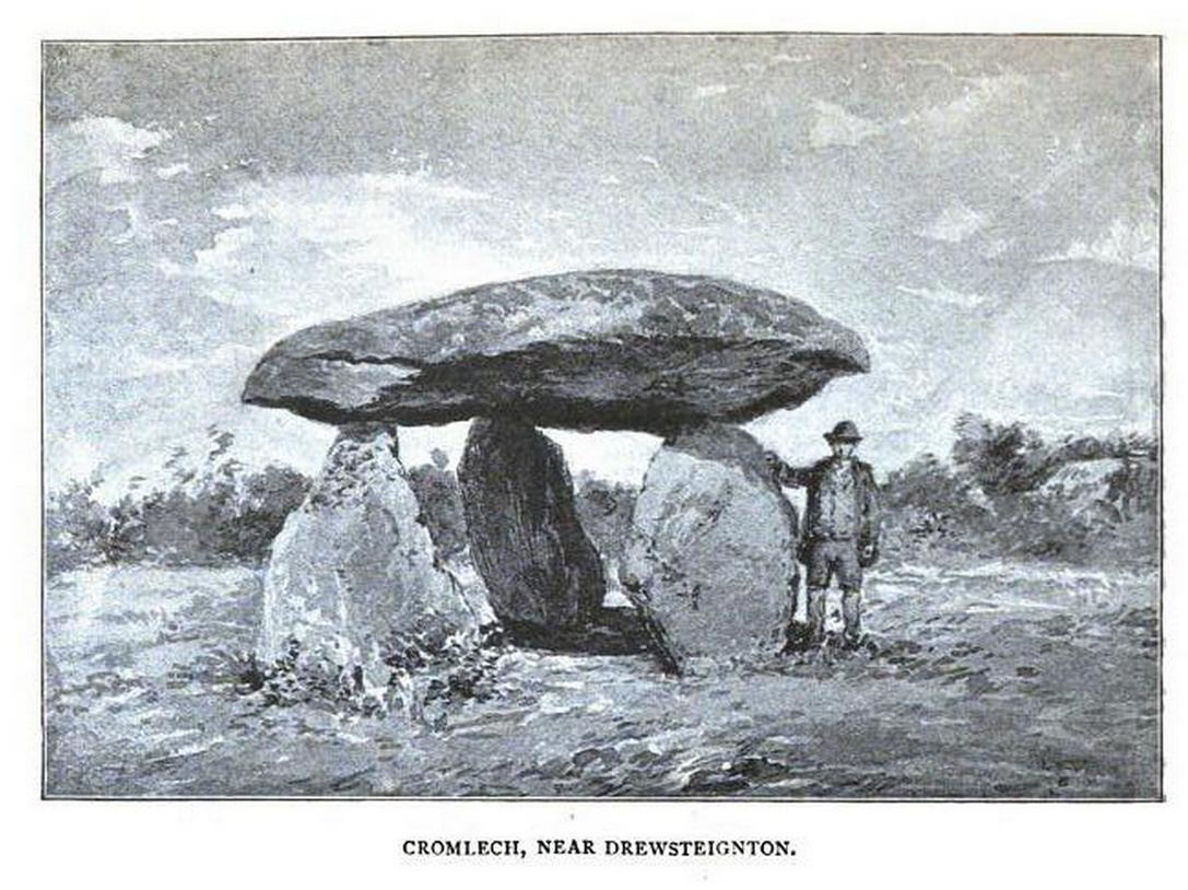
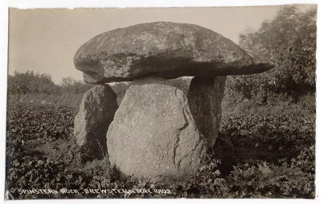
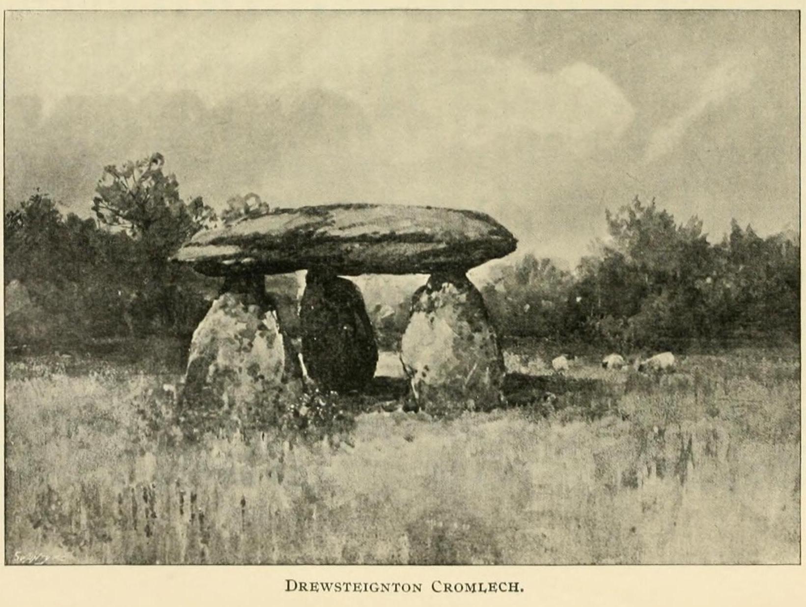
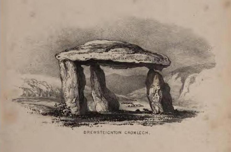
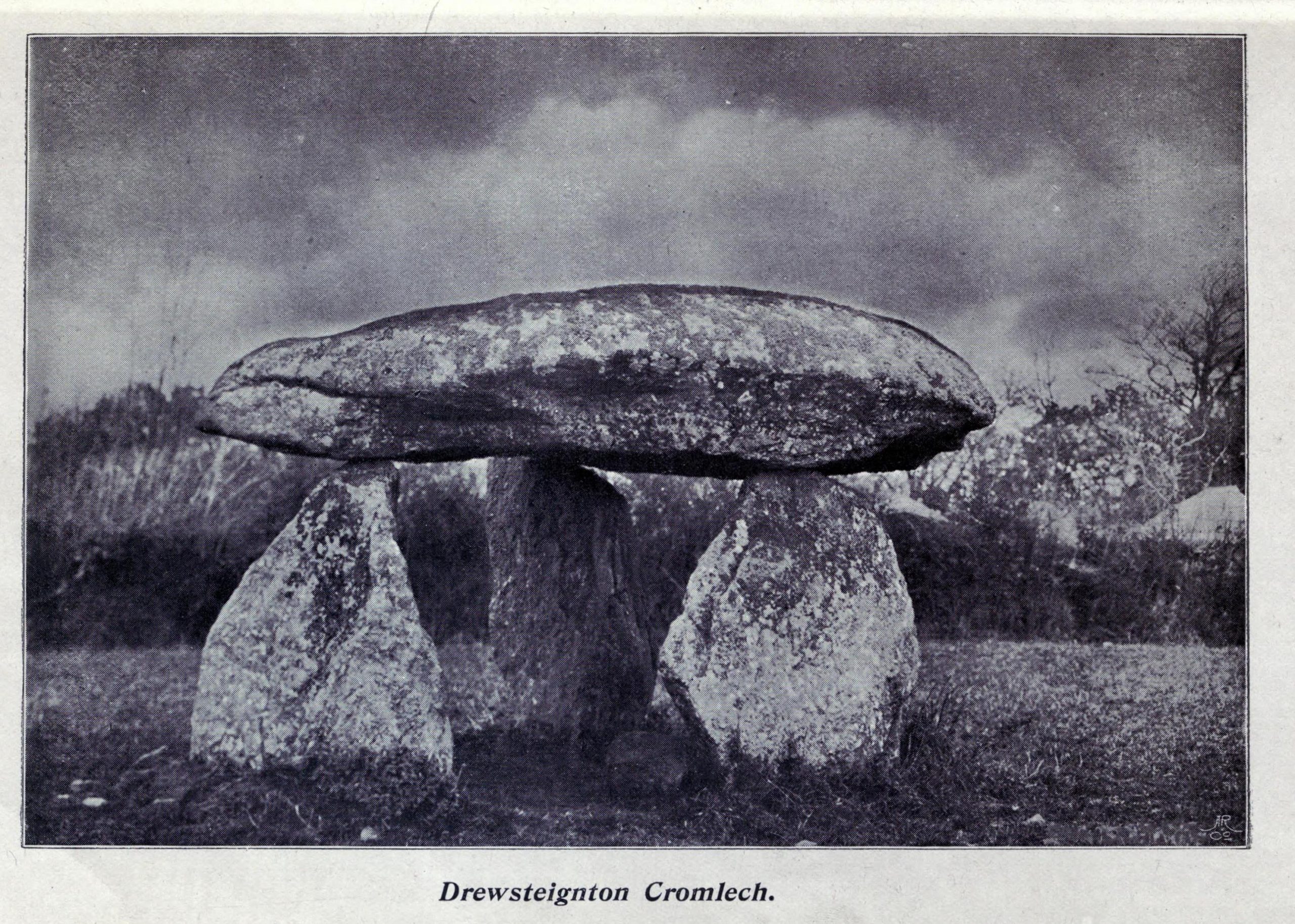
Highlighted on Benjamin Donn’s map of Devon in 1765, this impressive neolithic dolmen consists of three large granite support stones between 5 ft 7 in and 7 ft 7 in tall, surmounted by a large capstone measuring 15 feet by 10 feet. It collapsed in 1862 but was restored later the same year.
Folklore
In Murray’s (1851) Handbook for Travellers he told the following tale of the site:
This interesting old monument derives its name from a whimsical tradition that three spinsters (who were spinners) erected it one morning before breakfast; but “may we not,”* says Mr. Rowe (Peramb. of Dartmoor), “detect in this legend of the three fabulous spinners the terrible Valkyriur of the dark mythology of our Northern ancesters – the Fatal Sisters, the choosers of the slain, whose dread office was to ‘weave the warp and weave the woof of destiny.'”
Polwhele informs us that the legend varies, in that for the three spinsters some have substituted three young men and their father, who brought the stones from the highest part of Dartmoor; and in this phase of the legend has been traced an obscured tradition of Noah and his three sons.
.. The hill on which it stands commands an excellent view of Cawsand Beacon. About 100 yds. beyond the cromlech on the other (N.) side of the lane, is a pond of water, of about 3 acres, called Bradmere Pool, prettily situated in a wood. It is said to be unfathomable, and to remain full to the brim during the driest seasons, and some regard it as artificially formed and of high antiquity – in short a Druidical pool of lustration connected with the adjacent cromlech..
.. The country-people have a legend of a passage formed of large stones leading underground from Bradmere to the Teign, near the logan stone..
References:
Baring-Gould, Sabine, A Book of Dartmoor, London 1900.
Crossing, William, Gems in a Granite Setting, Western Morning News: Plymouth 1905.
Falcon, T.A., Dartmoor Illustrated, James G. Comin: Exeter 1900.
Murray, John, A Hand-book for Travellers in Devon & Cornwall, John Murray: London 1851.
Ormerod, G. Waring, Notes on Rude Stone Remains Situate on the Easterly Side of Dartmoor, privately printed 1873.
Page, John Lloyd Warden, An Exploration of Dartmoor and its Antiquities, Seeley: London 1892.
Worth, R. Hansford, Worth’s Dartmoor, David & Charles: Newton Abbot 1967.
Acknowledgements:Huge thanks for use of the Ordnance Survey map in this site profile, reproduced with the kind permission of the National Library of Scotland.
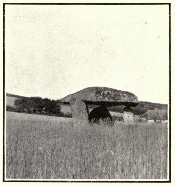
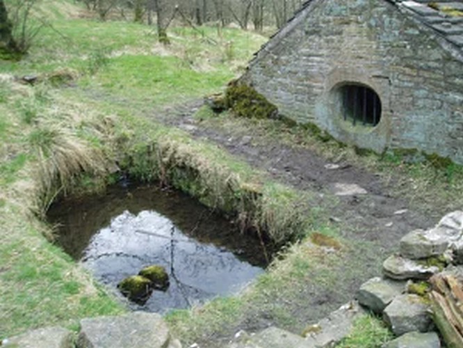
Take the A675 road to Bolton from Abbey Village, going up the track opposite Piccadily farmhouse until you reach the ruins in the woods. The site can also be reached by going south down the Tockholes Road car park following the sign for Hollinshead Hall on your right.
Archaeology & History
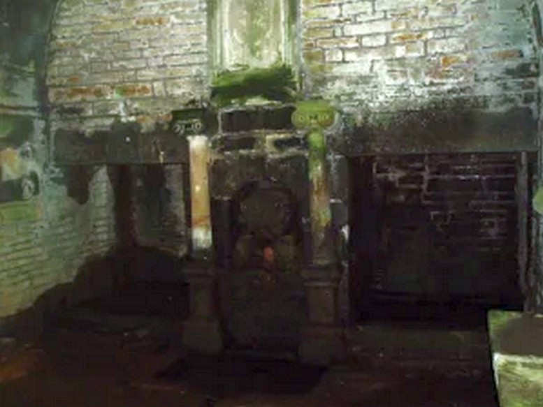
Hollinshead Hall
Associated with Hollinshead Hall, which is now a ruin, the well is made of the same sandstone rubble as the hall with a stone slate roof. The building a single cell is built into a slope from which the spring arises and is encapsulated by it. Either side a high walls creating a sort of forecourt with side benches with inward-facing chamfered piers with ball finials at the ends. The well house itself is quite an attractive building and is certainly not thrown up, having a symmetrical facade with chamfered unglazed widows which are fitted with spear-headed iron bars and clearly the building has never been glazed. The gable end has a large oval opening with a matching one at the rear. In the centre is a heavy board door with a chamfered doorway. This doorway unfortunately is locked baring any entrance to the well house.
Peering in through the windows one can see how strong the vaulted roof is, adorned by a pendent ball in its centre. The spring’s water flows from a crudely carved lion’s head, either side of a reredo of Ionic colonnettes, with a sunken stone tank beneath or each side a rectangular recess which enclose rectangular pools. There is a diamond-paved floor with a central gutter draining from this well or trough at centre of rear wall.
Local tradition accounts that there was a site here from Medieval times and indeed, that the name Hollinshead was derived from a version of holy well although O.E hol, for hollow is more likely although there is a Halliwell Fold Farm nearby being derived from O.E halig for healing. The pool with steps down above the well house may be the original well of course. The discovery of a hoard of medieval coins in 1970s would support the date and perhaps they were an offering.
Folklore
Abram’s Blackburn (1877) is perhaps the first to state that the water was curative. However, anonymous quote in Nightingales History of Tockholes describes the well as:
“Here no less than five different springs of water, after uniting together and passing through a very old carved stone representing a lion’s head, flow into a well. To this Well pilgrimages were formerly made and the water which is of a peculiar quality, is remarkable as an efficacious remedy for ophthalmic complaints.”
Another tradition is that the site was a resting place for pilgrims to Whalley Abbey and that the trough was used as baptistery, however, this would be more likely to be the spring above the well house. It is probably a spring house, a structure built over a natural source of water for the storage of dairy products and other foods that needed to be kept fresh.
Reculsancy was very prevalent in Lancashire and the well house does the bear the coat of arms of the Radcliffes. It would suggest why the structure is so ornate and suggest a 1600s date—although many authorities suggest an 18th century origin. The site would be a secret baptistery and its design as a dairy would also help as well as being still function, certainly the presence of benches suggest this functionality. It appears to be too close to the house to be a garden folly such as a grotto! The suggestion of stained glass in the windows suggests something more significant discovered during the present stone roof’s construction. Indeed, the choice of the lion’s head is possibly that of the ‘Lion of Judah’, meaning Jesus providing rich and valuable water, although this is a common motif on many drinking fountains of course! Interesting, Cramshaw (1994) tells us that the site was in the 1980s the site of a well dressing, although what type is unclear and no other author has mentioned it as far as I am aware. Perhaps we shall never know the real origin of this delightful building.