Lidstone, Chipping Norton, Oxfordshire

Standing Stones:  OS Grid Reference – SP 35487 24627

Also Known as:

  1. King Lud’s Stone
  2. Leodwine’s stone

Getting Here

Just get to the top of the hill thru the village and where the sharp bend turns, you’ll find one of the monoliths up against the wall above the roadside (hard to find in the undergrowth sometimes!).  The other stone is on the eastern side of the road through Lidstone from the A44, halfway into the village itself.

Archaeology & History

Lidstone monolith
Lidstone monolith

There are two small stones to be found in the lovely little hamlet of Lidstone.  The main one—Leodwin’s Stone—is at coordinate SP 35517 24656; and the smaller stone further up the hill is at SP 35487 24627.  First described in a treatise from 1235 AD as Lidenstan, the great place-name writer Ekwall (1940) thought this derived from ‘Leodwine’s Stone.” A few years later Gelling (1954) told us that “there is a monolith at Lidstone”, which she thought gave rise to the place-name, and not some chap named Leodwine.  Whichever it may be, we certainly have two small upright stones here — both worth having a look at if such things take your interest. (Tom Wilson and I included them in our short survey of the standing stones of the region in 1999) Further up at the top of the hill from here are the remains of an old tumulus.

Folklore

Said by Caroline Pumphrey (1990) to be the resting place of old King Lud, one of England’s last great pagan kings; another local writer Elsie Corbett (1962) also told a tale well-known to folklore students about this little monolith.  She related how a local man they knew as Mr Hitchcock told them,

“that they used to kid the boys there by telling them that when the stone hears the clock strike twelve it goes down to the stream to drink, and that it was just a ‘catch’ because there was no striking clock in the first place; but it is a ‘catch’ tacked onto some tale that must have been told in the hamlet long ages before there were clocks at all.”

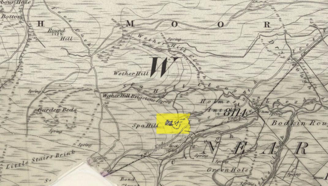
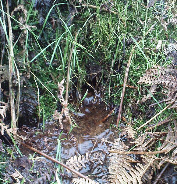
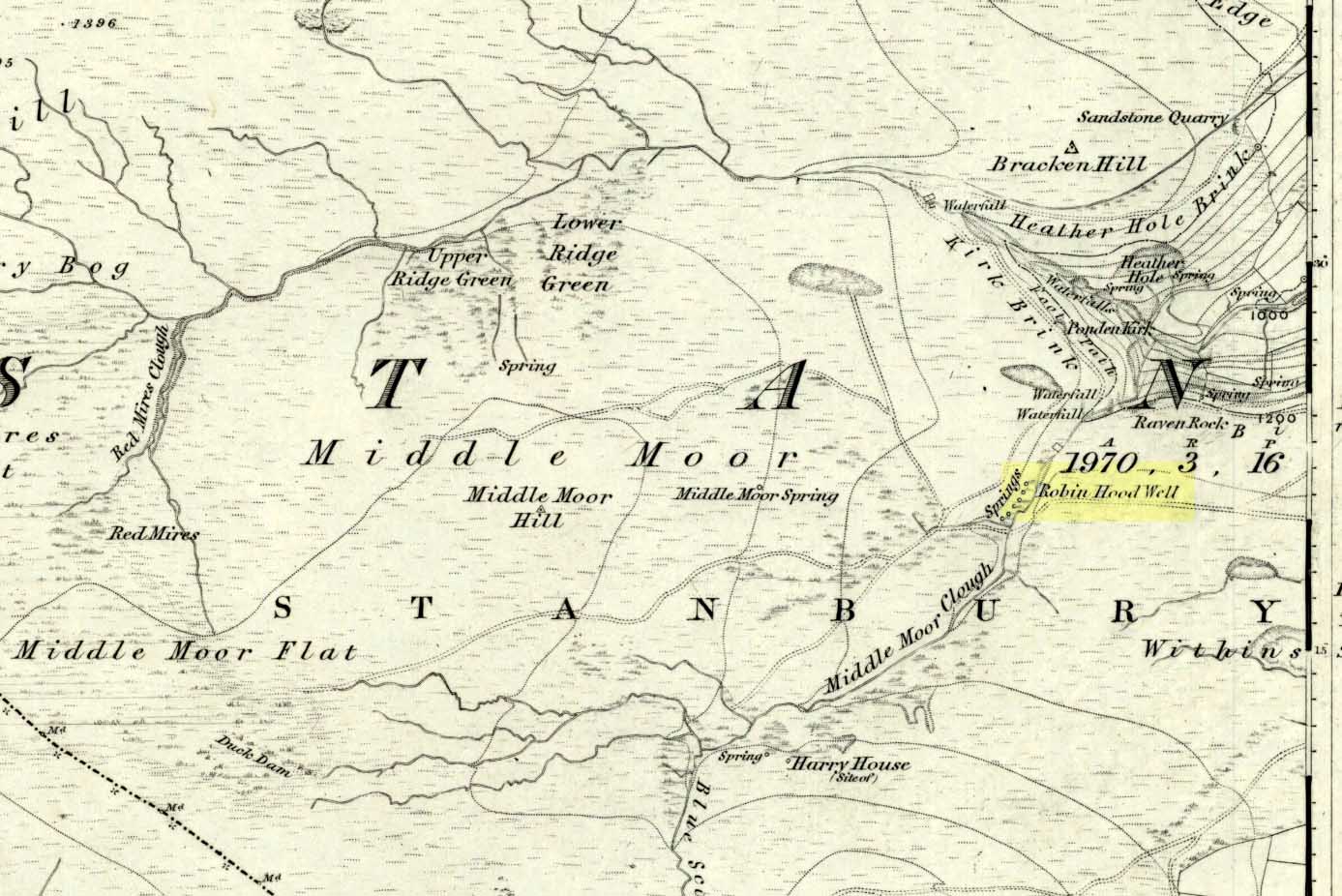
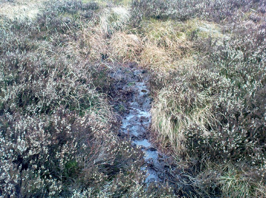
The said stream is a short distance due north of here, down the little valley.  The tale may come from it once acting as a shadow-marker, highlighting midday when the sun was high in the sky due south.  Makes sense of the folktale anyway!

References:

  1. Bennett, Paul & Wilson, Tom, The Old Stones of Rollright and District, Cockley: London 1999.
  2. Corbett, Elsie, A History of Spelsbury, Cheney & Sons: Banbury 1962.
  3. Ekwall, Eilert, Oxford Dictionary of Place-Names, OUP: Oxford 1940.
  4. Gelling, Margaret, The Place-Names of Oxfordshire – volume 2, Cambridge University Press 1954.
  5. Pumphrey, Caroline, Charlbury of our Childhood, Sessions Books: York 1990.

© Paul Bennett, The Northern Antiquarian 


Minning Low, Ballidon, Derbyshire

Cairns:  OS Grid Reference – SK 2091 5731

Also Known as:

  1. Minninglow
  2. Roystone Cairn

Getting Here

Minning Low from the air, looking NE (photo © Pete Glastonbury)

You can see the copse of trees here from all directions it seems, and there seem various ways in.  Don’t think there’s a direct footpath, but from all accounts the locals are friendly and you can cross the fields from various directions.  From either Pikehall to the north, Aldwark to the east, or Brassington from the south, head towards the distinct wooded copse atop of the hill and you’ll get there!

Archaeology & History

This superb-looking view catches the remains of at least two prehistoric tombs.  In Marsden’s (1977) brief notes of the site he describes,

“Disturbed mound in plantation with exposed limestone cist.  Primary cist rifled.  Secondary cremation.  A second barrow had been raised against the earlier cairn, containing a primary cremation in situ., with a burnt bronze razor, 2 flint knives and a bone tool.”

Barnatt & Collis (1986) give more detailed descriptions of the respective tombs.  The first is categorized as a passage grave chambered cairn:

“This large but mutilated barrow measures c.45 x 38m and in parts is over 2m high.  It had been much robbed for stone before the site was first recorded in the late 18th century.  The ruined remains of four chambers can be seen.  In 1843 Bateman located a fifth partially-collapsed chamber passage, now lost somewhere within the mound.  Rooke recorded a further one of two structures to the north and possibly west sides of the mound (Douglas 1793), that had gone or been reburied in Bateman’s day.  Small excavations by Marsden in 1973-4 clarified the design of the four visible chambers.  Each originally had tall portals, back stone, side slabs, low septal slabs and short entrance passages.  Drystone walling had been used to fill gaps between orthostats and in places to increase the heights of the sides.”

Although human remains were found here, the authors tell how the site was initially plundered as far back as the Romano-British period.  It had once been a long cairn, aligned ENE-WSW, but they give no notice of any potential astronomical orientation (does anyone know?).

References:

  1. Barnatt, John & Collis, John, Barrows in the Peak District, J.R. Collis: Sheffield 1986.
  2. Bateman, Thomas, Vestiges of the Antiquities of Derbyshire, London 1848.
  3. Douglas, J., Naenia Britannica, London 1793.
  4. Marsden, Barry M., The Burial Mounds of Derbyshire, privately printed: Bingley 1977.

© Paul Bennett, The Northern Antiquarian


Haworth Moor Spa Wells, West Yorkshire

Healing Wells:  OS Grid Reference – SE 0041 3513

Getting Here

Spa Wells on 1852 map

Go through Haworth and head for the well-known Penistone Hill country park.  On the far western side of the hill up near the top of Moorside Lane, there’s a car-park.  Right across the road from this there are two footpaths: one heads you into the moor, whilst the other (going the same direction) follows the edge of walling onto the moors.  Take this path. Walk on and downhill, past the end of the reservoir, then the path continues uphill. You’ll hit a nice cheery tree beside the path a few hundred yards up.  Stop here, look into the boggy region with bits of walling on the moor in front of you.  That’s where you’re heading!

Archaeology & History

The first, weaker of the Spa Wells

This was a really curious spot to me, as I found absolutely nothing about the damn place!  But thanks to the assistance of local historian and writer Steven Wood (2009), that’s changed.  Shown on the 1852 OS-map, at least two springs of clear water trickle slowly from the wet slope above you into the boggy reeds.  Close by there are overgrown remains of old buildings, covered with the time of moorland vegetation, seemingly telling that the waters were collected for bathing rooms.  But who the hell even started the notion that they’d be able to get Victorian rich-folk up here at the crack-of-dawn to drink or bathe in the waters is seemingly forgotten.  And, as is evident from the lack of local history, the project was a failed one which seemed not to have lasted too long. 

Folklore

The stronger of the Spa Wells
The stronger Spa Well

It was quite obvious that of all the springs around here and despite the strong-flowing streams either side of these spa well, that the local animals drink here more than the other nearby springs of water, as there were literally hundreds of animal tracks all across the boggy ground of the spas.*  The waters also seem to have the usual ‘spa’ qualities of stinking, but once we’d cleaned out the overgrown springs — which looked as if they hadn’t been touched for 100 years or more the waters were clear and tasted good, and were curiously slightly warm!

Although my initial search for information on this site drew a blank, Steve Wood pointed us in the right direction for info on the place.  As with many other holy wells and spas in Yorkshire, it turned out that this was another spot much revered around Beltane, indicating strongly there would have been  earlier pre-christian rites practiced at this site.   Steve pointed me to Martha Heaton’s (2006) local history work, which told:

“For many years the first Sunday in May was a special day. It was known as Spa Sunday, for on this day people gathered up in the hills overlooking what is now Leeshaw Reservoir, here was a well, known as Spa Well, and the stream which now feeds the reservoir is known as Spa Beck. People came from Haworth, Oxenhope, Stanbury, and other villages sitting round the well, they sang songs, some bringing their musical instruments to accompany the singing. Children brought bottles with hard spanish in the bottom filling the bottle with water from the well, shaking it until all the spanish or liquorice had been dissolved. This mixture was known as ‘Poppa Lol’ and would be kept for weeks after a little sugar had been added, then it was used sparingly as medicine.  The custom seems to have died out when Bradford Corporation took over the water and made Leeshaw Compensation Reservoir in 1875, though up to about 1930 two men from Haworth would wend their way to the spot on the moor, the first Sunday in May. The men were John Mitchell and Riley Sunderland, better known, in those days as ‘Johnny o’Paul’s’ and ‘Rile Sun’.

It was a great day for many people, the Keighley News of May 1867 mentioned it, the report of local news reads thus: ‘A large assembly met on Spa Sunday on the moors about two miles from Haworth, and a party of musicians from Denholme performed sacred music’.

This locality was often visited during the summer months by the Bronte family.”

References:

  1. Heaton, Martha, Recollections and History of Oxenhope, privately printed 2006.
  2. Wood, Steven & Palmer, Ian, Oxenhope and Stanbury through Time, Amberley Publishing 2009.

Acknowledgements: – Huge thanks to Steven Wood for his help; and to Hazel Holmes for permission to quote from Martha Heaton’s work.

* A common creation myth behind many healing wells is that animals with breaks or illness drag themselves to drink from otherwise small or insignificant springs and wells, despite of the copious streams or rivers which may be nearer.

© Paul Bennett, The Northern Antiquarian


Robin Hood’s Well, Stanbury Moor, West Yorkshire

Sacred Well:  OS Grid Reference – SD 9795 3629

Robin Hoods Well on 1851 map

Getting Here

Follow the same directions to get to the nearby Ponden Kirk and, once on top of the rocks, overlooking the valley, walk on the footpath to your right.  It bends round and follows the stream up onto the moors.  About 100 yards along, walk up the heathery slope to the right and you’ll find several boggy watering holes on the top of the ridge.  In looking at the first OS-map of the area in 1853, it seems that the northernmost of six boggy springs is the Robin Hood’s Well – although we don’t know this for certain.  It’s one of them though!

Archaeology & History

Robin Hood’s Spring, above Ponden Kirk

There’s little to see here really: it’s little more than a small boggy spring of water emerging from the edge of the ridge, as the photo shows.  Curiously, descriptions of the site (and its neighbouring compatriots, Will Scarlett’s Well and Little John’s Well) are sparse aswell.  It was noted by the Ordnance Survey lads in 1848 and subsequently posted on the first OS-map of the area in 1851.  Both Horsfall Turner (1879) and Johnnie Gray (1891) mention the site passing, saying nothing of the place. However, several years after Gray’s work, Halliwell Sutcliffe (1899) ventured here and gave us the first real description of the place, telling:

“Half-hidden underground, and fringed with fern and bog-weed, lie the three wells which go by the names of Robin Hood, Little John and Will Scarlett.  One may stop to ask how they came by their birth-names, to wonder why a man should have troubled to fashion them in this out-of-the-way spot; but neither speculation nor questioning of the moor folk brings one nearer to an answer.”

Folklore

Halliwell Sutcliffe's scruffy quick sketch, circa 1898
Halliwell Sutcliffe’s scruffy quick sketch, circa 1898

Apart from this site being a spot where the legendary outlaw stopped and drank in ages past, the healing attributes of these waters have long since been forgotten.  Considering the proximity of the Ponden Kirk and its legendary association with fertility and marriage rites, I’d guess that such lore wold have centred around Beltane, or Mayday; and Robin Hood is very well known in folklore to have close associations with the same period.  So — and I’m guessing here — it’s likely that whatever might have occurred at this well, would have taken place around Beltane aswell.

References:

  1. Gray, Johnnie, Through Airedale from Goole to Malham, Walker & Laycock: Leeds 1891.
  2. Sutcliffe, Halliwell, By Moor and Fell in West Yorkshire, T. Fisher Unwin: London 1899.
  3. Turner, J. Horsfall, Haworth, Past and Present, Hendon Mill: Nelson 1879.

© Paul Bennett, The Northern Antiquarian


Haulgh, Bolton, Lancashire

Tumulus (destroyed):  OS Grid Reference – SD 7242 0899

Archaeology & History

This single-grave burial — described by Barnes (1982) as a kerbed or revetted cairn — close to the very centre of modern-day Bolton, was once an impressive prehistoric tomb.  It was described by a local historian, Matthew Dawes, amidst a variety of prehistoric remains in and around Bolton, most of which have long-since been forgotten.

“Near Haulgh, about a quarter of a mile south-east from Bolton Parish Church, on a piece of high flat land, on the east bank of the Croal, and about fifty feet above the river, was a tumulus, about thirty feet in diameter, and four feet deep, consisting of small boulders… It was discovered in September, 1826, in forming a branch of the new road leading from Bolton to Bury. It was probably much depressed in its formation and was covered with a few inches of mound. The cop or fence crossed it in a north and south direction. About the centre of this tumulus was a cist-vaen, about four feet six inches long and one foot deep, formed of four upright stones and a coverer, and its length was nearly north and south. In this cist-vaen was a skeleton, with the legs doubled up, and the head to the north. Near the head, and on the west side, was found an urn, inverted, four and a half inches in the widest diameter, and three and a quarter inches high, and perforated by four small holes in the widest part. On the other side of the head was a bronze spear-head, four and three-eighths inches long, and one and three-eighths inch wide, of which the point was bent back, and a piece of the side chipped away. The urn and spear-head were taken to the Countess of Bradford, the Earl of Bradford being the owner of the land.”

Intriguingly, if you’re from the Bolton region, Mr Dawes also told that, “A man in the employ of the Earl of Bradford, the superintendent of the work, who made the discovery, informs me (1862) that two other tumuli were found shortly after the one just described, a few yards to the south of it, in the same fence.”  As yet I have no more information about these other tombs (gimme time though!)

References:

  1. Barnes, Bernard, Man and the Changing Landscape, Unversity of Liverpool 1982.
  2. Dawes, M., ‘British Burial Places near Bolton,’ in Trans. Hist. Soc. Lancs & Cheshire, volume 4, 1852.
  3. Scholes, James C., History of Bolton, Daily Chronicle: Bolton 1892.

© Paul Bennett, The Northern Antiquarian


Fair Haia, Carlton, North Yorkshire

Legendary Tree (destroyed?):  OS Grid Reference – SE 614 270

Getting Here

From Carlton, take the western Hirst Road to Temple Hirst village, then turn right once you’re in the village and go up Common Lane up for about a mile.  There’s a footpath on your left leading you to the Fair Oaks farmhouse. This was the spot!

Archaeology & History

This is fascinating sounding place which marked the central point of three old township boundaries nearly 1000 years ago.   I first found it mentioned in Morrell’s History and Antiquities of Selby (1867: 36-7), where this once famous tree is described in land sale transactions.  Morrell told:

“At Carlton the (Selby) abbey had considerable property, which was sold to the neighbouring priory of Drax.  The boundary of the property sold was a certain oak tree, called Fair-haia, in Burn Wood, which Adam de Bellaqua gave for this purpose, binding himself and his heirs never to cut it down or root it up, sub poena anathematis.”

But we found a more detailed outline in Dugdale’s Selby Abbey in Yorkshire, where the premises and townships given to Selby Abbey in the 12th and 13th centuries are listed.  In the township of ‘Carleton’ (as it was then spelt) Dugdale wrote:

“Peter de Brus gave the grange here, which the monks had held of Agnes, late wife of Ranulph FitzSwain.  Richard abbat of Selby granted to Robert prior of Drax all the tithe from the north part of the oak called Fair-haia, in the wood of Birne, or Berlay, through the middle of the marsh to Hundolfsweith; and from thence by the strait ditch directly to Espholm, and all the tithe from Espholme to Appletreholme, as the ditch goes to the new fosse or ditch of Carleton: and the prior granted to the abbat all the tithes on the south to the new ditch, and from thence to the river Ayre.  And Adam de Bellaqua gave this oak tree, called Fair-haia, as a boundary, never to be cut down (ad standum in perpetuum et non rescindendum), binding himself and his successors never to cut it down or root it up.”

One wonders: are there any remains left of this once great tree?  Has anyone actually transgressed and uprooted it in times past?  Is any other lore known of it?  And who was Adam de Bellaqua?

One of the most intriguing elements to this site is its name, for the word ‘haia’ literally means ‘god of the land’ — but whether we can take this meaning seriously is questionable, as it’s of Sumerian origin.  However, no local dialect words throw any light on the word and it may aswell be the name of the spirit of the tree as anything else.  Does anyone know owt more about this place?

References:

  1. Dugdale, William, Monasticon Anglicanum – volume 3, Longman, Hurst, Rees, Orme & Brown: London 1817.
  2. Morrell, W.W., The History and Antiquities of Selby, W.B. Bellerby: Selby 1867.
  3. Philpot, J.H., The Sacred Tree, MacMillan: London 1897.

© Paul Bennett, The Northern Antiquarian


St. Cuthbert’s Well, Waverbridge, Cumbria

Holy Well:  OS Grid Reference – NY 21479 48615

Also Known as:

  1. Haly Well
  2. Helly Well

Getting Here

St Cuthberts Well on 1868 map

A mile east of Waverbridge, turn down the track called Watergates Lonning. Before you reach the bottom, on the left side of the straight track is a spring of water. This is the old holy well.

Archaeology & History

Although much used in bygone times, very little of it can be seen nowadays.  When John Musther (2015) wrote about it recently, he told that although it was

“Once known for its copious amount of remarkably pure and sweet water, it is now only a trickle by a tree.”

Nearly three hundred yards away across the fields northeast of this small spring of water, was once seen “a pretty large rock of granite, called St. Cuthbert’s Stone“, whose mythic history will have been intimately tied to the holy well.

Folklore

In the second volume of William Hutchinson’s History of the County of Cumberland (1794), he tells that the St. Cuthbert’s Well,

“is a fine copious spring of remarkably pure and sweet water which…is called Helly-well, i.e. Haly or Holy Well. It formerly was the custom for the youth of all the neighbouring villages to assemble at this well early in the afternoon of the second Sunday in May, and there to join in a variety of rural sports. It was the village wake, and took place here, it is possible, when the keeping of wakes and fairs in the churchyard was discontinued. And it differed from the wakes of later times chiefly in this, that though it was a meeting entirely devoted to festivity and mirth, no strong drink of any kind was ever seen there, nor anything ever drunk but the beverage furnished by the Naiad of the place. A curate of the parish, about twenty years ago (c.1774), on the idea that it was a profanation of the Sabbath, saw fit to set his face against it; and having deservedly great influence in the parish, the meetings at Helly-well have ever since been discontinued.”

References:

  1. Hutchinson, William, The History and Antiquities of the County of Cumberland, volume 2, F. Jollie: Carlisle 1794.
  2. Musther, John, Springs of Living Waters: The Holy Wells of North Cumbria, J.Musther: Keswick 2015.

© Paul Bennett, The Northern Antiquarian


Rawthey Bridge, Fell End, Ravenstonedale, Cumbria

Stone Circle (destroyed):  OS Grid Reference – SD 714 978

Archaeology & History

This is yet another stone circle that’s been destroyed. It seems to have been described first by Nicolson & Burn (1777) — as “a circle of large stones, supposed to be a monument of druid worship” — but a century later when Reverend Nicholls (1877) came to describe it, he was talking of it in the past tense, saying:

“Fifty years ago there was a circle of stones on the high road leading from Kirkby Stephen to Sedbergh, near Rawthey Bridge, supposed to be a monument of Druid worship.  These stones, I have been informed by Mr. William Alderson of Brigg, were blocks of limestone, about three feet high, and were inconsiderably removed for the purpose of helping to build the abutment on the Ravenstonedale side of the present bridge which spans the Rawthey, and bears (the) date 1822.  The holes in which the stones stood are, however, yet visible, although overgrown with grass.  Collectively they form a circle.”

One writer later (1967) told that the site “seems to have stood on the moor to the left of the road opposite the confluence of the Sally Beck with the Rawthey.”  As far as I’m aware, little more is known of the site. Omitted from Burl’s magnum opus, it was included in Waterhouse’s (1985) fine survey of Cumbrian megaliths, but with no further details.  But another Victorian writer (Thompson 1892) thought it more likely that the ‘circle’ here was, in fact, more likely a barrow or grave-mound.  Sadly, we’ll probably never know…

References:

  1. Anon., Sedbergh, Garsdale and Dent, Reeds: Penrith 1967.
  2. Nicholls, Rev. W., The History and Traditions of Ravenstonedale, John Heywood: Manchester 1877.
  3. Nicolson, J. & Burn, R., The History and Antiquities of the Counties of Westmorland and Cumberland, London 1777.
  4. Thompson, Rev. W., Sedbergh, Garsdale and Dent, Richard Jackson: Leeds 1892.
  5. Waterhouse, John, The Stone Circles of Cumbria, Phillimore: Chichester 1985.

© Paul Bennett, The Northern Antiquarian


Market Cross, Keighley, West Yorkshire

Cross: OS Grid Reference – SE 06042 41002

Getting Here

Dead easy this one!  Go along North Street in Keighley, towards the main church in the middle of town (a St. Andrew’s church, previously St. Pete), by the once-infamous Lord Rodney pub, and the old stone edifice stands outside by the Green.  The much better Red Pig public house is across the road from here.

Archaeology & History

Keighley's Town Cross, 1847 - illustrated on a painting by Edwin Riby
Keighley’s Town Cross, 1847 – on a painting by Edwin Riby

For a relatively trivial archaeological site, it’s got a bittova history.  Not that this is an old site either!  We’re not sure just when this cross was made, but it’s certainly no more than 300 years old.  Before standing in its present position outside St. Andrew’s Church, sometime before 1840 it was said to have been a few hundred yards away above the present roundabout on Oakworth Road; and one record tells that it originally came from nearby Utley, a mile to the north.  Due to lack of decent records, we’re not sure about its early status as a market cross, nor when it was first erected.  Indeed, even the steps on which the cross presently stands are clearly more recent than the ones illustrated on Edwin Riby’s 1847 portrait, reproduced here.

Keighley Cross, on a grey wet day!

It would be good to get a complete history of this archaeological relic but it’s difficult with artifacts such as these; and although gaining access to the church now takes less time and effort than it used to (the vicar here used to be quite unhelpful, but has recently changed his ways – which is good!), it’s only open at certain times of the week.*  Friday afternoons seem OK to have a look round.  Please – if folk begin having trouble gaining access to the Church once more, let us know on here so we can make complaints about it.  The Church is paid for by local tax-payer’s cash, and so needs to be open to all of us.  Let’s hope this humble ingredient can be maintained for the good of all in this otherwise regressive social community (Keighley, that is…).

There’s also some very curious folklore to be added here in relation to the market and its cross, but its tale is gonna have to wait…

References:

  1. Gray, Johnnie, Through Airedale, from Goole to Malham, Elliott Stock: London 1891.
  2. Keighley, William, Keighley, Past and Present, R. Aked: Keighley 1858.

* There isn’t even a notice giving information, email or phone numbers, telling you who you can contact if you want to know anything about the history of the church, or visit it — which is quite dreadful considering how much money they get paid by tax-payers for their supposed socio-spiritual duties.

© Paul Bennett, The Northern Antiquarian


Dymond Stone, Burley Moor, West Yorkshire

Cup-Marked Stone:  OS Grid Reference – SE 12629 45206

Also known as:

  1. Carving no.118
  2. Carving no. 275

Getting Here

Dymond Stone, Ilkley Moor

It’s not too far from the main footpath from Ilkley to the Twelve Apostles stone circle.  As its discoverer C.W. Dymond (1880) said, “It lies alone, on and near the foot of a steep slope, about a furlong, or less than five minutes’ walk, north from the ruins of a small stone-circle (Twelve Apostles) which crowns the crest of the pass leading south-south-east from Ilkley to Eldwick, and just one mile and three-quarters from the former place.  If approached therefrom, it will be easily found about two hundred yards to the east of the point where the road surmounts the steep, to enter upon the upper plain.”  Otherwise, walk through the Twelve Apostles from the main footpath and out the other side, following the land where it slopes down and, near the bottom, you’ll see this large stone sitting quietly on its own…

1880 image of Dymond's carving
Dymond’s 1880 sketch

Archaeology & History

Not too sure about the veracity of this one to be honest.  It was first described by archaeologist C.W. Dymond (1880) as “a stone marked with a striking group of cups” – but these are small and untypical of the usual markings.  “The stone is 9 ft. 6 ins. in length, 6 ft. 3 ins. in breadth, and about 2 ft. in thickness; its upper surface dipping a little, with the ground, toward the north. Upon it may be seen a group of small cups, for the most part about half an inch in diameter,” he said.

Dymond thought that the design on the rock may have represented parts of the night sky, saying, “here we may have a rude attempt to portray the starry heavens spanned by the galaxy ; and that the outlying groups may have been intended to represent two of the constellations perhaps Orion, and another not so easily identified.”  But I think we can take this with a pinch of salt.

Included in Hedge’s (1986) survey without comment, Boughey and Vickerman (2003) correctly thought that the “small peck marks which are not typical cup-marks” might be “doubtful”.

References:

  1. Boughey, Keith & Vickerman, E.A., Prehistoric Rock Art of the West Riding, West Yorks Archaeology Service 2003.
  2. Dymond, C.W., ‘Cup Marks on Burley Moor,’ in Journal of the British Archaeological Association, volume 36, 1880.
  3. Hedges, John, The Carved Rocks of Rombalds Moor, WYMCC: Wakefield 1986.

© Paul Bennett, The Northern Antiquarian