Allt a’ Chaisteil, Bettyhill, Farr, Sutherland

Stone Circle:  OS Grid Reference – NC 7251 5756 

Getting Here

Allt a' Chaisteil 4-poster, Bettyhill

Allt a’ Chaisteil 4-poster remains

From Bettyhill village, take the A836 road west, down the hill from the village. Just before crossing the metal bridge over the River Naver at the bottom, go down the tiny road on the left. A mile or so along, go past the small loch by the roadside for another few hundred yards until you reach a quarry on the right. From here, cross the road and walk along the track towards the impressive Allt a’ Chaisteal Broch up the gorge.  About 100 yards above this, on the south-side of the fence, keep your eyes peeled for two small standing stones. You’ll find ‘em!

Archaeology & History

There seems to be no previous mention of this site in any of the archaeology records.  We were fortunate in venturing upon the place when Aisha, Lara and I were doing a typically circuitous meander to what I call the ‘Queen’s Cairn‘ of Strathnaver, above Skelpick Long.

Allt a' Chaisteil012

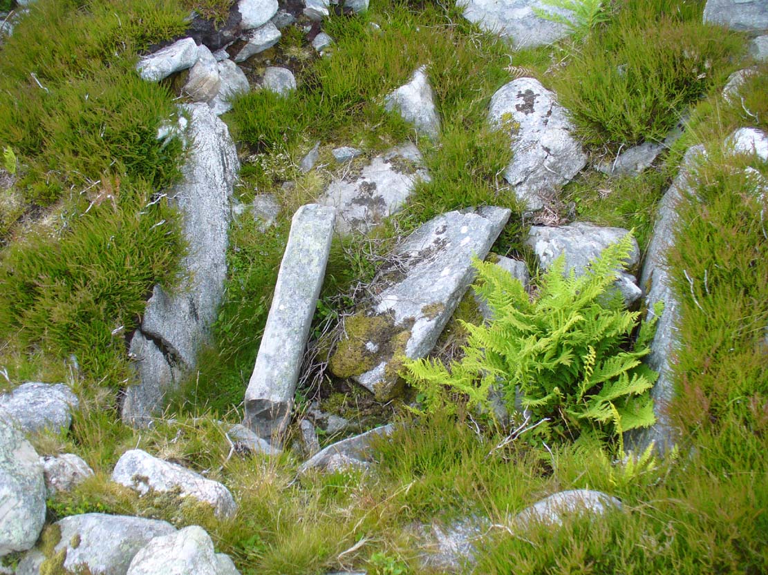
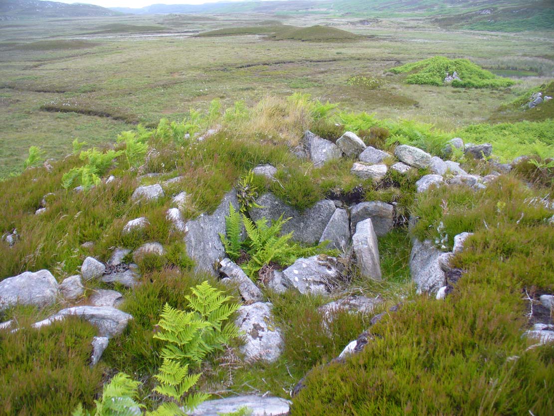
The southernmost stones

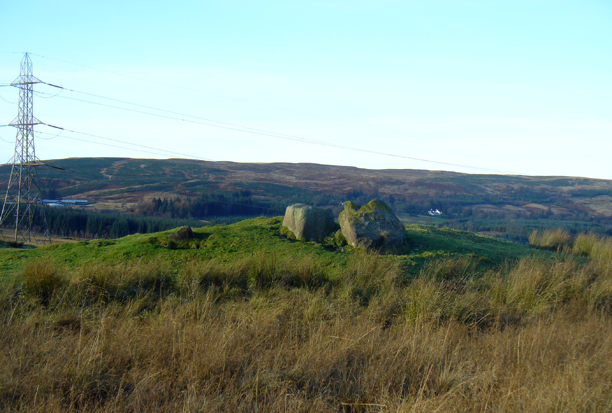
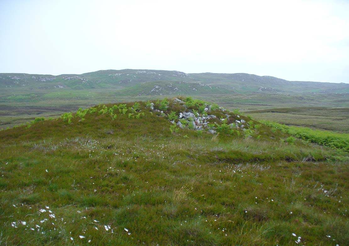
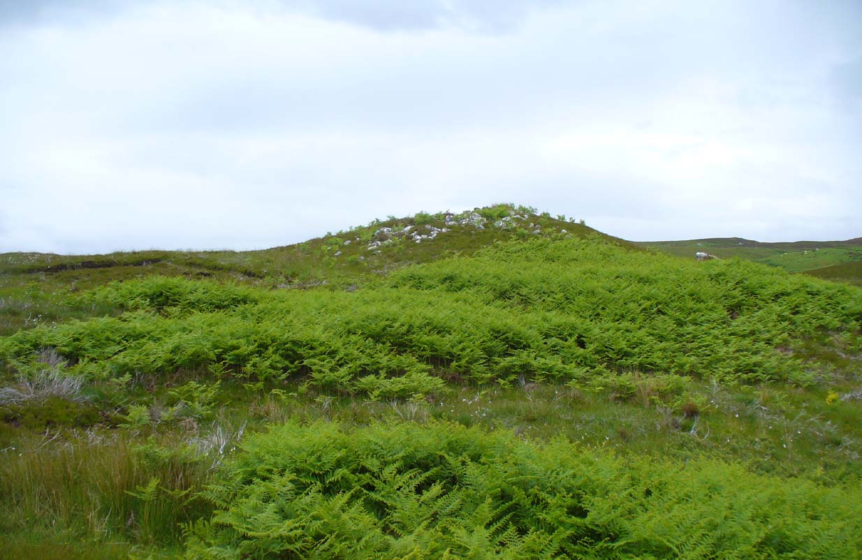
The site on its raised platform

The site on its raised platform

Approximately 10 yards in diameter, a raised platform 2-3 feet high consisting of thousands of small rocks in a roughly circular formation, is set on the edge of a slope above the Allt a’ Chaisteal Burn.  Two small upright standing stones are set near the southern edge of the platform, with a third on the northwestern bank of rubble, leaning or fallen into the stone mass.  A fourth stone to the northeastern edge is almost covered in rubble.

When we found the site, much of the heather had been burned away; if this had not been done, the site would not have been visible.  Even with this however, accurate visibility was troublesome as the heather had began to grow back and the infestation of bracken was raising its tick-infested fronds.

Close-up of the southern stones

Close-up of the southern stones

The site seems to be a good example of what Aubrey Burl (1988) calls a “four poster stone circle” – a number of which seem to be architectural ritual developments between cairns and stone circles.  It exists within the immense Strathnaver prehistoric complex – a literal ‘Valley of the Kings’ – where dozens of large cairns, and a number of immense megalithic tombs exist. It is very similar in size and lay-out to the recognized four-posters at Druid’s Altar in Yorkshire, the Glenshervie Burn in Glen Almond, etc.  It seems in relative isolation from other four-posters, the nearest known one being at Balnakeil (which Burl terms as being “uncertain”), more than 20 miles west of here; and the next being the Aberscross site some 35 miles away.   However, the remote landscape would explain its seeming isolation, as many more prehistoric sites remain unrecorded in the area.

References:

  1. Burl, Aubrey, Four Posters: Bronze Age Stone Circles of Western Europe, BAR 195: Oxford 1988.

Acknowledgements:  Huge thanks to the big heart of Aisha Domleo – and her sproglett Lara – for gerrin us up here, enabling its rediscovery.

© Paul Bennett, The Northern Antiquarian

Achamore Hut Circles, Bettyhill, Farr, Sutherland

Hut Circles:  OS Grid Reference – NC 74219 58055

Also Known as:

  1. Canmore ID 6262

Getting Here

Achamore's NE 'hut' circle, looking E

Achamore’s NE ‘hut’ circle, looking E

Along the A836 road a mile east of Bettyhill, a track goes south onto the moors just before Loch Salachaidh. Walk along here for several miles, past the windmills and past the Achadh Thaibstil Cairn, until you reach the remote green fields that are the remains of the clearance village of Achamore.  As you walk into the green grasses, a ruined building is to your left.  In front of you, a large raised round structure almost entirely covered in grass.  You’re here!

Archaeology & History

This is a curious structure – and were it not for being labelled as a ‘hut circle’ by the lads at Ordnance Survey, on first impression I’d be more tempted to classify it as either a collapsed broch, or a large cairn circle.  This is entirely due to the size of the thing, as it’s big for a hut circle!

NW arc of the circle

NW arc of the circle

Eastermost embankment

Eastermost embankment

Circular in form, the sides of the structure on its eastern face are nearly three feet high, piled at an angle of nearly 45 degrees, and several feet across before you reach the internal section of the said ‘hut circle.’  As you walk around it, the height of the piled stones diminishes to between 1-2 feet, but the diameter of the walling all round is consistently wide – increasing the thought of it being a collapsed or robbed-out broch.  The diameter of the structure is some 20 yards across, with an approximate circumference of 64 yards.

'Hut circle' atop of nearby hill

‘Hut circle’ atop of nearby hill

Another “hut circle” is immediately visible some 80 yards to the south, on top of the nearby grassy hilltop.  The majority of this is also covered in meadow grasses, with edges and upper surfaces all but hidden.  On its southeastern edge is what looks like a structural stone ‘entrance’ some two yards across and three yards long.

Other smaller hut circles in the area indicate that this region – like others nearby – was a place of consistent human habitation from prehistoric (probably Neolithic) times, unbroken all the way through until the 18th century.

© Paul Bennett, The Northern Antiquarian 
Achadh Thaibstil, Bettyhill, Farr, Sutherland

Chambered Cairn:  OS Grid Reference – NC 7398 5899

Also Known as:

  1. Canmore ID 6228
  2. Clachan Burn

Getting Here

Achadh Thaibstil cairn12

Achadh Thaibstil cairn, looking W

Along the A836 road a mile east of Bettyhill, a track goes south onto the moors just before Loch Salachaidh. Walk along here for several miles, past the windmills, past a small quarry on your left, and a hundred yards or so along, to the right of the track, you’ll notice a rounded hillock covered in stones and rock on the top (aswell as bracken in the summer and autumn).  That’s the spot!

Archaeology & History

Achadh Thaibstil cairn

Achadh Thaibstil cairn

This little-known cairn, close to the prehistoric hut circles on the other side of the track, is a medium-sized Neolithic or Bronze Age monument.  Not included in Audrey Henshall’s (1995) survey of the region, the tomb was built upon a small natural rise with the usual thousands of small and medium-sized stones rising up 4-5 feet high.   Near its crown we find an exposed chamber, typical of chambered tombs, measuring more than a yard across and two yards long, with flat slabs defining its sides.  It appears that the inner ‘chamber’ may have been split into two sections, as an oblong slab of stone runs parallel down the central ‘chamber’ a third of the way across.  The Canmore account simply tells how the cairn is on low knoll and

“measures about 10.5m in diameter and 1.0m high. It has been opened and a centrally placed slab lined cist revealed, the southern side of which is missing. The cist measures 1.4m east-west, with the east and west slabs 1.2m long and 0.6m high.”

Looking down into the chamber

Looking down into the chamber

From the chamber, looking N

From the chamber, looking N

On the horizon to the far north, the peak of the giant tomb known as Fiscary 2 rises up, indicating the cardinal direction.  This may have had geomantic significance, as ‘north’ signifies Death and darkness: the symbolic point where light never emerges; the point linked to the North Star, Alpha Draconis in the neolithic era, or Polaris in our present Age: the point to and from which shamans travel into the Land of the Gods.  These elements may or may not have been relevant here.

References:

  1. Henshall, Audrey S. & Ritchie, J.N.G., The Chambered Cairns of Sutherland, Edinburgh University Press 2005.

© Paul Bennett, The Northern Antiquarian 


Gough’s Barrow, Long Compton, Warwickshire

Tumulus (destroyed):  OS Grid Reference – SP 2946 3090

Archaeology & History

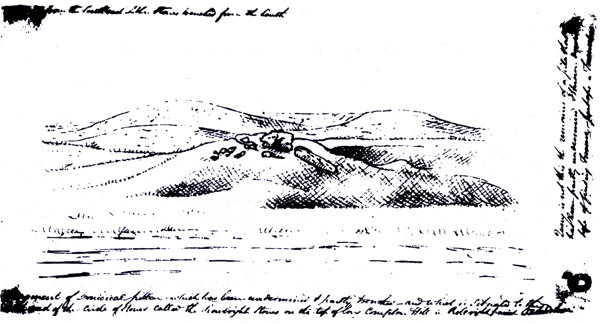
Only known drawing of Gough’s Barrow

In days of olde there were heathen sites around the edges of the beautiful Rollright Stones complex that have sadly fallen prey to the intensive agriculture of more modern ‘civilized’ times.  It’s become the way of things….. One site of importance in this geomythic  pantheon was the ‘Gough’s Barrow’—so named after a drawing was done of the site by Richard Gough, editor of the 1789 edition of Camden’s Britannia.  As far as I’m aware, it is the only one ever done of this monument.  The Oxford archaeologist George Lambrick (1988) saw “every reason to accept the position and details of the barrow”, upon which stood at least two large stones—one of which gained the description of a ‘druidical pillar.’

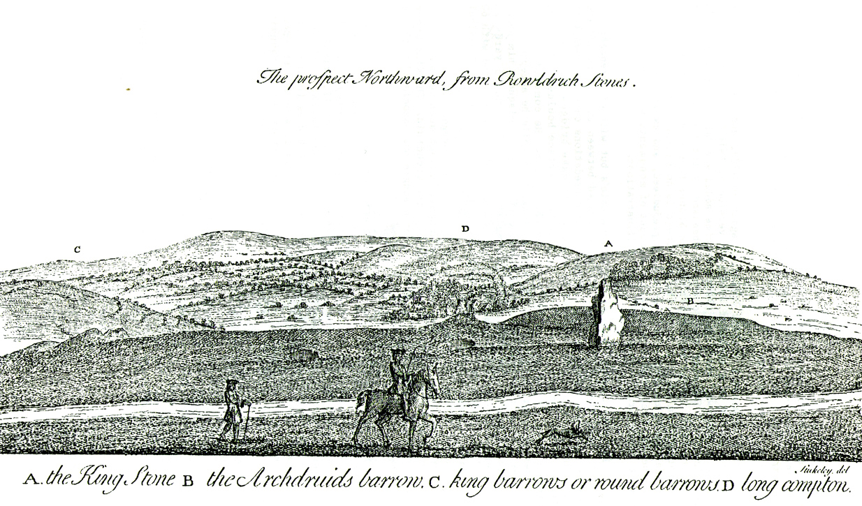
Stukeley's 1743 drawing

Stukeley’s 1743 drawing

The same barrow may have been recorded in one of drawings of the great William Stukeley, who visited the Rollright Stones in 1710 and then again in 1723.  On the left-side of the adjacent drawing you can see a denuded mound close to the edge of the picture, similar in shape and form to that drawn by Richard Gough.  It is probably the same tumulus or barrow.  Trial excavations at the site in 1983 looked for any remains of the old tomb, but nothing significant was uncovered.  Lambrick estimated that the site probably measured “about 18m wide and 20m long east-west,” and “was a megalithic barrow and was therefore probably Neolithic in origin.” 

References:

  1. Bennett, Paul & Chanter, James, The Complete Rollright Stones, forthcoming
  2. Bennett, Paul & Wilson, Tom, The Old Stones of Rollright and District, Cockley Press: Chipping Norton 1999.
  3. Burl, Aubrey, Great Stone Circles, Yale University Press 1999.
  4. Lambrick, George, The Rollright Stones, English Heritage 1988.
  5. Peters, Frances, “An Antiquarian Visit to the Rollright Stones,” in Wiltshire Archaeological & Natural History Magazine, volume 94, 2001.
  6. Stukeley, Willliam, Abury – A Temple to the British Druids, London 1743.

© Paul Bennett, The Northern Antiquarian


Lady’s Well, Blythborough, Suffolk

Healing Well:  OS Grid Reference – TM 450 762

Also Known as:

  1. Wishing Well
  2. Queen Ann’s Well
  3. Lady’s Fountain

Getting Here

The site is found down Spring Lane at the south end of Henham Park. The current A145 meeting the A12.

Archaeology & History

A large structure is a brick and stone arch and which has two low seats inside, giving the alternative name of Tramp’s or Traveller’s Rest having also brass cups attached to the structure for anyone wishing to drink there. The age of the fabric has said to be mainly 1780, although one view was that it was erected by the first Countess of Stradbrooke in the 19th century and may be that recorded in 1833 in the poem ‘Lady’s Fountain’ poem by Agnes Strickland (the alternative name Lady coming from the Lady Strickland).  Another view is that some of the fabric is 13th century in origin.   The structure is now dry and overgrown, apparently last having water in the 1900s.

ladyswell1

Folklore

The spring is said to be near the reputed to be the place of King Onna’s death (654 AD). This was the battle of Bulcamp where Onna was chased by the Pagan Penda along Kings Lane, a lane which cuts through nearby parishes of Sotherton, Henham and Blyford to here were they stood their ground and he and his son Firminus were killed and buried. The well being erected where the king’s body fell. The legend clearly explains the site’s other alternative name of Queen Anne’s well…Anne being close enough to Onna to be semantically changed over time, and misrepresented as a Queen rather than a King!

References:

  1. R.B. Parish, Holy wells and healing springs of Suffolk (in publication)

Links:

  1. Holy & Healing Wells – A Suffolk Field Trip


Raith Gardens, Kirkcaldy, Fife

Cup-and-Ring Stone:  OS Grid Reference – NT 27131 91374

Getting Here

The multiple-ringed petroglyph of Raith, Kirkcaldy

The multiple-ringed petroglyph of Raith, Kirkcaldy

On the more south-side of Kirkcaldy, head for the roundabout at the meeting of the A910, B925 and B9157, heading out west along the Auchtertool road; but just 60-70 yards past the roundabout, take the first right along Raith Drive.  Wibble along here for a few hundred yards until you reach Raith Gardens.  Walk down here for 50 yards and cross onto to the grasses opposite where a path runs parallel with a large old stone wall.  Barely 2 feet above ground level, keep yer eyes on the walling!

Archaeology & History

Close-up of the carving

Close-up of the carving

This is a peculiar one.  A very peculiar one!  Found embedded in some very old walling, it is similar in size, style and design to the curiously un-eroded multiple-ringed Binn-1 petroglyph 3.9 miles (6.2km) southwest, this concentric four-ringed ‘cup-and-ring’ stone actually seems to have no central cup.  That aint too unusual.  But the oddity here is its complete isolation—not merely from any other petroglyphs, but from any other neolithic or Bronze Age site.

The concentric rings are incomplete on the outer two rings, with openings or gateways to the inner two rings (a common element).  Several parallel scars are clearly visible that have been cut across the surface of the stone, affecting the clarity of the carving.  Whether these scars are geophysical, or were caused when the carving was moved and fit into the wall, we do not know.

The stone may or may not have been a portable one, typical of those attached to cairns or tomb-covers; or it may have been broken from a large piece of rock.  We just don’t know.  The design is typical of those found in relation to prehistoric tombs, yet none are known to have been here.  In 1872 The Antiquary Journal covered the story of four stone coffins being found when the first Co-op building was being built in Kirkcaldy, on top of which was “an earthen urn” – but where was that exactly?  Did the carving come from there?  We do know that the walling in which the carving has been fixed was once part of an old Abbot’s Hall – but whatever was here before that, history seems to have forgotten.

A fascinating little mystery this one…..

Acknowledgements:  Huge thanks to Penny Sinclair for showing us to this little-known site. Cheers Pen. 🙂

© Paul Bennett, The Northern Antiquarian

The Binn (01), Burntisland, Fife

Cup-and-Ring Stone:  OS Grid Reference – NT 22741 86948

Also Known as:

  1. Binn House
  2. Canmore ID 269301
  3. Craigkelly 
  4. Silverbarton Farm

Getting Here

The Binn1-2

Penny pointing the way

From Burntisland, go up the Cowdenbeath road for just over half-a-mile, then turn right and walk into the woods up the footpath.  Go uphill, over the first stile until you reach the field less than 200 yards above.  Follow the line of the trees, right, along the edge of the field for about 100 yards, then walk uphill into the trees again until you reach a small rocky outcrop.  That’s the spot!

Archaeology & History

Rediscovered in the summer of 2003, this is one in a small cluster of little-known petroglyphs on the western slopes of the hill known as The Binn.  Found less than a yard away from another carving, this ornate-looking fella consists of a wide cup-mark with three very well-defined concentric rings around it.  A carved line runs out from the central cup, down the gentle slope of the rock and out of the rings entirely; whilst 60° left of this line, a second one runs from the central cup to the inner edge of the third concentric ring. To the left of the 3-rings is another concentric system, with one clear ring around a faint shallow inner-cup and what seems to be a faint outer secondary ring.  A possible third isolated cup-mark is to the top-left of the multiple rings.

The carving under the overhang

The carving under the overhang

Close-up of the multiple rings

Close-up of the multiple rings

This is one of two carvings that are right next to each other and it is curious inasmuch as the erosion on it seems negligible.  This may be due to the overhanging rock which shelters it considerably from normal weathering processes.  Indeed, if the carving was uncovered from beneath a covering layer soil, the lack of erosion on it makes complete sense.  However, I have to say that I was slightly skeptical about assigning any great age to this particular design—and until we get an assessment from a reputable geologist we should perhaps be cautious about giving it a definite prehistoric provenance.  It’s still very much worth seeing though.  The carving on the adjacent rock however, is a different kettle o’ fish altogether!

Acknowledgements:  Huge thanks to Penny Sinclair for guiding us to this little-known site. Cheers Pen. 🙂

© Paul Bennett, The Northern Antiquarian

Craigenkirn, New Kilpatrick, Dumbartonshire

Long Cairn:  OS Grid Reference – NS 51839 78157 

Getting Here

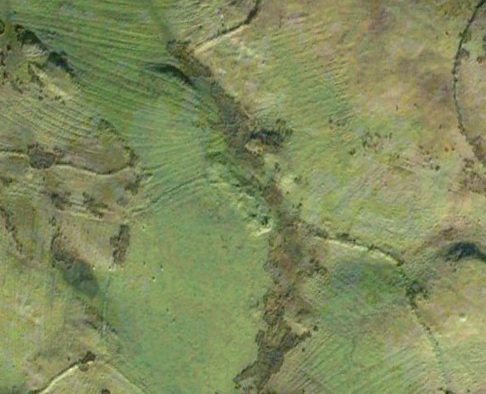
Aerial view of the cairn

Aerial view of the cairn

Take the A809 road several miles north out of Glasgow, between Bearsden and Drymen.  Once out of the suburban sprawl, passing Milngavie, you’re heading to the famous Carbeth hutters.  Before this, note the gold course on your right (east).  Park here and cross the road where a gate and overgrown footpath takes you onto the grassy hills.  Keep to the fence-side for about 700 yards until it veers downhill.  Don’t walk downhill!  Keep in the same direction into the short grasses and, veering gradually left, downhill for a couple hundred yards ahead and, across a small boggy area, you’ll note some large upright stones in front of a mound.  That’s it!

Archaeology & History

The SE stone 'entrance'

The SE stone ‘entrance’

There is no previous reference to this site which was found, quite fortuitously, by Nina Harris of Organic Scotland a few years ago.  She visited the site a number of times, puzzling over the curious line of possible standing stones at the edge the grass-covered mound—wondering if it was anything at all.  A few months ago she took us to see the place…

Modern gunshot cup-marks on entrance stone

Modern gunshot cup-marks on entrance stone

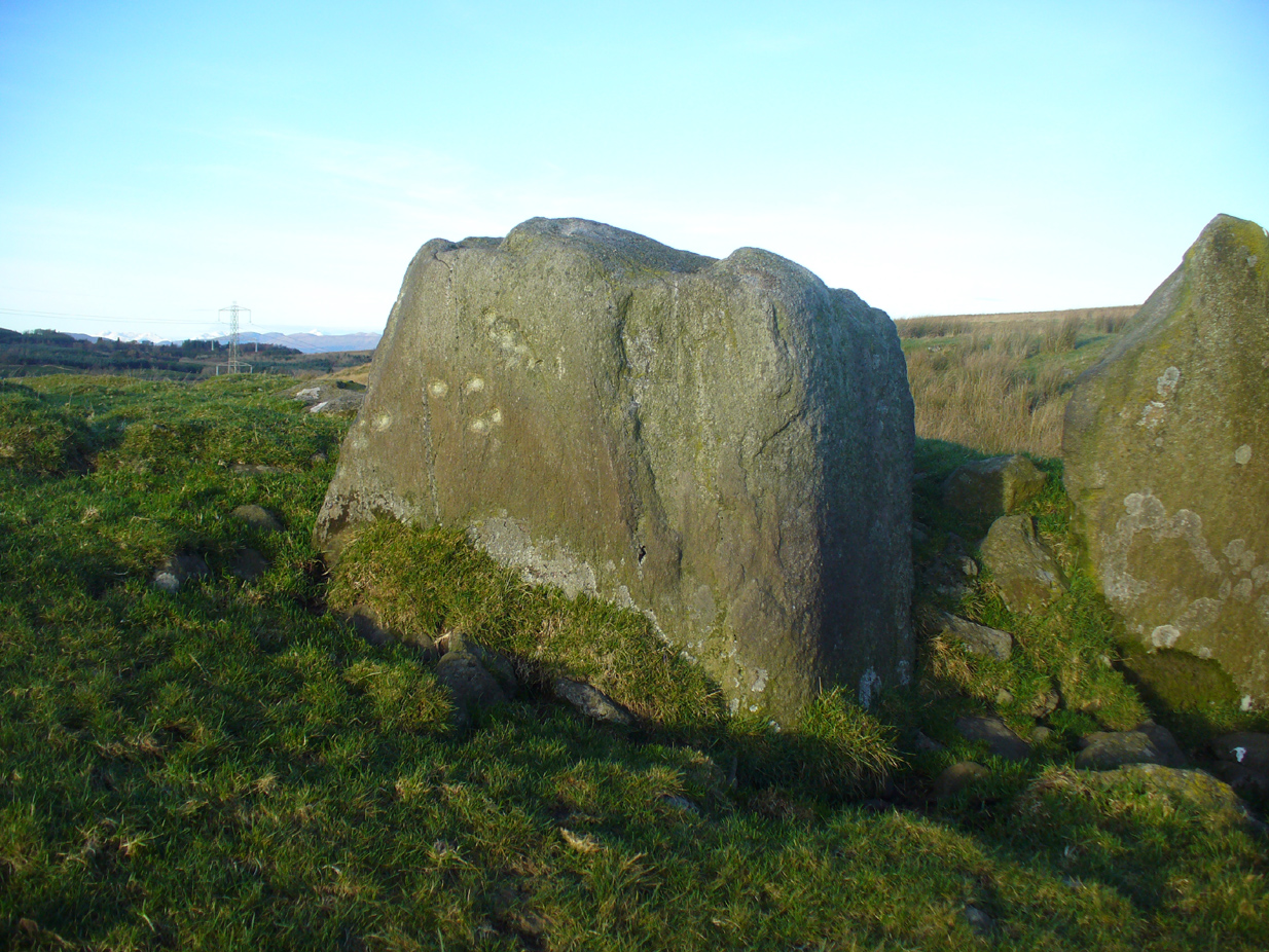
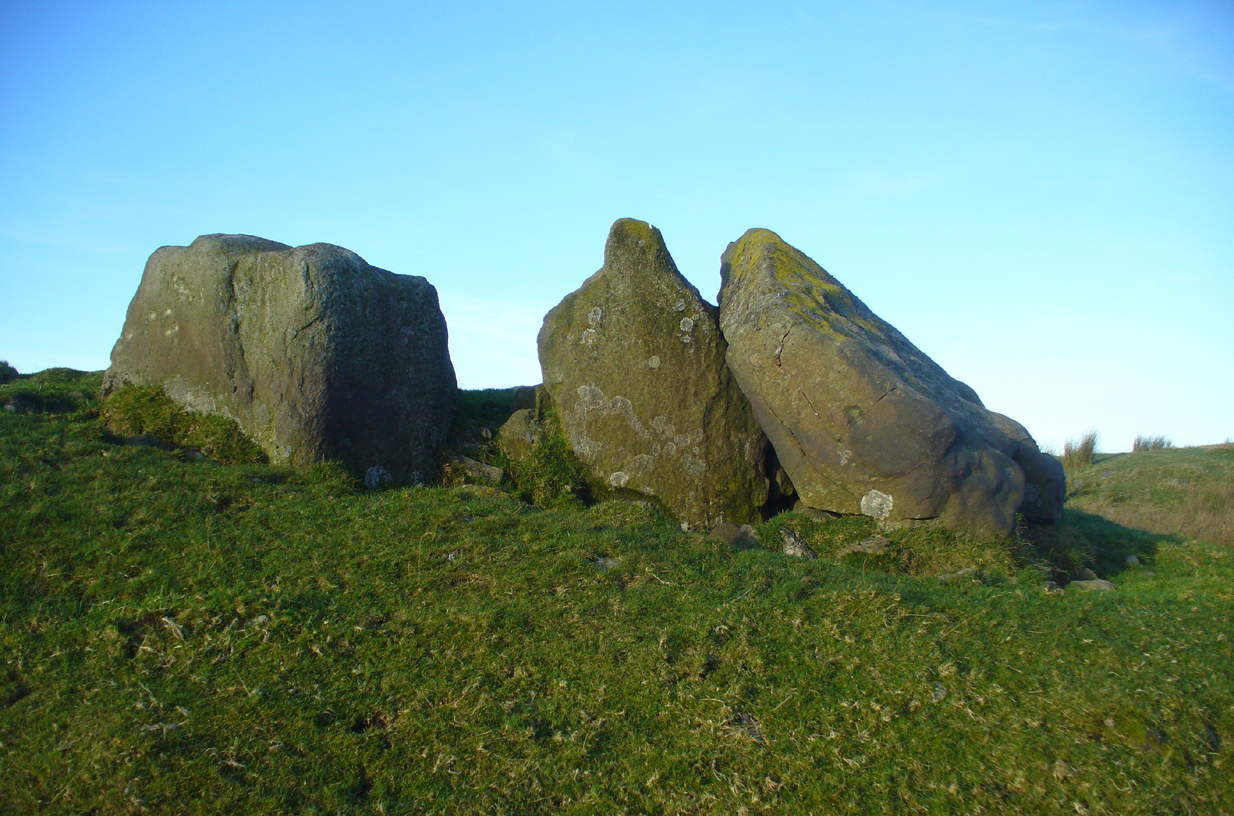
The site has been damaged and elements of it have been stripped for walling that are visible all around here.  The cairn is more than 55 yards in length, running from its southeastern stone ‘entrance’ to the gradually diminishing northwestern edges.  At its widest it is 14.6 yards (13.5m) across, near its southeastern end.  The main three standing stones at its entrance are four-feet tall at the highest, with one of them leaning upon another; an adjacent fourth stone, smaller than the main three, is more embedded into the cairn mass a couple of yards away.  Cup-marks on one of the three larger uprights here are recent gunshot marks; whilst the possible cup-marks on the largest upright are natural.

Line of ealling runs to the cairn

Line of ancient wall runs up and over the cairn

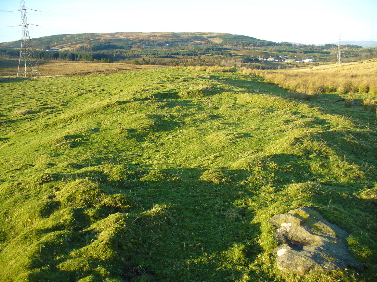
Looking NW along the cairn mass

Looking NW along the cairn mass

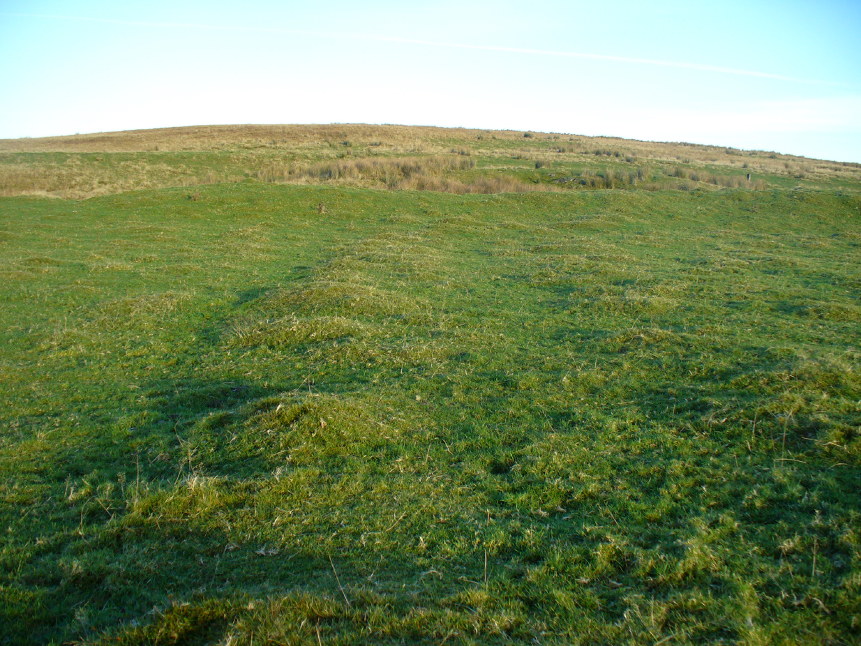
In standing on top of the long cairn, just above the large stones, you can see how sections of it have been stripped away.  Just beneath the surface is a line of internal walling, with what seems to be another one running parallel.  These run for a few yards until we reach a large circular depression within the overall cairn mass, a yard deep and 6-7 yards across; on the northern edge of which we can clearly see a section of walling beneath the surface.  When we look at the aerial view of this on Google Earth, we can clearly see how this walling actually begins way outside of the cairn mass itself, as a much denuded line of it (probably medieval in origin, though possibly Iron Age) curves across the grasslands from the west, crosses the long cairn and re-emerges on the other side of the adjacent boggy ground at its southeastern edges and continues on its way: indicating that the cairn mass beneath the wall is much older than the walls running across it.

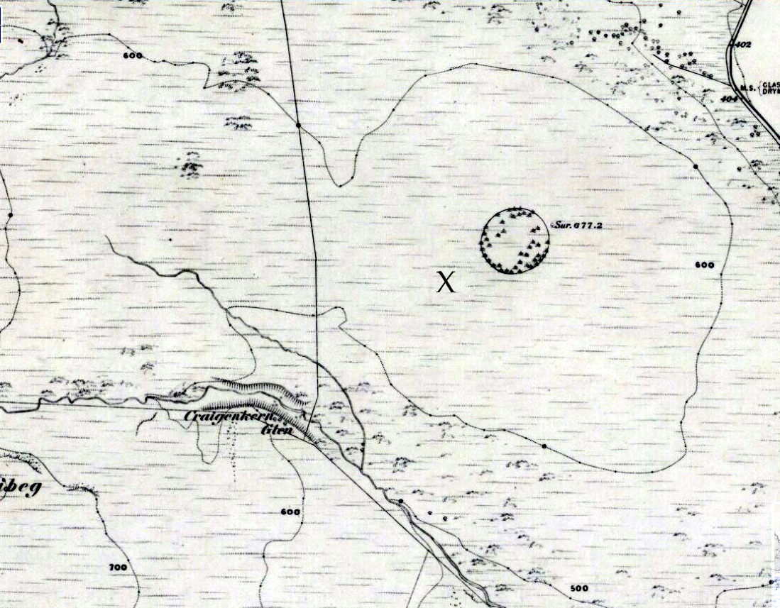
"X" marks the spot!

“X” marks the spot!

The main three 'entrance' stones

The main three ‘entrance’ stones

Audrey Henshall (1972) described the existence of another prehistoric chambered tomb like this one at Cairnhowit 1.95 miles (3.14km) southwest, and we find the Stockie Muir long cairn 3.12 miles (5.02km) to the northwest, clearly showing that the incidence of this monument is not an isolated one.  Others can be found not much further away.  The existence of the raised geological plate known as Carneddans Wood just over a mile south may have once been home to another chambered cairn.

Please note that the grid reference for this site fixes on the southeastern section of the cairn, where the upright stones are.

References:

  1. Henshall, Audrey S., The Chambered Tombs of Scotland – volume 2, Edinburgh University Press 1972.

Acknowledgements:  First and foremost to Nina Harris, for unknowingly finding the place; also to Paul Hornby and Marion Woolley for visits to the site.

© Paul Bennett, The Northern Antiquarian

Cochno (05), Duntocher, Dumbartonshire

Cup-Marked Stone:  OS Grid Reference – NS 50301 73655

Also Known as:

  1. Auchnacraig
  2. Canmore ID 44536

Getting Here


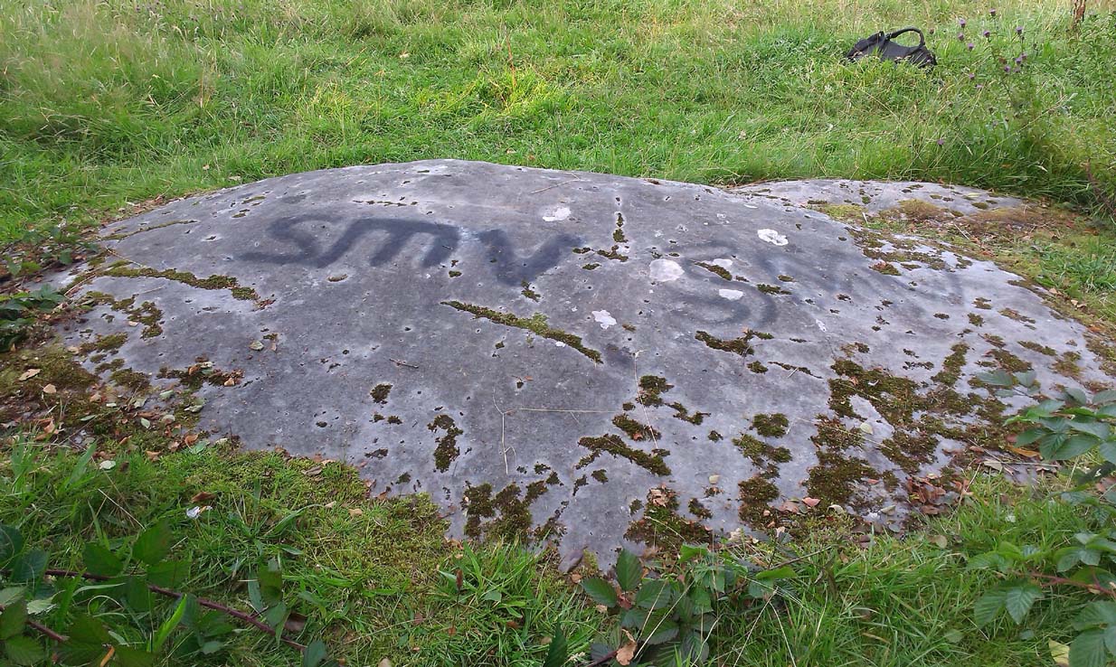
The Cochno (5) stone

Along the A810 Bearsden to Dunochter road, 100 yards past the Faifley roundabout, turn right up Cochno Road. Go up for literally 1 mile and hit the car-park.  Go back onto the road and walk uphill.  Barely 50 yards up, turn right and walk down the track.  About 350 yards along its bendy route, some grasslands appear on your right and there, about 40 yards away, is the large Cochno-5 carving.

Archaeology & History

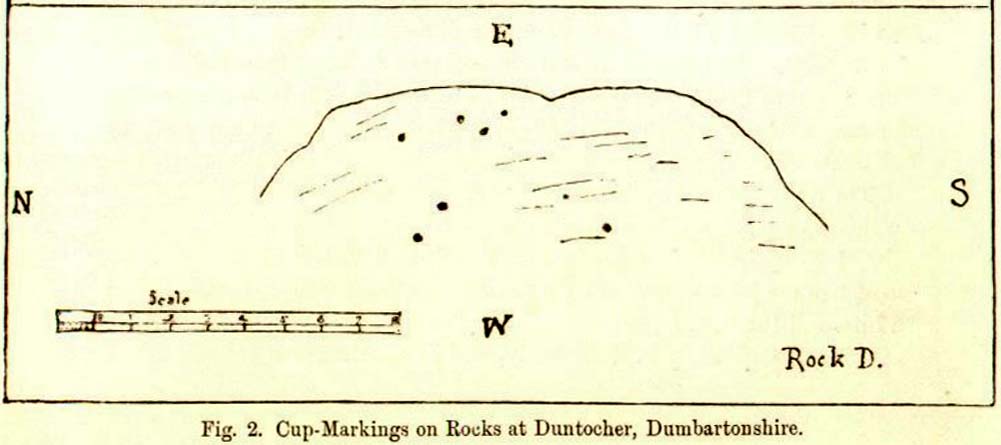
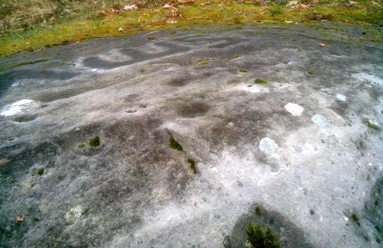
First described by James Harvey (1889) in association with adjacent carvings, he told that “there are eight isolated cups, two of which have a diameter of 2½ inches” on this stone.  Harvey was one of those who loved the idea that our ancestors were etching cup-marks as receptacles for collecting blood and similar christian fantasies. It was a bittova fad at the time.

J. Harvey’s 1889 sketch
Close-up of topmost cups

As we can see, the kids have sprayed their own ID onto the stone.  It’s highly unlikely that they were even aware of this being a prehistoric site as there’s nothing to indicate it as such, and I know of archaeologists who wouldn’t have even seen the cup-marks on the stone, so we can’t really apportion blame. (We must recall that businessman Tom Lonsdale and Ilkley Council branded such things as “twenty-first century informal unauthorised carvings” when they sought and succeeded to get large amounts of cash to justify their own ‘brand’ of vandalism and called it ‘art’.  Very common amongst those social types.)

References:

  1. Harvey, James, “Notes on Some Undescribed Cup-Marked Rocks at Duntocher, Dumbartonshire”, in Proceedings Society Antiquaries, Scotland, volume 23, 1889.

Acknowledgements:  Huge thanks to the awesome Aisha Domleo and her little dynamic duo for helping us get to this site.

© Paul Bennett, The Northern Antiquarian 

Priest’s Well, Tullibody, Clackmannanshire

Holy Well:  OS Grid Reference – NS 86069 95324

Also Known as:

  1. Canmore ID 47056

Getting Here

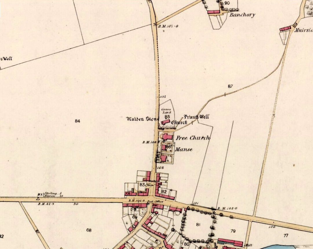
Priest Well on 1866 map

Priest Well on 1866 map

Along the A907 Stirling to Alloa road, turn onto the B9096 through Tullibody, turning up Menstrie Road until, on your right, you reach the old graveyard.  Walk along the track past the old section and go into the new graveyard. The second pathway down, keep your eyes peeled on the floor and you’ll see it.

Archaeology & History

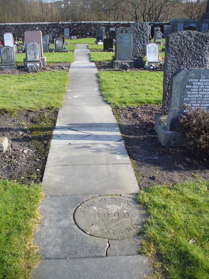
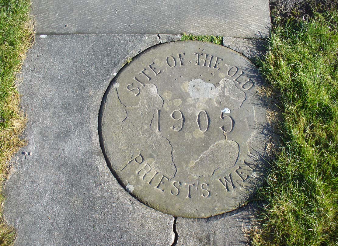
Just a flat carved stone laid in the expanded graveyard is all that remains to mark the site of this once sacred well.  On it, the inscribed slab reads, “Site of the old Priest’s Well – 1905.”

In the 19th century when the waters were still used by local villagers, Robert Kirk (1890) wrote the following,

Site of the Priests Well

Site of the old well

Carved commemorative stone

Carved commemorative stone

“Like the trees, we will now keep outside the dyke (round the old graveyard) and come to the Priest’s Well.  This well, an adjunct of the ancient building, appears to be coeval with the Old Church, and lay a few yards south of the Parsonage, which was demolished at the Reformation.  A small piece of ground in the immediate vicinity is known as the ‘Priest’s Croft’, and the adjacent field, tradition imagines to be the site of the original hamlet. When this well, from its proximity to the Churchyard, was condemned as unfit for human use, one old wife was heard to exclaim, “Na, na, I aye like a drink o’ the guid sweet priest.”

Despite being cited in the various Scottish holy wells reports, all mythic history of the site seems to have been forgotten.

References:

  1. Morris, Ruth & Frank, Scottish Healing Wells, Alethea Press: Sandy 1982.
  2. Kirk, Robert, Historical Sketch of Tullibody, Alloa 1890.
  3. Royal Commission on the Ancient & Historical Monuments, Scotland, Inventory of Monuments and Constructions in the Counties of Fife, Kinross and Clackmannan, HMSO: Edinburgh 1933.
  4. Simpkins, John Ewart, County Folklore – volume VII: Examples of Printed Folk-Lore Concerning Fife, with some Notes on Clackmannan and Kinross-Shires, Folk-Lore Society: London 1914.
  5. Walker, J. Russel, “Holy Wells in Scotland,” in Proceedings Society Antiquaries Scotland, volume 17, 1883.

© Paul Bennett, The Northern Antiquarian