Cup-and-Ring Stone (removed): OS Grid Reference – NX 550 520
Archaeology & History
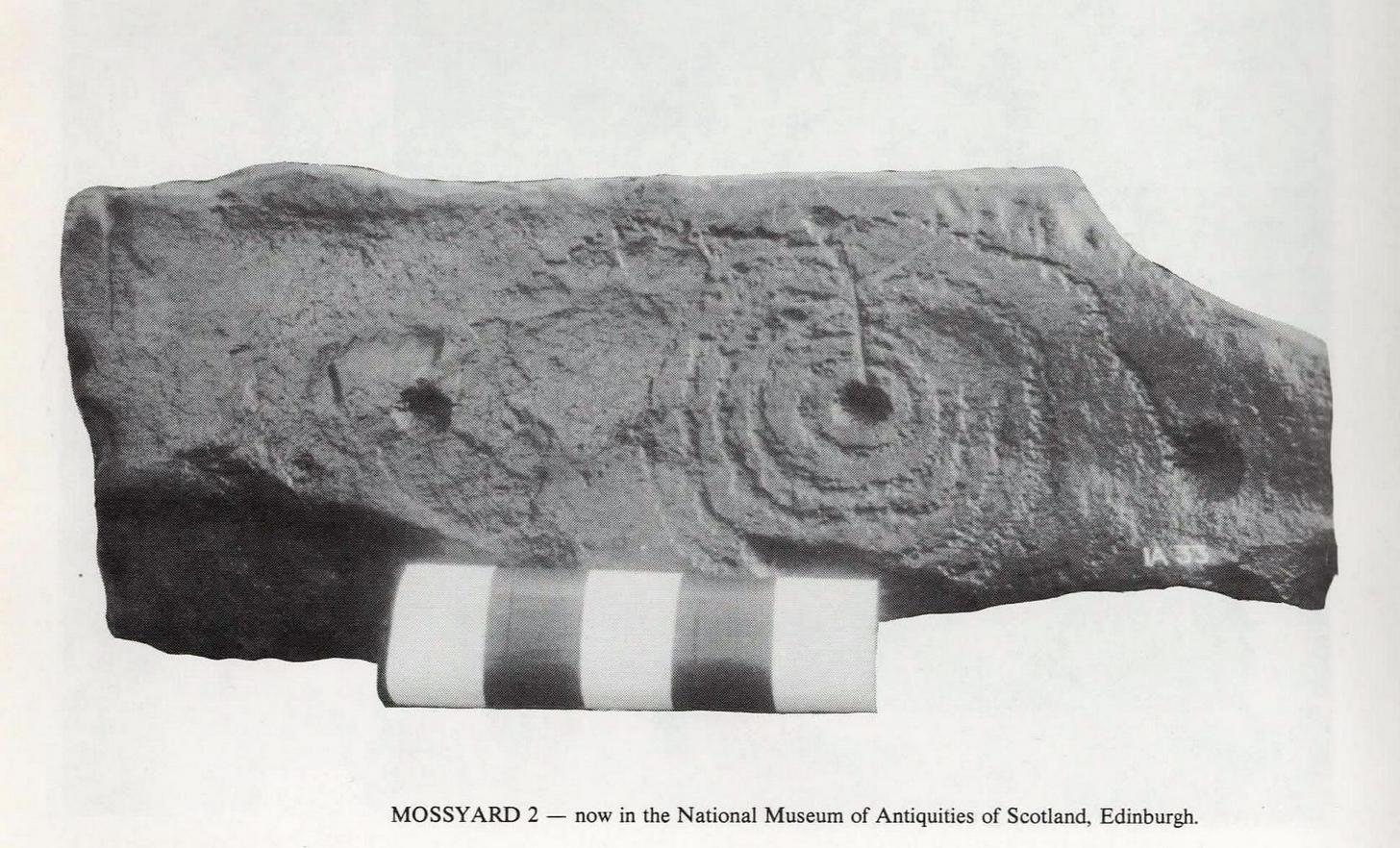
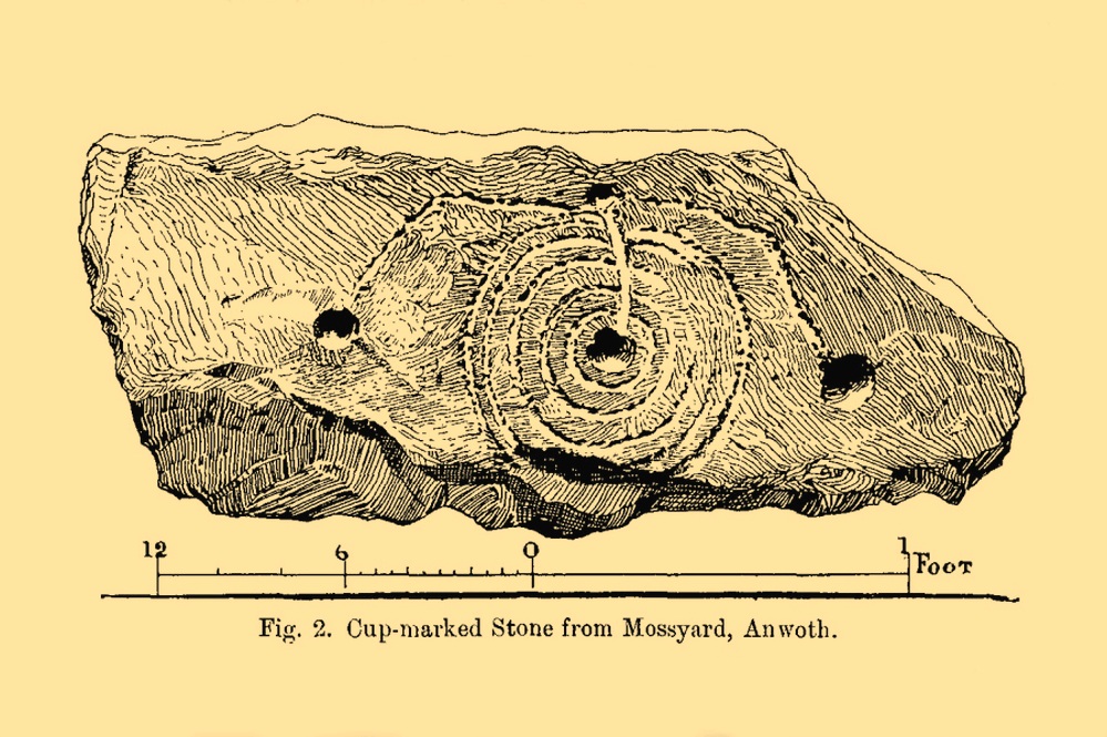
This impressive-looking carving was brought to the attention of the Scottish Society of Antiquaries by Sir Herbert H. Maxwell (1900), who thereafter moved it to the National Museum where, I presume, it still lives, in a box somewhere, sleeping gently. Maxwell’s brief resumé of the stone was as follows:
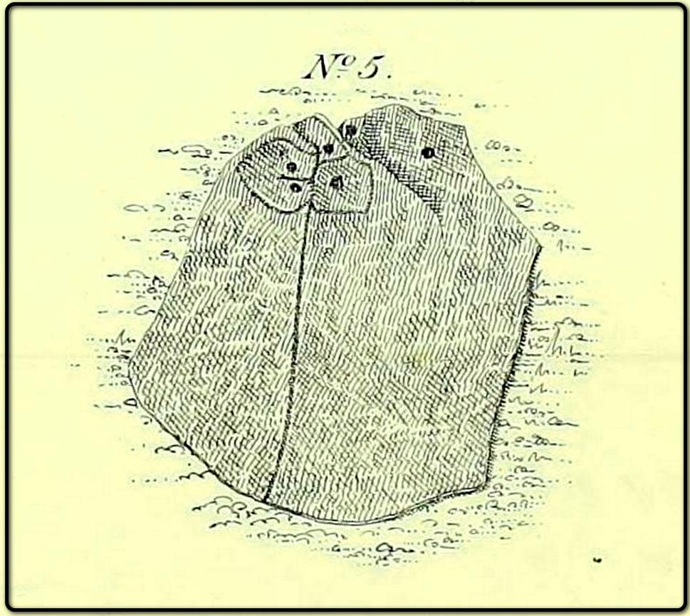
“Cup and Ring-marked Slab…found in a dyke on the farm of Mossyard, Anwoth, Kirkcudbrightshire. This cup-and ring-sculpturing is peculiar in having five rings round the central cup crossed by a gutter which ends in another cup from which gutters also proceed to right and left, each terminating in a cup.”
In Ron Morris’s (1979) survey he erroneously told how the carving had been found in a wall instead of the dyke from whence it came; but, that triviality aside, he described it as,
Morris’ 1979 photoMaxwell’s 1900 drawing
“A cup-and-five-rings, the rings slightly flattened where a radial groove from the cup passes through them. 23cm (9½in) diameter, grooves connecting this with 3 other cups. Carving depths up to ½cm (¼in). The rings are rather lightly pecked though quite wide and well preserved. All gapped, except the inner ring.”
If anyone is able to get any good photos of the carving, out from its museum hideaway, it would be good to see how it’s coping therein….
References:
Maxwell, Herbert R., “Donations to the Museum and Library,” in Proceedings Society Antiquaries, Scotland, volume 35, 1901.
Morris, Ronald W.B., The Prehistoric Rock Art of Galloway and the Isle of Man, Blandford: Poole 1979.
Cup-Marked Stone (destroyed?): OS Grid Reference – NN 8575 4901
Also Known as:
Clachmore
Archaeology & History
The Clach Mhor, or the Big Stone, is all but forgotten as an antiquarian relic in Aberfeldy. It’s history is somewhat piecemeal. First described in Hugh MacMillan (1884)’s essay on local cup-and-ring stones, he told that:
“A short distance above the village of Aberfeldy, where General Wade’s old road emerges from the houses, a huge stone, called the Clach Mhor, lies on the left-hand side in a slanting position half erect, as if supported by the garden wall of which it forms a part. …In all likelihood it originally stood erect, and formed one of a group of similar stones, its companions having been broken up in the formation of the road. …On the upper face there are some small cup-markings, not quite so well formed as usual, owing to the hardness of the material… The fact that they occur on only one side of the stone, and are scattered indiscriminately all over its surface, are sufficient to convince any one who is skilled in the subject that they are genuine specimens of prehistoric sculpture.”
Nearly thirty years after this initial description, MacMillan (1901) found that it had previously been a part of The Tullich stone circle, and following its destruction the Clach Mhor was moved and used as “part of a garden wall on the old military road passing along its base.”
More than fifty years later, the Aberfeldy historian N.D. Mackay (1954) told that up to 1910 the Clach Mhor was a conspicuous object, standing “as it were overlooking and to some extent overhanging the roadway down near the Square.” However, it
“was blasted and broken up in 1910 in the course of road widening operations, but a considable part of it was built into, and still forms the lower corner of, the garden boundary wall, nearest The Square, of the house which bears its name, ‘Clachmhor’. Its present position is slightly east of the site it occupied when I first knew it and, unless Wade’s men did actually move it, the site it occupied for centuries.”
Mackay also mentioned what he called the “indentations” on the stone which MacMillam deemed as cup-marks, but he pointed out that one Rev. John MacLean “believed they were made by the levers, jacks, etc, of (General) Wade’s men” when they cut the road into Aberfeldy in the 18th century, whilst
“A third solution was given by the son of a one-time local strong man called Big Robert, “What a strong man my father was,” he said, “he lifted that stone. Don’t you see the marks of his fingers on it?””
It’s not known what became of the Clach Mhor and whether it remains hiding in some walling, or whether it has met its demise….
References:
Mackay, N.D., Aberfeldy Past and Present, Town Council: Aberfeldy 1954.
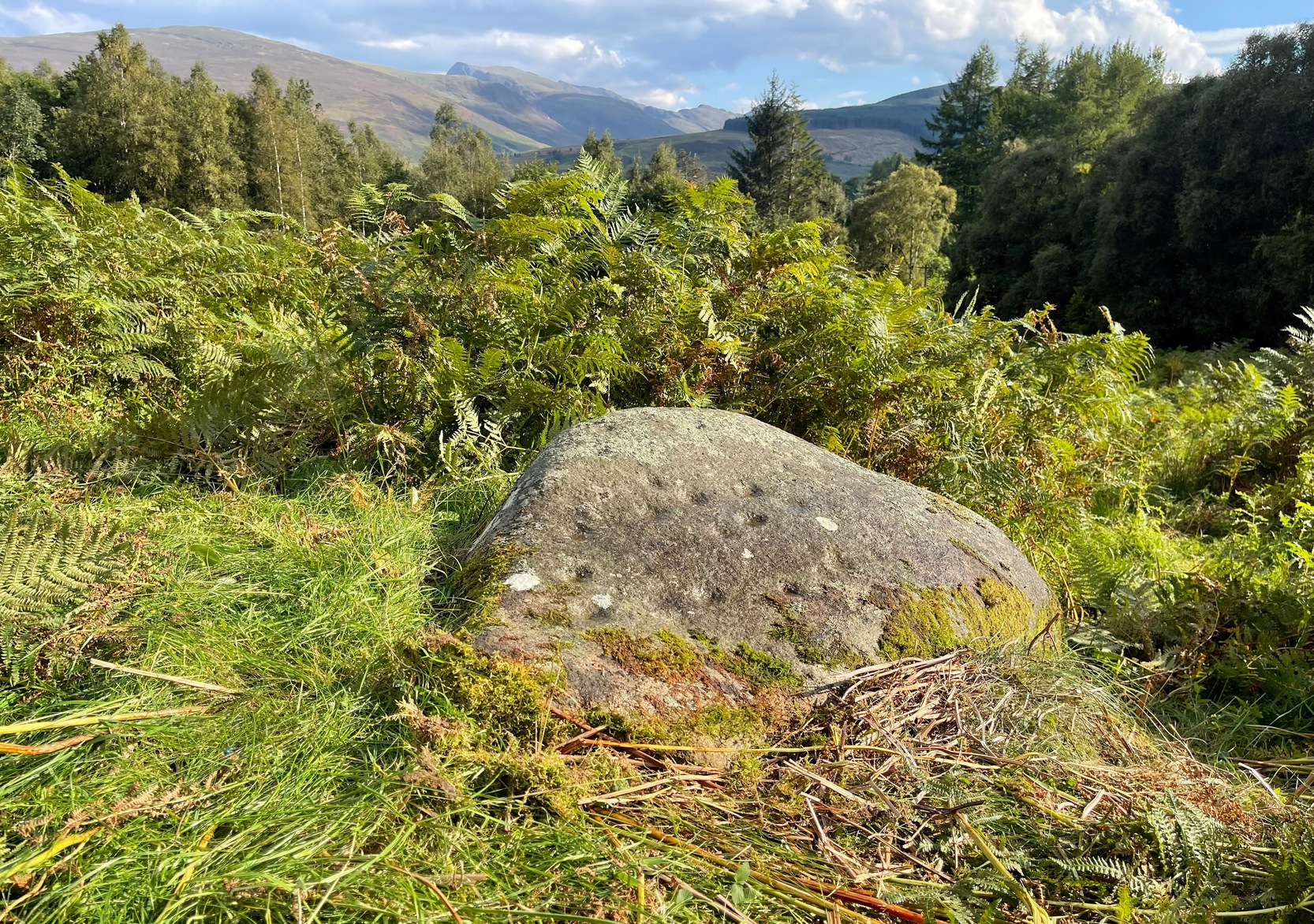
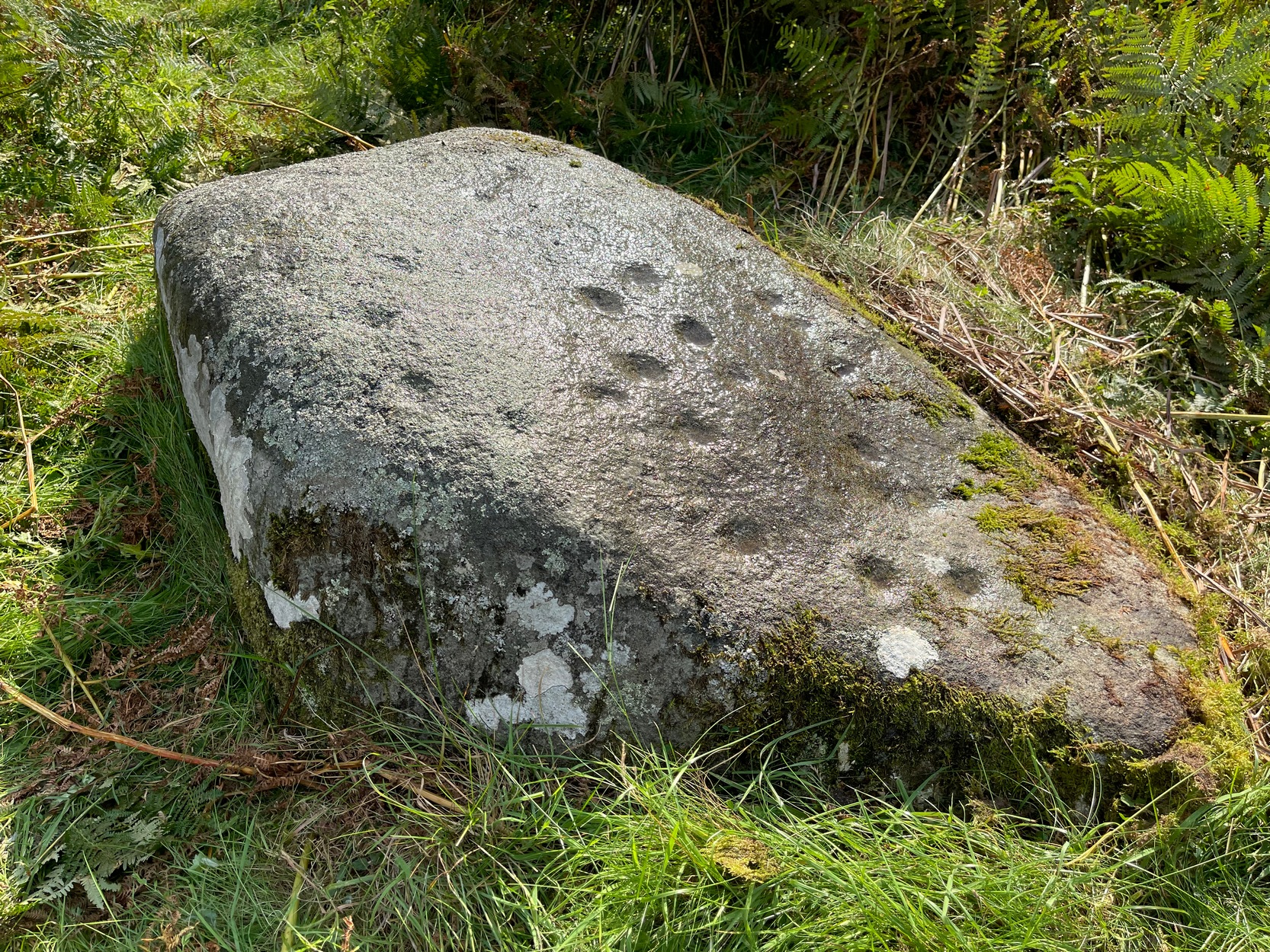
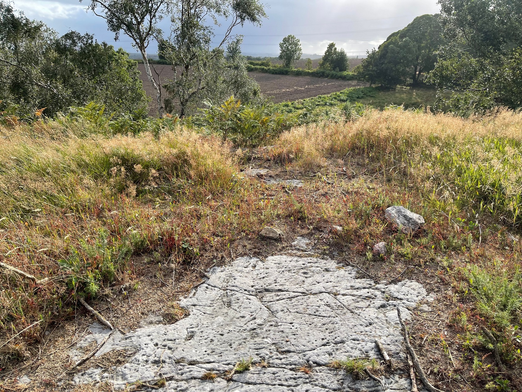
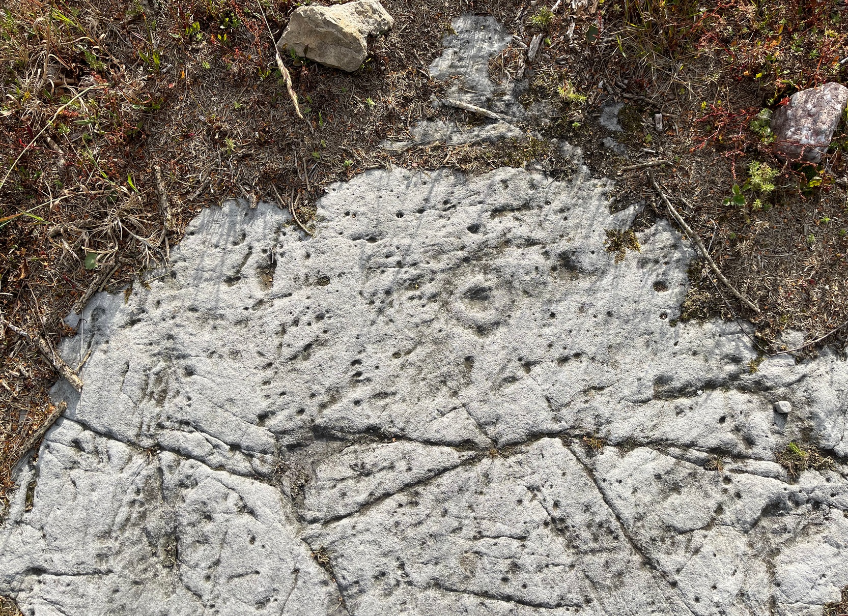
In Lochearnhead village start walking up the Glen Ogle road and, just past the last house on the right, a dirt-track bends down to an old building. Just before the building, keep your eyes peeled for the small footpath that runs down to the river. Walk along here and cross the river-bridge, then bear diagonally to your left and walk up the singular footpath. It snakes through the trees for a few hundred yards then opens out into a field. About 75 yards along the path in the field the land levels out. From here, walk through the grasses to your right about 20 yards. Zigzag about – you’ll find it.
Archaeology & History
Main cluster + v.faint ring
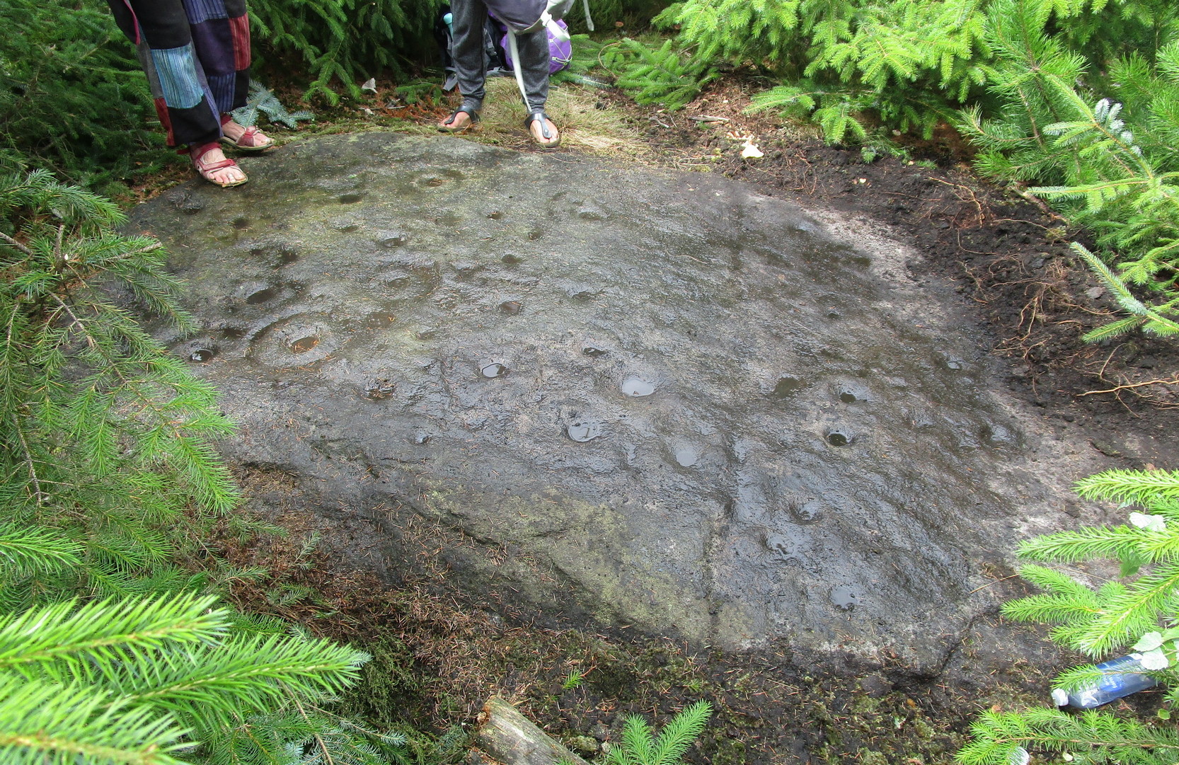
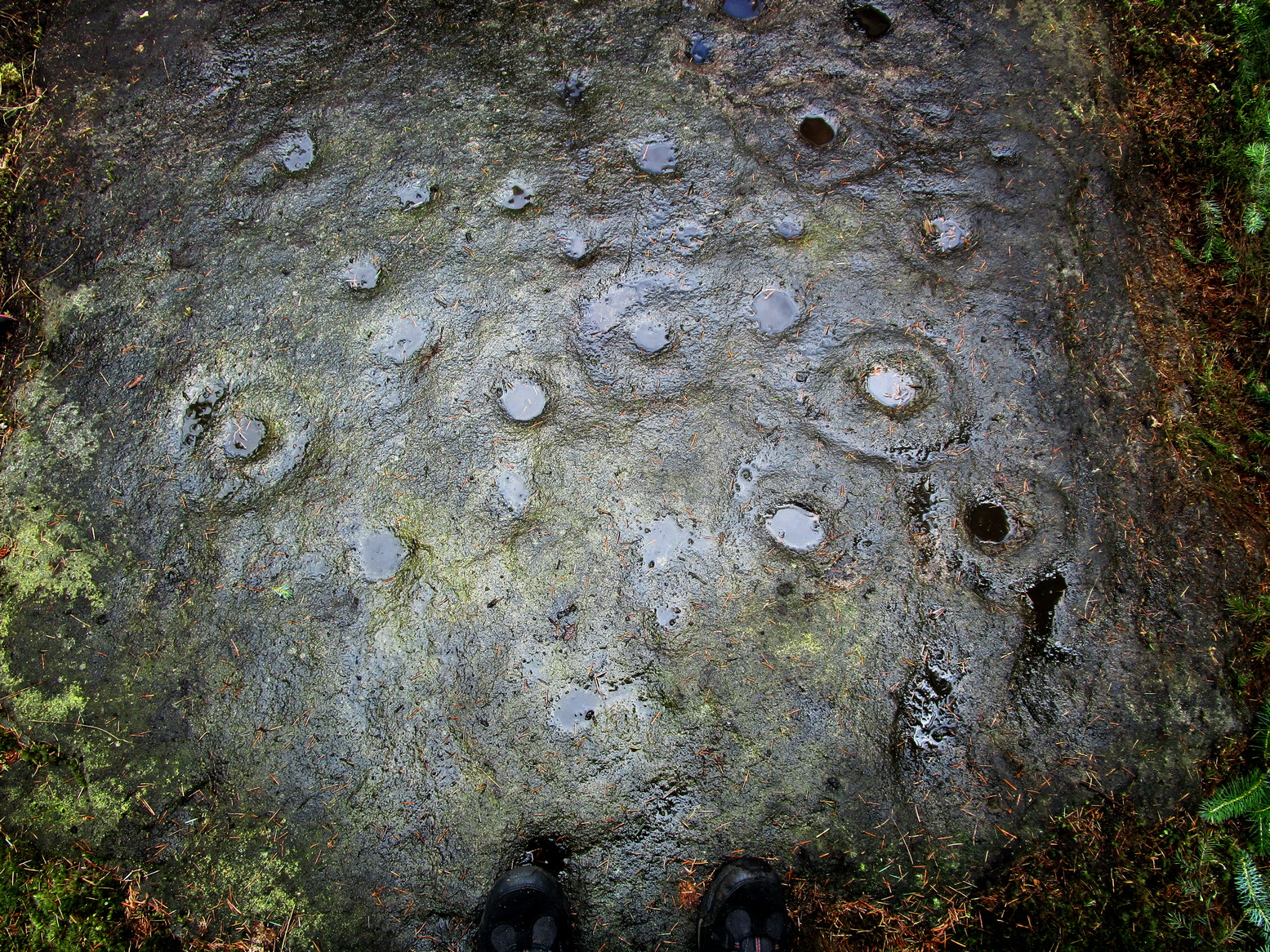
The setting of this carving is, like many of Perthshire’s petroglyphs, quite beautiful. It was made when the ‘artist’ carving the stone was crouched or sat on the ground, gazing at the southern landscape and heights around Ben Vorlich, whose mythic nature may have been part of the design.
Comprising of a cluster of typical cup-marks, there are two, perhaps three very faint rings in the design, which seems to have been described for the first time in George Currie’s (2012) typically short minimalist way. He told that in the field,
“50m E of the Ogle Burn is a boulder 2.1 x 0.9 x 0.5m, which bears 21 cup marks, 2 of which have single rings.”
Cup and faint ringFaint cups on the crown
Much of the original design is difficult to see in full unless the lighting is good. We spent several hours here and counted 25 cup-marks and found rings around three of them—but these proved difficult to photograph and some more visits are needed to capture them. “Officially” at least, there are no other carvings close to this one. But that’s obviously not going to be the case. Well worth checking out when you’re in the area.
References:
Currie, George, “Stirling: Balquhidder, Glen Ogle – Cup-and ring-marked rock”, in Discovery & Excavation Scotland, volume 13 (New Series), 2012.
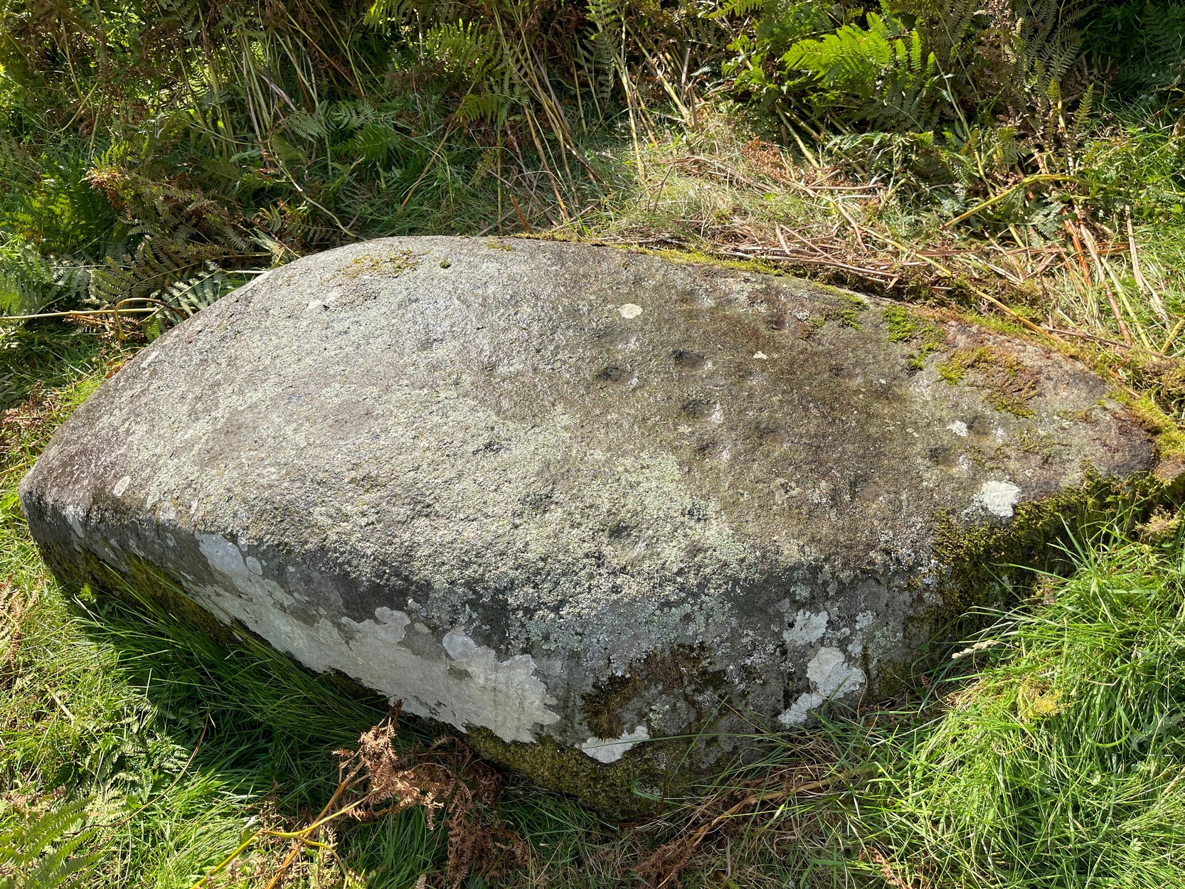
Cup-Marked Stone (removed): OS Grid Reference – SE 1579 3995
Archaeology & History
Jenny Lane carving
A small, seemingly broken cup-marked stone that may have once been part of a prehistoric tomb, found itself being included in an old wall at some time in the not-too-distant past: in the south-facing wall of the cricket ground at the top end of town. No one seemed to know it was there until it was noticed in the 1950s by a local man who brought it to the attention of Sidney Jackson (1958), editor of the local Bradford archaeology mag at the time. Jackson visited the site and thankfully did a sketch of what it looked like, before it was removed at a later date. He wrote:
“The small rectangular stone bearing four cup-shaped hollows…is another of Mr George Pritchard’s finds. It forms part of the high wall which bounds the Baildon Cricket Club’s ground in Jenny Lane… Its appearance suggests that it is part of a Bronze age cup-marked rock which was split to make building stones.”
Following its removal more than twenty years ago, it ended up in the hands of a dude from Cononley called Gerald Wright. I’m not sure whether it still lives over there or has subsequently found a new abode. Does anyone know what’s become of it…?
Folklore
Although there’s nothing specific to this carving, the place where it was found, on Jenny Lane, was where a phantom black dog used to be seen in bygone years. It was renowned as the harbinger od death.
References:
Jackson, Sidney, “Cup-Marked Stone in Jenny Lane, Baildon,” in Cartwright Hall Archaeology Group Bulletin, volume 3, part 10, 1958.
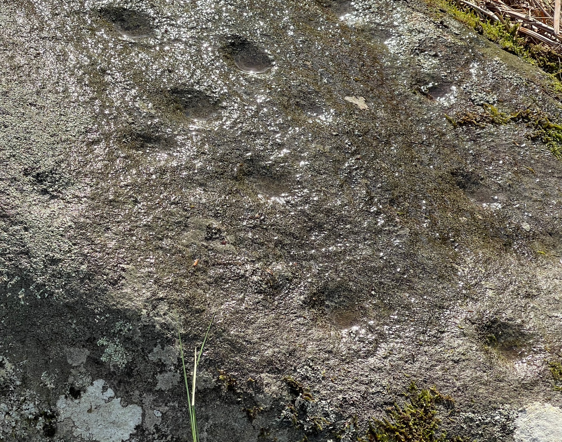
Once you’ve got yourself to the start of Shipley Glen, from the Old Glen House pub, from the car-park outside walk up the road for 60 yards (if you reach the next small car-parking spot, you’ve gone too far) then step off-road into the vegetation on your left and you’ll see the large flat fractured section of earthfast rock. Get low down and seek out the cup-mark first!
Archaeology & History
This is a very faded and quite basic design and unless you get decent low sunlight, it can be very difficult to discern. On my most recent visit here, conditions weren’t too good, as the photos here indicate.
The main feature is a single cup-mark surrounded by a very wide ‘square’ ring (if y’ get mi drift). It was first mentioned and illustrated in John Hedges (1986) survey, who described it simply:
“Striated, pitted bedrock with crack down centre, in grass and amongst other rocks and bedrock. Carving, centre and W end: enclosure type angular grooves and two cups.”
John Hedges 1986 sketchCup & surrounding lines
One of the two cups is presently beneath some shallow vegetation (easily removed if anyone’s passing), but the main feature of the large enclosing square and its central cup is presently exposed and can be seen when your eyes eventually adjust. Interestingly, Hedges shows the existence of a faint ring around the central cup inside of the larger square enclosure. If someone is able to capture a photo of this, please add it on our Facebook page. 🙂
I must point out that somewhere, not too far from this carving, was once found a very similar design known as the Brackenhall Green carving that possessed the same curious squared-ring feature that we find on this stone.
References:
Boughey, Keith & Vickerman, E.A., Prehistoric Rock Art of the West Riding, WYAS: Wakefield 2003.
Hedges, John (ed.), The Carved Rocks on Rombalds Moor, WYMCC: Wakefield 1986.
Cup-and-Ring Stone (destroyed): OS Grid Reference – SE 133 389
Archaeology & History
The lost carving of Brackenhall, in 1888
I first came across a description of this lovely-looking cup-and-ring carving during some research I was doing in the archives at Bradford Central Library in the 1980s—and decided there and then that I had to find it! It was described and illustrated for the first time by William Glossop (1888) when he made a short survey of some of the prehistoric sites on Baildon Hill and Shipley Glen. He told that it was one amidst “a cluster of rocks on Bracken Hall Green”—but was seemingly destroyed not too long after he wrote about it. There was some discussion in the late-1980s that it may have been a petroglyph that was cataloged by John Hedges as carving ‘BM14’ (at SE 13272 38924), due to it possessing a similar ‘artistic’ element (or motif, as some like to call it) and which is also along the Brackenhall plateau by the roadside about 160 yards below the entrance to the Brackenhall centre—but it turned out not to be the case.
A few years after Mr Glossop uncovered this carving, a short note by J.H. Turner (1894) described two cup-marked stones, “both now destroyed” that could be seen in the same area just as you entered “the plateau where the Easter fair is now held”. And his description closely fitted Glossop’s sketch. Turner wrote:
“The cups were three inches in diameter, and one inch deep, in an oblong 18 by 12 inches, with line 6 feet long towards the east. The second oblong, same size, had also an eastern pointer and one cup in the centre. These have both disappeared since June, 1889; I fear by wanton mischief.”
This would seem to be the same carving illustrated by Glossop, although it’s still difficult to say with any accuracy where it was located. The great historian W.Paley Baildon (1913) thought it may have been the same carving which Harry Speight (aka Johnnie Gray) described at the Glen Gate—and it does sound similar, but until we are able to ascertain (i) where Glen Gate was; and (ii) whether it coincided with the location of “where the Easter fair” was held, we must err on the side of caution. Tis an intriguing mystery… (Note: the grid-reference given for this site profile is an educated guesstimate!)
References:
Baildon, W. Paley, Baildon and the Baildons – volume 1, Adelphi: London 1913.
Glossop, William, ‘Ancient British Remains on Baildon Moor,’ in Bradford Antiquary, no.1, 1888.
Gray, Johnnie, Through Airedale from Goole to Malham, Walker & Laycock: Leeds 1891.
Turner, J. Horsfall, ‘Cup Marks, Shipley Glen,’ in Yorkshire County Magazine – volume 4, J.E. Watmough: Idel 1894.
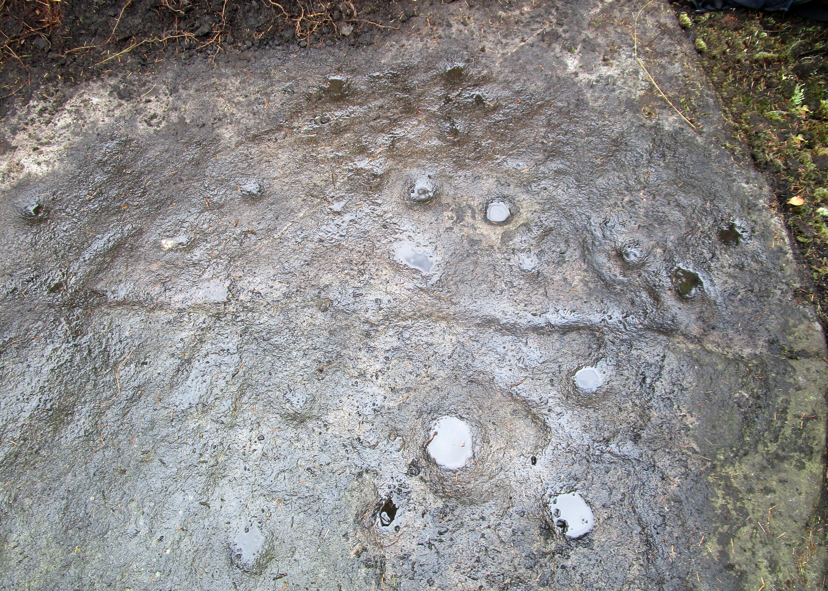
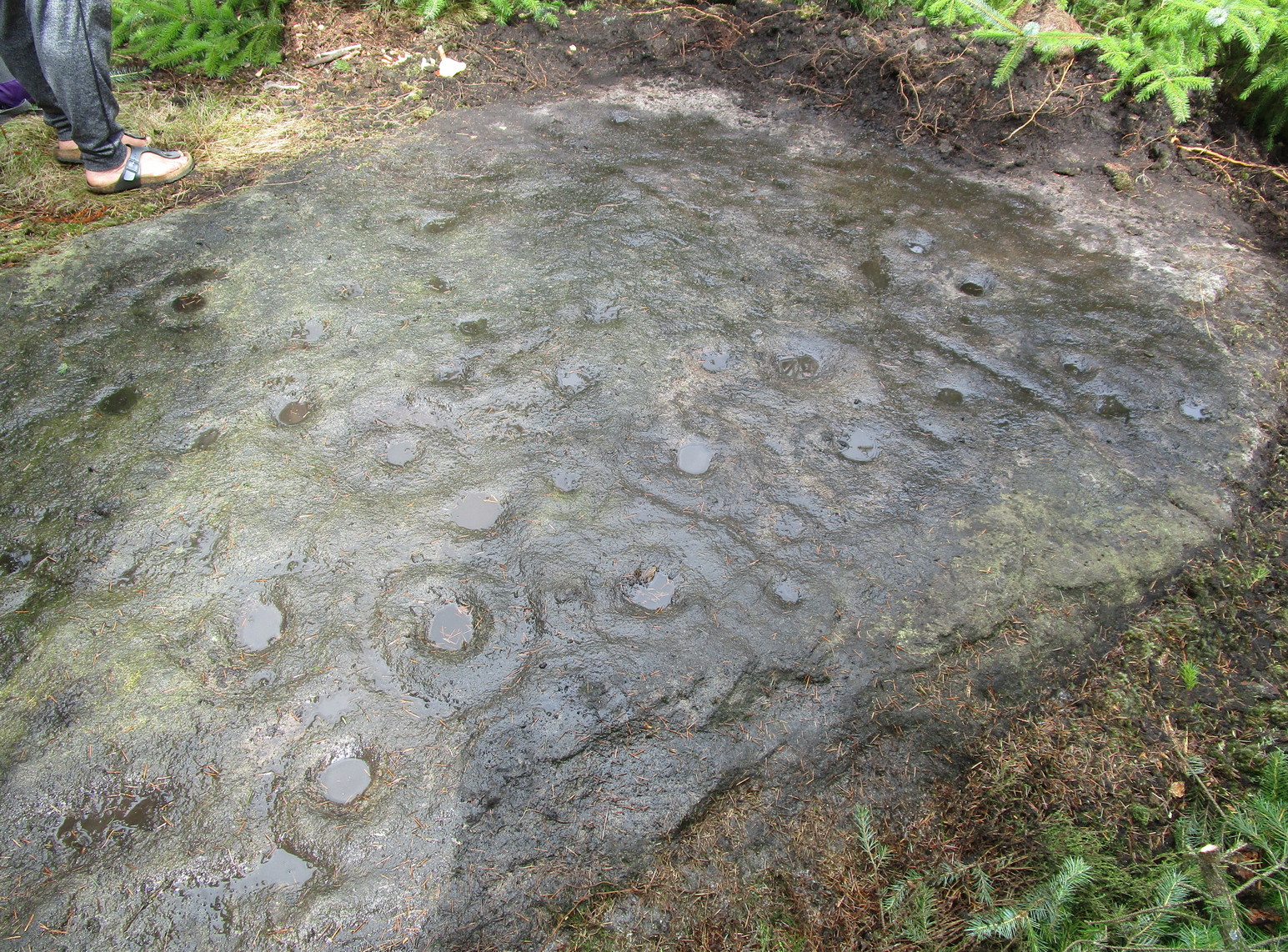
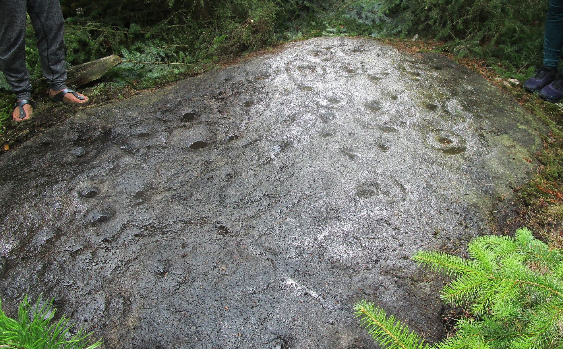
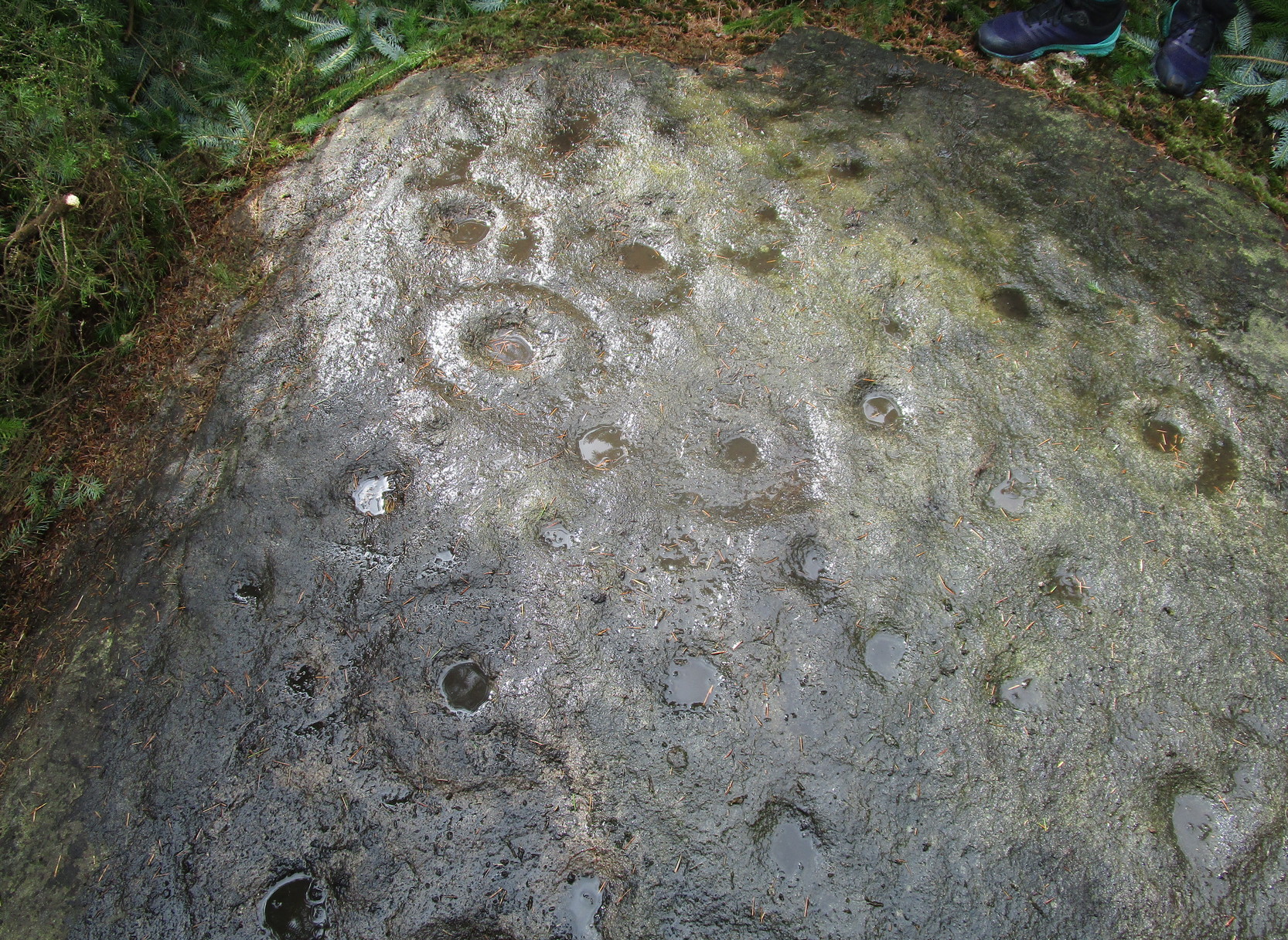
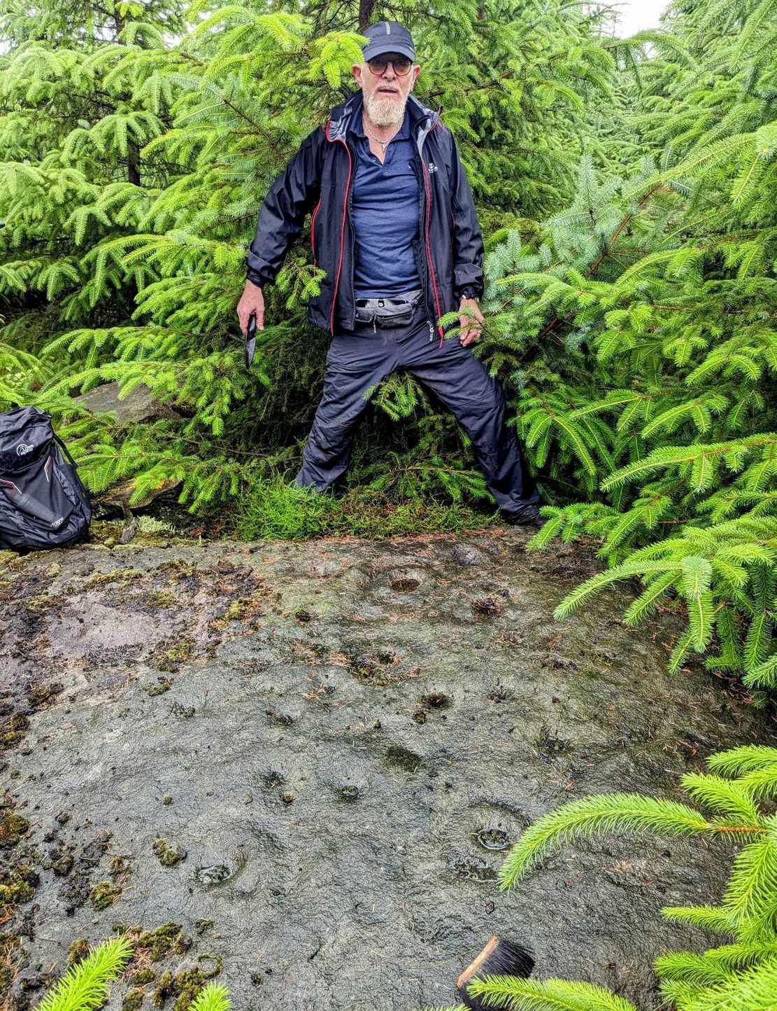
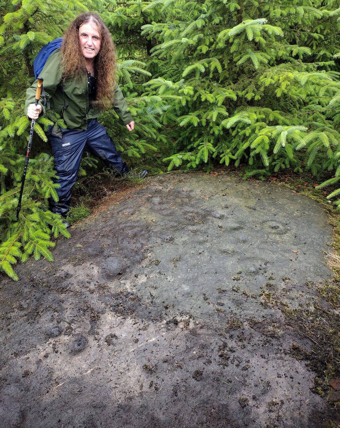
A real pain-in-the-arse to find this one, and even describing how to get there is troublesome—but I’ll try my best! I think the best starting point would be from the track that runs through Rivock plantation. Follow directions to reach the Ripple Stone carving, then walk 35-40 yards east to the ornate multiple-ringed stones of Rivock (067) and company. Now comes the tricky bit. From here walk, zigzag fashion (it’s the only way y’ can do it!) up the slope ever-so-slightly east of due south until you reach the top of the slope, where the land levels out. If you walked in a dead straight line from the triple-ringed Rivock (66) carving, it is almost bang on 100 yards. Anyhow, now you’re on top of the slope, zigzag about and look for the large flat oval-shaped stone. Take your time—you’re gonna need it!
Archaeology & History
Section of carving
Laid amongst the dense mass of cheap crappy pine trees that plagues some of our upland countryside depriving the land of necessary nutrients for animals, flowers and other trees, this impressive multiple cup-and-ringed marked rock lies sleeping. It was rediscovered in 2017 by local hunter Chris Slinger during one of his many ventures through the undergrowth. I’m informed that one of his compatriots reckons that he already knew about it some forty years prior to Chris claiming it—but as yet we have no way of knowing that for sure, so the name of the carving goes to Mr Slinger. And it’s a beauty—one helluva beauty!
Main line & ring clusterScattered mass of rings
This large, flat, ovoid-shaped stone, roughly 10 feet by 7 feet across, is virtually covered from head to foot in large and not-so-large cup-and-rings at varying levels of erosion. The carving appears to have been partitioned, so to speak, into two sections that are clearly defined by a carved line that runs the breadth of the stone. On the top, larger section above this main line are about 30 cup-marks, with perhaps a dozen of them having rings around them—some complete, some incomplete—scattered about in the usual non-linear manner. One or two of the cup-and-rings may have double-rings, but due to dark conditions in here none of us could be sure. On one visit, a local lady (Liz of Fell Edge if I remember rightly) noticed that the largest cluster of cup-and-rings near one quarter of the stone seemed to be arranged in a similar form to the Swastika Stone, 1.9 miles northeast of here!
Main line, cups & ringsCluster of cup & rings
On the lower smaller section of the carving, beneath the main line if you like, there’s not quite as much going on. At least twelve cup-marks are apparent here, at least five of which have rings around them. The main little bunch of these are pushed right up against the long carved line, seemingly communicating with other rings on the top-side of it. In some photos it looks as if, in this section of the stone, carved lines link the cup-and-rings on each side of the main dividing line (if y’ get mi drift). There’s a lot going on here. It’s a pretty complex carving as you can see: one of the best in the Rivock cluster and one that I’d like to spend more time with, if only to get a complete picture of what the carving looks like in full as we’ve not yet got to the outer edges of the stone itself, meaning that there may be more of it beneath the vegetation.
Stone-fondler KootStone-fondler Sean
I was hoping to get some much better photos of this site and clear back more of the covering foliage, but as the carving is now all but covered in dense forestry, we may have seen the last of it for a few decades. Even worse, there’s the great possibility that the carving will be destroyed when the forestry lads come to cut down the trees—through no fault of their own—as they’ll have no idea that it’s directly beneath their machinery. It would be good if some local volunteers could perhaps completely clear and protect this stone to avert such a likely disaster a few decades from now. A small metal fence with a little notice-board would do the trick!
Acknowledgements: Firstly, to Chris Slinger for rediscovering the carving; then to the modern stone-fondlers Rod ‘Koot’ Chambers and Sean Dillon for beginning the cleaning process, and for their photographs in this site profile; and then to Sarah Walker, Sarah Jackson and Marianna, for helping to bring the entire stone into view.
If you start from the Castleton (2) carving, in the first small birch copse closest to the road, walk to its southeast side where there’s a small break before the next small birch copse begins which runs along the raised rocky crag to the southeast. Walk along the back lower east-side of these birches for about 100 yards until you reach a break in the copse (the next lot of trees are another 30-40 yards further on) and from here walk up the slope onto the first flat piece of rock on the crag itself. Zigzag hereabouts until you’re about two or three yards from the edge.
Archaeology & History
Single cup-and-ring
Once this rock surface is covered again by Nature’s carpet, you’ll struggle to find it. Unlike many of its more ornate neighbours, this seems to be a lonely solitary cup-and-ring design, cut near the edge of a large level piece of otherwise blank rock. Numerous geological nicks and scratches scatter the same surface, but the carved element is easy enough to see, as the photos here show. It was rediscovered in the 1980s by Morris & van Hoek (1986) who described it simply as “a single cup and one ring, 8cm in diameter on horizontal rock.” There may well be additional elements to this design beneath the soil.
References:
Morris, Ronald W.B. & van Hoek, Maarten, “Stirling District: Castleton 4d; Castleton 5e,” in Discovery & Excavation, Scotland, 1986.
Acknowledgments: Massive thanks to Thomas Cleland for helping to make this site visible again.
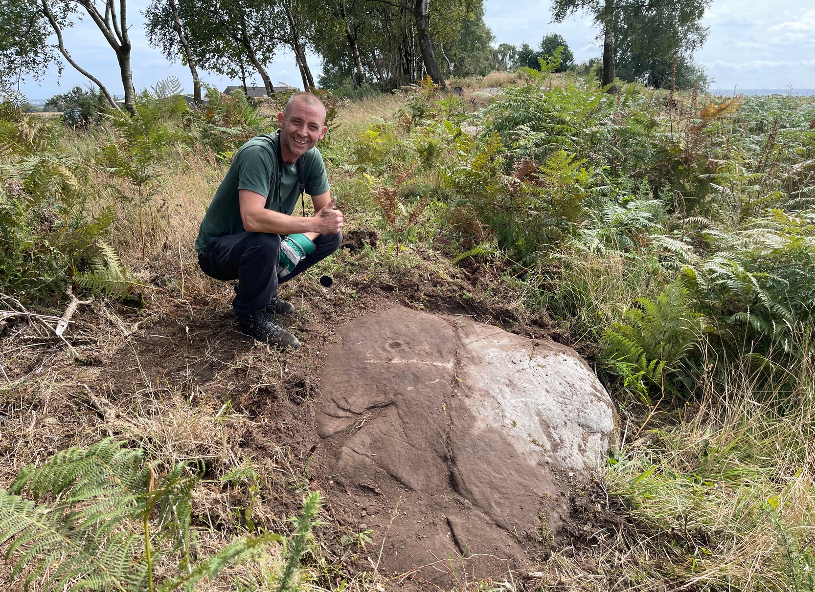
Start from the Castleton (2) carving, in the first small birch copse closest to the road and walk to its southeast side where there’s a small break in the trees before the next small birch copse begins, which runs along the raised rocky crag to the southeast. Walk to the front or western side of the trees there and along the very edge of the low crag. About thirty yards along, right on the edge of where the rocks begin, look for the smooth sloping earthfast boulder (about 20 yards before the mighty nine-ringer of Castleton 7). Rummage around and you’ll find it.
Archaeology & History
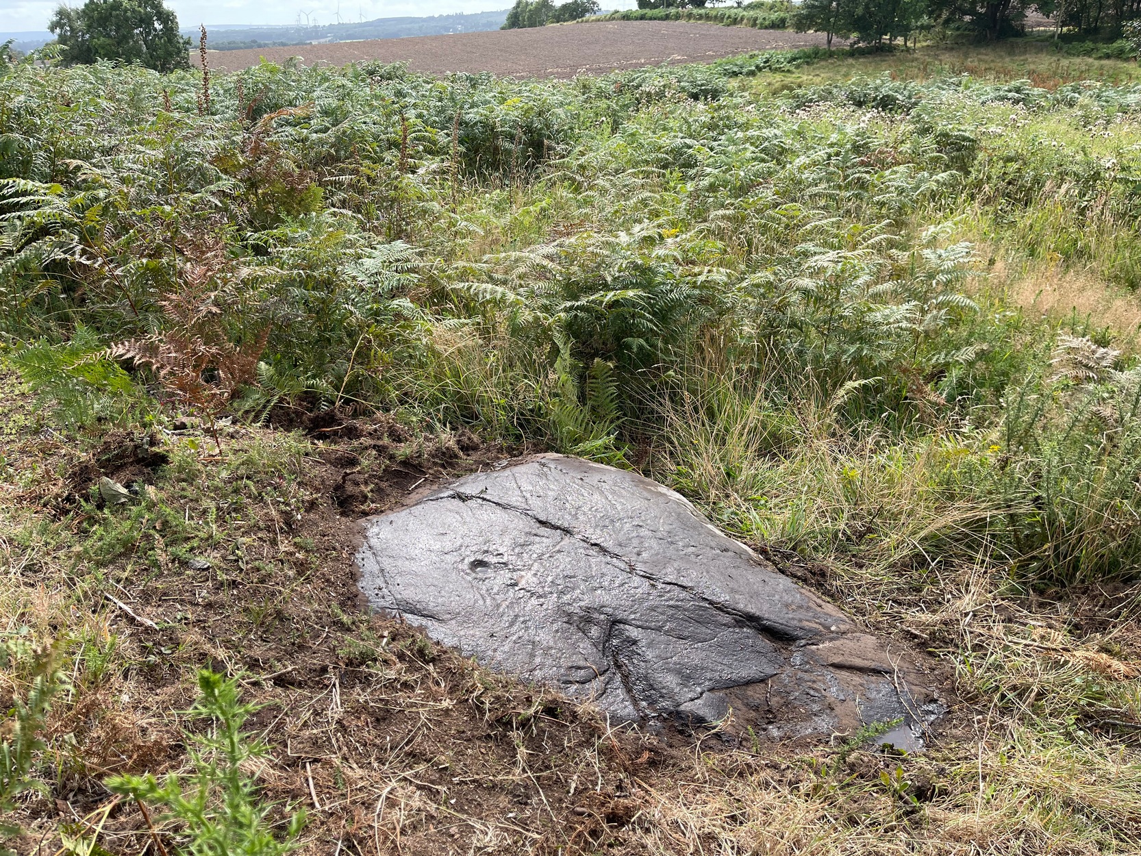
Castleton (7e) carving
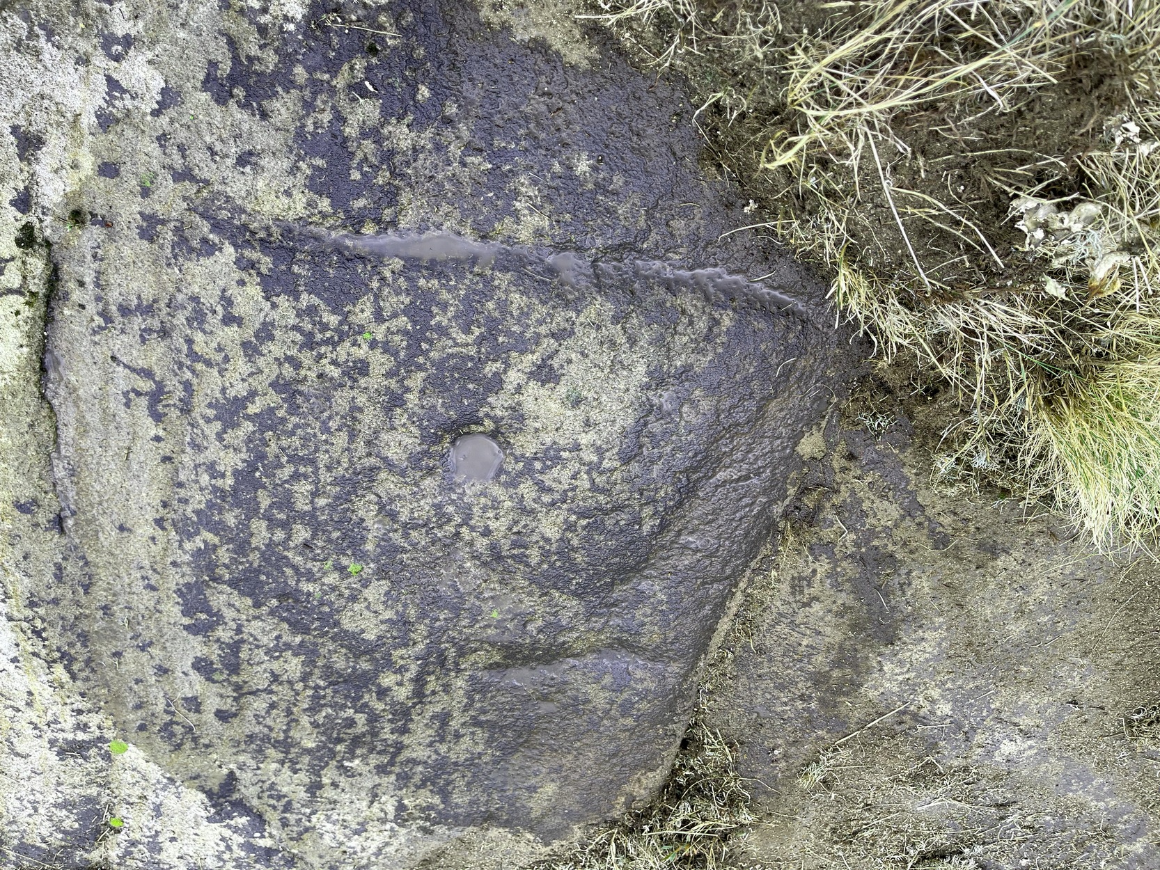
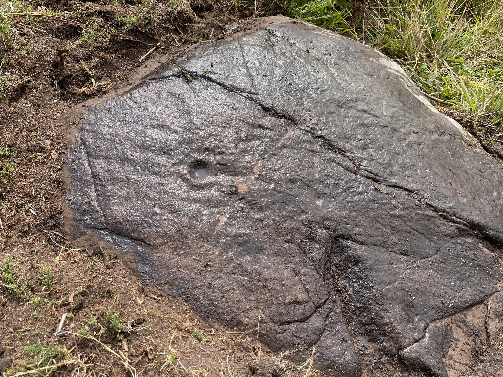
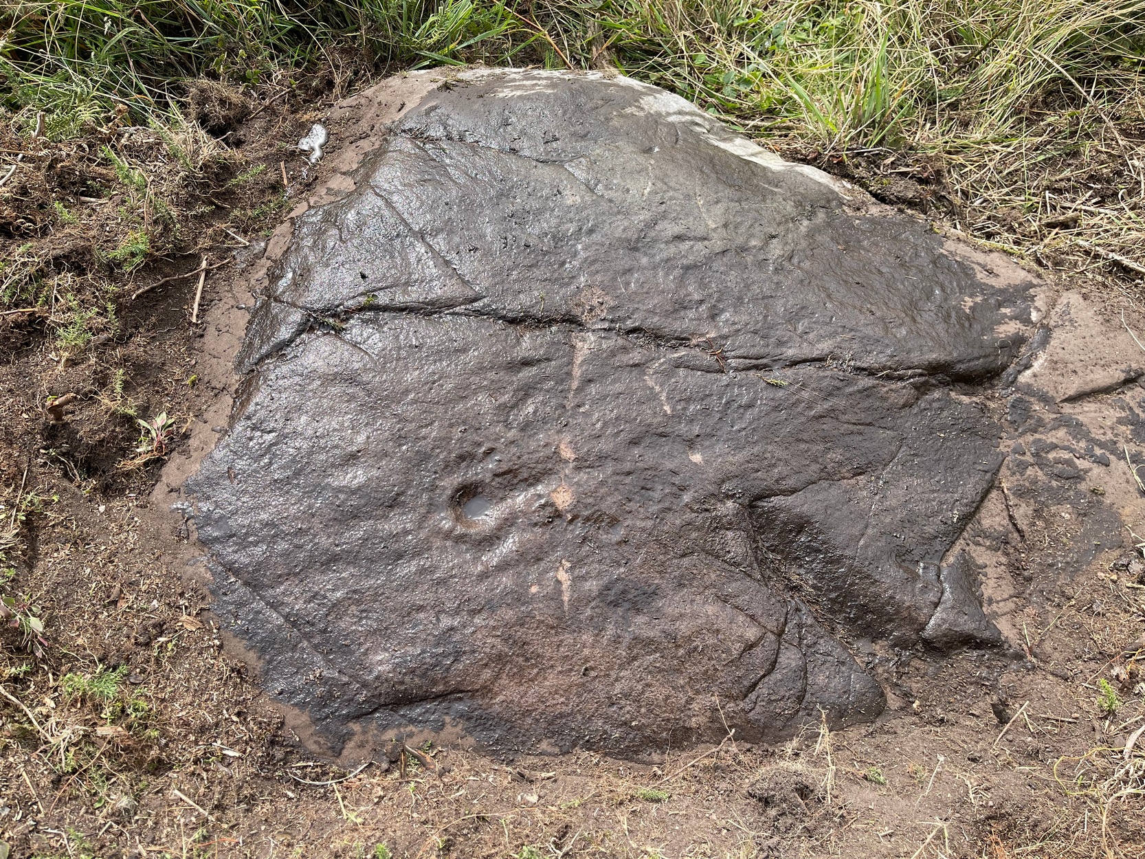
This newly recorded petroglyph was rediscovered by Thomas Cleland on August 6, 2025. Initially it was thought to consist of just a single cup-and-ring with an opening from which a carved line ran outwards; but, once wet, there seemed to be the beginning of an outer second-ring on its left-side. You can see it clearly in the photos. And, the more we looked, the more it seemed there were one or two other very faded elements.
Above the main cup-and-ring is a faint, shallow cup-marking and surrounding this appears to be an incomplete dumb-bell-shaped ‘ring’ that you can only just make out in the photos. It’s very faded and would seem to pre-date the primary design by some considerable time (unless, of course, it was merely ‘outlined’, so to speak and never completed).
Cup & ring & faint ‘bell’Cup & ring & faint ‘bell’
Both Tom and I are convinced that there’s more to this carving than is presently visible. The rock is covered in deeply compacted soil and it would require a lot of work to uncover the rest of it. A job for the future maybe…..
Note to self: This carving and all the others in the Castleton complex need to be fully re-catalogued as their indexing is haphazard through various academic tomes and websites.
Acknowledgements: Massive thanks to Thomas Cleland for locating this carving, for the first time in millenia. 🙂
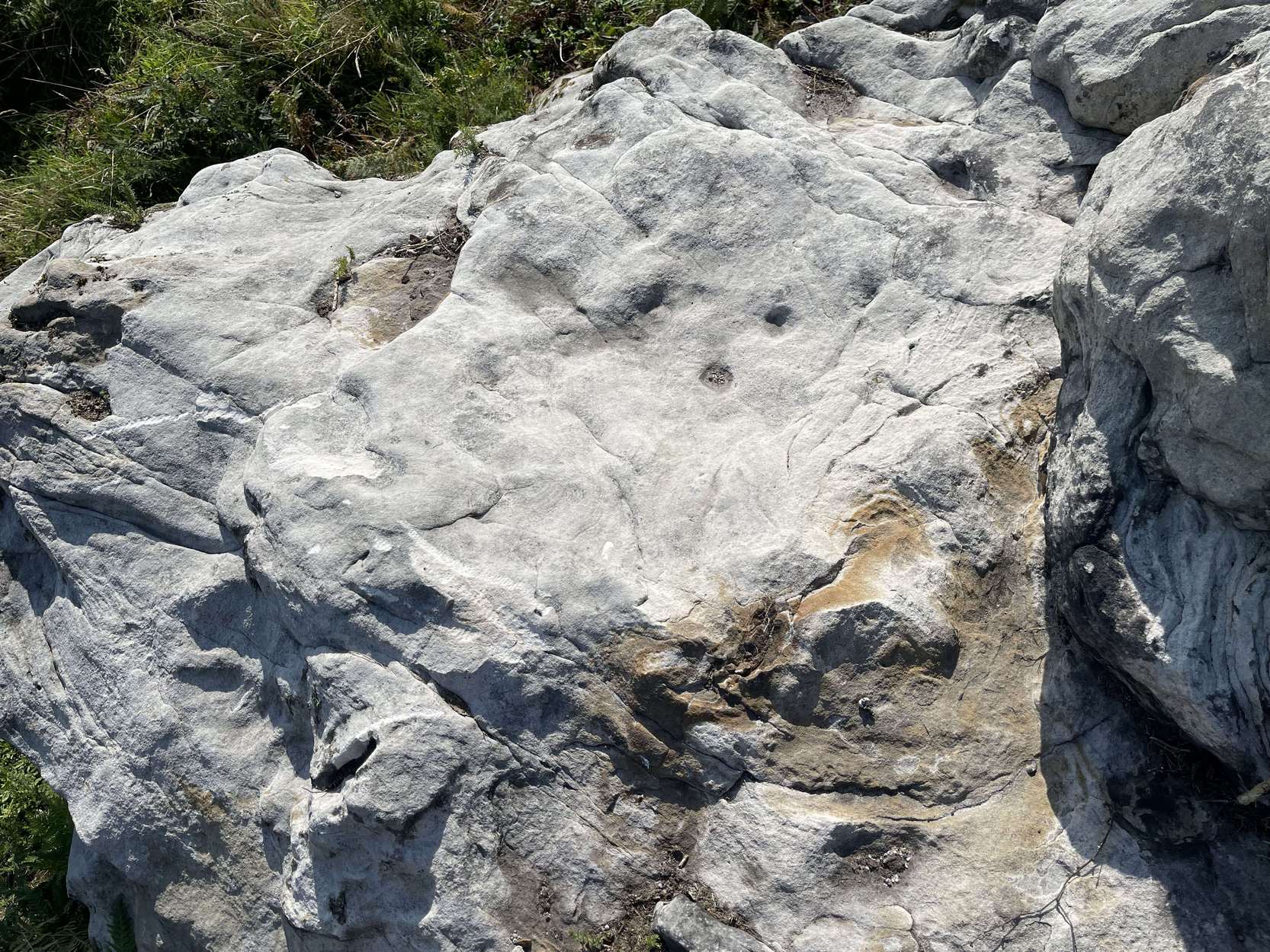
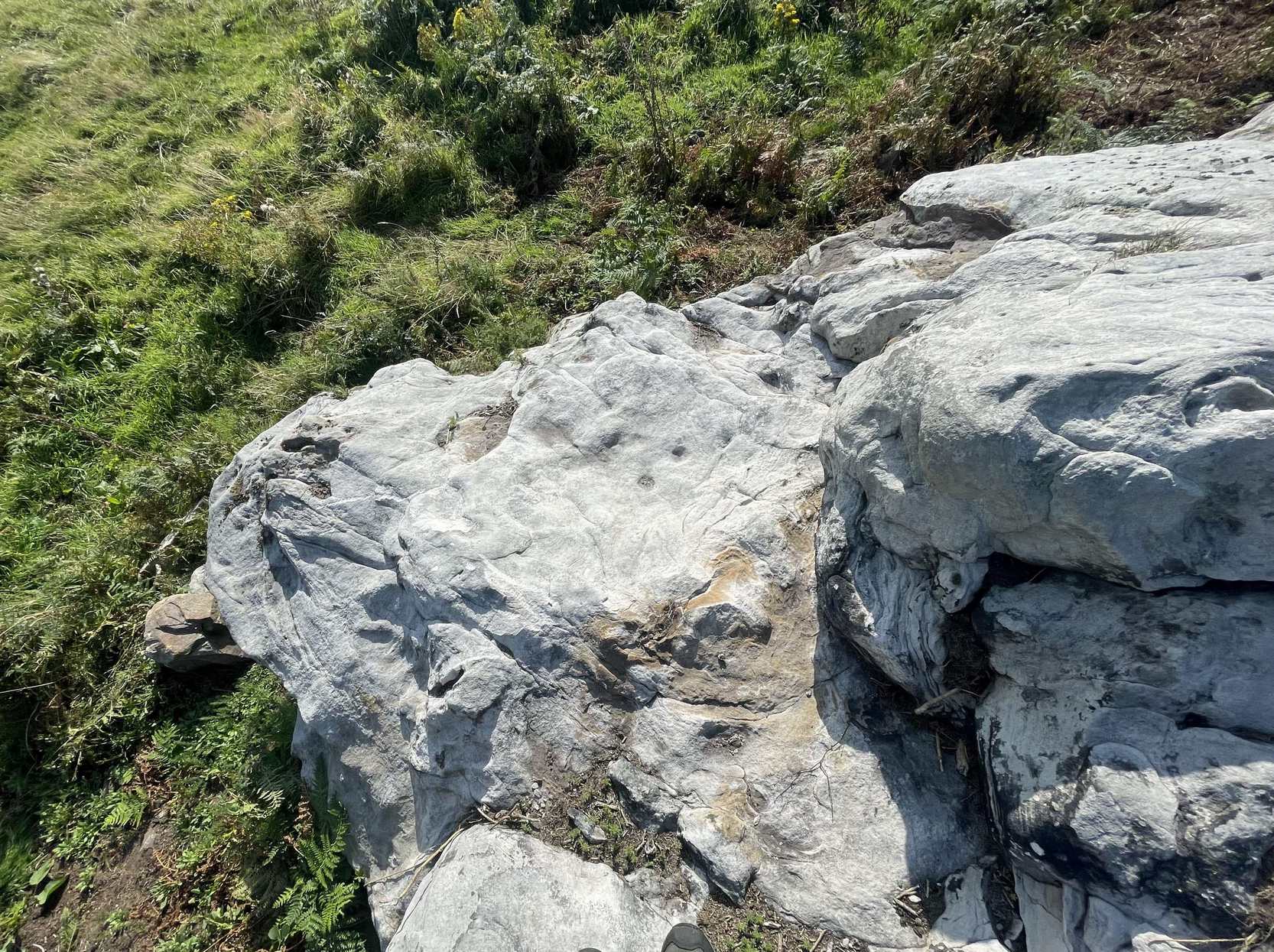
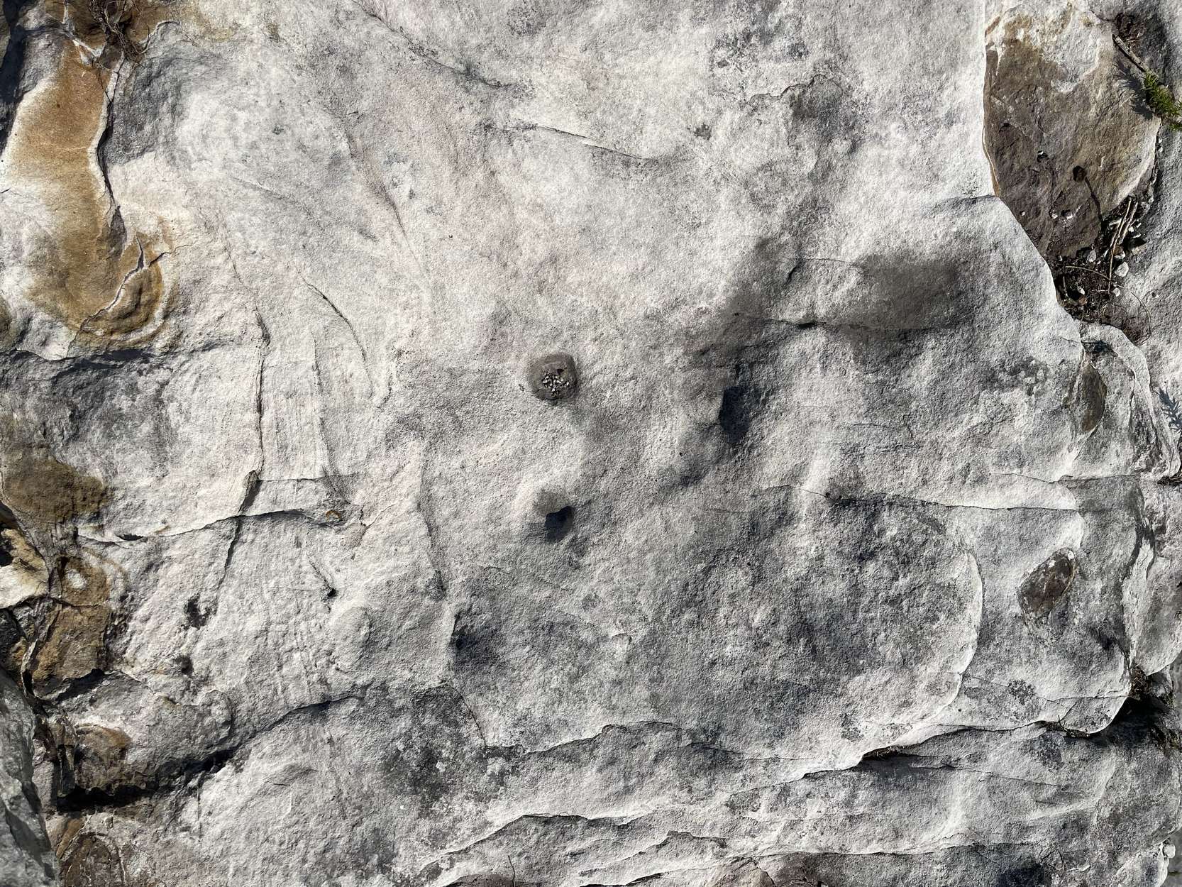
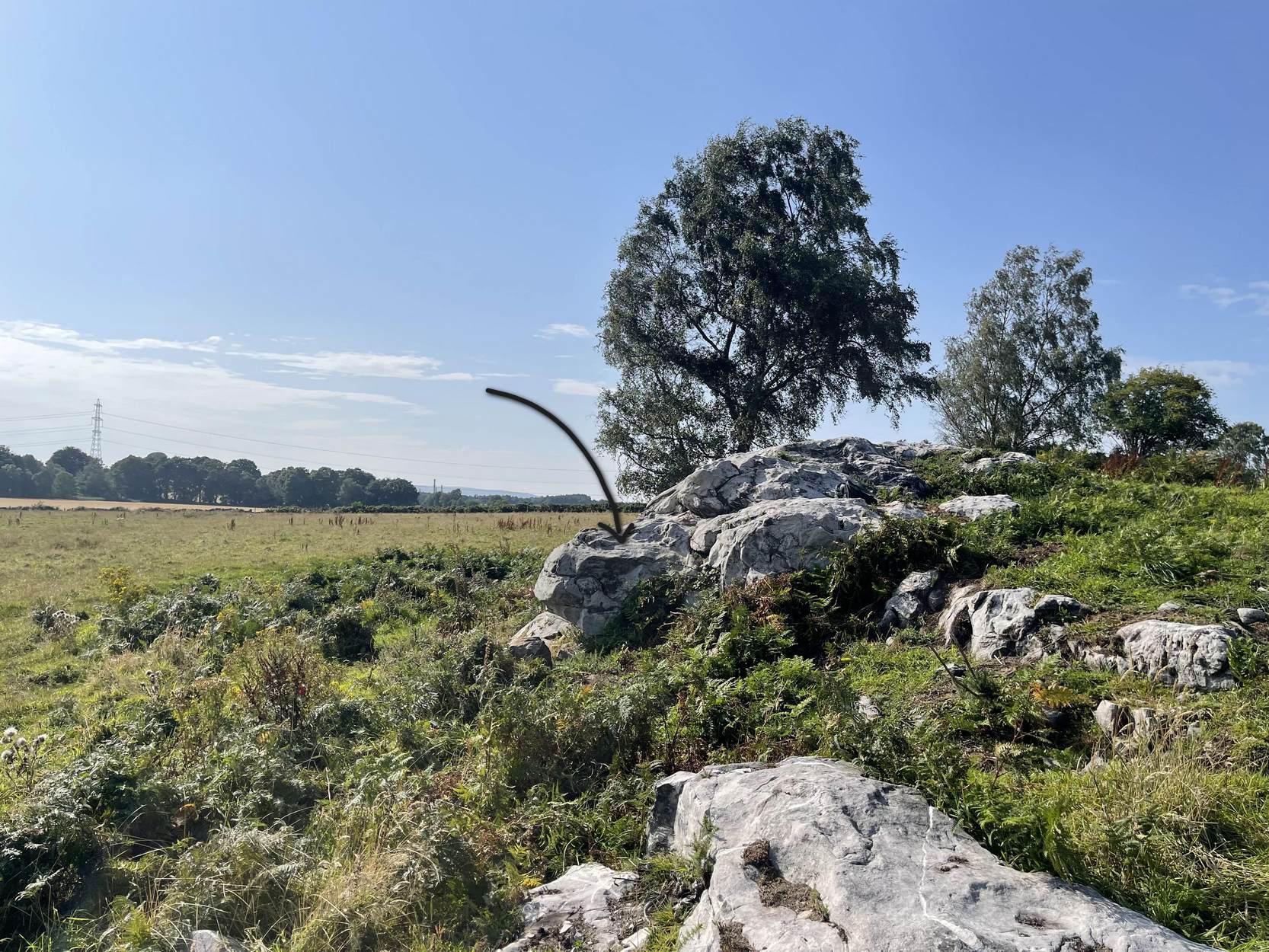
Follow the directions as if you’re visiting the impressive multi-ringed design of the Castleton (10) carving. Once there, walk south-east along the geological ridge for 45 yards where the small cliff drops down to the field. Just where this drop occurs, on a lower horizontal level of the rock face (only a small section) you’ll notice two distinct “cups”. You can’t really miss it!
Archaeology & History
This very basic cup-marked stone was, until recently, covered in dense gorse, making access to the site almost impossible. But following a fire that happened here not too long ago, the smoldering remains needed to be cleared and, once the job was done, we were able to see the two distinct ‘cups’ that were first described in Maarten van Hoek’s (1996) survey. But the cups that he described are, most likely, little more than Nature’s handiwork. I’m somewhat skeptical of them as being the real deal. In the same survey, he added another site, which are just natural bowls in the rock just over 100 yards southwest of here as being cup-marks — which they’re not!
References:
van Hoek, M.A.M.,”Prehistoric Rock Art around Castleton Farm, Airth,” in Forth Naturalist & Historian, volume 19, 1996.