Cup-and-Ring Stone (removed): OS Grid Reference – NO 378 308
Archaeology & History
Cup & ring stone of Balgay Hill
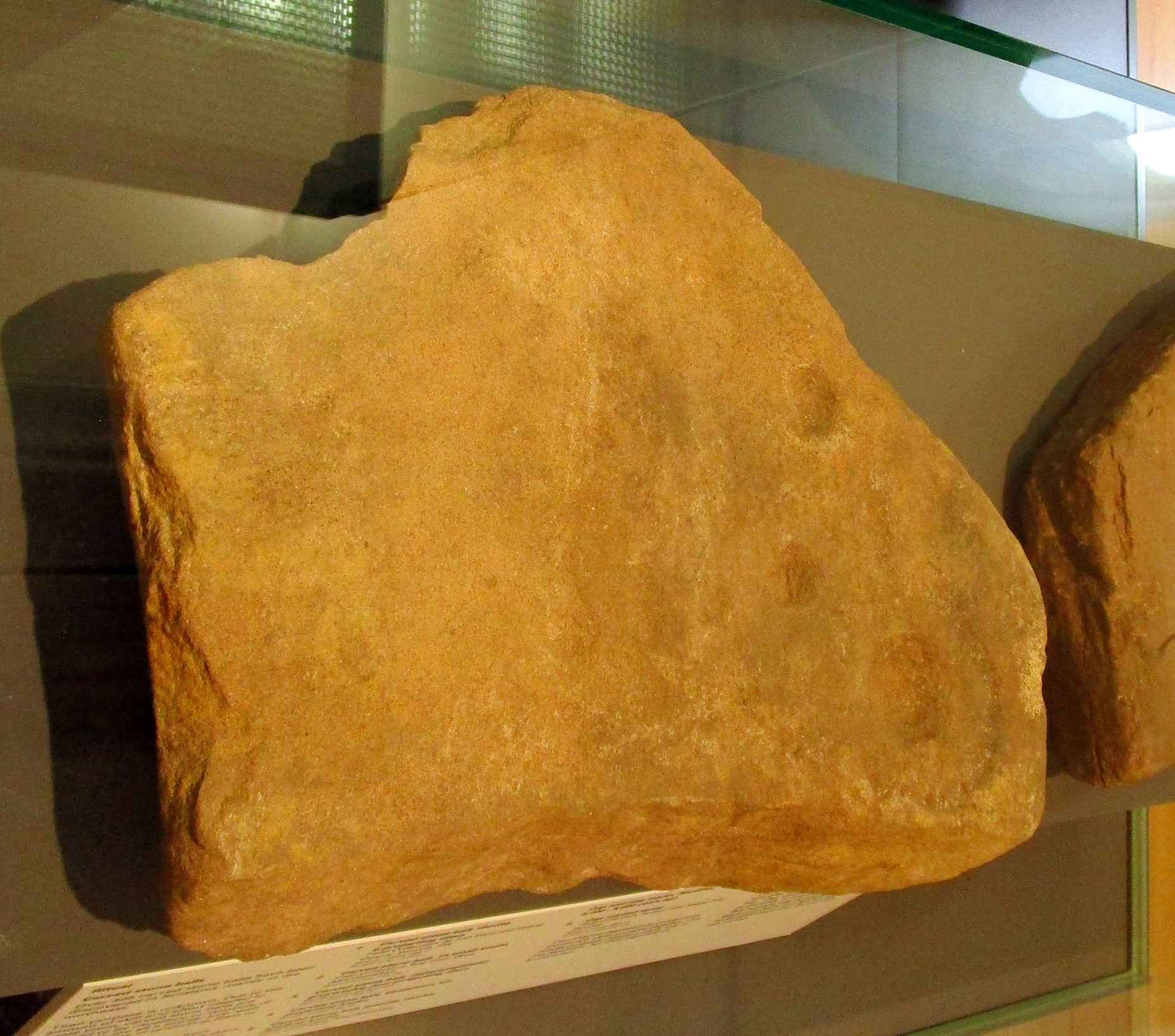
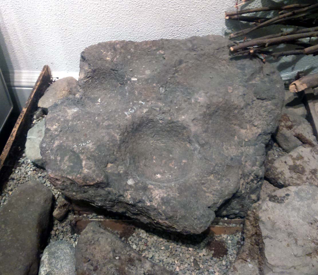
This little-known cup-and ring stone was found at ground level sometime around 2003, near the top of Balgay Hill. A small portable stone that may have been broken from a larger slab, it has what seems to be two if not three cup-and-rings, accompanied by two or three single cup-marks. One of the rings seems to have a faint line coming out of it. Unfortunately none of this is clear in the photos I took (the one attached here is the best), as it lives under glass in Dundee Museum, so it was very difficult to get decent images. It is now housed in the McManus Museum in Dundee (a damn good place, with very helpful staff) and well worth checking out if you’re in the area.
Cup-Marked Stone (lost): OS Grid Reference – NO 074 458
Archaeology & History
In J. Romilly Allen’s (1882) lengthy essay on rock art in Scotland, he mentions a singular boulder that was “found by Dr Rattray” at Laighwood, near Butterstone—but, unlike him, he gave no further details regarding its appearance or exact whereabouts. It was included in the Royal Commission (1990) survey of the area, with no additional details. It remains lost. In the event that you manage to rediscover it, grab some good photos of it and stick ’em on our Facebook group. (the grid-reference to this site is an approximation)
Royal Commission on the Ancient & Historical Monuments of Scotland, North-East Perth: An Archaeological Landscape, HMSO: Edinburgh 1990.
Acknowledgements:Huge thanks for use of the Ordnance Survey map in this site profile, reproduced with the kind permission of the National Library of Scotland.
Cup-Marked Stone (lost): OS Grid Reference – NO 0617 2328
Archaeology & History
Site shown on 1933 map
First highlighted on the 1933 OS-map of the area, it was located alongside the old fence-line hereby, but no subsequent description of the carving has been made since then. A small boulder and a number of other stones can be found along the line of fencing, but none seem to be possessed of petroglyphs and apart from it being shown on the old maps, I can find no reference or description of it. It may have been destroyed. Some researchers have wondered if the carving was mistakenly marked at this spot by surveyors who confused it with another one more than 500 yards to the southeast (and described by Fred Coles in 1903), but this would seem an unlikely error to have been made. Whilst this was described as a simple “cup-marked stone”, its neighbour at West Lamberkine (2) was a distinct and more complex cup-and-ring design.
References:
Coles, Fred, “Notices of …(4) of Some Hitherto Undescribed Cup-and-ring-marked Stones…” in Proceedings Society Antiquaries Scotland, volume 37, 1903.
Acknowledgements:Many thanks for use of the Ordnance Survey map in this site profile, reproduced with the kind permission of the National Library of Scotland.
Legendary Rock (destroyed): OS Grid Reference – HP 5223 0467
Archaeology & History
Whilst classifying this as a “legendary” rock, it was as much a functional stone that played an integral part of local village life in the 19th century and, most probably, way before that. This large stone possessed a large cavity in the shape of a giant human footprint, measuring 12 inch by 4 inch. It could be seen “above the Deeks of Bracon, North Yell, up Hena”, but when first described in 1865, it was said to be “no longer in existence.” Despite this, when an Ordnance Survey dood came looking for it in 1969, he reported it as “still in existence” and known of by local people. Is there anyone in the far far north who can tell us?
Folklore
The impression of the large footprint was natural, but the use to which local people made of it is valuable when we seek to understand pre-industrial customs. The Royal Commission (1946) lads echoed the folklore handed down by J.T. Irvine from 1865, telling that,
“Formerly the people used to wash in dew or rain-water that had gathered in the cavity and stand in it to get rid of warts. The tradition was that a giant had planted one foot here and the other on a stone on the Westing of Unst.”
Healing stones with such properties can be found everywhere on Earth.
References:
Royal Commission Ancient & Historical Monuments, Scotland, Inventory of the Ancient Monuments of Orkney and Shetland – volume 3, HMSO: Edinburgh 1946.
Legendary Rock (destroyed): OS Grid Reference – NJ 89397 49502
Also Known as:
Crawey Stone
Crawford Putting Stone
Crawstane
Devils Putting Stone
Archaeology & History
Stone shown on 1874 map
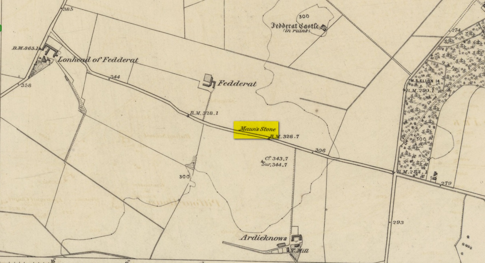
A site whose main claim to fame is its legendary nature. Seemingly buried or destroyed around the end of the 19th century, there have been suspicions that the stone might have had cup-marks on it (see Folklore below), but we’re not sure. Modern lore tells that when roadworks were done here in the 1950, a large stone was uncovered. A local man who was passing by told that he’d seen the Crawey Stone in his youth and that the stone they’d uncovered was one and the same.
Folklore
The story that used to be told amongst local people was thankfully preserved in an article by the pseudonymous “Mormond” (1889) in Scottish Notes & Queries. He told that:
“In the parish of New Deer, and in a field near the Old Castle of Fedderat, there is a large boulder of ten or twelve tons known as the Crawey Stone. I am unable to say if it still occupies its old site, or if it has been broken up for building purposes. The legend connected with this stone used to be well known in the parish, and a version of it appeared in The Aberdeen Magazine some 70 or 80 years ago. This version is substantially the same as the legend known in the district, and relates how a Crawford, the lord of the castle and lands, one day “as he looked o’er his castle wa’ ” — a phrase which often occurs in old ballads — observed a crunkled carl (old woman or witch, PB) inspecting the stone and afterwards successfully lifting up one end clear of the ground. Not to be conquered by such a shabby looking stranger, the laird, who was famed for his athletic powers, went out and challenged the carl; but on attempting to lift the boulder, burst a blood vessel; and the carl, who stood by watching him, suddenly disappeared in a flash of fire taking the remains of the laird along with her. The tradition is that the laird was not mourned for in the district, and the moral drawn was “He couldna hae expected ony ither en’.” When passing the boulder going to school, the legend was often referred to, and some indentations on it pointed out as the marks of the ill man’s fingers made at the time the superhuman feat was accomplished.”
These finger marks have been taken as possible cup-markings. They might have been, but we simply don’t know; they may just have been curious natural markings that gave rise to this animistic creation myth. Another tale told that the markings were due to an old giant in the neighbourhood who used the rock as a putting stone and rolled it to the spot where it used to stand. Giants are always attached to indigenous creation myths, some of which go back thousands of years.
“a large Stone of a roundish shape, built on an old fence, forming a side of the Public road leading from New Deer to Brocklay. Tradition asserts that it has been the putting Stone of a Giant in ancient times. There are Several holes in the Stone said to be the finger marks of the Giant.”
Cup-Marked Stone (lost): OS Grid Reference – NO 186 480
Archaeology & History
When J. Romilly Allen (1881) wrote about the megaliths and petroglyphs of Glenballoch, the owner of the property—a Mr George Harris—informed him of other archaeological finds in the locale: one of which was a cup-marked stone with distinct linear elements, whose description reminded me, slightly, of Ilkley’s Idol Stone. It was found a short distance east of the Glenballoch (or Craighall Mill) stone circle. Allen told how,
“Mr Harris…informed me that about twenty years ago he had dug up a stone with cup-markings upon it, on the opposite side of the valley to the south-east of the Glenballoch stone. The stone lay horizontally with the cups uppermost. It was split up and is now built into the out buildings of Glenballoch Farm. The two largest fragments form the cover and sill of the hole through which the shaft of the threshing machine passes through the wall of the horse-mill, into the house. A third fragment is built in above the window at the opposite side of the house, and is of greenish hue. Mr Harris expressed his great regret at not having known the value of this stone when he broke it up, and he is evidently proud of the stone which remains, and is determined that no ill shall befall it as long as he remains its guardian. The cup marks on the stone which was broken appear to have been arranged symmetrically in two rows, and Mr Harris affirms distinctly that they were alternately circular and rectangular.”
These three stone fragments have not been seen since. They may still be covered over in the spot Mr Harris described, but no one seems to have found them. In the event that someone manages to find them, see if you can get a few good photos and stick ’em on our Facebook group.
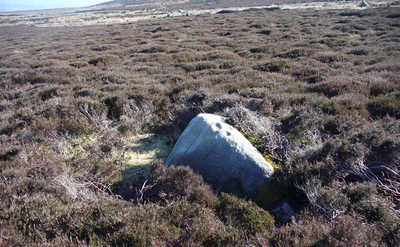
The easiest way to find this is to take the same directions to reach the Woofa Bank settlement. Get your compass out and make sure that you’re at the northern edge of the settlement walling. From here, walk about 60 yards northwest and keep your eyes peeled for a rock about 2 feet high, curved and elongated with its top surface above the heather. You’ll find it.
Archaeology & History
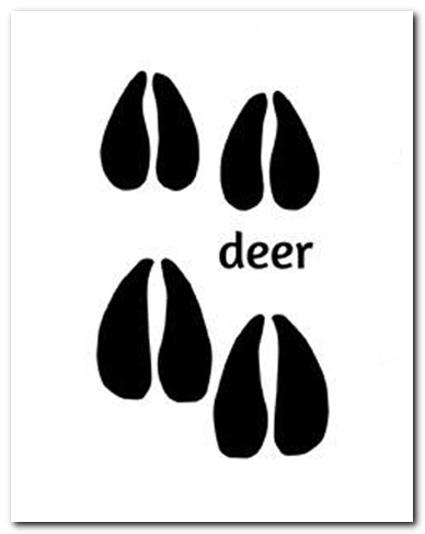
The name I’ve given to this stone is a conjectural one based entirely on comparative petroglyph designs elsewhere in the world. Or to put it more simply: elsewhere in the world we find examples of prehistoric rock art showing animal tracks and rituals relating to hunting animals, and in the design of this petroglyph on Ilkley Moor I wondered if we might be looking at something similar. Internationally respected anthropologists, archaeologists, geologists and rock art specialists such as Lawrence Loendorf (2008), Polly Schaafsma (1980), Dennis Slifer (1998) and many others show examples of animal tracks in the US and Mexico (examples exist throughout the world), and it’s not unlikely that some of the petroglyphs in the UK represent such things. But, like I say, this particular carving may have nowt to do with such a thing and the idea is entirely conjectural on my part and is probably way off the mark.
Deer-print motif & cup
Located less than 60 yards (54m) northwest of the impressive Woof Bank enclosure, it’s possible that the first literary note of this was by Stuart Feather (1968) when he made note of five cup-and-ring marked rocks (which) have been revealed by erosion in 1968,” telling us that some of the motifs on the rocks included cups with and without rings, channels and eye-shaped marks (occuli)— the latter of which may relate to this stone.
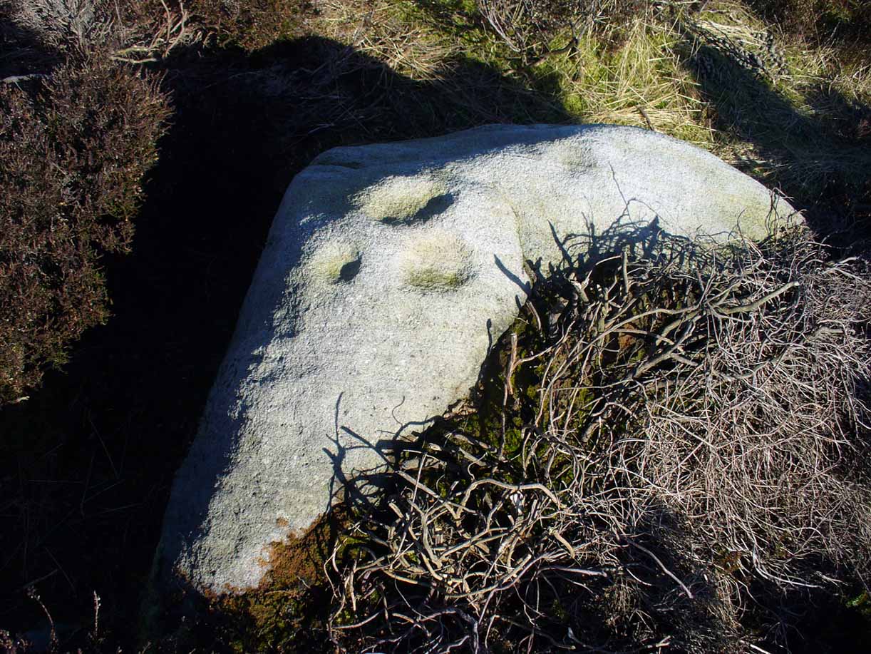
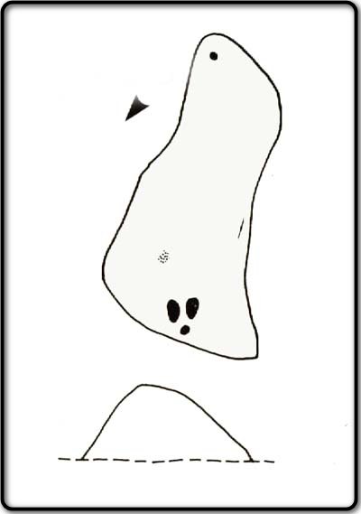
A more definite description of the stone was made in John Hedges (1986) survey where he described it in that usual simplistic form, telling us: “Long rock, its surface on two levels, sloping N to S in heather. Two large oval cups and one cup at N end. One clear cup at S end.”
Hedges’ 1986 sketch
It is these two elongated cups that have the distinct appearance of deer tracks. (another animal with a similar footprint is the goat) The cup-mark in front of them and the one at the back of the rock may be something relative to the animal. But more important than this is to recognise that, in lots of cultures, animal tracks are represented in some petroglyphs. That’s more important to think about when you look at British rock art, than the improbability of this design being such a thing…
References:
Boughey, Keith & Vickerman, E.A., Prehistoric Rock Art of the West Riding, WYAS: Wakefield 2003.
Feather, Stuart, “West Yorkshire Archaeological Register – Ilkley (WR) Green Crag Slack,” in Yorkshire Archaeology Journal, volume 42, 1968.
Hedges, John, The Carved Rocks on Rombalds Moor, WYMCC: Wakefield 1986.
Loendorf, Lawrence L., Thunder and Herds – Rock Art of the High Plains, Left Coast: Walnut Creek 2008.
Schaafsma, Polly, Indian Rock Art of the Southwest, University of New Mexico Press 1980.
Slifer, Dennis, Signs of Life – Rock Art of the Upper Rio Grande, Ancient City: New Mexico 1998.
This is a curious stone and may not be the type of ‘cup-marked’ rock we’re used to. Maybe… It is presently housed in Stirling’s Smith Art Gallery & Museum, where a small note tells that is was originally found “on the top of the Ochils, near Mount Alt Farm, Path of Condie in 1893.” The stone was found at the same time, and adjacent to, a prehistoric collared urn—which implies it had an association with a cairn or cist, or burial site of some sort (which isn’t uncommon). However, the exact location of its original whereabouts has been forgotten.
Broken off from a larger piece of stone, the remaining piece of rock has six cup-markings cut into it, between one and three inches across. The smallest cup is what we might call a ‘normal’ size, but the rest of them get increasingly large and may have been more functional than purely mythic in nature. In a small note attached to the stone in the Museum, they add the interesting note that,
“There are…indications that in some places they may be related to transhumance: the practice of moving sheep, cattle and goats to higher pastures in the summer, where they may have been used to mark routes or sources of water.”
They may indeed – amongst a variety of other things too. But the suggested relationship with cattle occurs in stones found near Haworth, West Yorkshire, where large man-affected carved ‘cups’ such as the ones here, were known to be filled with milk at specific times of Nature’s calendrical rhythms, for the spirits of the place to give good fortune to the farmer and local people. We know of one instance where this practice still occurs and goes back generations in the same family. Examples of this animistic practice have also been found in the Scottish Highlands.
Along the A810 Bearsden to Dunochter road, 100 yards past the Faifley roundabout, turn right up Cochno Road. Go up for literally 1 mile and hit the car-park. Go back onto the road and walk uphill. Barely 50 yards up, turn right and walk down the track. About 350 yards along its bendy route, some grasslands appear on your right and there, about 40 yards away, is the large Cochno-5 carving.
Archaeology & History
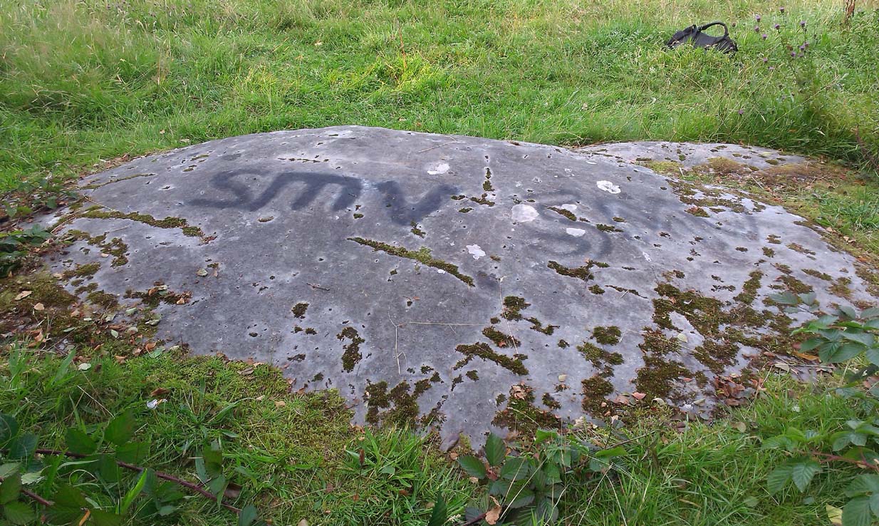
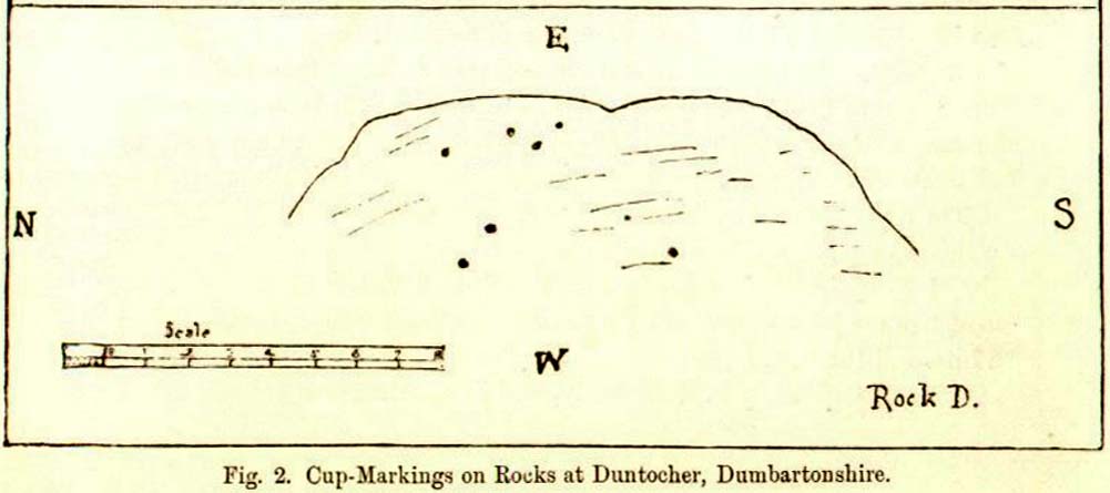
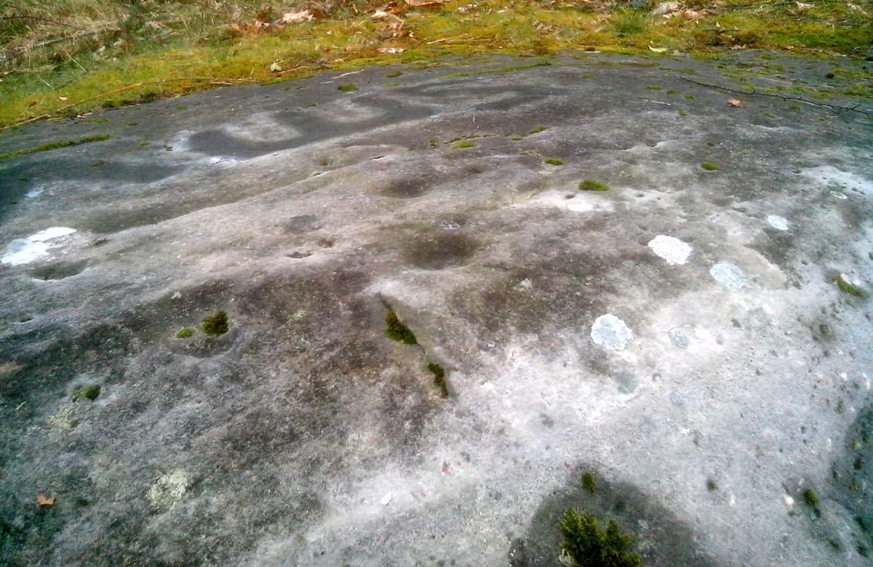
First described by James Harvey (1889) in association with adjacent carvings, he told that “there are eight isolated cups, two of which have a diameter of 2½ inches” on this stone. Harvey was one of those who loved the idea that our ancestors were etching cup-marks as receptacles for collecting blood and similar christian fantasies. It was a bittova fad at the time.
J. Harvey’s 1889 sketchClose-up of topmost cups
As we can see, the kids have sprayed their own ID onto the stone. It’s highly unlikely that they were even aware of this being a prehistoric site as there’s nothing to indicate it as such, and I know of archaeologists who wouldn’t have even seen the cup-marks on the stone, so we can’t really apportion blame. (We must recall that businessman Tom Lonsdale and Ilkley Council branded such things as “twenty-first century informal unauthorised carvings” when they sought and succeeded to get large amounts of cash to justify their own ‘brand’ of vandalism and called it ‘art’. Very common amongst those social types.)
References:
Harvey, James, “Notes on Some Undescribed Cup-Marked Rocks at Duntocher, Dumbartonshire”, in Proceedings Society Antiquaries, Scotland, volume 23, 1889.
Acknowledgements: Huge thanks to the awesome Aisha Domleo and her little dynamic duo for helping us get to this site.
Going out of Killin towards Kenmore on the A827 road, immediately past the Bridge of Lochay Hotel, turn left. Go down here for just over 2 miles and park-up where a small track turns up to the right, close to the riverside and opposite a flat green piece of land—right by The Green cup-marked rock-face. Walk up the small bendy track for about ⅔-mile (1km) and eventually, high above the tree-line, the road splits. Right here, go through the gate and walk downhill, over the boggy land, cross the burn, then the overgrown wall, and a second overgrown wall. Very close hereby is a small rise in the land amidst the mass of bracken, upon which is the stone in question!
Archaeology & History
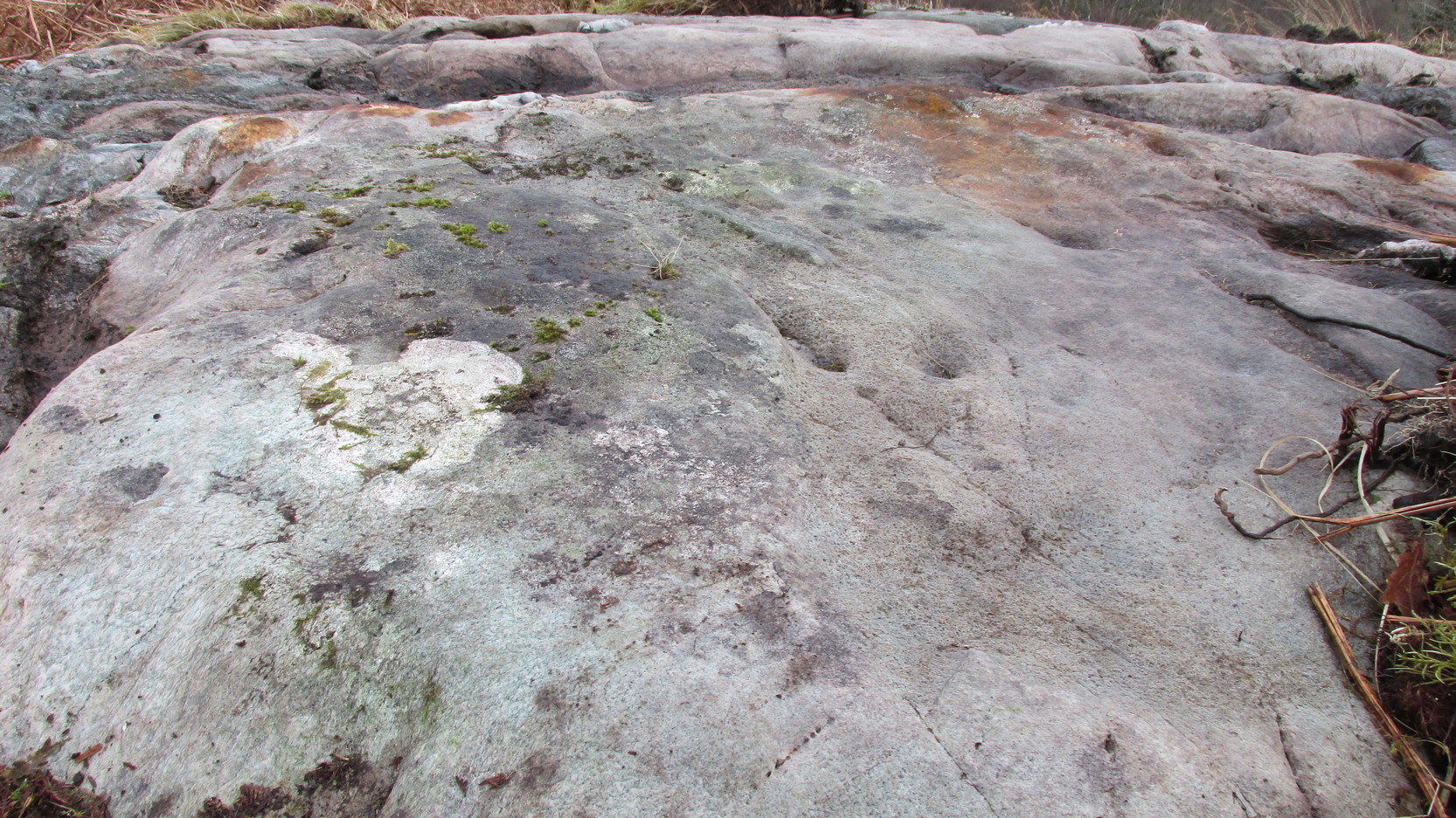
Close-up of some cups
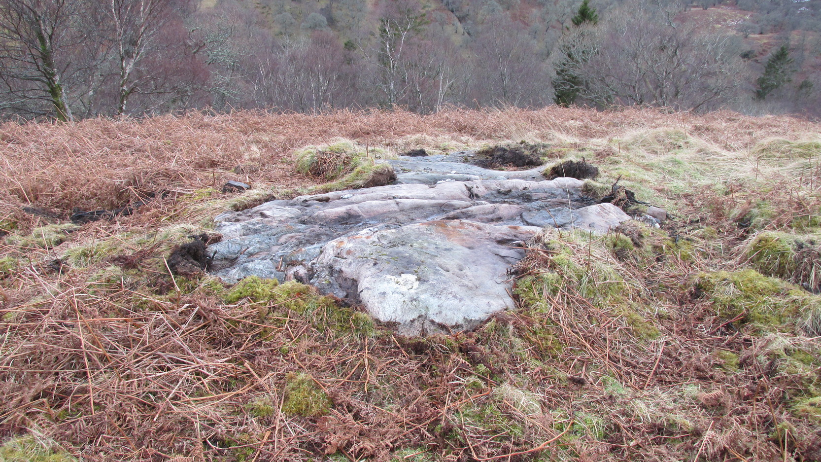
This large long, undulating, quartz-rich stretch of rock has two main petroglyphic sections to it, with curious visual sections of natural geological forms accompanying the cup-markings, found either side of the stone on its north and south sides. Its northern face has at least 20 cup-marks, of differing sizes, measuring between one and two inches across and up to half-an-inch deep. Their visual nature is markedly different to those on the more southern side of the stone, where they are generally smaller and much more shallow, perhaps meaning they were carved much earlier than their northern counterparts. One of the cups on this section has a very faint incomplete ring around it.
Running near the middle of the rock is a large long line of quartz and a deep cleft in which I found a curious worked piece of quartz shaped like a large spear-head, and another that looks like it’s been deliberately smoothed all round the edges. Both these pieces fit nicely in my hand. All around the edges of the stone, many tiny pieces of quartz were scattered, as if they had been struck onto the stone—either to try carving the cups (damn problematic!), or for some visual/magickal reason.