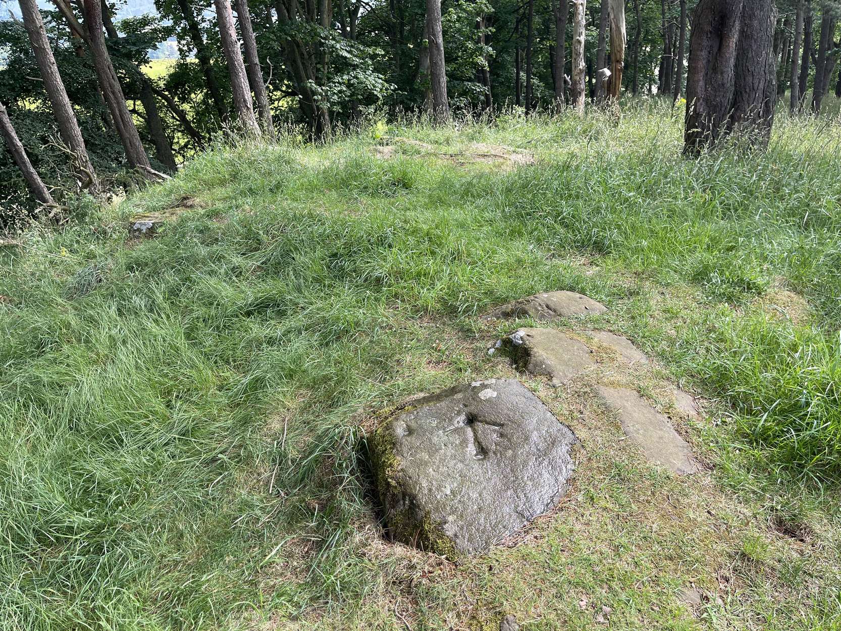
Cup-and-Ring Stone: OS Grid Reference – SE 03420 43572
Getting Here
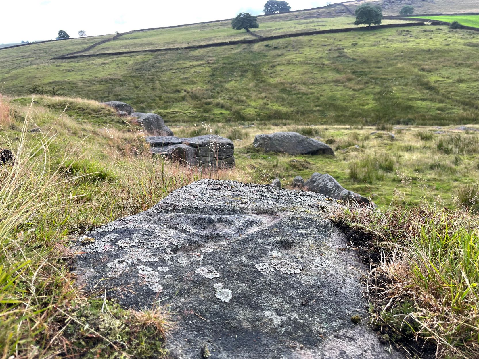
In Steeton, walk up the High Street and after a hundred yards or so, turn right to go up to Quarry House (opposite Falcon Cliffe), up past Quarry Cottages to the end where it turns into a track. Follow the track for 200 yards, where it bends left, then immediately right go into the field, following the wall along for 450 yards where you’ll go through a gate to another rocky steep hill-slope. Walk up by the side of the walling here, at the edge of the trees and, once at the top, bear right and a few yards along keep your eyes peeled. You’re virtually on top of it!
Archaeology & History
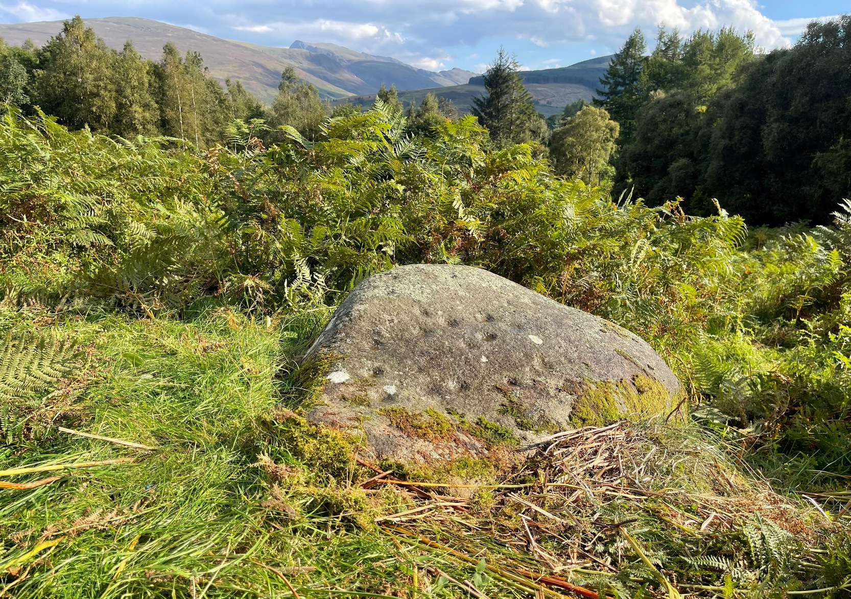
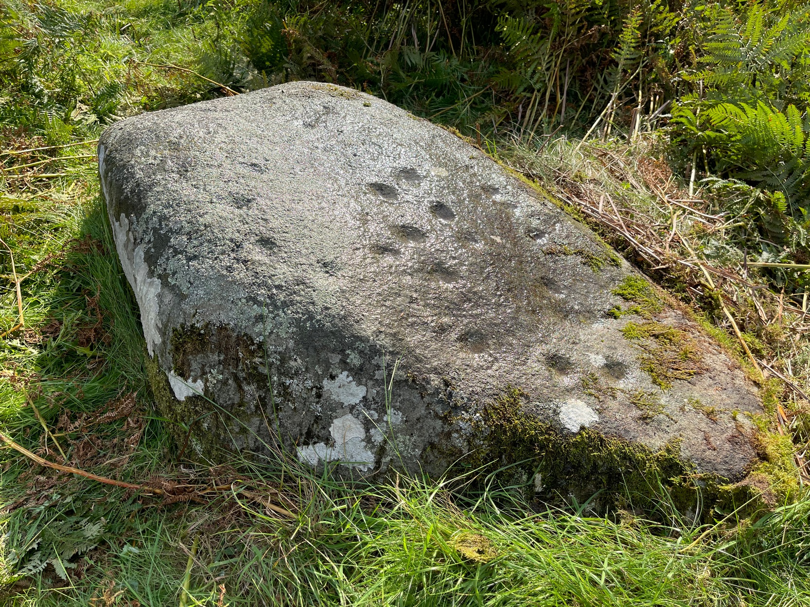
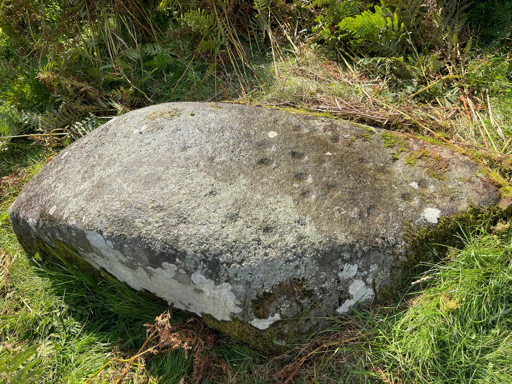
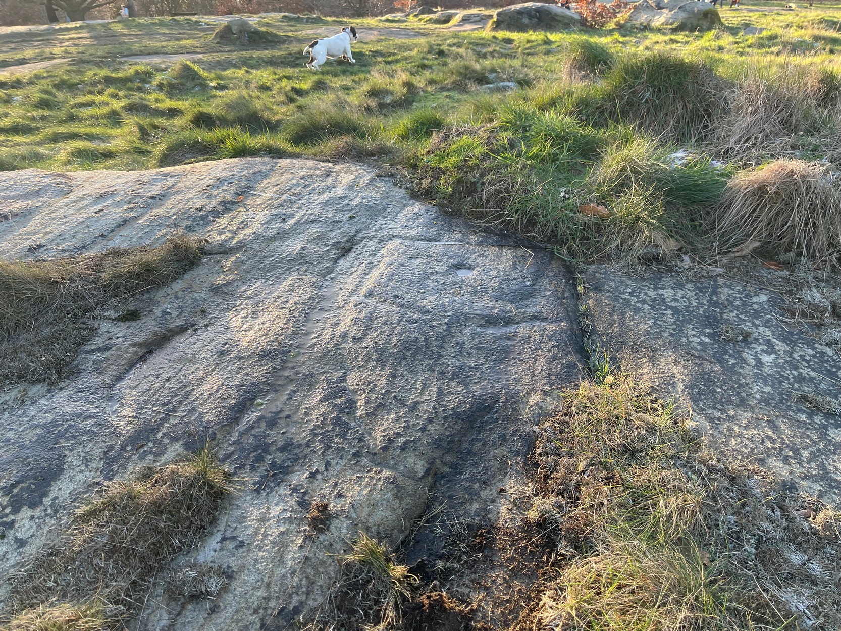
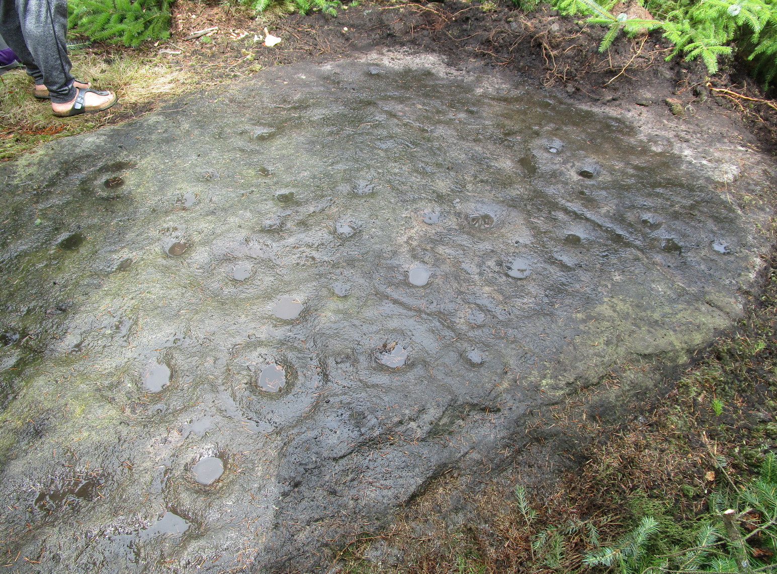
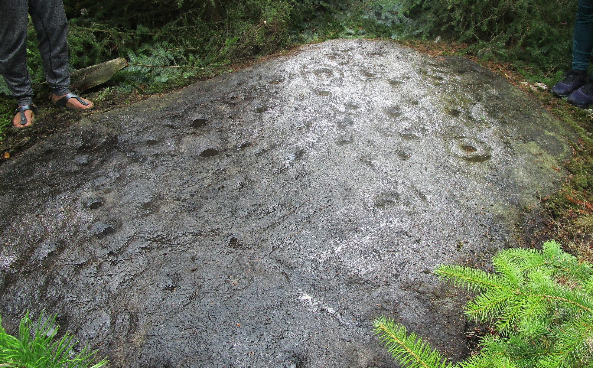
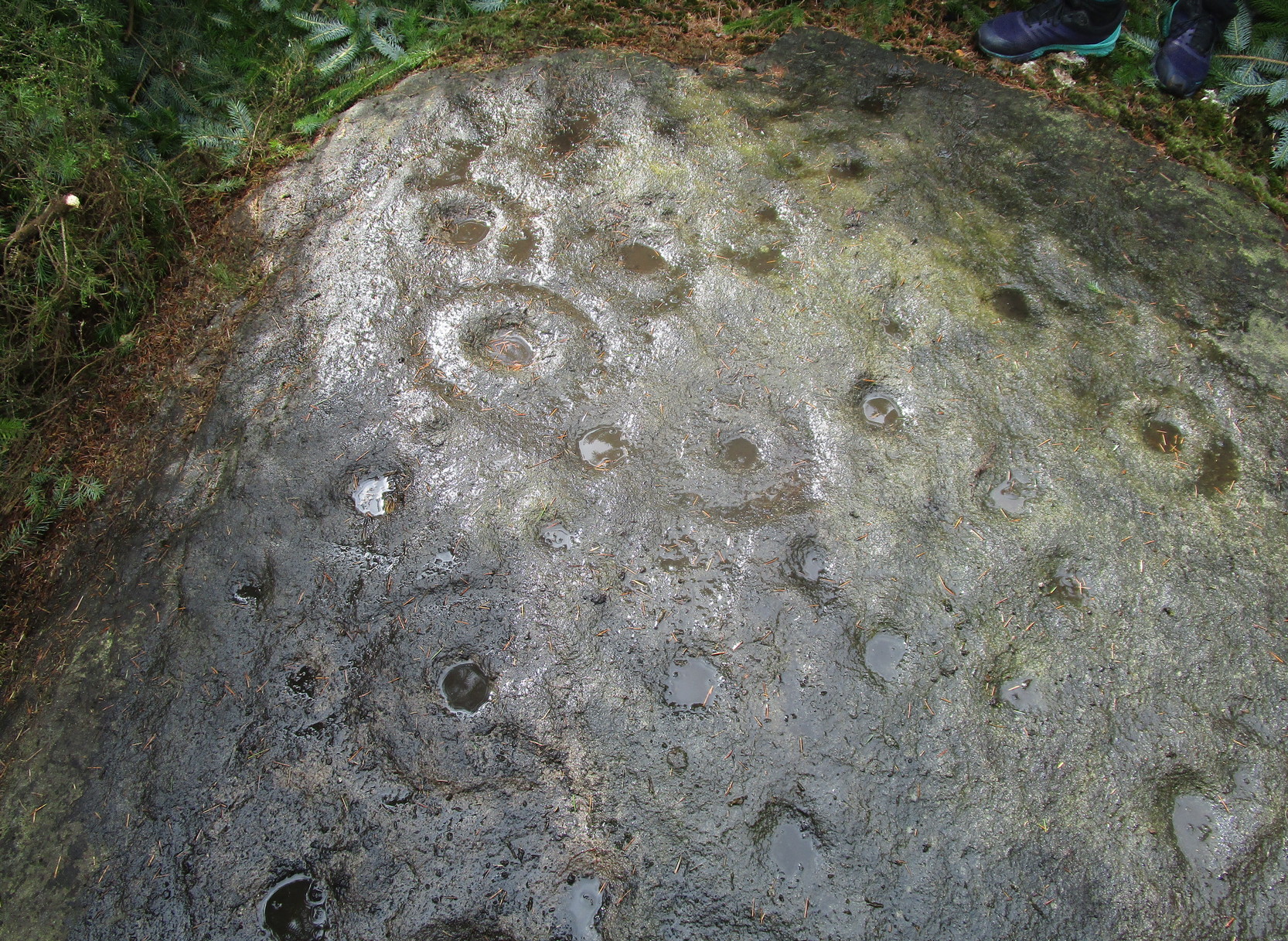
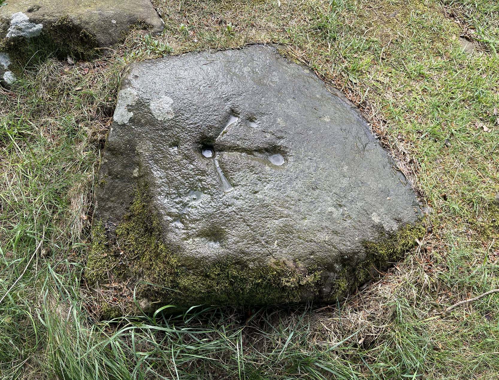
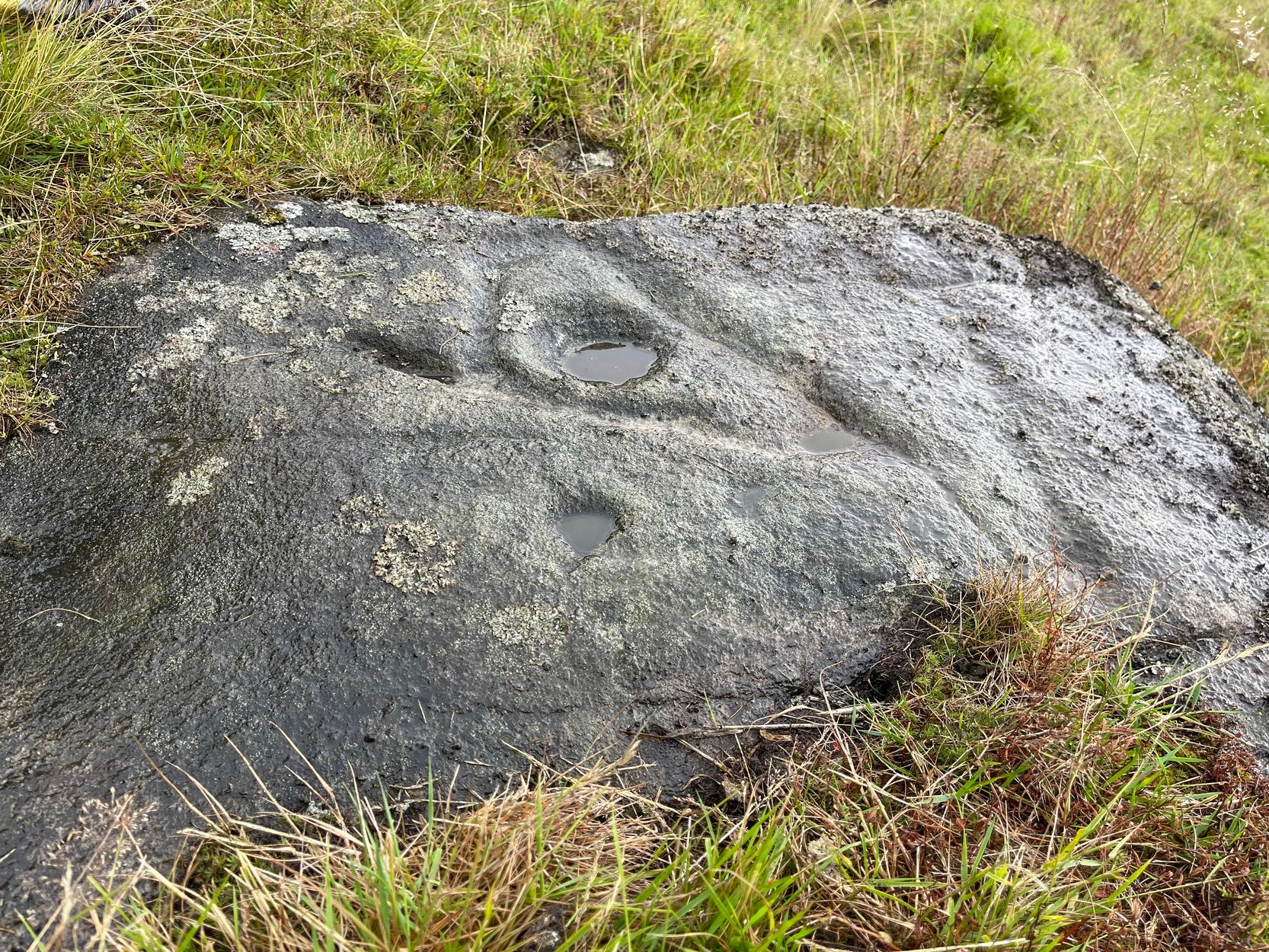
Not previously recorded, this is an unusual design: unusual in more ways than one. Firstly, it’s not entirely ‘ancient’; and secondly, the linearity in some of the carved lines around the cup-marks is unusual. It reminded me a little of the Hanging Stones above Ilkley, with its deeply cut lines, swerving around cup-marks, whose lack of ‘ancient’ guise is somewhat betrayed by the fact that Victorian quarry operations uncovered them—much like happened here…
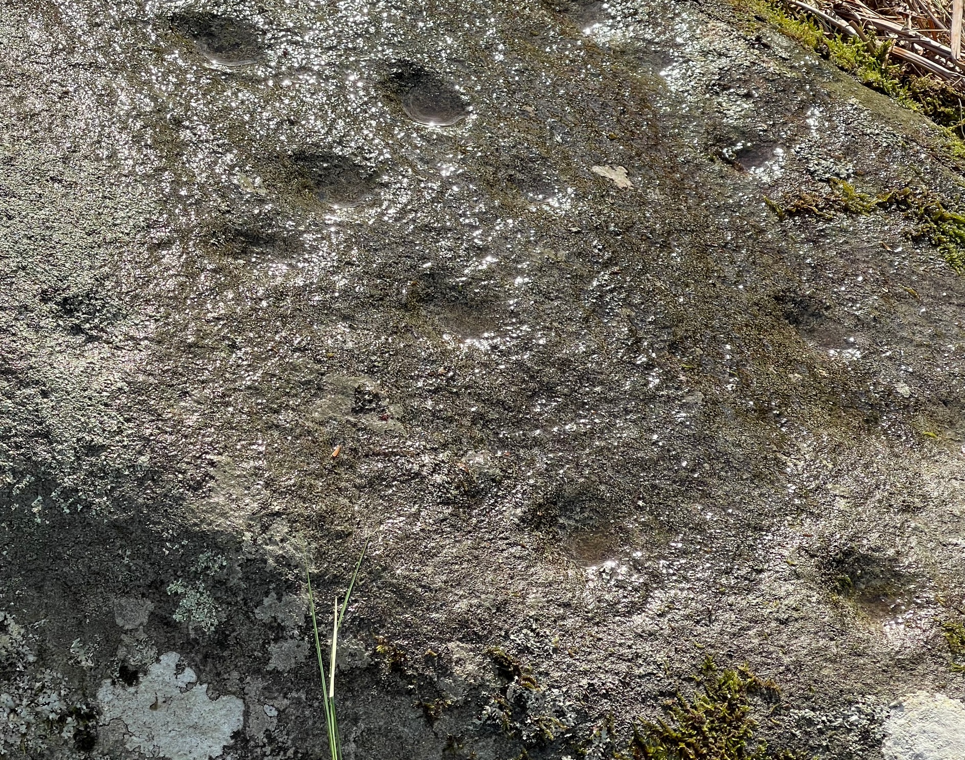
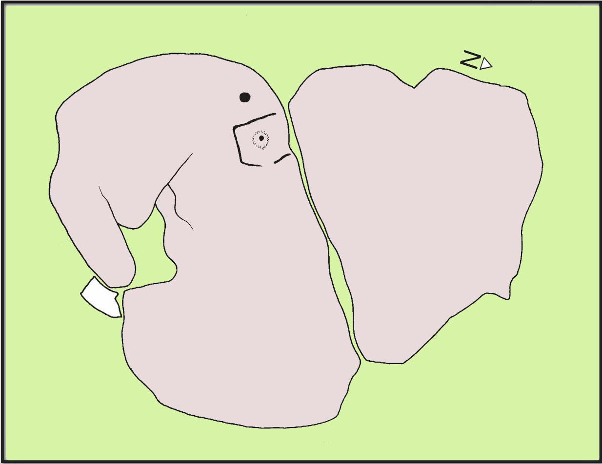
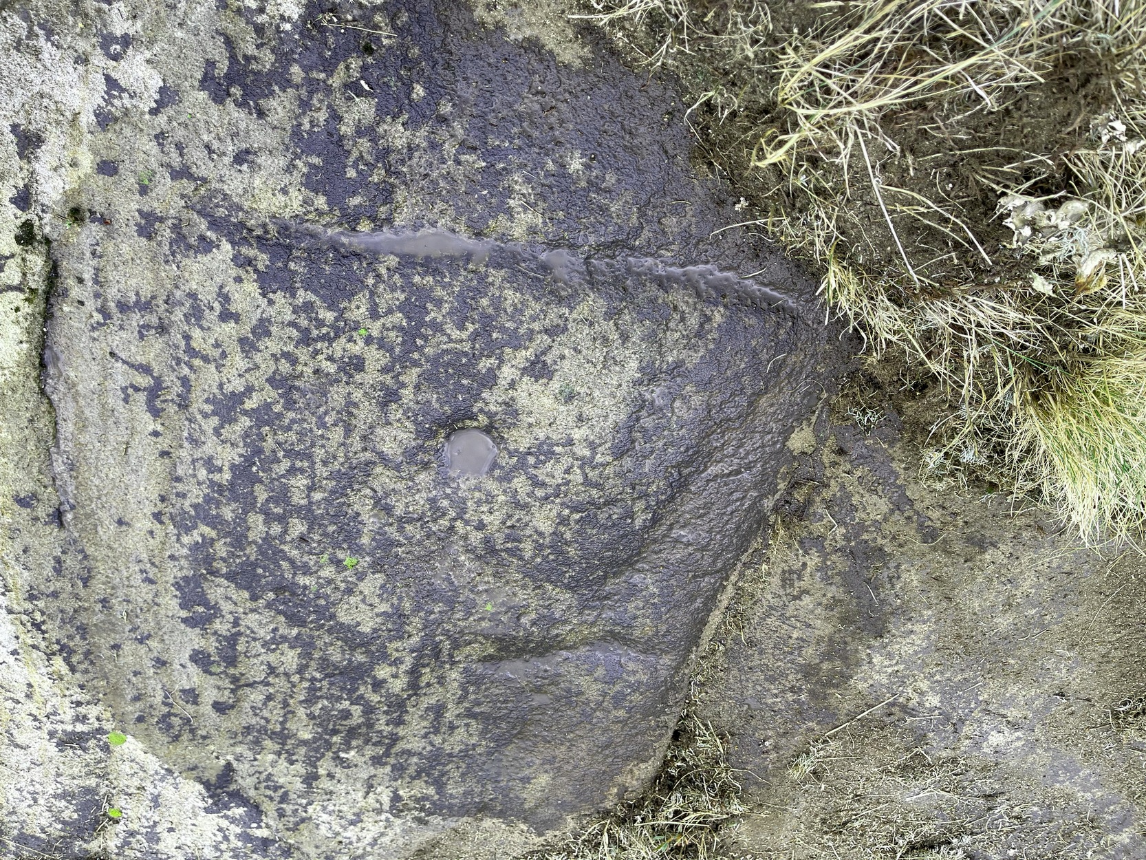
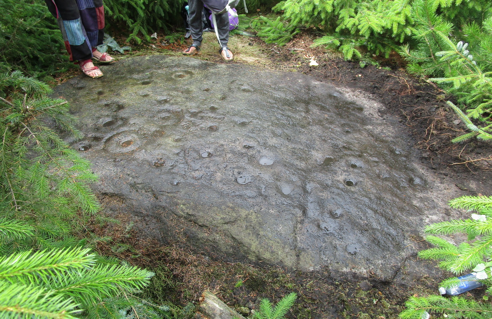
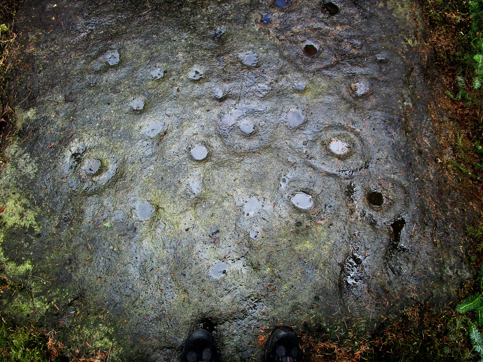
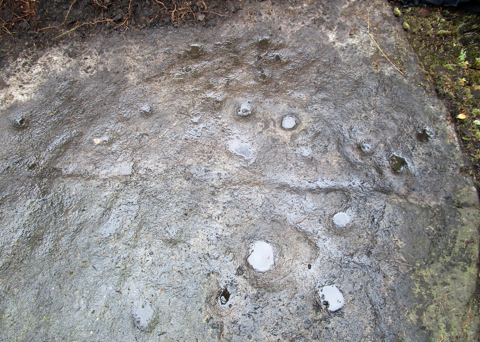
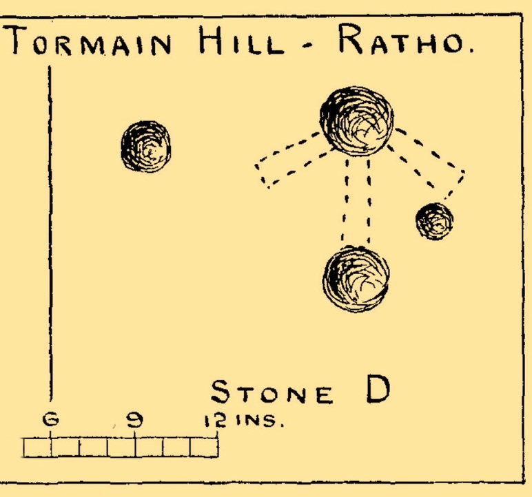
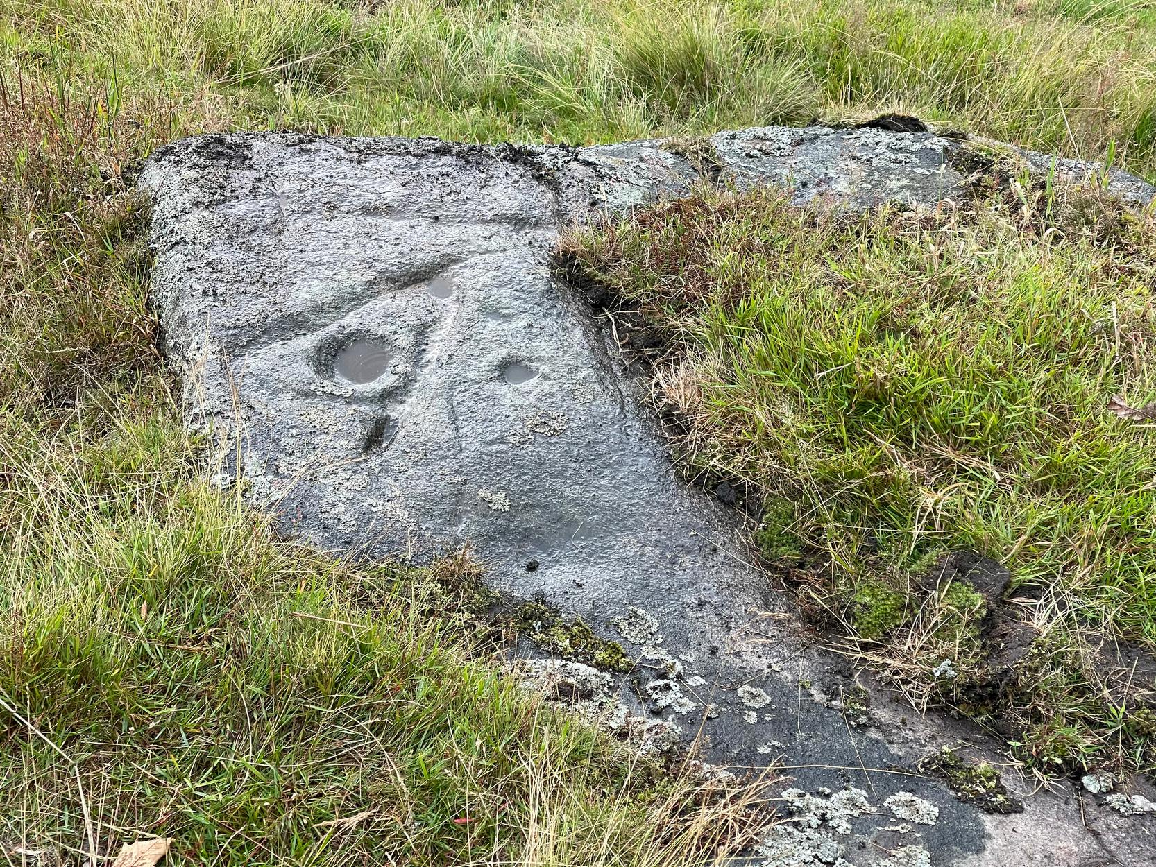 It was first noticed in 2024 by Collette Walsh during a petroglyphic foray in the area. She noticed the distinct cup-marks on the rock surface, but then when she noticed a distinct quarrying mark, she dropped the idea that it was prehistoric. But this distinct quarry or stone-mason mark—executed sometime in the 19th century when the Industrialists were working here—shouldn’t take our attention away from the cup-marks; nor indeed all aspects of the other carved lines that swing round the edges of the deepest of the three cups, which is surrounded by a long curved triangle, some of which was carved into a natural crack, highlighting it more. The single outlying cup looked, from some angles when wet, that it may have had a partial ring around it—but we were unsure and it may have just been a trick of the light, along with our desire to see more than there actually is. Anyhow, it’s worth seeing. But we could do with a stonemason to check it out, enabling us a better assessment of which bits of this design are old and which are not-so-old.

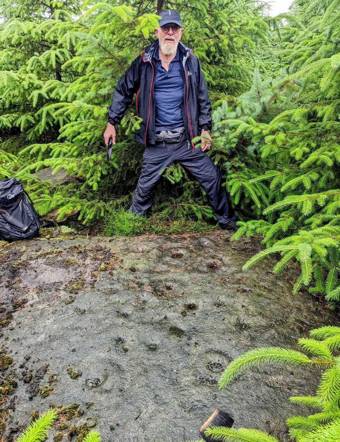
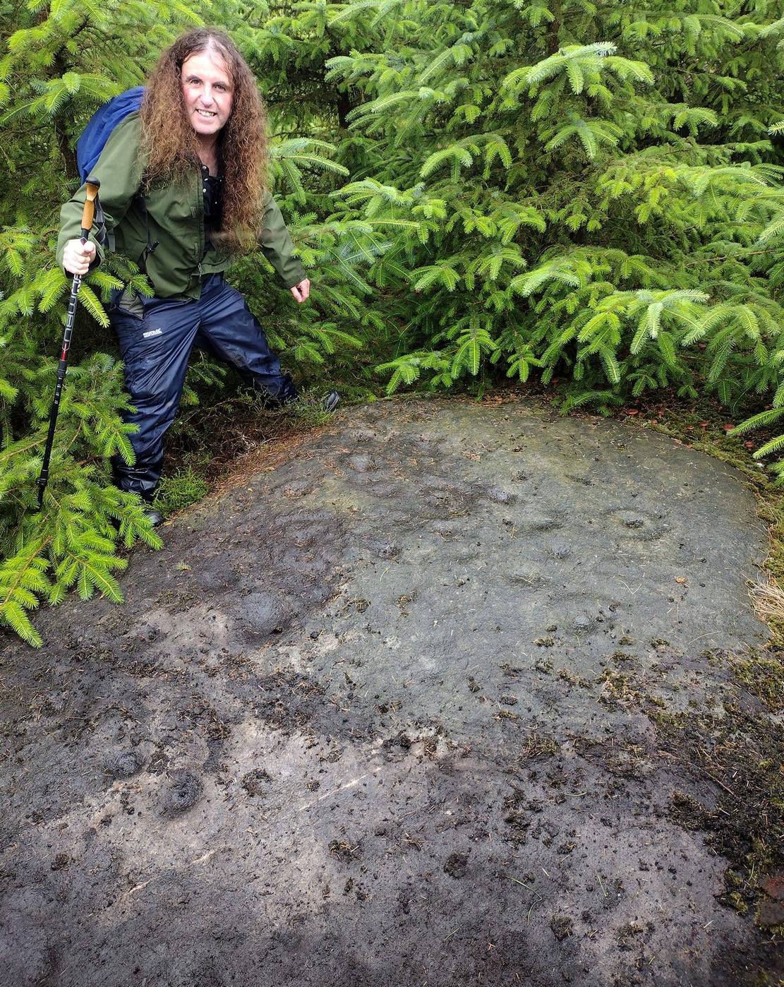
Acknowledgements: To Collette Walsh for uncovering this design; and to Tom Cleland for showing me where it lives!
© Paul Bennett, The Northern Antiquarian