This is a helluva long way to walk to find such a small site, but the landscape makes it all the worthwhile. So… From Callander, head up the Bracklinn Falls road, going past the car-park there and on for 1½ miles, watching for the track on your left where you park-up. Walk down the track, over the river, then uphill until another track veers to your left. Follow this for nearly a mile until meeting another track that veers right. 4-500 yards along, on the same side as the burn on your left, the hill slopes up where a small grassy mound sits on its ridge. That’s it.
Archaeology & History
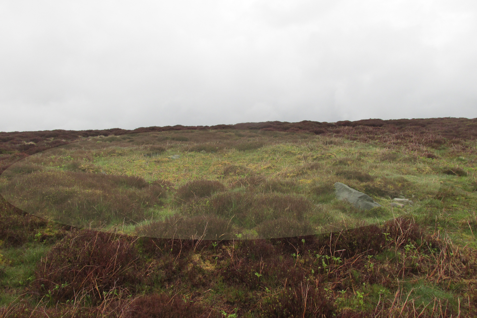
From the cairn to the SE
This site is likely to be of interest only to the hardcore antiquarians amongst you. It’s a small singular cairn sitting on a small hillock of once woodland-clad grasslands, a few hundred yards east of the much-ruined chambered cairn of West Bracklinn. Much of it is covered in vegetation, but sections of its stone structure are visible mainly on its south sides. Measuring 6 yards across and less than a yard high, it has been classed by Historic Scotland as Bronze Age in nature, although no excavation has been done here.
Reference:
Royal Commission Ancient & Historical Monuments of Scotland, Braes of Doune: An Archaeological Survey, RCAHMS: Edinburgh 1994.
A small and seemingly prehistoric grave, or cist, destroyed sometime around 1840, once existed on the top of a large hillock close to the River Carron where the bridge leads from Dunipace to Denny. Thankfully, memory of its existence was preserved by Robert Watson (1845) in his short description of Dunipace parish. He first began by talking of some large natural mounds on the eastern side of the township which, folklore told, gave rise to the place-name Dunipace; but from those mounds,
“About two miles to the westward of these hills, there was a very beautiful one about forty feet in height, and covering nearly three roods of ground, said also to be artificial. This hill was mutilated, from time to time, for the purpose of repairing roads and other purposes. It was entirely removed about six years ago, to form an embankment on the turnpike road near Denny bridge. The strata of which this hill was composed, were carefully observed during its removal. These were so regular, and as if rising out of, and gradually returning again to similar strata in the circumjacent level ground, as to afford conclusive evidence that the hill was not the work of man. On the top of this hill, and about three feet below the surface, was found a coffin or tomb, composed of five large un wrought stones, in which were the bones of a human body, scull and teeth not much decayed. Along with these, was a vase of coarse unglazed earthenware, containing a small quantity of material resembling the lining of a wasp’s nest, probably decayed paper or parchment, which in the lapse of ages had assumed that appearance. No conjecture could be formed about the individual here interred, tradition being entirely silent on the subject ; but this circumstance corroborates the opinion of some writers, that the hills of Dunipace might have been used as burying-places for ancient chiefs.”
The site was included in the Royal Commission’s (1963:1) Inventory, but they found no additional data about it.
References:
Royal Commission on the Ancient & Historical Monuments Scotland, Stirling – volume 1, HMSO: Edinburgh 1963.
Royal Commission on the Ancient & Historical Monuments of Scotland, Archaeological Sites and Monuments of Stirling District, Central Region, Society of Antiquaries of Scotland 1979.
Watson, Robert, “Parish of Dunipace,” in New Statistical Account of Scotland – volume 8, William Blackwood: Edinburgh 1845.
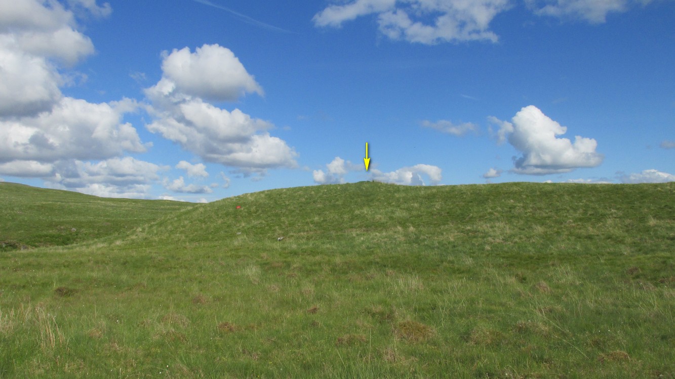
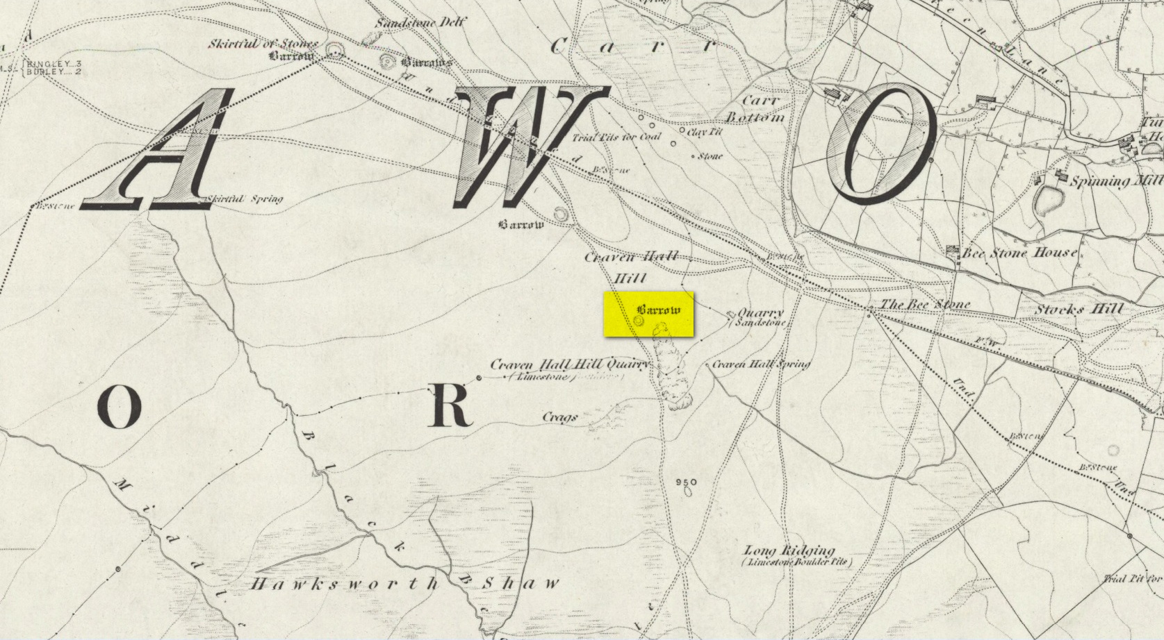
Unless the heather’s been burnt back, this takes a bitta finding. Direction-wise, the easiest is from the moorland road above Menston. Go up Moor Lane and then turn right along Hillings Lane. 350 yards on is a dirt-track on your right marked as Public Footpath. Walk up here for two-thirds of a mile—going past where the track goes left to the Shooting Range—to where the track splits. Bear left and after 250 yards you reach a fence on your left where the moorland proper begins. Follow this fence SW for 300 yards until it does a right angle turn. Just before this, you’ll see a large worn overgrown trackway or path running north into the moorland. Walk up here for nearly 100 yards and look around. Best o’ luck!
Archaeology & History
Western arc of earth & stone
Shown on the 1851 OS-map adjacent to the long prehistoric trackway that runs past Roms Law, the Great Skirtful and other prehistoric sites, the antiquarian wanderings of Forrest & Grainge (1868) came past here and, although didn’t mention the Craven Hall cairns directly, they did write of “a group of barrows” hereabouts, and this may have been one of them. James Wardell (1869) gave an even more fleeting skip, only mentioning “pit dwellings” hereby. A little closer to certainty was the literary attention Collyer & Turner’s (1885) pen gave, where they described, “near the adjoining old trackway, which runs from East to West, will be seen a small barrow”—but this could be either of the Craven Hill sites. And the usually brilliant Harry Speight (1900) gave the place only more brevity….
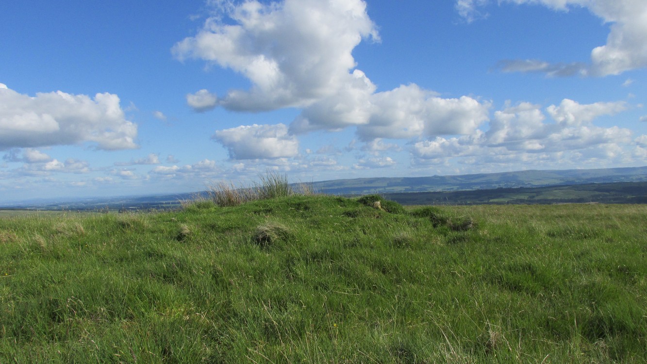
Structurally similar to Roms Law nearly ¾-mile northwest of here, this little-known and much denuded prehistoric tomb has seen better days. It is barely visible even when the heather’s low—and when we visited recently, the heather was indeed low but, as the photos here indicate, it’s troublesome to see. It’s better, of course, with the naked eye.
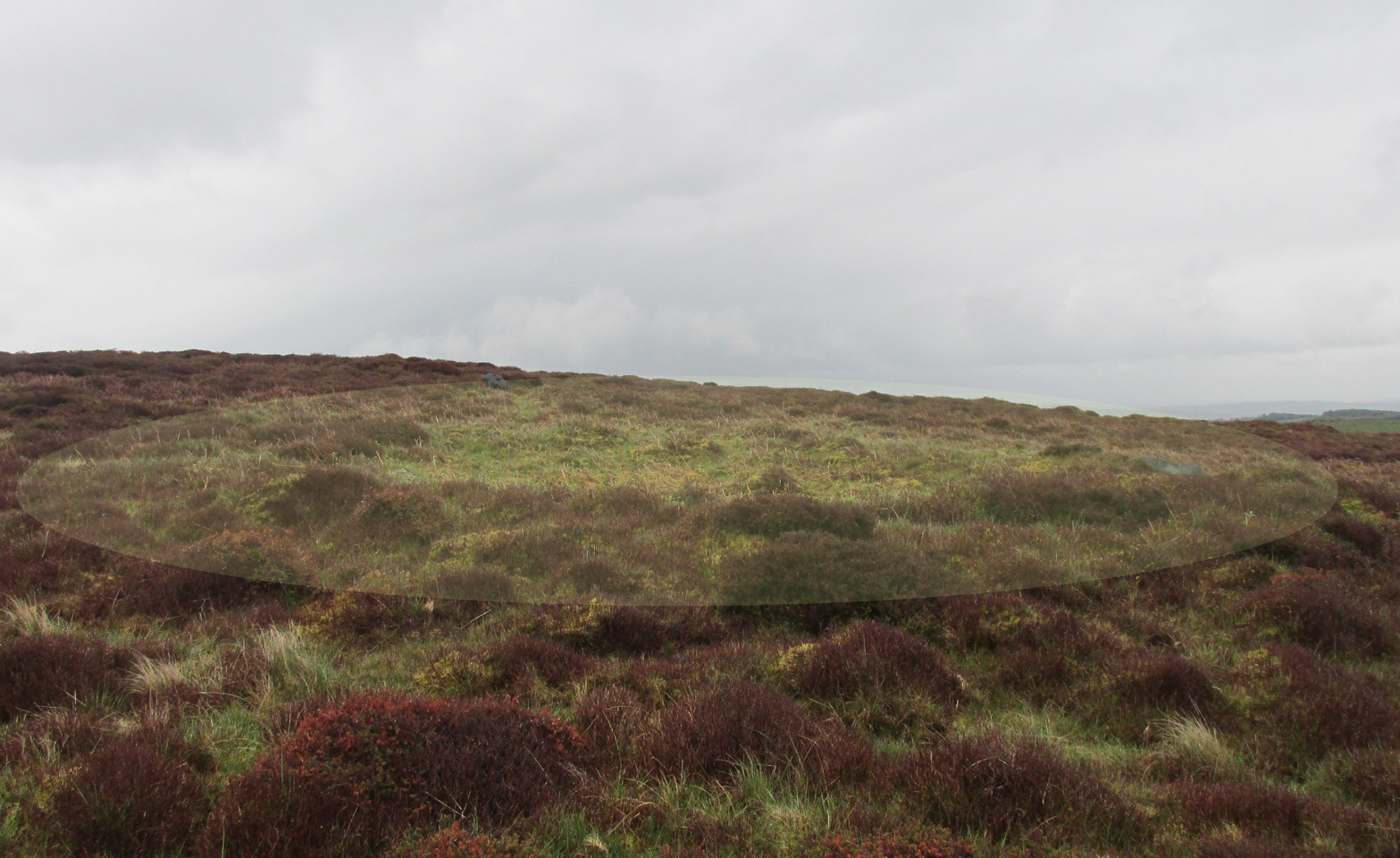
Highlighted ring cairn, looking NEHighlighted ring cairn, looking SE
It’s the most easterly cairn in the large Bronze Age necropolis (burial ground) on Hawksworth Moor. Measuring some 12 yards across and roughly circular in form, the ring is comprised mainly of many small stones compacted with peat, creating a raised embankment barely two feet high above the heath and about a yard across on average. A number of larger stones can be seen when you walk around the ring, but they don’t appear to have any uniformity in layout such as found at the more traditional stone circles. However, only an excavation will tell us if there was ever any deliberate positioning of these larger stones. It would also tell us if there was ever a burial or cremation here, but the interior of the ring has been dug out, seemingly a century or two ago…
References:
Collyer, Robert & Turner, J.H., Ilkley: Ancient and Modern, William Walker: Otley 1885.
Faull, M.L. & Moorhouse, S.A. (eds.), West Yorkshire: An Archaeological Guide to AD 1500 – volume 1, WYMCC: Wakefield 1981.
Forrest, C. & Grainge, William, A Ramble on Rumbald’s Moor, among the Rocks, Idols and Altars of the Ancient Druids in the Spring of 1869, H. Kelly: Wakefield 1868.
Speight, Harry, Upper Wharfedale, Elliott Stock: London 1900.
Wardell, James, Historical Notes of Ilkley, Rombald’s Moor, Baildon Common, and other Matters of the British and Roman Periods, Joseph Dodgson: Leeds 1869.
Tumulus (destroyed): OS Grid Reference – SE 234 336
Archaeology & History
Today, Hough Hill has almost completely given way to modern housing; but in bygone centuries, this hilltop once housed a prehistoric burial mound—albeit an inconspicuous one. It was mentioned briefly in Faull & Morehouse’s (1981) magnum opus, but we know very little of its overall appearance and stature. Its existence was recorded posthumously thanks to the antiquarian John Holmes, without whose notes it would have been lost to history.
During quarrying operations at Hough Hill in December 1879, an ornamental urn was found,
“filled with calcined bones (that) was placed on a dish shaped hollow, some two or three feet deep, with charcoal and burnt earth.”
Holmes compared some markings that were upon this urn to one that was uncovered in Acrehowe Hill above Baildon by J.N.M. Coll in 1845. Unfortunately the Hough Hill urn was broken into fragments shortly after being uncovered. All remains of the burial mound have been completely destroyed.
References:
Faull, M.L. & Moorhouse, S.A. (eds.), West Yorkshire: An Archaeological Guide to AD 1500– volume 1, WYMCC: Wakefield 1981.
Holmes. John, “A Sketch of the Pre-Historic Remains of Rombalds Moor,” in Proceedings of the Yorkshire Geological & Polytechnic Society, volume 9, 1886.
Wardell, James, Historical Notes of Ilkley, Rombald’s Moor, Baildon Common, and other Matters of the British and Roman Periods, Joseph Dodgson: Leeds 1869. (2nd edition 1881).
Tumulus (destroyed): OS Grid Reference – TL 5801 5874
Archaeology & History
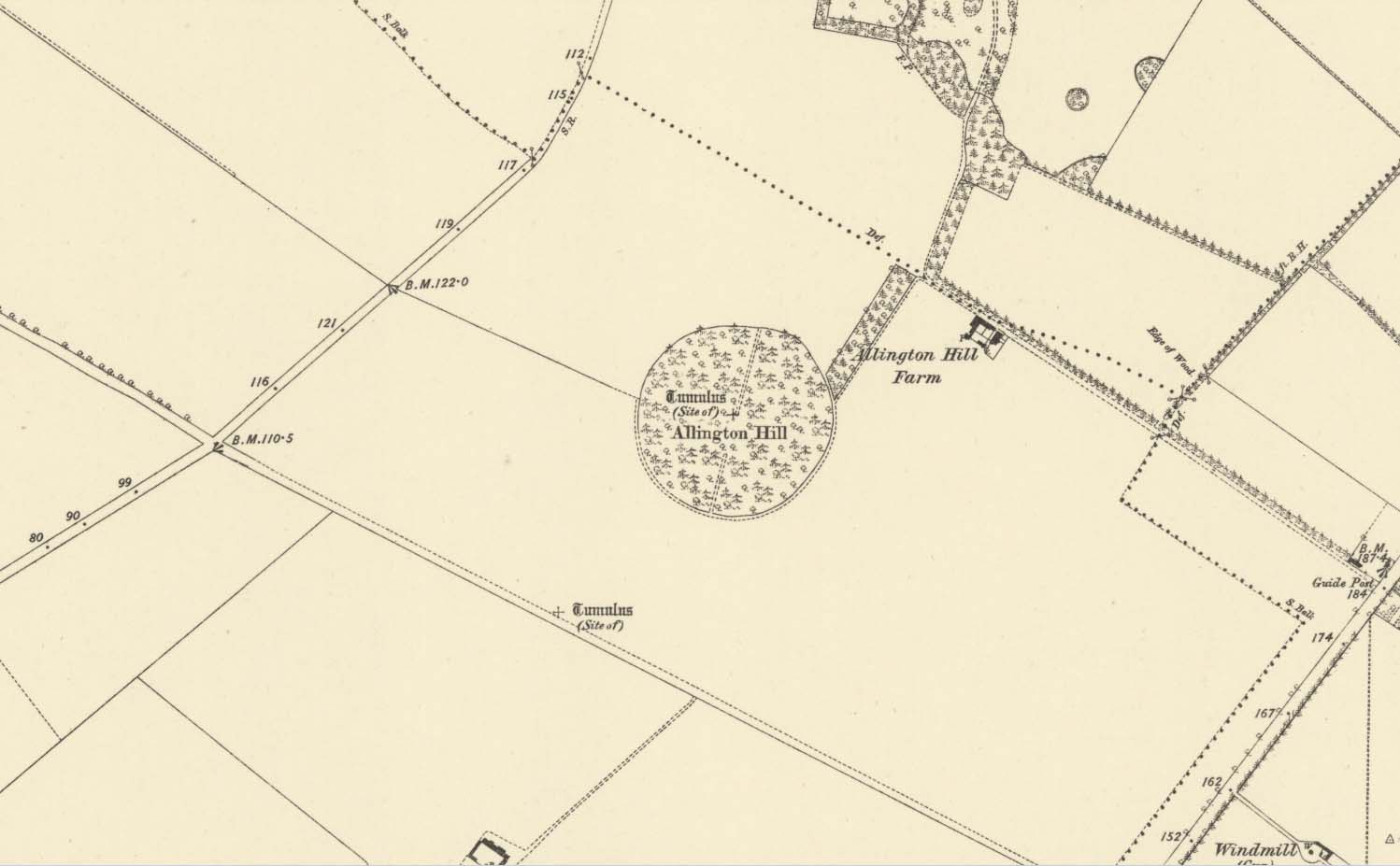
Site marked on 1886 map
In times of olde on this prominent tree-covered hill, a tomb of some ancient ancestor once lived. It had already been destroyed by some retards by the time the Ordnance Survey lads came here in 1885; but thankfully, memory gave its existence the note it deserved. The place had thankfully been given the once-over by some archaeologists in the middle of that century, giving us a pretty good idea as to its size and nature. Measuring some 90 feet across and fourteen feet high, this was no mere toddler!
A Mr W.T. Collings (1846) gave his Intelligence Report to the archaeological journal of the period, from which the following description is gained:
“The excavation of this tumulus in 1845 was made from east to west, commencing from the eastern side, in the direction of its centre, in which, at a depth of about three feet, there was found a cinerary urn in an inverted position, slightly tilted on one side, and surrounded by charcoal and burnt earth. It was filled with charcoal, but contained only one small fragment of bone. This vessel, which was of the simplest manufacture, moulded by the hand, and sun-baked, measured in height five inches, and its diameter at the largest part was five inches and a half. From the deep red colouring, and the general appearance of the surrounding soil, it would seem that a small hole had been first dug, charcoal and bones burnt in it, the vase placed on the fire in an inverted position, and the whole covered up. About ten feet eastward of the central deposit, on the south side of the line of excavation, and half a foot deeper, a deposit of fragments of bone was found apparently calcined, but with little charcoal or burnt earth, forming a layer not more than three inches thick, and two feet in circumference. There were several pieces of the skull, a portion of the alveolar process, inclosing a tooth, apparently that of a young person, pieces of the femur and clavicle, and other fragments. A little to the north of this spot there appeared a mass of charcoal and burnt earth, containing nothing of interest. After digging five or six feet deeper, operations were discontinued; and on the next day shafts were excavated from the centre, so as completely to examine every part, without any further discovery, and in every direction charcoal was found mingled with the heap, not in patches, but in fragments.”
Collings reported the existence of another burial mound a short distance to the south. It was one of at least five such tumuli in the immediate locale, all of which have been destroyed by retards in the area.
References:
Collings, W.T., “Archaeological Intelligence,” in Archaeological Journal, volume 3, 1846.
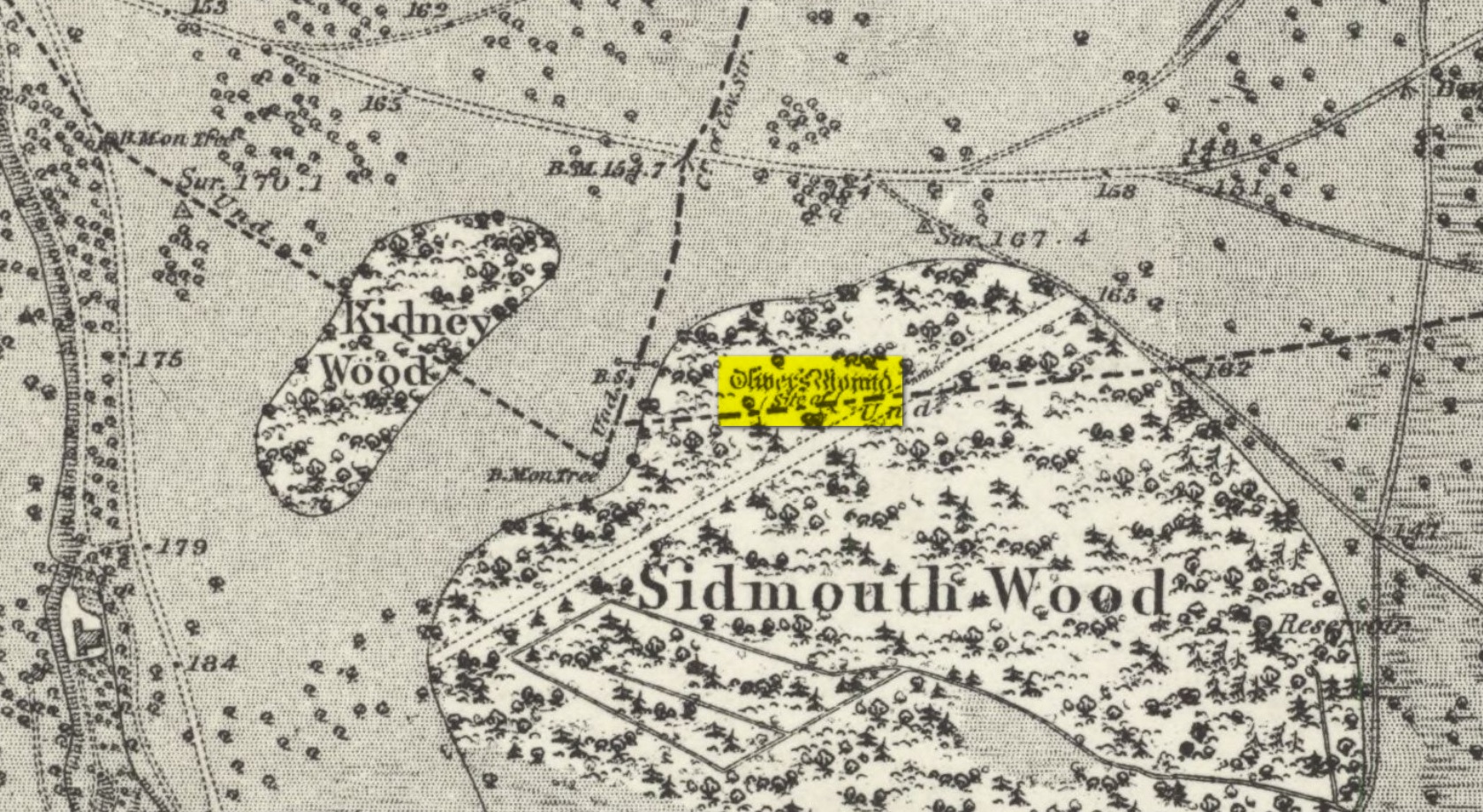
Tumulus (destroyed): OS Grid Reference – TQ 192 735
Also Known as:
Oliver’s Mount
Archaeology & History
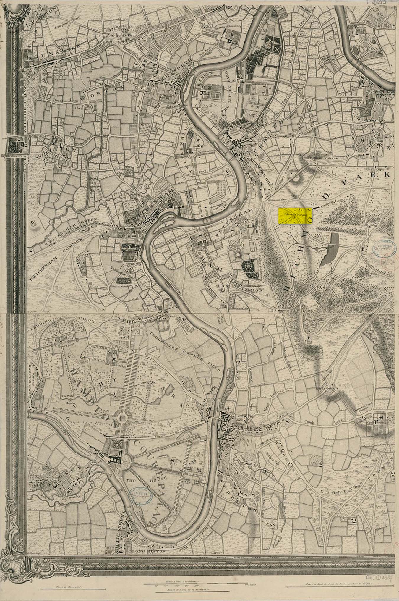
Roque’s 1746 map
Oliver’s Mound was highlighted as early as 1746 on John Roque’s map of the Country Near Ten Miles Round (London) as still standing. One hundred and fifty years later, when the Ordnance Survey lads came to map the area, it had gone. We don’t know exactly when it was demolished, so Historic England (not necessarily a good measure of accuracy) tell us its demise occurred “between 1760 and 1868”, so giving themselves at least some degree of safety!
As we can see in Mr Roque’s old map, an avenue of trees led up to the barrow. This avenue will have been created when Richmond Park and its gardens were laid out.
The round barrow was most likely Bronze Age in origin. The historian and folklorist Walter John (1093) reported that in 1834, three skeletons were found at a depth of a yard beneath the surface.
Folklore
Site shown on 1873 map
Traditional tells that the name of this barrow comes from when the religious extremist, Oliver Cromwell, and his men, set up camp here. A slight variant tells that Cromwell stood here to watch a skirmish.
Tumulus (destroyed): OS Grid Reference – TQ 222 709
Archaeology & History
It seems that a great number of prehistoric remains used to exist in and around the Wimbledon Common area. This one is mentioned only briefly in Thomas Stackhouse’s (1833) rare work on early British remains, where he wrote:
“Near an old single-trenched Camp at the South West comer of Wimbledon Common, is a very small flat Barrow cut into the form of a cross: I don’t know that it has been noticed by any writer.”
The “single-trenched Camp” he described is today known as Caesar’s Camp hillfort. By the time the Wimbledon historian William Bartlett (1865) came to write his survey, the site had been destroyed. In Mr Johnson’s (1903) survey, he seems to confuse this site with the large barrow cemetery that used to exist on the northern edges of Wimbledon Common described by William Stukeley and others.
(the grid-reference to this site is an approximation).
References:
Bartlett, William A., The History and Antiquities of Wimbledon, Surrey, J. & S. Richards: Wimbledon 1865.
Johnson, Walter, Neolithic Man in North-East Surrey, Elliot Stock: London 1903.
Take the Glenfarg road out of Bridge of Earn, cross the motorway and park at the layby past the bend. Go through the gate opposite and follow the track up to the telecoms mast, you can’t miss it..
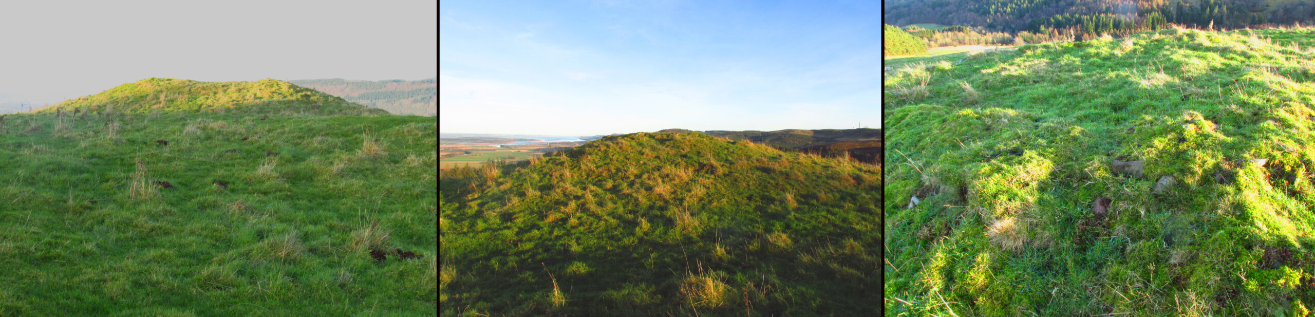
Archaeology & History
Shown on the 1866 OS Map
Visible from the lowlands below, it is described in the official listing as a cairn of prehistoric date, a funerary monument dating to the late neolithic to early Bronze Age. It is a broadly round stony mound, partially overgrown with turf on the north eastern (mid-summer sunrise) slope of Balmanno Hill, where it has extensive views over the surrounding country. It is 1.8m (6′) high, 17m (56′) across on the N-S axis and 16m (52′ ) on the E-W axis.
The top of the cairn has a depression in it: possibly the result of treasure-seeking long ago, but there is no evidence of any burial cist.
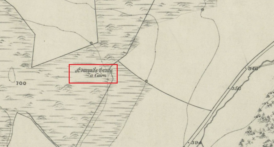
So who was ‘Edmund’? Was this a place of heathen ritual Christianised with the designation of St Edmund during the Anglo-Saxon incursions of the early middle ages, or the name of a local landowner? It is lost to history. The name ‘Balmanno’ can be interpreted as ‘Place of the Big Man’ – so have we an echo of a lost giant legend here in an area of Scotland where such legends abound, and long pre-date the construction of the cairn? Did later people name their local mythic giant ‘Edmund’?
An alternative meaning of ‘Balmanno’ is given by David Dow in the Old Statistical Account – the ‘Town of the Monk’.
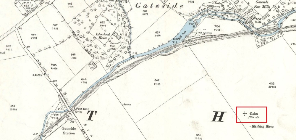
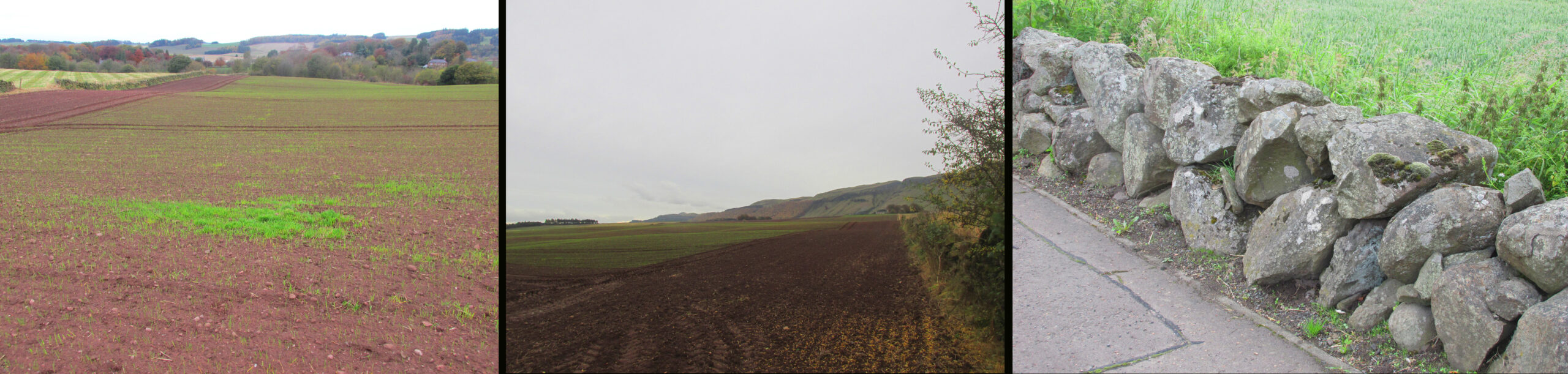
The easiest way is to turn south off the A91 at Gateside onto Station Road, and the site of the cairn is in the third field to the left over the railway bridge. I accessed the site walking along the old railway line and climbing up the embankment.
Archaeology & History
The site of the Cairn on the 1894 25 in. OS map.
In the shadow of the Lomond Hills of Fife, what was once a very large pre-historic cairn, officially described as of ‘unassigned’ period, was quarried to destruction around two hundred and twenty years ago, presumably to provide stones for dykes (stone walls), at that time of enclosures of common land and what the landowners liked to call ‘agricultural improvements’.
In the early nineteenth century, this part of the Eden Valley between Gateside and the Lomond Hills was what would now be called a ritual landscape. There were, according to Miller:
‘nearly in a line between the two Laws ( Lomond Hills) noless than eight “druidical temples” (Stone circles) close together‘
and a number of impressive burial cairns, of which Easter Nether Urquhart seems to have been the largest. There were in addition large numbers of graves containing masses of cremated of human bones. Nearly all this archaeology has been subsequently destroyed by the farmers.
Two local antiquarian writers proposed that all these human remains had been buried there following the battle of Mons Graupius between the Roman Invaders under Agricola, and the Caledonians, and went on to argue that the Eden Valley was the site of this historic defeat for the ancient Caledonians defending their homeland. Whatever and whenever the origins of the cairns and human remains, subsequent researchers disagree with these nineteenth century arguments in favour of the Eden Valley, and tend to favour a more northerly location for Mons Graupius. Nevertheless we have these two historians to thank for leaving us descriptions of the cairn.
One of the antiquarians, Rev. Andrew Small wrote in 1823:
‘The Slaughter here seems to have been so dreadful, that even after the lapse of 17 Centuries the Common tradition of the Country bears, and seems to be as fresh in the Mouths of both old and young as though the battle had been fought only a hundred years ago, – that after this battle the River Eden ran red with blood for two days…’
It seems more likely that the event remembered was part of the campaign by Roman Emperor Septimus Severus and his son Caracalla to subdue the Caledonians around 209-210 CE. Modern writer, Simon Elliott:
‘Archaeological data is now emerging to show ….. a major depopulation event, indicating something close to a genocide was committed by the Romans in the central and upper Midland Valley.’
Andrew Small describing the cairn and some of the cremation remains in 1823:
‘There was also a very large cairn laid upon these ; and the proprietor lately told me that when removing the stones, besides the ashes already mentioned, there was also a pit of pure fine sand by itself, about as fine as is usually put into sand-glasses, which he thinks had been used for regulating the fire in burning of the dead. This cairn stood a little north of an ancient Druids temple, only one stone now remaining, out of ten of which it formerly consisted ‘.
Lieutenant – Colonel, Miller writing in 1829:
‘Farther west ….a very large cairn stood, containing upwards of two thousand cart-loads of stones. Upon removing it about thirty years ago, a pit six feet long, two broad, and of the same depth, was found, quite full of burnt bones; and near it another, two feet square and two deep, full of the finest sand. An urn was also found, near the surface of the cairn, full of bones. A very fine Druid’s temple stood on the south side of it, consisting of seven very large stones…’
As the builders of the cairn didn’t have access to carts, and that the stones all had to be moved by hand, it gives an indication of the manpower needed to build the cairn, and the status of the individuals whose remains were buried there. And we have to question why a special chamber been built into the base of the cairn to hold fine sand, and what was the purpose of this sand?
Left – View of Cairn site looking north, centre of the field beyond the tractor tracks. Centre – View looking south. Right – The cairn recycled? Walling on the south side of A91 at Gateside
Folklore
While not writing specifically of the cairn, Revd. Small recounts these tales of the surrounding land, relating it to his belief that it was the site of Mons Graupius:
‘I cannot forbear to mention here, also, a singular circumstance I had from the landlord and landlady, both yet alive, — viz. that before parking or inclosing took place, they were accustomed to have folds built of feal or turf for the cattle lying in at night ; but that, when the folds happened to be in this place where the dead had been burnt, the cattle would never lie in them, but always broke through or leaped over the dyke ; that they were obliged to give a man a boll of barley extra to watch them, when they lay in this spot, which was obliged to be repeated every four or five years in rotation ; but that sometimes the man was not able to keep them in by all his endeavours, the cattle looking wild and terrified in appearance ; and sometimes it required the united efforts of all the hands that could be had to keep them in, oftentimes springing over the fold dykes close beside them, and frequently crouching and trembling as if they would have fallen down with terror, although nothing appeared visible to the visual organs either of the man or those that occasionally assisted him. However, after the discovery of so many ashes and fragments of human bones, the man declared that, had he known of these being so near, he would not have been so fond of watching.’
‘The late farmer of Upper Orquart, a most respectable man, with whom I was well acquainted, and upon whose farm the principal part of the battle was fought, told me also that always when the folds happened to be both at where the Caledonians were burnt as well as the Romans — but particularly he specified the spot where the Romans had been burnt, or the Witch Know or Knoll — the cattle would never lie in the fold, but were always breaking ” the fauld,” as he called it, except when they were particularly watched ; and even that was not always effectual for keeping them from doing it either. This would insinuate as if the spirits of these departed heroes of antiquity sometimes visited and hovered about the places where their ashes had been deposited ; though invisible to the more refined visual organs of the human eye, yet obviously visible in some shape or other to the more gross visual organs of the irrational or bestial tribe, else how can these forementioned occurrences be accounted for? This hypothesis seems to be borne out by Balaam’s Ass perceiving the Angel twice, when he himself could not do so till his eyes were supernaturally opened.’
Afterword
Although the cairn no longer exists, its stones were probably reused for local walling, and it’s likely, but not provable, that the wall on the south side of the A91 past the Station Road turning is built from stones removed from the cairn.
References:
Elliott, Simon, Septimus Severus in Scotland, Greenhill Books, 2018.
Miller, Lt. Col., “An Inquiry Respecting the Site of theBattle of Mons Grampius“, 1829, published in Archaeologica Scotica vol. IV, 1857.
Small, Andrew, Interesting Roman Antiquities Recently Discovered in Fife, John Anderson, Edinburgh, 1823
Tumuli (destroyed): OS Grid Reference – TL 584 600
Archaeology & History
The precise location of two prehistoric burial mounds at place with the conspicuous name of Beacon Hill, has yet to be satisfactorily located. Their existence is recorded way back, in 1279 according to P.H. Reaney (1943), when they were described as Tweynhowes, being on the boundary of Swaffham Priory. Information on them is scant and scattered with the earliest seeming to be an account by Thomas Kerrich (1817), who reported their removal and finds therein, in 1815. The editor of Archaeologia told us:
Beacon Hill urn, 1817
“The Rev. Thomas Kerrich…exhibited to the Society, an Urn, which had been found a few days before by some labourers who were employed to remove one of the Barrows upon Newmarket-heath, called the Beacon Hills. “It stood upon what probably was the surface of the earth before the tumulus was raised. The diameter of the barrow was near thirty yards, and the perpendicular height probably about eight or nine feet. There are more of these tumuli remaining, some of them very near to the place on which this, out of which the urn came, lately stood. They command an extensive view over the town of Cambridge, Gog-Magog Hills, &c.”
Subsequently a short piece in the Cambridge Chronicle in 1846 told the following:
“Two of the barrows on the edge of Newmarket Heath, belonging to the group called the Beacons, were examined in May 1846 by a party from Cambridge. In one of them nothing was found as it appeared to have been previously opened; in the other the remains of a British interment, consisting of rude vase (now in the Cambridge Antiquarian Museum), a few bones and some ashes, were discovered.”
This was echoed nearly forty years later in a survey by Charles Babbington (1883), who gave little by way of extra information; and was echoed again in Cyril Fox’s (1923) huge archaeological survey. Herein, Mr Fox told us that the two barrows were located at the “east end of a four-mile racecourse.” The only additional lore we’ve had since then is a collation of by the Royal Commission lads who thought that the respective tombs were located more precisely as the grid-references TL 5839 5998 and TL 5850 6004 respectively.
Reaney, P.H., The Place-Names of Cambridgeshire and the Isle of Ely, Cambridge University Press 1943.
Royal Commission Ancient Historical Monuments, Inventory of Historical Monuments in the County of Cambridgeshire – Volume 2: North-East Cambridgeshire, HMSO: London 1972.