Tumulus (destroyed): OS Grid Reference – TL 6091 6304
Also Known as:
- Newmarket Heath 1
- Ninescore Hill Barrow
Archaeology & History
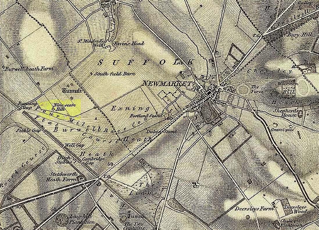
Upon the small and curiously-named Ninescore Hill on the edge of Newmarket’s race-course, the old-school archaeologist Cyril Fox (1923) told that “800 yards due east of Running Gap”, was a prehistoric burial mound that was destroyed in 1885. Highlighted on the 1834 OS-map, a 19th century excavation found that the tomb “contained two inhumation interments associated with beakers,” along with some “flint arrowheads, and a secondary interment, probably Saxon.” In more recent times, the doods from the Royal Commission (1972) added the site to their inventory and noted that a faint outline—known as as ring ditch—is visible from the air when conditions are just right. But there’s bugger all left of it at ground level.
References:
- Fox, Cyril, The Archaeology of the Cambridge Region, Cambridge University Press 1923.
- Royal Commission Ancient Historical Monuments, Inventory of Historical Monuments in the County of Cambridgeshire – Volume 2: North-East Cambridgeshire, HMSO: London 1972.
© Paul Bennett, The Northern Antiquarian