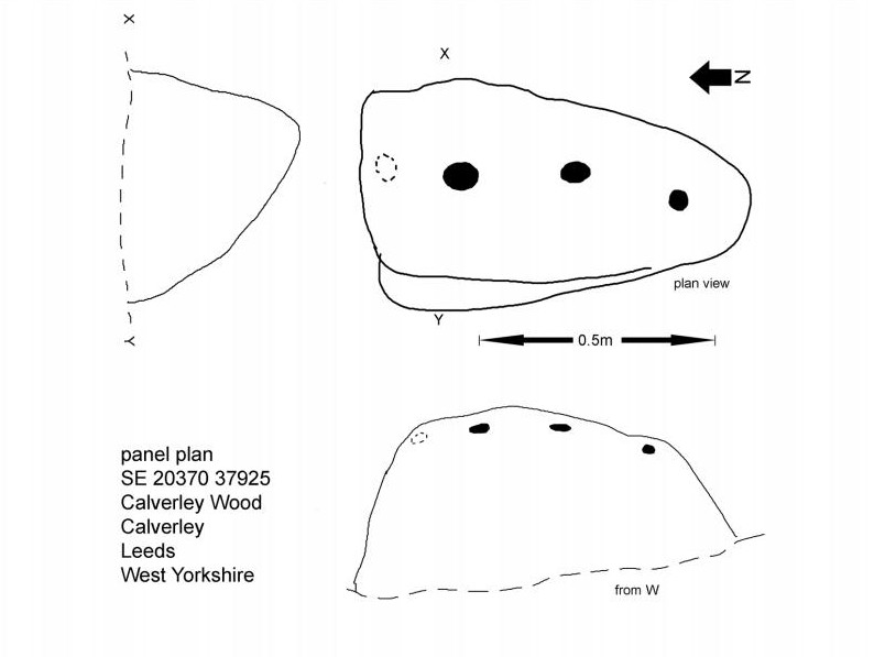
Cup-Marked Stone: OS Grid Reference – SE 13077 40097
Also Known as:
- Carving no.11 (Hedges)
- Central Design Stone
Baildon Moor carving
Take the directions to find the Glovershaw Quarry carving,or the Baildon Moor 126 carving and the newly-found Toad Stones circle, and zigzag about in the bracken when it’s down at the end of Winter (forget it from summertime onwards!). You’re damn close.
Archaeology & History
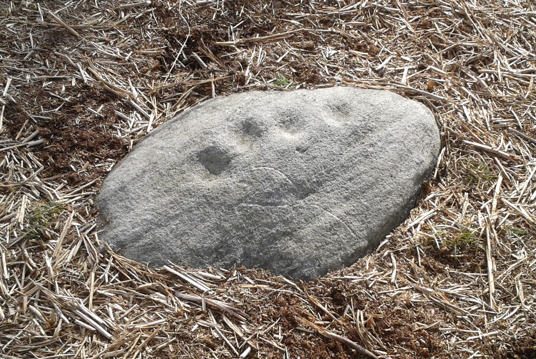
A carving that I first visited when I was a child – but one which, curiously, caught my attention. The small arc of four cup-marks that you can see on the stone was an integral feature of other carvings in this particular region—though not all, of course. It seemed to me at the time that it had symbolic significance, as the arc occurred in a number of other Baildon petroglyphs. Astronomy was my fetish at that time and so I saw the arc as solar or stellar movements across the sky, represented by the cup-markings. It was one of many fascinating Rorschach’s that I encountered, just as rock art students across the world do when looking at these ancient carvings. However, the simple symbolism of this and similar nearby carvings has stuck and plays under my skin somewhat: one of those curious non-egoic tickles, constantly nudging away, as if there’s something in it, but being looked at from the wrong angle…
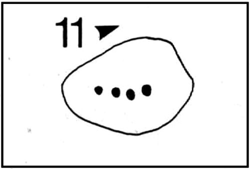
John Hedges 1986 sketch
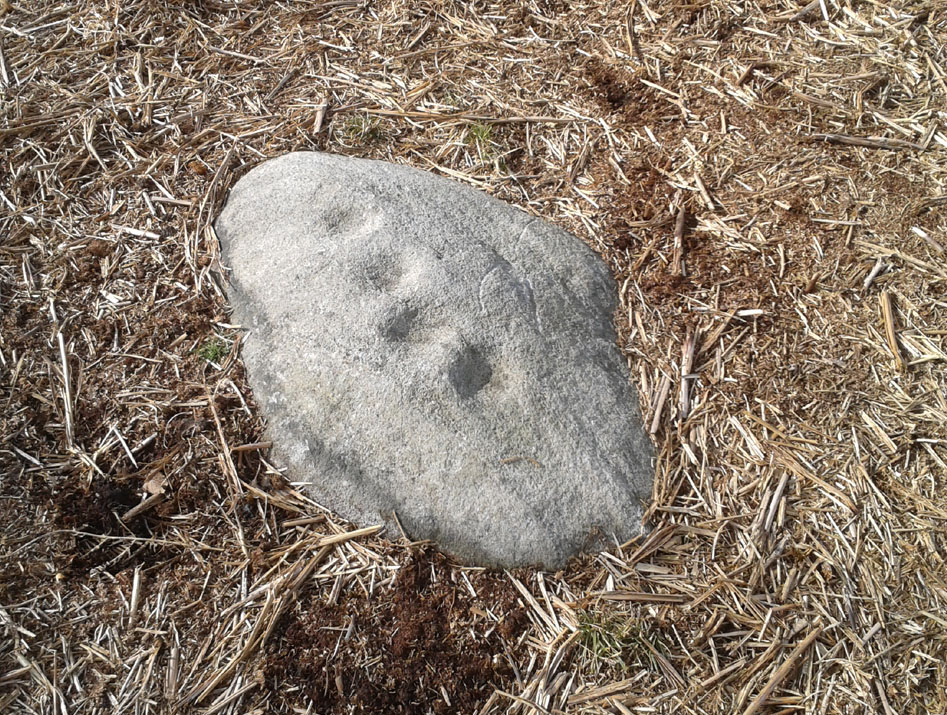
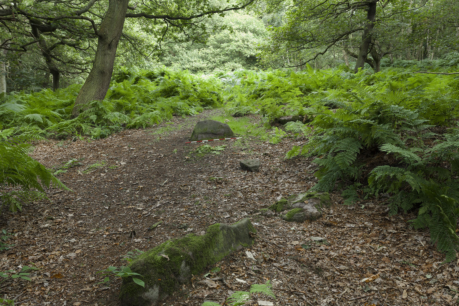
Looking down at the cups
Anyway… All we have here is a primary design of four cup-marks reaching across a small earthfast stone. Other simple carvings are found close by and there are the remains of several prehistoric cairns circles within a few hundred yards. Beneath the deep bracken-mass, it is highly probable that other ancient remains remain hidden.
The carving was first recognised in one of Sidney Jackson’s (1958) archaeology bimbles in the 1950s with his bunch of northern antiquarians from Cartwright Hall, Bradford. It later found its way into the survey of John Hedges (1986) where he described it, simply:
“Small, lozenge-shaped, smooth grit rock, sloping NW-SE into grass and bracken, four symmetrical cups in slight curve.”
References:
- Baildon, W. Paley, Baildon and the Baildons – parts 1-15, Adelphi: London 1913-1926.
- Bennett, Paul, Of Cups and Rings and Things, unpublished: Shipley 1981.
- Bennett, Paul, Megalithic Ramblings between Ilkley and Baildon, unpublished: Shipley 1982.
- Boughey, Keith & Vickerman, E.A., Prehistoric Rock Art of the West Riding, WYAS: Leeds 2003.
- Cowling, Eric T., Rombald’s Way, William Walker: Otley 1946.
- Hedges, John, The Carved Rocks on Rombald’s Moor, WYMCC: Wakefield 1986.
- Jackson, Sidney, “Cup-Marked Boulders, Baildon Moor,” in Cartwright Hall Archaeology Group Bulletin, 3:2, 1958.
© Paul Bennett, The Northern Antiquarian