Nothing has previously been written of this site. Its existence came to light during one of umpteen enquiries I’d made with a well-known and very respected local lady, born and bred in Killin (sadly, a dying breed), who is known as a fount of knowledge regarding the history of the area. We were talking about the ancient sites and folklore of the neighbourhood and, amidst being her usual helpful self she asked, “have you been to the Coin Tree? The place where we leave offerings to the spirit of the place?”
I hadn’t.
“No, I’ve never heard of the place.”
“We keep it quiet, ” she said, “for obvious reasons.”
I knew what she meant. The Fairy Tree at Aberfoyle is a case in point: littered with plastic pentagrams, children’s toys and so-called “offerings” of all kinds that have made it little more than a dumping ground for pseudo-pagans and new-age nuts that needs to be cleaned regularly by local folk.
Anyhow, our informant proceeded to give us directions to find the place, going out of the village, but asked that if we were to write about it, to keep its location quiet, “as the place is still used by us”—i.e., old locals. After a slow trek along one of the roads out of the village we saw nothing that stood out. Eventually we came across a fella relaxing in his garden and asked him if he knew anything about an old tree where offerings were made. He gave us that look that olde locals do, to work out whether you’re a tourist or not and, after telling him what we’d been told and who had told us —that seemed to do the trick!
“You’d mean the Fairy Oak I s’ppose? Aye,” he said, “gerrin the car and I’ll drive y’ down to it.”
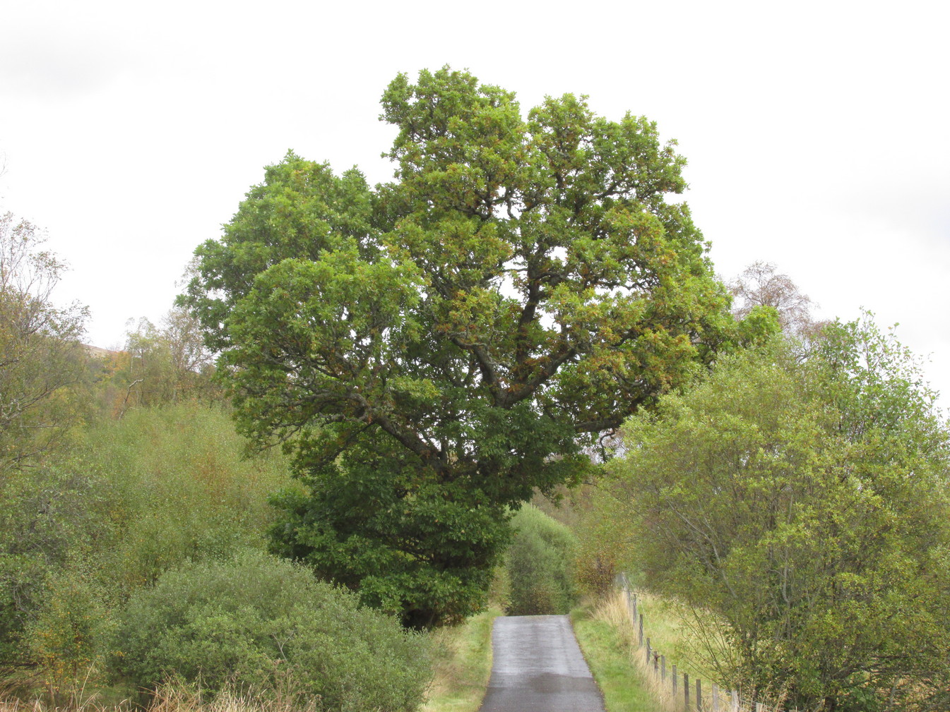
So we did. A short distance back along the road that we’d come down he stopped and walked along a to large oak tree beside the road. We’d walked straight past it—but in truth it’s not a conspicuous tree and unless you were shown where it was, you’d miss it as easily as we did (and I’m usually damn good at finding such things!). We thanked the fella for taking us to see it and he drove back home to leave us with out thoughts.
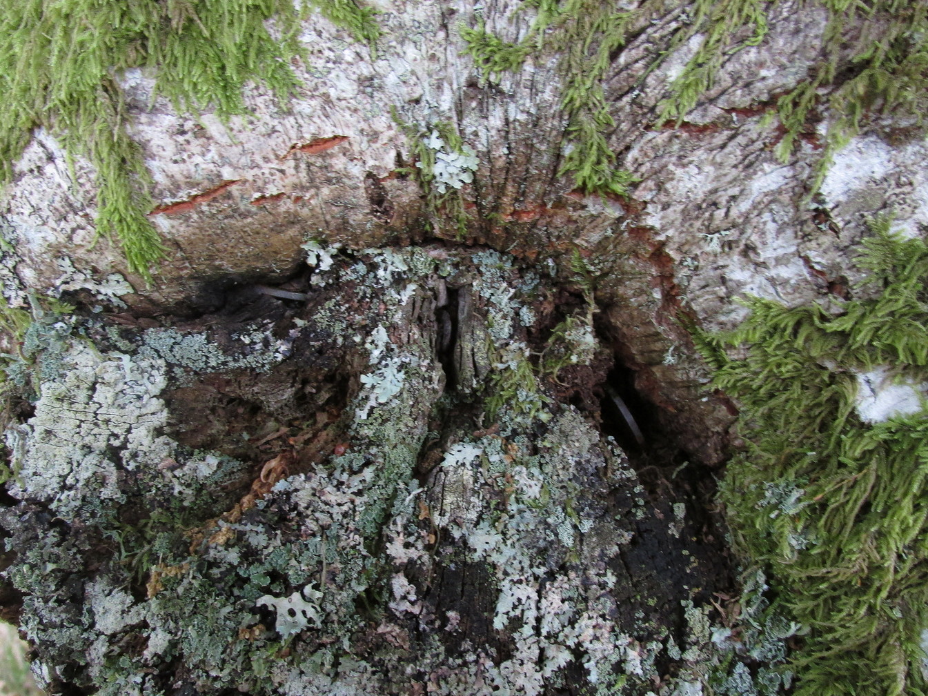
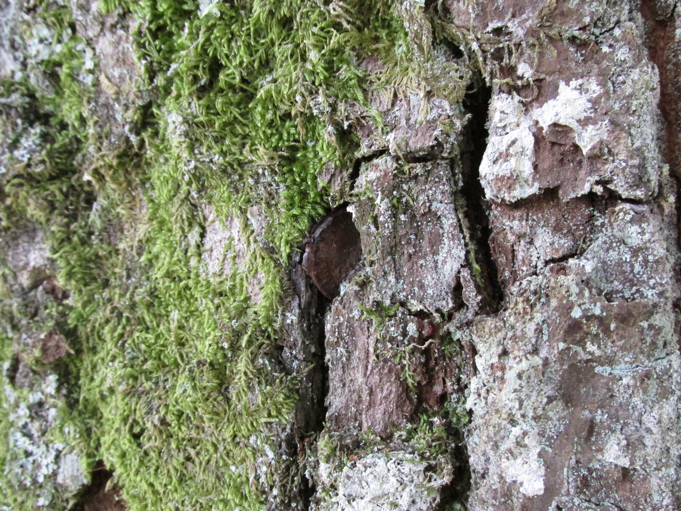
More coins as offeringsCoins for the little people
Embedded into the tree—some of them barely visible where the bark had grown over them—were clusters of old coins all around its trunk; some of them very old. These had been inserted into the tree as offerings in the hope that the little people, or the genius loci would bring aid to that which was asked of it.
In a field across the road there’s a large “fairy-mound” hillock: one of Nature’s creations, but just the sort of place where many little people are said to live in many an old folk-tale. Some such mounds are old tumuli, but this aint one of them. It’s possible that it had some relationship with the tree where the fairy folk are said to reside but, if it did, our informants didn’t seem to know.
The important thing to recognise here is that in some of the small villages and hamlet in our mountains, practices and beliefs of a world long lost in suburbia are still alive here and there… But even these are dying out fast, as most incomers have no real attachment to the landscape that surrounds them. Simply put: they see themselves as apart from the landscape as opposed to being a part of it.
Cup-and-Ring Stone: OS Grid-Reference – C 30754 37541
Archaeology & History
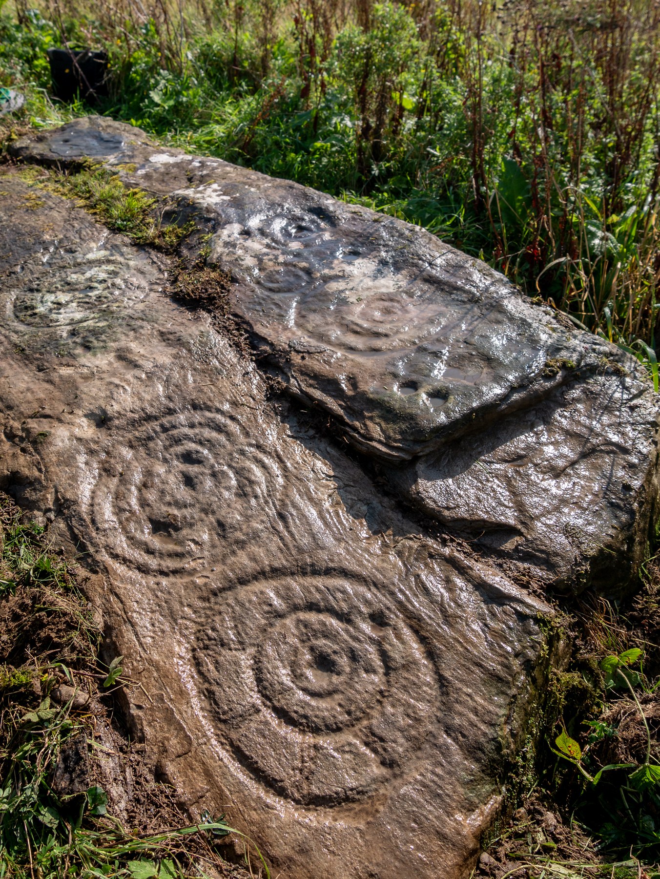
Incredible setting -incredible carving
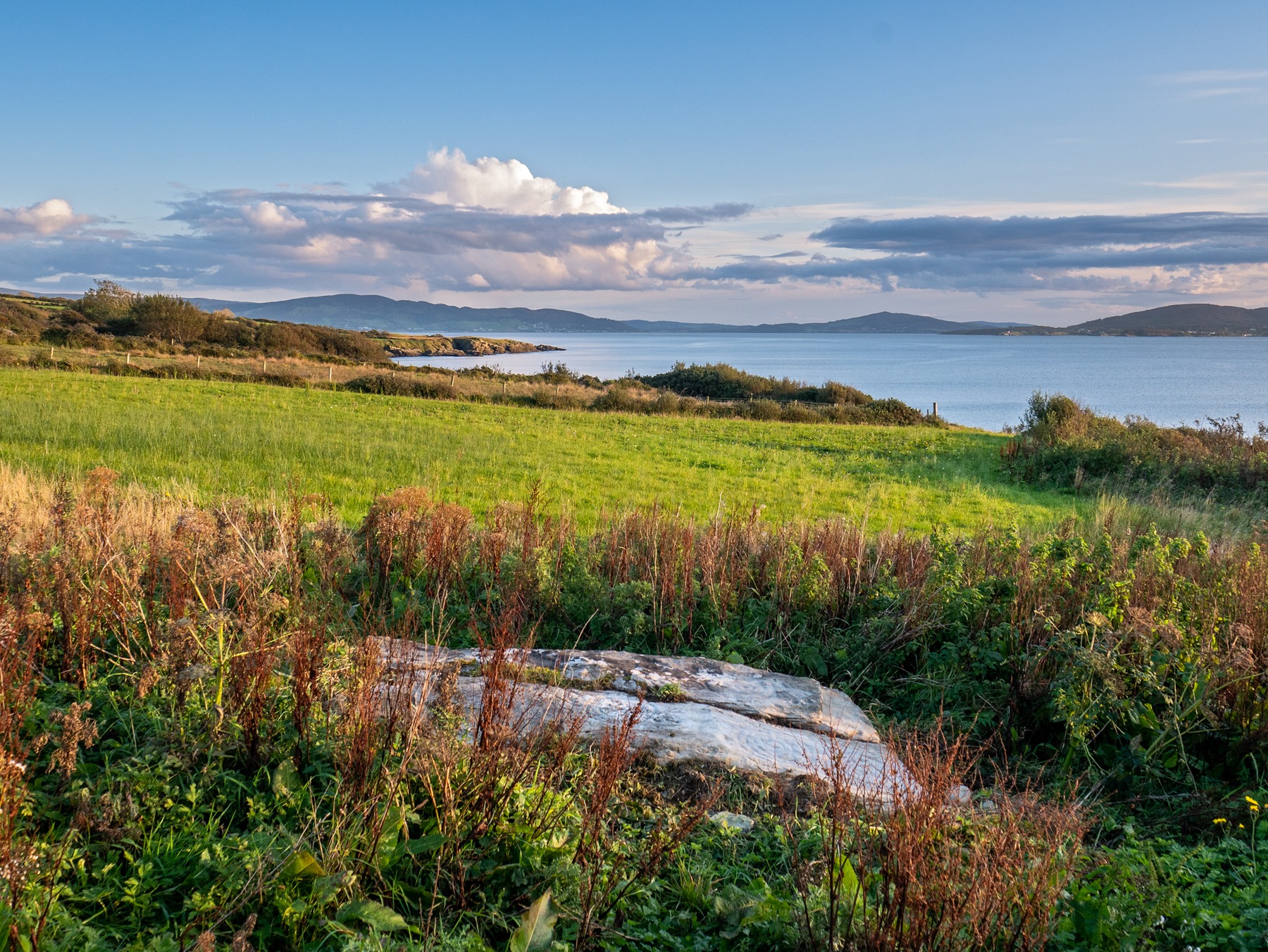
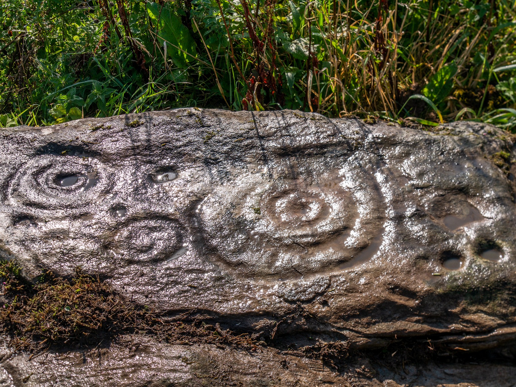
This is an incredible find—dare I say a beautiful find—uncovered beneath the soil a few years ago on farmland close to the shore of Loch Swilly by one of the farm-workers. We were lucky inasmuch as when it was found he noticed curious markings on it. Informing the farmer, between them they peeled back the rest of the soil and found the incredible carving that we see here in Bettina Linke’s photos.
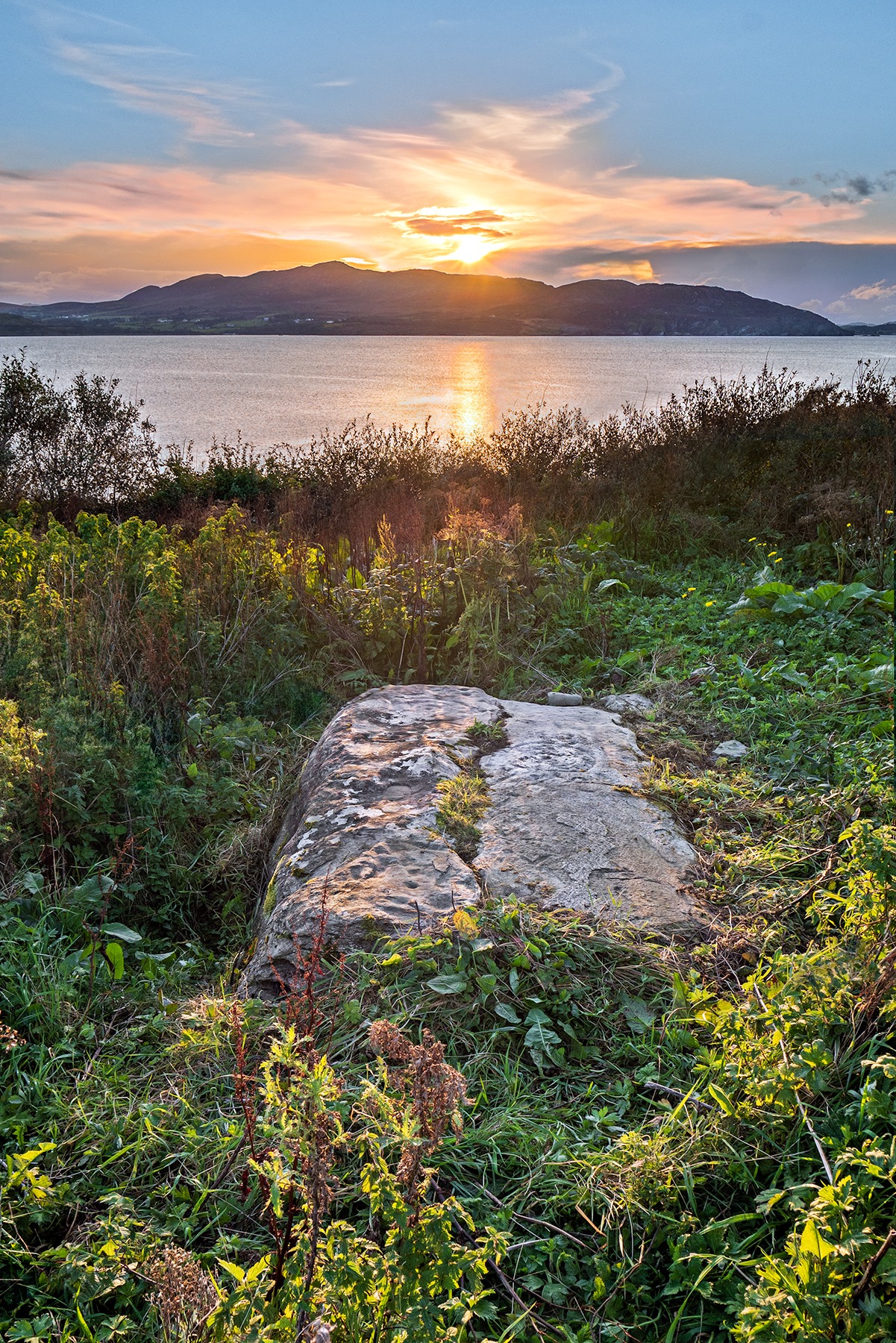
Etched onto a sloping stone overlooking the blue panorama that is Loch Swilly, this petroglyph has a 180º view of the landscape, from the southeast through to the northwest. This panorama—unimpaired by trees thanks to its proximity to the sea loch—was probably an important ingredient in the mythic function of the carving and is something we’ll return to shortly…
Local rock art specialist, Liam McLaughlin was informed of the discovery and, along with Bettina Linke, they met up with the farmer who showed them the carving. I have little doubt that they were very impressed by what lay before their eyes! They told that the rock,
“is aligned east-west with the visible motifs, apart from a few cup marks, situated at the western end of the outcrop. Interestingly, the northern half/leaf is little worn and individual peck marks, made millennia ago, are clearly visible, suggesting it may have been covered for most of the time. The southern half is clearly worn and smoothed out and therefor appears to have been exposed for a considerable amount of time.”
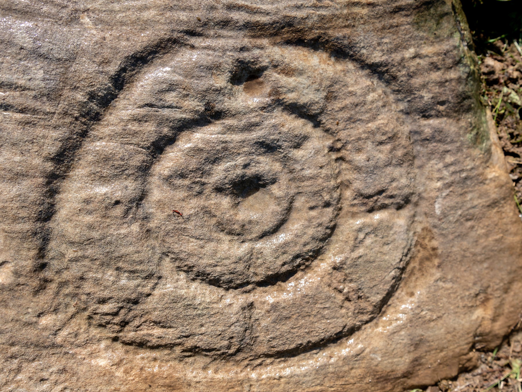
Archetypal cup-and-ringsAncient solar motif?
One of the most impressive elements in the overall design is the solar motif, i.e., a series of concentric rings (in this case three) with a number of ‘spokes’ reaching outwards as if to indicate the rays of the sun itself. This is shown clearly in one of Bettina’s photos here. This symbol is found on other neolithic carvings in Ireland: not least the incredible designs in the Newgrange complex where the solar alignment is unmistakable.
The discovery of the carving was reported to the Irish National Monument Service and added to the Heritage Environment Inventory where a detailed report was subsequently written, much of which is extracted here:
“The rock art panel is on an outcrop of bedrock, aligned east to west and slightly sloping in this direction towards Lough Swilly and Knockalla Mountains, also known as the Devil’s Backbone. It lies in an arable field near a field wall in rough ground. Visibility is good to the SE, S, W, and NW across Lough Foyle and the Fanad peninsula.”
On the northern section of the stone,
“There are three large motifs and well preserved with cup and pecking marks between them. There are traces of a fourth large motif on the east end but the rock surface has been eroded or damaged, making it impossible to ascertain the design of the motif.
“Starting from west to east, the top large motif has three rings and a diameter of 43cm. The centre cup mark is shallow and has a diameter of 5cm. There is second shallow cup mark between the 2nd and 3rd ring in the southern part of the motif. Its diameter is 3cm. One tail, is running from the inner ring outwards to the west and a second one is running towards the north. Peck marks, covering the motif, are still visible, particular in the rings.
“The motif below has four rings and a diameter of 39cm. The centre cup mark is very shallow and has a diameter of 4cm. And like in the above motif it has a tail running northwards. But a special mentioning has to be made of the unusual heart shape of its rings with the indentation to the south. Peck marks are still visible in the rings. As far as could be made out, there are five cup marks between those two motifs with diameters between 3cm – 5cm. This part also contains several single peck marks of about 1cm in diameter.
“The next large motif below has a diameter of 37cm, three rings and a centre cup with a diameter of 3cm. A tail appears to divide the motif into an eastern and western half. Another tail seems to run from the centre cup through the inner and middle ring towards east.
“Large peck marks of 1cm diameter cover the entire motif, which can be particular well seen in the embossed space between the middle and outer ring. There are more, large peck marks above the motif to the west as well as four possible shallow and small cup marks. Although the two closed to the motif, in what appears to be a twin configuration, could be two independent but slightly damaged peck marks.
“All of the three motifs on the northern wing leave the distinct impression that they may have been sun wheels with some spokes no longer visible or not visible during our visits.
“The southern wing:
“Like the northern ring the large motifs are placed in the western end of the wing with only a few cup marks on its eastern tip. The edges of the carvings are rounder and more worn, although some rings and cup marks are distinctively deeper. The latter might suggest that these motifs were carved at a different time and by different hands. It also appears that this wing was longer exposed than the northern one.
“The motifs are as followed from west to east: two deep cup marks on the northern side. Diameter for the upper one 5cm in diameter, for the lower one 4cm. There could be a shallow third one below and a damaged one to the south.
“Next in the centre of the wing is a large, three ringed motif with a diameter of 40cm and a centre cup mark, 3.5cm in diameter. Some of the photos show possible if faint tails or spokes, suggesting that this also could be a sun wheel motif. No visible peck marks. Below is a small double ring motif with a diameter of 17cm and a centre cup mark with a diameter of 2cm. Just below and to the south-east is a cup mark, circa 3 cm in diameter. Beside it to the east another cup mark about 5cm in diameter. There are one or two, maybe three circa 2.5cm cup marks in the white lichen area to the north-east of the small ringed motif. And some faint peck marks appear between the large 3 ring motif above and the small ringed motif close to the natural split of the bedrock. The next motif below is a deep double ring motif with a diameter of 26cm and a centre cup mark of 5cm. No tails or spokes could be detected. The white lichen area with up to three possible single cup marks is just beside it, close to the natural dividing crack.
“In the middle of the southern wing are faint traces which suggest that there could have been another motif, now destroyed, of an estimated diameter of 28cm.
“The eastern tip has one large cup mark of 10cm and 3 small cup marks between 2.5cm and 3cm. There might be a fifth but damaged cup mark.”
Somerville’s astronomical linesThe setting sun: a mythic function?
The fact that the stone itself is aligned east-west and pointing towards the outline of the Knockalla Mountains, suggesting “a solar/sunset alignment at the equinoxes” may well be true, but whether this was intended or not is another matter.
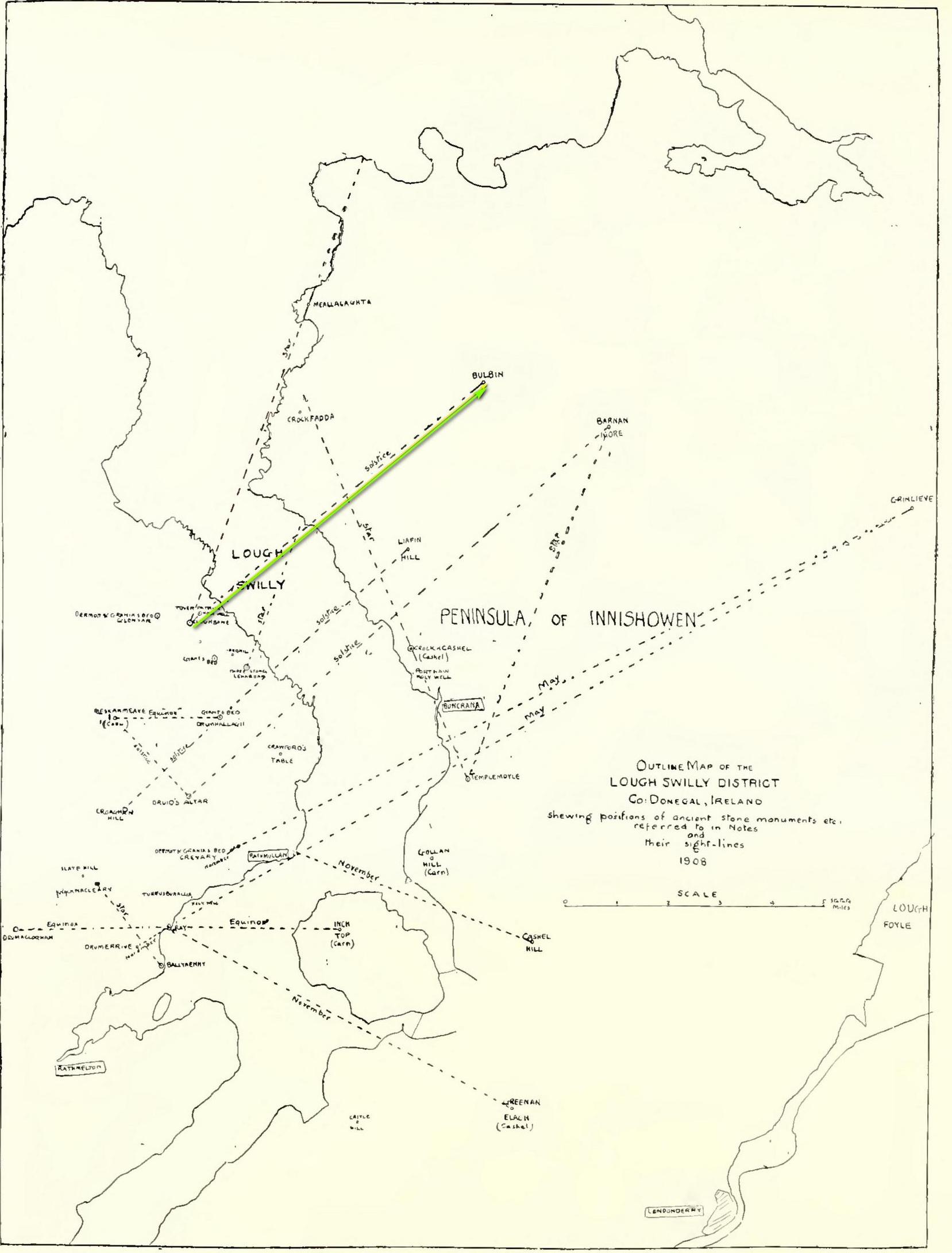
Intriguingly, one of the archaeo-astronony pioneers, Boyle Somerville (1909) wrote a article in the Journal of the Royal Society of Antiquaries of Ireland about a number of summer solstice alignments he thought existed in this precise locale. Amongst them was one he found running from the standing stone at Cloghbane on the other side of Loch Swilly—known as the White or Rowan Stone—heading northeast to the small mountainous peak of Bulbin, approximately 7.1 mile away. Somerville found that,
“The outline of the mountains visible to the northward from Cloghbane shows two sight-lines that undoubtedly were used from this position. One is for the summer solstitial sunrise over the prominent peak Bulbin; the other is over a low and small but conspicuous round-topped headland, towards the mouth of the Lough, which is in line with an exactly similar hill behind it; their two summits being practically coincident, forming a single sky-line; so that, from Cloghbane, their angle of elevation by theodolite is the same.”
The primary motifs
The first alignment is the relevant one here: it not only relates to the rising sun at solstice in 1000 BC, but our Glebe petroglyph lies right on the edge this alignment! (give or take a few yards) Whether or not this is a coincidence we cannot say for certain, but the ‘solar motif’ in the design would seem a strong indicator that implies some sort of solar function here.
As always with cup-and-rings, their non-linear designs tickle our minds with possibilities, probabilities and that there thing called the mysterious, which Einstein described as “the source of all true art and science…”
One final and important thing to anyone who may want to visit this site: please contact the farmer and ask his permission if you want to see it. Cheers. 😉
Acknowledgements: Massive, huge huge thanks to Bettina ‘Grianan Swilly’ Linke for the superb photos and data for this site profile. And (although he doesn’t know it yet!) thanks are also due to the farmer and his employee who rediscovered the carving and to Liam McLaughlin who put pen to paper and told the rest of us about it.
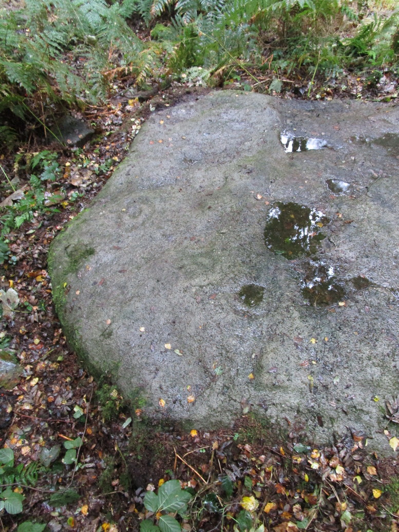
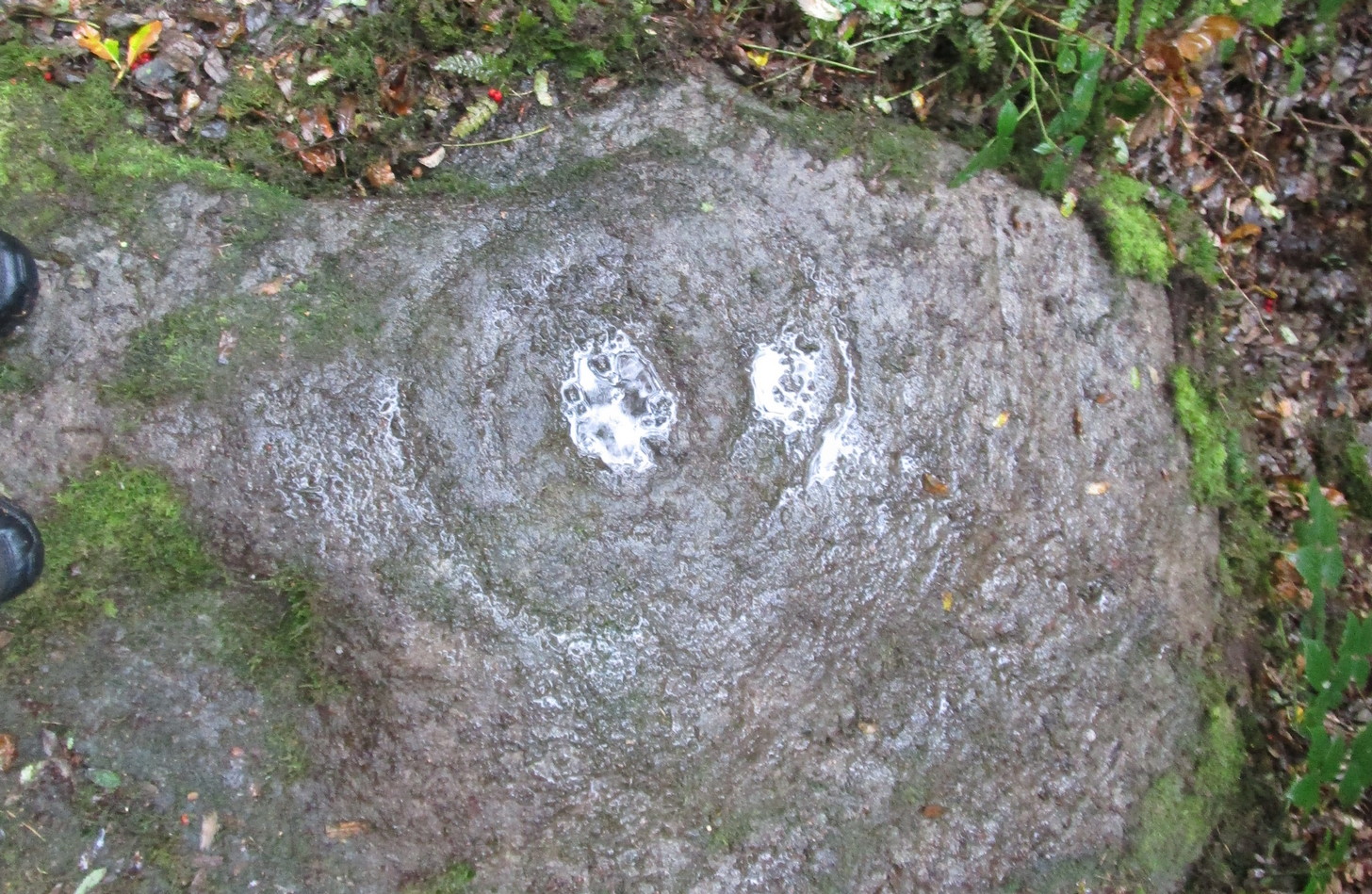
Follow the same directions as if you’re visiting the impressive Fairy Stone carving, then 3 yards east is the Cottingley 2 double cup-and-ring, keep walking past through trees for another 5-6 yards where you’ll come across this reasonably large curved flat stone. Y’ can’t really miss it
Archaeology & History
Cup, with ring faintly visible
This was another carving in the small cluster by the Fairy Stone that I found on my visit here in the 1980s—but it’s a pretty innocuous one to be honest. There’s a faded incomplete “ring” (not really visible on my photos due to pouring rain and very poor light when I was here) with a distinct cup-mark in the middle. Several inches away from the cup-and-ring is a carved line that arcs around it creating an incomplete oval design; and what seems to be a single cup-mark is visible at the top of this oval. Other marks on the stone are both natural as well as recent ‘scratches’.
Some elements of this carving—as with others in this petroglyph cluster—seems to be modern. The cup-and-ring seems to be the real deal, but the ‘oval’ seems to have been added much more recently, perhaps by the scouts who play around in this part of the woods.
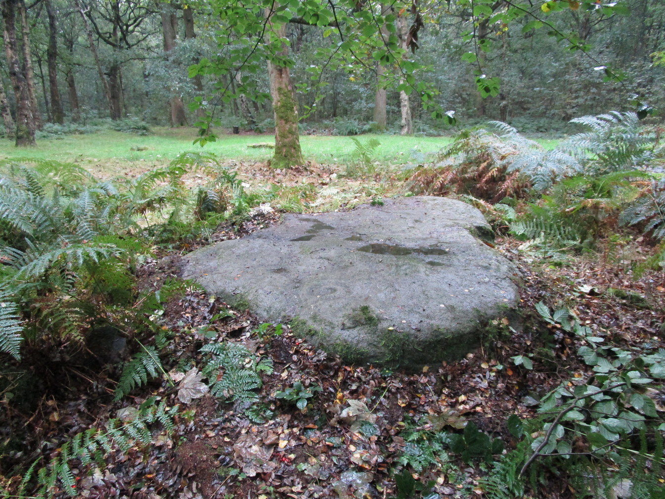
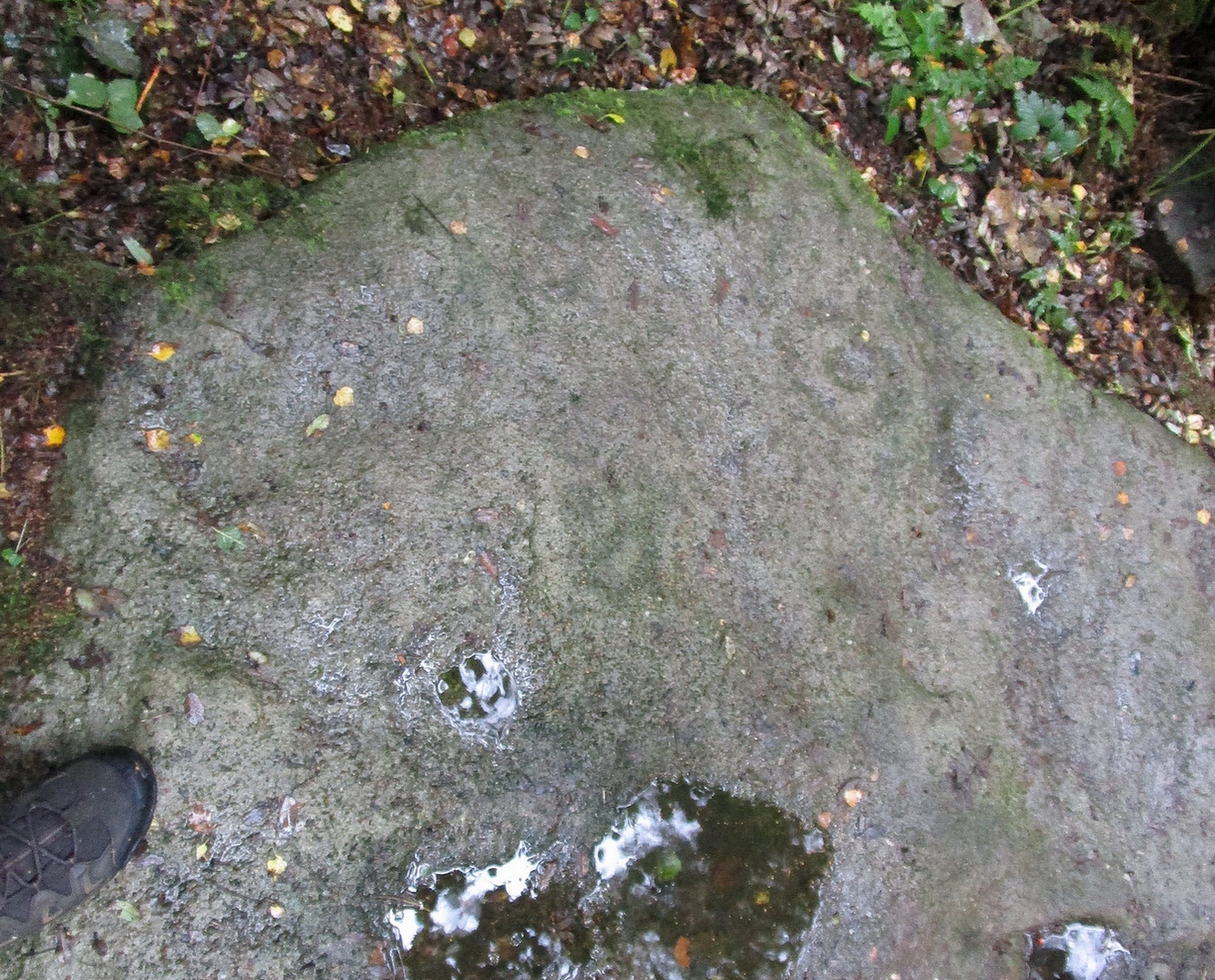
Get yerself to the Fairy Stone, then walk east past the adjacent woodland carvings—numbers 2, 3 and 4—from where you should walk about another 10 yards east across the grass, keeping your eyes peeled for a large flat stone measuring about 6ft by 10ft just as you go back into the tree cover north-side. You’ll find it.
Archaeology & History
This large carved rock is the easternmost known petroglyph in this small woodland cluster of five. (a sixth one can be found, but it’s several hundred yards east from here) Consisting of two distinct cup-and-rings in relative proximity to each other on the northern section of the stone, this design—unlike others in this group—has a greater sense of stylistic authenticity to it. Despite this, one of the two cup-and-rings seems to be a more recent addition to the rock, as close inspection shows peck marks that aren’t very well eroded as you’d expect on rock of this type if it was truly ancient. The more faded cup-and-ring on its northwestern section looks to have a greater sense of age about it when we look at its erosion level….perhaps…
The 2 Cup & RingsThe 2 cup-and-rings
We have to take into consideration when looking at this carving and the others nearby that possess some quite peculiar design-elements, that this section of woodland is used extensively by boy scouts who do what boy scouts do in their teenage ventures: from making fires, climbing trees and, perhaps, scribing on stones if/when their elders aint looking. It’s an important ingredient that has to be taken into consideration when looking at the more rash motifs hereby—this carving included. The more faded cup-and-ring on this, however, may be the real deal. And hopefully, next time I visit this site, She’ll not be dark and pouring with rain (much though I love such weather), so I’ll be able to get some better photos!
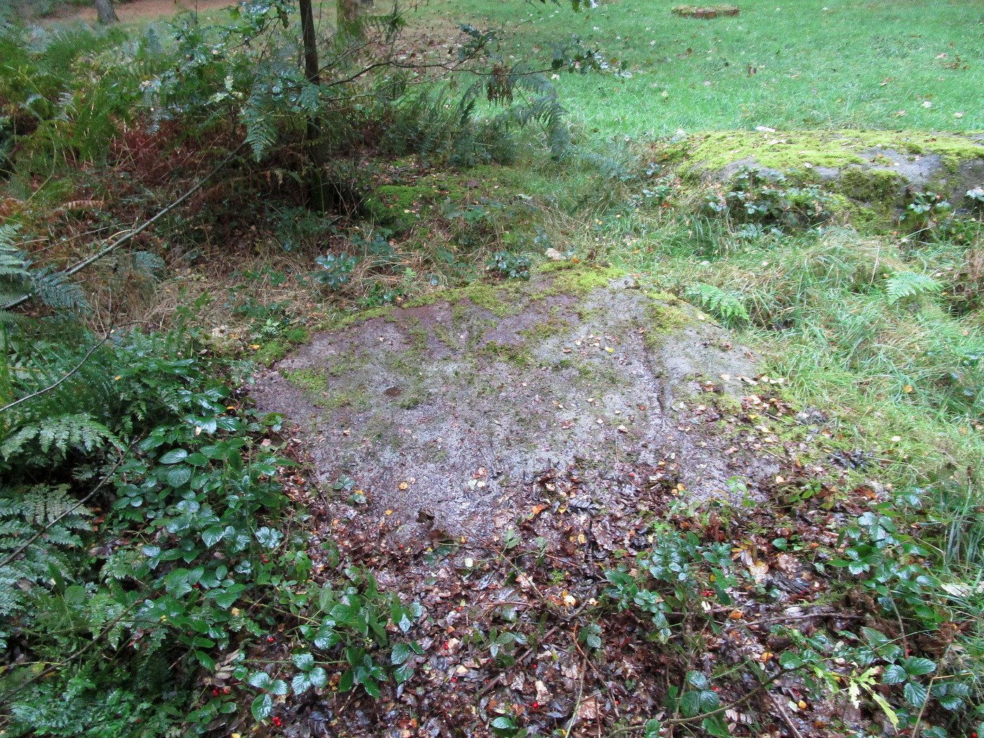
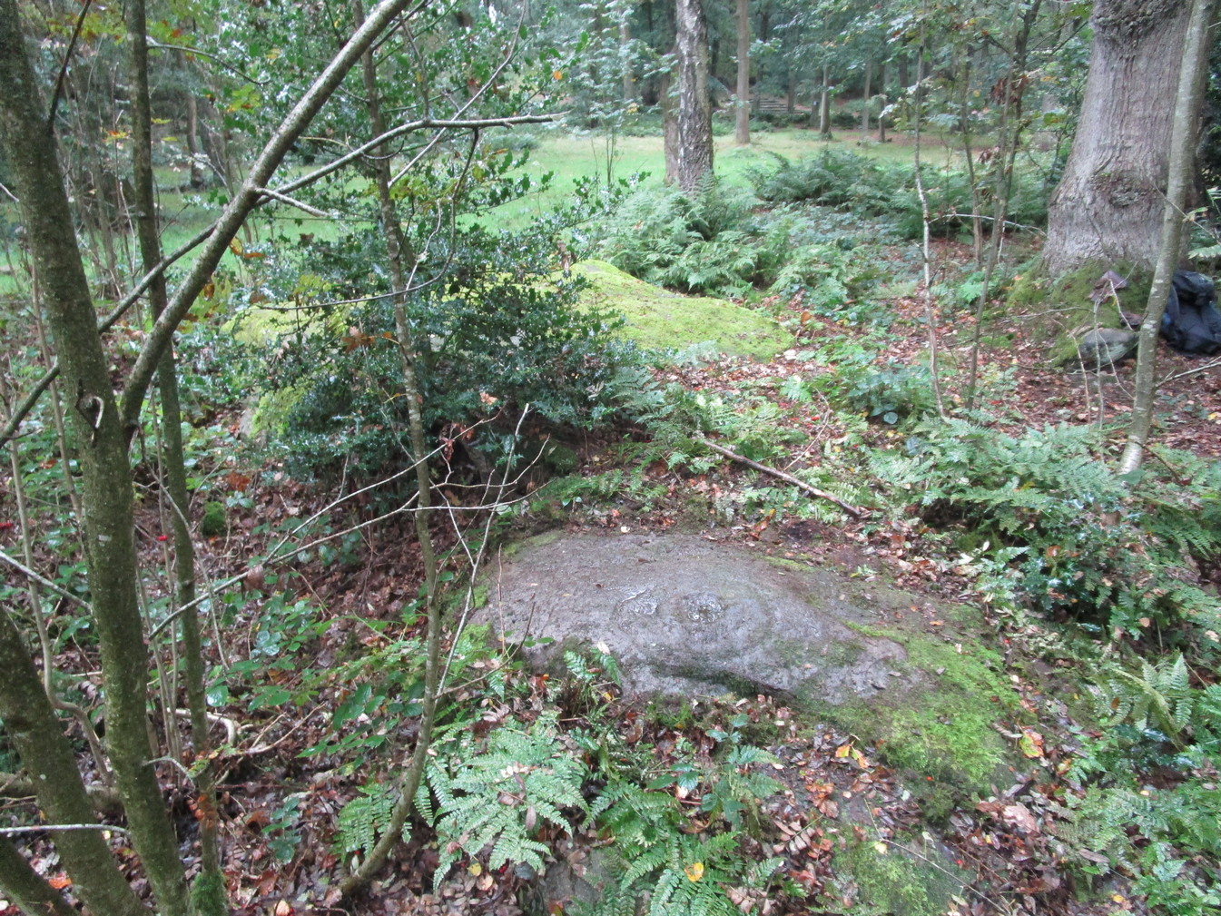
Follow the same directions as if you’re visiting the impressive Fairy Stone carving, then check out the overgrown rock three yards away, to the east. You might have to rummage under the scrubbage to see it, but you’ll find it if you want to!
Archaeology & History
I first found this stone in the 1980s when I’d been shown the Fairy Stone carving which, at the time, was thought to be all alone. But I used the olde adage: “where’s there’s one cup-and-ring, others tend to be“—and found this and several others closed by.
Large messy cup-and-ring
It’s a relatively small, slightly-domed earthfast rock, upon which we find an unusually large cup-and-double-ring design with a carved line running from the large central cup out to the edge of the stone. However, the carved lines that constitute both the inner and outer rings are ‘crude’ in form and style when compared to the vast majority of other British petroglyphs; and for some reason, this aspect of the design has me casting doubts over its prehistoric authenticity. I hope I’m wrong!
References:
Bennett, Paul, ‘Tales of Yorkshire Faeries,’ in Earth 9, 1988.
Bennett, Paul, The Old Stones of Elmet, Capall Bann: Milverton 2001.
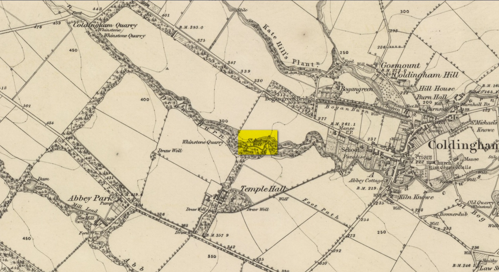
By the side of the stream known as St Andrew’s Burn, in the small wooded glen to the rear (west) of the Crosslaw Caravan Park (right by the side of the A1107 road), you can still find the flowing waters of this all-but-forgotten holy well that was dedicated to Scotland’s patron saint, god knows how long ago! The first description I’ve come across relating to the site is in William King’s (1858) early work on Coldingham Priory, where he told that,
“In a dean a little westward from the village, and on the border of the property of Bogangreen, is a spring of excellent water, called St Andrew’s Well, from which the monastery was supplied by leaden conduits, portions of which are occasionally turning up to view. These pipes are thick and well made.”
Fifty years later when Adam Thomson (1908) penned his magnum opus on Coldingham parish, the well was still in a good state of affairs. Hereby there grew much chamomile which, he thought, “the monks were wont to cultivate for the healing of the sick.”
Folklore
St Andrew’s feast day is November 30 and is known as Anermas.
References:
Hunter, William K., History of the Priory of Coldingham, Sutherland & Knox: Edinburgh 1858.
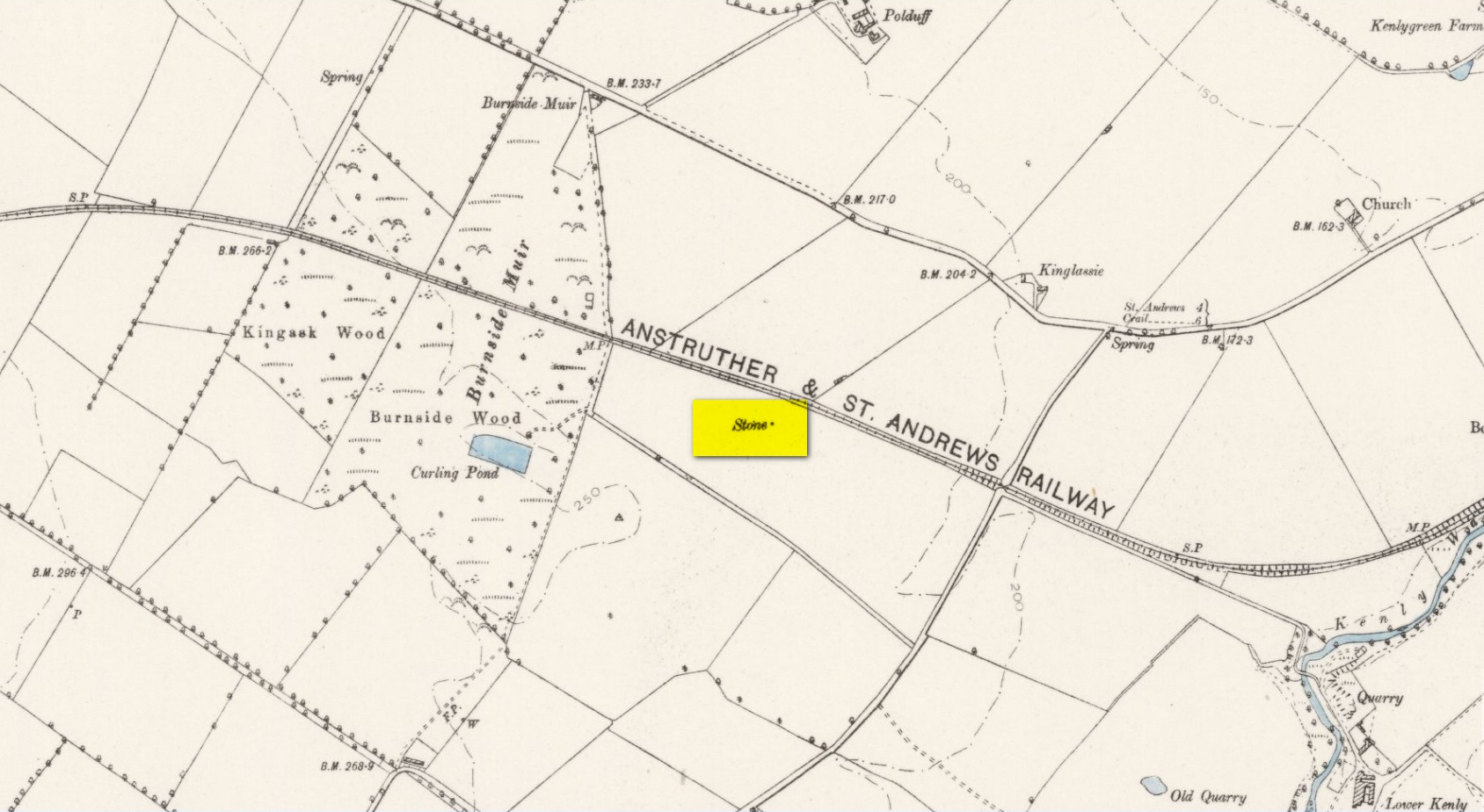
Take the A917 road southeast out of St Andrews, heading towards the hamlet of Boarhills about 4 miles away. However, about a half-mile before you get to Boarhills, keep your eyes peeled for a small minor road on your right, signposted to Dunino, 3 miles. Go along here for about 350 yards where you’ll reach a track cutting across the road. Walk up the gently sloping field here on your right and you’ll see, 400 yards from the road whence you’ve parked, a tall thin upright stone standing alone…
Archaeology & History
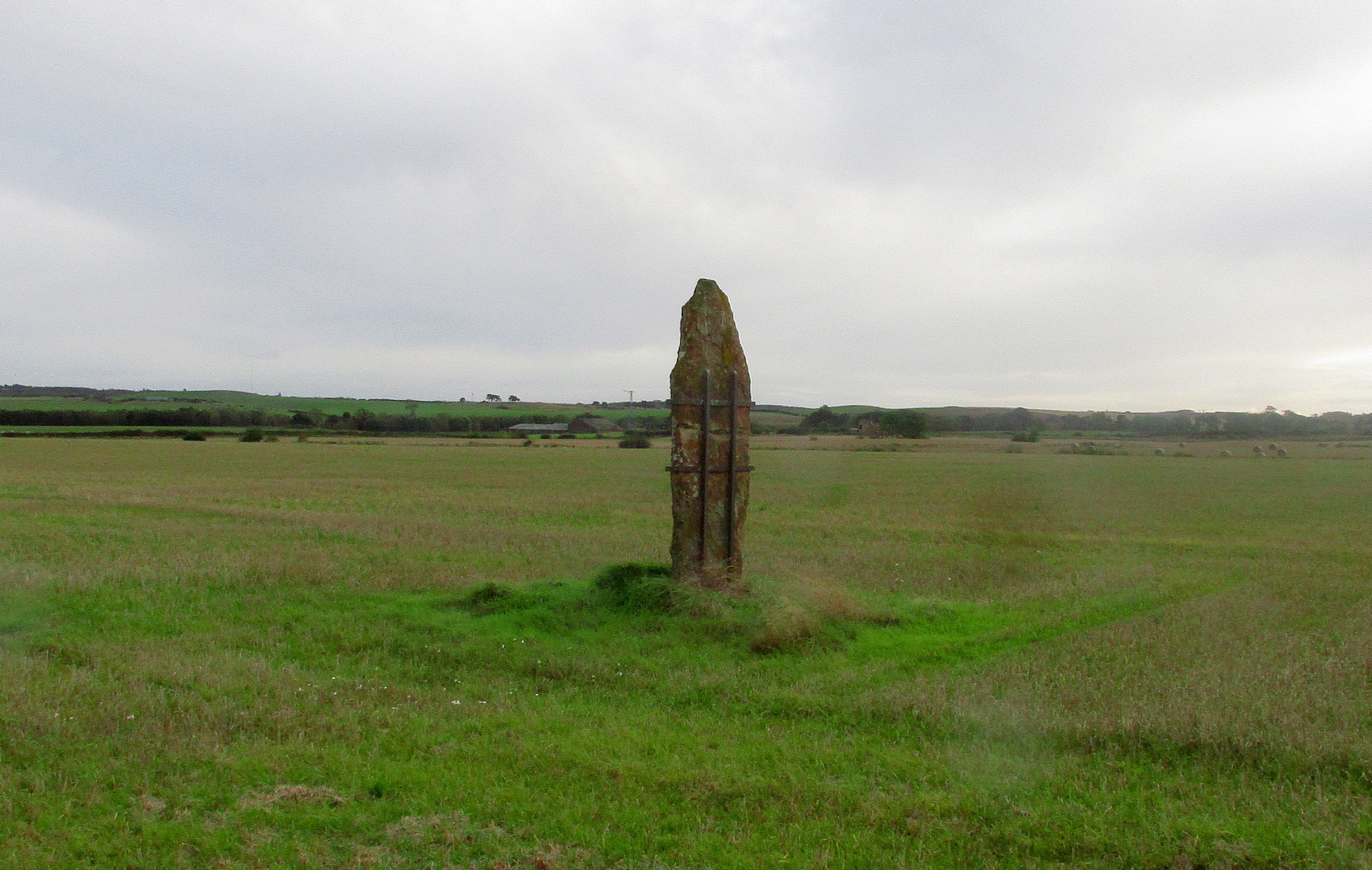
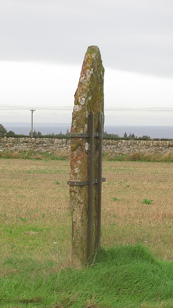
Highlighted on the 1893 and 1896 OS-maps (as merely a “Stone”), this tall and incredibly skinny standing stone has seen better days. After many-a-millenia, the god of storms cut the stone to the ground not too many years ago, leaving it broken in the middle o’ the field where once it stood. Thankfully however, local folk ensured that it was eventually resurrected and fixed into position once more, albeit in a somewhat ugly cage—or corset as Mr Hornby called it!
The Royal Commission (1933) lads checked the stone out for inclusion in one of their damn good surveys, they told us the following:
“About midway between the farms of Polduff and Peekie, and on the south side of the Anstruther and St Andrews Railway, 200 feet above sea level, there is a fine block of red sandstone, which rises to a height of just over 9 above ground. It averages 4¼ inches in thickness and measures 2 feet 4 inches wide across the broad faces. The stone has been set up with the major axis north-east and south-west and has been well packed round the base with smaller stones.”
Interestingly—to me anyhow—when the monolith was recently stood back in its upright position, the archaeo’s found a spring of water beneath it. Many dowsers (and I don’t mean the ones who fallaciously reckon they’re finding ‘energy lines’ all over the place) have found the crossing of underwater streams and water sources to be a common feature beneath megalithic sites.
Folklore
In Richard Batchelor’s (1997) short work on the ancient sites of this area, he calls attention to what a Mr N. Dow thought was a ley-line passing from the cairn on top of Kellie Hill 4¾ miles (7.64km) away, northeast to the Peekie Stone, and which Mr Batchelor points out is close to the major lunar standstill.
References:
Batchelor, Richard A., Origin of St Andrews, Shieling: St Andrews 1997.
Royal Commission on the Ancient & Historical Monuments, Scotland, Inventory of Monuments and Constructions in the Counties of Fife, Kinross and Clackmannan, HMSO: Edinburgh 1933.
Acknowledgements: Huge thanks to Paul Hornby for use of his photos.
Holy Well (destroyed): OS Grid Reference – SE 6071 5187
Archaeology & History
At the beginning of the 19th century, William Hargrove (1818) described the scant remains of some old walling along old Haver Lane (renamed as Green Lane and now known as The Stonebow) which were the remains of a building, long gone, and which,
“tradition informs us (was) a religious house, which formerly stood here, called Holy-Priests; and though the site of it is not known, the report is greatly strengthened by the appearance of the walls just mentioned, and by the circumstance of a deep draw-well which now remains, being still called Holy-Priests Well.”
Some suggest that this water source may still exist beneath one of the buildings hereby, but the landscape here has been so badly mutilated over the last two hundred years that it’s very unlikely.
References:
Hargrove, Willliam, History and Description of the Ancient City of York – volume 2, part 2, W. Alexander: York 1818.
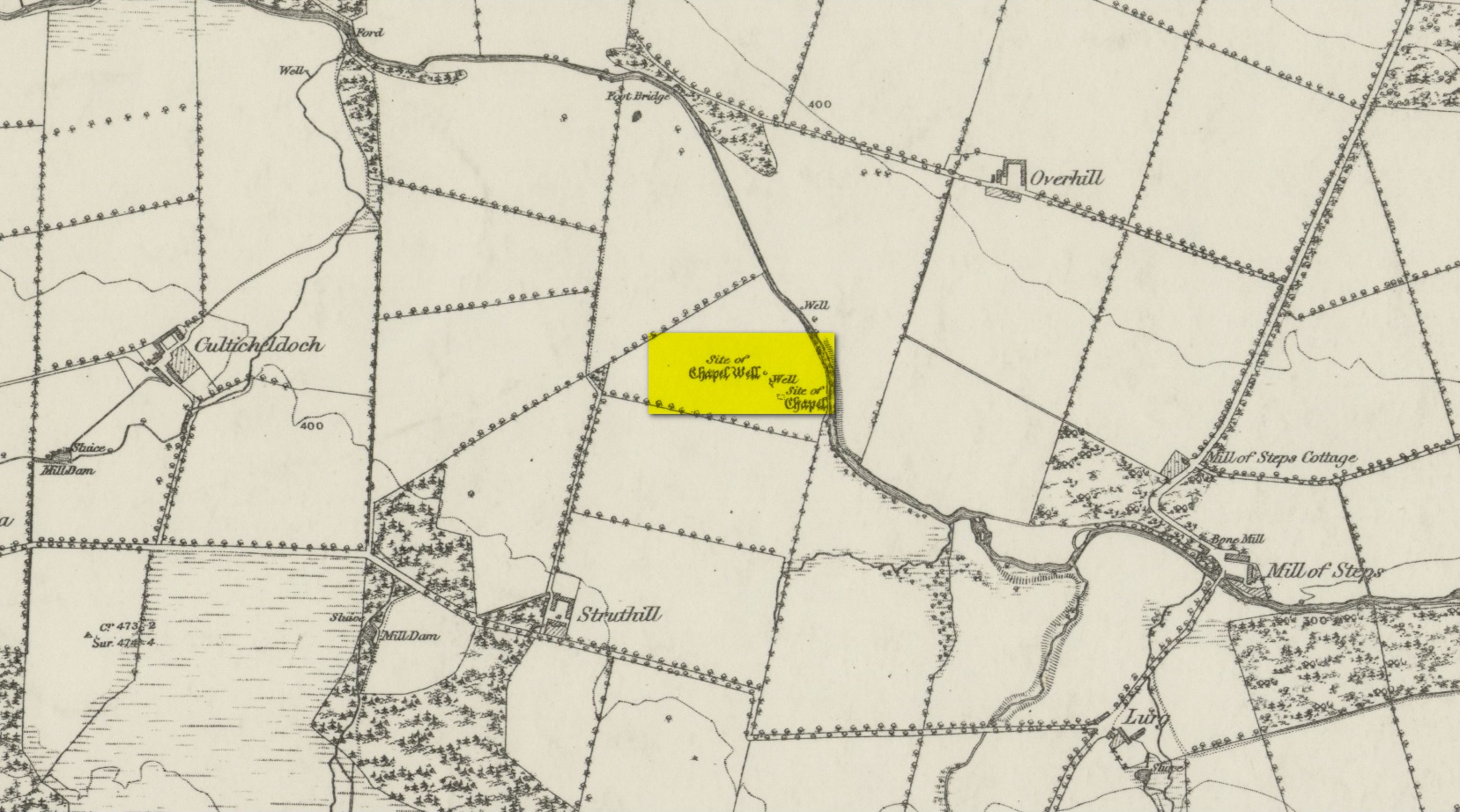
From Muthill, go up Thornhill Street out of the village for nearly 1½ miles. You’ll have just passed the double hairpin bend, crossed the rivulet, then reached the large old farmhouse of Lurgs. From here, turn right and after just over half-a-mile you reach Struthill where, running by the side of the house, is a small trackway. Ask the folks at the house, who are most helpful, and walk down the track for nearly 400 yards and go through the first gate on your right, crossing the field until it dips down to the burn. The boggy marshy mass running from near the top of the slope is what you’re looking for!
Archaeology & History
Shown on the 1863 map as the Chapel Well, the dedication of the waters to St. Patrick coincided with a chapel that once stood here, also in his name. Very low faint remains of the chapel, completely overgrown, can still be made out amidst the rushes. It’s one of two holy wells in Muthill parish that are dedicated to St. Patrick.
Very little of any real spring of water can be seen nowadays. Indeed, the site today is merely a much overgrown bog-of-a-well whose water oozes down the slope into the Juncus rushes, trickling into the adjacent burn. I had a drink of the water from the slopes, which tasted OK and did me no harm whatsoever.
Folklore
The most important aspects of this site was its use by local people and the attributes it was given. We know not how far back such folklore goes, but it would have been many many centuries, if not millenia. Water worship (if that’s the right word) is the most archaic of all traditional forms of veneration. This place was no exception. In John Shearer’s (1883) excellent local history work, he gave the following account of the site:
“About a quarter of a mile west from the Mill of Steps, upon a height on the right bank of the Machany, are to be seen the ruins of a small chapel. When other places of Popish worship were thrown down after the Reformation, the Presbytery of Auchterarder ordered it to be demolished about 1650 to repress the superstitions practised at this place of resort. West from the chapel is an excellent spring which was held in great veneration in those dark ages of superstition, when the ignorant and credulous populace were deceived by the crafty priests who stood below the spreading branches of an ancient ash which grew near the fount, pronouncing a benediction on the weary pilgrims as they drank of the waters. And as it was celebrated for its healing qualities in many different distempers, numbers yearly visited it from a great distance to benefit by its virtues with as much devotedness as the Mahometan pilgrims visit the tomb of their Prophet. Insanity was also cured here. Several persons testified before the Presbytery of Stirling, in 1668, that having carried a woman thither, they staid two nights at a house hard by the well. The first night they bound her twice to a stone at the well, but she came into the house to them being loosed without any help. The second night they bound her again to the same stone and she returned loosed. And they also declared that “she was mad before they took her to the well, but since that time she is working and sober in wits.”
“This well was still celebrated in the year 1723 and votive offerings were left, but no one then surviving appeared to appreciate the virtues of the stone. Small offerings were given in coin and thrown into the well and those who had no coin brought white stones which were laid in regular order along the declivity where the water runs to the river. Coins have been of late found in the well and the white stones are still to be seen. The officiating priest generally resided at Drummond Castle. Within the last sixty years, several of the gentry have come in their carriages to inspect these relics which were held in so great reputation in ancient times. The chapel and well are about one mile south west from Muthill.”
References:
MacKinlay, James M., Folklore of Scottish Lochs and Springs, William Hodge: Glasgow 1893.
Holy Well (destroyed?): OS Grid Reference – SO 9609 8284
Archaeology & History
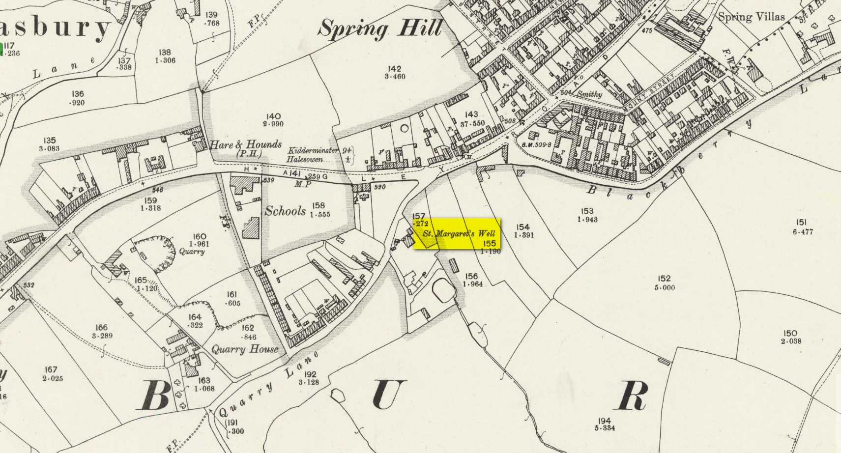
The site on the 1904 map
Shown on the 1904 OS-map, beneath the aptly-named St Margaret’s Hill on its northern side, we can see where the holy well of St Margaret used to be, not too long ago. Although it seems to have fallen pray to industrial destruction, there are a number of old references to the site, mainly gathered together in Jeremy Harte’s (2008) magnum opus on the subject. It was also mentioned in a survey by the British Geological Society (Richardson 1930) where we were told that it was,
“in the private grounds of a house recently erected, and is a spring issuing from the Halesowen Sandstone at the junction of two faults (shown west of the ‘H’ of Hasbury on the new series Geological Map, Sheet 168) about 100 yds SW of the point where Blackberry Lane joins Hagley Road. It is referred to, as a well of good cold unmineralised water, by T. Nash in 1781.”
And it was Mr Nash who gave us the earliest description of the place, saying:
“In the hamlet or township of Hasbury is an ancient holy well, called St Margaret’s Well, which formerly had much good stonework about it; but that was wholly removed in the year 1747. One of these stones contained some curious sculpture, the figure of a man in a posture of hasty walking, and in the next compartment that of another man leaning on crutches… This place is called Margaret’s Hill and the water of the well supplies a small brook, which runs below the Grange, and falls into a piece of water at the end of the town, called Cornbow Pool.”
It’s more than probable that the old carvings he described—of one man on crutches and the other of a figure walking speedily—represents one of the main curative allegations that these waters possessed. Cases of people walking on crutches to sacred wells, drinking the waters, then walking away without them (and in many cases leaving their crutches at the well-side as testament to its properties) are commonplace. And, aptly enough, the curative elements of this ancient site has been maintained in modern times with the medical centre of St Margaret’s Well Surgery being built by this very spot!