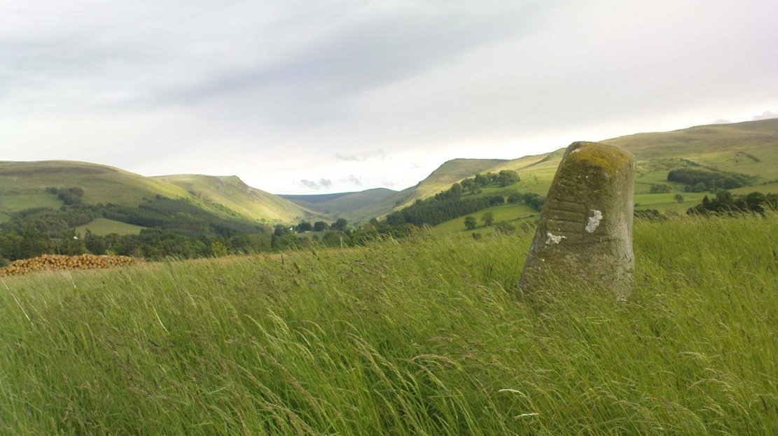
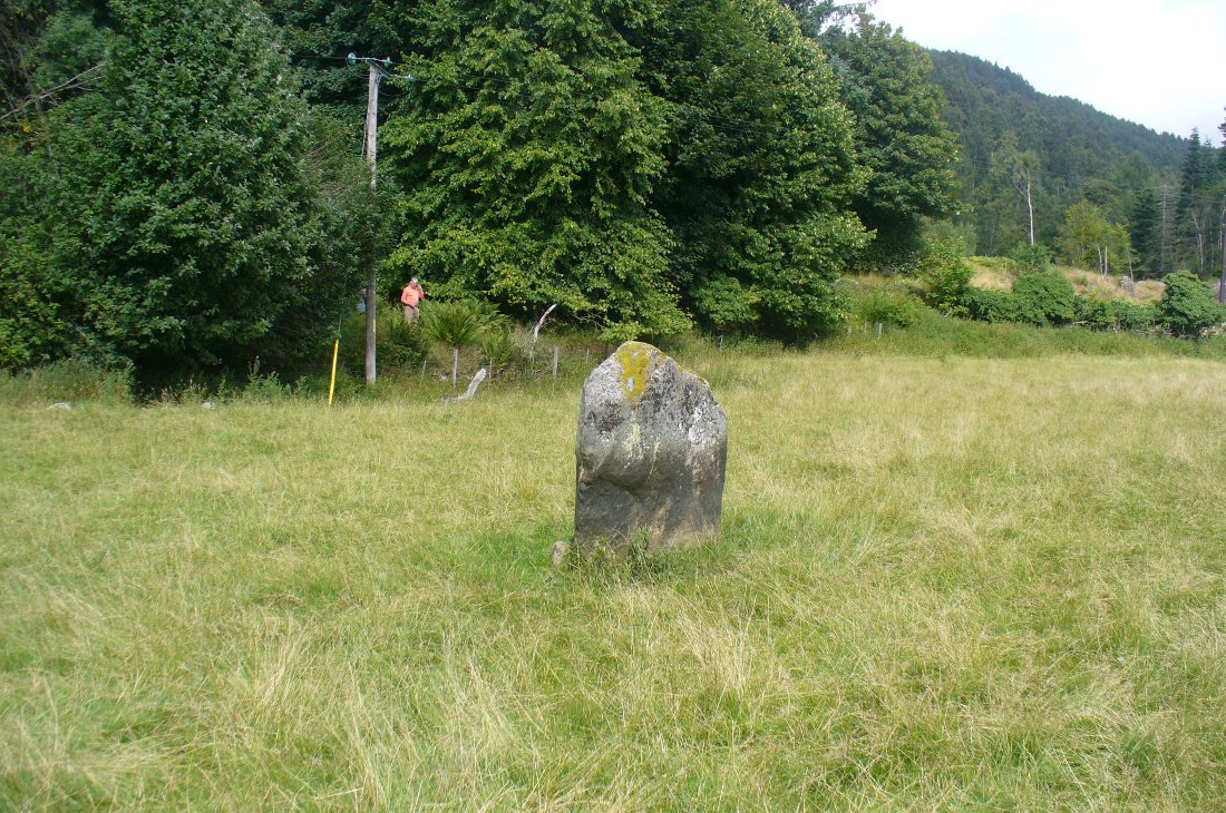
Take the A923 road through Dunkeld and across the river, making sure that where the road veers sharply to the right as you go out of town, you go the left as the road bends round. 100 yards along, past the trees on your left, fields open up. A few hundred yards along on the left, you’ll note the small standing stone about 50 yards in the field below the wall, getting close to some trees again. That’s the spot!
Archaeology & History
The stone is given only a passing mention in the Royal Commission’s (1994) poor work on the region, describing neither its height nor form and erroneously relating it to what is probably a much earlier series of pit alignments in the same field. Thankfully we had a better description from the early 20th century antiquarian Fred Cole (1908) who visited and drew the site and who told us:
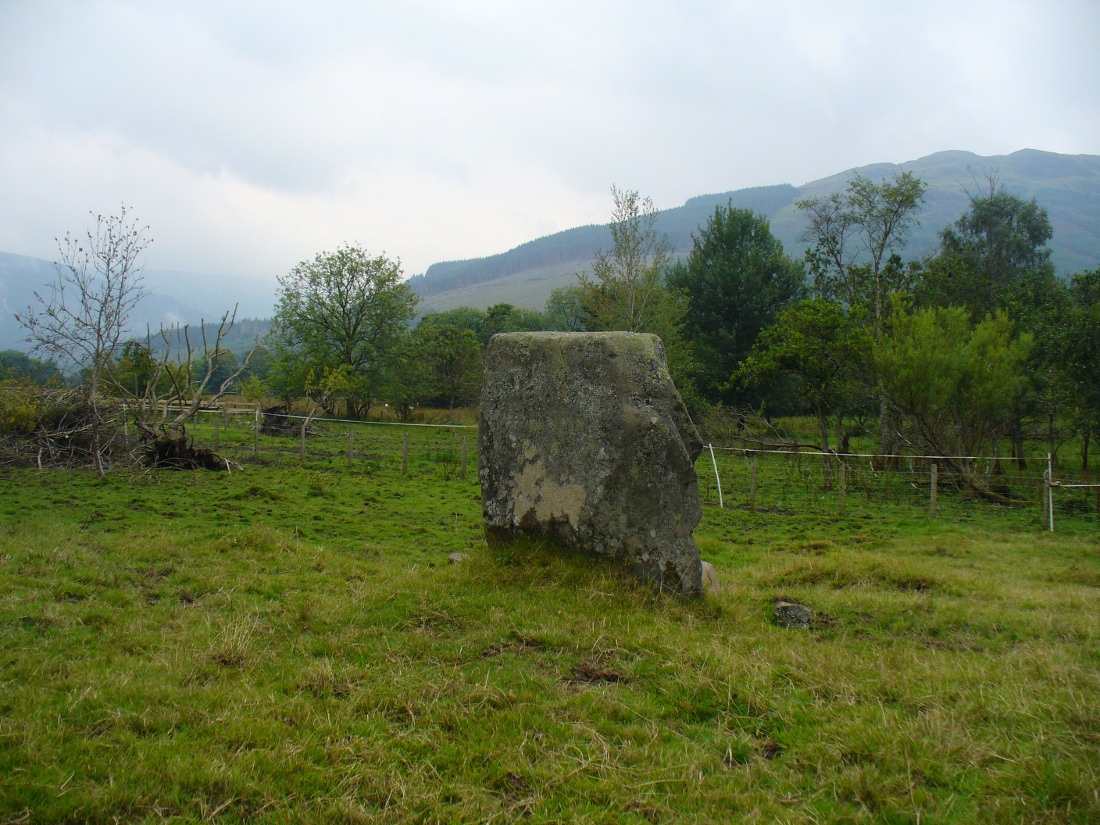
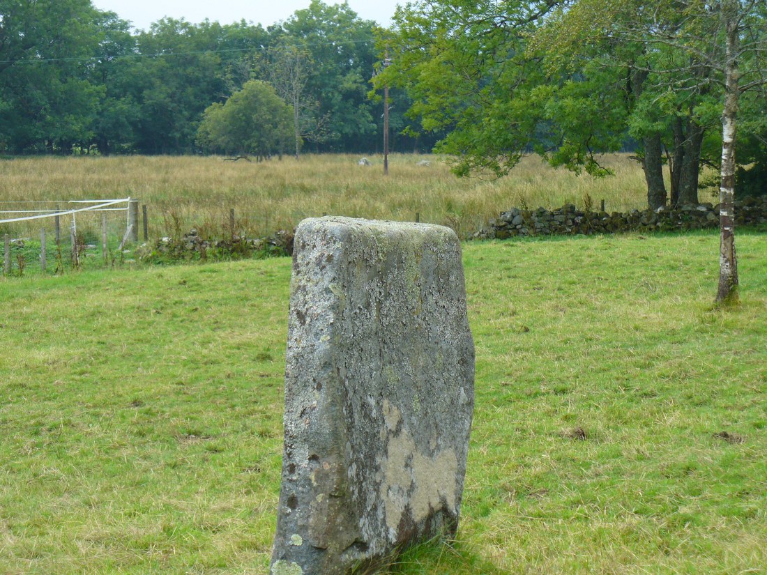
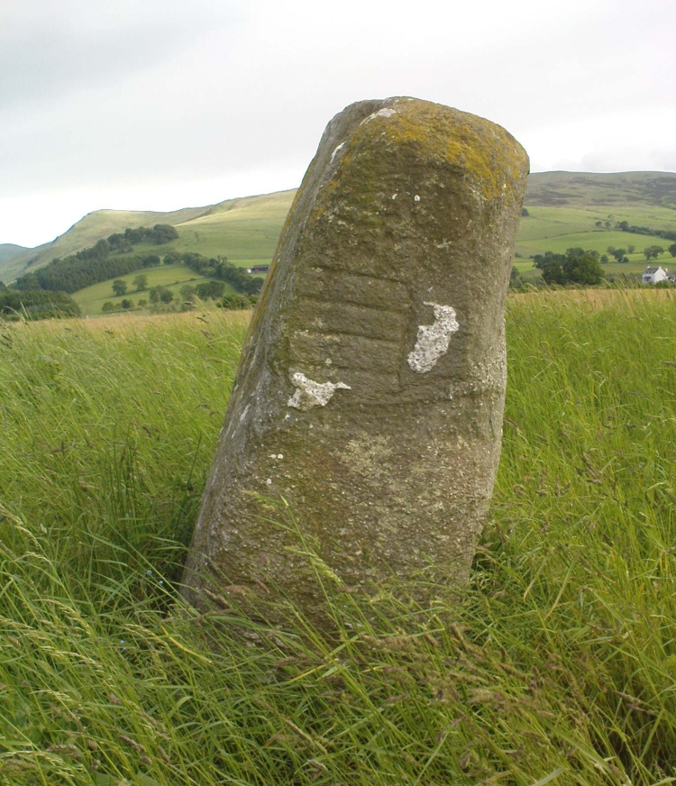
Standing stone, looking NEDunkeld Stone looking north
“This Stone is marked on the Ordnance Map in a field behind the Lodge, at a height above sea-level of 300 feet, and styled “sepulchral.” In size and character it much resembles the Kilmoraich monolith, and seems to have stood solitary for ages. It is a roughly oblong slab of schist, set with its longer axis nearly east and west, the north face measuring 4 feet and the south 4 feet 9 inches, and the basal girth about 10 feet 7 inches. It is 4 feet 9 inches in height. The grandly-timbered policies of the ducal estate enclose this site on all sides. In the illustration…the Stone is drawn as seen from the east.”
Close to the walling on the WNW just a few yards away, we see a cluster of small rounded stones and a couple of larger stones, much overgrown, giving the impression that they were field clearance. There is a possibility that they may have had something to do with the standing stone in earlier times; the small stones being very worn and perhaps being part of a cairn—although there seems little evidence of this in the on-line aerial surveys. The stone was also mentioned in Elizabeth Stewart’s Dunkeld (1926), where she wrote:
“In the park near Polney Loch, one mile from Dunkeld, is a Standing Stone, quite noticeable from the Highland road. This monolith is one of those styled sepulchral, and is a rough oblong slab of schist, its basal girth being 10 feet 7 inches, and its height 4 feet 9 inches. Mr. Coles, who describes this stone in the “Proceedings of the Society of Antiquaries”, supposes it to have been part of a circle. It is not far from the ancient stronghold on King’s Seat.”
From Balquhidder village, take the road east towards Auchtubh as if you’re gonna visit the Priest’s Stone, just past the house of Tom na Cruich on the right-hand side of the road. When you get to the house, if you ask the owners there how best to get to the stone, they are very friendly and very helpful in pointing you in the right direction.
Archaeology & History
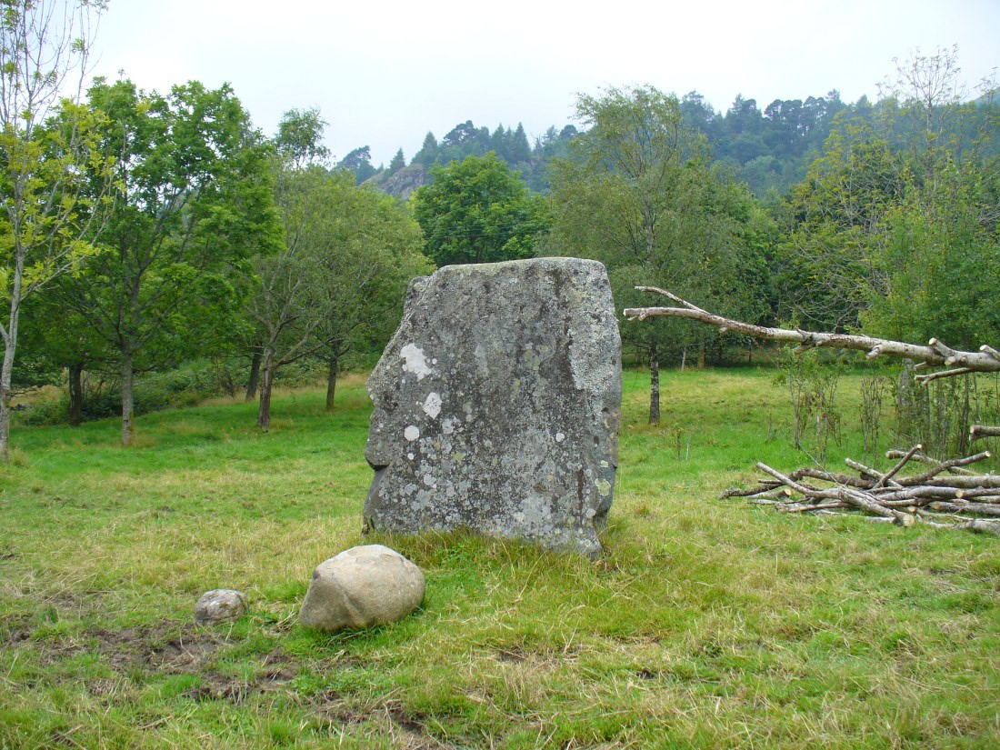
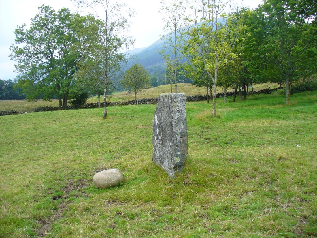
This solitary standing stone first seems to be mentioned in J.W. Gow’s (1887) essay on the prehistoric antiquities of this part of Rob Roy’s country. Found below the house and hillock where the old gallows used to be, he told:
“On the level ground below (Tom na Croich) …there is a prominent monolith, standing about 4½ feet above ground, quite flat, on the top. It is shaped like a wedge, with the edge to the east, and is famous in Balquhidder as the place where trials of strength took place.”
Note the stones in next fieldPuidrac Stone, looking N
Below the standing stone is a small rock, whose predecessor played an important part in some local traditions relating to this site. (see ‘Folklore’ below) Also, due west of here in the next field, you will be able to see a couple of seemingly upright stones in the tall reeds 200 yards away, which early records say were part of a stone circle—now much in ruin—known as Clachan Aoraidh or the Worshipping Stones. There is the possibility that this single stone was an outlier to the circle. It’s astronomy might be worth checking….
Folklore
When we visited the stone last week, the owners of the house above asked if we’d managed “to lift the stone”—and I wondered what they meant at first, until they told us the folklore about the site. They narrated the tale almost exactly as it had been described first of all in J.W. Gow’s (1887) essay, which said the following:
A new ‘lifting stone’ in front of Puidrac
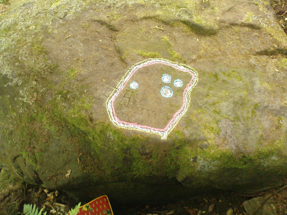
“It is shaped like a wedge, with the edge to the east, and is famous in Balquhidder as the place where trials of strength took place. A large round water-worn boulder, named after the district, ‘Puderag’, and weighing between two and three hundredweight, was the testing stone, which had to be lifted and placed on the top of the standing stone. There used to be a step about 18 inches from the top, on the east side of the stone, on which the lifting stone rested in its progress to the top. This step or ledge was broken off about thirty years ago, as told to me by the person who actually did it, and the breadth of the stone was thereby reduced about 8 inches. This particular mode of developing and testing the strength of the young men of the district has now fallen into disuse, and the lifting-stone game is a thing of the past. A former minister of the parish pronounced it a dangerous pastime. Many persons were permanently injured by their efforts to raise the stone, and it is said that he caused it to be thrown into the river, but others said it was built into the manse dyke, where it still remains. There were similar stones at Monachyle, at Strathyre, and at Callander, and no doubt in every district round about, but the man who could lift ‘Puderag’ was a strong man and a champion.”
The present stone that is positioned on the ground below the standing stone was put here in much more recent times.
References:
Gow, James M., “Notes in Balquhidder: Saint Angus, Curing Wells, Cup-Marked Stones, etc”, in Proceedings of the Society of Antiquaries Scotland, volume 21, 1887.
Acknowledgements: To Kenny and Laura for their help and guidance here. Huge thanks!
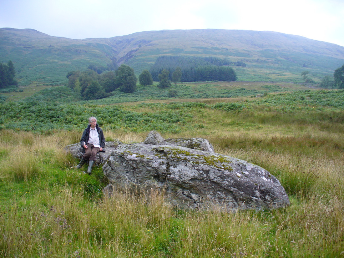
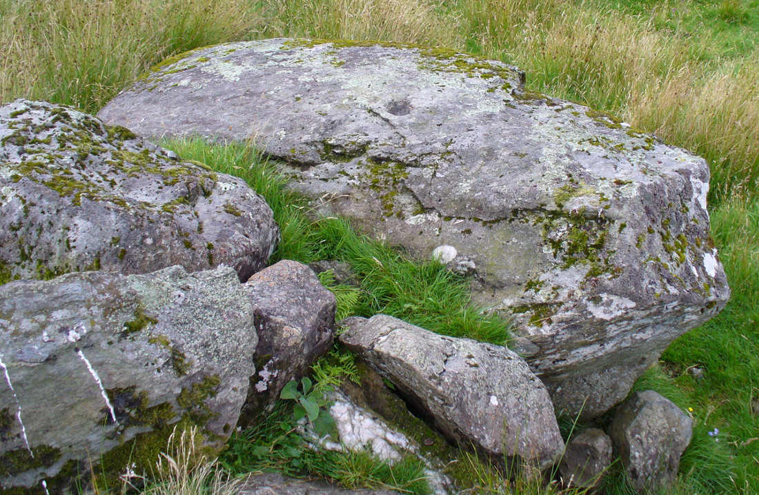
From Balquhidder village, walk eastwards along the road for a few hundred yards until you reach Auchleskine Farm on your left. A short distance past here there’s a gate taking you into the rough field on the left. Go through here and note a large clump of rocks diagonally up the slope about 100 yards away. That’s your spot!
Archaeology & History
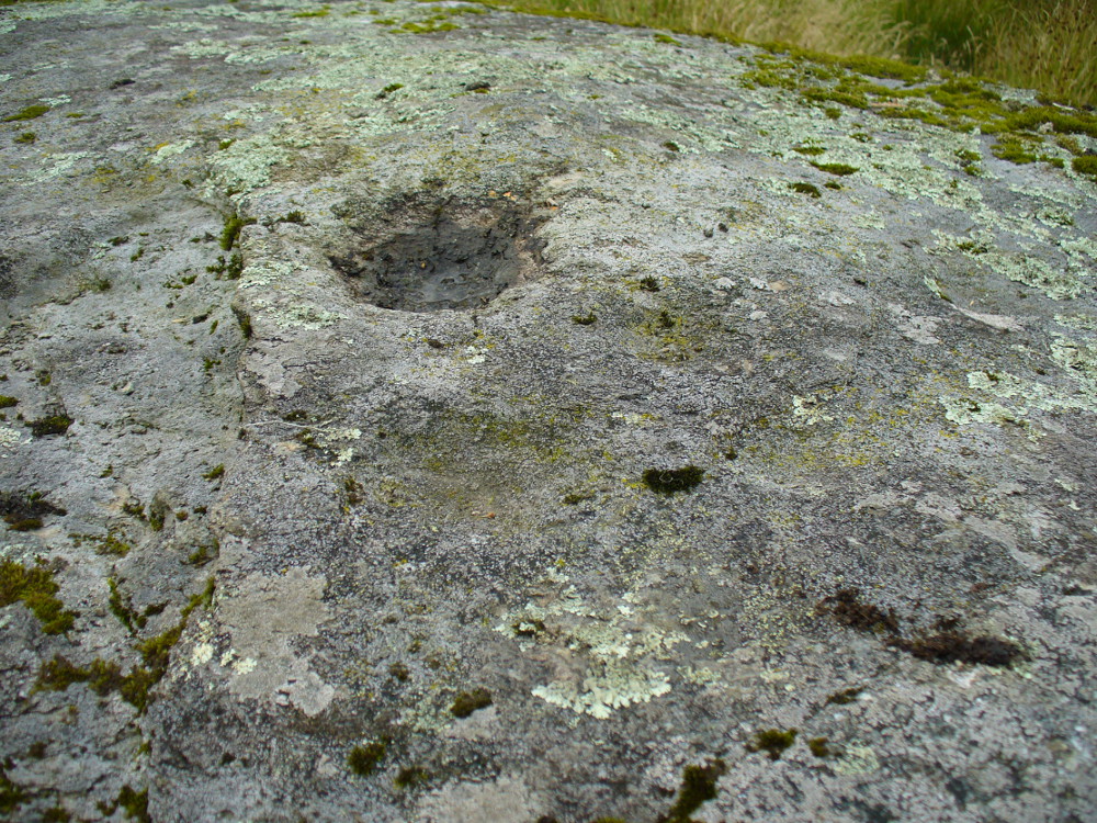
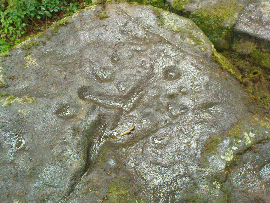
Very little has been said of this large cup-marked stone, just up from the road near Balquhidder. It was first found and described in J.M. Gow’s (1887) fine essay on the local antiquities of the area, where he told:
“About 400 yards directly east from the farm-house there is a group of three large water-worn boulders of coarse mica-schist, with veins of quartz, the largest of which is about 15 feet long, 7 feet broad, and nearly 5 feet above ground. On the top of this stone there are seven cup-marks of various sizes. The largest are 5 inches in diameter and 2 inches deep; the smaller ones are shallower and from 1½ to 2½ inches in diameter. There may have been more marks on this stone, as a portion of the top near the marks has been broken off, and there are several other faint hollows, but, in my opinion, not sufficiently pronounced to indicate that they ever were cups.”
Cupmarks on top of the rockThe carving from above
Although his caution on the number of cups on the stone is to be commended, it was obvious during our visit to the site a few days ago that there are at least 18 cup-marks on the surface of this large rock. There may be more (the grey cloudy day and misty light wasn’t good in allowing us to see the carving clearly). The most pronounced of the cups are on the very top of the stone, whilst others were carved mainly on the eastern slope of the rock.
At least two other cup-marked stones occur at the farmhouse itself, whilst on the road immediately below was once the cup-marked healing stone known as Clach nan Sul. It’s likely that other carvings are hiding away in the hills hereby…
References:
Gow, James M., “Notes in Balquhidder: Saint Angus, Curing Wells, Cup-Marked Stones, etc”, in Proceedings of the Society of Antiquaries Scotland, volume 21, 1887.
Follow the directions to reach Panorama Woods carving 232. Barely a yard or two southwest across the small gap where the kids have their little den or hideout, this long curvaceous rock is the fella in question.
Archaeology & History
Cup-markings on the rock
Curiously not included in the ‘official’ records, this large piece of rock, living right in between the Panorama Woods carvings 231 and 232, has at least two, possibly three faint cup-marks etched in the top northeastern portion of the rock. Of the same style and probably period as the basic designs on stones 230 and 231, this is one in a cluster of petroglyphs that used to live at the edge of a prehistoric enclosure, destroyed at the end of the 19th century.
References:
Bennett, Paul, Of Cups and Rings and Things, unpublished: Shipley 1981.
Bennett, Paul, The Panorama Stones, Ilkley, TNA: Yorkshire 2012.
Take the Wells Road from Ilkley centre up towards White Wells, bending to the right as you hit the edge of the moor. Keep along the road, past the old college building with its lake and turn right up Westwood Drive. Keep going all the way up till you hit the small woodland on your right. Where the woodland ends – stop! Walk into the trees about 10-15 yards and you’ll see the large rocks ahead of you. Amongst other petroglyphs hereby, you’ll find this carving is on one of them.
Archaeology & History
Close-up of deep cups & grooves
Although only given the usual dry description by our academic catalogue chaps, there’s something about this design that I’ve always liked. We first came across it ourselves in the late 1970s, in search of the legendary Panorama Stones, and found instead this large enclosure design with at least three cups inside it, still clearly visible. It is one of a cluster of carvings hereby, all of which were once adjacent to a prehistoric enclosure, described in the 1880s and destroyed soon after. This and the associated carvings very probably had some archaeocentric relevance to the lost enclosure.
Large carved ‘enclosure’, recently chalkedDrawing of the carving (after Hedges 1986)
The carving is sandwiched in between its petroglyphic companions, stone 231 and stone 233. As can be seen on some of the photos here, more recent vandalism has been inflicted on this carving and the recent chalk colouring is what local archaeologists Gavin Edwards and Alex Gibson have termed “social history”, implying fallaciously that cup-and-ring art could be seen as little more than neolithic and Bronze Age scribblings on rock, without any meaning other than it being comparable to “Leeds United Rules OK.” They may be right (highly unlikely) – but in reading copiously about prehistoric petroglyphs in cultures beyond the UK, we find that traditional societies tell such carvings relate to their creation myths, or river spirits, or rock spirits, and are intrinsically related to wider animistic cosmologies and social customs. This indicates, to me at least, that modern archaeologists who think of rock art as little more than childish scribblings still have a great deal to learn and we should beware their uneducated musings about our ancient carvings.
Although the complete carved ‘enclosure’ and its internal cups were mistakenly drawn in John Hedges (1986) survey, he described as being a,
“Roughly incised ‘enclosure’ with five cups in it, twenty eight shallow cups or depressions, one large oval marking, three irregular basins.”
In the later work of rock art students Boughey & Vickerman’s (2003), they simply said of the site:
“Large flat-topped, upstanding rectangular rock. Twenty-eight shallow cups, a few enclosed in two groups by grooves; irregular small basins.”
References:
Bennett, Paul, Of Cups and Rings and Things, unpublished: Shipley 1981.
Bennett, Paul, The Panorama Stones, Ilkley, TNA: Yorkshire 2012.
Boughey, Keith & Vickerman, E.A., Prehistoric Rock Art of the West Riding, WYAS: Wakefield 2003.
Hedges, John (ed.), The Carved Rocks on Rombalds Moor, WYMCC: Wakefield 1986.
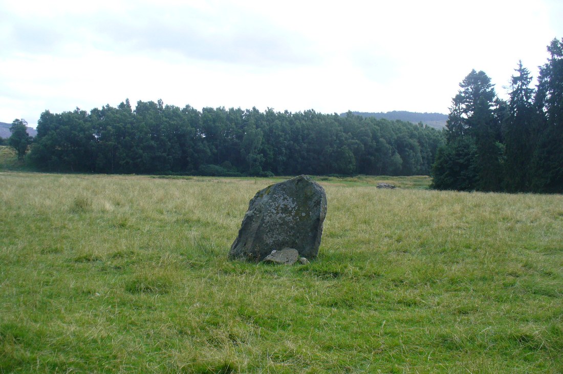
Take the same directions as if you’re visiting the multiple-ringed Agra Woods petroglyph (West Agra 8). From just below here, keep to the woodland side, and follow the line of tall drystone walling along to the east for a hundred yards or more, keeping your eyes peeled for the stone in question, just in front of a nice oak tree. You can’t really miss it!
Archaeology & History
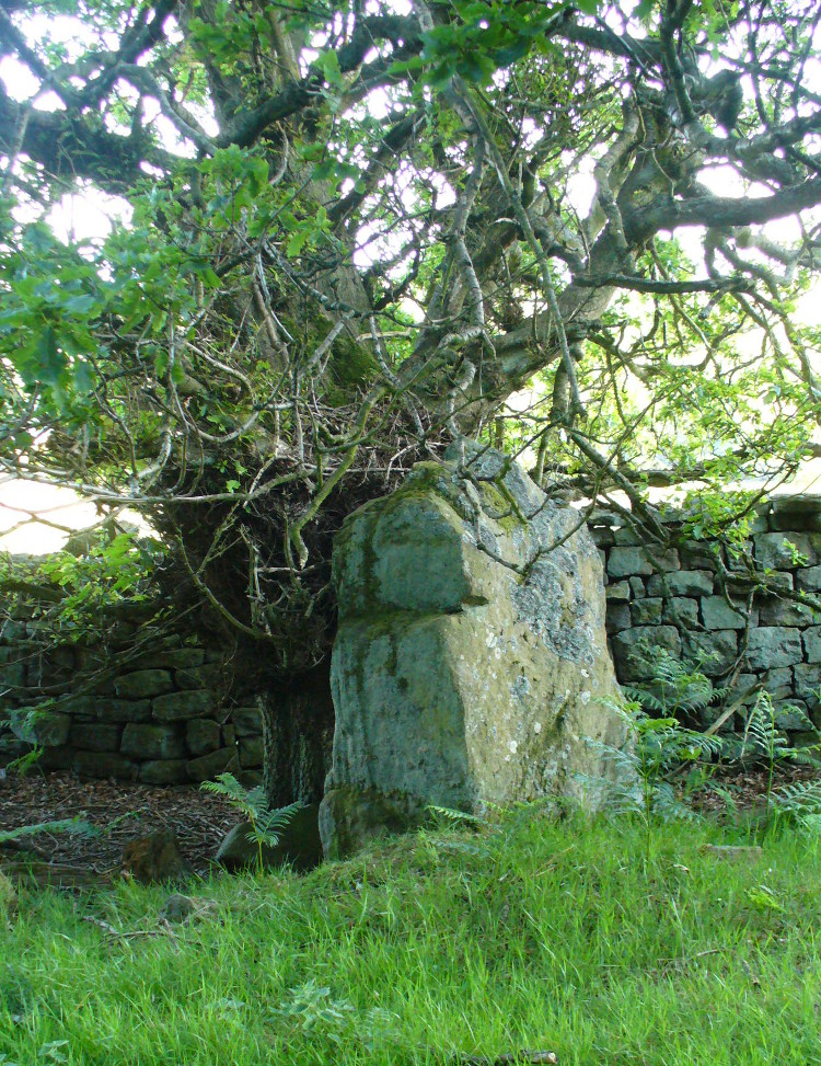
Not too far away from the scattered cluster of West Agra’s cup-and-ring stones, can be found this very bulky six foot tall standing stone, near the edge of the old walling on the inner-side of the Agra Woods. It was rediscovered by Paul Hornby on a Northern Antiquarian outing in May 2011, who told it to be “quite a massive thing!” (I’ve yet to visit the site so can’t give my personal impressions of the site)
Get to Pubil at the top of Glen Lyon, then walk on the track on the north side of Loch Lyon. Several miles along you turn up Glen Meurain. When you reach the crossing of the stream, follow the waters up Allt Meurain for about 3-400 yards until you find a small flat section of marshland right by the streamside. You’ll notice rocky undulations of human remains here, and a distinct small cairn of rocks near the top of this section. Have a good rest here (and I’d advise avoiding the place in the summer months).
Archaeology & History
Remote indeed is this small cairn—less than 3 feet high and 4 feet across—sitting by the burn-side in a place many miles from any human habitation. It is found amidst a small cluster of other archaeological remains close to each other, as if indicating a settlement of sorts, abandoned probably around the time of the Highland Clearances. Although it is highlighted on modern OS-maps in antiquated lettering, the cairn here looks like it is only a few centuries old. A larger mass of rubble stone is found adjacent to the small pile of rocks, from which it may originally have been taken. Without archaeological analysis we will not know for certain the real age of this old tomb.
MacRee’s Cairn & adjacent rubble
Folklore
The small grassy hillside immediately across the trout stream here is known as Sith Trom’aidh – the Sad Fairy mound, whose history appears to have been lost. Alexander Stewart (1928) told that this cairn was the burial place of one of Colin Campbell’s dairymaids, found and slain here during a skirmish with cattle raiders in the 16th century.
References:
Stewart, Alexander, A Highland Parish; or, The History of Fortingall, Alex MacLaren & Sons: Glasgow 1928.
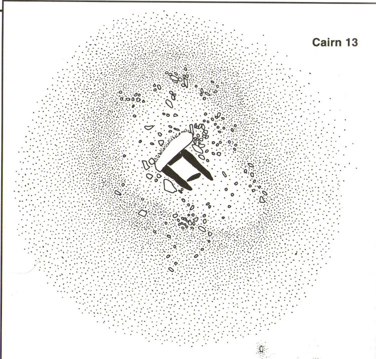
A very well-preserved prehistoric cist and cairn (grave), sat amidst a valuable prehistoric landscape full of megaliths and other important prehistoric remains. Megalith enthusiast and antiquarian, Nik Megalithic, told that:
“The cairn is about 12 m diameter and 1 metre high, and has a large Kist in the middle. The cist has side slabs about 2 metres long and spaced 1 metre apart, and it is about 0.7m deep. The large capstone is tipped off to the west, and can be seen protruding above the cairn from quite some distance away.”
Described in association with the rich mass of other tombs and megalithic stone rows here, author Jeremy Butler told that,
“Cairn 13 is also in line with (cairns) 1-4, but just out of sight around the hillside 150m to the northwest. The mound contains a well-preserved cist, “a very fine example”, according to Worth, who cleared it out about 1900 but with “no result from excavation.” The displaced cover and massive side-slabs project well beyond its ends.”
Both Butler and Worth mention how cairn 13 is part of an alignment with two other cairns very close by.
Folklore
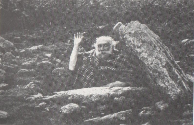
Spike Milligan in his tomb
Although legends of giants and pixy folk are well known round here, there is nothing specific I can find to this one site. One of the most important finds in recent years—as the photo above shows quite clearly—was the fact that before joining The Goons, the British comedian Spike Milligan used to live in this prehistoric tomb. When asked why he didn’t live in a house like other normal people, he invited us in for a cup of tea. Some historians believe that the person in the photo is in fact Mr R.H. Worth—author of Worth’s Dartmoor—but Mr Milligan insisted that Worth was an imposter!
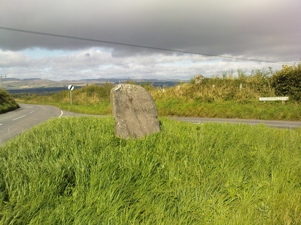
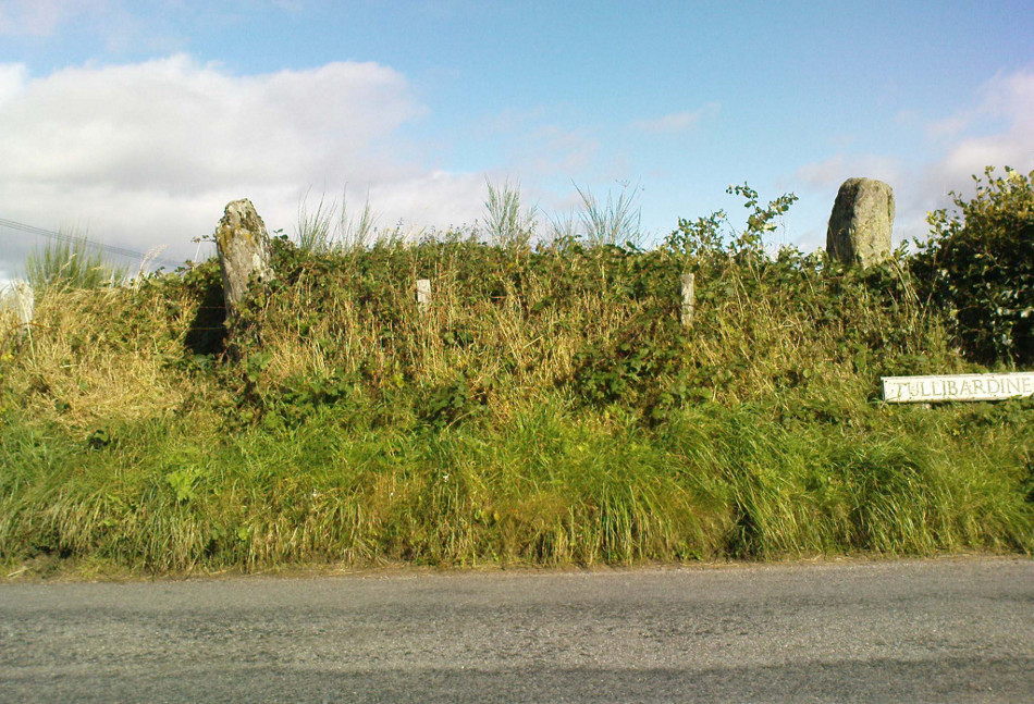
From Auchterarder’s A824 main street, going out towards the golf course take the Orchil Road on your right and then about fifty yards along, turn right again up Tullibardine Road. Park up somewhere about a hundred yards along, then just walk further down the road until you’ll see the standing stone right at the road junction. Look into the field on your right, above you, and another two are hiding in the brambles and grasses.
Archaeology & History
Included in Andy Finlayson’s (2010) fine local survey, this is an intriguing little group of three standing stones (and a fourth buried beneath the turf), all very close to each other. They are shown on the modern Ordnance Survey maps as “standing stones”, but have been catalogued by archaeologists as the denuded remains of a ‘Four Poster’ stone circle. Despite this, the circle wasn’t included in Aubrey Burl’s (1988) definitive work on the subject, nor his megalithic magnum opus. (Burl 2000)
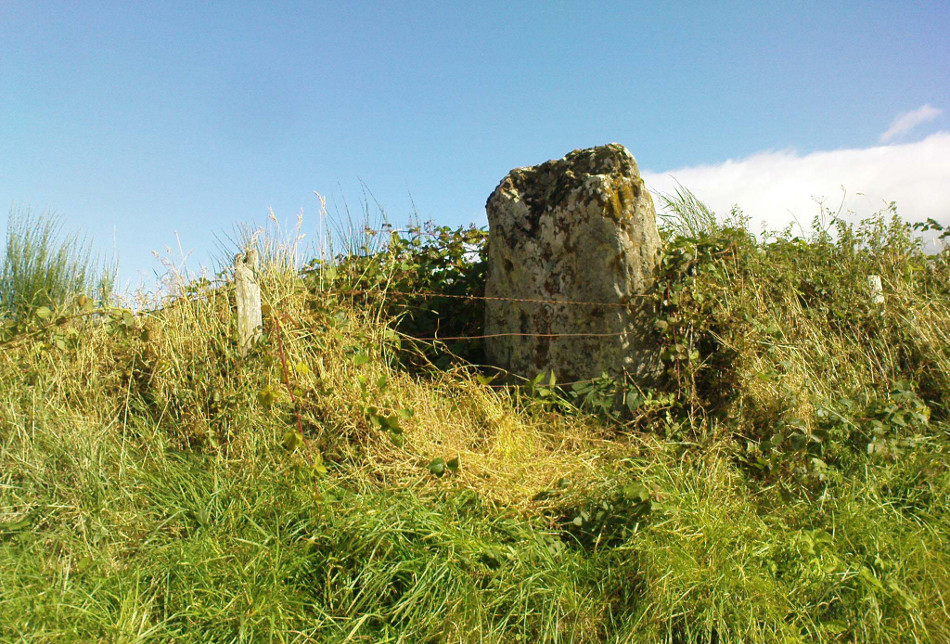
Northern hedgerow stone…and two in the hedgerow
Of the two uprights above the roadside at the field edge, a faint carved hand can be found on the upright west-facing side of the southernmost of the two standing stones. Although faint, this doesn’t appear to be ancient. Written accounts of these stones are few and far between it seems. The earliest seems to be in the lengthy essay written by Mr Hutchison (1893), in which he gave an excellent account:
“Less than a mile to the west of (Auchterarder)…is a fine group of stones, two only of which are now standing. These stand on the summit of what has been a well-defined mound, and the stones now lying where the roads unite seem to have stood originally at the same height. The road has been driven through the group at a lower level than the summit of the mound, and the stones have been thrown down and laid in the waste space at the point of junction. The small mercy to be thankful for is that they have not been broken up altogether and used for road metaL This has probably been due to the circumstances that one of these stones has a curious encircling groove running round it, which perhaps impressed even the vandal roadmakers with the idea that it might be worthy of preservation. It would be interesting to know whether, when the circle or group of stones was cut through, any cist or interment was found. One would expect such to be the case, but I have not yet got any information on the point. There are several stones lying on the spot which may or may not be pieces of the original standing stones. Two considerable bits of old red sandstone, at least, look as if they were fragments of an original whole. Two great stones, however, are unmistakably prostrate standing-stones; and from the positions in which they lie, it seems to me as if the persons who had uprooted them had laid them down as nearly as possible on the sites they had occupied (at the original higher level, of course) when standing.
“The direction in which both of the standing stones point is 236º, and a line taken from each of the prostrate stones to the opposite standing one gives very nearly the same angle (240º). The prostrate stones are of metamorphic schist. The northerly one measures 7 feet in length by 3 feet in width, and is from 12 to 18 inches thick. A grove or furrow, 2 inches deep at its greatest depth, and from 2 to 4 inches wide, appears to run right round it, at a distance of 2 feet 10 inches from the end, which may have been about the middle height of the stone when erect. The lower side of the stone cannot be seen, but the appearance at the edges indicates that the furrow is carried all the way round. It looks just such a hollow as might be worn in stone by the long continued attrition of an iron chain. The more southerly prostrate stone is 6 feet in length, 4 feet wide, and has an average thickness of 18 inches. The two stones still standing are on the high bank above the road, just inside the hedge. These are both of old red sandstone, thinnish slabs, facing in the direction already mentioned. That to the south is 4 feet 10 inches in height, 2 feet 8 inch broad at the base, and 10 inches thick. The other is 5 ft. 3 in. at its greatest height, 3 feet 10 inches wide, and from 13 to 15 indies thick. On its northern face it shows a number of depressions or indentations curiously resembling prints of human feet. These Mr Kidston considers to be due to natural weathering.”
Southern carved stone
Yet the “prints of human feet” are very much man-made. A closer examination of these carvings is obviously needed.
Whether these stones originally played a part in an old tumulus, a cairn circle, or a typical stone circle, is hard to say with any certainty now. We are in a landscape where megalithic remains were once in great excess: with the standing stones of Blackford to the south; the lost circle of Gleneagles nearby; the megaliths near Muthill and many many more…
References:
Burl, Aubrey, Four Posters: Bronze Age Stone Circles of Western Europe, BAR 195: Oxford 1988.
Finlayson, Andrew, The Stones of Strathearn, One Tree Island: Comrie 2010.
Hutchison, A.F., “The Standing Stones of Stirling District,” in The Stirling Antiquary, volume 1, 1893.
Strachan, Favid (ed.), A History of Blackford, Blackford Historical Society 2010.
Along the A9 dual carriageway between Blackford and Auchterarder, take the A823 road south, up Glen Eagles as if you’re going towards Pool of Muckhart and Dunfermline. Less than 100 yards up the road, turn immediately to your right and park-up. On the overgrown grassy land on the right-hand side of the road, you’ll see this solid monolith calling for your attention. You can go through the gate. You can’t really miss it!
Archaeology & History
Looking south, to the fairy-haunted Ben Shee
Described by archaeologists as a Class 1 Pictish Symbol Stone (and shown on OS maps as such), this is a fine solid standing stone more than 5 feet tall, with a lovely view up Gleneagles to the fairy mountain of Ben Shee beckoning in the distance. Immediately north on the other side of the dual carriageway, the tree-lined mound 100 yards away is an ancient fort (which we’ll deal with in another entry); and of course we have the nearby companion of the Gleneagles A standing stone a coupla hundred yards west. Whether or not this stone and its western companion ever had anything to do with the lost stone circle of Gleneagles, we might never know.
Close-up of the carved designsCharles Calders drawing of the carvings
Although it seems consensus opinion that the standing stone here is prehistoric, the monolith was of some venerable importance to the Pictish people of the Ochils, who, according to the Royal Commission lads (1999) carved on this stone “the faint symbols of a goose and rectangle.” The rectangle, however, is in fact a parallelogram—as the images here clearly show. Archaeologist Richard Feachem (1977) thought the design was in fact “a double-sided comb.” I have my doubts (a much smaller and probably more recent parallelogram design was recently identified on the upright face of the large Dunruchan D standing stone, about 10 miles WNW of here). The ‘goose’ is carved above this geometric form and is much fainter, which may imply it was carved much earlier. In Elizabeth Sutherland’s (1997) survey, she suggests the bird may be an eagle. It is equally possible that it is a swan.
The earliest detaied account of this stone and its companion is in Mr Hutchison’s (1893) fine essay, where he wrote:
“On the south side of the road from Blackford to Auchterarder, about 150 yards west from Loaninghead where the line of the road is crossed by that from Gleneagles to Crieff, stands a fine stone of Highland grit. It measures 4ft. 10in. in height above ground, 10ft. in girth at the base, and 6ft. 9in. in circumference at top. It shows four sides of nearly equal measurement:— that facing north being 2ft 4in., south 2ft. 8in., west 2ft 5in., and east 3ft. On the north is an incised figure in the form of an parallelogram, 10in. broad by 9in. high, divided into three equal portions by two horizontal lines.”
“In the park near Polney Loch, one mile from Dunkeld, is a Standing Stone, quite noticeable from the Highland road. This monolith is one of those styled sepulchral, and is a rough oblong slab of schist, its basal girth being 10 feet 7 inches, and its height 4 feet 9 inches. Mr. Coles, who describes this stone in the “Proceedings of the Society of Antiquaries”, supposes it to have been part of a circle. It is not far from the ancient stronghold on King’s Seat.”