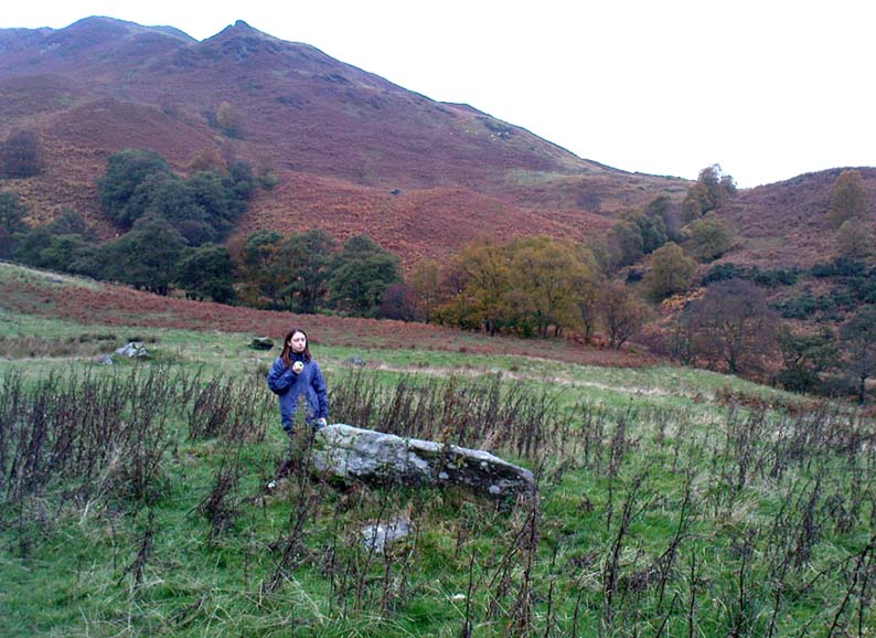
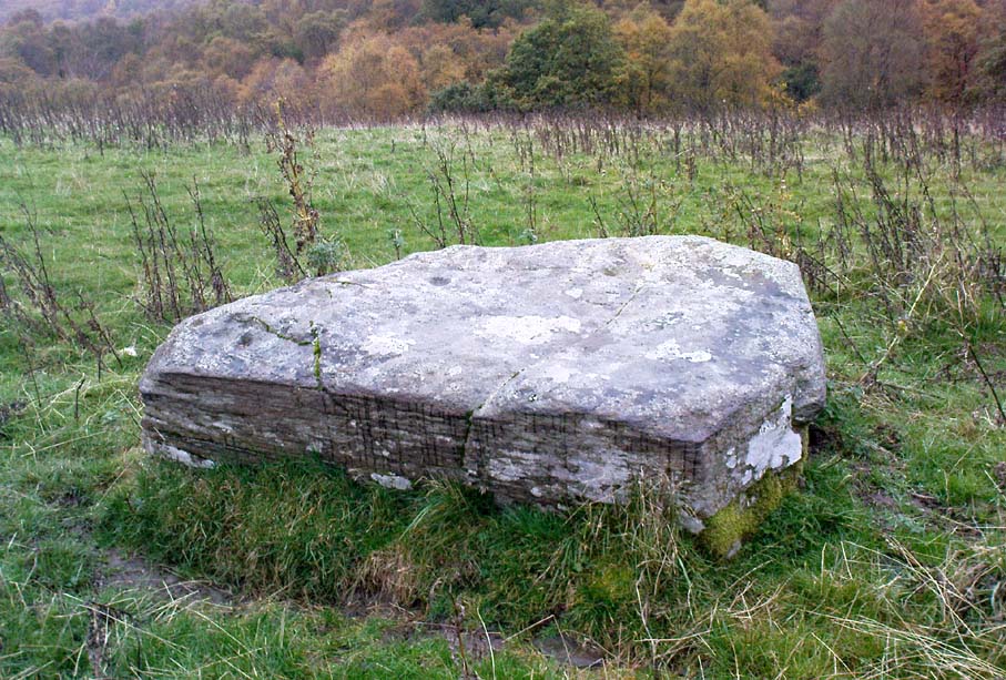
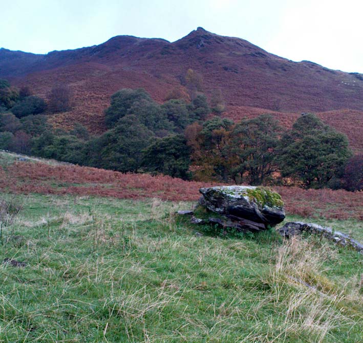
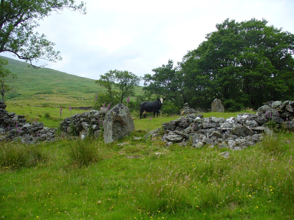
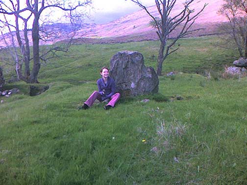
In Mr Kennedy’s book (1927) on the folklore of Strathtay, he informed that this Witches Stone was examined and taken to Edinburgh sometime in the 19th Century, but returned to its home by a local man called Mr McNaughton who lived at Bail-an-eas. The stone was restored close to the walls in which it was first found. He also told us the following:
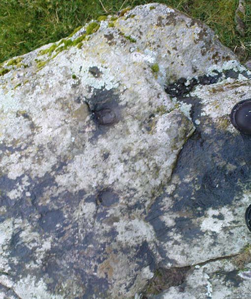
“In bygone days the witches of Strathtay amd Grandtully had their great meeting place at Tulliepourie. There the Witches’ Stone…with its round bowl-shaped holes, is still in evidence. Satan attended and assumed the shape of a he-goat; but going to the meeting he is said to have rolled along in the shape of a large cart-wheel – gyrating and describing the figure eight. This must have been an exceedingly interesting site! The orgies that ensued at these meetings were disgustingly wicked!”
The fairy folk, whose main home was the hill of Craig Scriadlain further uphill from here, would also have their revelries here. Many of the other sites near here were also used by the same little people of Scriadlain.
References:
Kennedy, James, Folklore and Reminiscences of Strathtay and Grandtully, Munro Press: Perth 1927.
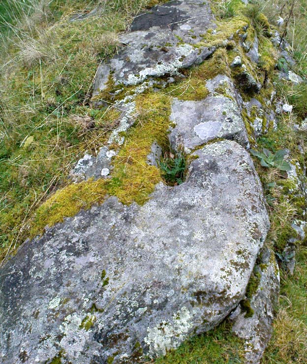
From Killin, take the Glen Lochay Road past the Moirlanich Longhouse, but keep on for another mile, and take the track on the left up to Murlaganmore cottages. As the track turns right of the tree-line, cross the field (left) up towards the open gate as if you’re going to the Murlaganmore 2 carving, where you’ll see this large flattish rock in the grasses about 100 yards before it.
Archaeology & History
When we visited this old boulder last week, we had the misfortune of grey days and dark clouds throwing their faded light across this cup-marked rock, not really letting us see with any clarity the many cups which pepper (mainly) the edges of the rock. But the cups are faded anyway, so accounts tell, and the 15 which we counted were same 15 recorded about 100 years ago in C.G. Cash’s (1912) survey. There, he described this old stone as,
“about 200 yards south of the house, in the middle of the uppermost pasture. It is a large block of quartz schist stuck thick with garnets, and bearing fifteen cup-marks, only one of which — 3 inch in diameter and 1 inch deep — is really well defined, and several of which are faint.”
Faint cups barely visibleC.G. Cash’s early drawing
But despite the grey day (She was absolutely teeming with rain half of the time!), I found the setting here absolutely gorgeous, with the many shades of old trees and the clear blood of pure waters falling through the landscape. And, without doubt, there are other carved stones nearby that have yet to capture the attention of surveyors. You can smell them!
References:
Cash, C.G., ‘Archaeological Gleanings from Killin,’ in PSAS 46, 1911-12.
Royal Commission on Ancient & Historical Monuments, Scotland, The Archaeological Sites and Monuments of Stirling District, RCAHMS: Edinburgh 1979.
Take the same direction to reach the Murlaganmore Footprint, continuing up past the cottages. 100 yards on, where there’s a bend in the track, cross the field on your left and go thru the gate higher up the slope. Stick to the small rough ‘path’, past the Murlaganmore 1 carving for nearly 100 yards, where a small rocking-stone-like rock is ahead of you. That’s it!
Archaeology & History
Close-up of cup-marks
This stone’s in a lovely setting, with the craggy rise of Creag Mhor and the waterfall of Airigh an Fhraoich up the rich coloured slope behind it. But the carving here is a simple one, with perhaps only 2 cup-markings etched on the stone’s upper surface, as the photo here shows. Tis a lovely setting though, and there are other carved rocks living nearby which aint yet seen the pages of any record-books.
It was first mentioned in C.G. Cash’s (1912) essay on the antiquities of Killin and district, who told that here was “one well-cut cup, 3 inches in diameter and 1½ inches deep, and also a doubtful or faint one.” The carving was later listed in the Royal Commission’s Stirling District report (1979) as simply “a boulder bearing cup-marks.”
References:
Cash, C.G., ‘Archaeological Gleanings from Killin,’ in PSAS 46, 1911-12.
Royal Commission on Ancient & Historical Monuments, Scotland, The Archaeological Sites and Monuments of Stirling District, RCAHMS: Edinburgh 1979.
From Killin, take the small road to the Moirlanich Longhouse, but keep on for another mile. Just before the road crosses the river, stop! In the fields above you to the left are a few trees and some rocks. Walk uphill till you’re nearly level with the cottages at Murlaganmore (the gate’s about 10-15 yards away) just above the gorze bushes and check out the long rock. If you can’t see it at first, bimble about till you find it. You’re just about on it!
Although shown on modern OS-maps as a ‘Sculptured Rock’ and included in the Canmore survey, when we visited this site a few days ago I have to say that unless evidence to the contrary can be obtained, this ‘site’ should be declassified as an archaeological remnant of the prehistoric period. It appears to be natural — though could have had some agricultural purpose or origin in centuries past.
The ‘footprint’ appears to have been described first of all by F.W.L. Thomas (1879) in his essay on the inaugural seat of Kings at Dunadd, where a similar footprint is found at the top of the fort. Thomas thought that this curious footprint could have had a similar function — though even folklore hereabouts seems silent on such a matter. The site is included in Ron Morris’ 1981 survey, where he too described it as “probably natural but just possibly man-improved.”
References:
Morris, Ronald W.B., The Prehistoric Rock Art of Southern Scotland, BAR: Oxford 1981.
Thomas, F.W.L., ‘Dunadd, Glassary, Argyllshire: The Place of Inauguration of the Dalriadic Kings’, in Proc Soc Antiq Scot, vol.13, 1879.
Truly troublesome if you aint into walking. Many ways up, but the easiest has to be the zigzagging trackway up from the valley bottom just by The Green a few hundred yards past Lochay Power Station, up the southern edge of Creag na Cailleach. At the end of the trackway, take the stream uphill for a few hundred yards and watch out for the rocky rise to your right (east). Head for it and check out the rocks there. You’ll find it!
Archaeology & History
Single cup-marked rock below Creag na Cailleach
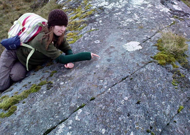
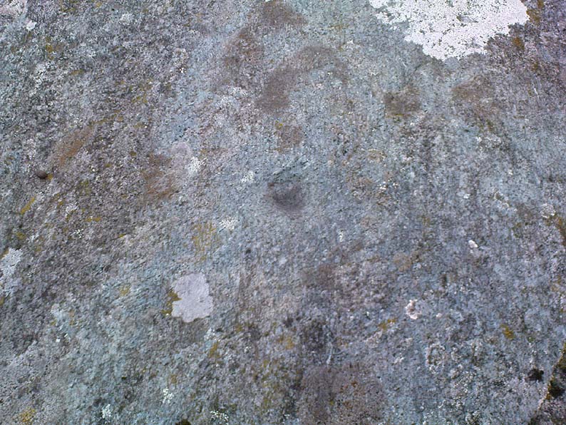
I’m not sure that anything’s previously been written about this curious single cup-marked boulder. I say ‘curious’, simply because of the location and position of the clear cup-mark on this near-gigantic piece of embedded stone. We walked upon the rocky outcrop south of Creag na Cailleach (above the tree-line where the land levels out) and first saw the cup-marking at the top-end of this huge rock (amidst a number of others) on the large rise a coupla hundred yards west of Allt na Ceardaich. And as the carved cup was on the top-end of the boulder, I was expecting to find much more of the rock with other motifs scattering its body — but was amazed to find that this was the only single cup-marking on an otherwise huge stone. A mixture of bewilderment and disappointment came over me as I shook my head in disbelief that only a single cup had been scribed into an otherwise massive rock.
Close-up of the cup-marking
However, the light was poor with low cloud and it was nearing sunset, so there may have been other aspects to this carving which we missed out on. One other ‘possible’ cup-mark might have been done, but it seemed very dubious even in the poor light. I was all for having another look at it the following day; but wandering halfway up a mountain just to see if this was the only cup-marking on this outcrop was summat my daughter wasn’t into doing! So the site must await another mad cup-and-ring-crazed traveller on another day to get a more detailed inspection! George – are you out there anytime soon!?
Going thru Pitlochry town, turn up the A924 road for about a mile till you hit the Moulin Inn on your left-hand side. Just past here, take the road left and continue for 2-300 yards until the stone in the field stands out on your right-hands side. Y’ can’t really miss it!
Archaeology & History
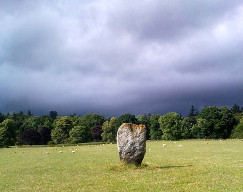
I should mebbe have this site entered as a ‘stone circle’ and not just an old monolith, as numerous other standing stones were in close attendant not too long ago and it was said to have been a circle. Certainly when the great Fred Coles (1908) talked about this place, he
“was informed by the tenant, Mr Reid…that many years ago, in his grandfather’s time, “there were several more stones standing”, all smaller than this monolith and that, upon the orders given by Mrs Grant Ferguson of Baledmund, some of these were saved from total demolition, and are supposed to be lying half-buried in the field to this day.”
…and here’s the big man close-up
Though I imagine these remnants have now been removed. Aerial images, when conditions are just right, might prove fruitful here.
But the solitary stone still standing here is quite a big fella. Heavily encrusted with quartz and more than 7 feet tall, it’s a nice fat chunky thing, with its lower half being somewhat slimmer than the top. Well worth having a look at!
Folklore
Once an old moot site, folklore also tells that an old market was once held here (there was some other folklore I had of this place, but can’t for the life of me find it at the moment!).
As you go through Pitlochry’s main street, watch out for the right-turn up the A924 road. Go up here for perhaps a mile. You’ll know you’re getting close as you pass the Moulin pub and the seeming avenue of trees opens on either side of the road. A coupla hundred yards up into the trees, there’s the left-turn up the Balnakeilly driveway. Stop! It’s on your left.
Archaeology & History
The Balnakeilly Monolith
Knocking on for nine-feet tall, there’s some debate as to the archaic authenticity on this standing stone. Ian Armit and his mate (1998) certainly wondered whether this was an ancient stone or not and, gotta say, when I came up here a coupla weeks back, I got the same impression. It doesn’t have that feel about it which comes from the real olde ones; but this could be due to it having been moved in the not-too-distant past. Though when Alan Reid wrote about it in 1911 he told us that,
“it bears marks of having been…worked slightly into shape by some pointed tool whose traces are plainly seen on several of its angles.”
Not something you’d find on monoliths that are a few thousand years old! But if this stone was moved when the entrance to Balnakeilly drive was done, or the road widened, this could account for such markings. We could do with digging into any archives that may exist about Balnakeilly or the Pitlochry roads to see if there’s any record of this stone to end the debate once and for all. Tis a good site to visit though – check it out!
Cairn (destroyed): OS Grid Reference – NO 2738 4885
Archaeology & History
Unfortunately we can no longer see the large prehistoric tomb that was once visible in the fields here, close to the bottom corner of the field below the old Bridge of Ruim, a couple of hundred yards north of the A926 road to Ruthven. The site was destroyed around 1863, but records show that there were several burials found here containing human bones, along with an urn. Described in an early PSAS article, the Scottish Royal Commission chaps seemed to think that “its position may be indicated by a low swelling in the field”, about 30 yards southeast of the position shown on the first OS-map. Anyone know owt more about this place?
References:
Royal Commission on the Ancient & Historical Monuments of Scotland, North-East Perth: An Archaeological Landscape, HMSO: Edinburgh 1990.
From Killin, travel down Glen Lochay, past Stag Cottage or Duncroisk and over the shallow river of Allt Dhun Croisg. If you’re in a car you can park up a 100 yards past the river bridge and walk up the track from here. After a 10 minute walk, above the trees you come to the derelict village of Tirai* where, until recently, you were greeted by a tall totem-pole of a gnarled tree (it was superb!) which is now Earth-lain, and a fine view of the evolving hills. Here amidst the ruins we also find a standing stone or two.
Archaeology & History
The village of Tirai was deserted sometime in the 19th century (due to the disgusting clearances of the English), but at least two standing stones still live amidst its ruins. The tallest is nearly four-feet tall in the middle of the grassy patch and is much used by grateful cattle to rub themselves against when midges and horseflies drive them mad! The Scottish Royal Commission lads reckon the megaliths here are,
“possibly a survivor of a stone circle as a similar stone is used nearby as a gate-post to an enclosure and several other large stones have been incorporated in the walls of the surrounding buildings.”
This may well be so – but it is equally possible that these are merely the remains of standing stones which once stood along this ridge and which were taken for use in the village.
One of the Tirai standing stones
Of the remaining standing stones in this idyllic setting – the Royal Commission fellas counted possibly four of ’em – all are roughly the same size, between 3 and 4 feet high. Johnstone & Wood (1996) also think the stones here may once have related to a prehistoric cairn in the village.
This is an utterly beautiful arena, even in the heights of winter. The village sits on the rear slopes behind the old cailleach, and there are plenty of cup-and-ring carvings, both known and unknown scattering the rocks and nearby hills. The curious Duncroisk Crosses carving is just visible from here, on the other side of the rocky gorge. Lost tales and lost sites abound here also. I did sit and wonder though… Considering that the villagers here left the old standing stones in place until very recent centuries at the heart of their hamlet, what uses did they make of it, or what tales did it speak? Or had the purge of the Church already taken its toll…?
References:
Gillies, William A., In Famed Breadalbane, Munro Press: Perth 1938.
Johnstone, A.S.K. & Wood, J.S., ‘An Archaeological Field Survey of Deserted Townships at Tirai, Glen Lochay, Killin,’ Association of Certificated Field Archaeologists (Glasgow University) Occasional Paper no 9 (1996).
* The place-name Tirai means ‘land of good luck or joy,’ which truly speaks well of its spirit and setting to me.
Another silly-sounding directional pointer! Get to the now tourist-infested town of Killin (best in Winter, when the town is quiet and you get to know the locals a lot better) and travel through it as if you’re going to follow Loch Tay up its western side. As you’re going out of the village towards the Bridge of Lochay Hotel (an excellent place), you’ll see an amphitheatre of mountains in the background. The tallest of the hills on the left is where you’re heading. Go straight up the hillside and follow your nose!
Creag na Cailleach, Killin
The hill guards the entrance to the legendary Glen Lochay (Valley of the Black Goddess). There are many ways to climb her, but my first venture here took me up the waterfalls and steepish burn of Allt na Ceardaich. Once on the level, I found myself surrounded by that amphitheatre I mentioned, from where – on my first visit – I took up the sheer face of this great mountain. (to be honest it’s nowt special if you’re into mountaineering) From the tops you’ve got a damn good view all round. But respect this old hill, as danger awakens to idiots who would think themselves champions.
Folklore
Here, where axes were quarried by ancient man from beneath Her rocky slopes, this ‘Hill of the Old Woman’, or ‘Hag’, was one of the abodes of the primal Mother Goddess in olden times, so says her name. Her ‘dark’ aspect seemed manifest one time when I climbed her with a rather stupid man in tow. Following one of the streams back into the valley below, he thought it wise to copy my gazelle-nature as I sprang without thought, quickly, from rock to rock, bouncing at speed down the fast-flowing stream (which takes a lotta weird practice and very strong ankles!), in spite of the advice to do otherwise – and in doing so he broke his leg in three places and, to make it worse, had to spend the night there in complete agony!
Don’t tell me there’s no ‘dark’ goddess to some of these great places!
Axe production has been found to have occurred as early as 2500 BC. There have been numerous flint finds hereabouts aswell – but considering this is a mountain, you’d expect to find something on or about Her slopes!
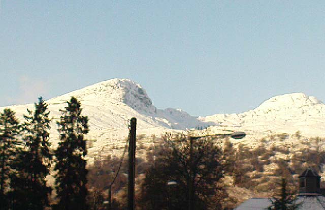
I’ve just been back up here as the first good snow fell upon the hills and the white cover brought the elements out of her form in a way I’d not seen before. Tis a wonderful place the Creag na Cailleach; and, it seems, a site that played a now forgotten part in the ancient name of the glen, Lochay, which was the living abode of the Black Goddess in more archaic days. Twouldst be good to hear some of the authentic old stories from old locals that were once known of this ancient deity in the glens. If anyone knows of such tales, let us know before they are lost forever…
References:
Ritchie, P.R., ‘The Stone Implement Trade in Third Millenium Scotland,’ in Coles & Simpson’s, Studies in Ancient Europe, Leicester University Press 1968.
Acknowledgements: Huge thanks to Lindsay Campbell for her hospitality, food and roof hereby.