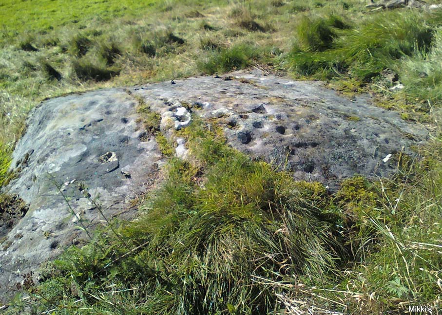
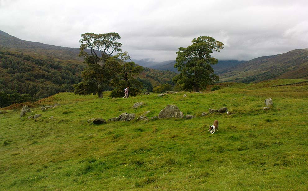
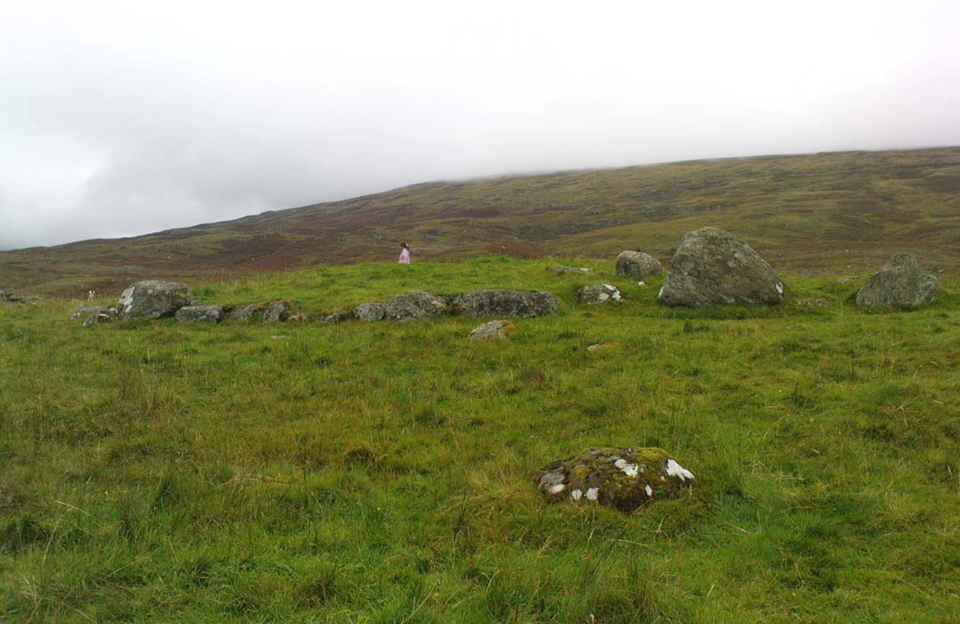
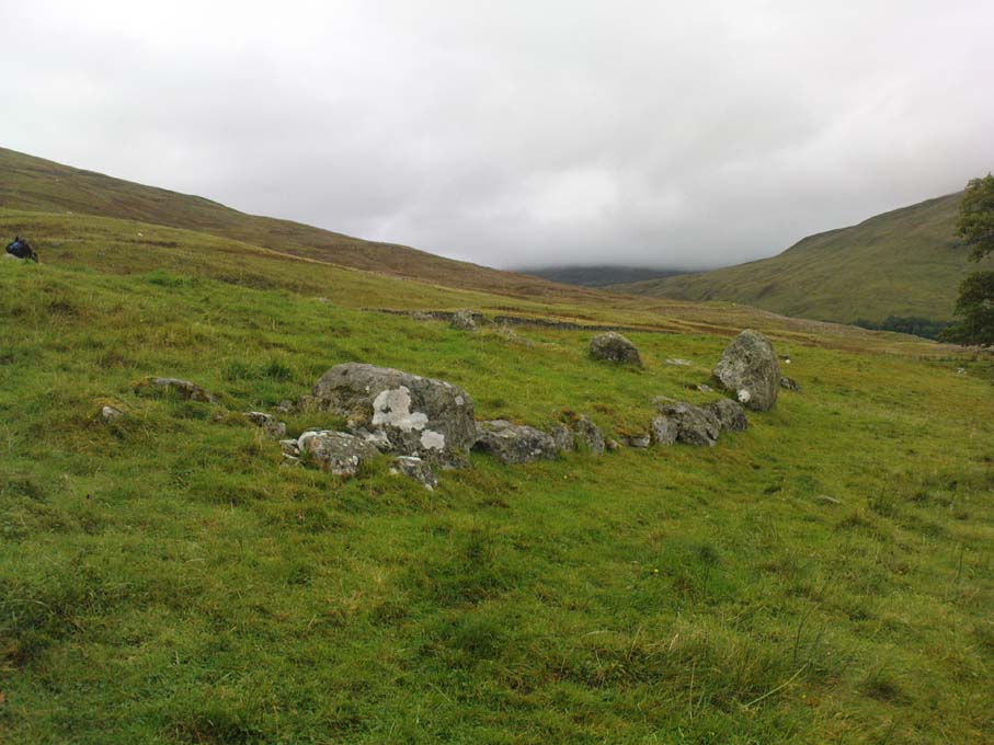
Monzie Carving, Crieff, Perthshire

Cup-and-Ring Stone:  OS Grid Reference – NN 88161 24176
Getting Here

Andy Finlayson’s original piece

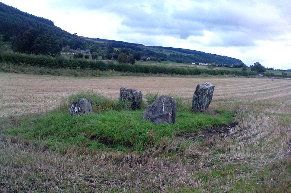
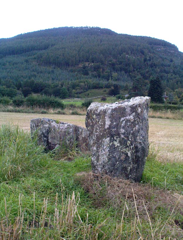
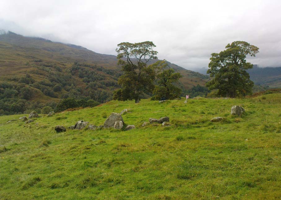
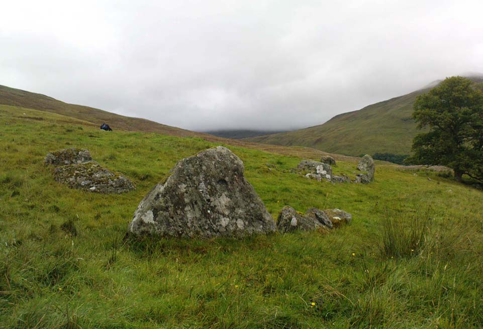
From Gilmerton village, take the A822 Dunkeld road north.  Go for about 200 yards and take the little road to Monzie; watching carefully another 200 yards on for the dirt-track on the left taking you across the fields.  Go along the track, watching out for the small stones in the field on your right less than 200 yards along.  You can’t really miss ’em!  This small ring of stones is the Monzie Cairn Circle.  The carving is just in front of it!

Archaeology & History

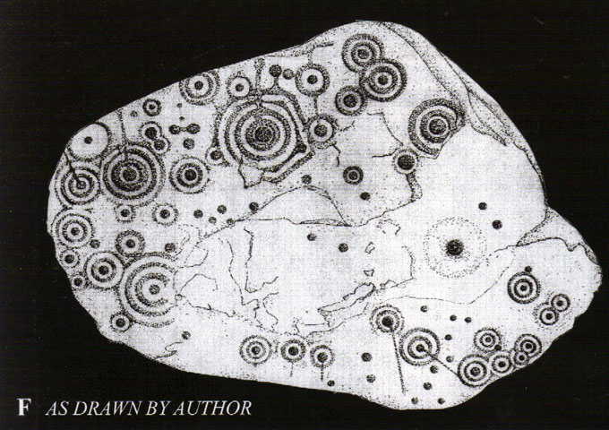
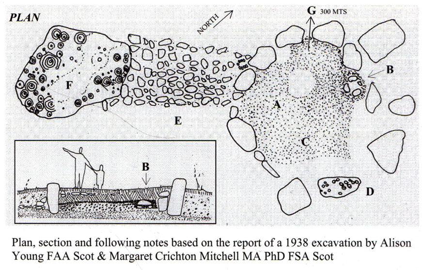
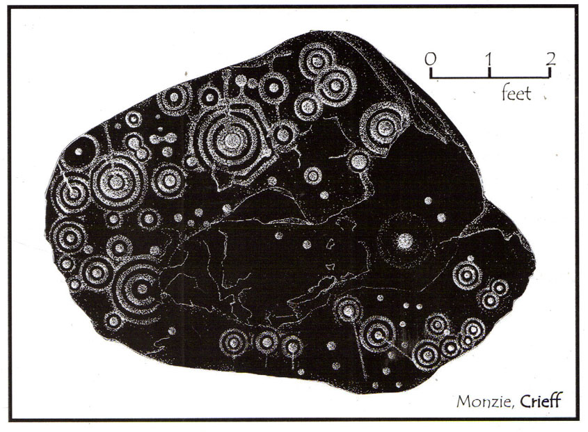
Although we know this brilliant carved stone has some relationship with the Monzie cairn circle only five yards away (it was linked via a man-made stone causeway, running between the circle and the carving), the stone itself is very much deserving of its own entry here — and at the same time I can give Andrew Finlayson’s (2010) excellent book a decent plug aswell! (the superb drawings of the stone, top & bottom, are from Andy’s work)
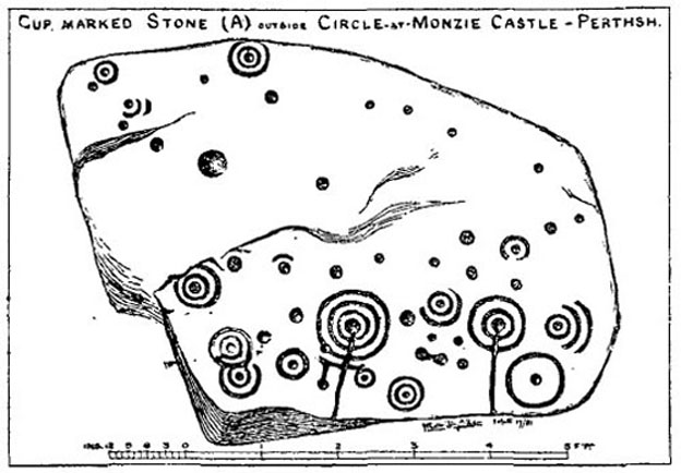
Allen’s 1882 drawing
Carving & proximity of circle

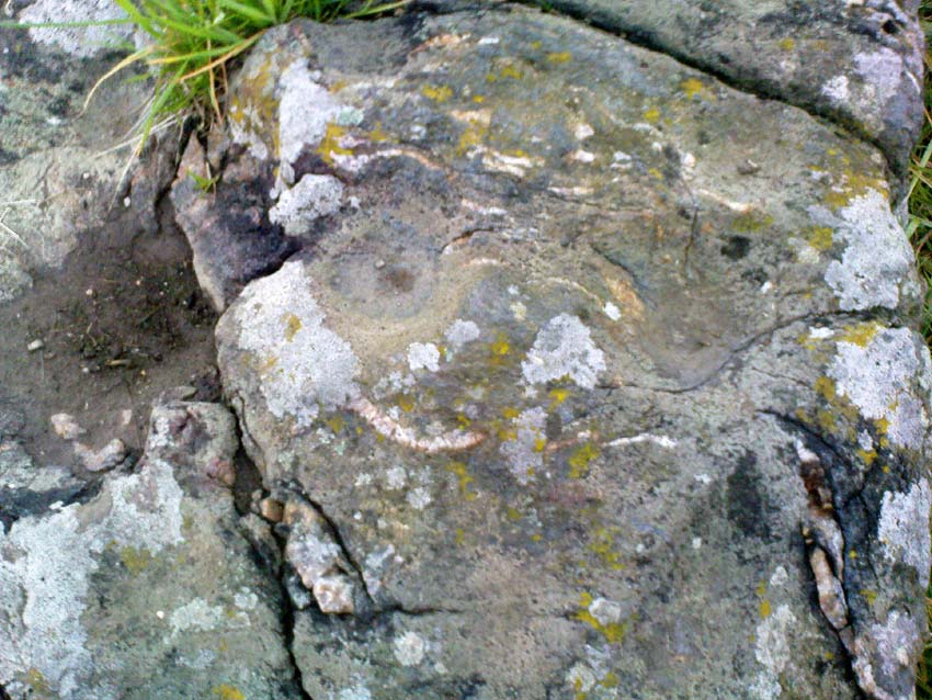
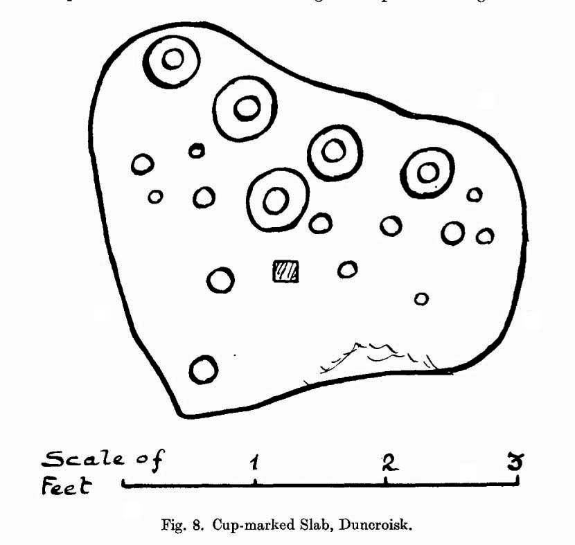
First mentioned (I think) in Simpson’s (1867) early survey, the carving was described soon after by J. Romilly Allen (1882), who gave us an early drawing of the stone.  Thought by some to have originally stood upright, the carving was described by Aubrey Burl (2000) as being, “decorated with forty-six cupmarks, cup-and-rings, nine double, one triple, there are grooves and a pair of joined cups.”  It’s certainly an impressive carving!

Although the carving has been posited by some archaeologists as an outlier to the Monzie circle, it’s probable that the circle emerged from the carving — a concept that some may find difficult to understand.  I’m not aware of any modern excavations here (the last, I think, was in 1938), but my guess would be that the stone causeway laid between the cup-and-ring stone and the circle ran towards the circle from the carving, and not the other way round.  The carving is probably older than the stone ring — though of course, without excavation, my idea could be utter bullshit! (there are also some cup-marked stones in the circle aswell – though none as impressive as this)
The carving in shadow (© Andrew Finlayson)

One of my truly favourite megalith fanatics (despite some of his alignments being out), Alexander Thom, came here and thought this old carving “coincided with a rough stellar alignment from the centre-point of the cairn” (Hadingham 1974); though his notes in Megalithic Rings (1980) tell that,

“from the cupmarked stone beside the circle, the midsummer sun sets above an outlier some 800ft distant.”

The “outlier” that Thom mentions is known as the Witches’ Stone of Monzie, which Simpson (1867) appears to have mistakenly thought was the name of this very carving.

References:

  1. Allen, J. Romilly, “Notes on some Undescribed Stones with Cup Markings in Scotland,” in Proceedings of the Society of Antiquaries Scotland, volume 16, 1882.
  2. Burl, Aubrey, The Stone Circles of Britain, Ireland and Brittany, Yale University Press 2000.
  3. Finlayson, Andrew, The Stones of Strathearn, One Tree Island: Comrie 2010.
  4. Hadingham, Evan, Ancient Carvings in Britain, Garnstone: London 1974.
  5. Simpson, James, Archaic Sculpturings of Cups, Circles, etc., Upon Stones and Rocks in Scotland, England and other Countries, Edmonston & Douglas: Edinburgh 1867.
  6. Thom, Alexander, “Megalithic Astronomy: Indications in Standing Stones,” in Vistas in Astronomy, volume 7, 1966.
  7. Thom, A., Thom, A.S. & Burl, H.A.W., Megalithic Rings, BAR: Oxford 1980.

© Paul Bennett, The Northern Antiquarian

Duncroisk Burn, Glen Lochay, Killin, Perthshire

Cup-and-Ring Stone:  OS Grid Reference – NN 5281 3635

Also Known as:

  1. Canmore ID 24177
  2. CEN 19 (Morris)
  3. Duncroisk 2 Carving (Canmore)
  4. Tirai Wall Carving
  5. Tullich (Morris)

Getting Here

A ring of cups, encircling cups

Go thru Killin and, just past the Bridge of Lochay hotel, take the tiny road on your left.  Go down here for 3 miles till you pass the gorgeous Stag Cottage (with its superb cup-and-rings in the field across the road) for another 300 yards, past Duncroisk Farmhouse set back on your right, then over the small river bridge.  Just over the bridge there’s a gate on your left.  Go thru this and up the track until you get to another large gate.  Go thru this, then walk immediately left where you’ll notice a large-ish boulder sat on the nearby slope ahead of you in a part of some very old walling.  That’s your target!

Archaeology & History

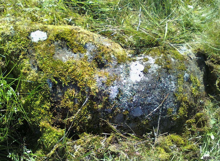
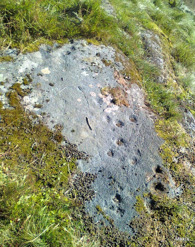
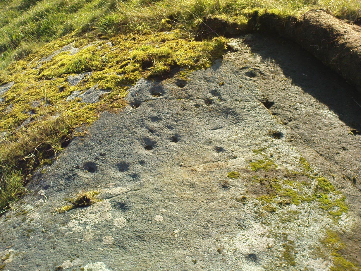
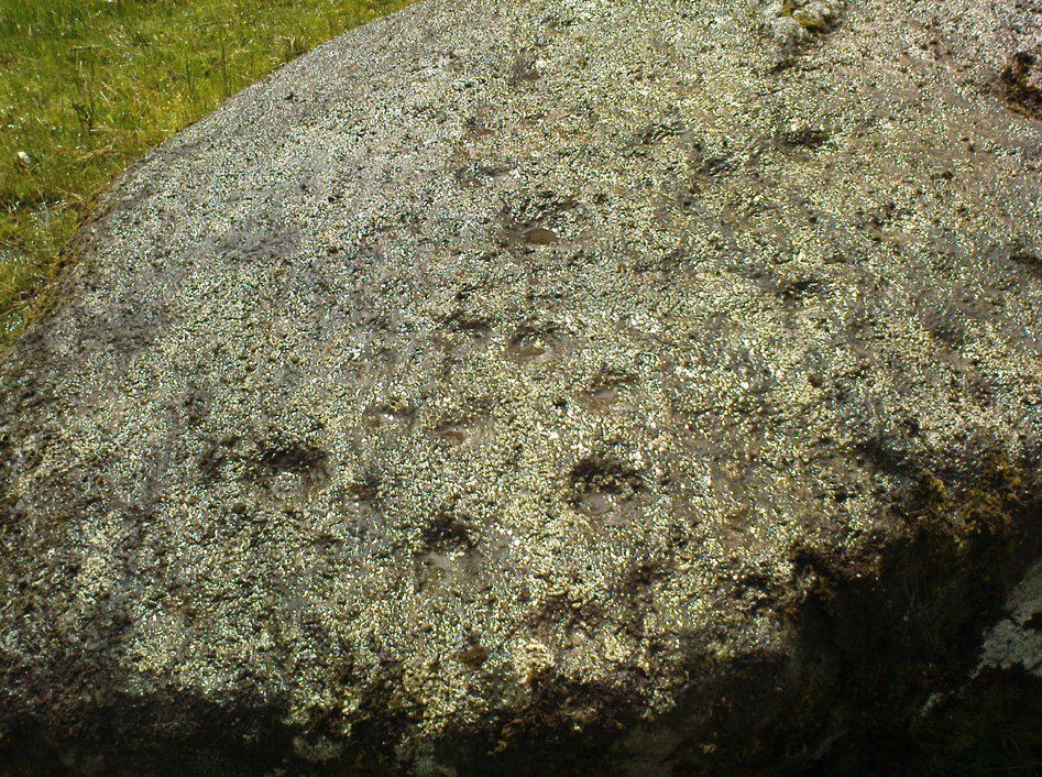
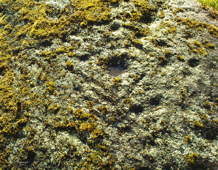
The title of this carving is slightly misleading, as the stone concerned is about 50 yards west of the fast-running burn.  But it’s pretty easy to locate.  When we visited the stone recently, as the photos show, the rock was all-but covered in a beautiful patchwork of lichen and moss, inhibiting the visibility of a quite impressive carving.  But we have to let this be.

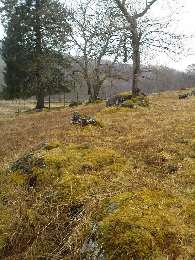
The carving’s on the big rock by tree, in the walling
Line of walling clearly evident

The carved rock plays an important part in a line of ancient prehistoric walling, which looks Iron Age in nature, but without an excavation we’ll not know for certain.  The walling is quite extensive and is an integral part of the extended derelict village of Tirai, with its standing stones and other monuments.  This begs the questions: was the carving executed before or after the walling was created?  Was the stone carved in traditional neolithic/Bronze Age periods and later accommodated into the walling?

Even in the grey overcast light of a winter’s day when we first visited here, many cups were clearly visible on the rock’s surface, but they were difficult to contextualize in terms of artificial and natural aspects of the stone.  Later visits here at the end of Spring enabled a much better assessment — though capturing the surrounding “rings” proved difficult.  The carving is shown highlighted on Ron Morris’ (1981) map of the cluster of Duncroisk carvings, and described as a:

“domed schist boulder, 2½m by 2m, 1¼m high (8ft x 6ft x 4ft).  On its top, mostly where sloping…are: 2, and possibly 3, cups-and-one-ring, much weathered and only visible when wet in very low sun, probably un-gapped, and at least 32 cups.  Diameters up to 17cm (6½in) and depths up to 1cm.”

But this is only half the story.  Despite what Mr Morris and the more recent Canmore records tell us about this carving, there are in fact at least 52 cups on the surface of the rock, at least two of which have definite ring-like forms around them.  The largest of the cups has linear features around a large section of it, but to ascribe these elements as ‘rings’ is also stretching it a bit — as one of the photos here clearly shows.  The ‘ring’ consists more of two separate straight lines with curvaceous ends: more like a right-angled carving with a swerve than any traditional ring.  It’s a quite unique feature by the look of things.

Faint cup-and-ring and cups…and…
Cups & right-angled lines

The majority of the carved cups and lines occur on the eastern side of the boulder, with only a few singular cups almost fading their way onto its western sloping sides.  And of primary visual interest are the swirl of cups that surround two small cups at the ESE corner of the rock.  These give the impression of running into another swirl of cups that hedge their ways around the edges of the largest cup-and-right-angled-lines, until bending back up and along the southern-side of the stone.  This possibly deliberate sequence of cups then continues in roughly the same form back upwards to near the top-middle of the rock and onto a complete cup-and-ring.  Just above the top of this runs a short pecked line just detached from the cup-and-ring, but of obvious mythic relevance in the story which this carving once told.

RWB Morris’ sketch of the design

It’s an absolutely fascinating carving which gives the distinct impression of narrating a myth of journeying, by either a person, tribes or ancestral beings.  Of course we’ll probably never know for sure what story it once told; but its tale may have been known by the people of the once proud village of Tirai which was only destroyed a couple of centuries ago, along whose fallen walls this great stone still rests within…

And finally, for those students exploring the potential relationship that cup-and-rings may have with water: please note that in wet conditions, a spring of water emerges right underneath the very base of this large rock.

…to be continued…

References:

  1. Morris, Ronald W.B., The Prehistoric Rock Art of Southern Scotland, BAR 86: Oxford 1981.
  2. Royal Commission on the Ancient & Historical Monuments of Scotland, Archaeological Sites and Monuments of Stirling District, Central Region, Society of Antiquaries of Scotland 1979.

© Paul Bennett, The Northern Antiquarian


Duncroisk (3), Glen Lochay, Killin, Perthshire

Cup-and-Ring Stone:  OS Grid Reference – NN 53447 35669

Also Known as:

  1. Canmore ID 24181
  2. Duncroisk 5 (Canmore)

Getting Here

Duncroisk 3 Carving
Duncroisk 3 Carving

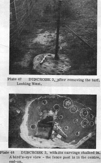
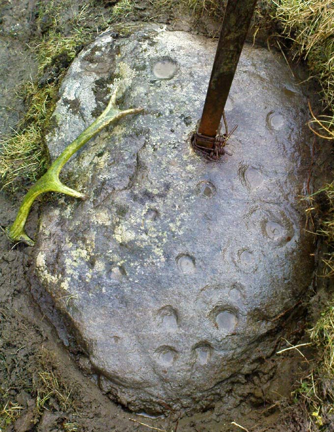
Two real ways to get here. Either (i) follow the directions to get to the Stag Cottage carvings of Duncroisk 1, then walk down to the fence by the riverside and walk along to the left for a coupla hundred yards till you reach a second metal fence-post sticking out of a rock on the other side of the deer-fencing; or (ii) from the roadside burn a coupla hundred yards along the road before you reach Stag Cottage, follow it down to the riverside, then head along the footpath behind the fencing, parallel with the river’s edge.  It aint far.  Within 100 yards you’ll reach the stone with the metal pole sticking out of it and the carvings are on this!

Archaeology & History

Confusingly redesignated as Duncroisk 5 carving by the usually efficient Canmore people, we’re sticking with this stone’s original name given by Ronald Morris (1981) in his British Archaeological Report of this and nearby carvings — and a quite fascinating carving this is as well!

C.G. Cash’s drawing
Duncroisk 3 stone

As with many cup-and-rings, erosion and lighting has a powerful effect on seeing the design correctly.  On my visit here in recent months there were quite distinct additional elements in the carving which haven’t been noted by previous archaeologists.  But in saying that, there were also some elements that were reported by the earliest antiquarians that proved difficult to see in the grey light of day when I was here.  The earliest report of the carving by C.G. Cash (1912) told there to be five rings, whereas today only 3 or 4 are visible (though this will probably change when viewed in other lighting conditions).

When Mr Cash told of this stone in his essay on the antiquities of Killin it sounded as if it was lucky to have survived, as it had previously been dug out and left by the roadside, before then being reused by a local to fix a fence-post in!  Mr Cash told us that the local,

“had used it as the foundation stone of the stretching post at the south end of the easternmost fence on the farm, and there I found it, near the brink of the river, buried in sand and turf.  I cleared it and then in pouring rain crouched over it to make a hasty sketch.  It bears eighteen cups, of which five are surrounded by rings.  The largest cups are 2½ inches and the rings 6 inches in diameter.”

Ron Morris’ images

When I visited the place the weather was much the same as Mr Cash described: lovely teeming rain, typical of the mountains, with the surrounding trees breathing moisture onto the slopes as ever.

Years later when Ronald Morris (1981) came here he saw “4 cups-and-one-ring…probably complete rings, up to 12cm (5 in) in diameters and 10 cups up to 2cm deep.”

If you stand and face the stone, the cup-marking on its lower right side (see Morris’ old photo, above) has a pecked line running from it further to the right and down to the edge of the rock.  You can clearly make it out on the top photo.  This carved line also seemed to touch another carved line which can be seen running along the outer edge of the stone — although the poor light didn’t allow me to view this with absolute confidence.  I’ll have another look at it again when I’m up in the area in May and hopefully confirm or deny it with greater confidence (and if anyone else gets here in the meantime, have a look and see what y’ think).

References:

  1. Cash, C.G., “Archaeological Gleanings from Killin,” in Proceedings of the Society of Antiquaries of Scotland, volume 46, 1911-12.
  2. Morris, Ronald W.B., The Prehistoric Rock Art of Southern Scotland, BAR 86: Oxford 1981.

© Paul Bennett, The Northern Antiquarian

Carse Farm (north), Dull, Perthshire

Stone Circle:  OS Grid Reference – NN 8022 4873

Also Known as:

  1. Carse Farm I
  2. Weem circle

Getting Here

To get here, follow the same directions to reach its nearby colleague of Carse Farm south — but instead of walking down the track to where its companion is found, this small ring of stones is found a coupla hundred yards into the first field by the roadside.  Unless the field’s fulla corn (in which case, give it a miss cos even if you do find it, you won’t be able to make much out), y’ can’t really miss it!

Archaeology & History

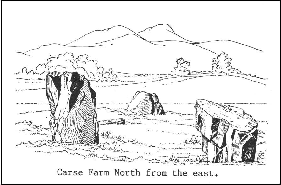
As with its nearby companion of Carse Farm south, this small “ring” of four stones is found along the Tay valley floor and, though cited as a stone circle in many archaeology tomes, should more accurately be defined as a cairn circle of sorts.  Structurally akin to other four-posters, it reminded me of a distant companion in North Yorkshire more than 200 miles south: the Druids Altar at Bordley, which is also a robbed prehistoric tomb and not a stone circle.  But it’s a fine little site sat amidst the majestic temple of surrounding hills on all sides, bar east, where the Tay valley reaches into the distance.

Faint cup-marks
Carse Farm, looking north

Like its damaged companion in the field below, some of the stones in this circle also have well-defined cup-markings on top of the uprights; although when we visited here, low cloud and late daylight conditions prevented us from getting good images of the cup-marks concerned (as the photo of one of them here illustrates).  The cup-markings are, curiously, carved on the top of the small standing stones.

Described briefly in Alexander Thom’s Megalithic Rings (1980), he regarded its geometry as “circular” in structure.  Aubrey Burl (1988) gave the lengthier archaeological history of the site, telling:

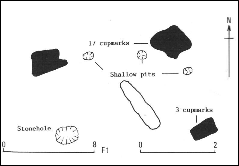
“On the ‘carse’, or lowland…this 4-poster was excavated in 1964.  When Coles saw it in 1907 only three smallish stones remained standing although “it seems clear that at this site there were originally four Stones as in so many other Perthshire groups”… The SW stone was missing but halfway between the NW and SE stones a long, thin slab lay half-buried.

“Coles noticed that there were cupmarks on the tops of both the NE and SE stones.  The SE had three carvings but the top of the NE had no fewer than 17, the largest ‘cup’ being 4 by 3½in (10 x 9cm).  In the group were two ‘dumb-bells’.  In the same field the farmer had dragged away a buried stone which was also cupmarked.* (my italics, PB)

“Of the three standing stones, the NE is 3ft 11in (1.2m) high; the SE, 5ft 1in (1.6m); and the NW, 4ft 1in (1.3m).  These heights…are almost double those cited by Coles (1908: 126).

“”The 1964 excavation discovered the SW stonehole.  The 5ft 10in (1.8m) long stone lying at the centre of the 4-Poster was erected in it, a task made easier by the fact that its base had been keeled… The base was unweathered showing that the stone had been toppled in quite recent times as had the stones of the two Fortingall 4-Posters…3¾ miles to the WSW. The four stones stood at the corners of a rectangle 12ft by 8ft (3.7 x 2.4m) on a long ENE-WSW axis.  They also stood on the circumference of a circle 14ft 5in (4.4m) in diameter.

“A tapering pit was discovered against the inner face of the NE stone, about 2ft 6in (76cm) across and 1ft 2in (37cm) deep.  It was filled with cremated bone and sticky black earth and charcoal.  At the bottom, a collared urn lay on is side, its rim decorated in geometrical designs.  A flint flake lay near it.  Within the 4-Poster there were three shallow pits, two between the NW and NE stones, another between the SE and SW.  Their edges were clean and they had been backfilled with brown loam.  The excavators thought they might have “been used for stabilising props during the erection of the stones.” …As the heaviest block, that at the NW, weighed about 6 tons it would have required 20 to 30 people to drag it upright…and the use of such props would have made their insertion safer.”

Burl’s collated ground-plan
Fred Coles’ 1908 drawing

Unless the people building this site were dwarves, we’ve gotta re-assess this latter remark (which Burl quotes from the earlier archaeologist’s report from the 1960s).  Having personally been involved with the creation of modern stone circles with stones larger than the ones here, we know that the uprights here could have been erected by 8-10 people at the very most.

Archaeology and folklore records describe many other prehistoric sites along this section of the upper Tay valley, but it’s also very likely that other “circles” or cairns of similar structure to the two known at Carse Farm once existed close by that are not in modern literary accounts.

References:

  1. Burl, Aubrey, Four Posters: Bronze Age Stone Circles of Western Europe, BAR 195: Oxford 1988.
  2. Coles, Fred, “Report on Stone Circles Surveyed in Perthshire – Northeastern Section,” in Proceedings of the Society of Antiquaries of Scotland, volume 42, 1908.
  3. Stark, Gordon (ed.), Cupmarked Stones in Strathtay, Breadalbane Heritage Centre 2005.
  4. Stewart, M.E.C., “Carse Farm 1 and 2,” in Discovery & Excavation, Scotland, 1964.
  5. Thom, A., Thom, A.S. & Burl, H.A.W., Megalithic Rings, BAR 81: Oxford 1980.

* Is anyone aware of further details about this carving? Do we have any sketches of it?

© Paul Bennett, The Northern Antiquarian


Carse Farm (south), Dull, Perthshire

Stone Circle:  OS Grid Reference – NN 8026 4847

Also Known as:

  1. Carse Farm II
  2. Tegarmuchd

Getting Here

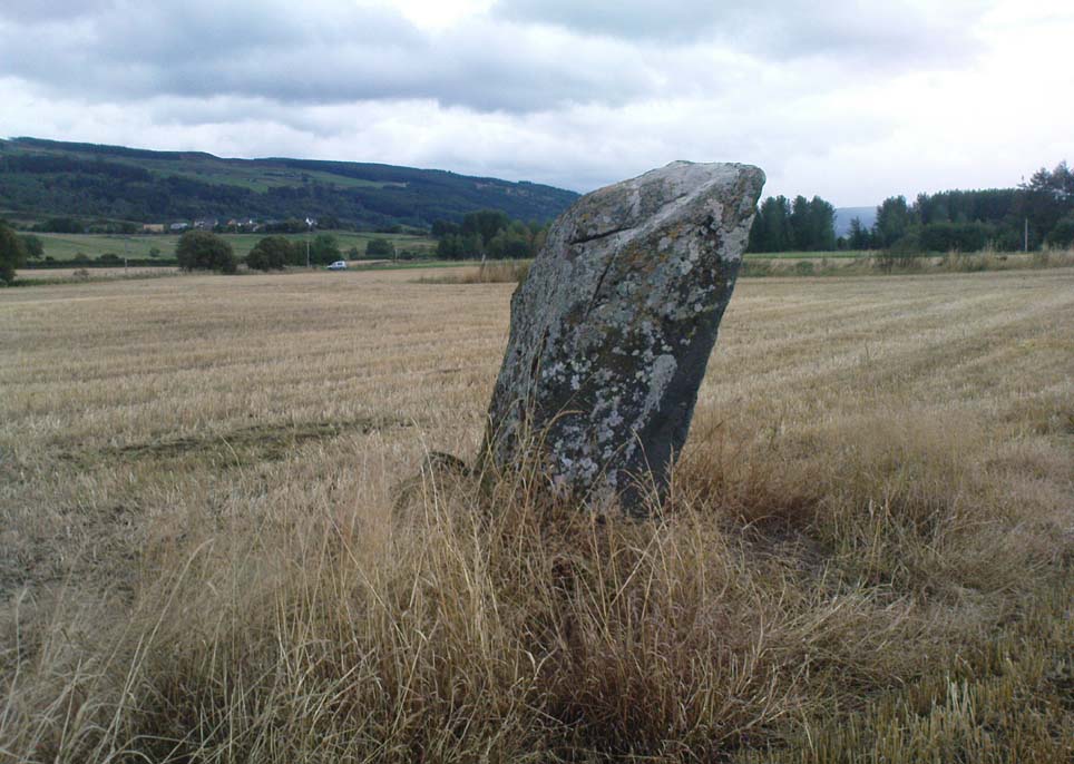
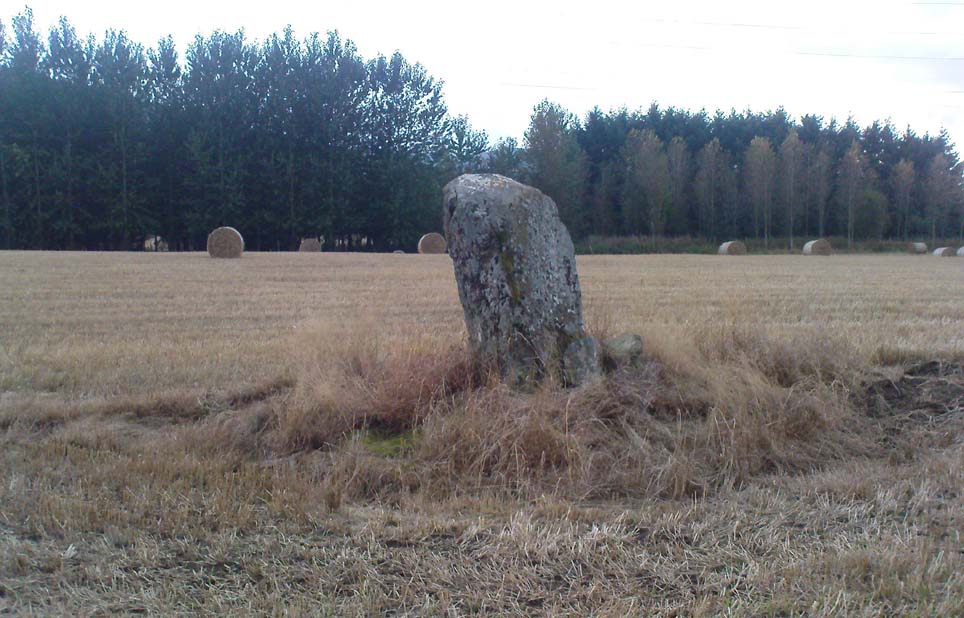
Carse Farm Standing Stone

Pretty easy to find – assuming it aint at the height of summer and the crops are approaching maturity, otherwise you’re only gonna see its head!  But, this aside: from Aberfeldy, take the B846 road over the river bridge that bends you along the valley of the River Tay towards Appin of Dull.  After some 2 miles you’ll pass the right-turn up to Dull.  Go past this for another coupla hundred yards or so, watching out for the left-turn down towards the farmhouse of Carse and park up where you can (if you go past it, there’s the second turn up to Dull, again on your right, where you can turn round). As you walk down the track towards Carse Farm, watch out on your right in the field below Carse I, in the second field down.  You can’t really miss it. (and the farmer here is spot on if you ask to check the stone – as long as the crops aint growing)

Archaeology & History

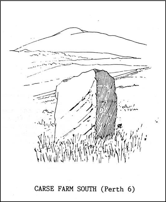
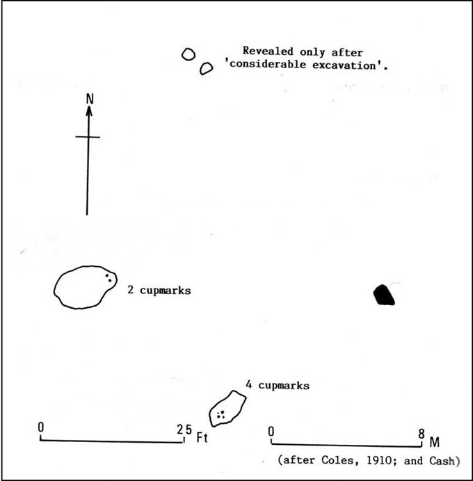
Although all that’s left of what is thought to have been a once proud stone circle is the singular upright standing stone in the middle of the field.  Aubrey Burl (1988) thought that this was one of the typical “four poster”rings that scatter our isles, but I’m not so sure misself.  There were other stones associated with the site when Burl described it, but these were covered over in our visit here a few months back — which is a pity, as two of the stones are reported as possessing cup-markings (if/when we revisit the site, I’ll try get some images of the respective stones and add them on TNA as individual carved stones).  The site gives the distinct impression of it having a funerary character of some sort and not a true stone circle — and this was strongly suggested by some of the finds inside the “ring”, described below.

Fred Cole’s old drawing
Aubrey Burl’s groundplan

Both this and its associated “circle” a few hundred yards away — known as Carse Farm north — sit on a flat level of ground in the Tay valley, with rounded hills all most sides.  This landscape setting was obviously of some importance to the people who put the circle here in the first place but, not living in the region, it’s difficult to assess the mythic relevance some of the hills will have obviously played in the siting of these stones.

In bygone days, it was reported that the much of the site was ploughed away due to agricultural excesses, so there was obviously much more to it in earlier centuries.  Describing the solitary stone that’s left today, along with the earlier excavation results, Mr Burl (1988) wrote:

“The stone still standing, of quartziferous schist, is 6ft 3in (1.9m) high.  Its longer faces are aligned NW-SE.  32ft 6in (9.9m) to its SW is a large prostate block, sub-elliptical and about 8ft long and 4ft 3in wide (2.4 x 1.3m).  It has probably fallen outwards. (my italics, PB)  If so, when standing near the top of its inner face were four cupmarks in a cross pattern.

“About 32ft ((9.8m) to its NW is a fallen and enormous schist slab, 11ft long and 5ft wide (3.4 x 1.5m).  It also appears to have toppled outwards.  Near the bottom of its inner face are two cupmarks.  The situation of these three stones suggests that they once stood at the corners of a rectangle some 32ft (9.8m) square, the pillars of a huge four-poster nearly six-times the national average and with an internal area ten times bigger than the small 4-poster (Carse Farm north, PB) just to its north.

“Excavation  in 1964 found the socket from which the great prostrate slab had been dragged… Cash (1911) had noted the presence of a small stone inside the ring about 20ft (6.1m) west of the standing stone.  It proved to be 4ft (1.2m) square with a carefull-dressed face.  It had been set upright, standing about 1ft 4in (41cm) above the ground.  Three sides of the worked face ‘had been carefully chiselled away to a straight edge.’ It may have been a slab lining the inner central space of a destroyed ring-cairn.  Burnt bone was found near it. There was also a rounded river pebble with a worked hollow on one side…”

Folklore

Carse Farm stone

Stewart (1964) described the site as having been “christianized” not long ago, by having the northernmost standing stone in the ring removed.  This is intriguing inasmuch as “north” is the place of greatest symbolic darkness in the pre-christian mythos, and represented death and illumination in magickal terms.  North was also the point taken by witches and shamans in their excursions into Underworlds, usually via the North Star, which tethered the Earth to the heavens (see Godwin’s Arktos [1993], and Grant, The Magical Revival [1973])  In the removal of this northern stone for the reasons given, that implies some magickal events or folklore were in evidence here when this took place.  Anyone got any further information along these lines, or has it long since been subsumed?

References:

  1. Burl, Aubrey, Four Posters: Bronze Age Stone Circles of Western Europe, BAR 195: Oxford 1988.
  2. Coles, Fred, “Report on Stone Circles Surveyed in Perthshire (Aberfeldy District),” in Proceedings of the Society of Antiquaries of Scotland, volume 44, 1910.
  3. Stewart, M.E.C., “Carse Farm 1 and 2,” in Discovery & Excavation, Scotland, 1964.

© Paul Bennett, The Northern Antiquarian

Loch Glassy, Weem, Perthshire

Sacred Loch:  OS Grid Reference – NN 850528

Also Known as:

  1. Loch Glassie

Folklore

Here we have another case of another loch in Scotland that was said by local people to be inhabited by legendary water monsters.  In the tale which follows we may simply have a case of a very bad accident that was, in more superstious times, bestowed upon this legendary animal.  We may never know.  James Kennedy (1928) told the story, saying:

“It was inhabited, like Loch Derculich, by the ‘Each Uisge‘ of Icelandic origin.  On summer evenings it could be seen roaming at large on a green meadow adjacent to the tarn, and to all appearance a canny enough creature.  One summer Sunday afternoon, six Strathtay girls and a boy set out from their homes to inspect the ‘Each Uisge.’  They found him, patted him on the head and neck, and this kindness is apparently relished, for it lay on the sward and allowed them to sit on its back.  The boy, who had a semi-bald scabbed head, stood at a distance and watched developments.  He concluded that this animal was not the genuine horse it seemed to be, and thought that it grew considerably larger than it was at first.  When the Each has the six girls comfortably seated on its back, it suddenly rose, plunged into the loch, and drowned the lot.  The boy immediately took to his heels and the Each after him, but fear enabled the boy to outstrip the horse, who would stop now and again in the pursuit and cry, “Fuirich mo ghille maol carrach!  Fuirich mo ghille maol carrach!” — Stop, you bald scabbed-headed boy.  Ultimately the Each gave up the chase, and the boy, much frightened, got safely home and related all that happened on that eventful Sunday evening.  The parents of the girls found parts of their bodies floating on the waters of the loch, and the name Loch Lassie was given to it, which it retains to this day.”

References:

Kennedy, James, Folklore and Reminiscences of Strathtay and Grandtully, Munro Press: Perth 1928.

© Paul Bennett, The Northern Antiquarian

Loch Derculich, Dull, Perthshire

Sacred Loch:  OS Grid Reference – NN 864 549

Folklore

Although this upland loch is today renowned as little more than a decent fishing spot, the waters here were long known to be haunted and the abode of a legendary water spirit.  In local tradition, the loch is said to be named after “an ancient Chief of Pictish origin” — whose burial mound is nearby — and in James Kennedy’s (1928) fascinating folklore work he also told that,

“Loch Dereculich was the habitation of a ‘Tarbh Uisge’ (water bull), the dangerous water demon… This dreaded monster, as the Norwegian peasant will gravely assure a traveller, demands every year a human victim, and carries off children who stray too near its abode… Less than one hundred and twenty years ago, the Loch Derculich Water Bull was seen sauntering along its shores.  At peat-making times it was observed very frequently.”

References:

  1. Kennedy, James, Folklore and Reminiscences of Strathtay and Grandtully, Munro Press: Perth 1928.

© Paul Bennett, The Northern Antiquarian

Stag Cottage, Glen Lochay, Perthshire

Cup-and-Ring Stones:  Grid Reference – NN 5320 3584

The carved rocky outcrop

Also Known as:

  1. Duncroisk 1 (Morris 1981)
  2. Duncroisk 4 (Canmore)
  3. Keeper’s Cottage

Getting Here

From the north side of Killin, take the minor road next to the Bridge of Lochay Hotel at Killin, past the hydroelectric station, through the wooded section until the fields open out again. The first gorgeous old house you come to is on the right-hand side of the road. Stop here! (I could really do with living here misself – tis a truly superb place!) You can ask the lady at the house where the carvings are and she’s very happy to point them out – they’re on the rocky crag near the bottom-end of the field on the other side of the road.

Archaeology & History

R.W.B. Morris sketch of the main carvings

What a brilliant setting and clump of carvings we have here! As you get to the rocky hillock in the field, you see that there are numerous rocks visible along the ridge, a number of which have carvings on them – some with just cups, but most possess a number of cup-and-rings.  It’s an excellent spot!  Depending on the time of year when you come here will determine whether or not you get a better look at the carvings or not.  I’d recommended April and May as the best time, as the vegetation is at its lowest then.  Visiting the site near the end of summer doesn’t give you as good a view — but even then, if you like your rock art, you’ll still love it!  The rocks here are mainly quartzite schist, with a number of the surfaces being almost pure quartz.  Intriguingly, none of the pure quartz sections appear to have been carved on.

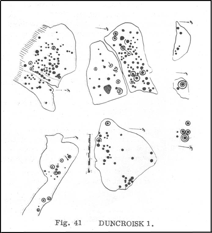
The carvings here were first mentioned in an article by D. Haggart (1895), who described them as “a very remarkable set of incised rock sculptures…discovered lately in this neighbourhood by Mr John McNaughton.”  And remarkable they are indeed!  In Ronald Morris’ (1981) survey of this site — which he labelled Duncroisk 1 — he counted eight separate rock surfaces that had been carved, marking them as carvings a-h, but there are at least eleven of them here; and in all honesty, if we could strip the surface of the hill of its vegetation, we’d probably find a few more hidden away!

Cup-marked stone

As you’ve walked across the field from the road, past the first unrecorded cup-marked stone near the start of the rocky rise, we reach Mr Morris’s ‘stone A’ near the easternmost end of the ridge, which is just a small slab of stone with “at least 6 cup-marks” on its surface.  It’s easily missed in poor light, so watch out.  However, if you reach ‘stone b’ (described below), just walk back ten steps and you’ll see it.

Carved Stone B

Ten yards west is ‘Stone B’, seemingly split into two sections, whereupon we find “a cup-and-two-rings and at least 12 cups-and-one-ring, up to 19cm in diameter – some rings gapped, others not, some with and some without a radial groove from the cup, and some with a “runner” or cup in a ring. There are also at least 58 cups” on this section of rock. ‘Stone C’ can also be missed, this time due to its size and the fact that the larger cup-marked surfaces are ahead of you.  But assuming you don’t miss it, this carving consists of “a well-preserved cup-and-two-complete-rings 25cm in diameter, and a cup.”

Carved Stone D

‘Stone D’ is just next to ‘stone C’, but with rather more ornate designs etched upon it.  This is one of the more archetypal petroglyph designs that are found in the photo-guides and textbooks.  Morris (1981) told that it consisted “of a cup-and-two-complete-rings and 2 cups-and-one-complete-ring up to 20cm in diameter, also a cup-and-one-complete-ring and 2 cups.”  The photo here shows it pretty clearly.

Carved Stone E
Curious 'bowl', top-centre
Curious ‘bowl’, top-centre

‘Stone E’ is the next one along, just a foot or two away and Mr Morris (1981) told that the carving consists of “2 cups-and-one-ring up to 13cm in diameters, 1 complete, the others gapped, joined by groove to a cup, and at least 33 cups (C.G. Cash counted 42 in 1911).”  Most of the carved elements on this rock are around the edges of the stone.  A very large faded circular depression, man-made, is also visible on this section of the petroglyph (above left), suggestive of lunar symbolism.

Carved Stone F

‘Stone F’ is less than 10 yards further west and has the greatest number of cup-markings of the entire group here, as Morris described: “3 cups-and-one-complete-ring up to 9cm in diameter, and at least 80 cups, a few of which are widely scattered over a big area sloping steeply further south, beyond the attached diagram.”  It’s perhaps the most notable of the carved rocks along the ridge here — not by virtue of its design, more its geological physique than anything else.

Carved stone G

‘Stone G’ is next along and has a curious look about it, suggestive of more modern times.  At first sight it doesn’t seem to have quite the magnitude that Morris’ description affords it, but on closer inspection by rolling some of the covering turf back away from the rock, you can see what he meant.  This stone has “10 cups-and-one-complete-ring, up to 10cm diameter…and also 15 cups.”  One of the cup-and-rings on this section was found by Morris to have been “the smallest so far recorded by the author in Scotland.”

Then we reach ‘stone H’ at the eastern end of the carved ridge, consisting of simply 3 cup-markings.  One of them has a faint arc pecked around it.  Further along the rock, a complete cup-and-ring is visible close to the edge.

This entire line of petroglyphs is a fine place in a fine setting, perfect for meditative practices!  Other carvings can be found close by: Duncroisk 3 is a coupla hundred yards east across the field just over the fence by the riverside; and Duncroisk 2 is on the other side of the fence down towards the River Lochay on the same side of the adjacent burn less than 100 yards away (though this is trickier to reach). Other prehistoric sites can be found not too far away…

Folklore

Local people tell of having seen curious lights flitting along the edges of the field, river Lochay and roadside close to the carved rocks hereby.

References:

  1. Cash, C.G., “Archaeological Gleanings from Killin,” in Proceedings of the Society of Antiquaries of Scotland, volume 46, 1911-12.
  2. Cormack, E.A., “Cross-Markings and Cup-Markings at Duncroisk, Glen Lochay,” in Proceedings of the Society of Antiquaries, Scotland, volume 84, 1952.
  3. Gillies, William A., In Famed Breadalbane, Munro Press: Perth 1938.
  4. Haggart, D., “Notice of the Discovery of Cup-and-Ring Sculpturings at Duncrosk, near the Falls of Lochay, in Glenlochay,” in Proceedings of the Society of Antiquaries of Scotland, volume 29, 1894-95.
  5. Morris, Ronald W.B., The Prehistoric Rock Art of Southern Scotland, BAR 86: Oxford 1981.

© Paul Bennett, The Northern Antiquarian

Tullich, Glen Lochay, Killin, Perthshire

Enclosure:  OS Grid Reference – NN 5235 3684

Also Known as:

  1. Tirai West
  2. Tullich East
  3. Canmore ID 78043

Getting Here

The ‘stone circle’ of Tullich!

Go through Killin past the Bridge of Lochay pub, turning immediately down the small lane by its side.  After about 3 miles you’ll cross over the small river past Duncroisk.  Keep going for another few hundred yards (if you reach Tullich you’ve gone too far), watching out for the gate on your left.  Walk up to the top of this field, over the wall and up again.  You’ll see a couple of tall trees with distinctive walling next to them, just on a ridge above you.  That’s where you’re heading!

Archaeology & History

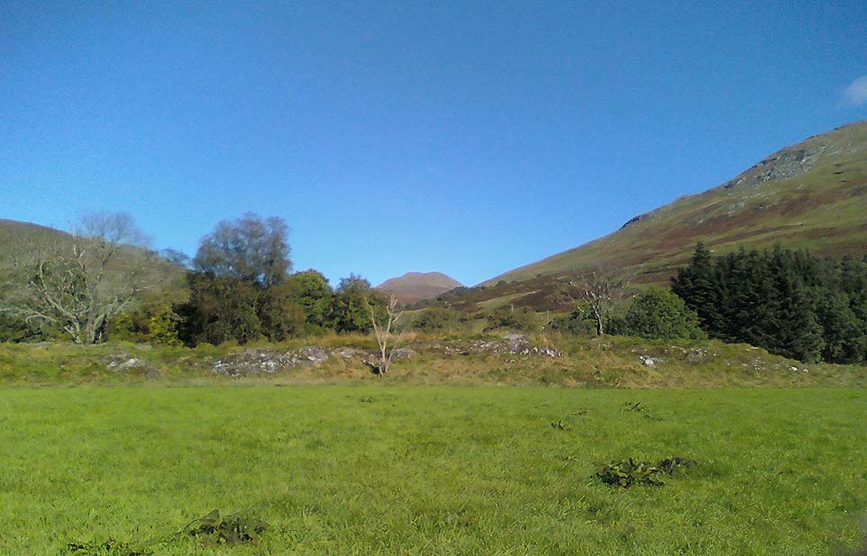
This is a fine-looking example of a prehistoric enclosure, perched on the edge of one of the grassy knolls on the far western extremities of the deserted village of Tirai.  If you walk towards it from the derelict village east of here, the elliptical form of the site gives you the distinct impression that you’ve just chanced upon a seemingly unknown stone circle nestled upon the edges of this gorgeous Scottish glen; but this initial excitement is soon dispelled once you get into the heart of the site!

Southern line of walling
Looking east

Although you’ll find a couple of derelict post-medieval buildings on the western side of this structure, the lay-out of this monument would seem to be Iron Age origin, perhaps earlier.  It certainly has all the hallmarks of a walled structure from that period and typifies many others that I’ve explored down the years.

The eastern and southern sections of the walls are in very good states of preservation, although the ground has obviously grown up and around the bases of the stonework.  It has a total outer circumferences of about 95 yards (87m), with the many upright stones measuring between 12 inches to more than 3 feet in height.  The western section of the enclosure is mostly overgrown but easily traced on foot.  Near the centre of the site is a large flattish stone that gave the impression of having an oratory function from where one could speak to the rest of the people sat around the inner edges of the enclosure — but this was a purely subjective impression.

NE sections of enclosure
Outer section & ‘standing stone’

On the southern side of the elliptical structure is another, outer line of walling, or a stone alignment of some sort just a few yards long, consisting of just a few upright stones — one of which stands considerably taller than all the others hereby, giving the impression of a standing stone.  It has a large natural cup-marking on its southern face.

To my limited knowledge there’s been no excavations here, so one wonders whether or how or if the people of Tirai made use of this much earlier building.  The Canmore entry of the place tells:

“The N side of this enclosure is a low turf and stone bank of height 0.3m and is 20m long, spread to about 1.2m. The E side is outlined by large stones set on edge with no evidence of intermediate stone walling or turf. A bank of similar more continuous stone extends to the W from the S of the main enclosure down sloping ground. This type of walling is different from any other on Tirai. The large stones set on end have suggested a prehistoric date for this enclosure.”

References:

  1. Johnstone, A. & Wood, S., “Tirai (Killin Parish), Pre-Enclosure Settlements,” in Discovery & Excavation in Scotland, 1990.

© Paul Bennett, The Northern Antiquarian

Clach na Sithean, Strathtay, Perthshire

Cup-Marked Stone:  OS Grid Reference – NN 895 531

Also Known as:

  1. Balendune
  2. Ballinduin

Folklore

This large cup-marked stone was known by local people as the Clach na Sithean, or the stone of the fairies.  Its smooth surface and well-cut grooves was said to be due to the fairies sharpening their knives upon it, and the straight cuts or grooves were tests of the keenness of their blades.

In addition to the fairies having hold over this stone, a brownie creature also roamed between here and the burn of Allt Mor.  Although a dutiful creature, he commonly used to scare the women when they returned from the ceilidhs by chasing them and screaming a curious noise at them. But as well as this, he would also enter the local houses and farms after nightfall and, when the local folk were asleep, would clean the supper dishes and put them in their rightful places. But if there was no work to be done once he had entered their homes, he would take the dishes out and place them on the floors where they would be found in the morning by perplexed householders.  Then they’d know that the brownie had visited. Sometimes he was a great help to the housewives, other times a nuisance.  He became known to local people as Puddlefoot, or Cas an Lubain, but so offended was he by the name when he heard it, that he let out an almighty scream and vanished, never to be seen again.

References:

  1. Kennedy, James, Folklore and Reminiscences of Strathtay and Grandtully, Munro Press: Perth 1927.

© Paul Bennett, The Northern Antiquarian