Bruan Broch, Caithness, Scotland

Broch:  OS Grid Reference – ND 31028 39501

Also Known as:

  1. Canmore ID 8934

Archaeology & History

It seems there’s not been a lot of archaeohistory written about this ruined site — nor its companion that was once visible 50 yards to the west.  In Richard Feachem’s (1977) gazetteer he described it simply as:

“a turf-covered stony mound some 10ft in height, standing in the middle of an enclosure formed by a ditch with a wall on its inner lip, which is best preserved on the west.”

Folklore

A common aspect of faerie-lore are incidences of apparent time-lapses — beloved in modern times in certain UFO encounters (Vallee 1969; Keel 1970).  Such was the case here, in the story described at this ruinous old site by George Sutherland (1937).  He wrote:

“Two men carrying a small keg of whiskey for the New Year festivities were passing the church of Bruan. They heard stirring bagpipe music and a few hundred yards further on they came to the Bruan Broch and found it open, and saw a number of the little folk in green dancing merrily to the music. One of the men was eager to join them in the dance and went in. The other man was more cautious and remained outside, and waited patiently until his friend would have his dance. A long weary time passed and his friend was not appearing. He went to the open door of the broch and called to his friend to come out. His friend said, “I have not got a dance yet!” After another long wait he shouldered the keg of whiskey and set out for home, never doubting but that his friend would return home before morning. Next day he called at his friend’s house to see if he had come home, and to his consternation found that he had not. Then he went to the broch in the hope of finding him there, but the broch showed no trace of a door, and no trace or soil or stones having been disturbed since the days of King Brude MacBile, and there was no appearance of man or fairy. It was an old belief that in such a case the same scene would be enacted in the same place in a year after, and accordingly on the anniversary of that day he went to the Bruan Broch. It was open, the music and dancing were going on as before, and his friend was there. He put some iron article in the door to prevent the fairies from closing it… He went to the open door and said to his friend, “Are you not coming home now?” His friend replied, “I have not got a dance yet.” He told his friend that he had been a year in the broch, and that it was surely time for him to come home now, but his friend did not believe that he was more than an hour or so there. The man then made a rush at his friend, seized him, and dragged him out by sheer force, and they set out for home together. It was difficult for him to realise that his sojourn with the fairies was such a prolonged one, but the fact that his own child did not recognise him, together with other changes that had taken place, convinced him.”

References:

  1. Feachem, Richard, Guide to Prehistoric Scotland, Batsford: London 1977.
  2. Keel, John A., UFOs: Operation Trojan Horse, Souvenir Press: London 1970.
  3. Sutherland, George, Folklore Gleanings and Character Sketches from the Far North, John-o-Groats Journal: Wick 1937.
  4. Vallee, Jacques, Passport to Magonia: From Folklore to Flying Saucers, H.Regnery: Chicago 1969.

© Paul Bennett, The Northern Antiquarian

Bàrr a’ Chuirn, Kilmartin, Argyll

Cairn:  OS Grid References – NR 8122 9782

Also Known as:

  1. Canmore ID 39465
  2. Lady’s Seat Cairn

Getting Here

Many ways to get here, but you’ve gotta amble off-path through the woods to eventually find it — but it’s not difficult. From Kilmartin village head to Slockavullin and walk up the winding track which takes you towards the Ballygowan cup-and-ring stones, but follow it into the woods instead. The OS-map’s gonna be your best guide here. I first visited this spot from the south and ambled about, aimlessly at times for several hours, after I’d first been to the great ruined mansion of Poltalloch. Well worth checking out if you enjoy finding allsorts!

Archaeology & History

The old tomb is actually a few hundred yards beneath the small rocky summit of Barr a’ Chuirn, with the overgrowth of the woods imposing itself upon it. The Scottish Royal Commission report (1988) told that there was a large seat built here in the 19th century called the Lady’s Seat, and actually set up on the cairn itself so giving groovy views all round to those who came here. The Seat was made from large slabs of stone, which may originally have come from the old tomb.  An excavation here in the mid-19th century,

“found the remains of two cists and some burnt bones, with a ‘skeleton of later date, between the two cists, but probably put there by the men who destroyed the cairn.’ In 1929 Craw re-examined the site and found that the central cist had chambered and grooved slabs. This cist is aligned ENE and WSW, and the E end-slab is now missing; the cist measured about 1m by 0.5m and about 0.3m in depth internally. The northern side-slab is grooved at the west end.”

References:

  1. Royal Commission on the Ancient & Historical Monuments of Scotland, Argyll: volume 6 – Mid-Argyll and Cowal, HMSO: Edinburgh 1988.

© Paul Bennett, The Northern Antiquarian

Grumbeg, Loch Naver, Sutherland

Cup-and-Ring Stone:  OS Grid Reference – NC 635 384

Archaeology & History

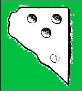
This small cup-marked stone came to light following the work of Mr Angus MacKay of Sutherland, more than 100 years ago.  In his essay in the Scottish Antiquaries journal (1905), he wrote the following:

Grumbeg carving

“A cup-marked stone was found by me in the burial place of Grumbeg, Strathnaver, September 1905, standing upright at the head of a grave, and showing about 6 inches above the ground. It is evidently a fragment of a larger slab: its extreme length is 20 inches, and it is about 15 inches at its broadest part. The upper three circles are 2.5 inches in diameter and 1.5 inches deep, very symmetrically hollowed out, but the fourth and lower circle is shallow and indistinct. As the stones covering the other graves are for the most part what is called rough mountain slabs, it seems to me that this cup-marked fragment was found in its present condition elsewhere, and placed here to conveniently show a lair.”

If such was the case, a good contender might be the denuded chambered cairn close by.

References:

  1. MacKay, Angus, “Notes on a Slab with Incised Crescentic Design, Stone Mould for Casting Bronze Spear-Heads, A Cup-Marked Stone, Holy Water Stoup and other Antiquities in Strathnaver, Sutherlandshire,” in Proceedings of the Society of Antiquity, Scotland, volume 40, 1905-6.

© Paul Bennett, The Northern Antiquarian
Braid Hills, Edinburgh, Midlothian

Cup-and-Ring Stone:  OS Grid Reference – NT 251 696

Archaeology & History

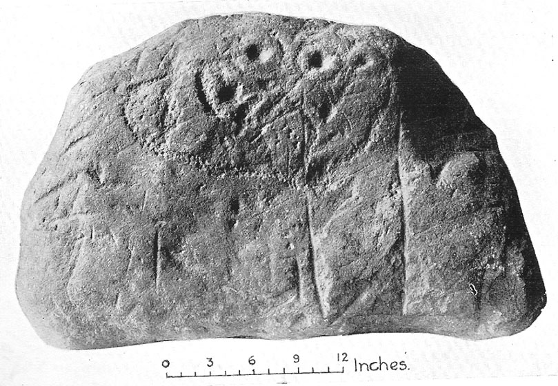
Braid Hills carving

This is a fine-looking old cup-and-ring stone!  Although no longer in situ (one of those really important golf courses needed to be built, so it had to go!), the 3 or 4 cup-and-rings seen here, carved at the end of what look like some sort of ‘stalks’, emerging from a distinctive radial under-curve, gave me a somewhat anthropomorphic impression of chaps in a boat — perhaps sailing into the Firth o’ Forth a short distance away! The Scottish Royal Commission (1929) report said the following of the stone:

“In 1897 a boulder of white sandstone with cup-and-ring markings on its surface was discovered on the Braid Hills golf course, and it was later presented to the National Museum of Antiquities.  The stone measures almost 3 feet by 1 foot 9 inches, by 1 foot thick and is roughly oblong.  The markings comprise seven cups in all, and at least three of these are completely surrounded by a ring and cut by a radial channel.”

Although nothing was said in the RCAHMS account, the stone gives one the impression it was associated with a tomb.  And I know it aint the same, but when I first saw this carving, it reminded me of the Ri Cruin carving in Kilmartin, Argyll.  It’s the potential “boat” feature that did it for me!

References:

  1. Royal Commission on the Ancient & Historical Monuments of Scotland, Inventory of Monuments and Constructions in the Counties of Midlothian and West Lothian, HMSO: Edinburgh 1929.

© Paul Bennett, The Northern Antiquarian

Lipney, Blairlogie, Stirlingshire

Standing Stone:  OS Grid Reference – NS 8436 9803

Also Known as:

  1. Canmore ID 145078

Getting Here

From Menstrie, walk up the path behind the post office and head up onto the hills, following the track that runs up alongside the Menstrie Burn.  After about 500 yards, crossing a stream, the path has a sort of hairpin kink and, shortly past this a smaller path leads off up into the grasslands on your left.  The standing stone can be seen up this path about 100 yards up.

Archaeology & History

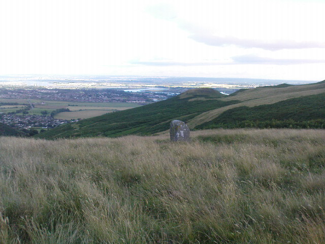
The Lipney Stone

We came across this small standing stone, less than four feet high, after running and jumping down the steep eastern slope of Dumyat at some speed — or rather, Naomi came across the little thing and then told me about it after I’d run round and further down the slope towards the upper stretches of the Menstrie Burn (I was knackered!).

It’s a curious little thing inasmuch as it stands here alone, with no other companions close by; although there were a number of other stones scattering the grasslands hereabouts and other stones may await discovery.  Little seems to have been said of the site.  The Canmore record tells:

“It measures 1.1m in height, 0.7m in breadth and 0.4m in thickness, and is aligned with its long axis NE-SW. It rises with straight sides and leans to the SE.”

There are extensive remains of earthworks scattering the slopes hereby, though much of this seems medieval in nature.  Any further information about this old stone would be much appreciated!

© Paul Bennett, The Northern Antiquarian

White Stone, Dunblane, Stirlingshire

Standing Stone:  OS Grid Reference – NN 8063 0420

Also Known as:

  1. Glenhead
  2. MacGregor Stone
  3. NN80SW 3 (Canmore)
  4. Whittieston Stone

Getting Here

If you’re not into the walk, get the bus running NE between Dunblane and Greenloaning — the A9 — getting off at the Little Chef on the dual carriageway and cross the road, walking up the track to Upper Whiteston Farm (the owners here are very helpful).  As you walk up the track you’ll notice the large upright in the edge of the field a coupla hundred yards to your right.  That’s the one!

Archaeology & History

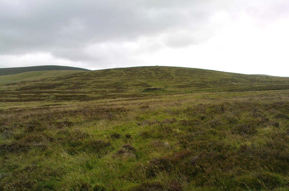
This is a mightily impressive site if you’re into yer megaliths!  When it was visited and measured by Mr Hutchinson (1893) in the 19th century he found it to be 9ft 4 in tall; and although it seems quite isolated at first sight, we find that there is another large stone companion laid down not far to the north of here which may have had some relationship with it .  But that aside…  There are also as many as eight cup-markings on the stone’s eastern face: one large one and seven smaller ones, in no particular order as usual!  It was these cup-marks that gave me the impression there was once a burial associated with the stone, but the archaeology records seem silent on such a matter; though folklore tradition tells another story…

Folklore

Mr Hutchinson (1893) told that the legend attached to this stone appears to be “of quite recent date.”  He said how,

“In the district the stone is known as the MacGregor Stone, and the tradition accounting for the name is to the effect that here a countryman was sacrificed by the followers of Rob Roy, when forming for the engagement on Sheriffmuir, in order to satisfy the ancient Highland superstition that first-blood was an infallible omen of success… The tradition is precise enough to state that a man of the name Dawson was seized in the adjoining hamlet of Whiteheadston (for such is the orignal name) as a whig, and therefore a foeman and proper victim.  Dawson, however, suspecting the intentions of the captors, vehemently professed himself a supporter of King James and was left off.  But another inhabitant of the hamlet not so acute or not so hypocritical, was immolated at the stone.”

Hutchinson however, doubts the accuracy of the tale and suggests that the local name of the MacGregor’s Stone derives from the fact that the monolith stands upon land once owned by the MacGregors of Balhaldies, countenancing that the stone “is of much earlier date than the MacGregors of Balhaldie or any other sept of the Children of the Mist.”  I think he’s got a point!

References:

  1. Hutchinson, A.F., “The Standing Stones of Stirling District,” in The Stirling Antiquary, volume 1, 1893.

© Paul Bennett, The Northern Antiquarian

Ben Ledi, Callander, Stirlingshire

Sacred Mountain:  OS Grid Reference – NN 562 097

Getting Here

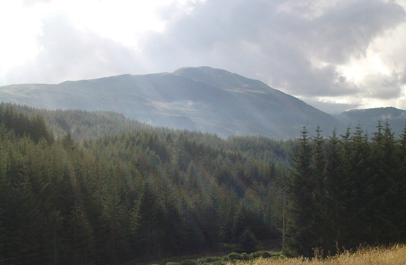
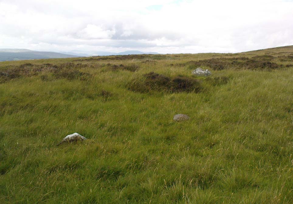
The hazy peak of Ben Ledi

From the tourist-infested (but lovely) town of Callander, look west to the largest of the nearby mountains — that’s where you’re heading!  You can keep along the A84 road out of the town for 4-5 miles (past the Falls and Pass of Leny) till you reach the parking spot on your left.  Cross the river and go up into the signposted woodland.  Keep walking up thru the trees until the rocky mass emerges above you.  You can either keep to the path and follow the long walk round the mountain, or go straight up the crags above you.  The top’s in sight!

Folklore

Getting up here is no easy task if you’re unfit — but it’s well worth the effort for the journey alone!  And in bygone centuries it seems, local people made it a particular pilgrimage at specific times during the year.  Even the name of this great hill has some supposed affinity with holy issues; though some modern english etymologists put a dampener on such things.  In Charles Rogers’ (1853) excellent Victorian exposition, he told that,

“Benledi is an abbreviation of the Celtic Ben-le-dia, signifying the hill of God.”

But whether the old heathens who named most of these ancient mountains would echo his oft-repeated derivation is another thing altogether!  However, there are other decidedly pre-christian events that used to be enacted here, for the summit of Ben Ledi was, tradition tells, where the sun god was worshipped.  It would seem, however, that this tradition is a somewhat watered-down version of it as a site of cosmological and social renewal. (see Eliade 1974) For akin to the annual pilgrimage that happens upon Croagh Patrick in County Mayo, Ireland, here upon Ben Ledi,

“For three days and three nights…the inhabitants of the district in those primitive times convened, at the period of summer solstice, on the summit of the mountain, to join in the rites of heathen worship.”

More recent lore tells the date of such sacred gatherings was Beltane.  Also a short distance to the north of the summit of Ben Ledi is a small loch known as Lochan-nan-corp.  Mr Rogers again tells us that,

“Here two hundred persons, who were accompanying a funeral from Glenfinglas to the churchyard of St. Bride, suddenly perished; the ground had been covered with snow and the company were crossing the lake on the ice, when it at once gave way.”

It seems a most unusual event.  But the tale itself implies that a corpse route passed by the way of this high summit, down to the heathen chapel of St. Bride at the bottom of its eastern face: a huge undertaking in itself with probably archaic origins.  Does anyone know owt more about this?

References:

  1. Eliade, Mircea, The Myth of the Eternal Return, Princeton University Press 1974.
  2. Eliade, Mircea, Patterns in Comparative Religion, Sheed & Ward: London 1958.
  3. Roger, Charles, A Week at Bridge of Allan, Adam & Charles Black: Edinburgh 1853.

© Paul Bennett, The Northern Antiquarian

Carmyllie Hill, Greystone, Angus

Tumulus:  OS Grid Reference – NO 545 434

Also Known as:

  1. Fairyfold Hillock
  2. Fairy Folk Hillock

Folklore

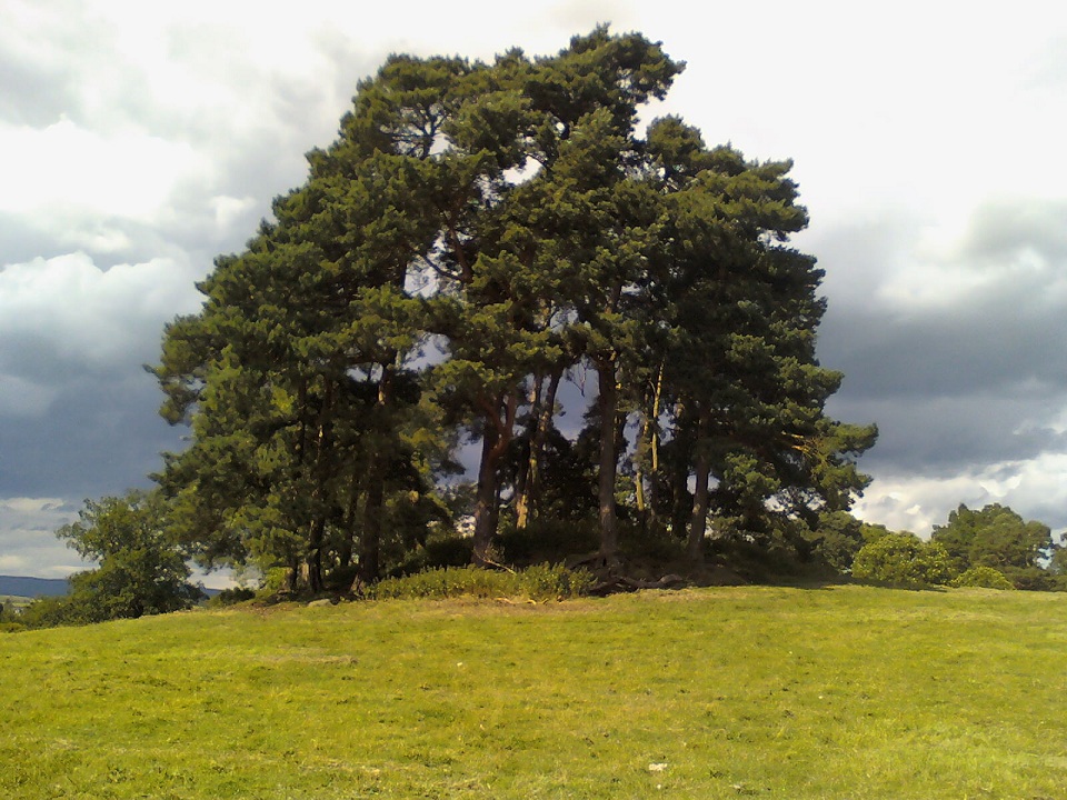
An intriguing site this, as it doesn’t appear to be in the Canmore archaeological register – unless it’s the Canmore site 34750.  Yet Alexander MacGregor (1937) mentions the place in his folklore study as being a site where the little people lived.  Shown on the first OS-map of the region as ‘Fairyfold Hillock’, Mr MacGregor (1937) said of it:

“Near the summit of Carmylie Hill is a large barrow or tumulus, which was believed at one time by the natives to be a favourite haunt of the fairies, where, with much splendour, they held their nightly revels. It still bears the name of ‘Fairy-Folk Hillock.'”

However it seems that quarrying operations may have destroyed the site.  The tomb here was probably the same one described by Mr Andrew Jervise in the Journal of the Kilkenny and South East of Ireland Archaeological Society (1864-66), where he wrote:

“Many years ago I took note of another example of these ‘footmarks,’ which was found in the parish of Carmyllie…  This was discovered in the course of making agricultural improvements some thirty-five years ago, on which occasion stone coffins or cists were got, and in one of these was a bronze (?) ring, of about three inches in diameter, now said to be lost.  Apart from the cists there was a rude boulder of about two tons weight; and upon the lower side of it, as my informant told me, was scooped the representation of a human foot. This too was associated with the elves; for the hillock upon which these discoveries were made was called the ‘fairies’ knowe;’ and tradition says that, but for a spirit that warned the workmen to suspend operations when they began to prepare for the foundations of the parish church, the church would have been built upon that spot!”

References:

  1. MacGregor, Alexander, Highland Superstitions, Eneas MacKay: Stirling 1937.

© Paul Bennett, The Northern Antiquarian

Harperstone Circle, Dunblane, Stirlingshire

‘Stone Circle’:  OS Grid Reference – NN 838 032

Archaeology & History

An intriguing entry inasmuch as we don’t know the full history and nature of the site.  Whether this site was the “druidical circle” mentioned in the 1791 Old Statistical Account of Scotland ” upon the heights of Sheriffmuir,”(vol.3, p.210), we cannot be sure.  The site was certainly described by Mr Hutchinson (1893) more than a century ago as a “stone circle”, but earlier still in a short piece in the Stirling Journal of May 5, 1830.  It read:

“About eight miles from Stirling by the Sheriffmuir Road, near a place called Harperstone, there is a remarkable circle of stones, supposed to have been a druidical place of worship of old.  The site of this circle is rather uncommon in this country — being on the back summit of a high hill, one of the Ochils called the Black Hill, and exposed to every wind that blows.  It is about two english miles south of the present roadway.”

The writer’s notes then told of some curious finds by this circle, giving the impression that it may have had another function: perhaps a cairn of sorts; perhaps an ancient building — we may never know.  Nevertheless, his information is intriguing.

“Tradition records two remarkable circumstances connected with this druidical circle, which may perhaps be worthy of being preserved.  About the middle of last century (c.1750) there were dug up at the foot of the larger stones three vessels of clay of antique shapes, containing coins of very ancient date, which were long preserved by Monteath of Park, but are now, we regret to say, lost.  So late as 1770, these coins were, it is said, to be seen at Park House, all of gold.  About the year 1715, some stones on which had been engraved inscriptions were dug up at the same place; and at a previous period specimens of ancient Pictish armour were dug up from the bowels of this hill, which had been carefully deposited of yore some feet below the surface in crypts of curious description.”

When Mr Hutchinson came to explore this region in search of the stone circle, his nose took him to a site a few hundred yards north of nearby Harperstone Farm, where he found a large stone:

“It is 9 feet long by 6 feet across on the top, is 3 feet thick and measures 26 feet round.   This appears to have been a centre stone, and a surrounding circle is traceable more or less distinctly — moreso to the west and north, less so to the east and south.  The radius of the circle is about 15 yard, and a similar distance separates each of the larger stones yet traceable in the circle.  The ground beside the great central stone appears to have been excavated…”

Black Hill, Sheriffmuir, looking east
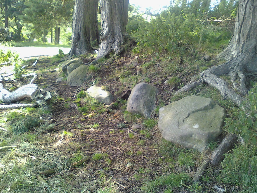
Arc of 3 stones in large ellipse

But it would seem that Hutchinson’s site and the one described in the Stirling Journal of 1830 are two distinctly separate items if their relative topographical descriptions are to be accepted.  No doubt — like many a-local who’s found these same written accounts — when we visited and wandered back and forth over the Black Hill site in Autumn 2010, we were as puzzled as others before us in finding nothing on the named Black Hill.  Nothing that could remotely be viewed as the circle described was anywhere in evidence.  The only thing that we found of any potential was on the flat below the southern ridge of the hill, heading towards the small copse of trees, where is a possible ring of seven stones, albeit a low one, in an ellipse formation.  The ground was much overgrown and a spring of water emerged from the edge of where might have been an eighth stone.  The photo shown here was the best we could get of the site.  It’s unlikely to be the place which Messrs Hutchinson and company wrote about.

A more detailed examination of the landscape around this ‘Harperstone Circle’ is needed.

References:

  1. Hutchinson, A.F., “The Standing Stones of Stirling District,” in The Stirling Antiquary, volume 1, 1893.

© Paul Bennett, The Northern Antiquarian


Kippenross House, Dunblane, Stirlingshire

Cairn:  OS Grid Reference – NN 7837 0037

Getting Here

Kippenross Cairn

From Dunblane Cathedral walk straight down town along High Street, but where the road bends to cross the river, keep to your left and onto the dual carriageway.  Walk straight across and along the “private” drive that leads to Kippencross House.  The first 100 yards is wooded either side of you, but when you come out into the grassy open, walk on for another 100 yards or so, keeping your eyes peeled for the rise in the grassland on your right, topped with a clump of trees.  This is the cairn!

Archaeology & History

This is a lovely site, perched near the crown of a small hillock, surmounted with a crown of pinus trees that would have delighted Alfred Watkins and his ley-hunters.  It is a veritable faerie mound, seemingly alone amidst this modernised but well-kept gardenscape.  The large tomb sits upon a small rise in the land here, where the grasslands fall to its west and northern sides with some obvious deliberation.

Kerbstones on south side

The cairn doesn’t appear to have been excavated (but I don’t have my library to hand, so could be wrong – I’ll check when I get back home) and though there’s a distinct impression of cup-marked stones close by, we couldn’t find owt in our brief bimble here.  The tomb measures about 20 yards across, and rises perhaps six feet or more above the ground level.  Although a little overgrown with summer herbage (mainly Urtica and friends), quite a few small stones were visible close to the surface on different parts of the mound, looking like typical cairn material; though around its mainly southern edge is a line of larger kerb stones showing the outline of what would seem to be the edge of the monument.

The cairn is definitely worth having a look at if you’re in the area.  It’s certainly a beautiful little spot to sit for a while…

References:

  1. Royal Commission on the Ancient & Historical Monuments Scotland, Stirling – volume 1, HMSO: Edinburgh 1963.
  2. Royal Commission on the Ancient & Historical Monuments of Scotland, Archaeological Sites and Monuments of Stirling District, Central Region, Society of Antiquaries of Scotland 1979.

© Paul Bennett, The Northern Antiquarian