Cup-and-Ring Stone (removed): OS Grid Reference – NO 378 308
Archaeology & History
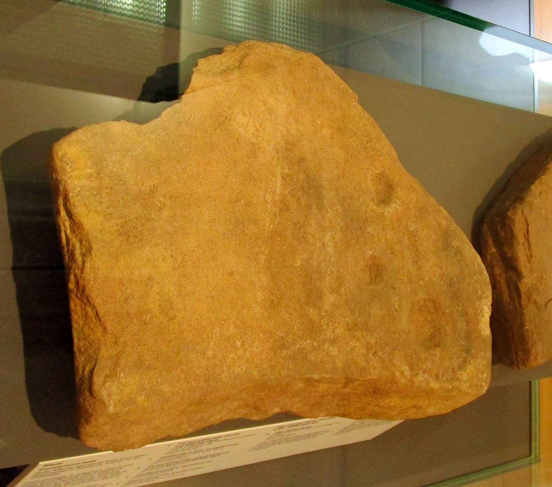
Cup & ring stone of Balgay Hill
This little-known cup-and ring stone was found at ground level sometime around 2003, near the top of Balgay Hill. A small portable stone that may have been broken from a larger slab, it has what seems to be two if not three cup-and-rings, accompanied by two or three single cup-marks. One of the rings seems to have a faint line coming out of it. Unfortunately none of this is clear in the photos I took (the one attached here is the best), as it lives under glass in Dundee Museum, so it was very difficult to get decent images. It is now housed in the McManus Museum in Dundee (a damn good place, with very helpful staff) and well worth checking out if you’re in the area.
Cup-and-Ring Stone (removed): OS Grid Reference – NO 5061 5565
Archaeology & History
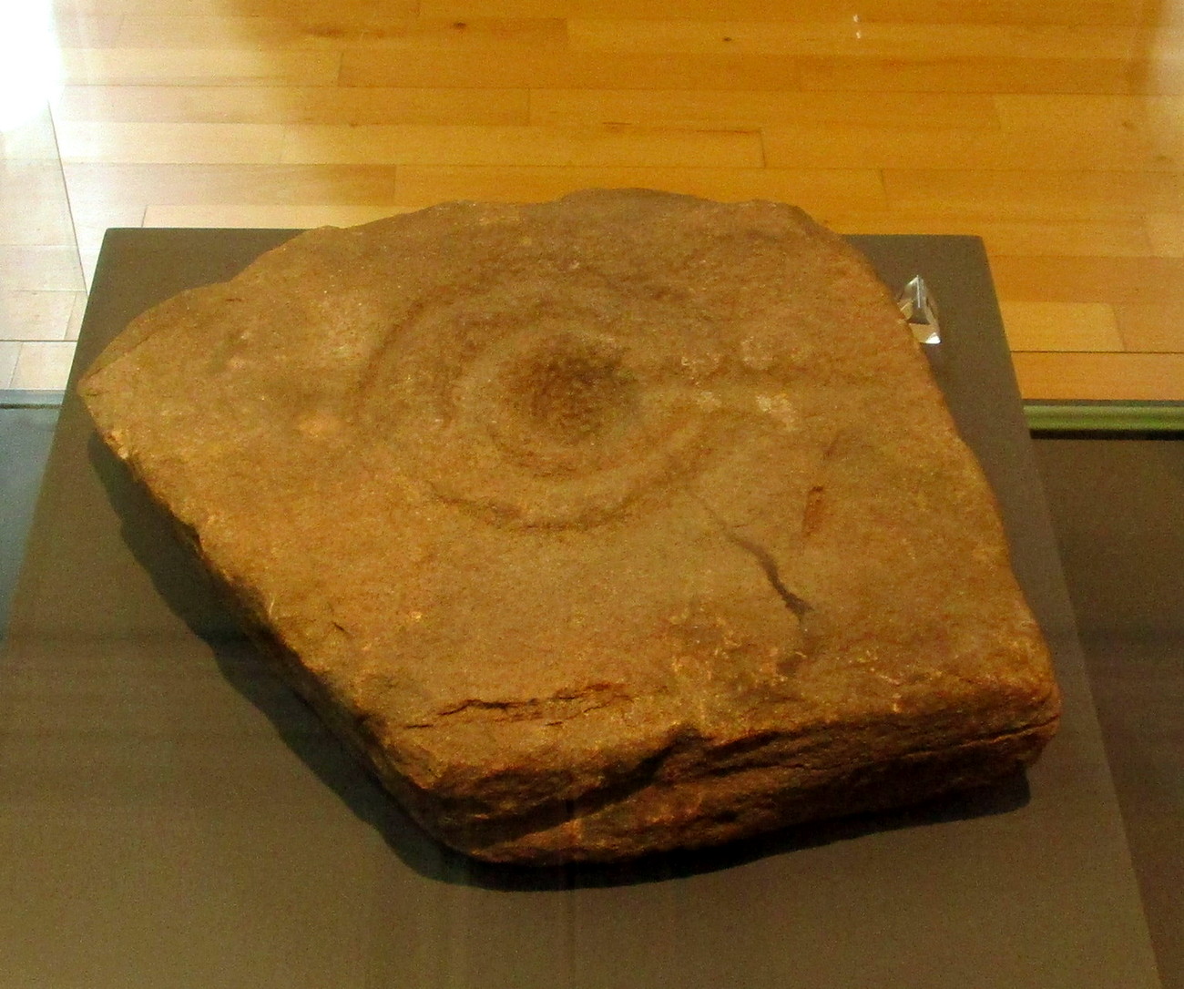
Finavon carving, now in Dundee Museum
Close to the western walls of the Finavon Iron Age hillfort this small (portable?) cup-and-ring stone was found at ground level in 1987. It was probably knowingly reused in the construction of the hillfort, but whether it was just deemed as an innocuous carving thrown into the mass, or whether it held a place of importance cannot be known.
The primary design consists of a cupmark surrounded by a double-ring, with a line coming out of the central cup towards the edge of the stone. The stone itself—measuring 12 inch by around 10 inch—has been cut from a larger piece, meaning the original design may have been larger. It is now housed in the McManus Museum in Dundee (a damn good place, with very helpful staff).
Cup-Marked Stone (lost): OS Grid Reference – NO 3975 3340
Also Known as:
Magdalen’s Kirkton Stone
Archaeology & History
In the mid-1890s, workmen ploughing one of the fields near the steading at Magdalen’s Kirkton farm hit a large stone beneath the soil. It turned out to be the covering stone of a prehistoric burial, or cist, that was aligned east-west. Whilst the remains in the cist had all but turned to dust, the covering stone had a number of cupmarks on it. It was described only briefly by R.N. Kerr (1896), who told that,
“The stone forming the lid of the cist is cup-marked. It weighs 5 cwt., 1 qr., 21½ lbs., and its thickness varies from 9 to 12 inches. There are 40 or more cup-markings on it, varying from 1 to 3 inches in diameter.”
It would seem that no sketches were made of this carving and I’ve been unable to find any more details about it. Help!
From Doune, take the A84 road to Callander. As you pass through the hamlet of Buchany, keep your eyes peeled a few hundred yards on as the road dips down and swerves gently right, for the road sign of Drumloist (or Moist as some locals keep amending!) which goes up to the right. It’s a small single track road that zigs and zags slowly uphill. After exact one mile you reach a small track on your right (there one left too). Carefully park hereby (don’t block the gate!). Across the road, go through the gate on your right and walk along the edge of the field until you reach the burn. Go across it, and then across the field, through the gate and you’ll see it ahead of you. In the tick season (summer) treat the brackens as possessed by a plague and avoid it!
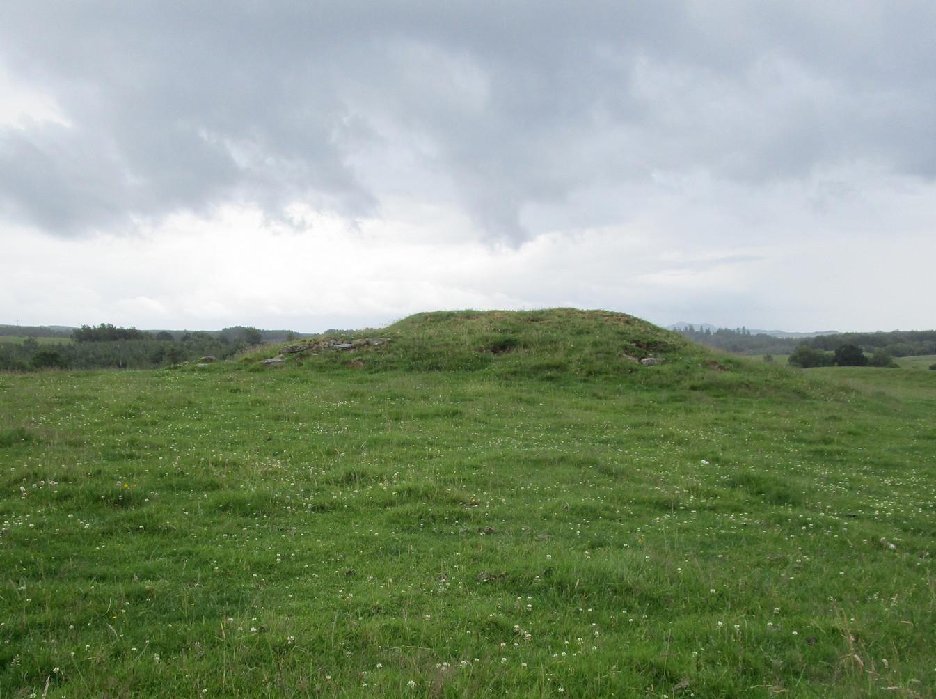
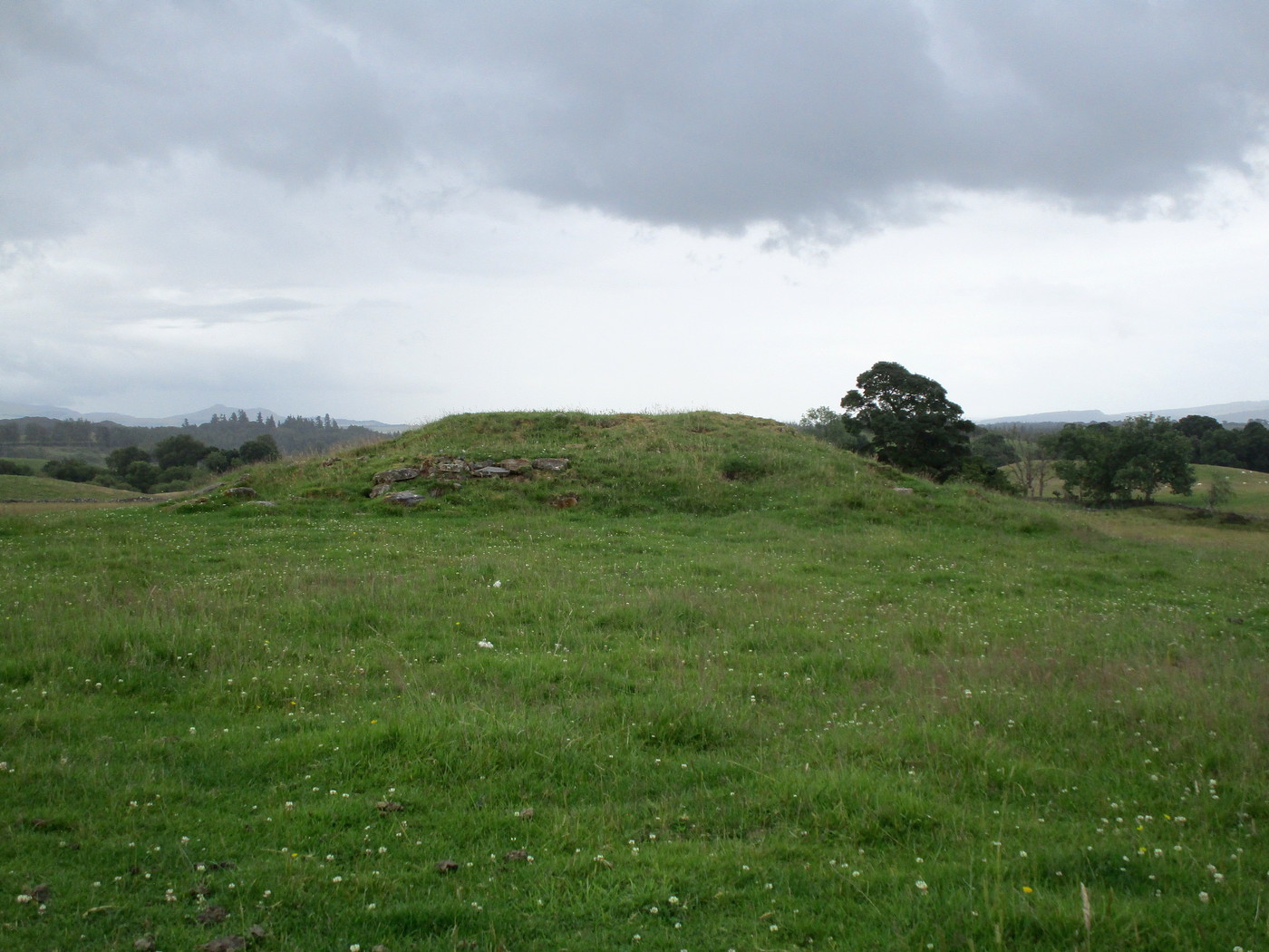
Archaeology & History
Looking at its stony face
A curiously forgotten place, hidden from sight, this large rounded grass-covered mound with small upright stones around one side, seems timeless amidst the open fields. It seems alone, but the denuded chambered tomb of Ballachraggan is just visible 1.4 miles to the northwest on the near-horizon; and there’s a hidden cairnfield just a half-mile away. This cairn measures 18 yards (N-S) by 16 yards (E-W) and stands 7-8 feet high when you look at it from its southern side. The top of the mound is a mix of stone and grass with a slight dip in the middle, perhaps by someone in ages past digging, albeit only slightly—perhaps scared away by the old folk buried herein.
One of the most notable aspects of this site is the complete silence. On my last two visits hereby, a fusion of mists from the low cloud above and the breathing Earth below gave an atmosphere the likes of which lived when this tomb was first built. On one occasion hereby, no vehicles for several hours gave the silence a curious atmosphere (those of you who like sitting in the rain with the wilderness will know what I mean). To me this is a gorgeous site…
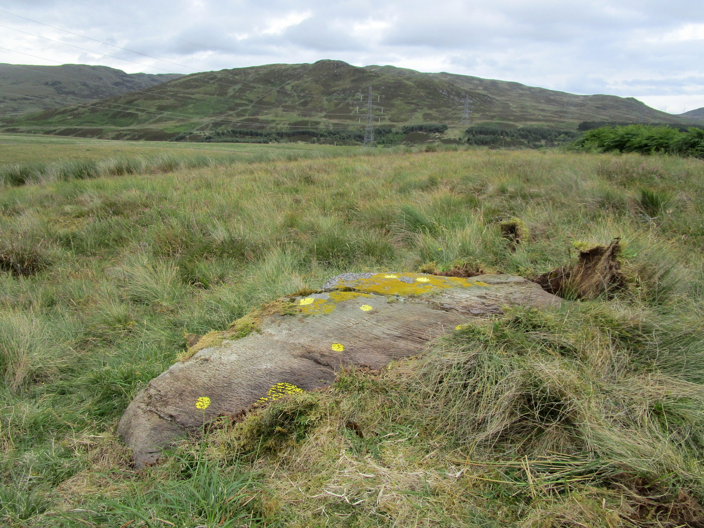
Take the A822 road to the northeast of Crieff and head 4-5 miles along until you enter the Sma’ Glen. You go past Ossian’s Stone and after crossing the river the road starts to go uphill. Nearly 2 miles up, the road levels out and at the left-side of the road is a small thin car-parking spot. Keep your eyes truly peeled for that! Go through the gate and turn right (north), up the grassy slope. Follow this footpath (known as General Wade’s road) straight past Corrymuckloch Farm until, about 250 yards on, the track splits. Take the left track and nearly 500 yards along walk up the embankment on your left and look around (if you reach the gate you’ve gone too far).
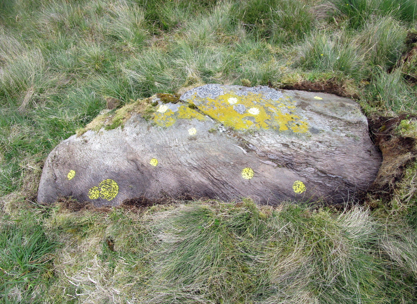
Archaeology & History
Corrymuckloch (14) stone
This stone was rediscovered in July 2023 during a cursory survey of other carvings in the Corrymuckloch cluster (17 and counting!). Most of the stone was covered in vegetation when first found, with just a single cupmark near its crown ensuring it got more attention. Altogether there are 10 or 11 cup-marks of varying levels of erosion across the length and breadth of the rock. The most notable one is on the northwest side of the stone, it being twice the size of the others and of much greater depth. It may originally have been a natural depression that was enhanced when the stone was carved. This larger cup has a smaller one attached just above it.
An intriguing find was noted all along the western edge of the rock, where upwards of a hundred small pieces of quartz—the majority of it crystal clear—were scattered between the stone edge and the soil. This is an ingredient that’s been noted at a number of petroglyphs in Scotland.
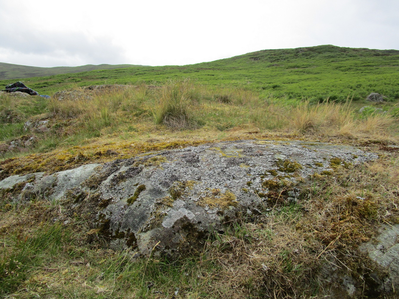
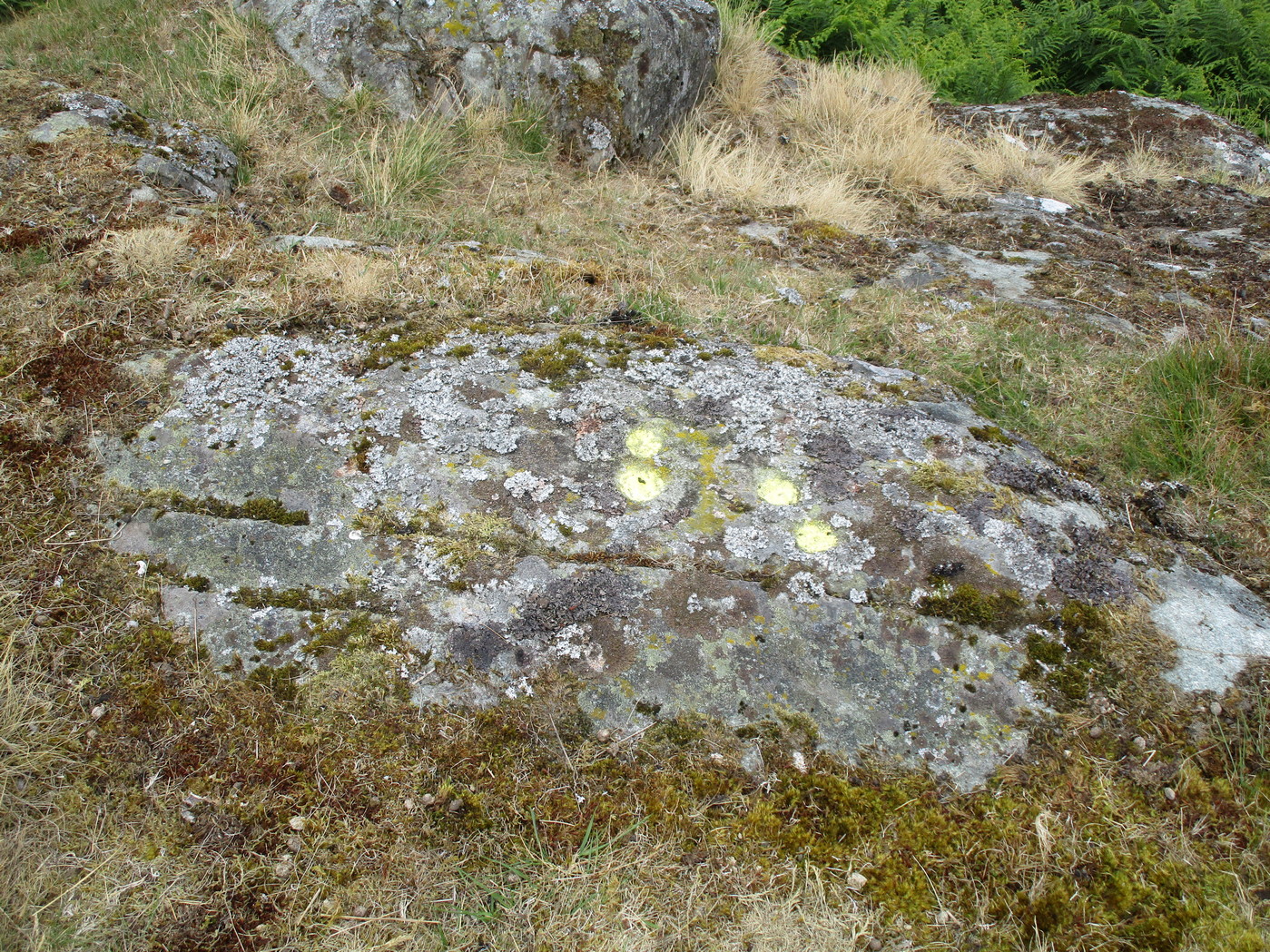
Take the A822 road to the north-east of Crieff and head 4-5 miles along until you enter the Sma’ Glen. You go past Ossian’s Stone and after crossing the river the road starts to go uphill. Nearly 2 miles up, the road levels out and at the left-side of the road is a small thin car-parking spot. Keep your eyes truly peeled for that! Walk through the gate and along the track (west) for 300 yards until you reach the fence. Once here, walk right (north) and go through the gate less than 50 yards away. Less than 300 yards ahead of you you’ll see a small rock outcrop. Get to it!
Archaeology & History
Rediscovered in July 2023, on this small rock outcrop it seems that only the lower east section has been carved, and it can be pretty difficult to see beneath the old layers of lichen that’s been painted across its surface. Comprising of just four cup-marks close to each other on the top of the stone, there’s a possible fifth cup to be seen on its northeast length. It’s nowt special to look at to be honest, but it’s worth checking out when you’re looking at the others in this cluster. In truth, this is another that’s only gonna be of interest to the real geeks amongst you!
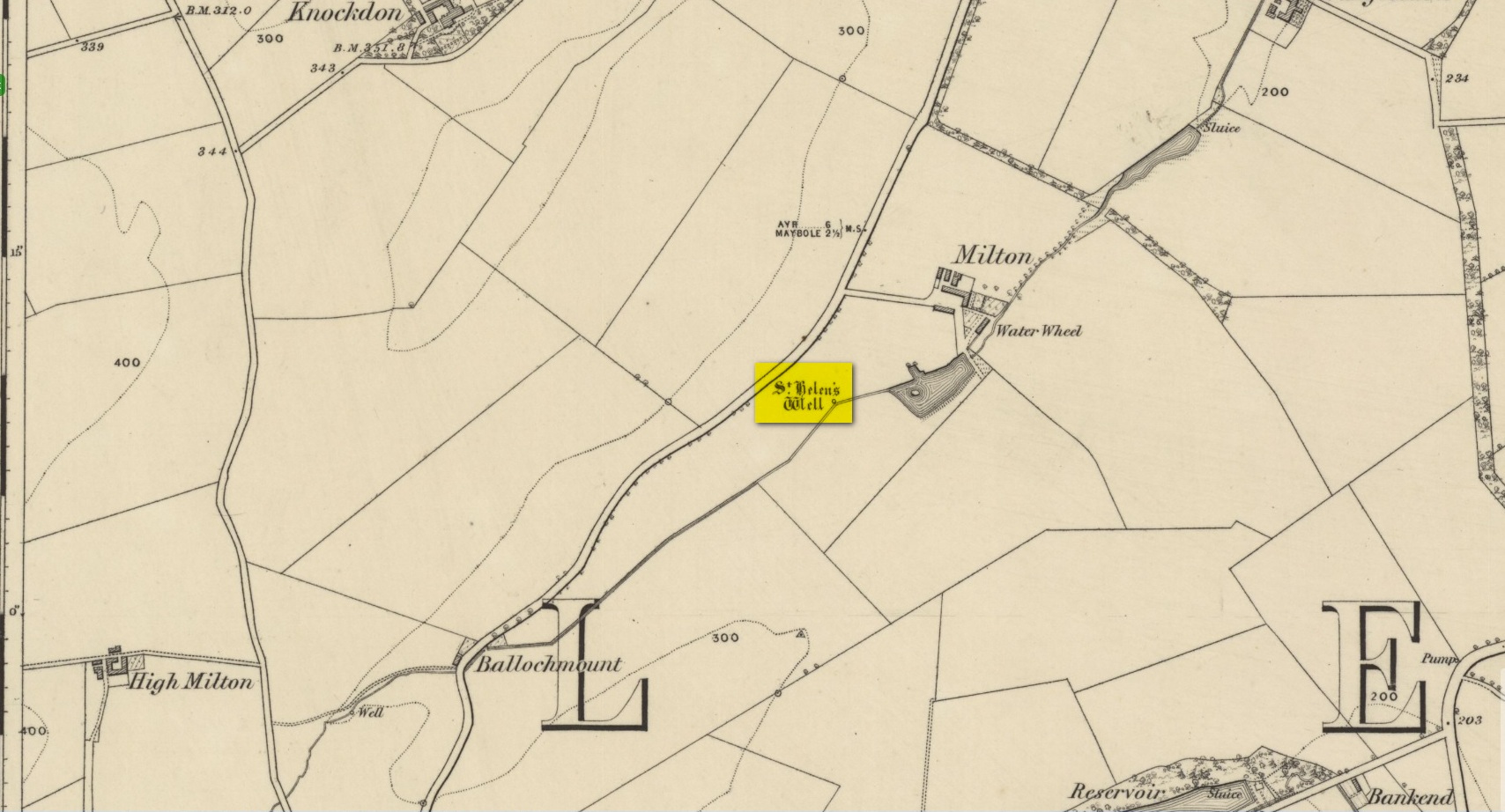
In spite of this site being covered over some time in the 1950s, it is still retained on the modern Ordnance Survey maps. It was shown on the first one in 1860, but its literary history goes back much further. We find it described by the Minister for Maybole — one William Abercrummie — in his short 17th Century work named A Description of Carrict. He noted several springs in Maybole township, with this one of possessing the usual hallmarks of both christian and peasant customs alike:
“Another spring there is called St. Helens well or by a curt pronuntiation St. Emus for St. Antonies well, it is about a myle and ane halfe from Mayboll on the road to Aire a litle north of Balachmont. It is famous for the cure of unthriving children, to which at the change of the quarter especially at May-day there is a great resort of people from all quarters, and at a good distance.”
This piece was repeated in several 19th century works, including one by William Roberston (1891), who commented on the traditions themselves, saying:
“This can unquestionably be traced as a remnant of the ancient superstition that miracles were wrought at Holy Wells; which all the anathemas of the Reformed Kirk could not for a time obliterate from the minds of the common people. The records of the Kirk-session bear witness to the prevalence of applying to Saints’ Wells for the cure of bodily infirmities on stated occasions; particularly, when the Saint or Angel was understood to ‘move the waters.’ Pins, pieces of the dress of the patient, or such small trifles, were left at the well – the remains, no doubt, of the offerings formerly made to the Clergy – and in token that the disease was transferred from the sufferer to the rags, thus offered to the Genius loci. Numerous traces of this prevailing superstition could easily be cited.”
When the Ordnance Survey dudes wrote about the site in the Name Book in 1857, all they could tell us was that it was, “a beautiful spring of excellent water” but was said to have “no medicinal properties.”
Despite this sacred well now being covered over, there is surely a case to be made here for it to be restored back to its former glory, for all to visit and see. Local historians, pagans and Christians alike — join forces and gerrit sorted!
References:
MacKinlay, James M., Folklore of Scottish Lochs and Springs, William Hodge: Glasgow 1893.
Cup-Marked Stone (lost): OS Grid Reference – NO 074 458
Archaeology & History
In J. Romilly Allen’s (1882) lengthy essay on rock art in Scotland, he mentions a singular boulder that was “found by Dr Rattray” at Laighwood, near Butterstone—but, unlike him, he gave no further details regarding its appearance or exact whereabouts. It was included in the Royal Commission (1990) survey of the area, with no additional details. It remains lost. In the event that you manage to rediscover it, grab some good photos of it and stick ’em on our Facebook group. (the grid-reference to this site is an approximation)
Royal Commission on the Ancient & Historical Monuments of Scotland, North-East Perth: An Archaeological Landscape, HMSO: Edinburgh 1990.
Acknowledgements:Huge thanks for use of the Ordnance Survey map in this site profile, reproduced with the kind permission of the National Library of Scotland.
Cup-Marked Stone (lost): OS Grid Reference – NT 179 356
Archaeology & History
In Sir George Douglas’ (1899) brief sketch of prehistoric remains in Peeeblesshire, he described coming across a petroglyph somewhere near the top of the Iron Age hillfort east of Stobo Castle, near Drumelzier (King Arthur country). He told that,
“on a flat stone lying on the slope of the fort at Lour, are two “cups,” measuring 2¾ inches in diameter and an inch in depth, and exhibiting perfect symmetry in their form and position on the stone: they have been thought to be genuine examples of “rock-markings”.”
The carving hasn’t been seen since and it’s presumed that vegetation has covered the stone. (the grid-reference for this site is an approximation)
Cup-and-Ring Stone (lost): OS Grid Reference – NT 269 419
Also Known as:
Kittlegairy Burn
Archaeology & History
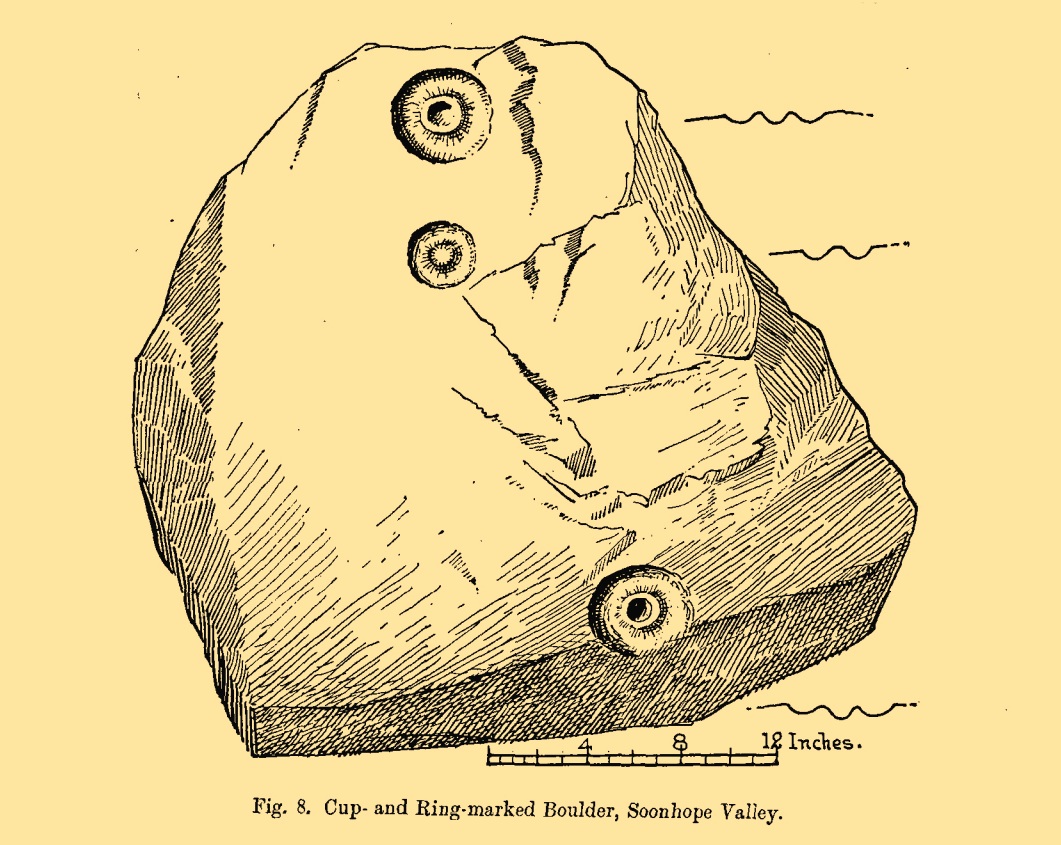
Fred Coles’ 1898 sketch
An apparently isolated cup-and-ring stone was found on the hills north of Peebles at the end of the 19th century by the renowned Scottish megalith explorer, Fred Coles. (1899) He was having a look at some of the hillforts in the area and—as some of us tend to do—he began meandering off-track, down streams, through bogs and as a result came across the carving that’s illustrated here. It’s subsequently become “lost” in the hills, but it shouldn’t be too difficult to locate, as the description he gave of its whereabouts is a pretty good one. He told us:
“A very little over one mile and a quarter up the valley, measuring from the road at Kerfield Cottage, a tiny rivulet called Kittlegairy Burn trickles down from the SE into the main stream. On the hill to its east, and about 450 feet higher, are the remains of a fort, one of a series of three crowning prominent heights along this side of the valley. Down the main stream from Kittlegairy Burn is a large ruined sheep-shelter called Soonhope. Nearly midway between these two points a deep curve has been hollowed out of the E. bank; and, at the foot of this rather high gravel bank, half immersed in the stream, lies the block of stone with the cup-and ring-marks. They were discovered, 14th September 1896, by my daughter, Helen, on crossing the stream; and we at once proceeded to make a measured drawing, a reproduction of which is given here…. The depth of the rings in proportion to their width is the one most noticeable feature; next, the extreme thinness of the intervening ‘neck’; but, on a minute and careful examination of the nature of the stone itself, taking into consideration that its angularity and sharpness of edge and the absence of moss or even of confervoid growths on its surfaces went against the possibility of its being truly waterworn.”
The rock had obviously fallen from its original position above the burn. Today, the entire area where this stone exists has been covered by a huge forestry plantation, but if any rock art fanatics from the Peebles area get bored one day and have nothing to do…..
References:
Coles, Fred, “Notices of the Discovery of a Cist and Urns at Juniper Green, and of a Cist at the Cunninghar, Tillicoultry, and of some Undescribed Cup-marked Stones’, in Proceedings Society Antiquaries, Scotland, volume 33, 1899.
Morris, Ronald W.B., “The Cup-and-Ring and Similar Early Sculptures of Scotland; Part 2 – The Rest of Scotland except Kintyre,” in Transactions of the Ancient Monuments Society, volume 16, 1969.