Ostensibly non-linear carved designs, generally assumed to be Bronze Age in date, but many originate in the neolithic period (some may indeed date back to 5000 BCE). Their central features are small rounded cup-markings, circles, semi-circles, curved lines (short, mid-length, and long), straight-ish lines, double- and multiple-rings, all in usually abstract design-forms. Their almost complete non-linear nature relate to non-egoic structuralisms, making them difficult to ‘intellectually’ grasp. Added to this is that no two carvings are the same. Although no direct ‘meaning’ can be ascribed to the carvings, many of them have a relationship with ancient notions of death and/or burial. In animistic terms, they relate to the spirit of rocks and other features of the natural landscape. They have very little relationship with alignment features (though exceptions in some megalithic rings have been found). Some modern writers allege positive relationships with water, but this ingredient (if tenable) cannot yet be said with any certainty: the idea should be forged onto animistic relationships with the land itself.
Cup-Marked Stone (missing): OS Grid Reference – ND 04321 56794
Archaeology & History
When Alastair MacLaren (1955) first excavated an Iron Age hut circle just above the northern edge of Loch Shurrery, he found, “from the tumble of the wall came a cup marked stone.” It emerged from southwestern side of this habitation site, on a small portable-sized stone, and consisted of just a single distinct cup-mark. When the site came to be re-examined many years later, it had gone. MacLaren was of the opinion that the stone had merely “served as core material and was of no other significance to the builders of the hut circle than just a handy bit of rubble to fill the space between the inner and outer faces.” This may have been the case; although it may have originally been carried from one of the many chambered cairns in the region.
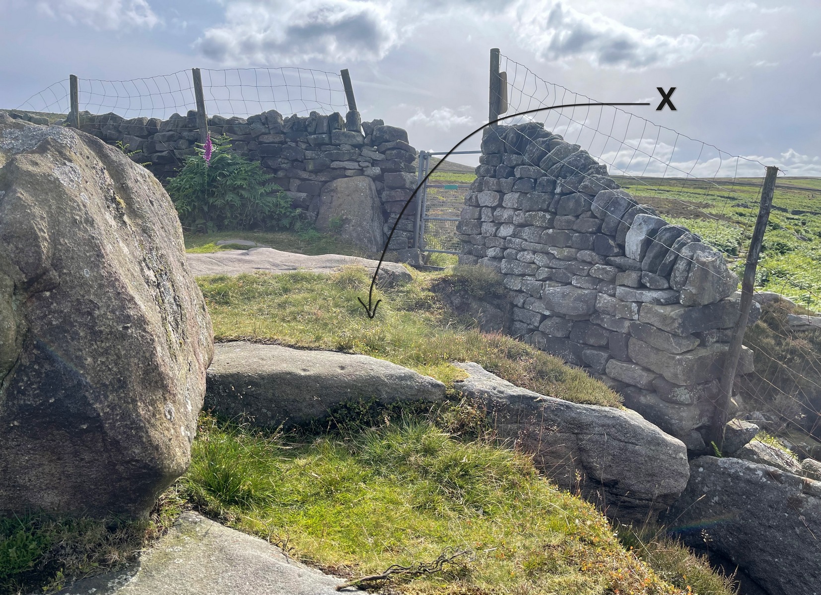
Take the Wells Road from Ilkley centre up towards White Wells, bending to the right as you hit the edge of the moor. Keep along the road, past the old college building with its lake and turn right up Westwood Drive. Keep going all the way up (it becomes Panorama Drive) till you hit the small woodland on your right. Where the woodland ends – stop! Walk into the trees about 10-15 yards and you’ll see the large rocks ahead of you. Brush back the vegetation and you’ll find it.
Archaeology & History
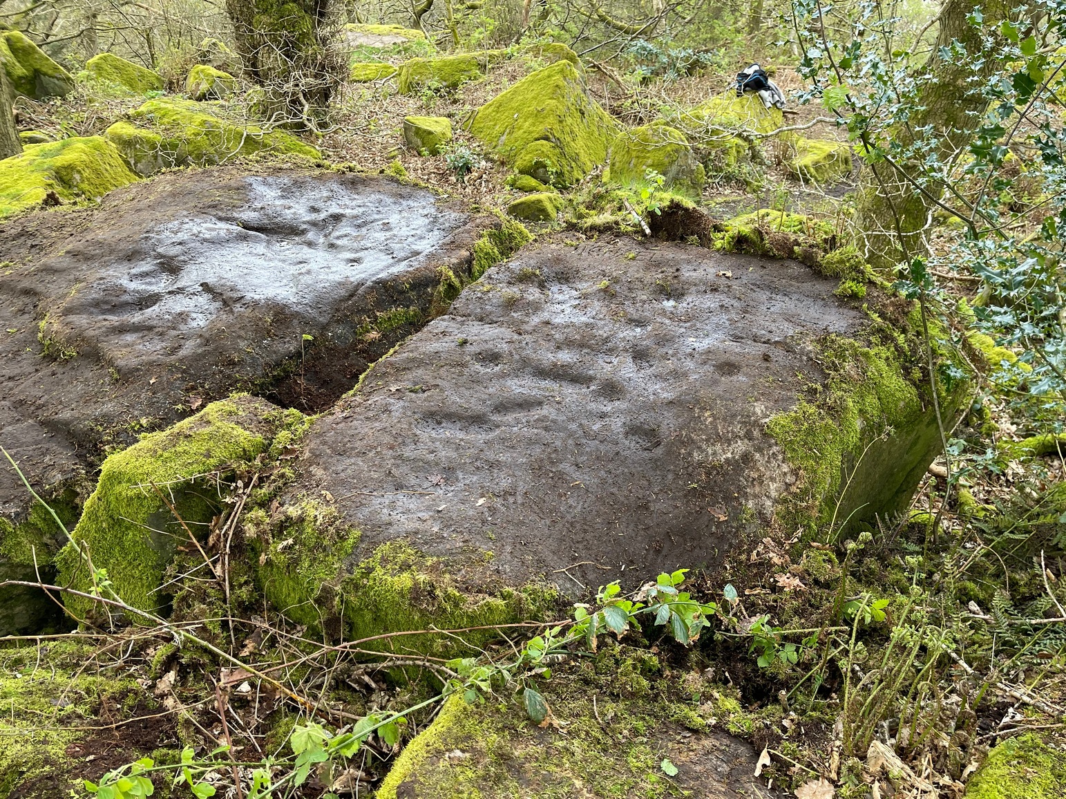
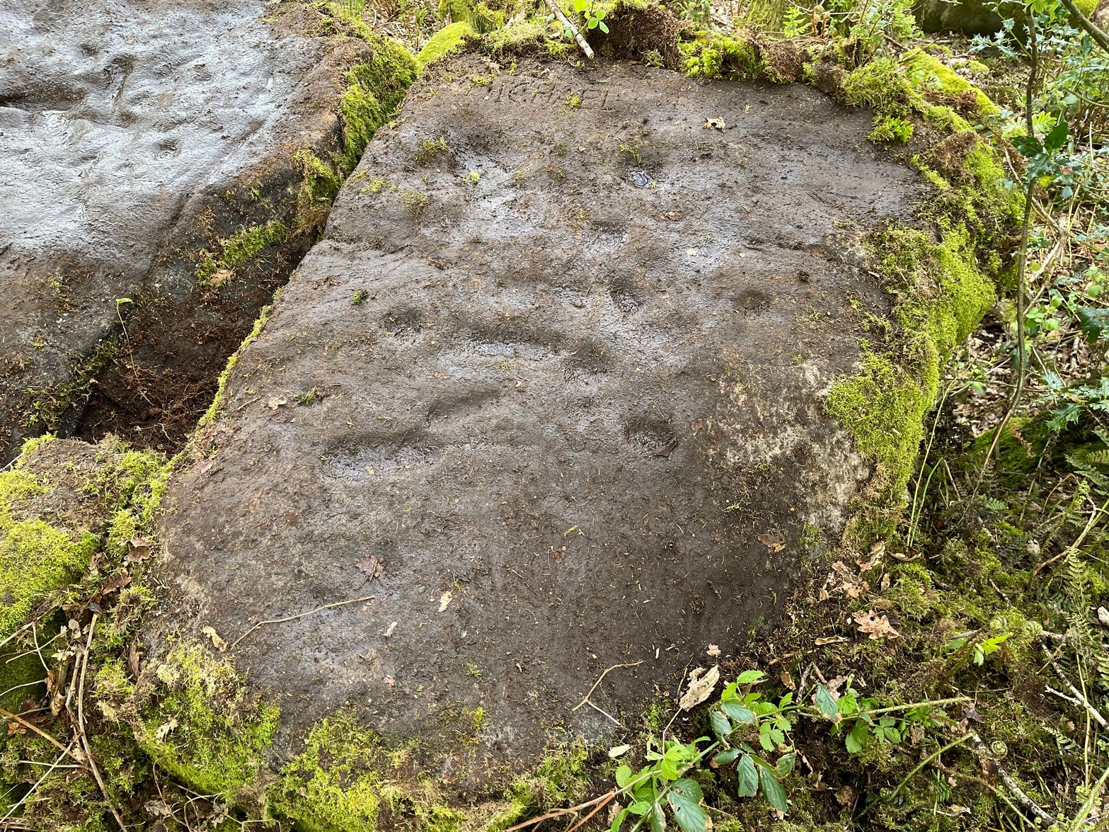
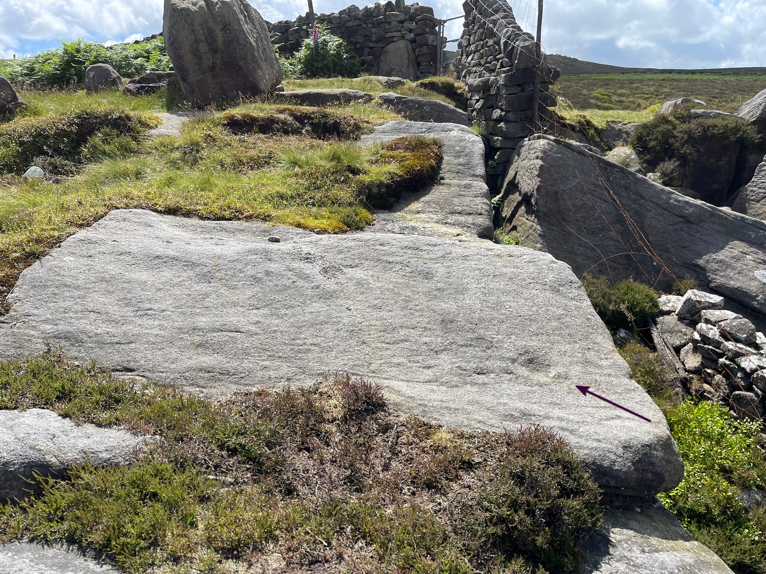
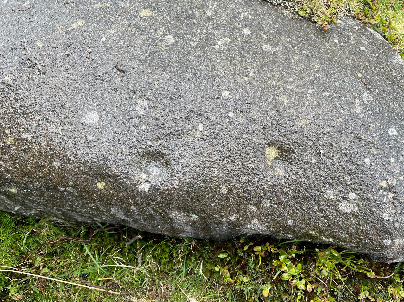
This large flat rock surface has a scattering of archetypal deep cup-markings, with other fainter marks scattered over most of its surface. It sits right next to carving no.232, with its own equally large, naturally worn basins.
Faint cup&ring just visible
It was visited in the 1870s (along with the other Panorama Stones) and subsequently illustrated in the personal sketch-pad of Mr Thorton Dale (we’re hoping to have them scanned in due course for open Creative Commons use) who showed the basic cup-marks and shaped “lines” or footsteps that give this petroglyph its name. Little more was said of it until Hedges (1986) described it in his survey, whose notes were subsequently repeated in Boughey & Vickerman’s (2003) work as being a “medium-sized flat-topped, upstanding rectangular rock. Eight cups, six deep ovals, faint circles and lines on SW end.” One of the most notable cup-and-rings can just be made out near the middle of the stone, on the left-side of one the footprints.
The depth of these incisions in this design strongly suggests that the carving was worked and reworked over many centuries, suggesting utilitarian usage of some kind, be it ceremonial or otherwise. It’s also very unusual inasmuch as elongated footstep-like cuttings are scarcities, not just in Yorkshire petroglyphs, but in prehistoric carvings across Britain. Check it out when you’re next walking up to the Swastika Stone.
References:
Bennett, Paul, The Panorama Stones, Ilkley, TNA: Yorkshire 2012.
Boughey, Keith & Vickerman, E.A., Prehistoric Rock Art of the West Riding, WYAS: Wakefield 2003.
Hedges, John (ed.), The Carved Rocks on Rombalds Moor, WYMCC: Wakefield 1986.
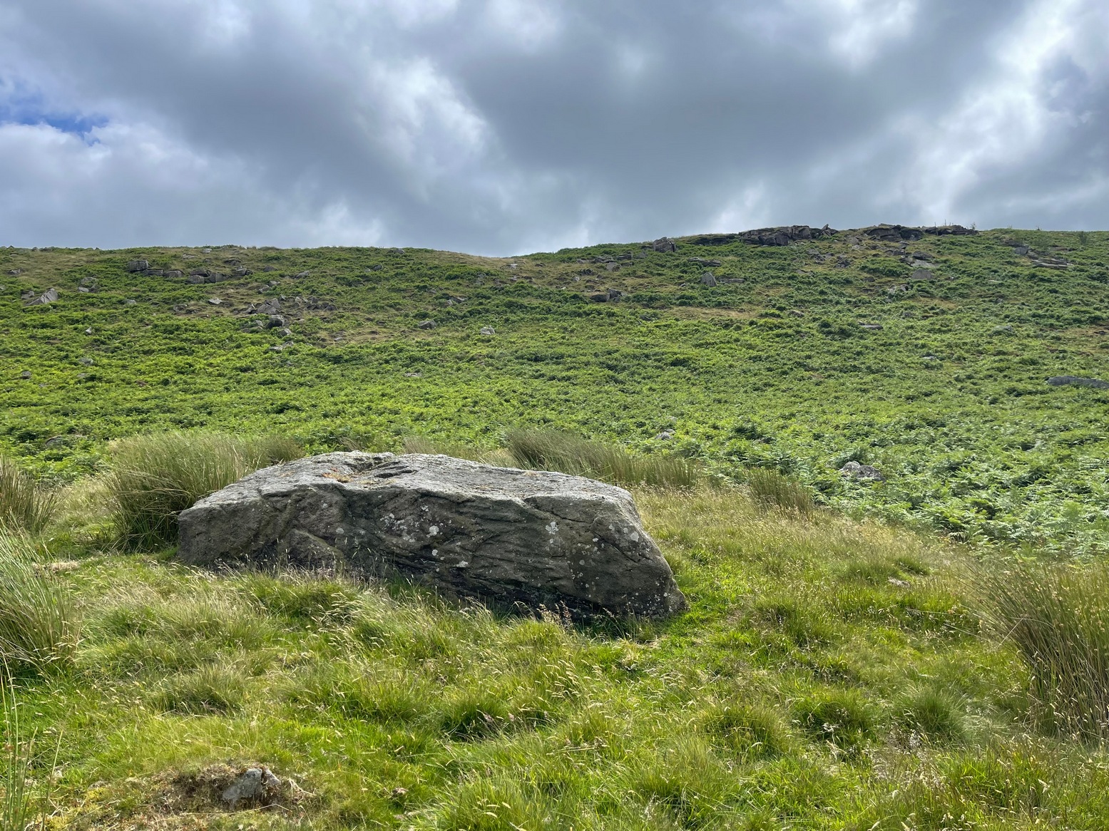
Simply follow the same directions as if you’re going to the Allt Thorrisdail (1) petroglyph, and the large, roughly oval-shaped boulder just a few yards away is the one you’re after. You can’t miss it!
Archaeology & History
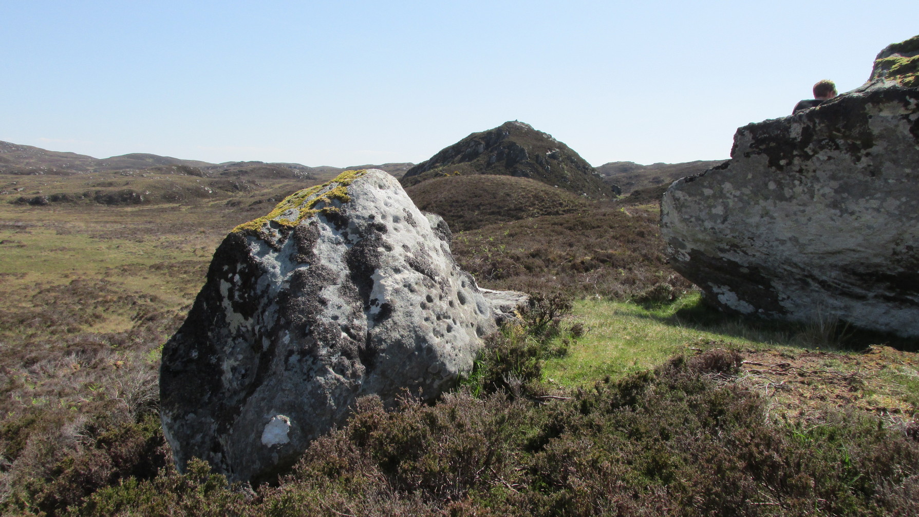
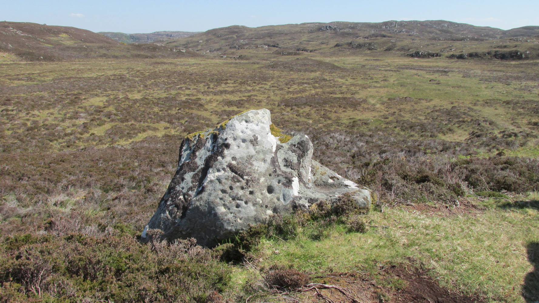
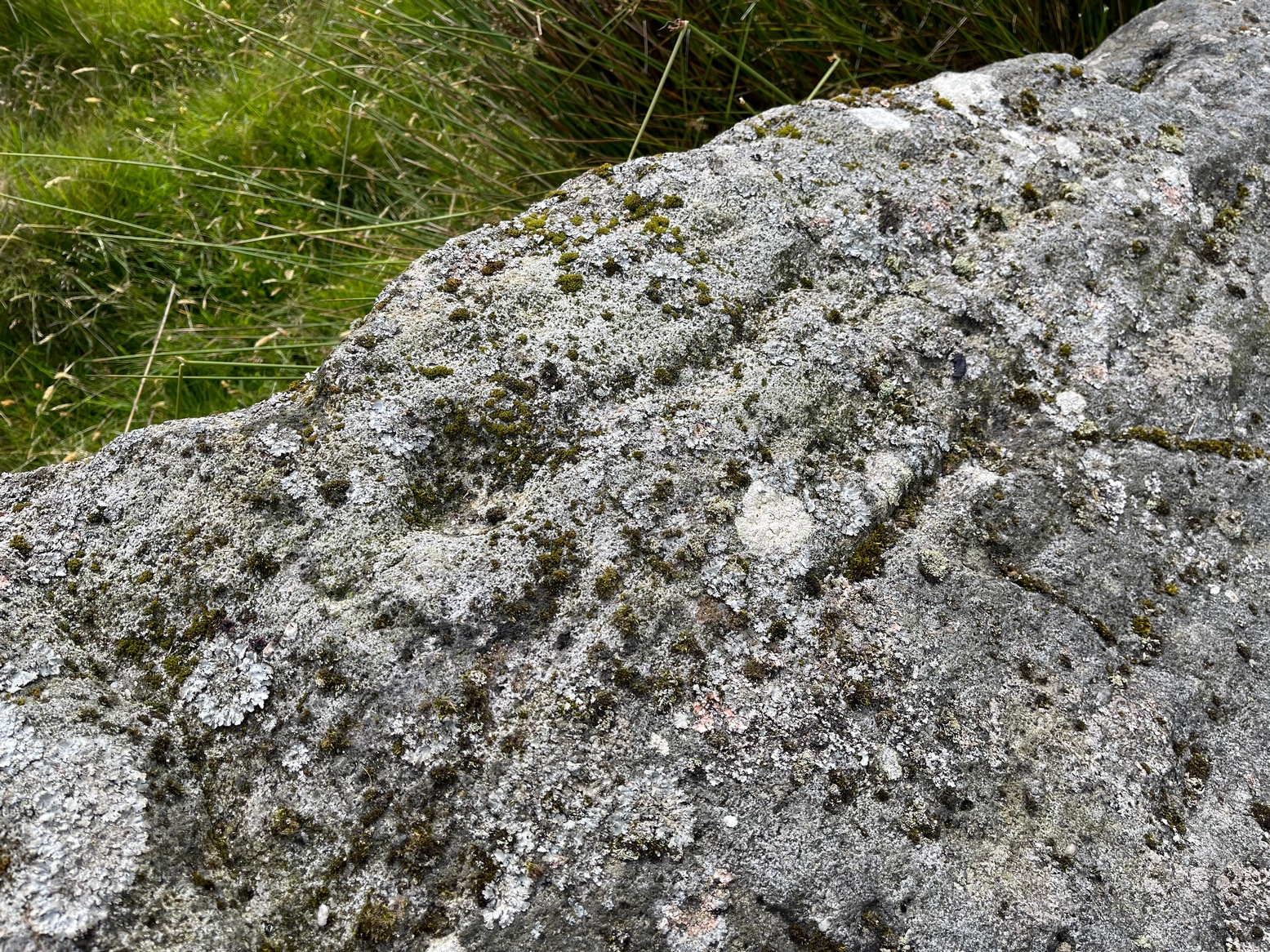
This large, earthfast, ovoid ball of rock has a series of cup-marks on three of its curvaceous faces, some of which seem to be natural, with a number of them “enhanced” by human hands at some time in the long long ago….
The main cluster of these cups can be found on its near-vertical western-face: an unusual feature in itself! There are several cups on its southern curve and, further round, low down on the east side of the rock we see a few more of them hiding away. These, too, seem to have been Nature’s handiwork, then enhanced by the hands of wo/men. The carving was described in Hew Morrison’s (1883) work as possessing two groups of cup-marks,
“similar to that on the neighbouring stone, one of eighteen small and one large cup, and another of eleven small marks. There is a solitary mark on the summit of this stone, and its southern face is marked by lines crossing each other, but without any apparent order or design.”
On its northern face we see a large oval hollow, an inch or so deep throughout, that has all the hallmarks of being a primitive face. There is a tradition of such a rock “face” carving somewhere close by, which seems to be lost—and this would seem to be culprit! If you visit the place, let us know what you think!
One feature that stands out at this site is the nearby pyramidal hill whch, I think, had some mythic relationship with the carvings. Impossible to prove, obviously, but the pyramid is such a dominant feature in this landscape that a relationship seems inevitable. I can only echo what I’ve said in the site profile for the adjacent carving here: tis a ritual place indeed – without any shadow of doubt. And I don’t say such things lightly. This place is truly superb!
References:
Mercer, R.J., Archaeological Field Survey in Northern Scotland 1976-1979, University of Edinburgh 1980.
Royal Commission on Ancient & Historical Monuments, Scotland, Second Report and Inventory of Monuments and Constructions in the County of Sutherland. HMSO: Edinburgh 1911.
Acknowledgements: Huge thanks to Sarah MacLean for her company and landscape knowledge in visiting this and other nearby antiquarian sites. And to Aisha Domleo, for getting me into this neck o’ the woods in the first place….where’er She may be….
For those who like a walk: take the route to reach the Swastika Stone and keep walking west along the Millenium Way footpath, past the Piper’s Stone carving and over the next two walls. Then, stagger down the steep hill and head for the large upright near-cuboid block of stone and, once here, walk 30 yards to your east! Alternatively, from the Silsden-side, go along Brown Bank Lane up and past Brown Bank caravan park, and at the second crossroads turn right and travel for exactly 1¼ miles (2km) along Straight Lane (from hereon there’s nowhere to park!) which runs naturally into Moorside Lane, and notice the raised gate entrance into the field on your right. Walk to the top of this field, go through the next gate and, less than 100 yards uphill (south) you’ll find the stone in question.
Archaeology & History
Cup, incomplete ring & line
Rediscovered by Paul Bowers in 2011, this is another one of those petroglyphs that’s difficult to make out unless the light is falling just right across the surface of the stone. Two distinct cup-marks can be seen near the more southern-edge of the stone, one of which has a near-complete, albeit unfinished ring around it, and from this a seemingly carved line runs roughly parallel with the edge of the stone, down towards another equally distinct cup close to the southwestern edge of the rock. Most of the stone is nicely covered in a decent lichen cover, so the design’s a bit difficult to see when the light’s not right. But, if you’ve made it this far, the petroglyph 30 yards to the west will make up for any disappointment you may have!
References:
Boughey, Keith & Vickerman, E.A., Prehistoric Rock Art of the West Riding Supplement, 2018.
Get up to the Swastika Stone, then head west along the footpath towards the Piper Stone. Shortly before there, you’ll see the small cup-marked Piper’s Crag (3) carving, just by the walling. From this carving, just step a few yards down the slope and on the smooth sloping rock face is this faded carving. You’ll see it.
Archaeology & History
A larger than normal single cup-mark near the bottom slope of this rock has an incomplete ring around its east and southern edges, possibly with another broken element of it on its northern edge. It’s difficult to work out whether or not this is one of Nature’s curious markings and so needs looking at in different lights to work it out, one way or the other. It’s included in Boughey & Vickerman’s (2018) updated rock art survey, but there are a number quite natural cup-marks in that tome, so we need to exercise a little bit of caution here. However, it does seem to have a greater degree of authenticity than some of the other dubious single cup-marked stones in their book. Check it out on your way to the Piper’s Stone.
References:
Boughey, Keith & Vickerman, E.A., Prehistoric Rock Art of the West Riding Supplement, 2018.
Heading up from Ilkley, follow the directions to reach the Swastika Stone, then keep walking (west) along the footpath to the small clump of trees, and keep walking past them too and keep going along the same path as if you’re heading toward the Piper’s Stone. About 200 yards before reaching it, just where the gate and boundary stone is in the old walling, there’s a small line of crags to the right of your feet and there, at the edge of the path, is the stone in question. You’ll see it (unless it’s a cloudy gray day, in which case you might struggle).
Archaeology & History
The two cup-marks
This is one of a number of cup-marked stones that you’ll find scattering this part of the moor, almost all of which are Nature’s handiwork (a few of these natural carvings have somehow found their way into Keith Boughey’s [2018] updated West Riding rock art book). I’m not 110% certain that this doesn’t have Nature’s name on it either, but it’s got a greater degree of probability to it than some of the others. It’s a simple little thing, as y’ can see, consisting of just the two cup-marks, smaller than usual, living next to each other. If it’s the real deal, we can surmise that it may have been carved by a young person back-in-the-days. In the walling just above this stone you can see the medieval boundary stone, which might—just might—have a prehistoric pedigree to it….
References:
Boughey, Keith & Vickerman, E.A., Prehistoric Rock Art of the West Riding Supplement, 2018.
Take the directions to reach the Ninewells ring cairn on the hills east of Dunkeld. Once here, if you can work your way through the dense mass of prickly vegetation in and around the circle, on its western side you’ll find three elongated monoliths (if you stood them upright they’d be taller than all the rest) laid next to each other. On the smallest of these three, next to an upright, almost pyramidal stone, you’ll find what you’re looking for. Persevere! (someone needs to clean up this impressive site and keep it in good condition)
Archaeology & History
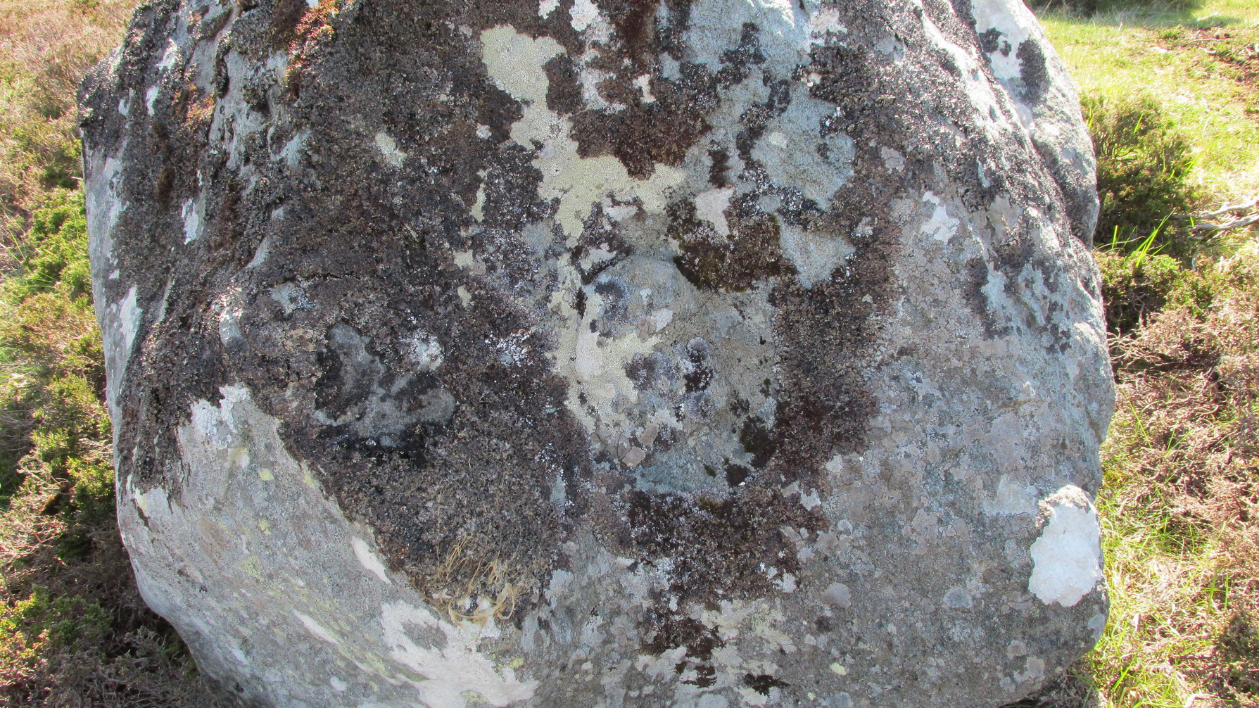
Cluster of 4 or 5 cups
This minor-looking petroglyph can be found on the upper surface of the westernmost stone in the cairn circle. It’s nowt much to look at and will only be of interest to the hardcore rock art freaks among you. Carved onto the flattened edge of the stone are at least four shallow cup markings, close to each other. When we visited here, the light wasn’t good, but it seemed that a fifth cupmark was sat amidst the small cluster. You can make them all out (just!) in the photo. Another visit on a better day would tell us one way or the other…
References:
Royal Commission on the Ancient & Historical Monuments of Scotland, South-East Perth: An Archaeological Landscape, HMSO: Edinburgh 1994.
Acknowledgements:Huge thanks for use of the Ordnance Survey map in this site profile, reproduced with the kind permission of the National Library of Scotland.
Cup-Marked Stone (lost): OS Grid Reference – NO 262 503
Archaeology & History
In an excursion to the Iron Age Hillfort on Barry Hill in the early 1960s by some members of the Perthshire Society of Natural Science, near the very top on its southwestern side they discovered “a small cup marked stone.” (Longworth 1962) It hasn’t been seen since. And whether it was in the walling of the fort, or was a carved earthfast rock, they neglected to tell. When I visited here several years ago I couldn’t find the damn thing and presume that it’s simply been overgrown by the vegetation. In the event that you manage to rediscover the carving, see if you can catch us a good photo or two and stick ’em on our Facebook group.
References:
Longworth, Ian, “Dundee, Angus,” in Discovery & Excavation, Scotland, 1962.
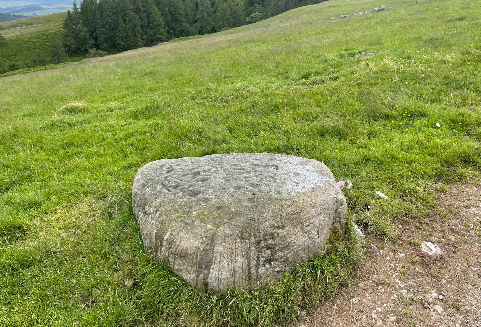
A couple of miles east of Crieff, take the A822 road from the Gilmerton junction and head up towards the Sma’ Glen. After literally 1¾ miles (2.8km), on the right-side of the road, you can park-up right opposite the dirt-track that leads up to Connachan Farm a half-mile away. Keep walking up past the farm to the Connachan (2) petroglyph, and keep to the track uphill for another 600 yards keeping your eyes peeled for a notable singular rock on your left, about 10 yards into the heather. It’s pretty easy to see. If the track’s levelled out, you’ve gone too far!
Archaeology & History
Perhaps the most attractive of the Connachan petroglyphs is this curvaceous stone with its archetypal double-ringed motif. It seems to have been described firstly by Margaret Stewart (1967), whose description (to me at least) doesn’t quite do it justice; but then, they are somewhat troublesome abstract creations most of the time. She told it to it be,
“a boulder 4’10” x 3’10 x 2′ in height with 6 cups and a grooved circle, which incorporates two more cup marks on its outline. The grooved circle encloses a gapped circle with another cup mark at its centre.”
Connachan (4), looking NMain face of the carving
So, nine cups in all: one with the double-ring around it, and two of the cups touching the outer ring. The cup-marks are ostensibly as Stewart described them, but there are another two or three which I was unable to capture in the photos, as the daylight wasn’t good when we came here. They’re shallow but very distinct when you see and feel them in the flesh, so to speak, and are closer to the top- and bottom-centre of the stone in the photos here. Well worth checking out if you’re in the area!
References:
Stewart, Margaret E.C., “Connachan, Crieff – Cup Marks and Hut Circle,” in Discovery & Excavation, Scotland, 1967.
Acknowledgements:Huge thanks for use of the Ordnance Survey map in this site profile, reproduced with the kind permission of the National Library of Scotland.
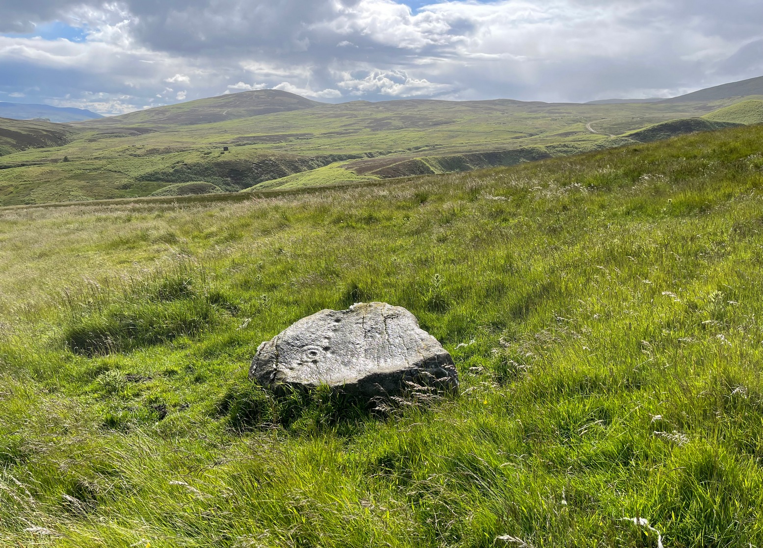
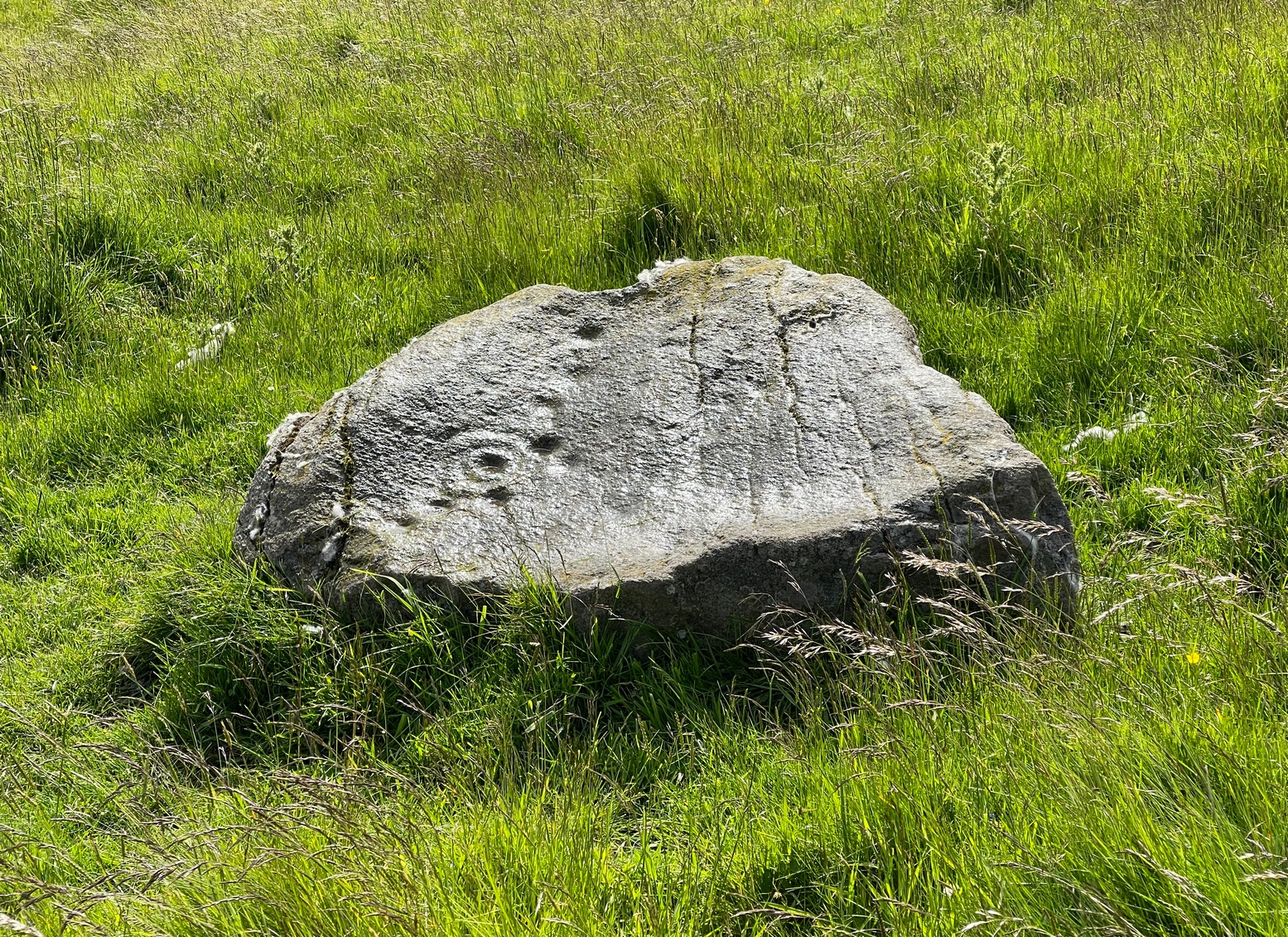
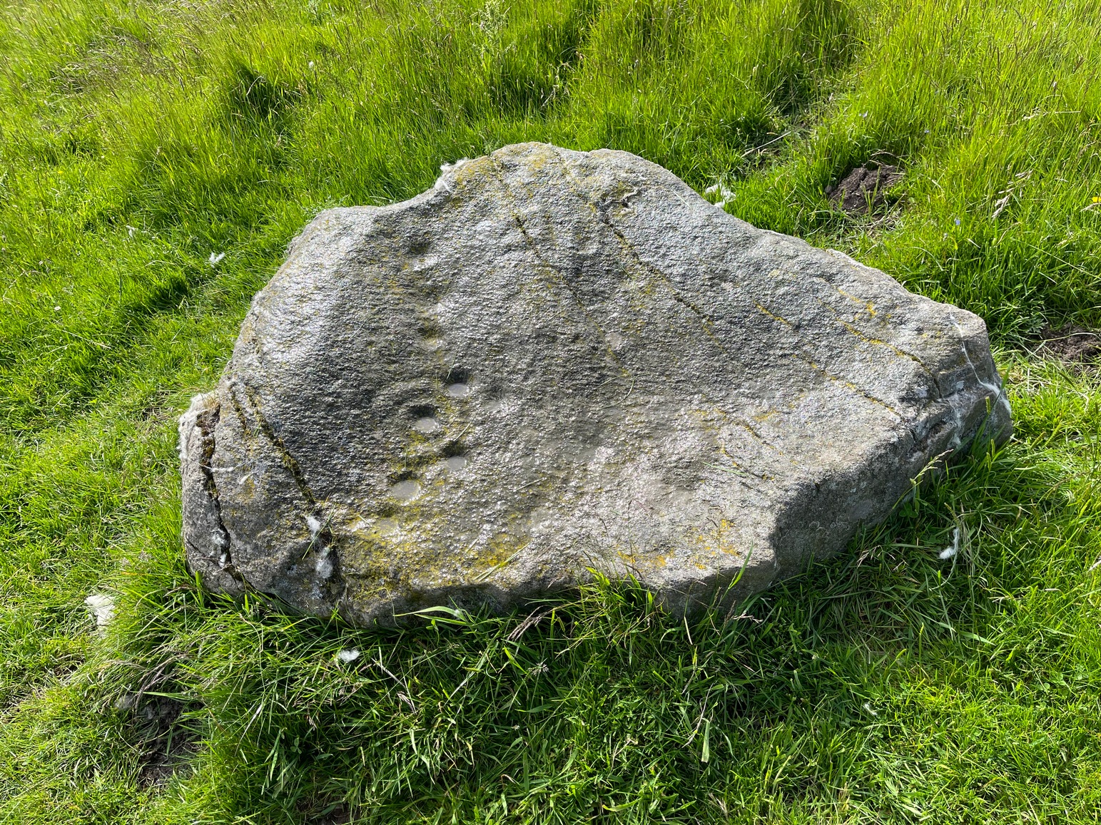
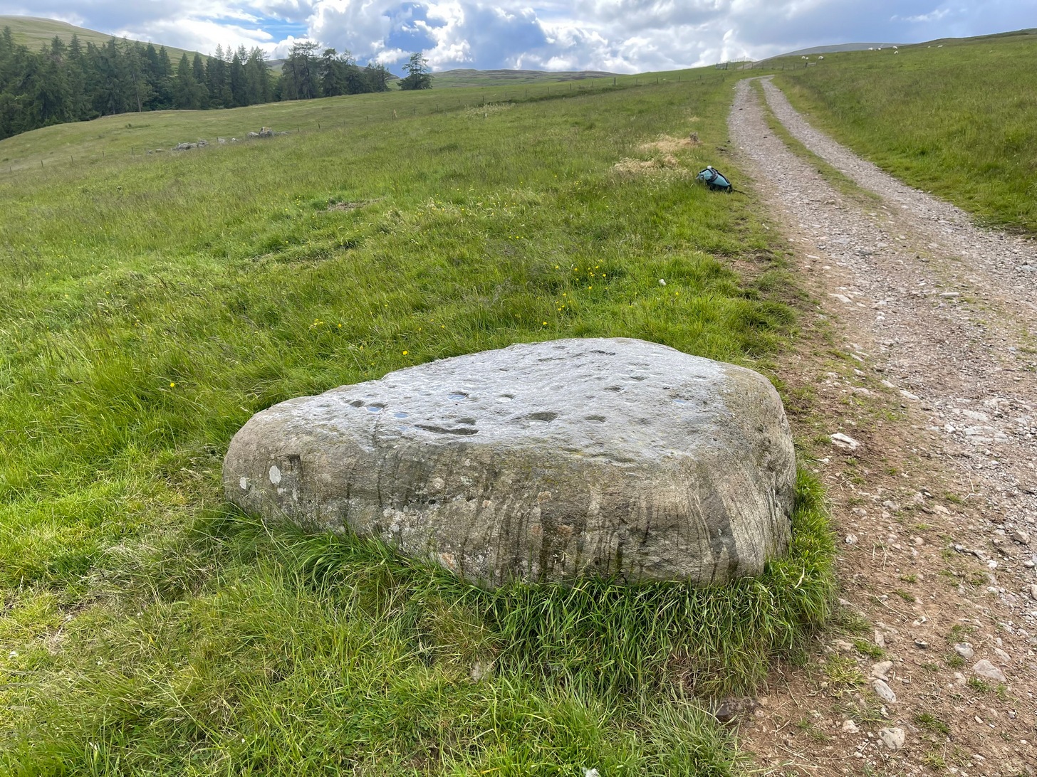
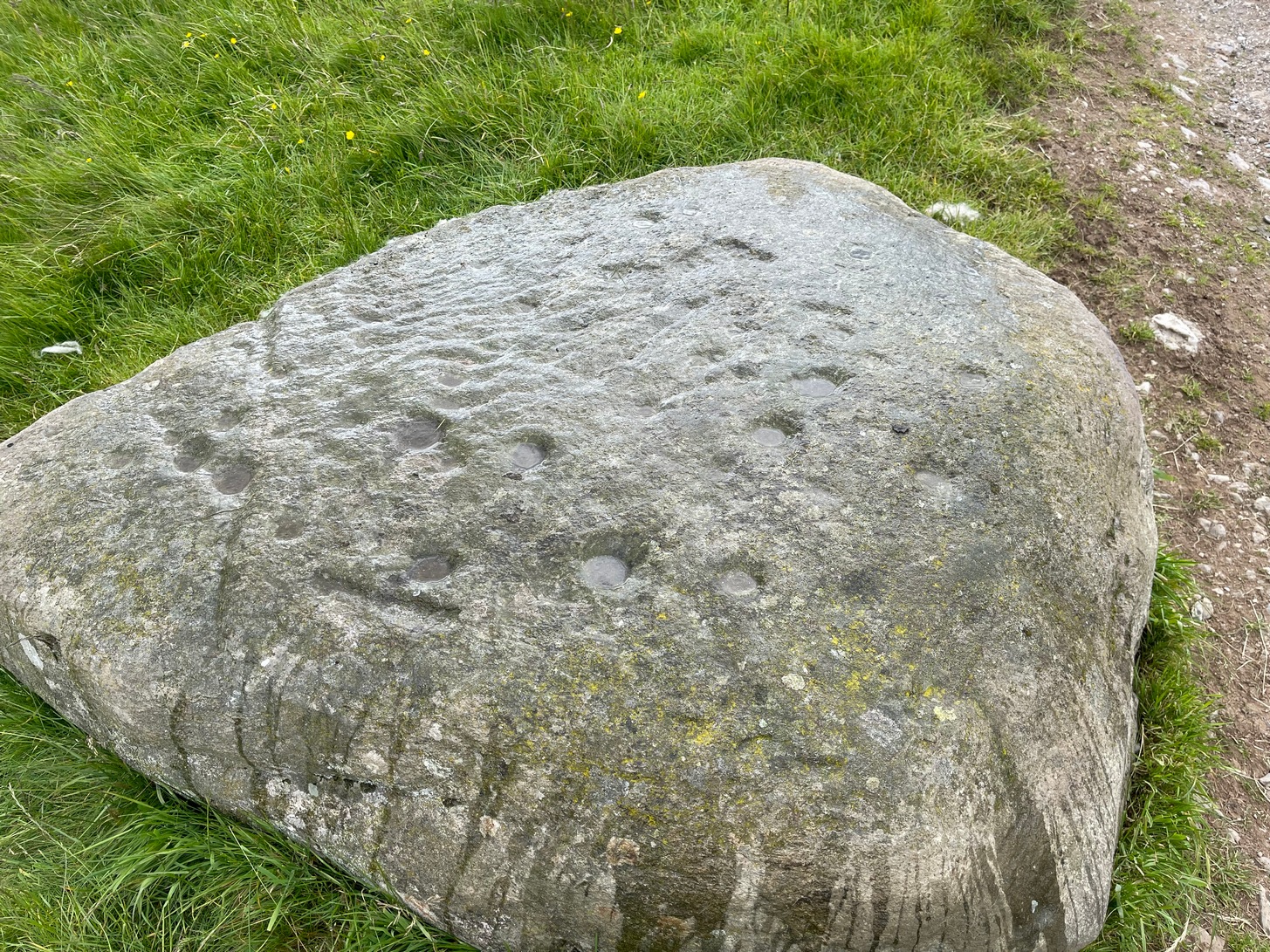
A couple of miles east of Crieff, take the A822 road from the Gilmerton junction and head up towards the Sma’ Glen. After literally 1¾ miles (2.8km), on the right-side of the road, you can park-up right opposite the dirt-track that leads up to Connachan Farm a half-mile away. Keep walking up the track, past the farm and the cottages, and about 300 yards further along, right by the track-side, you’ll see a large stone. Y’ can’t really miss it!
Archaeology & History
This carving was seemingly rediscovered by J.H. Maxwell of Crieff in the 1960s, but not in the position it presently occupies by the trackside. A large body of field clearance rocks lies scattered 60 yards to the west, which is where it was reportedly first seen; which means that, even then, it wasn’t in its original spot. But at least we can be assured that it came from somewhere very close to its present location, by the trackside.
Close-up of cups & linesThe carving, looking SW
It’s not overly impressive in terms of its design, comprising almost entirely of cup-markings: at least thirty, perhaps as many as thirty-four. When we visited here recently, Nature wasn’t overly concerned about giving us decent daylight, so we couldn’t see the carving clearly, but it did seem that a carved broken “ring” swerves around at least one of the cups near the middle of the stone. You can make it out in the photos here (centre-left). There are what seems to be several other carved lines on different parts of the stone but, again, without decent daylight, we could neither get decent photos, nor do a decent sketch of them. The Scottish Rock Art Project, who got themselves nigh on a million quid to survey all our carvings up here, neither sketched, photographed or visited this or the others in this Connachan petroglyph cluster, so we’re none the wiser as to its original form. If you happen to visit this carving when the daylight is being nice, see if you can catch us a good photo or two and stick ’em on our Facebook group.
References:
Stewart, Margaret E.C., “Connachan, Crieff – Cup Marks and Hut Circle,” in Discovery & Excavation, Scotland, 1967.