To search for any sites in the northern counties of England (previously known as Brigantia), click on the list of relevant counties, below. Please note that not all these english counties were truly in Brigantia, but they came close to its southern edges; and as parts of them tickle the edges of the southern Pennines, I thought they should be included. Hope that’s OK with everyone!
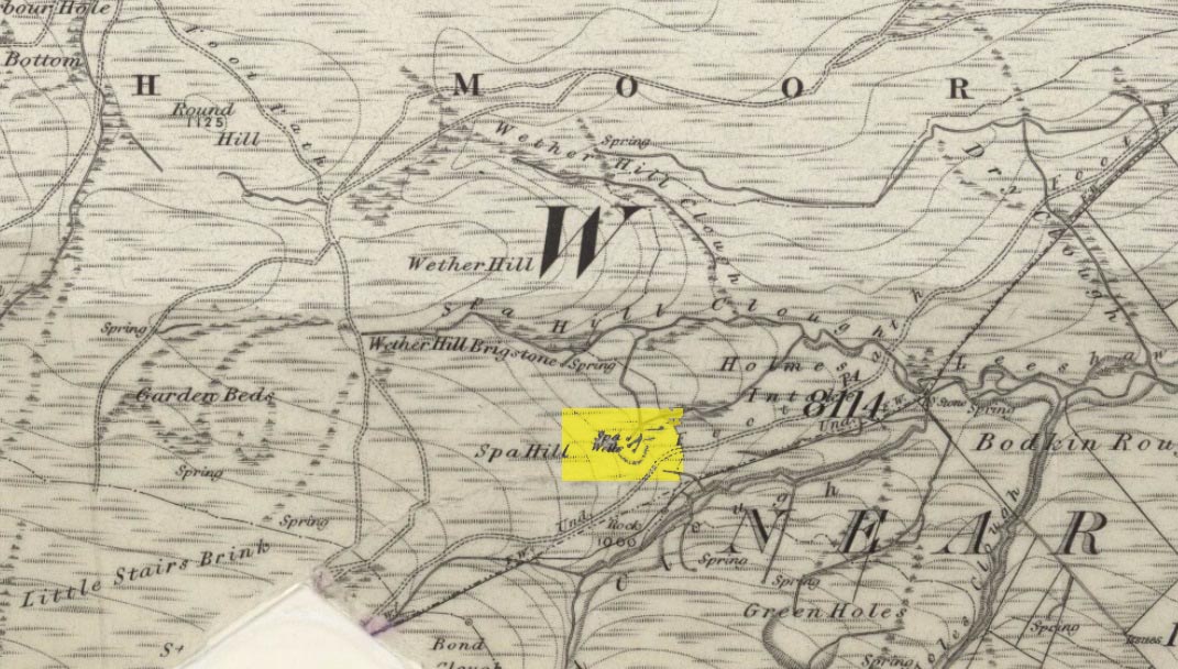
Go through Haworth and head for the well-known Penistone Hill country park. On the far western side of the hill up near the top of Moorside Lane, there’s a car-park. Right across the road from this there are two footpaths: one heads you into the moor, whilst the other (going the same direction) follows the edge of walling onto the moors. Take this path. Walk on and downhill, past the end of the reservoir, then the path continues uphill. You’ll hit a nice cheery tree beside the path a few hundred yards up. Stop here, look into the boggy region with bits of walling on the moor in front of you. That’s where you’re heading!
Archaeology & History
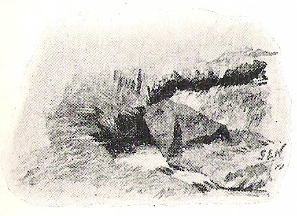
The first, weaker of the Spa Wells
This was a really curious spot to me, as I found absolutely nothing about the damn place! But thanks to the assistance of local historian and writer Steven Wood (2009), that’s changed. Shown on the 1852 OS-map, at least two springs of clear water trickle slowly from the wet slope above you into the boggy reeds. Close by there are overgrown remains of old buildings, covered with the time of moorland vegetation, seemingly telling that the waters were collected for bathing rooms. But who the hell even started the notion that they’d be able to get Victorian rich-folk up here at the crack-of-dawn to drink or bathe in the waters is seemingly forgotten. And, as is evident from the lack of local history, the project was a failed one which seemed not to have lasted too long.
Folklore
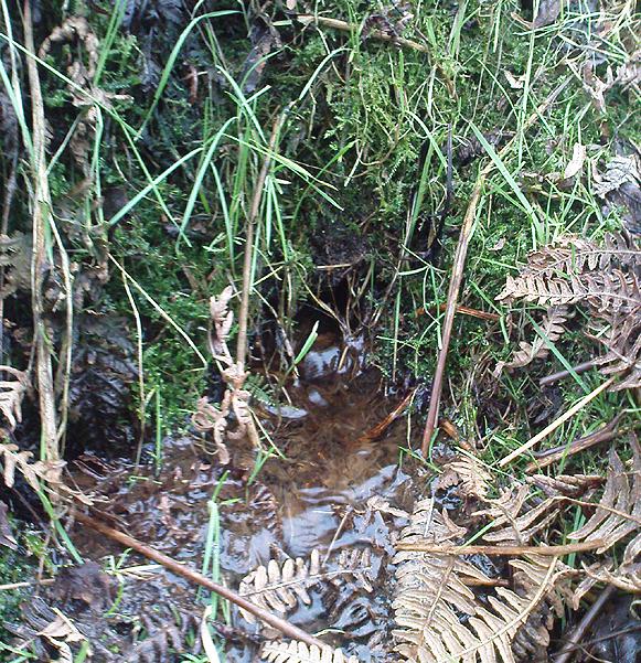
The stronger Spa Well
It was quite obvious that of all the springs around here and despite the strong-flowing streams either side of these spa well, that the local animals drink here more than the other nearby springs of water, as there were literally hundreds of animal tracks all across the boggy ground of the spas.* The waters also seem to have the usual ‘spa’ qualities of stinking, but once we’d cleaned out the overgrown springs — which looked as if they hadn’t been touched for 100 years or more — the waters were clear and tasted good, and were curiously slightly warm!
Although my initial search for information on this site drew a blank, Steve Wood pointed us in the right direction for info on the place. As with many other holy wells and spas in Yorkshire, it turned out that this was another spot much revered around Beltane, indicating strongly there would have been earlier pre-christian rites practiced at this site. Steve pointed me to Martha Heaton’s (2006) local history work, which told:
“For many years the first Sunday in May was a special day. It was known as Spa Sunday, for on this day people gathered up in the hills overlooking what is now Leeshaw Reservoir, here was a well, known as Spa Well, and the stream which now feeds the reservoir is known as Spa Beck. People came from Haworth, Oxenhope, Stanbury, and other villages sitting round the well, they sang songs, some bringing their musical instruments to accompany the singing. Children brought bottles with hard spanish in the bottom filling the bottle with water from the well, shaking it until all the spanish or liquorice had been dissolved. This mixture was known as ‘Poppa Lol’ and would be kept for weeks after a little sugar had been added, then it was used sparingly as medicine. The custom seems to have died out when Bradford Corporation took over the water and made Leeshaw Compensation Reservoir in 1875, though up to about 1930 two men from Haworth would wend their way to the spot on the moor, the first Sunday in May. The men were John Mitchell and Riley Sunderland, better known, in those days as ‘Johnny o’Paul’s’ and ‘Rile Sun’.
It was a great day for many people, the Keighley News of May 1867 mentioned it, the report of local news reads thus: ‘A large assembly met on Spa Sunday on the moors about two miles from Haworth, and a party of musicians from Denholme performed sacred music’.
This locality was often visited during the summer months by the Bronte family.”
References:
Heaton, Martha, Recollections and History of Oxenhope, privately printed 2006.
Wood, Steven & Palmer, Ian, Oxenhope and Stanbury through Time, Amberley Publishing 2009.
Acknowledgements: – Huge thanks to Steven Wood for his help; and to Hazel Holmes for permission to quote from Martha Heaton’s work.
* A common creation myth behind many healing wells is that animals with breaks or illness drag themselves to drink from otherwise small or insignificant springs and wells, despite of the copious streams or rivers which may be nearer.
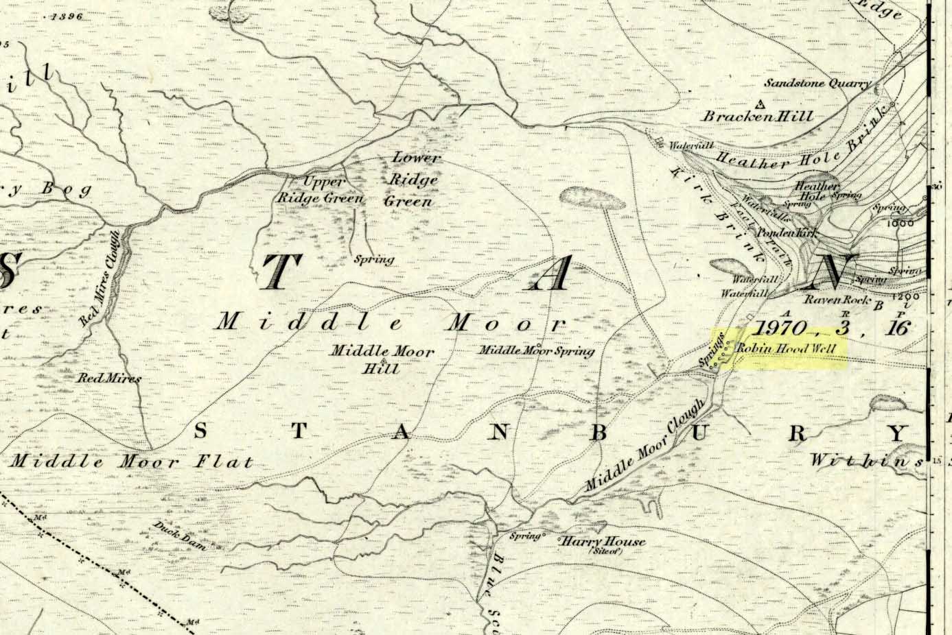
Follow the same directions to get to the nearby Ponden Kirk and, once on top of the rocks, overlooking the valley, walk on the footpath to your right. It bends round and follows the stream up onto the moors. About 100 yards along, walk up the heathery slope to the right and you’ll find several boggy watering holes on the top of the ridge. In looking at the first OS-map of the area in 1853, it seems that the northernmost of six boggy springs is the Robin Hood’s Well – although we don’t know this for certain. It’s one of them though!
Archaeology & History
Robin Hood’s Spring, above Ponden Kirk
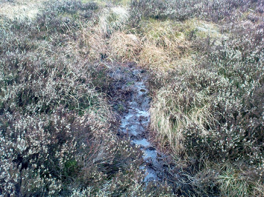
There’s little to see here really: it’s little more than a small boggy spring of water emerging from the edge of the ridge, as the photo shows. Curiously, descriptions of the site (and its neighbouring compatriots, Will Scarlett’s Well and Little John’s Well) are sparse aswell. It was noted by the Ordnance Survey lads in 1848 and subsequently posted on the first OS-map of the area in 1851. Both Horsfall Turner (1879) and Johnnie Gray (1891) mention the site passing, saying nothing of the place. However, several years after Gray’s work, Halliwell Sutcliffe (1899) ventured here and gave us the first real description of the place, telling:
“Half-hidden underground, and fringed with fern and bog-weed, lie the three wells which go by the names of Robin Hood, Little John and Will Scarlett. One may stop to ask how they came by their birth-names, to wonder why a man should have troubled to fashion them in this out-of-the-way spot; but neither speculation nor questioning of the moor folk brings one nearer to an answer.”
Folklore
Halliwell Sutcliffe’s scruffy quick sketch, circa 1898
Apart from this site being a spot where the legendary outlaw stopped and drank in ages past, the healing attributes of these waters have long since been forgotten. Considering the proximity of the Ponden Kirk and its legendary association with fertility and marriage rites, I’d guess that such lore wold have centred around Beltane, or Mayday; and Robin Hood is very well known in folklore to have close associations with the same period. So — and I’m guessing here — it’s likely that whatever might have occurred at this well, would have taken place around Beltane aswell.
References:
Gray, Johnnie, Through Airedale from Goole to Malham, Walker & Laycock: Leeds 1891.
Sutcliffe, Halliwell, By Moor and Fell in West Yorkshire, T. Fisher Unwin: London 1899.
Turner, J. Horsfall, Haworth, Past and Present, Hendon Mill: Nelson 1879.
Tumulus (destroyed): OS Grid Reference – SD 7242 0899
Archaeology & History
This single-grave burial — described by Barnes (1982) as a kerbed or revetted cairn — close to the very centre of modern-day Bolton, was once an impressive prehistoric tomb. It was described by a local historian, Matthew Dawes, amidst a variety of prehistoric remains in and around Bolton, most of which have long-since been forgotten.
“Near Haulgh, about a quarter of a mile south-east from Bolton Parish Church, on a piece of high flat land, on the east bank of the Croal, and about fifty feet above the river, was a tumulus, about thirty feet in diameter, and four feet deep, consisting of small boulders… It was discovered in September, 1826, in forming a branch of the new road leading from Bolton to Bury. It was probably much depressed in its formation and was covered with a few inches of mound. The cop or fence crossed it in a north and south direction. About the centre of this tumulus was a cist-vaen, about four feet six inches long and one foot deep, formed of four upright stones and a coverer, and its length was nearly north and south. In this cist-vaen was a skeleton, with the legs doubled up, and the head to the north. Near the head, and on the west side, was found an urn, inverted, four and a half inches in the widest diameter, and three and a quarter inches high, and perforated by four small holes in the widest part. On the other side of the head was a bronze spear-head, four and three-eighths inches long, and one and three-eighths inch wide, of which the point was bent back, and a piece of the side chipped away. The urn and spear-head were taken to the Countess of Bradford, the Earl of Bradford being the owner of the land.”
Intriguingly, if you’re from the Bolton region, Mr Dawes also told that, “A man in the employ of the Earl of Bradford, the superintendent of the work, who made the discovery, informs me (1862) that two other tumuli were found shortly after the one just described, a few yards to the south of it, in the same fence.” As yet I have no more information about these other tombs (gimme time though!)
References:
Barnes, Bernard, Man and the Changing Landscape, Unversity of Liverpool 1982.
Dawes, M., ‘British Burial Places near Bolton,’ in Trans. Hist. Soc. Lancs & Cheshire, volume 4, 1852.
Scholes, James C., History of Bolton, Daily Chronicle: Bolton 1892.
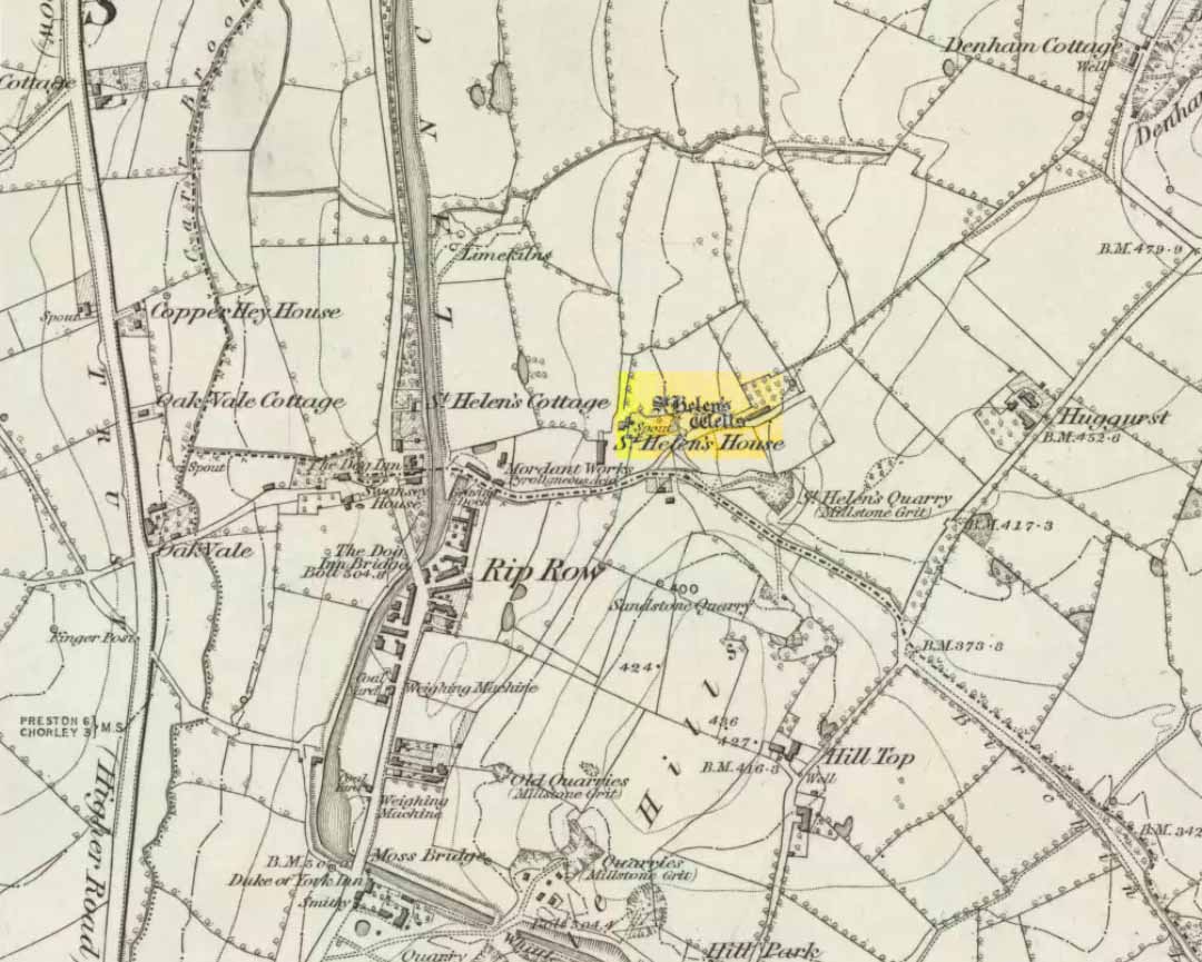
Destroyed when the M6 motorway was built – but if you’re a really fanatic and wanna see the setting, simply get to the bridge that crosses the M61 north of the town, leading to Birchin Lane and Denham Lane. (To be honest though, if I lived nearby, I’d have to make 100% certain, and have a look in the trees between the west-side of the M6 and the trees at the end of the Wells Close Fold cul-de-sac, just in case its waters are there. If you find anything, let us know!)
Archaeology & History
St Helen’s Well (Taylor 1906)
Highlighted on the very first OS-map of the region in 1848, this was one of many examples of a site dedicated to an important pre-christian deity which was eventually morphed into the character of Saint Helen. Several sites nearby were all named after the saint, including the quarries, a cottage, house and the wells themselves.
When Henry Taylor (1906) came here, he wrote the following about this once important site:
“This celebrated well is situated in a wild, rugged and hilly part of the hundred, in the south of the parish of Brindle… The water, brilliantly clear and sparkling, bubbles up through white sand at the bottom of a stone-lined pit, about seven feet square and four feet deep. On the southerly side of this pit, a few feet from it, is another similar stone-lined pit of about the same size. An old inhabitant tells me that formerly both pits — now nearly empty — were filled to the brim; and this was clearly the case, as an open stone channel is in situ, provided to carry the overflow water from the southernmost pit, the water dropping from it down into the valley. These structures are clearly of considerable antiquity, but the stones are somewhat displaced through neglect. The water now comes underground, through a pipe, into a farmyard about one hundred yards south of the well in a splendid crystal stream. Drinking water appears to be scarce in this district, for we met carts full of barrels which were apparently being taken to the neighbouring villages for sale from this spring.”
Folklore
Local folk visited here and dropped crooked pins into the well in the hope of wishes and future blessings — one report saying such practices were done by local catholics!
References:
Taylor, Henry, The Ancient Crosses and Holy Wells of Lancashire, Sherratt & Hughes: Manchester 1906.
From Carlton, take the western Hirst Road to Temple Hirst village, then turn right once you’re in the village and go up Common Lane up for about a mile. There’s a footpath on your left leading you to the Fair Oaks farmhouse. This was the spot!
Archaeology & History
This is fascinating sounding place which marked the central point of three old township boundaries nearly 1000 years ago. I first found it mentioned in Morrell’s History and Antiquities of Selby (1867: 36-7), where this once famous tree is described in land sale transactions. Morrell told:
“At Carlton the (Selby) abbey had considerable property, which was sold to the neighbouring priory of Drax. The boundary of the property sold was a certain oak tree, called Fair-haia, in Burn Wood, which Adam de Bellaqua gave for this purpose, binding himself and his heirs never to cut it down or root it up, sub poena anathematis.”
But we found a more detailed outline in Dugdale’s Selby Abbey in Yorkshire, where the premises and townships given to Selby Abbey in the 12th and 13th centuries are listed. In the township of ‘Carleton’ (as it was then spelt) Dugdale wrote:
“Peter de Brus gave the grange here, which the monks had held of Agnes, late wife of Ranulph FitzSwain. Richard abbat of Selby granted to Robert prior of Drax all the tithe from the north part of the oak called Fair-haia, in the wood of Birne, or Berlay, through the middle of the marsh to Hundolfsweith; and from thence by the strait ditch directly to Espholm, and all the tithe from Espholme to Appletreholme, as the ditch goes to the new fosse or ditch of Carleton: and the prior granted to the abbat all the tithes on the south to the new ditch, and from thence to the river Ayre. And Adam de Bellaqua gave this oak tree, called Fair-haia, as a boundary, never to be cut down (ad standum in perpetuum et non rescindendum), binding himself and his successors never to cut it down or root it up.”
One wonders: are there any remains left of this once great tree? Has anyone actually transgressed and uprooted it in times past? Is any other lore known of it? And who was Adam de Bellaqua?
One of the most intriguing elements to this site is its name, for the word ‘haia’ literally means ‘god of the land’ — but whether we can take this meaning seriously is questionable, as it’s of Sumerian origin. However, no local dialect words throw any light on the word and it may aswell be the name of the spirit of the tree as anything else. Does anyone know owt more about this place?
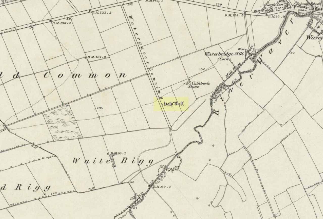
A mile east of Waverbridge, turn down the track called Watergates Lonning. Before you reach the bottom, on the left side of the straight track is a spring of water. This is the old holy well.
Archaeology & History
Although much used in bygone times, very little of it can be seen nowadays. When John Musther (2015) wrote about it recently, he told that although it was
“Once known for its copious amount of remarkably pure and sweet water, it is now only a trickle by a tree.”
Nearly three hundred yards away across the fields northeast of this small spring of water, was once seen “a pretty large rock of granite, called St. Cuthbert’s Stone“, whose mythic history will have been intimately tied to the holy well.
Folklore
In the second volume of William Hutchinson’s History of the County of Cumberland (1794), he tells that the St. Cuthbert’s Well,
“is a fine copious spring of remarkably pure and sweet water which…is called Helly-well, i.e. Haly or Holy Well. It formerly was the custom for the youth of all the neighbouring villages to assemble at this well early in the afternoon of the second Sunday in May, and there to join in a variety of rural sports. It was the village wake, and took place here, it is possible, when the keeping of wakes and fairs in the churchyard was discontinued. And it differed from the wakes of later times chiefly in this, that though it was a meeting entirely devoted to festivity and mirth, no strong drink of any kind was ever seen there, nor anything ever drunk but the beverage furnished by the Naiad of the place. A curate of the parish, about twenty years ago (c.1774), on the idea that it was a profanation of the Sabbath, saw fit to set his face against it; and having deservedly great influence in the parish, the meetings at Helly-well have ever since been discontinued.”
References:
Hutchinson, William, The History and Antiquities of the County of Cumberland, volume 2, F. Jollie: Carlisle 1794.
Musther, John, Springs of Living Waters: The Holy Wells of North Cumbria, J.Musther: Keswick 2015.
Stone Circle (destroyed): OS Grid Reference – SD 714 978
Archaeology & History
This is yet another stone circle that’s been destroyed. It seems to have been described first by Nicolson & Burn (1777) — as “a circle of large stones, supposed to be a monument of druid worship” — but a century later when Reverend Nicholls (1877) came to describe it, he was talking of it in the past tense, saying:
“Fifty years ago there was a circle of stones on the high road leading from Kirkby Stephen to Sedbergh, near Rawthey Bridge, supposed to be a monument of Druid worship. These stones, I have been informed by Mr. William Alderson of Brigg, were blocks of limestone, about three feet high, and were inconsiderably removed for the purpose of helping to build the abutment on the Ravenstonedale side of the present bridge which spans the Rawthey, and bears (the) date 1822. The holes in which the stones stood are, however, yet visible, although overgrown with grass. Collectively they form a circle.”
One writer later (1967) told that the site “seems to have stood on the moor to the left of the road opposite the confluence of the Sally Beck with the Rawthey.” As far as I’m aware, little more is known of the site. Omitted from Burl’s magnum opus, it was included in Waterhouse’s (1985) fine survey of Cumbrian megaliths, but with no further details. But another Victorian writer (Thompson 1892) thought it more likely that the ‘circle’ here was, in fact, more likely a barrow or grave-mound. Sadly, we’ll probably never know…
References:
Anon., Sedbergh, Garsdale and Dent, Reeds: Penrith 1967.
Nicholls, Rev. W., The History and Traditions of Ravenstonedale, John Heywood: Manchester 1877.
Nicolson, J. & Burn, R., The History and Antiquities of the Counties of Westmorland and Cumberland, London 1777.
Thompson, Rev. W., Sedbergh, Garsdale and Dent, Richard Jackson: Leeds 1892.
Waterhouse, John, The Stone Circles of Cumbria, Phillimore: Chichester 1985.
Dead easy this one! Go along North Street in Keighley, towards the main church in the middle of town (a St. Andrew’s church, previously St. Pete), by the once-infamous Lord Rodney pub, and the old stone edifice stands outside by the Green. The much better Red Pig public house is across the road from here.
Archaeology & History
Keighley’s Town Cross, 1847 – on a painting by Edwin Riby
For a relatively trivial archaeological site, it’s got a bittova history. Not that this is an old site either! We’re not sure just when this cross was made, but it’s certainly no more than 300 years old. Before standing in its present position outside St. Andrew’s Church, sometime before 1840 it was said to have been a few hundred yards away above the present roundabout on Oakworth Road; and one record tells that it originally came from nearby Utley, a mile to the north. Due to lack of decent records, we’re not sure about its early status as a market cross, nor when it was first erected. Indeed, even the steps on which the cross presently stands are clearly more recent than the ones illustrated on Edwin Riby’s 1847 portrait, reproduced here.
Keighley Cross, on a grey wet day!
It would be good to get a complete history of this archaeological relic but it’s difficult with artifacts such as these; and although gaining access to the church now takes less time and effort than it used to (the vicar here used to be quite unhelpful, but has recently changed his ways – which is good!), it’s only open at certain times of the week.* Friday afternoons seem OK to have a look round. Please – if folk begin having trouble gaining access to the Church once more, let us know on here so we can make complaints about it. The Church is paid for by local tax-payer’s cash, and so needs to be open to all of us. Let’s hope this humble ingredient can be maintained for the good of all in this otherwise regressive social community (Keighley, that is…).
There’s also some very curious folklore to be added here in relation to the market and its cross, but its tale is gonna have to wait…
References:
Gray, Johnnie, Through Airedale, from Goole to Malham, Elliott Stock: London 1891.
Keighley, William, Keighley, Past and Present, R. Aked: Keighley 1858.
* There isn’t even a notice giving information, email or phone numbers, telling you who you can contact if you want to know anything about the history of the church, or visit it — which is quite dreadful considering how much money they get paid by tax-payers for their supposed socio-spiritual duties.
It’s not too far from the main footpath from Ilkley to the Twelve Apostles stone circle. As its discoverer C.W. Dymond (1880) said, “It lies alone, on and near the foot of a steep slope, about a furlong, or less than five minutes’ walk, north from the ruins of a small stone-circle (Twelve Apostles) which crowns the crest of the pass leading south-south-east from Ilkley to Eldwick, and just one mile and three-quarters from the former place. If approached therefrom, it will be easily found about two hundred yards to the east of the point where the road surmounts the steep, to enter upon the upper plain.” Otherwise, walk through the Twelve Apostles from the main footpath and out the other side, following the land where it slopes down and, near the bottom, you’ll see this large stone sitting quietly on its own…
Dymond’s 1880 sketch
Archaeology & History
Not too sure about the veracity of this one to be honest. It was first described by archaeologist C.W. Dymond (1880) as “a stone marked with a striking group of cups” – but these are small and untypical of the usual markings. “The stone is 9 ft. 6 ins. in length, 6 ft. 3 ins. in breadth, and about 2 ft. in thickness; its upper surface dipping a little, with the ground, toward the north. Upon it may be seen a group of small cups, for the most part about half an inch in diameter,” he said.
Dymond thought that the design on the rock may have represented parts of the night sky, saying, “here we may have a rude attempt to portray the starry heavens spanned by the galaxy ; and that the outlying groups may have been intended to represent two of the constellations perhaps Orion, and another not so easily identified.” But I think we can take this with a pinch of salt.
Included in Hedge’s (1986) survey without comment, Boughey and Vickerman (2003) correctly thought that the “small peck marks which are not typical cup-marks” might be “doubtful”.
References:
Boughey, Keith & Vickerman, E.A., Prehistoric Rock Art of the West Riding, West Yorks Archaeology Service 2003.
Dymond, C.W., ‘Cup Marks on Burley Moor,’ in Journal of the British Archaeological Association, volume 36, 1880.
Hedges, John, The Carved Rocks of Rombalds Moor, WYMCC: Wakefield 1986.
Various ways to get here, probably the easiest is by taking the A639 north from Bolton, up to Turton & Entwhistle Reservoir. Park up in the layby and walk onto the hills behind you (south), right near the very top. Look around!
Archaeology & History
A long article by Major Gilbert J. French — ‘The Stone Circles on Chetham’s Close’ — in one of our northern antiquarian journals of 1894, told us a great deal about the sad remains of this once proud circle. I have reproduced the main body of the article here (with minor editing), which I hope is of interest to local historians and archaeologists around Bolton:
Early drawing of this now-ruined site
From time immemorial the existence of a so-called Druidical circle upon the top of Chetham’s Close has been recognised, and at one time the monuments of this circle must have been very pronounced and prominent. Within the last quarter of a century, however, the stones have been sadly mutilated and in part destroyed. This was chiefly done by the tenant farmer of the late owner, Mr. James Kay, who objected to people visiting the situation. Mr. Kay was communicated with, but did little or nothing to prevent the mutilation. I am glad to say that the present owner has expressed his intention of faithfully restoring and protecting the circle, and by the aid of the plan taken in 1871 by Mr. Thomas Greenhalgh, of Thornydikes, near Bolton, will have little trouble in doing so.
Writing to me on August 9th, 1890, he says: “I have this afternoon spent some time on the site of the Druidical circle with Mr. Edmund Ashworth, and, with the assistance of Mr. Greenhalgh’s plan, we have clearly made out the position of the circle. I am glad to find there are sufficient stones and remains of stones to enable this to be done, and it seems that there are similar stones close at hand to complete the circle.”
By the courtesy of Mr. J. P. Earwaker, I have had placed in my hands an early description of the circle, published in 1829 (August 11th) in the first volume of the Cambrian Society, and contributed by a writer who signs himself ‘Elvaeliad.’ He says:
“In the parish of Bolton-le- Moors is a hill named Turton Heights, and on the south-east end of it is a large sheep pasture, which goes by the name of Chetham’s Close. Nearly on the summit of this close, but inclining to the north-east, are the remains of a bardic temple, the diameter of which is about seventeen yards. There are only six stones of the circle remaining, and these are sorely mutilated either by time or the hand of man. The circle is as perfect as if traced by the compasses of Newton or La Place; and, what is rather singular, an upright stone stands about thirty-seven yards nearly east from its outward verge and another about seventeen yards due south. The ‘maen gorsedd’ has disappeared as well as some other stones forming the circle, and, from the oozy nature of the ground, I am inclined to believe that independent of the mutilations mentioned, the surface of the earth has risen considerably since the circle was first constructed. The views to the north and east are very fine, but bounded by hills rising and swelling above each other. Towards the south and south-east are seen Bolton and Manchester, with their busy populations; a considerable part of fertile Cheshire, Mow Hill in Staffordshire, and lofty ranges of mountains both in Derbyshire and Yorkshire; and were it not for Edgar¹ or Winter Hill on the west Penmaenmawr frowning upon the sea, Moel y Vammeau, and the bicapitated head of Snowdon would be distinctly visible on a clear day.
“Frequently have I visited this interesting spot, and, amidst the silence and solitude which reign there, thought of ‘the days of former years.’ Here have the bards in their different orders often met and performed their various rites and mysteries, with their uni-coloured robes flowing before the breeze. Here have hundreds, probably thousands, standing without the circle observed the solemn proceedings, and listened with deep attention to the maxims and doctrines which philosophers and Druids delivered. Since those periods, what changes, what revolutions have taken place! How often has the blue lightning flashed and the thunder rolled over this sacred spot! Kingdoms have risen and fallen, emperors have been throned and dethroned, arts and sciences have retrograded and advanced, and various and awful occurrences have taken place; but these rude stones, though severely shattered, still remain as attestations of the religious and philosophical views of the ancient Briton. But where are the founders of this monument and those who worshipped there ? The sages who often proclaimed within this circle,
‘Y gwir yn erbyn y byd,’ are gone the way of all flesh. “Our fathers, where are they? The prophets, do they live for ever?”
“About a mile and a half from this bardic temple a neighbour and friend of mine, whilst digging a drain, about twenty years ago (1819), discovered the head of an old British standard, which is now in my possession. It is of copper, the head of which is shaped like an axe, and the other end has a double groove in which the flagstaff entered, and, by that means, became firmly fixed. Its weight is fourteen ounces and a half, but was evidently heavier when perfect, as the ring on its side through which the cord of the flag ran is broken off, and the lower end of the groove has been also mutilated. Its figure, though not an exact one, may be seen in Gough’s edition of Camden’s Britannia, vol. ii., p. 501, pi. xviii., figure 13. From traces still remaining it is evident that a Roman road passed within two hundred yards where this relic was found. Now, my opinion is that the Romans and Britons met there in hostile array, and with their flags unfurled; that in the action which took place the Roman soldiers, for soldiers are ever the same, dashed at the British flag and cut it down, and that, owing to the tumult, the confusion, and the boggy nature of the ground, the standard head was broken off, sunk into the earth, and was lost.” (This account was then signed ‘Elvaeliad’, August 11th, 1829.)
Thus ends this chronicler, and his testimony is useful as corroborating that of subsequent generations.
In 1871 Mr. Thomas Greenhalgh, of Thornydikes, Bolton, prepared the following account of the circle, which was read before the British Archaeological Association, on June I4th of that year, and is published in the twenty-seventh volume of the transactions of that society:
“The township of Turton, like many others in southwest Lancashire, is largely occupied by lofty moorland hills the home of the grouse and the lapwing. Amongst these wilds is a range of high ground standing more distinct from the other moors than is usual with hills of this nature. The range is divided into two parts by a slight depression. That portion to the north is named Turton Heights, and is stated by the Ordnance Survey to be one thousand one hundred feet above the sea. The southern half is known as Chetham Close, from its having been the property of that old Lancashire worthy, Humphrey Chetham. This part is twenty-five feet lower than Turton Heights, and the depression spoken of above sinks about thirty feet lower still. The summit of each is a sort of table-land, sloping gently towards the depression just named, and extending both together about a mile from north to south by a quarter of a mile from east to west.
“Nearly in the centre of the northerly slope of Chetham Close and at an elevation of one thousand and sixty feet stand several stones of a Druidical circle. This circle, I should judge, originally consisted of eleven stones. Of these seven are still standing in a more or less perfect state. The diameter of the circle is small, being only fifty-one feet six inches. So the stones are, as might be expected, small likewise. The tallest is fifty-five inches by eighteen inches wide, and the shortest (number four) eight inches only in height. At the distance of forty-five feet, south-west from the outside of the circle, stands a solitary stone, nineteen inches high by ten inches wide, and southsouth-east at a distance of one hundred and two feet another stone, thirty-five inches high by seventeen inches wide. The stones vary in thickness from nine inches to fifteen inches.
“The position of the stones is circular, with vacant spots, and their dimensions and shapes vary. The table-land gradually rises from the circle in a southsouth-east direction and a short distance past the outlying stone a height of one thousand and seventy-five feet is attained, and a quarter of a mile further on a view is to be got, with a clear atmosphere, which towards the south is bounded only by the powers of vision. From this spot the ancient people who erected the circle must have often gazed on a scene which persons now familiar with south Lancashire would find it impossible to realise. The valleys and even the sides of the hills were clothed with trees, the oak and birch predominating, whilst the margins of the numerous streams and swamps were overhung by the alder; the wild boar and doubtless the wolf roamed in the woods, and smaller game abounded in the more open parts. The numerous waters throughout the district would be alive with fish, amongst which the salmon might be numbered; for when the country was better wooded and entirely uncultivated the large rainfall of the district (now about a mean of fifty-five inches) would be still more copious, and keep the streams full of water.
“The last few centuries have, however, wrought a wonderful change in the scene, which has been the most rapid since the introduction of machinery into the country; and from the same spot may now be seen the habitations, comprised in towns, villages, and farmhouses, of hundreds of thousands of human beings. Unfortunately, however, there are still to be found amongst us persons as barbarous in some respects as the rude people who erected the circle. These were rude in their ideas of building; the others barbarous in wantonly destroying that which time had made more interesting than the palaces of kings. Up to the spring of last year the circle appeared to have suffered little for ages; but at that time rambling over the moors I turned aside to take another look at the circle. Not that I thought of anything having happened, but for old acquaintance sake; when to my surprise I noticed a framework of wood within the circle, and upon reaching the spot itself what my disgust and astonishment were may be easily imagined, when I found two of the stones broken almost to fragments, and several others damaged. This could only have been effected by the aid of a heavy hammer, as the stories broken were before strong and sound. Fortunately, they were not rooted up so their places are still seen in the group. One very small one has apparently been in the state it now is for a long time.
“I at once communicated my unpleasant discovery to the owner of the land, James Kay, Esq., of Turton Tower, who instituted an enquiry, and traced it to some members of a picnic party, who had made use of the ground without asking leave. A few more such wanton pieces of mischief, and this interesting relic, like many others of its class, will be irrecoverably destroyed.
“About a mile from the circle, north-west from it and on a much lower level, eight hundred and ninety feet above the sea, is a flat piece of bog, called ‘Charter’s Moss.’ Here was found, about 1810, a bronze British celt. It was discovered by a man whilst digging turf, as I am told, at four feet from the surface. Having taken a careful drawing of it, I found, upon comparing it with similar objects in the British Museum, that in cases Nos.13 to 20, ‘British Antiquities Department,’ there were several closely resembling it, and one [No.315 Z] the all but exact representation of it. The Rev. Probert, in whose possession it had been for nearly half a century, and who resided a few hundred yards from the spot where it was dug up, died recently (then 1871), and bequeathed it to New College,² Gordon Square, London.”
I have no doubt that the British celt referred to in this account by Mr. Greenhalgh is the same as that mentioned in the previous description by ‘Elvaeliad,’ and I conjecture that this is the nom de guerre of the same Rev. William Probert referred to, who was a literary man, and the author of Ancient Laws of Cambria (1823) and other works. I am glad to say that this celt was kindly given up by the authorities of Manchester New College, and has been placed in the Chadwick Museum, Bolton. It is also interesting to note that a similar specimen was found in a quarry on Cockey Moor, near Ainsworth, about three miles from and in view of the circle, by Dr. Denham, about 1839. It is still in the possession of his family.
Mr. Matthew Dawes, of Bolton, also wrote a description of the circle, which was read before the Historic Society, in 1852. He says: “I accompanied Sir Henry Dryden to visit these remains in 1850. At that time there remained six stones upright, varying in height from one foot six inches to four feet, and in thickness from eleven inches to two feet. Judging from the relative distances of those remaining three stones have been taken away. At one hundred and fifteen feet south-east from the circle is a single stone and at eighty-two feet south-west is another, and between these two stones is an assemblage of smaller stones only just appearing out of the boggy soil.”
It has long been supposed that this circle of upright stones was the only one on the site; indeed, the late Mr. Scholes, in his recently published History of Bolton (1892, p.11), says only one circle is known about Bolton.
The adjacent ‘cairn circle’, in 1894
In June of last year, in company with Mr. Thomas Hardcastle, I visited the site, and noticed what was evidently another circle. This we perceived from the stones cropping up in places and from the nature of the turf. I find that the same opinion was formed by a member of the Manchester Literary Club (the late Mr. E. Kirk), who, in a paper read before the club, in November, 1878, says: “There are two circles, the more northerly formed of large individual stones, set diadem or corona fashion, the other of smaller stones, as if it had been a walled enclosure with a pile in the centre.” This observation is quite correct, and a removal of the surface of the earth last June to a depth of three to six inches revealed a perfect stone-walled circle, as shown in the illustration. This circle is larger than the upright one, being exactly twenty-four yards across (the size of similar stone circles, ex. gr., the circle at Zennor, Cornwall). It lies to the south-west of the upright circle and is twenty yards from the outlying westerly stone of same, and is twelve yards from the outlying southerly stone of same, and is on slightly higher ground than the first circle. The circle is faced on both inside and outside by large flat stones, and the space within is occupied by smaller stones. I can find no trace of mortar nor marks of tools, nor do I find any gateway or opening to the circle, although the whole of it has not yet been laid bare. The circling wall is of an average width or thickness of four feet. The stones are the ordinary grit stone of the district. The removal of part of the earth within the circle has shown a number of stones lying there and there is also a large collection in the exact centre. It is most symmetrically round, and the wall is very evenly and regularly constructed.
I think there is no doubt but that it is of later date than the upright circle and may have been subsequently used as a place of worship.
Possibly it may, in accordance with the theory of Dr. Colley March, have been a place for mortuary exposure before subsequent sepulture, and it is interesting to note that the Three Lowes in the valley below and about half a mile away are reputed Barrows. No bones or remains of any sort have yet been found, but so far only the upper surface lies exposed. Its situation and shape preclude the idea of its being a sheep-fold, and from its dimensions it is not likely to have been a watch tower or a “burgh.” Possibly it may be the site of a collection of ancient British dwellings, clustered together, and defended by the enclosing wall. The owner, Mr. Hardcastle, intends to make careful excavations, and from these some further information and enlightenment will probably be thrown upon the origin of what is undoubtedly a most interesting and important archaeological discovery.
Notes:
1. This is evidently the origin of the name of the adjacent township, “Egerton.” I have seen the place, “Edgar’s town,” marked in (fifteenth century) Lancashire maps.
2. Now the Manchester College, Oxford (Unitarian).